March 2nd-4th Potential Snowstorm
+45
Angela0621
Artechmetals
gigs68
Grselig
GreyBeard
deadrabbit79
sabamfa
le88kb
nofoboater
mhbaben
Yschiff
Vinnydula
HectorO
Joe Snow
cooladi
WOLVES1
Sharon L
jimv45
aiannone
oldtimer
essexcountypete
Ram4wd
docstox12
devsman
CPcantmeasuresnow
dsvinos
tigernumba1
jbnyy224
SoulSingMG
Noreaster
skinsfan1177
sroc4
pdubz
Quietace
Sanchize06
SNOW MAN
Dunnzoo
algae888
RJB8525
amugs
Math23x7
jmanley32
nutleyblizzard
NjWeatherGuy
Frank_Wx
49 posters
Page 1 of 43
Page 1 of 43 • 1, 2, 3 ... 22 ... 43 
 March 2nd-4th Potential Snowstorm
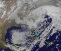
A potent piece of short wave energy coming out of Southern California (thanks to the strong amplitude of the MJO), will be tracking across the southern half of the country and eventually up our coast. With confluence to our north due to the Polar Vortex, as well as a strong area of High Pressure, this surface low that develops from the wave off Cali will have no chance of cutting to our west. Therefore, we will remain cold enough for snow (though there is a slight caveat).

From the 500 mb vort map above taken from the latest 12z GFS, you can see why there is a strong indication of overrunning precipitation breaking out over the Mid-Atlantic / Northeast. The combination of low level cold air from the strong PV to our north (thanks to the extremely -EPO) and the presence of the southeast ridge to our south (goes back to the +TNH pattern of this season) will create a gradient with snows to the north and rain to the south, with freezing rain also possible where surfaces are below freezing.
Along the gradient, waves of low pressure will develop which will enhance precipitation rates and cause this to become a long duration event. Possibly 30+ hours (up to 50+ hours possible!) of light to moderate snowfall. Obviously this will add up when all is said and done, and some places could be looking at 10+ inches of snow. The areas who will jackpot are those JUST north of the gradient because that is where the best lift (700 mb frontogenesis) will set up. Right now, I think central / northern NJ into NYC / LI could get into some of that.
There is still a lot of detail we need to iron out. Exactly where that gradient sets up and whether or not it tracks north of us at some point (which would give us some rain / freezing rain) also needs to be watched.
We'll see what happens. A conservative call right now would be 4-8 inches with POTENTIAL of 12-18 inches.
Last edited by Frank_Wx on Fri Feb 28, 2014 11:29 pm; edited 2 times in total
_________________
_______________________________________________________________________________________________________
CLICK HERE to view NJ Strong Snowstorm Classifications
 Re: March 2nd-4th Potential Snowstorm
Agree as of now Frank, GFS was beautiful but as we know still quite a while to go yet, going to get track well ironed by Friday

NjWeatherGuy- Advanced Forecaster

- Posts : 4100
Reputation : 28
Join date : 2013-01-06
Location : Belle Mead, NJ
 Re: March 2nd-4th Potential Snowstorm
NjWeatherGuy wrote:Agree as of now Frank, GFS was beautiful but as we know still quite a while to go yet, going to get track well ironed by Friday
Yea, hopefully. I think a few inches is reasonable right now. 3-6/4-8 type. But the potential is there for much more if all comes together. A lot of waves of low pressure along the gradient
_________________
_______________________________________________________________________________________________________
CLICK HERE to view NJ Strong Snowstorm Classifications
 Re: March 2nd-4th Potential Snowstorm
Iv'e liked the early March period for awhile now. PV is in a much better position.
_________________
_______________________________________________________________________________________________________
CLICK HERE to view NJ Strong Snowstorm Classifications
 Re: March 2nd-4th Potential Snowstorm
Yeah, I think a storm is definite at this point, just need to iron out track and QPF, then we can worry about P-type, not to set the weenies into overdrive buy the 12z GFS shows 16-18 swath through PHI, CNJ and NYC. Widespread 12"+, would love to lock it in but still way too far out.

NjWeatherGuy- Advanced Forecaster

- Posts : 4100
Reputation : 28
Join date : 2013-01-06
Location : Belle Mead, NJ
 Re: March 2nd-4th Potential Snowstorm
I sincerely think NJ is in a prime spot right now.
_________________
_______________________________________________________________________________________________________
CLICK HERE to view NJ Strong Snowstorm Classifications
 Re: March 2nd-4th Potential Snowstorm
NJ gets snow for 48+ hours more like 52 on the GFS. Ive never seen a storm that lasts so long, dubious to believe it.

NjWeatherGuy- Advanced Forecaster

- Posts : 4100
Reputation : 28
Join date : 2013-01-06
Location : Belle Mead, NJ
 Re: March 2nd-4th Potential Snowstorm

_________________
_______________________________________________________________________________________________________
CLICK HERE to view NJ Strong Snowstorm Classifications
 Re: March 2nd-4th Potential Snowstorm
Still throwing off light snow at 168, instantwrathermaps snow map has final of 20"+ inches in northern half of NJ

NjWeatherGuy- Advanced Forecaster

- Posts : 4100
Reputation : 28
Join date : 2013-01-06
Location : Belle Mead, NJ
 Re: March 2nd-4th Potential Snowstorm
Folks in the mid Hudson Valley might need to prepare themselves for disappointment if current guidance holds up. Since there is a gradient with this storm, that means someone is going to jackpot and areas just a few miles away could have drastically less snow.
_________________
_______________________________________________________________________________________________________
CLICK HERE to view NJ Strong Snowstorm Classifications
 Re: March 2nd-4th Potential Snowstorm
GFS snow map. Wow....


_________________
_______________________________________________________________________________________________________
CLICK HERE to view NJ Strong Snowstorm Classifications
 Re: March 2nd-4th Potential Snowstorm
Yep, that's a HECS in my book. GFS came in even colder this run. Don't need it to trend any colder, or we run the risk of suppression; as far as what the GFS depicts. Like I said before, need to temper excitement. Just need consistency with the models and their ensembles for now.Frank_Wx wrote:GFS snow map. Wow....

nutleyblizzard- Senior Enthusiast

- Posts : 1952
Reputation : 41
Join date : 2014-01-30
Age : 57
Location : Nutley, new jersey
 Re: March 2nd-4th Potential Snowstorm
Franjk was hoping I was gonna get to post it all I have to say is GFS is making a comeback and holy crap! And thats not including the possible 7th event.
End of run holy jeeze!
http://www.instantweathermaps.com/GFS-php/showmap-conussfc.php?run=2014022612&time=PER&var=ASNOWI&hour=384
End of run holy jeeze!
http://www.instantweathermaps.com/GFS-php/showmap-conussfc.php?run=2014022612&time=PER&var=ASNOWI&hour=384

jmanley32- Senior Enthusiast

- Posts : 20512
Reputation : 108
Join date : 2013-12-12
Age : 42
Location : Yonkers, NY
 Re: March 2nd-4th Potential Snowstorm
Frank_Wx wrote:GFS snow map. Wow....
I just looked at the 2-meter temperatures for the potential snow event next week on the 12Z GFS and after 1 AM Monday March 3rd, it stays below 25 degrees in NYC for the duration of the storm, so I'm guessing that would be at least 15:1 snow ratios. Also, when the storm clears, it gets down into the single digits...
Math23x7- Wx Statistician Guru

- Posts : 2379
Reputation : 68
Join date : 2013-01-08
 Re: March 2nd-4th Potential Snowstorm
As I understand instantwxmaps takes rations into account. still if all pans out at least major hit through 4th/5th and possibly more further out. Getting a little psyched but not too much, hesitant on such a large event but it has happened before.

jmanley32- Senior Enthusiast

- Posts : 20512
Reputation : 108
Join date : 2013-12-12
Age : 42
Location : Yonkers, NY
 Re: March 2nd-4th Potential Snowstorm
If Euro comes in similar and CMC we def have something here. 

jmanley32- Senior Enthusiast

- Posts : 20512
Reputation : 108
Join date : 2013-12-12
Age : 42
Location : Yonkers, NY
 Re: March 2nd-4th Potential Snowstorm
My bad saw franks post on the other threat 9-10th now instead of 7th for possible event. March is def come in like a lion if this all works out. Frank what do you think the chances for at least the first one to pan out as intense as GFS and Euro and dare I say the clown CMC yesterday?

jmanley32- Senior Enthusiast

- Posts : 20512
Reputation : 108
Join date : 2013-12-12
Age : 42
Location : Yonkers, NY
 Re: March 2nd-4th Potential Snowstorm
Frank, if you look at the 500mb map of the GFS at hr 150, the PV dives SE and nearly phased with that last wave down south. If that happened, it would of made this run even more prolific. Something else to look for in future runs. A very volatile set up for sure! 

nutleyblizzard- Senior Enthusiast

- Posts : 1952
Reputation : 41
Join date : 2014-01-30
Age : 57
Location : Nutley, new jersey
 Re: March 2nd-4th Potential Snowstorm
Hey nutley all i know in what you said was phase which usually means huge! Ahhh going to be a long 3-4 days, hoping Friday we can hone in on something more concise but several model runs with SOME consistency already from what I have seen.

jmanley32- Senior Enthusiast

- Posts : 20512
Reputation : 108
Join date : 2013-12-12
Age : 42
Location : Yonkers, NY
 Re: March 2nd-4th Potential Snowstorm
NjWeatherGuy wrote:NJ gets snow for 48+ hours more like 52 on the GFS. Ive never seen a storm that lasts so long, dubious to believe it.
Tom do you remember the great Presidents Day(s) Storm of 1978 - I sure as hell do - started snowing on Sunday afternoon and lasted until Wed early morning - is is possible hell ya but I hear you we are still a ways away from the GFS idea. I know different set up no retrograding of the LP away and then back to teh coast etc. Just stating that it did happen - I was nine years old at that time.
This board is hopping - LOVE IT!!
_________________
Mugs
AKA:King: Snow Weenie
Self Proclaimed
WINTER 2014-15 : 55.12" +.02 for 6 coatings (avg. 35")
WINTER 2015-16 Total - 29.8" (Avg 35")
WINTER 2016-17 : 39.5" so far

amugs- Advanced Forecaster - Mod

- Posts : 15091
Reputation : 213
Join date : 2013-01-07
Age : 54
Location : Hillsdale,NJ
 Re: March 2nd-4th Potential Snowstorm
nutleyblizzard wrote:Frank, if you look at the 500mb map of the GFS at hr 150, the PV dives SE and nearly phased with that last wave down south. If that happened, it would of made this run even more prolific. Something else to look for in future runs. A very volatile set up for sure!
Nuts you beat me to it - I was just seeing that on my lunch break and it misses by a smidge - catches the tail of it? - if that happens then BOOM!
_________________
Mugs
AKA:King: Snow Weenie
Self Proclaimed
WINTER 2014-15 : 55.12" +.02 for 6 coatings (avg. 35")
WINTER 2015-16 Total - 29.8" (Avg 35")
WINTER 2016-17 : 39.5" so far

amugs- Advanced Forecaster - Mod

- Posts : 15091
Reputation : 213
Join date : 2013-01-07
Age : 54
Location : Hillsdale,NJ
 Re: March 2nd-4th Potential Snowstorm
jmanley32 wrote:Hey nutley all i know in what you said was phase which usually means huge! Ahhh going to be a long 3-4 days, hoping Friday we can hone in on something more concise but several model runs with SOME consistency already from what I have seen.
if this all trends continuing Friday we have something cooking here big time lets hope it doesn't get the local tv mets jinx

RJB8525- Senior Enthusiast

- Posts : 1994
Reputation : 28
Join date : 2013-02-06
Age : 38
Location : Hackettstown, NJ
 Re: March 2nd-4th Potential Snowstorm
The canadian is a HUGE HIT!!!

nutleyblizzard- Senior Enthusiast

- Posts : 1952
Reputation : 41
Join date : 2014-01-30
Age : 57
Location : Nutley, new jersey
 Re: March 2nd-4th Potential Snowstorm
amugs wrote:NjWeatherGuy wrote:NJ gets snow for 48+ hours more like 52 on the GFS. Ive never seen a storm that lasts so long, dubious to believe it.
Tom do you remember the great Presidents Day(s) Storm of 1978 - I sure as hell do - started snowing on Sunday afternoon and lasted until Wed early morning - is is possible hell ya but I hear you we are still a ways away from the GFS idea. I know different set up no retrograding of the LP away and then back to teh coast etc. Just stating that it did happen - I was nine years old at that time.
This board is hopping - LOVE IT!!
mugs I remember that storm. I was 15 years old. we put chains on my dads van. he was in the fish business had to drive down to fulton market in lower manhattan. we got stuck several times even with the chains. it just kept snowing for days. one of my favorite snow storms

algae888- Advanced Forecaster

- Posts : 5311
Reputation : 46
Join date : 2013-02-05
Age : 61
Location : mt. vernon, new york
 Re: March 2nd-4th Potential Snowstorm
nutleyblizzard wrote:The canadian is a HUGE HIT!!!
getting really excited now. we are in a good range now. 4-5 days out. trying to keep expectations down but that's really hard right now.

algae888- Advanced Forecaster

- Posts : 5311
Reputation : 46
Join date : 2013-02-05
Age : 61
Location : mt. vernon, new york
Page 1 of 43 • 1, 2, 3 ... 22 ... 43 
Page 1 of 43
Permissions in this forum:
You cannot reply to topics in this forum|
|
|

 Home
Home