
 Search
February 17th Storm: 1st Call Snow Map and Observations
Page 6 of 16 •  1 ... 5, 6, 7 ... 11 ... 16
 ![]()
Re: February 17th Storm: 1st Call Snow Map and Observations
![]() by billg315 Mon Feb 16, 2015 3:40 pm
by billg315 Mon Feb 16, 2015 3:40 pm
billg315- Advanced Forecaster - Mod

- Posts : 4461
Join date : 2015-01-24
Re: February 17th Storm: 1st Call Snow Map and Observations
![]() by billg315 Mon Feb 16, 2015 3:45 pm
by billg315 Mon Feb 16, 2015 3:45 pm
billg315- Advanced Forecaster - Mod
- Posts : 4461
Join date : 2015-01-24
Re: February 17th Storm: 1st Call Snow Map and Observations
![]() by snow247 Mon Feb 16, 2015 3:51 pm
by snow247 Mon Feb 16, 2015 3:51 pm
Last edited by snow247 on Mon Feb 16, 2015 3:52 pm; edited 1 time in total

snow247- Pro Enthusiast

- Posts : 2417
Reputation : 0
Join date : 2014-08-27
Location : Mount Ivy, NY - Elevation 545'
Re: February 17th Storm: 1st Call Snow Map and Observations
![]() by RJB8525 Mon Feb 16, 2015 3:52 pm
by RJB8525 Mon Feb 16, 2015 3:52 pm
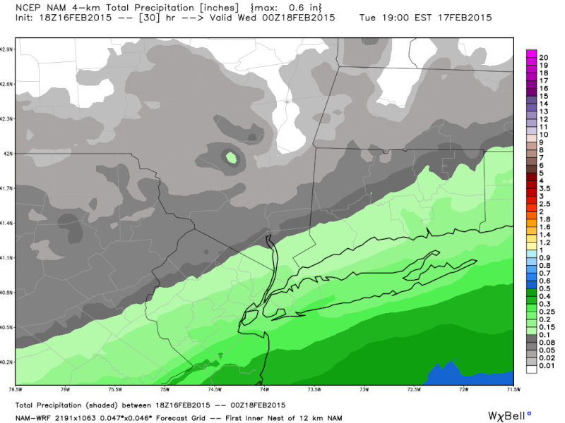
THE NATIONAL WEATHER SERVICE IN NEW YORK HAS ISSUED A WINTER
WEATHER ADVISORY FOR SNOW...WHICH IS IN EFFECT FROM MIDNIGHT
TONIGHT TO NOON EST TUESDAY.
* LOCATIONS...LONG ISLAND...NEW YORK CITY...AS WELL AS EASTERN
ESSEX AND EASTERN UNION COUNTIES.
* HAZARD TYPES...SNOW.
* ACCUMULATIONS...SNOW ACCUMULATION OF 2 TO 4 INCHES.
* WINDS...NORTH 5 TO 10 MPH WITH GUSTS UP TO 20 MPH.
* TEMPERATURES...IN THE TEENS.
* TIMING...SNOW IS EXPECTED TO BEGIN AFTER MIDNIGHT TONIGHT AND
CONTINUE INTO THE TUESDAY MORNING RUSH. SNOW ENDS BY TUESDAY
AFTERNOON.
* IMPACTS...HAZARDOUS TRAVEL CONDITIONS DUE TO REDUCED VISBILITIES
AND SNOW COVERED ROADS.

RJB8525- Senior Enthusiast

- Posts : 1994
Reputation : 28
Join date : 2013-02-06
Age : 38
Location : Hackettstown, NJ
Re: February 17th Storm: 1st Call Snow Map and Observations
![]() by Quietace Mon Feb 16, 2015 3:53 pm
by Quietace Mon Feb 16, 2015 3:53 pm

Quietace- Meteorologist - Mod

- Posts : 3687
Reputation : 33
Join date : 2013-01-07
Age : 27
Location : Point Pleasant, NJ
Re: February 17th Storm: 1st Call Snow Map and Observations
![]() by Frank_Wx Mon Feb 16, 2015 3:53 pm
by Frank_Wx Mon Feb 16, 2015 3:53 pm

_________________
_______________________________________________________________________________________________________
CLICK HERE to view NJ Strong Snowstorm Classifications

Frank_Wx- Godzilla Seeker

- Posts : 21305
Reputation : 328
Join date : 2013-01-05
Age : 31
Location : Jersey City, NJ -

Re: February 17th Storm: 1st Call Snow Map and Observations
![]() by Frank_Wx Mon Feb 16, 2015 3:54 pm
by Frank_Wx Mon Feb 16, 2015 3:54 pm

_________________
_______________________________________________________________________________________________________
CLICK HERE to view NJ Strong Snowstorm Classifications
Frank_Wx- Godzilla Seeker
- Posts : 21305
Reputation : 328
Join date : 2013-01-05
Age : 31
Location : Jersey City, NJ -
Re: February 17th Storm: 1st Call Snow Map and Observations
![]() by down tines Mon Feb 16, 2015 3:57 pm
by down tines Mon Feb 16, 2015 3:57 pm

down tines- Posts : 39
Reputation : 0
Join date : 2013-01-24
Location : Allentown N.J.
Re: February 17th Storm: 1st Call Snow Map and Observations
![]() by billg315 Mon Feb 16, 2015 3:59 pm
by billg315 Mon Feb 16, 2015 3:59 pm
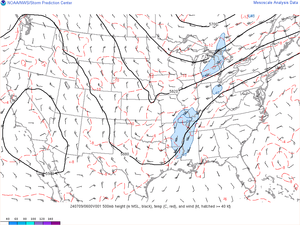
Hard to say if the storm is little further north or whether the warm air just made it a little further north. I do notice that it is snowing moderately in Dayton, OH from a heavier band that has formed on the back far NW side of the storm from Ohio into central Indiana just south of Indianapolis. They were supposed to get less than an inch total as they were too far north. Be interesting to see if they end up with a little more.snow247 wrote:Nashville was expected to get 3-7 inches of snow, but all they have been getting today is freezing rain and what looks like only an inch of snow at the most. Probably doesn't mean anything for us, but could this mean that the storm is slightly further north than expected?

billg315- Advanced Forecaster - Mod
- Posts : 4461
Reputation : 185
Join date : 2015-01-24
Age : 50
Location : Flemington, NJ
Re: February 17th Storm: 1st Call Snow Map and Observations
![]() by billg315 Mon Feb 16, 2015 4:04 pm
by billg315 Mon Feb 16, 2015 4:04 pm
billg315- Advanced Forecaster - Mod
- Posts : 4461
Reputation : 185
Join date : 2015-01-24
Age : 50
Location : Flemington, NJ
Re: February 17th Storm: 1st Call Snow Map and Observations
![]() by Frank_Wx Mon Feb 16, 2015 4:06 pm
by Frank_Wx Mon Feb 16, 2015 4:06 pm
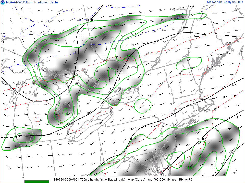
billg315 wrote:Frank's map looks pretty solid to me. I think a lot of areas on the southern tier of the 2-4 will in fact get the 4, but likewise those on the NW side of it may only get 2 or 3.
Yes, I was thinking about adding a 3-5" zone but it's negligible. A Met once told me if you do not have any drastic changes to make to your 1st call, then do not even bother with a final call. Anyways, always good to go with your first hunch. Clear signal of being less reliant on the models and more reliant on what's happening in the atmosphere. It's clear to me the midwest short wave is not that strong and we'll also be battling some dry air.
_________________
_______________________________________________________________________________________________________
CLICK HERE to view NJ Strong Snowstorm Classifications
Frank_Wx- Godzilla Seeker
- Posts : 21305
Reputation : 328
Join date : 2013-01-05
Age : 31
Location : Jersey City, NJ -
Re: February 17th Storm: 1st Call Snow Map and Observations
![]() by skinsfan1177 Mon Feb 16, 2015 4:06 pm
by skinsfan1177 Mon Feb 16, 2015 4:06 pm

skinsfan1177- Senior Enthusiast
- Posts : 4485
Reputation : 35
Join date : 2013-01-07
Age : 46
Location : Point Pleasant Boro
Re: February 17th Storm: 1st Call Snow Map and Observations
![]() by billg315 Mon Feb 16, 2015 4:09 pm
by billg315 Mon Feb 16, 2015 4:09 pm
billg315- Advanced Forecaster - Mod
- Posts : 4461
Reputation : 185
Join date : 2015-01-24
Age : 50
Location : Flemington, NJ
Re: February 17th Storm: 1st Call Snow Map and Observations
![]() by snow247 Mon Feb 16, 2015 5:11 pm
by snow247 Mon Feb 16, 2015 5:11 pm
snow247- Pro Enthusiast
- Posts : 2417
Reputation : 0
Join date : 2014-08-27
Location : Mount Ivy, NY - Elevation 545'
Re: February 17th Storm: 1st Call Snow Map and Observations
![]() by Frank_Wx Mon Feb 16, 2015 5:49 pm
by Frank_Wx Mon Feb 16, 2015 5:49 pm

Congrats to QuietAce, Skins and Tom. 4-8" jackpot.
_________________
_______________________________________________________________________________________________________
CLICK HERE to view NJ Strong Snowstorm Classifications
Frank_Wx- Godzilla Seeker
- Posts : 21305
Reputation : 328
Join date : 2013-01-05
Age : 31
Location : Jersey City, NJ -
Re: February 17th Storm: 1st Call Snow Map and Observations
![]() by billg315 Mon Feb 16, 2015 5:55 pm
by billg315 Mon Feb 16, 2015 5:55 pm
billg315- Advanced Forecaster - Mod
- Posts : 4461
Reputation : 185
Join date : 2015-01-24
Age : 50
Location : Flemington, NJ
Re: February 17th Storm: 1st Call Snow Map and Observations
![]() by NjWeatherGuy Mon Feb 16, 2015 5:58 pm
by NjWeatherGuy Mon Feb 16, 2015 5:58 pm

NjWeatherGuy- Advanced Forecaster

- Posts : 4100
Reputation : 28
Join date : 2013-01-06
Location : Belle Mead, NJ
Re: February 17th Storm: 1st Call Snow Map and Observations
![]() by Yschiff Mon Feb 16, 2015 6:05 pm
by Yschiff Mon Feb 16, 2015 6:05 pm
http://videowall.accuweather.com/detail/videos/current-weather-news/video/3901417444001/storm-targets-dc-richmond-and?autoStart=true
Yschiff- Posts : 139
Reputation : 1
Join date : 2014-01-04
Location : Far Rockaway New York
Re: February 17th Storm: 1st Call Snow Map and Observations
![]() by Quietace Mon Feb 16, 2015 6:09 pm
by Quietace Mon Feb 16, 2015 6:09 pm
I really do hope so...Pretty skeptical, but optimistic at the same time looking over thingsFrank_Wx wrote:Light to moderate snow on the HRRR by 5am. Looks like it starts around 1am. Steadiest between 4-7am. Tapers off by 9-10am.
Congrats to QuietAce, Skins and Tom. 4-8" jackpot.
Quietace- Meteorologist - Mod
- Posts : 3687
Reputation : 33
Join date : 2013-01-07
Age : 27
Location : Point Pleasant, NJ
Re: February 17th Storm: 1st Call Snow Map and Observations
![]() by Quietace Mon Feb 16, 2015 6:17 pm
by Quietace Mon Feb 16, 2015 6:17 pm
Quietace- Meteorologist - Mod
- Posts : 3687
Reputation : 33
Join date : 2013-01-07
Age : 27
Location : Point Pleasant, NJ
Re: February 17th Storm: 1st Call Snow Map and Observations
![]() by lglickman1 Mon Feb 16, 2015 6:30 pm
by lglickman1 Mon Feb 16, 2015 6:30 pm
lglickman1- Pro Enthusiast
- Posts : 319
Reputation : 0
Join date : 2013-02-05
Location : New Rochelle, NY
Re: February 17th Storm: 1st Call Snow Map and Observations
![]() by skinsfan1177 Mon Feb 16, 2015 6:34 pm
by skinsfan1177 Mon Feb 16, 2015 6:34 pm
skinsfan1177- Senior Enthusiast
- Posts : 4485
Reputation : 35
Join date : 2013-01-07
Age : 46
Location : Point Pleasant Boro
Re: February 17th Storm: 1st Call Snow Map and Observations
![]() by Quietace Mon Feb 16, 2015 6:35 pm
by Quietace Mon Feb 16, 2015 6:35 pm
You should start to see the precip start moving into the area slowly south to northskinsfan1177 wrote:I think so it may start moving a little more northly. Is this correct ace
Quietace- Meteorologist - Mod
- Posts : 3687
Reputation : 33
Join date : 2013-01-07
Age : 27
Location : Point Pleasant, NJ
Re: February 17th Storm: 1st Call Snow Map and Observations
![]() by skinsfan1177 Mon Feb 16, 2015 6:37 pm
by skinsfan1177 Mon Feb 16, 2015 6:37 pm
Quietace wrote:You should start to see the precip start moving into the area slowly south to northskinsfan1177 wrote:I think so it may start moving a little more northly. Is this correct ace
That's what I thought humidity currently 50% should rise more
skinsfan1177- Senior Enthusiast
- Posts : 4485
Reputation : 35
Join date : 2013-01-07
Age : 46
Location : Point Pleasant Boro
Re: February 17th Storm: 1st Call Snow Map and Observations
![]() by Quietace Mon Feb 16, 2015 6:39 pm
by Quietace Mon Feb 16, 2015 6:39 pm
Yeah very soonskinsfan1177 wrote:Quietace wrote:You should start to see the precip start moving into the area slowly south to northskinsfan1177 wrote:I think so it may start moving a little more northly. Is this correct ace
That's what I thought humidity currently 50% should rise more
Quietace- Meteorologist - Mod
- Posts : 3687
Reputation : 33
Join date : 2013-01-07
Age : 27
Location : Point Pleasant, NJ
Re: February 17th Storm: 1st Call Snow Map and Observations
![]() by skinsfan1177 Mon Feb 16, 2015 7:00 pm
by skinsfan1177 Mon Feb 16, 2015 7:00 pm
skinsfan1177- Senior Enthusiast
- Posts : 4485
Reputation : 35
Join date : 2013-01-07
Age : 46
Location : Point Pleasant Boro
Re: February 17th Storm: 1st Call Snow Map and Observations
![]() by weatherwatchermom Mon Feb 16, 2015 7:07 pm
by weatherwatchermom Mon Feb 16, 2015 7:07 pm

weatherwatchermom- Senior Enthusiast
- Posts : 3729
Reputation : 77
Join date : 2014-11-25
Age : 60
Location : Hazlet Township, NJ
Page 6 of 16 • 1 ... 5, 6, 7 ... 11 ... 16 ![]()
|
|
|