
 Search
Long Range Thread 24.0
Page 19 of 21 •  1 ... 11 ... 18, 19, 20, 21
 ![]()
Re: Long Range Thread 24.0
![]() by sroc4 Wed Mar 02, 2022 7:53 am
by sroc4 Wed Mar 02, 2022 7:53 am
rb924119 wrote:sroc4 wrote:heehaw453 wrote:Yeah with Canada having ample cold air the -EPO would bleed down cold as the SE ridge gets pushed on by TPV in Greenland. I think that could happen in March but not February because I've seen this look get pushed back several times. And my concern with March is when it does actually happen it maybe too late for a lot of folksBut let's see if this starts building more consistency and alignment as we get within say 7 days. Because if it does manifest itself by end February, I-95 would be in the game for its effects.
Ray and Haw great discussions. I still think we have to watch and worry about the PNA domain. The "look" at the H5 anomaly maps towards the end of the month does hint at that -EPO but the negative PNA look is also there. Relative to the previously similar pattern in Dec I certainly recognize climatologically the air mass in Canada headed into March is much colder/denser, and hopefully the extremely anomalous neg PNA (-3 to -4 sigma in Dec) may not be quite as strong; however, that neg PNA may still provides "the trap door" for the coldest anomalies to escape and lead to a storm track less than ideal whenever any amped up energy ejects out of the SW CONUS trough by way of pumping the SE ridge out ahead; esp if interacts/phases with N energy too soon. I will remain skeptical this far out that we wont see a slightly less pronounced version of the Dec pattern develop if we go back to that -EPO/_PNA couplet without and real help from the NAO or AO domains.
Of course this may just be me being gun shy. Ill give it some time before I decide how I overall feel about it. Centers of the higher and lower height anomalies and of course how the orientations of the ridge/trough axis' evolves will go a long way to making up my mind.
The -PNA look IS there, and WILL BE real. However, this is very different from December with respect to the global and hemispheric forcing. In December, the larger backdrop SUPPORTED the anomalous western trough/eastern ridge regime. This time, however, it doesn’t. Globally and hemispherically, the forcing will be acting to establish the anomalous trough in the eastern CONUS. So what should happen, and I covered this a few days ago, is that the western trough should shear out (leading to the gradient pattern at first), and then eventually, the remnants will fold under the western ridge in an anti-cyclonic wave break event. When that happens, the remains of the Southeast Ridge will retrograde west to fill that void over the Southwest, and a unified western ridge/eastern trough will result. When this occurs, it SHOULD present a storm opportunity, probably between March 6th-10th, if I had to guess. The period we are seeing now on the modeling is the transition period, but we are only seeing the first half - the -PNA pattern will only be transient in my opinion.
In doing a little examining of the March pattern I felt this discussion by Ray back MID FEB should be bumped.
sroc4- Admin

- Posts : 8331
Join date : 2013-01-07
Re: Long Range Thread 24.0
![]() by sroc4 Wed Mar 02, 2022 7:56 am
by sroc4 Wed Mar 02, 2022 7:56 am
rb924119 wrote:rb924119 wrote:sroc4 wrote:heehaw453 wrote:Yeah with Canada having ample cold air the -EPO would bleed down cold as the SE ridge gets pushed on by TPV in Greenland. I think that could happen in March but not February because I've seen this look get pushed back several times. And my concern with March is when it does actually happen it maybe too late for a lot of folks
Ray and Haw great discussions. I still think we have to watch and worry about the PNA domain. The "look" at the H5 anomaly maps towards the end of the month does hint at that -EPO but the negative PNA look is also there. Relative to the previously similar pattern in Dec I certainly recognize climatologically the air mass in Canada headed into March is much colder/denser, and hopefully the extremely anomalous neg PNA (-3 to -4 sigma in Dec) may not be quite as strong; however, that neg PNA may still provides "the trap door" for the coldest anomalies to escape and lead to a storm track less than ideal whenever any amped up energy ejects out of the SW CONUS trough by way of pumping the SE ridge out ahead; esp if interacts/phases with N energy too soon. I will remain skeptical this far out that we wont see a slightly less pronounced version of the Dec pattern develop if we go back to that -EPO/_PNA couplet without and real help from the NAO or AO domains.
Of course this may just be me being gun shy. Ill give it some time before I decide how I overall feel about it. Centers of the higher and lower height anomalies and of course how the orientations of the ridge/trough axis' evolves will go a long way to making up my mind.
The -PNA look IS there, and WILL BE real. However, this is very different from December with respect to the global and hemispheric forcing. In December, the larger backdrop SUPPORTED the anomalous western trough/eastern ridge regime. This time, however, it doesn’t. Globally and hemispherically, the forcing will be acting to establish the anomalous trough in the eastern CONUS. So what should happen, and I covered this a few days ago, is that the western trough should shear out (leading to the gradient pattern at first), and then eventually, the remnants will fold under the western ridge in an anti-cyclonic wave break event. When that happens, the remains of the Southeast Ridge will retrograde west to fill that void over the Southwest, and a unified western ridge/eastern trough will result. When this occurs, it SHOULD present a storm opportunity, probably between March 6th-10th, if I had to guess. The period we are seeing now on the modeling is the transition period, but we are only seeing the first half - the -PNA pattern will only be transient in my opinion.
Here’s the EPS’ first indication of this:
Note the return of the trough to the southeast of Hawaii. This is present on all guidance at about this time, though with somewhat different location. This indicates that the -PNA is already having energy get drawn westward beneath the ridge, with some also being allowed to escape downstream. You get a trough east or southeast of Hawaii, and that only adds to the forcing acting to kick the trough out of the Southwest.

So should this one.
That is all.
sroc4- Admin
- Posts : 8331
Join date : 2013-01-07
Re: Long Range Thread 24.0
![]() by amugs Wed Mar 02, 2022 9:30 am
by amugs Wed Mar 02, 2022 9:30 am
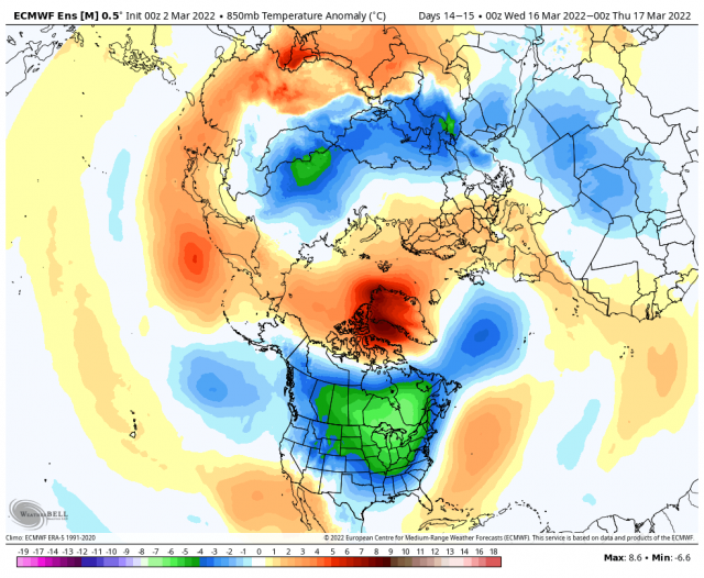
.png)
Well there is green in the temps below normal for sure .....if it verifies - watch this happen and we are 34* and wet pasty snow!!!!
_________________
Mugs
AKA:King: Snow Weenie
Self Proclaimed
WINTER 2014-15 : 55.12" +.02 for 6 coatings (avg. 35")
WINTER 2015-16 Total - 29.8" (Avg 35")
WINTER 2016-17 : 39.5" so far

amugs- Advanced Forecaster - Mod

- Posts : 15093
Reputation : 213
Join date : 2013-01-07
Age : 54
Location : Hillsdale,NJ
Re: Long Range Thread 24.0
![]() by sroc4 Wed Mar 02, 2022 9:40 am
by sroc4 Wed Mar 02, 2022 9:40 am
amugs wrote:ST Paddys Day Green ?? More ways than one possibly!!
Well there is green in the temps below normal for sure .....if it verifies - watch this happen and we are 34* and wet pasty snow!!!!
OBV its way out there, but keeping in mind this is the avg of many individual runs, IF some of the negative along the WC of Canada end up further west and east then the PNA ridge would have a chance to go up. A PNA ridge axis in this vicinity would sharpen the eastern trough and lead to a storm chance.
Again fun to think about but way to far off to take serious at this time. That said the stuff I posted above lends credence to this sort of thing developing mid to late March. Mayb I recall this image in 10days

_________________
"In weather and in life, there's no winning and losing; there's only winning and learning."
WINTER 2012/2013 TOTALS 43.65"WINTER 2017/2018 TOTALS 62.85" WINTER 2022/2023 TOTALS 4.9"
WINTER 2013/2014 TOTALS 64.85"WINTER 2018/2019 TOTALS 14.25" WINTER 2023/2024 TOTALS 13.1"
WINTER 2014/2015 TOTALS 71.20"WINTER 2019/2020 TOTALS 6.35"
WINTER 2015/2016 TOTALS 35.00"WINTER 2020/2021 TOTALS 37.75"
WINTER 2016/2017 TOTALS 42.25"WINTER 2021/2022 TOTALS 31.65"

sroc4- Admin
- Posts : 8331
Reputation : 301
Join date : 2013-01-07
Location : Wading River, LI
Re: Long Range Thread 24.0
![]() by sroc4 Wed Mar 02, 2022 10:31 am
by sroc4 Wed Mar 02, 2022 10:31 am
_________________
"In weather and in life, there's no winning and losing; there's only winning and learning."
WINTER 2012/2013 TOTALS 43.65"WINTER 2017/2018 TOTALS 62.85" WINTER 2022/2023 TOTALS 4.9"
WINTER 2013/2014 TOTALS 64.85"WINTER 2018/2019 TOTALS 14.25" WINTER 2023/2024 TOTALS 13.1"
WINTER 2014/2015 TOTALS 71.20"WINTER 2019/2020 TOTALS 6.35"
WINTER 2015/2016 TOTALS 35.00"WINTER 2020/2021 TOTALS 37.75"
WINTER 2016/2017 TOTALS 42.25"WINTER 2021/2022 TOTALS 31.65"
sroc4- Admin
- Posts : 8331
Reputation : 301
Join date : 2013-01-07
Location : Wading River, LI
amugs likes this post
Re: Long Range Thread 24.0
![]() by amugs Wed Mar 02, 2022 12:50 pm
by amugs Wed Mar 02, 2022 12:50 pm
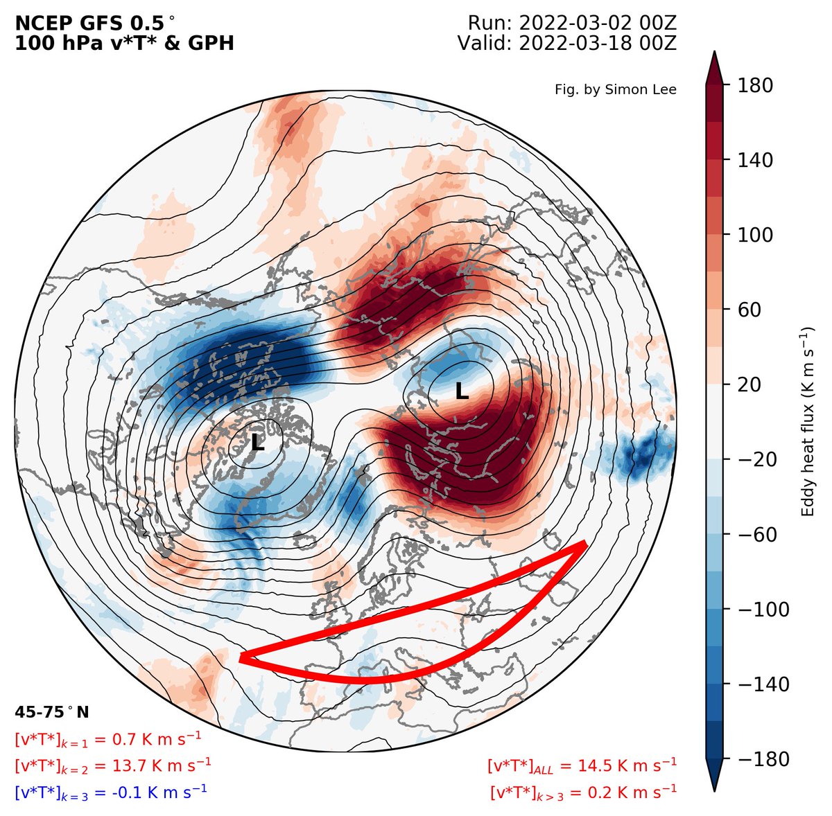
From
Dr Simon Lee
Last edited by amugs on Thu Mar 03, 2022 2:46 pm; edited 1 time in total
_________________
Mugs
AKA:King: Snow Weenie
Self Proclaimed
WINTER 2014-15 : 55.12" +.02 for 6 coatings (avg. 35")
WINTER 2015-16 Total - 29.8" (Avg 35")
WINTER 2016-17 : 39.5" so far
amugs- Advanced Forecaster - Mod
- Posts : 15093
Reputation : 213
Join date : 2013-01-07
Age : 54
Location : Hillsdale,NJ
Re: Long Range Thread 24.0
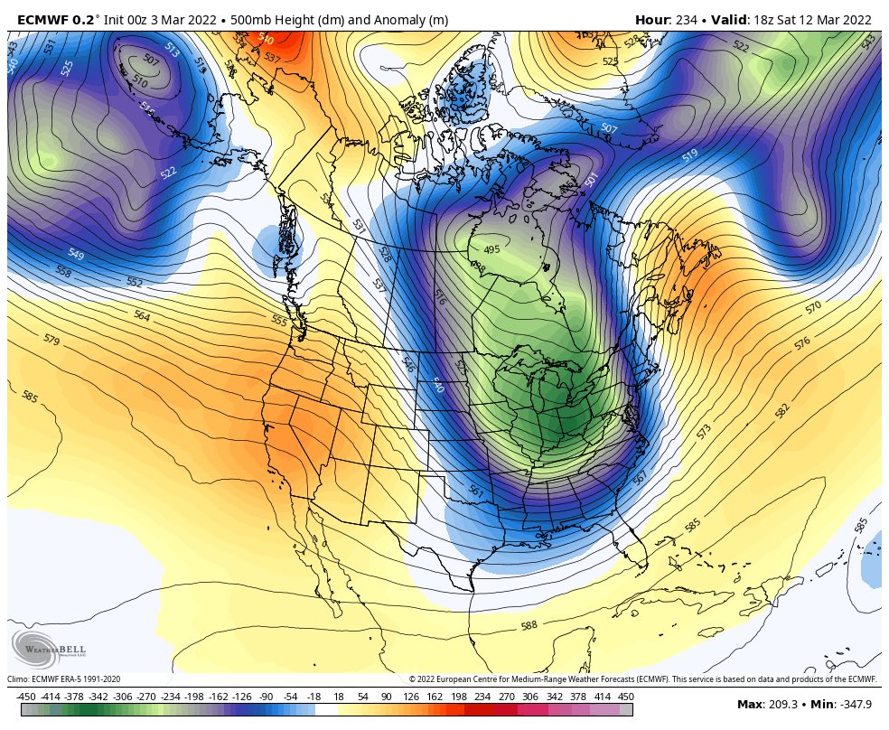
![]() by amugs Wed Mar 02, 2022 7:42 pm
by amugs Wed Mar 02, 2022 7:42 pm

_________________
Mugs
AKA:King: Snow Weenie
Self Proclaimed
WINTER 2014-15 : 55.12" +.02 for 6 coatings (avg. 35")
WINTER 2015-16 Total - 29.8" (Avg 35")
WINTER 2016-17 : 39.5" so far
amugs- Advanced Forecaster - Mod
- Posts : 15093
Reputation : 213
Join date : 2013-01-07
Age : 54
Location : Hillsdale,NJ
Re: Long Range Thread 24.0
![]() by amugs Thu Mar 03, 2022 9:20 am
by amugs Thu Mar 03, 2022 9:20 am
_________________
Mugs
AKA:King: Snow Weenie
Self Proclaimed
WINTER 2014-15 : 55.12" +.02 for 6 coatings (avg. 35")
WINTER 2015-16 Total - 29.8" (Avg 35")
WINTER 2016-17 : 39.5" so far
amugs- Advanced Forecaster - Mod
- Posts : 15093
Reputation : 213
Join date : 2013-01-07
Age : 54
Location : Hillsdale,NJ
Re: Long Range Thread 24.0
![]() by sroc4 Thu Mar 03, 2022 10:02 am
by sroc4 Thu Mar 03, 2022 10:02 am
_________________
"In weather and in life, there's no winning and losing; there's only winning and learning."
WINTER 2012/2013 TOTALS 43.65"WINTER 2017/2018 TOTALS 62.85" WINTER 2022/2023 TOTALS 4.9"
WINTER 2013/2014 TOTALS 64.85"WINTER 2018/2019 TOTALS 14.25" WINTER 2023/2024 TOTALS 13.1"
WINTER 2014/2015 TOTALS 71.20"WINTER 2019/2020 TOTALS 6.35"
WINTER 2015/2016 TOTALS 35.00"WINTER 2020/2021 TOTALS 37.75"
WINTER 2016/2017 TOTALS 42.25"WINTER 2021/2022 TOTALS 31.65"
sroc4- Admin
- Posts : 8331
Reputation : 301
Join date : 2013-01-07
Location : Wading River, LI
Re: Long Range Thread 24.0
![]() by sroc4 Thu Mar 03, 2022 12:46 pm
by sroc4 Thu Mar 03, 2022 12:46 pm
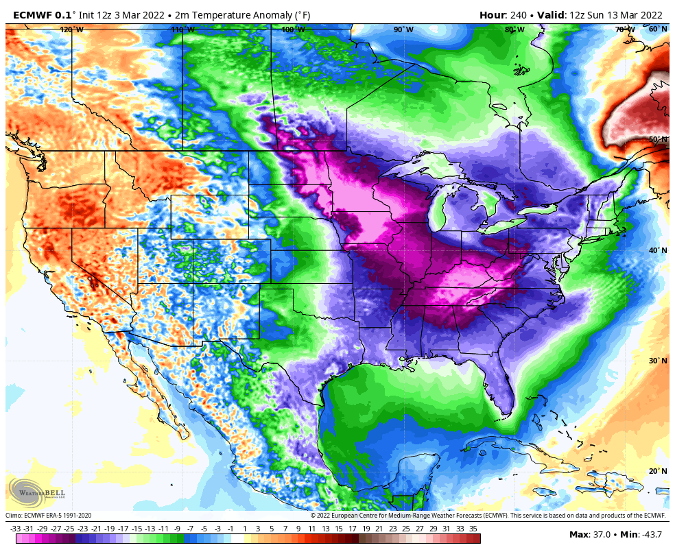
sroc4 wrote:There is def a storm signal mid month.
To be more specific 12th-18th. At least one opportunity IMO
_________________
"In weather and in life, there's no winning and losing; there's only winning and learning."
WINTER 2012/2013 TOTALS 43.65"WINTER 2017/2018 TOTALS 62.85" WINTER 2022/2023 TOTALS 4.9"
WINTER 2013/2014 TOTALS 64.85"WINTER 2018/2019 TOTALS 14.25" WINTER 2023/2024 TOTALS 13.1"
WINTER 2014/2015 TOTALS 71.20"WINTER 2019/2020 TOTALS 6.35"
WINTER 2015/2016 TOTALS 35.00"WINTER 2020/2021 TOTALS 37.75"
WINTER 2016/2017 TOTALS 42.25"WINTER 2021/2022 TOTALS 31.65"
sroc4- Admin
- Posts : 8331
Reputation : 301
Join date : 2013-01-07
Location : Wading River, LI
phil155 likes this post
Re: Long Range Thread 24.0
![]() by phil155 Thu Mar 03, 2022 2:35 pm
by phil155 Thu Mar 03, 2022 2:35 pm
phil155- Pro Enthusiast

- Posts : 475
Reputation : 4
Join date : 2019-12-16
Re: Long Range Thread 24.0
![]() by amugs Thu Mar 03, 2022 2:47 pm
by amugs Thu Mar 03, 2022 2:47 pm
YIKES
_________________
Mugs
AKA:King: Snow Weenie
Self Proclaimed
WINTER 2014-15 : 55.12" +.02 for 6 coatings (avg. 35")
WINTER 2015-16 Total - 29.8" (Avg 35")
WINTER 2016-17 : 39.5" so far
amugs- Advanced Forecaster - Mod
- Posts : 15093
Reputation : 213
Join date : 2013-01-07
Age : 54
Location : Hillsdale,NJ
Re: Long Range Thread 24.0
![]() by amugs Thu Mar 03, 2022 9:18 pm
by amugs Thu Mar 03, 2022 9:18 pm
It's looking like March 10-13th could bring a cold air outbreak (and possibly even a legitimate storm) to the Eastern US. This is thanks to an intense, high-latitude ridge displacing an Arctic airmass into North America. A +PNA then funnels this airmass south and east. pic.twitter.com/c58Xa8WyDu
— Nikhil Trivedi (@DCAreaWx) March 4, 2022
_________________
Mugs
AKA:King: Snow Weenie
Self Proclaimed
WINTER 2014-15 : 55.12" +.02 for 6 coatings (avg. 35")
WINTER 2015-16 Total - 29.8" (Avg 35")
WINTER 2016-17 : 39.5" so far
amugs- Advanced Forecaster - Mod
- Posts : 15093
Reputation : 213
Join date : 2013-01-07
Age : 54
Location : Hillsdale,NJ
Re: Long Range Thread 24.0
![]() by Radz Fri Mar 04, 2022 6:33 am
by Radz Fri Mar 04, 2022 6:33 am

Radz- Pro Enthusiast
- Posts : 1028
Reputation : 17
Join date : 2013-01-12
Location : Cortlandt Manor NY
Re: Long Range Thread 24.0
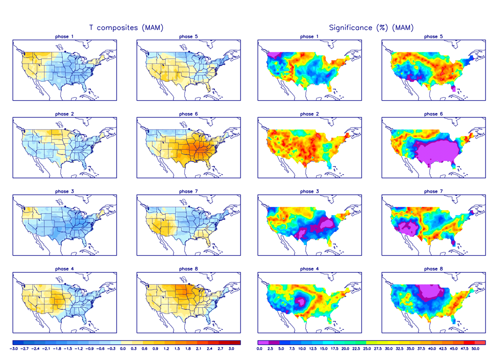
![]() by amugs Fri Mar 04, 2022 11:49 am
by amugs Fri Mar 04, 2022 11:49 am
.gif)
Temps outlook in these phases
_________________
Mugs
AKA:King: Snow Weenie
Self Proclaimed
WINTER 2014-15 : 55.12" +.02 for 6 coatings (avg. 35")
WINTER 2015-16 Total - 29.8" (Avg 35")
WINTER 2016-17 : 39.5" so far
amugs- Advanced Forecaster - Mod
- Posts : 15093
Reputation : 213
Join date : 2013-01-07
Age : 54
Location : Hillsdale,NJ
Re: Long Range Thread 24.0
![]() by amugs Fri Mar 04, 2022 11:54 am
by amugs Fri Mar 04, 2022 11:54 am
AO Negative (N)

NAO N

EPO N

PNA N to Positive

WPO N the whole time

Remember the WPO and EPO couplet when negative will drive the cross polar flow into the US and East
Last edited by amugs on Fri Mar 04, 2022 3:00 pm; edited 1 time in total
_________________
Mugs
AKA:King: Snow Weenie
Self Proclaimed
WINTER 2014-15 : 55.12" +.02 for 6 coatings (avg. 35")
WINTER 2015-16 Total - 29.8" (Avg 35")
WINTER 2016-17 : 39.5" so far
amugs- Advanced Forecaster - Mod
- Posts : 15093
Reputation : 213
Join date : 2013-01-07
Age : 54
Location : Hillsdale,NJ
Re: Long Range Thread 24.0
![]() by amugs Fri Mar 04, 2022 11:55 am
by amugs Fri Mar 04, 2022 11:55 am

_________________
Mugs
AKA:King: Snow Weenie
Self Proclaimed
WINTER 2014-15 : 55.12" +.02 for 6 coatings (avg. 35")
WINTER 2015-16 Total - 29.8" (Avg 35")
WINTER 2016-17 : 39.5" so far
amugs- Advanced Forecaster - Mod
- Posts : 15093
Reputation : 213
Join date : 2013-01-07
Age : 54
Location : Hillsdale,NJ
Re: Long Range Thread 24.0
![]() by sroc4 Fri Mar 04, 2022 12:53 pm
by sroc4 Fri Mar 04, 2022 12:53 pm
amugs wrote:Can these tele's actually verify - if so BEQWARE OF TEH IDES OF MARCH!!
AO Negative (N)
NAO N
EPO N
PNA N to Positive
WPO N the whole time
Remember the WPO and EPO couplet when negative will drive the cross polar flow into the US and East
Correlates nicely with the 12th-18th time frame for at least one storm opportunity.
_________________
"In weather and in life, there's no winning and losing; there's only winning and learning."
WINTER 2012/2013 TOTALS 43.65"WINTER 2017/2018 TOTALS 62.85" WINTER 2022/2023 TOTALS 4.9"
WINTER 2013/2014 TOTALS 64.85"WINTER 2018/2019 TOTALS 14.25" WINTER 2023/2024 TOTALS 13.1"
WINTER 2014/2015 TOTALS 71.20"WINTER 2019/2020 TOTALS 6.35"
WINTER 2015/2016 TOTALS 35.00"WINTER 2020/2021 TOTALS 37.75"
WINTER 2016/2017 TOTALS 42.25"WINTER 2021/2022 TOTALS 31.65"
sroc4- Admin
- Posts : 8331
Reputation : 301
Join date : 2013-01-07
Location : Wading River, LI
amugs likes this post
Re: Long Range Thread 24.0
![]() by sroc4 Fri Mar 04, 2022 12:54 pm
by sroc4 Fri Mar 04, 2022 12:54 pm
But we all know the truth....once we get to about day 5-7 slowly but surely the frequency at which we start checking in with the board begins to creep up. "Is there still a threat for snow? Hmm there is. Ehh I dont care anyway, the warmth feels too good and its still most likely wont happen. Ill check back again in a day or two"
Then we get to 5days out and you realize the cold air looks real, and the surface maps are showing 6"+ on random runs. Even though Its gone on the next run you cant help but start checking in more frequently to see if subsequent runs, or if the other models start showing it too.
Now we are inside 5days and the mind numbing desire for one last snowstorm takes back over and we all start checking in again beginning with when we wake up, followed by around noon ish give or take, and then again before bed....at a minimum.
Once inside day 3 if its still there then it doesn't matter, March or January, we are all in.
About 3-4days before we start looking into the details....
We Track!!!

_________________
"In weather and in life, there's no winning and losing; there's only winning and learning."
WINTER 2012/2013 TOTALS 43.65"WINTER 2017/2018 TOTALS 62.85" WINTER 2022/2023 TOTALS 4.9"
WINTER 2013/2014 TOTALS 64.85"WINTER 2018/2019 TOTALS 14.25" WINTER 2023/2024 TOTALS 13.1"
WINTER 2014/2015 TOTALS 71.20"WINTER 2019/2020 TOTALS 6.35"
WINTER 2015/2016 TOTALS 35.00"WINTER 2020/2021 TOTALS 37.75"
WINTER 2016/2017 TOTALS 42.25"WINTER 2021/2022 TOTALS 31.65"
sroc4- Admin
- Posts : 8331
Reputation : 301
Join date : 2013-01-07
Location : Wading River, LI
amugs, crippo84, weatherwatchermom, SENJsnowman and Irish like this post
Re: Long Range Thread 24.0
![]() by rb924119 Fri Mar 04, 2022 2:26 pm
by rb924119 Fri Mar 04, 2022 2:26 pm
rb924119 wrote: Can’t understand all the talk of “winter cancel” from other places. I’m doubling down on my call for March - it looks quite January-esque to me with respect to H5. In my opinion, the MJO is going to pull the same stunt that it did in December, though on the opposite side of the world. I think this MJO pulse is going to be stuck in Phase 2/3 for a while (several weeks), which bodes well for our March prospects (in addition to other factors that I’m looking at. It’s what happens after that that’s going to be interesting from a meteorological perspective. My earlier call for a west-based NAO to develop in March *might be* a little too fast, and it may hold off until late-month (this requires further thought over coming days), but I do like my initial call for an ugly and unsettled opening to April.The pattern will flip in April, and once it does, it’s going to get warm in a hurry. But when that flip should occur also requires further hypothesizing. That said, I also like the initial idea of an early and fast start to the severe weather season for the CONUS, mainly once we get to April, but this should also prevent any early-season tropical development, at least anywhere near the mainland U.S. I’ll add further insights into the thoughts that require more brainpower at some point haha
Bolded part for my man mugsy
Original post was made February 10th, for reference.
rb924119- Meteorologist

- Posts : 6890
Reputation : 194
Join date : 2013-02-06
Age : 32
Location : Greentown, Pa
sroc4, amugs and weatherwatchermom like this post
Re: Long Range Thread 24.0
![]() by amugs Fri Mar 04, 2022 2:59 pm
by amugs Fri Mar 04, 2022 2:59 pm
@SROC absolutely. AS I have said ....BEWARE OF THE IDES OF MARCH!!
_________________
Mugs
AKA:King: Snow Weenie
Self Proclaimed
WINTER 2014-15 : 55.12" +.02 for 6 coatings (avg. 35")
WINTER 2015-16 Total - 29.8" (Avg 35")
WINTER 2016-17 : 39.5" so far
amugs- Advanced Forecaster - Mod
- Posts : 15093
Reputation : 213
Join date : 2013-01-07
Age : 54
Location : Hillsdale,NJ
Re: Long Range Thread 24.0
![]() by sroc4 Mon Mar 07, 2022 11:35 am
by sroc4 Mon Mar 07, 2022 11:35 am
heehaw453 wrote:Saturday is about the SE ridge as it has been since beginning of February. It's a nice PNA as shown on the GEFS so i do think a sig storm will develop. But this is unconventional for sig snow for these parts. I'd much rather have -NAO more westward beating down that ridge and forcing the storm underneath us than rely on the east based TPV which failed to do this in several times in February. It just doesn't seem to get the job done. I think this weekend isn't much white unfortunately. Also keep in mind GEFS is the best look for snow out of all major guidance ATM.

I dont think we are close to seeing how this one plays out just yet. Of all variations in the modeling now it appears there is nothing but warm solns for most of our coverage area as the interaction between the N and S energy is too far west. And like as stated there is nothing on the Atlantic side to prevent it from cutting. However; I could see a scenario where a left over piece of energy hanging back ends up being what gives us a shot with a well times 50/50 low vs the southern energy can get out ahead delaying the phase a bit. Either N energy trends further back and delayed and or the southern energy trends faster; ahead of the N piece. Only chance we have for this one, but again unlikely ATT
_________________
"In weather and in life, there's no winning and losing; there's only winning and learning."
WINTER 2012/2013 TOTALS 43.65"WINTER 2017/2018 TOTALS 62.85" WINTER 2022/2023 TOTALS 4.9"
WINTER 2013/2014 TOTALS 64.85"WINTER 2018/2019 TOTALS 14.25" WINTER 2023/2024 TOTALS 13.1"
WINTER 2014/2015 TOTALS 71.20"WINTER 2019/2020 TOTALS 6.35"
WINTER 2015/2016 TOTALS 35.00"WINTER 2020/2021 TOTALS 37.75"
WINTER 2016/2017 TOTALS 42.25"WINTER 2021/2022 TOTALS 31.65"
sroc4- Admin
- Posts : 8331
Reputation : 301
Join date : 2013-01-07
Location : Wading River, LI
Re: Long Range Thread 24.0
![]() by heehaw453 Mon Mar 07, 2022 11:51 am
by heehaw453 Mon Mar 07, 2022 11:51 am
sroc4 wrote:heehaw453 wrote:Saturday is about the SE ridge as it has been since beginning of February. It's a nice PNA as shown on the GEFS so i do think a sig storm will develop. But this is unconventional for sig snow for these parts. I'd much rather have -NAO more westward beating down that ridge and forcing the storm underneath us than rely on the east based TPV which failed to do this in several times in February. It just doesn't seem to get the job done. I think this weekend isn't much white unfortunately. Also keep in mind GEFS is the best look for snow out of all major guidance ATM.
I dont think we are close to seeing how this one plays out just yet. Of all variations in the modeling now it appears there is nothing but warm solns for most of our coverage area as the interaction between the N and S energy is too far west. And like as stated there is nothing on the Atlantic side to prevent it from cutting. However; I could see a scenario where a left over piece of energy hanging back ends up being what gives us a shot with a well times 50/50 low vs the southern energy can get out ahead delaying the phase a bit. Either N energy trends further back and delayed and or the southern energy trends faster; ahead of the N piece. Only chance we have for this one, but again unlikely ATT
Right. the cutting is one aspect but it's just as much about the crap antecedent air mass due to that SE ridge. It's been an Achilles heal for us for 5/6 weeks and this is more of the same non favorable synoptic setups. IMO best case is c-1" well north/west of I-95 and maybe I-81 corridor can get a little goodness, but anything south of Scranton area doubt it. Just a little Atlantic help here would make a world of difference. But I certainly won't tell Mother Nature what she can and cannot do, so let's see.

heehaw453- Advanced Forecaster

- Posts : 3906
Reputation : 86
Join date : 2014-01-20
Location : Bedminster Township, PA Elevation 600' ASL
Re: Long Range Thread 24.0
![]() by heehaw453 Tue Mar 08, 2022 6:34 am
by heehaw453 Tue Mar 08, 2022 6:34 am


heehaw453- Advanced Forecaster
- Posts : 3906
Reputation : 86
Join date : 2014-01-20
Location : Bedminster Township, PA Elevation 600' ASL
Snow88 likes this post
Re: Long Range Thread 24.0
![]() by dkodgis Wed Mar 09, 2022 7:29 am
by dkodgis Wed Mar 09, 2022 7:29 am

dkodgis- Senior Enthusiast

- Posts : 2501
Reputation : 98
Join date : 2013-12-29
Re: Long Range Thread 24.0
![]() by heehaw453 Wed Mar 09, 2022 8:06 am
by heehaw453 Wed Mar 09, 2022 8:06 am
dkodgis wrote:Looks like Fri/Sat falling into place a bit more?
My opinion is no. Without the SE ridge being beaten down we just have a very poor antecedent air mass. That is a function of a poor Atlantic among other things. We won't get the storm to slow down for aforementioned reasons to allow colder air to work in and outside of I81 Binghamton area I don't see this having a chance for any meaningful snow. Maybe some c-1" further west in NEPA, EPA.
Our snow valve turned off end of January
 It happens...
heehaw453- Advanced Forecaster
- Posts : 3906
Reputation : 86
Join date : 2014-01-20
Location : Bedminster Township, PA Elevation 600' ASL
Re: Long Range Thread 24.0
![]() by SoulSingMG Wed Mar 09, 2022 9:17 am
by SoulSingMG Wed Mar 09, 2022 9:17 am

SoulSingMG- Senior Enthusiast
- Posts : 2853
Reputation : 74
Join date : 2013-12-11
Location : Long Island City, NY
Page 19 of 21 • 1 ... 11 ... 18, 19, 20, 21 ![]()
|
|
|