
 Search
QUESTIONS AND LEARNING
+2
Frank_Wx
sroc4
6 posters

QUESTIONS AND LEARNING
![]() by sroc4 Wed Jan 09, 2013 7:41 am
by sroc4 Wed Jan 09, 2013 7:41 am
Ive always felt that if I could visualize in my mind what I am trying to learn it made it easier to understand. These are some very general explanations which may help people visualize what is being talking about, and what is happening at any given time when looking at the general patterns for our weather.
As a general rule what is happening on the 500mb charts (approx 18,000ft above sea level) and above dictates the set up for the wind patterns which governs whether or not a region will see warm, cold or seasonable weather. Here is yesterdays 12z GFS 500mb at hr 180, similar to the one that Frank posted in his blog.
https://2img.net/r/ihimizer/img853/5130/education1.gif
Notice the two areas of high pressure (HP) otherwise known as ridges. And notice the area of Low Pressure (LP) in this case known as the polar vortex (PV), and the jet stream winding in between them. Now comes the visual part. Its these upper level HP's and LP's that dictates how and where the jet stream moves. The jet stream is like a river of wind, and winds its way in between areas of HP and LP in the upper levels of the atmosphere. To better understand this pretend you are standing on the ground looking at this same map in the horizontal plane instead of looking over the top like in the image above (area marked X on the bottom). It may look something like this:
https://2img.net/r/ihimizer/img690/872/educationjet.jpg
So where an air mass originates from dictates who sees what. For instance in this next image, which is the same one from above the ridge in the west pushes the jet stream north. By doing so it kind of tips the bucket of cold air, if you will, allowing the cold air up in Canada to spill southward into the central part of the country.
https://2img.net/r/ihimizer/img687/2996/education2.gif
The LP, or PV with its counter clockwise rotation works together with the HP ridge and its clockwise wind rotation in the west to drive the cold air in Canada south via a northwest flow in the upper atmosphere making the center of the country unseasonably cold.
Now look at the ridge in the south east. The clockwise wind rotation pumps warm air into the east with a southwest flow. You can see that that air originates from the warm air tropics keeping the east coast unseasonably warm.
If you look up in the Top right of the image there where I have labeled -NAO the three arrow are showing the south west edge of a north Atlantic ridge causing the Jet stream to turn back and head north west. This helps to keep the cold bottled up. When there is a +NAO, for the most part, that ridge is not there and the jet is allowed to continue to flow in a more easterly to north easterly direction. This more west to east flow of the jet is what is referred to as a progressive flow.
A + PNA and a -EPO tends to lead to these ridges in the west which allow for a deeper trough via a more North to south orientation of the jet stream on the west side of a trough. A -NAO allows for a more south to north orientation of the jet on the east side of a trough. How positive or neg these teleconnections are dictates just how big of a ridge, or deep of a trough there is. Now one could see how if you had a -PNA and a +NAO there would be a lack of a ridge in the west and no block to buckle the jet in the east and a very progressive west to east jet stream flow across the entire country would occur. This usually leads to moderate temps and a not very stormy weather pattern across the nation as a whole as the air mass for the country would have originated from out over the pacific ocean instead of up in Canada.
Just how strong the SE ridge is and how far north the ridge in the west pushes, will dictate just how far east this trough can move, and how deep it gets which will lead to just how cold we get in the north east. If the SE ridge remains strong and does not retreat south eastward the eastern side of the trough depicted in the image above may be forced northward somewhat forcing some of the cold north with it by the time it reaches the east coast.
Well that's it for now. I hope that helps some of you better understand some of the dynamics and driving forces behind the general weather patterns.

sroc4- Admin

- Posts : 8331
Reputation : 301
Join date : 2013-01-07
Location : Wading River, LI
Re: QUESTIONS AND LEARNING
![]() by Frank_Wx Wed Jan 09, 2013 7:05 pm
by Frank_Wx Wed Jan 09, 2013 7:05 pm
This was a fabulous explanation and if someone wants to learn some basics, this is a good way of doing so.

Frank_Wx- Godzilla Seeker
- Posts : 21305
Reputation : 328
Join date : 2013-01-05
Age : 31
Location : Jersey City, NJ -

Re: QUESTIONS AND LEARNING
![]() by Frank_Wx Thu Jan 10, 2013 12:51 am
by Frank_Wx Thu Jan 10, 2013 12:51 am
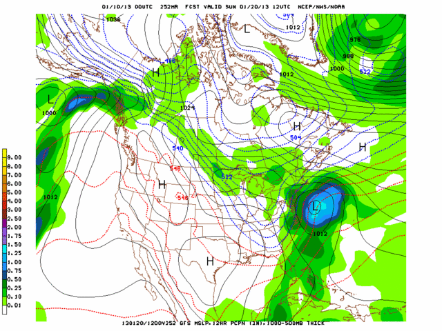
Fantasy land GFS shows a snowstorm around the 20th. Just so everyone knows, in the banter thread you can post about WHATEVER you want. As long as it is weather related and deals with weather in the LONG RAMGE.
Frank_Wx- Godzilla Seeker
- Posts : 21305
Reputation : 328
Join date : 2013-01-05
Age : 31
Location : Jersey City, NJ -
Re: QUESTIONS AND LEARNING
![]() by labgirl Wed Jan 16, 2013 11:48 am
by labgirl Wed Jan 16, 2013 11:48 am
What is a Miller B storm? I'm supposed to take my mom (who is 86) for blood work next week, I have a feeling this is a strong storm with a lot of snow.

labgirl- Posts : 32
Reputation : 2
Join date : 2013-01-07
Location : Stratford, CT
Re: QUESTIONS AND LEARNING
![]() by sroc4 Wed Jan 16, 2013 12:07 pm
by sroc4 Wed Jan 16, 2013 12:07 pm
labgirl wrote:What is a Miller B storm? I'm supposed to take my mom (who is 86) for blood work next week, I have a feeling this is a strong storm with a lot of snow.
A Miller B is a storm that develops a low pressure somewhere off the east coast, and a second wave of low pressure dives in from the north along a trough typically reffered to as an Alberta clipper. The Low coming in from the north phases with (transfers, or infuses its energy into) the low on the coast. This added energy allows the coastal low to rapidly intensify using the energy from the phased northern low, and the Atlantic ocean to produce very heavy precip. as it rides up the coast. Timing of the phase, and positioning of the trough are key to nailing down a track. In general Miller B set ups are more diff to predict the further out you are because there are more pieces of the puzzle to put together.
In contrast a Miller A type storm is a single low that develops off the E coast and uses the energy from the gulf stream and Atlantic to strengthen as it rides up the coast. It too can produce heavy precip.
Im at work otherwise I would post a pic as well. In many ways superstorm Sandy was a Miller B setup. FYI this storm for next week is still a long way from being nailed down.
sroc4- Admin
- Posts : 8331
Reputation : 301
Join date : 2013-01-07
Location : Wading River, LI
Re: QUESTIONS AND LEARNING
![]() by labgirl Wed Jan 16, 2013 1:02 pm
by labgirl Wed Jan 16, 2013 1:02 pm
Thanks for the reply, great explanation and I actually understand it! 
labgirl- Posts : 32
Reputation : 2
Join date : 2013-01-07
Location : Stratford, CT
sroc4- Admin
- Posts : 8331
Reputation : 301
Join date : 2013-01-07
Location : Wading River, LI
Re: QUESTIONS AND LEARNING
![]() by Noreaster Wed Jan 16, 2013 6:05 pm
by Noreaster Wed Jan 16, 2013 6:05 pm
Here's a slide show..miller a and miller b
http://www.examiner.com/slideshow/miller-a-vs-miller-b-storms#slide=9153736
http://www.examiner.com/slideshow/miller-a-vs-miller-b-storms#slide=9153736

Noreaster- Posts : 463
Reputation : 5
Join date : 2013-01-08
Age : 41
Location : Merrick, NY
Re: QUESTIONS AND LEARNING
![]() by Noreaster Wed Jan 16, 2013 6:10 pm
by Noreaster Wed Jan 16, 2013 6:10 pm
I posted this for three straight winters on the other board. This is great and shows you the history of snow storms in our area. It shows u totals, the upper level low tracks best for snow, the surface low tracks, the ENSO's and strength of such state (el nina /la nina),miller a or b, by month, and so on...It's very interesting
'
http://berkswintercast.tripod.com/id85.html
'
http://berkswintercast.tripod.com/id85.html
Noreaster- Posts : 463
Reputation : 5
Join date : 2013-01-08
Age : 41
Location : Merrick, NY
Re: QUESTIONS AND LEARNING
![]() by docstox12 Wed Jan 16, 2013 6:38 pm
by docstox12 Wed Jan 16, 2013 6:38 pm
Noreaster wrote:I posted this for three straight winters on the other board. This is great and shows you the history of snow storms in our area. It shows u totals, the upper level low tracks best for snow, the surface low tracks, the ENSO's and strength of such state (el nina /la nina),miller a or b, by month, and so on...It's very interesting
'
http://berkswintercast.tripod.com/id85.html
This is really a great read and excellent.Brought back a lot of memories.That Miller B Feb 1961 snowstorm had a brief period of sleet and freezing rain in the NYC area, but it changed right back to snow.
That Feb. '83 Snowstorm dumped snow at a rate of 3 inches an hour for 6 straight hours without letup.I've never seen anything like it in 52 years of observing.Mr.G was going crazy on the tv,LOL!
Sadly, in NNJ, that March 1993 Superstorm turned to heavy sleet after dumping 14 inches of snow.There was a total of 18 inches of snow and sleet.Had the track not been so close to the coast, we would have gotten 30 inches like they did near the Delaware Water gap.

docstox12- Wx Statistician Guru

- Posts : 8504
Reputation : 222
Join date : 2013-01-07
Age : 73
Location : Monroe NY
Re: QUESTIONS AND LEARNING
![]() by Math23x7 Wed Jan 16, 2013 6:59 pm
by Math23x7 Wed Jan 16, 2013 6:59 pm
docstox12 wrote:Noreaster wrote:I posted this for three straight winters on the other board. This is great and shows you the history of snow storms in our area. It shows u totals, the upper level low tracks best for snow, the surface low tracks, the ENSO's and strength of such state (el nina /la nina),miller a or b, by month, and so on...It's very interesting
'
http://berkswintercast.tripod.com/id85.html
This is really a great read and excellent.Brought back a lot of memories.That Miller B Feb 1961 snowstorm had a brief period of sleet and freezing rain in the NYC area, but it changed right back to snow.
That Feb. '83 Snowstorm dumped snow at a rate of 3 inches an hour for 6 straight hours without letup.I've never seen anything like it in 52 years of observing.Mr.G was going crazy on the tv,LOL!
Sadly, in NNJ, that March 1993 Superstorm turned to heavy sleet after dumping 14 inches of snow.There was a total of 18 inches of snow and sleet.Had the track not been so close to the coast, we would have gotten 30 inches like they did near the Delaware Water gap.
Doc, I'm in my early 20s and what comes close to the snowfall rates that you described in the February 1983 storm is the January 26-27, 2011 snowstorm. The storm last just a few hours, but had snowfall rates of several inches per hour. Not sure whether or not it's miller B, but the rates were as heavy, if not heavier, than the December 26-27, 2010.
Math23x7- Wx Statistician Guru
- Posts : 2379
Reputation : 68
Join date : 2013-01-08
Re: QUESTIONS AND LEARNING
![]() by labgirl Wed Jan 16, 2013 7:48 pm
by labgirl Wed Jan 16, 2013 7:48 pm
What I remember most about the 1996 Blizzard was that back then there weren't a whole lot of people who had 4WD vehicles so hospital security and volunteer private citizens who had 4WD used to pick up essential personel and bring us in the night before and we got paid for sleeping over (unfortunately in a hospital bed). So I got picked up along with a whole bunch of other ladies and we rattled around in this old Bronco and got dropped off at the hospital. Then the next day no one had any way to get home. I finally got a ride and when we pulled up to my driveway the snow at the bottom was so high that I don't even know how I got in the house. And I hand shoveled that all on my own, I think it took me 4 hours. Nowadays they pick up NO ONE, we are on our own and if you call out sick durung a snow storm you don't get paid. 
labgirl- Posts : 32
Reputation : 2
Join date : 2013-01-07
Location : Stratford, CT
Re: QUESTIONS AND LEARNING
![]() by Frank_Wx Wed Jan 16, 2013 7:52 pm
by Frank_Wx Wed Jan 16, 2013 7:52 pm
Ha, that's a great story labgirl.
Unfortunately, I do not remember this storm. Was only 4 years old...
Unfortunately, I do not remember this storm. Was only 4 years old...
Frank_Wx- Godzilla Seeker
- Posts : 21305
Reputation : 328
Join date : 2013-01-05
Age : 31
Location : Jersey City, NJ -
Permissions in this forum:
You cannot reply to topics in this forum|
|
|