
 Search
JAN 28th-30th 2024 Potential system compliments of a +PNA
Page 2 of 5 •  1, 2, 3, 4, 5
 ![]()
Re: JAN 28th-30th 2024 Potential system compliments of a +PNA
![]() by Frank_Wx Thu Jan 25, 2024 7:57 am
by Frank_Wx Thu Jan 25, 2024 7:57 am
The transfer to the coast is always a tricky one. Is the secondary too close to the coast? Who suffers from the dreaded area of subsidence? Exactly how deep can the secondary get to pull colder air down to the coast? These are the main questions that enter my mind.
Models are conflicted as they try to solve these questions. We definitely have a long way to go. Gun to my head, based on this seasons trend, N&W should do well again. A nice moderate snowfall possibly. Unfortunately I think the coast will roast. Temps will be in the 50s leading up to the event, and the ULL won’t be south enough to drag in the cold air from the north. MAYBE a minor accumulation on the table. Hope I’m wrong. But at least it’s something to track
Frank_Wx- Godzilla Seeker

- Posts : 21305
Join date : 2013-01-05 -

SENJsnowman and MattyICE like this post
Re: JAN 28th-30th 2024 Potential system compliments of a +PNA
![]() by kalleg Thu Jan 25, 2024 8:06 am
by kalleg Thu Jan 25, 2024 8:06 am
"Coast will roast"! Great phrase, though a sad prediction indeed...Frank_Wx wrote:Agreed Scott…pleasantly surprised we’re even talking snow. But good things happen when you get a well timed PNA spike. I wish for northern stream interaction but I think I need to eliminate this idea from my mind. El Niño is going to Nino.
The transfer to the coast is always a tricky one. Is the secondary too close to the coast? Who suffers from the dreaded area of subsidence? Exactly how deep can the secondary get to pull colder air down to the coast? These are the main questions that enter my mind.
Models are conflicted as they try to solve these questions. We definitely have a long way to go. Gun to my head, based on this seasons trend, N&W should do well again. A nice moderate snowfall possibly. Unfortunately I think the coast will roast. Temps will be in the 50s leading up to the event, and the ULL won’t be south enough to drag in the cold air from the north. MAYBE a minor accumulation on the table. Hope I’m wrong. But at least it’s something to track
kalleg- Posts : 142
Join date : 2013-01-15
Re: JAN 28th-30th 2024 Potential system compliments of a +PNA
![]() by amugs Thu Jan 25, 2024 8:22 am
by amugs Thu Jan 25, 2024 8:22 am
sroc4 wrote:Not a lot changed in my mind overnight. Models continue to show decent potential for this Sunday into Monday. All the major players are there. IMO a more surpressed soln is way more likely than a primary that cuts too far north and warm soln with an arctic HP on the move the way it is.
We still have a long way to go with this despite it only about 3.5-4.5 days out. Its going to be really fun to be watching the transfer of the primary to the coast on the real time meso maps, and monitor the where and when and then where the mid level low closes and positions itself. I think there could be surprises both good and bad depending on where you live in real time with this one.
Buckle up folks. Tracking snow in a shitty pattern. And check your point and click apps. Notice the temp profiles beyond the weekend into next week. They aren’t that warm.
We Track.

GFS says warm up phase 6 HAHAHA!!
_________________
Mugs
AKA:King: Snow Weenie
Self Proclaimed
WINTER 2014-15 : 55.12" +.02 for 6 coatings (avg. 35")
WINTER 2015-16 Total - 29.8" (Avg 35")
WINTER 2016-17 : 39.5" so far

amugs- Advanced Forecaster - Mod

- Posts : 15093
Reputation : 213
Join date : 2013-01-07
Age : 54
Location : Hillsdale,NJ
Re: JAN 28th-30th 2024 Potential system compliments of a +PNA
![]() by heehaw453 Thu Jan 25, 2024 8:45 am
by heehaw453 Thu Jan 25, 2024 8:45 am
heehaw453- Advanced Forecaster

- Posts : 3906
Reputation : 86
Join date : 2014-01-20
Location : Bedminster Township, PA Elevation 600' ASL
Re: JAN 28th-30th 2024 Potential system compliments of a +PNA
![]() by sroc4 Thu Jan 25, 2024 9:33 am
by sroc4 Thu Jan 25, 2024 9:33 am
Frank_Wx wrote:Agreed Scott…pleasantly surprised we’re even talking snow. But good things happen when you get a well timed PNA spike. I wish for northern stream interaction but I think I need to eliminate this idea from my mind. El Niño is going to Nino.
The transfer to the coast is always a tricky one. Is the secondary too close to the coast? Who suffers from the dreaded area of subsidence? Exactly how deep can the secondary get to pull colder air down to the coast? These are the main questions that enter my mind.
Models are conflicted as they try to solve these questions. We definitely have a long way to go. Gun to my head, based on this seasons trend, N&W should do well again. A nice moderate snowfall possibly. Unfortunately I think the coast will roast. Temps will be in the 50s leading up to the event, and the ULL won’t be south enough to drag in the cold air from the north. MAYBE a minor accumulation on the table. Hope I’m wrong. But at least it’s something to track
For the record I disagree with the phrase the coast will roast. There is a weak s/w that moves through Sat and by late sat the coastal plain through mid to maybe the northern third of NJ is down to the low 40's high 30's at worst depending on the model. The real key for the coastal plain will be how the mid levels behave. Upon the initial transfer of the slp to the coast the surface and mid levels are still warm, but as the new low gets going where and how quick the 700 and 850mb levels can close and where the slp is situated, will determine the fate for the coastal plain. Once they close off, or IF they close off, but when they do the door that opens is not to a marginal air mass. It's to a arctic one. So IF the HP is far enough south and the mid level lows close off early enough mid levels temps will crash hard, and the surface temps will follow. The dynamics of this process will def be very challenging to see esp in an operational model 3 days out. We will also prob find that even meso model's will struggle with te finer details of this process such that an area of 15-25mils difference can mean the difference between a change over or not. I personally would not throw in any towel until late Sunday regardless of where you live.
_________________
"In weather and in life, there's no winning and losing; there's only winning and learning."
WINTER 2012/2013 TOTALS 43.65"WINTER 2017/2018 TOTALS 62.85" WINTER 2022/2023 TOTALS 4.9"
WINTER 2013/2014 TOTALS 64.85"WINTER 2018/2019 TOTALS 14.25" WINTER 2023/2024 TOTALS 13.1"
WINTER 2014/2015 TOTALS 71.20"WINTER 2019/2020 TOTALS 6.35"
WINTER 2015/2016 TOTALS 35.00"WINTER 2020/2021 TOTALS 37.75"
WINTER 2016/2017 TOTALS 42.25"WINTER 2021/2022 TOTALS 31.65"

sroc4- Admin
- Posts : 8331
Reputation : 301
Join date : 2013-01-07
Location : Wading River, LI
kalleg and silentwreck like this post
Re: JAN 28th-30th 2024 Potential system compliments of a +PNA
![]() by sroc4 Thu Jan 25, 2024 9:34 am
by sroc4 Thu Jan 25, 2024 9:34 am
_________________
"In weather and in life, there's no winning and losing; there's only winning and learning."
WINTER 2012/2013 TOTALS 43.65"WINTER 2017/2018 TOTALS 62.85" WINTER 2022/2023 TOTALS 4.9"
WINTER 2013/2014 TOTALS 64.85"WINTER 2018/2019 TOTALS 14.25" WINTER 2023/2024 TOTALS 13.1"
WINTER 2014/2015 TOTALS 71.20"WINTER 2019/2020 TOTALS 6.35"
WINTER 2015/2016 TOTALS 35.00"WINTER 2020/2021 TOTALS 37.75"
WINTER 2016/2017 TOTALS 42.25"WINTER 2021/2022 TOTALS 31.65"
sroc4- Admin
- Posts : 8331
Reputation : 301
Join date : 2013-01-07
Location : Wading River, LI
silentwreck likes this post
Re: JAN 28th-30th 2024 Potential system compliments of a +PNA
![]() by MattyICE Thu Jan 25, 2024 11:25 am
by MattyICE Thu Jan 25, 2024 11:25 am
MattyICE- Advanced Forecaster
- Posts : 249
Reputation : 6
Join date : 2017-11-10
Age : 38
Location : Clifton, NJ (Eastern Passaic County)
heehaw453 and SENJsnowman like this post
Re: JAN 28th-30th 2024 Potential system compliments of a +PNA
![]() by heehaw453 Thu Jan 25, 2024 11:42 am
by heehaw453 Thu Jan 25, 2024 11:42 am
MattyICE wrote:Not sure they’ll roast either. But the air mass is dog shit, frankly. The need for the coast is to have a more suppressive TPV/HP below it helping temps but actually risking shearing the storm out. I think that’s a bigger risk currently than straight suppression. Some guidance is showing this and it results in a non-amped strung out spotty precip mess for the coastal plain, whereas a more amped scenario just means rain to 84. Im not sure there is a middle ground without literally everything coming together perfectly, which is never likely and makes those setups so special. Certainly trackable for the next couple of days and if people manage their expectations (by that I mean zero snow. Maybe white rain for an hour at the end) then maybe there can be some nice surprises. I just think the overall antecedent setup is too hostile and that points to this not working, which is fine imo because it was always going to be a rather long shot, regardless of what the 12z Euro showed yesterday. I think that demonstrated pretty close to the best case scenario that is highly unlikely…BUT…we still TRACK.
Well said. The Euro ain't what it used to be... 5 years ago I would have looked at the EPS inside of D5 and been excited. I looked at it yesterday with many shades of doubt and figured it'd change its tune.
heehaw453- Advanced Forecaster
- Posts : 3906
Reputation : 86
Join date : 2014-01-20
Location : Bedminster Township, PA Elevation 600' ASL
MattyICE likes this post
Re: JAN 28th-30th 2024 Potential system compliments of a +PNA
![]() by billg315 Thu Jan 25, 2024 12:36 pm
by billg315 Thu Jan 25, 2024 12:36 pm
MattyICE wrote:Not sure they’ll roast either. But the air mass is dog shit, frankly. The need for the coast is to have a more suppressive TPV/HP below it helping temps but actually risking shearing the storm out. I think that’s a bigger risk currently than straight suppression. Some guidance is showing this and it results in a non-amped strung out spotty precip mess for the coastal plain, whereas a more amped scenario just means rain to 84. Im not sure there is a middle ground without literally everything coming together perfectly, which is never likely and makes those setups so special. Certainly trackable for the next couple of days and if people manage their expectations (by that I mean zero snow. Maybe white rain for an hour at the end) then maybe there can be some nice surprises. I just think the overall antecedent setup is too hostile and that points to this not working, which is fine imo because it was always going to be a rather long shot, regardless of what the 12z Euro showed yesterday. I think that demonstrated pretty close to the best case scenario that is highly unlikely…BUT…we still TRACK.
I feel like this summarizes most of our systems this season. All of these are just strung out and spotty, so even when the cold air source is available (whether it be a very cold antecedent air mass like last week, or a cold High up in eastern Canada like this one), the systems are just not cashing in.

billg315- Advanced Forecaster - Mod
- Posts : 4466
Reputation : 185
Join date : 2015-01-24
Age : 50
Location : Flemington, NJ
Re: JAN 28th-30th 2024 Potential system compliments of a +PNA
![]() by billg315 Thu Jan 25, 2024 12:45 pm
by billg315 Thu Jan 25, 2024 12:45 pm
Hope he comes around by late season, or at least takes a step forward next season.
billg315- Advanced Forecaster - Mod
- Posts : 4466
Reputation : 185
Join date : 2015-01-24
Age : 50
Location : Flemington, NJ
docstox12, kalleg, essexcountypete, heehaw453, SENJsnowman and MattyICE like this post
Re: JAN 28th-30th 2024 Potential system compliments of a +PNA
![]() by MattyICE Thu Jan 25, 2024 1:08 pm
by MattyICE Thu Jan 25, 2024 1:08 pm
billg315 wrote:MattyICE wrote:Not sure they’ll roast either. But the air mass is dog shit, frankly. The need for the coast is to have a more suppressive TPV/HP below it helping temps but actually risking shearing the storm out. I think that’s a bigger risk currently than straight suppression. Some guidance is showing this and it results in a non-amped strung out spotty precip mess for the coastal plain, whereas a more amped scenario just means rain to 84. Im not sure there is a middle ground without literally everything coming together perfectly, which is never likely and makes those setups so special. Certainly trackable for the next couple of days and if people manage their expectations (by that I mean zero snow. Maybe white rain for an hour at the end) then maybe there can be some nice surprises. I just think the overall antecedent setup is too hostile and that points to this not working, which is fine imo because it was always going to be a rather long shot, regardless of what the 12z Euro showed yesterday. I think that demonstrated pretty close to the best case scenario that is highly unlikely…BUT…we still TRACK.
I feel like this summarizes most of our systems this season. All of these are just strung out and spotty, so even when the cold air source is available (whether it be a very cold antecedent air mass like last week, or a cold High up in eastern Canada like this one), the systems are just not cashing in.
Yep. Then it’s just annoying because the LP might even take a good track and we’re left unable to fathom an LP in a perfect spot in prime Climo resulting in showers. Or rain to buffalo. Etc.
MattyICE- Advanced Forecaster
- Posts : 249
Reputation : 6
Join date : 2017-11-10
Age : 38
Location : Clifton, NJ (Eastern Passaic County)
Re: JAN 28th-30th 2024 Potential system compliments of a +PNA
![]() by essexcountypete Thu Jan 25, 2024 1:12 pm
by essexcountypete Thu Jan 25, 2024 1:12 pm
billg315 wrote:We just need one of these suckers to deepen rapidly and tap into that cold air, but they can't seem to get their act together. To borrow Scott's "rebuilding football team" analogy for this winter, it seems our quarterback (the storm(s)) has offensive weapons available (cold High in Canada, ridge out west, 50/50 low) but hasn't learned to use them yet, so our offense can't put up the big scores. He needs some confidence and zip on his throws.
Hope he comes around by late season, or at least takes a step forward next season.
I'm afraid this winter is stuck in Concussion Protocol

essexcountypete- Pro Enthusiast

- Posts : 783
Reputation : 12
Join date : 2013-12-09
Location : Bloomfield, NJ
sroc4 and billg315 like this post
Re: JAN 28th-30th 2024 Potential system compliments of a +PNA
![]() by heehaw453 Thu Jan 25, 2024 1:22 pm
by heehaw453 Thu Jan 25, 2024 1:22 pm
850mb vorticity disorganized

500mb vorticity too positively tilted

As far as I'm concerned this is irrelevant for MBY probably be an inch or two at best

heehaw453- Advanced Forecaster
- Posts : 3906
Reputation : 86
Join date : 2014-01-20
Location : Bedminster Township, PA Elevation 600' ASL
Re: JAN 28th-30th 2024 Potential system compliments of a +PNA
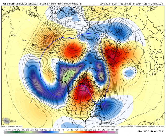
![]() by MattyICE Thu Jan 25, 2024 1:27 pm
by MattyICE Thu Jan 25, 2024 1:27 pm
heehaw453 wrote:12Z Euro disorganized mess from what yesterday 12Z showed. The trough (2nd pic) leaning positive tilt never allows the consolidation. The best shot is if that h5 through can tilt neutral and the mid-levels close off. Otherwise I don't much of anything with this regardless of what snow maps may or may not show.
850mb vorticity disorganized
500mb vorticity too positively tilted
As far as I'm concerned this is irrelevant for MBY probably be an inch or two at best
That PNA looks way less tall than yesterday. And that was the one thing we really had going!
MattyICE- Advanced Forecaster
- Posts : 249
Reputation : 6
Join date : 2017-11-10
Age : 38
Location : Clifton, NJ (Eastern Passaic County)
SENJsnowman likes this post
Re: JAN 28th-30th 2024 Potential system compliments of a +PNA
![]() by heehaw453 Thu Jan 25, 2024 1:37 pm
by heehaw453 Thu Jan 25, 2024 1:37 pm
MattyICE wrote:heehaw453 wrote:12Z Euro disorganized mess from what yesterday 12Z showed. The trough (2nd pic) leaning positive tilt never allows the consolidation. The best shot is if that h5 through can tilt neutral and the mid-levels close off. Otherwise I don't much of anything with this regardless of what snow maps may or may not show.
850mb vorticity disorganized
500mb vorticity too positively tilted
As far as I'm concerned this is irrelevant for MBY probably be an inch or two at best
That PNA looks way less tall than yesterday. And that was the one thing we really had going!
Yep. Certainly not helping the s/w development after it transfers.

heehaw453- Advanced Forecaster
- Posts : 3906
Reputation : 86
Join date : 2014-01-20
Location : Bedminster Township, PA Elevation 600' ASL
MattyICE likes this post
Re: JAN 28th-30th 2024 Potential system compliments of a +PNA
![]() by SENJsnowman Thu Jan 25, 2024 1:49 pm
by SENJsnowman Thu Jan 25, 2024 1:49 pm
heehaw453 wrote:MattyICE wrote:heehaw453 wrote:12Z Euro disorganized mess from what yesterday 12Z showed. The trough (2nd pic) leaning positive tilt never allows the consolidation. The best shot is if that h5 through can tilt neutral and the mid-levels close off. Otherwise I don't much of anything with this regardless of what snow maps may or may not show.
850mb vorticity disorganized
500mb vorticity too positively tilted
As far as I'm concerned this is irrelevant for MBY probably be an inch or two at best
That PNA looks way less tall than yesterday. And that was the one thing we really had going!
Yep. Certainly not helping the s/w development after it transfers.
Windshield wipers! Cuz without unfettered optimism right now
SENJsnowman- Senior Enthusiast

- Posts : 1186
Reputation : 61
Join date : 2017-01-06
Age : 51
Location : Bayville, NJ
sroc4, essexcountypete, heehaw453 and weatherwatchermom like this post
Re: JAN 28th-30th 2024 Potential system compliments of a +PNA
![]() by MattyICE Thu Jan 25, 2024 3:02 pm
by MattyICE Thu Jan 25, 2024 3:02 pm
SENJsnowman wrote:heehaw453 wrote:MattyICE wrote:heehaw453 wrote:12Z Euro disorganized mess from what yesterday 12Z showed. The trough (2nd pic) leaning positive tilt never allows the consolidation. The best shot is if that h5 through can tilt neutral and the mid-levels close off. Otherwise I don't much of anything with this regardless of what snow maps may or may not show.
850mb vorticity disorganized
500mb vorticity too positively tilted
As far as I'm concerned this is irrelevant for MBY probably be an inch or two at best
That PNA looks way less tall than yesterday. And that was the one thing we really had going!
Yep. Certainly not helping the s/w development after it transfers.
Windshield wipers! Cuz without unfettered optimism right now, we got nuthin!
Lol. Fair. I’m always on board for the windshield affect - but I usually expect that when the setup is a bit more neutral. This one is pretty putrid and my heart will pine for a comeback, but my mind says the typical wiper affect won’t apply to this storm. We’ll see!
MattyICE- Advanced Forecaster
- Posts : 249
Reputation : 6
Join date : 2017-11-10
Age : 38
Location : Clifton, NJ (Eastern Passaic County)
SENJsnowman likes this post
Re: JAN 28th-30th 2024 Potential system compliments of a +PNA
![]() by heehaw453 Thu Jan 25, 2024 3:05 pm
by heehaw453 Thu Jan 25, 2024 3:05 pm
heehaw453- Advanced Forecaster
- Posts : 3906
Reputation : 86
Join date : 2014-01-20
Location : Bedminster Township, PA Elevation 600' ASL
essexcountypete and MattyICE like this post
Re: JAN 28th-30th 2024 Potential system compliments of a +PNA
![]() by sroc4 Thu Jan 25, 2024 3:20 pm
by sroc4 Thu Jan 25, 2024 3:20 pm
sroc4 wrote:Irish wrote:Thx for the detailed write-up, Sroc. So, if I'm reading this correctly, most likely no matter how it shakes out, the coast has a high % of an all rain event?
Irish, I hesitate to use any sort of definitive adjectives etc to describe chances for anyone particular in general, except to say that since we are in a warm phase of the MJO and the air mass leading into the weekend is less than ideal, and the pattern as a whole is less than ideal for winter weather outcomes in the north east, if you live along the coastal plain you should not expect to see white, but simultaneously understand that the chances are def not zero percent. Gun to head for my back yard on Long Island I give it <10% chance at this time. That WILL change, for better or worse, over the next 3-4 days. Off the coast percentages increase a little, but I think 50/50 is the best anyone should consider up through this am regardless of where you live.
So for me, this one will be more in the thrill of the tracking and the learning that comes along with it. If any white ends up IMBY, even if its white rain(non accumulating snow falling from the sky), I will consider that a win, given the current state of the atmosphere....again this is my current expectation.
Cautious optimism, with realistic expectations
_________________
"In weather and in life, there's no winning and losing; there's only winning and learning."
WINTER 2012/2013 TOTALS 43.65"WINTER 2017/2018 TOTALS 62.85" WINTER 2022/2023 TOTALS 4.9"
WINTER 2013/2014 TOTALS 64.85"WINTER 2018/2019 TOTALS 14.25" WINTER 2023/2024 TOTALS 13.1"
WINTER 2014/2015 TOTALS 71.20"WINTER 2019/2020 TOTALS 6.35"
WINTER 2015/2016 TOTALS 35.00"WINTER 2020/2021 TOTALS 37.75"
WINTER 2016/2017 TOTALS 42.25"WINTER 2021/2022 TOTALS 31.65"
sroc4- Admin
- Posts : 8331
Reputation : 301
Join date : 2013-01-07
Location : Wading River, LI
essexcountypete and MattyICE like this post
Re: JAN 28th-30th 2024 Potential system compliments of a +PNA
![]() by billg315 Thu Jan 25, 2024 4:09 pm
by billg315 Thu Jan 25, 2024 4:09 pm
billg315- Advanced Forecaster - Mod
- Posts : 4466
Reputation : 185
Join date : 2015-01-24
Age : 50
Location : Flemington, NJ
Re: JAN 28th-30th 2024 Potential system compliments of a +PNA
![]() by heehaw453 Thu Jan 25, 2024 4:20 pm
by heehaw453 Thu Jan 25, 2024 4:20 pm
heehaw453- Advanced Forecaster
- Posts : 3906
Reputation : 86
Join date : 2014-01-20
Location : Bedminster Township, PA Elevation 600' ASL
billg315 likes this post
Re: JAN 28th-30th 2024 Potential system compliments of a +PNA
![]() by nutleyblizzard Thu Jan 25, 2024 6:59 pm
by nutleyblizzard Thu Jan 25, 2024 6:59 pm
18z GFS came in with a slightly better ridge out west along with a slightly amped system which in turn gave SNE bigger snowfall totals than the 12Z run. Baby steps. What I’d like to see is that trough to become more neutral which would really help our cause. We still have time for changes. 0z runs tonight would be a good start.heehaw453 wrote:I don't think I can recall one cold H pressure getting parked over Quebec Jan/Feb. Definitely not coinciding with moisture. The basic synoptics are there IMO if the storm can deepen. The initial moisture with a weak storm isn't going to do too much for most in this forum outside very elevated areas as the initial air mass is garbage. Models could absolutely change up tomorrow. But to sroc's point expect nothing and work up from there.

nutleyblizzard- Senior Enthusiast
- Posts : 1952
Reputation : 41
Join date : 2014-01-30
Age : 58
Location : Nutley, new jersey
sroc4 and amugs like this post
Re: JAN 28th-30th 2024 Potential system compliments of a +PNA
![]() by heehaw453 Thu Jan 25, 2024 10:31 pm
by heehaw453 Thu Jan 25, 2024 10:31 pm

heehaw453- Advanced Forecaster
- Posts : 3906
Reputation : 86
Join date : 2014-01-20
Location : Bedminster Township, PA Elevation 600' ASL
Re: JAN 28th-30th 2024 Potential system compliments of a +PNA
![]() by aiannone Thu Jan 25, 2024 11:03 pm
by aiannone Thu Jan 25, 2024 11:03 pm

_________________
-Alex Iannone-

aiannone- Senior Enthusiast - Mod
- Posts : 4813
Reputation : 92
Join date : 2013-01-07
Location : Saint James, LI (Northwest Suffolk Co.)
Re: JAN 28th-30th 2024 Potential system compliments of a +PNA
![]() by CPcantmeasuresnow Thu Jan 25, 2024 11:29 pm
by CPcantmeasuresnow Thu Jan 25, 2024 11:29 pm
aiannone wrote:0z Nam was damn close
I'm good right where it is, but that's probably not the final outcome.

CPcantmeasuresnow- Wx Statistician Guru

- Posts : 7274
Reputation : 230
Join date : 2013-01-07
Age : 103
Location : Eastern Orange County, NY
docstox12, kalleg and phil155 like this post
Re: JAN 28th-30th 2024 Potential system compliments of a +PNA
![]() by sroc4 Fri Jan 26, 2024 6:27 am
by sroc4 Fri Jan 26, 2024 6:27 am
While a few of the models I was hoping for went warm, there are still a couple that are hanging on to their he colder solns. It’s still only Friday so there is still time for things to swing the other way. Again I’ve seen cold air, when on the move win out later in the season regardless of what models say.
Happy Friday
_________________
"In weather and in life, there's no winning and losing; there's only winning and learning."
WINTER 2012/2013 TOTALS 43.65"WINTER 2017/2018 TOTALS 62.85" WINTER 2022/2023 TOTALS 4.9"
WINTER 2013/2014 TOTALS 64.85"WINTER 2018/2019 TOTALS 14.25" WINTER 2023/2024 TOTALS 13.1"
WINTER 2014/2015 TOTALS 71.20"WINTER 2019/2020 TOTALS 6.35"
WINTER 2015/2016 TOTALS 35.00"WINTER 2020/2021 TOTALS 37.75"
WINTER 2016/2017 TOTALS 42.25"WINTER 2021/2022 TOTALS 31.65"
sroc4- Admin
- Posts : 8331
Reputation : 301
Join date : 2013-01-07
Location : Wading River, LI
SENJsnowman likes this post
Re: JAN 28th-30th 2024 Potential system compliments of a +PNA
![]() by Frank_Wx Fri Jan 26, 2024 7:24 am
by Frank_Wx Fri Jan 26, 2024 7:24 am


_________________
_______________________________________________________________________________________________________
CLICK HERE to view NJ Strong Snowstorm Classifications

Frank_Wx- Godzilla Seeker
- Posts : 21305
Reputation : 328
Join date : 2013-01-05
Age : 31
Location : Jersey City, NJ -
Sponsored content
Page 2 of 5 • 1, 2, 3, 4, 5 ![]()
|
|
|