Feb 2024 Observations and Discussion
+22
phil155
SoulSingMG
SENJsnowman
sabamfa
MattyICE
jmanley32
Irish
sroc4
CPcantmeasuresnow
1190ftalt
crippo84
jurzdevil
billg315
aiannone
heehaw453
frank 638
dkodgis
docstox12
weatherwatchermom
hyde345
Frank_Wx
amugs
26 posters
Page 3 of 6 •  1, 2, 3, 4, 5, 6
 Re: Feb 2024 Observations and Discussion
13.3 was the low. Nice snow pack to cool the air.
heehaw453- Advanced Forecaster

- Posts : 3906
Join date : 2014-01-20
heehaw453- Advanced Forecaster

- Posts : 3906
Join date : 2014-01-20
essexcountypete likes this post

jmanley32- Senior Enthusiast

- Posts : 20517
Reputation : 108
Join date : 2013-12-12
Age : 42
Location : Yonkers, NY
 Re: Feb 2024 Observations and Discussion
How far N precip makes it is still up in the air. As of now points just N of the Bronx, and 5-6 miles east and west of the Hudson River and points a mile or two N of the Tarry town area are likely to see close to 6". In between those locations its going to rain. At least thats how it looks to me
_________________
"In weather and in life, there's no winning and losing; there's only winning and learning."
WINTER 2012/2013 TOTALS 43.65"WINTER 2017/2018 TOTALS 62.85" WINTER 2022/2023 TOTALS 4.9"
WINTER 2013/2014 TOTALS 64.85"WINTER 2018/2019 TOTALS 14.25" WINTER 2023/2024 TOTALS 13.1"
WINTER 2014/2015 TOTALS 71.20"WINTER 2019/2020 TOTALS 6.35"
WINTER 2015/2016 TOTALS 35.00"WINTER 2020/2021 TOTALS 37.75"
WINTER 2016/2017 TOTALS 42.25"WINTER 2021/2022 TOTALS 31.65"

sroc4- Admin

- Posts : 8331
Reputation : 301
Join date : 2013-01-07
Location : Wading River, LI
crippo84, essexcountypete and MattyICE like this post
 Re: Feb 2024 Observations and Discussion
NWS Upton latest thoughts:
Another low will move off the southern Mid Atlantic coast late
Fri night and pass well south of Long Island into early
Saturday afternoon, but perhaps still close enough to produce a
period of light snow, more so across the NYC metro area and
Long Island where an inch of accumulation appears likely.
_________________
-Alex Iannone-

aiannone- Senior Enthusiast - Mod

- Posts : 4814
Reputation : 92
Join date : 2013-01-07
Location : Saint James, LI (Northwest Suffolk Co.)
 Re: Feb 2024 Observations and Discussion
Morning models for Friday night/Saturday morning system:
GFS is too far south for much snow north of the South Jersey area. Would bring a nice 1-3" snowfall across South Jersey primarily south of the AC Expressway, with a coating to an inch for the rest of the state. 2-4" across the Delmarva.
EURO is further north and brings a statewide 2-4" type event from I-80 south with an inch or so north of that.
The 12z NAM just came in and is coming in on the side of the GFS at the moment maybe a tick further north with the 1-3' up to Route 70 (If you've never lived in South Jersey, you probably don't even know where that is but is farther north than the AC Expressway roughly Philly to Lakewood).
Prospects for accumulating snow right now: Advantage far South Jersey.

billg315- Advanced Forecaster - Mod

- Posts : 4469
Reputation : 185
Join date : 2015-01-24
Age : 50
Location : Flemington, NJ
heehaw453- Advanced Forecaster

- Posts : 3906
Reputation : 86
Join date : 2014-01-20
Location : Bedminster Township, PA Elevation 600' ASL
kalleg likes this post
 Re: Feb 2024 Observations and Discussion
haha, you almost had me till I put together the mapping in my head (I def know it's not gonna rain). but in all seriousness can the 3-6 get into the NYC metro area, that appears right now to be really far south of here. We track.sroc4 wrote:
How far N precip makes it is still up in the air. As of now points just N of the Bronx, and 5-6 miles east and west of the Hudson River and points a mile or two N of the Tarry town area are likely to see close to 6". In between those locations its going to rain. At least thats how it looks to me

jmanley32- Senior Enthusiast

- Posts : 20517
Reputation : 108
Join date : 2013-12-12
Age : 42
Location : Yonkers, NY
 Re: Feb 2024 Observations and Discussion
I did not read the posts after yours scott, I see the answer as of rn.

jmanley32- Senior Enthusiast

- Posts : 20517
Reputation : 108
Join date : 2013-12-12
Age : 42
Location : Yonkers, NY
 Re: Feb 2024 Observations and Discussion
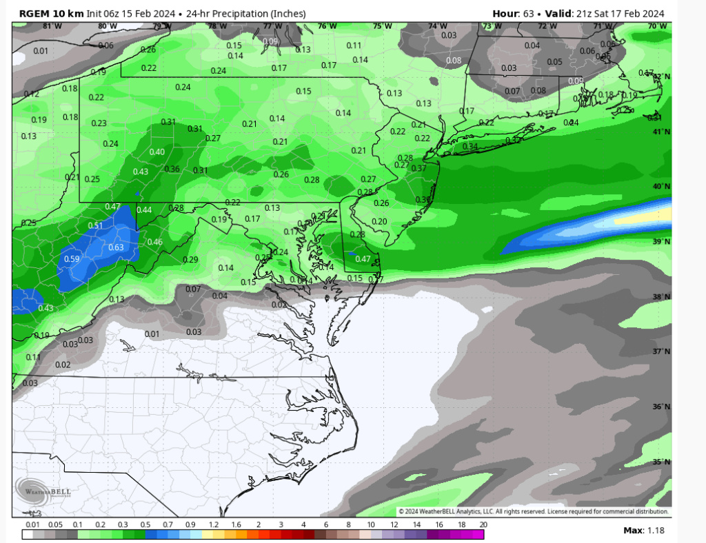
I know it’s a different setup than last time - but it just FEELS like there’s been a persistent de-amping trend all winter as storms approach. Definitely hope the RGEMs more northern solution works out - but I’m setting my expectations pretty low north of 78 in nj into the general metro area. I mean like a slushy inch…maybe 2. More would be nice but there is a limit to how far northward a SLP can trend or a precip shield can trend. While there will be great ratios I can imagine there not being a lot of QPF or intensity and some issues with virga. Whatever CAN fall will stick though as temps and timing are favorable.
MattyICE- Advanced Forecaster

- Posts : 249
Reputation : 6
Join date : 2017-11-10
Age : 38
Location : Clifton, NJ (Eastern Passaic County)
sroc4 likes this post
 Re: Feb 2024 Observations and Discussion
Models have been awful this these last few storms for many areas not just ours
MSP Airport reported 6.9” of new snowfall this morning. Another big short-term model bust, this time most guidance was too far south and too weak with the system overall. #mnwx pic.twitter.com/8CI3oSjC2M
— John Homenuk (@jhomenuk) February 15, 2024
_________________
Mugs
AKA:King: Snow Weenie
Self Proclaimed
WINTER 2014-15 : 55.12" +.02 for 6 coatings (avg. 35")
WINTER 2015-16 Total - 29.8" (Avg 35")
WINTER 2016-17 : 39.5" so far

amugs- Advanced Forecaster - Mod

- Posts : 15093
Reputation : 213
Join date : 2013-01-07
Age : 54
Location : Hillsdale,NJ
sroc4 and MattyICE like this post
heehaw453- Advanced Forecaster

- Posts : 3906
Reputation : 86
Join date : 2014-01-20
Location : Bedminster Township, PA Elevation 600' ASL
SENJsnowman likes this post
heehaw453- Advanced Forecaster

- Posts : 3906
Reputation : 86
Join date : 2014-01-20
Location : Bedminster Township, PA Elevation 600' ASL
 Re: Feb 2024 Observations and Discussion
So, the models have this as a Jersey Shore ‘Special’. I put special in quotes there, cuz it just ain’t that special. And the models seems to be split into two camps:
Jersey Shore ‘Special’:
Euro, CMC, RGEM, HRDPS all put 3-4” (@ 10-1 ratio) up and down the Jersey coast. The HRDPS seems to be the most souped up. RGEM brings up to 2” into the boards northern zones as well.
Big Fat Nothing Burger:
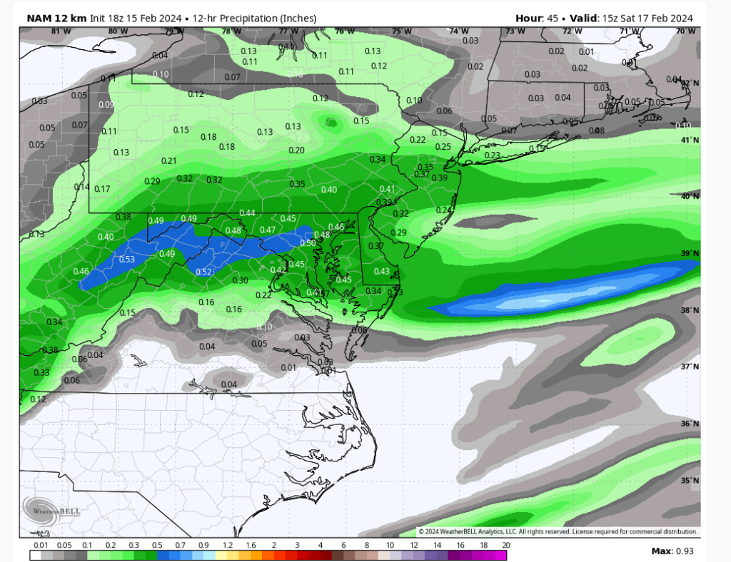
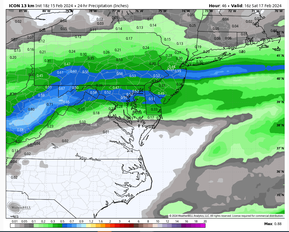
GFS, Ikon and 12k NAM all show 1” or less once you reached central Ocean County.
1st pic is RGEM surface map and 2nd pic is HRDPS snowfall map.
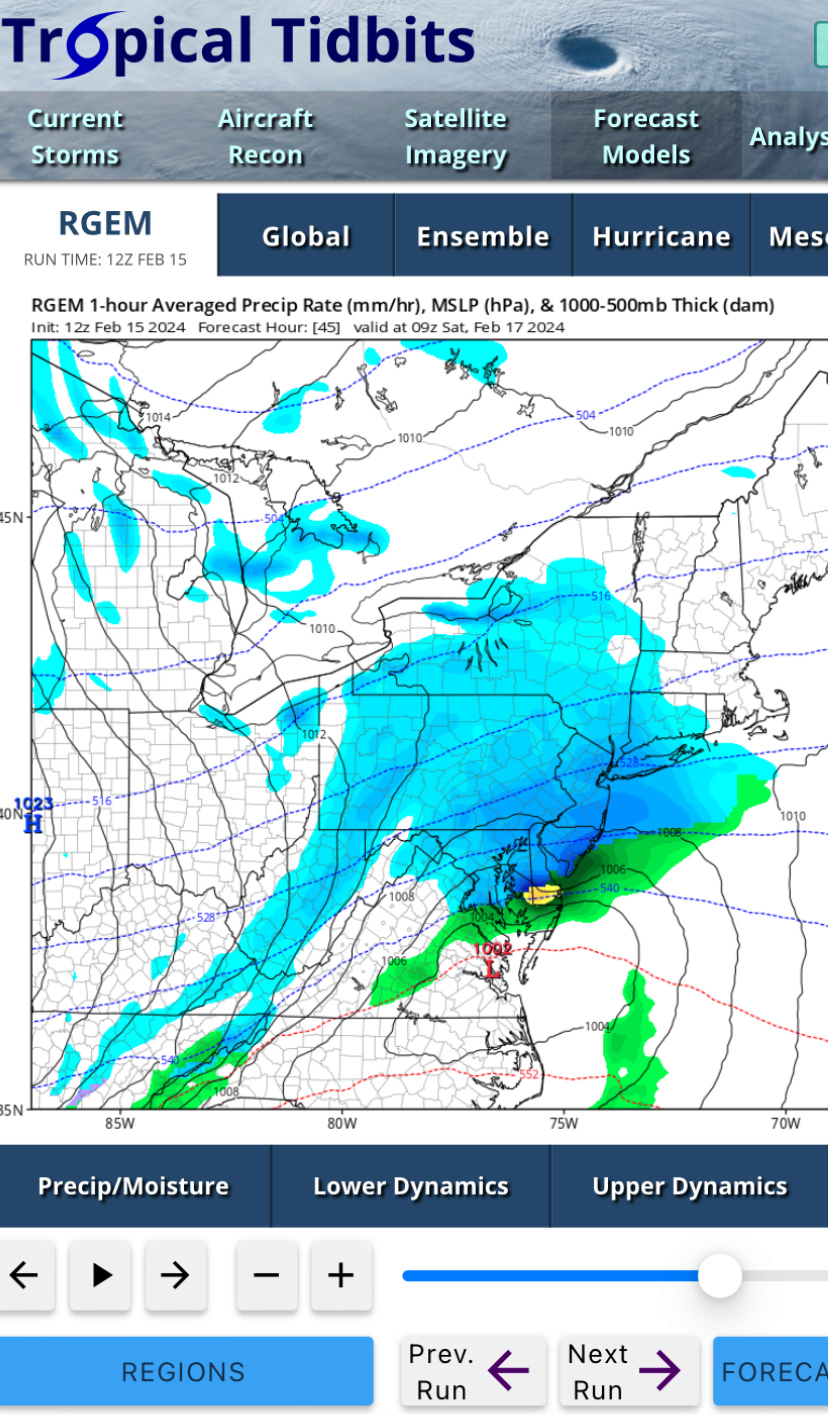
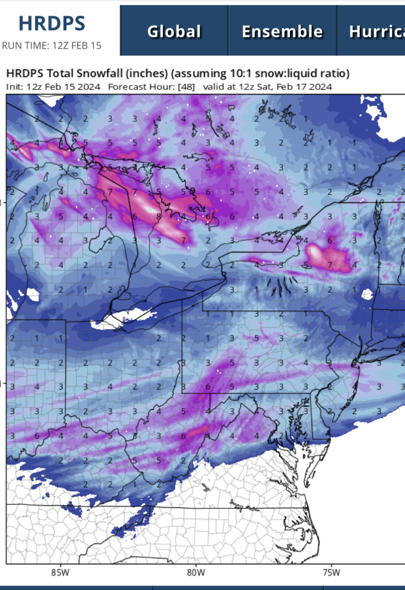
Edit: I have to walk back my editorial there a little bit: 5-6” (which is depicted for the Shore on both maps above at 15/20-1 ratio) would certainly feel special if it were to happen.
Jersey Shore ‘Special’:
Euro, CMC, RGEM, HRDPS all put 3-4” (@ 10-1 ratio) up and down the Jersey coast. The HRDPS seems to be the most souped up. RGEM brings up to 2” into the boards northern zones as well.
Big Fat Nothing Burger:
GFS, Ikon and 12k NAM all show 1” or less once you reached central Ocean County.
1st pic is RGEM surface map and 2nd pic is HRDPS snowfall map.


Edit: I have to walk back my editorial there a little bit: 5-6” (which is depicted for the Shore on both maps above at 15/20-1 ratio) would certainly feel special if it were to happen.
SENJsnowman- Senior Enthusiast

- Posts : 1186
Reputation : 61
Join date : 2017-01-06
Age : 51
Location : Bayville, NJ
 Re: Feb 2024 Observations and Discussion
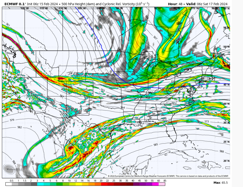
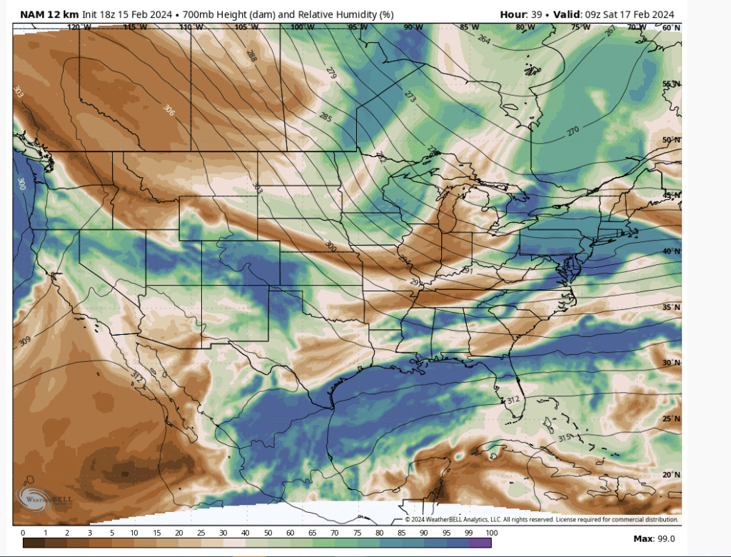
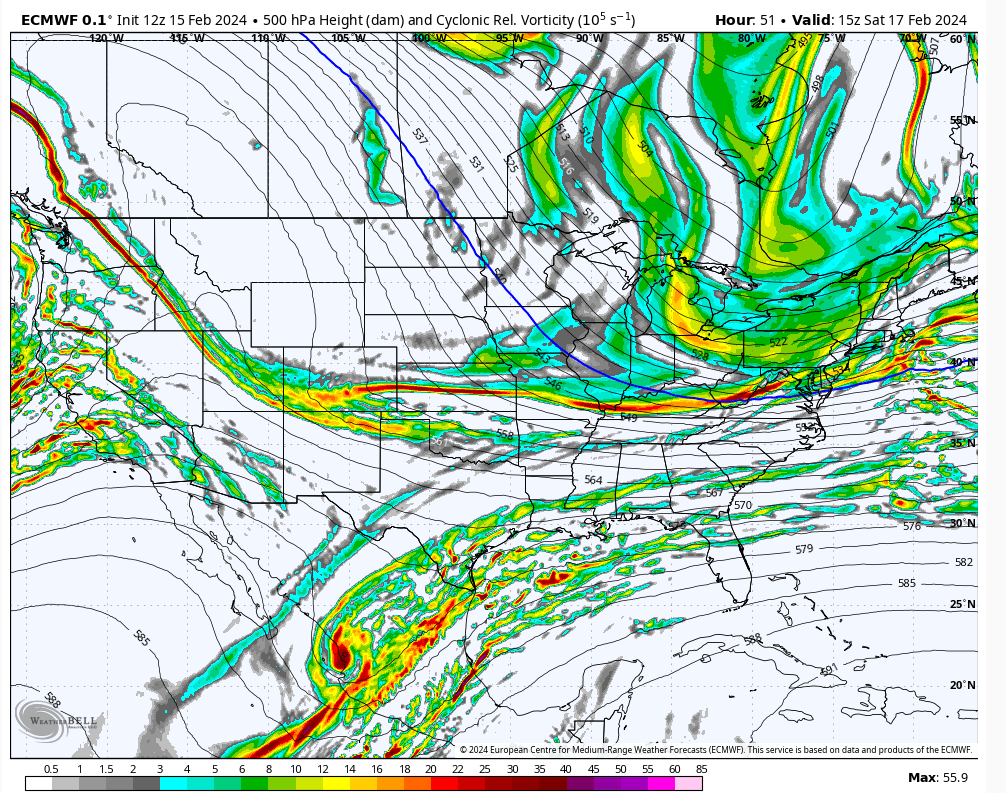
SNEJ there's upside potential with this as shown with the 12Z Euro. There is a n/s partial phase as the mid-levels approach the coast. Watch the 850's close-off as a result. Trust me when I tell you that if that phase happens early enough your area is going to get clipped with heavy snow. Like 6-8" worth. Big IF, but this can bust big time on the upside.

heehaw453- Advanced Forecaster

- Posts : 3906
Reputation : 86
Join date : 2014-01-20
Location : Bedminster Township, PA Elevation 600' ASL
Grselig and SENJsnowman like this post
heehaw453- Advanced Forecaster

- Posts : 3906
Reputation : 86
Join date : 2014-01-20
Location : Bedminster Township, PA Elevation 600' ASL
 Re: Feb 2024 Observations and Discussion
Going to be in South Jersey at the shore this weekend so I'm not opposed to SNJ jackpotting. lol. But hopefully it is nice event statewide and into the NYC/LI area so everyone can freshen up their snowpack! I think everyone would be happy with a 2-4" event after Tuesday. Anything above that from a system like this is a big bonus.

billg315- Advanced Forecaster - Mod

- Posts : 4469
Reputation : 185
Join date : 2015-01-24
Age : 50
Location : Flemington, NJ
 Re: Feb 2024 Observations and Discussion
Looks nice for the Central NJ and Shore folks and LI too!!!Enjoy!

docstox12- Wx Statistician Guru

- Posts : 8507
Reputation : 222
Join date : 2013-01-07
Age : 73
Location : Monroe NY

SoulSingMG- Senior Enthusiast

- Posts : 2853
Reputation : 74
Join date : 2013-12-11
Location : Long Island City, NY
heehaw453- Advanced Forecaster

- Posts : 3906
Reputation : 86
Join date : 2014-01-20
Location : Bedminster Township, PA Elevation 600' ASL
 Re: Feb 2024 Observations and Discussion
NWS Mt Holly for SNJ:
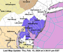
.WINTER WEATHER ADVISORY IN EFFECT FROM 10 PM FRIDAY TO 10 AMEST SATURDAY...
* WHAT...Snow expected. Total snow accumulations of 2 to 3 inches with locally higher amounts up to 4 inches.
* WHERE...Portions of central and northern Delaware, northeast Maryland and southern New Jersey.
* WHEN...From 10 PM Friday to 10 AM EST Saturday.
* IMPACTS...Plan on slippery road conditions.
* ADDITIONAL DETAILS...Periods of light to moderate snowfall is expected Friday night into Saturday. PRECAUTIONARY/PREPAREDNESS ACTIONS... Slow down and use caution while traveling. The latest road conditions for the state you are calling from can be obtained by calling 5 1 1. &&

billg315- Advanced Forecaster - Mod

- Posts : 4469
Reputation : 185
Join date : 2015-01-24
Age : 50
Location : Flemington, NJ
 Re: Feb 2024 Observations and Discussion
That’s at least 3 models now (Ikon, RGEM and HRDPS) that shoot a streak of heavy snow west to east across Monmouth County. Basically coming down my chimney like Santa. Sadly though, we still have over 24 hours before kickoff, so no reason to just assume that will hold. Still, a beautiful sight to behold and plenty of cause for cautious optimism!
For all of you more north (which is the vast majority of the forum), we’ve all seen how these southern specials tend to expand their precip shield N and W at game time, no matter how much the models agree before hand that it won’t happen. Especially for southern and eastern LI.
Time to track!

SENJsnowman- Senior Enthusiast

- Posts : 1186
Reputation : 61
Join date : 2017-01-06
Age : 51
Location : Bayville, NJ
sroc4, docstox12, kalleg and phil155 like this post
 Re: Feb 2024 Observations and Discussion
billg315 wrote:NWS Mt Holly for SNJ:
.WINTER WEATHER ADVISORY IN EFFECT FROM 10 PM FRIDAY TO 10 AMEST SATURDAY...
* WHAT...Snow expected. Total snow accumulations of 2 to 3 inches with locally higher amounts up to 4 inches.
* WHERE...Portions of central and northern Delaware, northeast Maryland and southern New Jersey.
* WHEN...From 10 PM Friday to 10 AM EST Saturday.
* IMPACTS...Plan on slippery road conditions.
* ADDITIONAL DETAILS...Periods of light to moderate snowfall is expected Friday night into Saturday. PRECAUTIONARY/PREPAREDNESS ACTIONS... Slow down and use caution while traveling. The latest road conditions for the state you are calling from can be obtained by calling 5 1 1. &&
My Holly is super conservative when forecasting expected snowfall for the Shore. You can always apply a multiplier of 1.5 or 2 to their forecast in terms of what the upside potential is.
SENJsnowman- Senior Enthusiast

- Posts : 1186
Reputation : 61
Join date : 2017-01-06
Age : 51
Location : Bayville, NJ
 Re: Feb 2024 Observations and Discussion
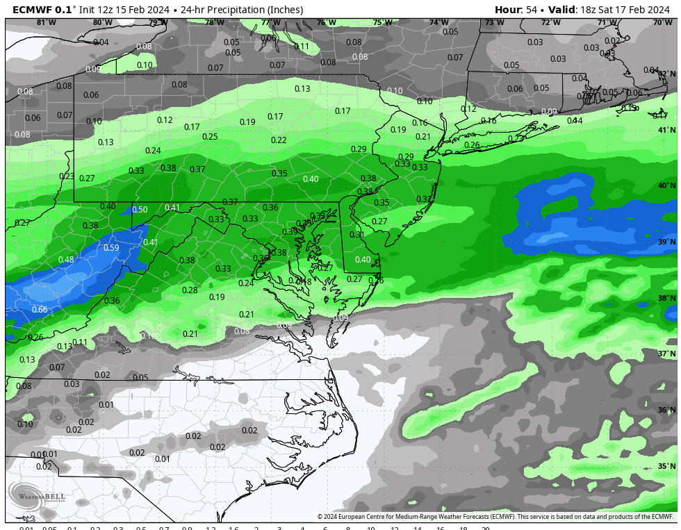
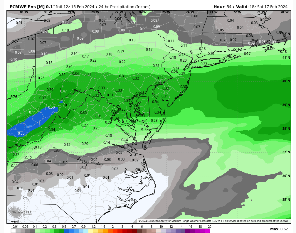
What would .59 equate to?

Irish- Pro Enthusiast

- Posts : 788
Reputation : 19
Join date : 2019-01-16
Age : 45
Location : Old Bridge, NJ
 Re: Feb 2024 Observations and Discussion
Irish wrote:What would .59 equate to?
assuming 10:1 ratio 5.9"
assuming 15-20:1 ratio 8.85-11.8"
S and central NJ will not likely see those higher end ratios IMO.
_________________
"In weather and in life, there's no winning and losing; there's only winning and learning."
WINTER 2012/2013 TOTALS 43.65"WINTER 2017/2018 TOTALS 62.85" WINTER 2022/2023 TOTALS 4.9"
WINTER 2013/2014 TOTALS 64.85"WINTER 2018/2019 TOTALS 14.25" WINTER 2023/2024 TOTALS 13.1"
WINTER 2014/2015 TOTALS 71.20"WINTER 2019/2020 TOTALS 6.35"
WINTER 2015/2016 TOTALS 35.00"WINTER 2020/2021 TOTALS 37.75"
WINTER 2016/2017 TOTALS 42.25"WINTER 2021/2022 TOTALS 31.65"

sroc4- Admin

- Posts : 8331
Reputation : 301
Join date : 2013-01-07
Location : Wading River, LI
 Re: Feb 2024 Observations and Discussion
SENJsnowman wrote:
That’s at least 3 models now (Ikon, RGEM and HRDPS) that shoot a streak of heavy snow west to east across Monmouth County. Basically coming down my chimney like Santa. Sadly though, we still have over 24 hours before kickoff, so no reason to just assume that will hold. Still, a beautiful sight to behold and plenty of cause for cautious optimism!
For all of you more north (which is the vast majority of the forum), we’ve all seen how these southern specials tend to expand their precip shield N and W at game time, no matter how much the models agree before hand that it won’t happen. Especially for southern and eastern LI.
Time to track!
Even Middlesex County according to this get .44 or so which even at an 8:1 ratio would get 3 inches or so which is ok
phil155- Pro Enthusiast

- Posts : 475
Reputation : 4
Join date : 2019-12-16
 Re: Feb 2024 Observations and Discussion
SENJsnowman wrote:
That’s at least 3 models now (Ikon, RGEM and HRDPS) that shoot a streak of heavy snow west to east across Monmouth County. Basically coming down my chimney like Santa. Sadly though, we still have over 24 hours before kickoff, so no reason to just assume that will hold. Still, a beautiful sight to behold and plenty of cause for cautious optimism!
For all of you more north (which is the vast majority of the forum), we’ve all seen how these southern specials tend to expand their precip shield N and W at game time, no matter how much the models agree before hand that it won’t happen. Especially for southern and eastern LI.
Time to track!
It has expanded North, I may squeeze out a few inches at 10:1 ratios, nice snowpack refresh.

docstox12- Wx Statistician Guru

- Posts : 8507
Reputation : 222
Join date : 2013-01-07
Age : 73
Location : Monroe NY
Grselig likes this post
Page 3 of 6 •  1, 2, 3, 4, 5, 6
Permissions in this forum:
You cannot reply to topics in this forum|
|
|

 Home
Home