
 Search
Coastal Storm 9/25/14
Page 2 of 3 •  1, 2, 3
 ![]()
Re: Coastal Storm 9/25/14
![]() by Dunnzoo Wed Sep 24, 2014 10:28 am
by Dunnzoo Wed Sep 24, 2014 10:28 am
Dunnzoo- Senior Enthusiast - Mod

- Posts : 4887
Join date : 2013-01-11
Re: Coastal Storm 9/25/14
![]() by algae888 Wed Sep 24, 2014 10:40 am
by algae888 Wed Sep 24, 2014 10:40 am
algae888- Advanced Forecaster

- Posts : 5311
Join date : 2013-02-05
Re: Coastal Storm 9/25/14
![]() by amugs Wed Sep 24, 2014 12:10 pm
by amugs Wed Sep 24, 2014 12:10 pm
http://www.wrh.noaa.gov/mesowest/getobext.php?sid=CBBV2
Waves 5.25' with a 4 second period
HRRR

_________________
Mugs
AKA:King: Snow Weenie
Self Proclaimed
WINTER 2014-15 : 55.12" +.02 for 6 coatings (avg. 35")
WINTER 2015-16 Total - 29.8" (Avg 35")
WINTER 2016-17 : 39.5" so far

amugs- Advanced Forecaster - Mod
- Posts : 15093
Reputation : 213
Join date : 2013-01-07
Age : 54
Location : Hillsdale,NJ
Re: Coastal Storm 9/25/14
![]() by amugs Wed Sep 24, 2014 12:20 pm
by amugs Wed Sep 24, 2014 12:20 pm
Gotta love the weather! (I hope I am saying this come Jan/Feb
_________________
Mugs
AKA:King: Snow Weenie
Self Proclaimed
WINTER 2014-15 : 55.12" +.02 for 6 coatings (avg. 35")
WINTER 2015-16 Total - 29.8" (Avg 35")
WINTER 2016-17 : 39.5" so far
amugs- Advanced Forecaster - Mod
- Posts : 15093
Reputation : 213
Join date : 2013-01-07
Age : 54
Location : Hillsdale,NJ
Re: Coastal Storm 9/25/14
![]() by sroc4 Wed Sep 24, 2014 1:27 pm
by sroc4 Wed Sep 24, 2014 1:27 pm
http://earth.nullschool.net/#current/wind/isobaric/500hPa/orthographic=-89.78,37.56,2048
Notice the surface wind analysis there is currently two weak areas of LP developed. One just off the NC coast, and a second just off the N panhandle of Fla.
http://earth.nullschool.net/#current/wind/surface/level/orthographic=-92.94,40.36,2048
Current mesoscale analysis does not indicate the two LP's off the SE Coast are closed
http://www.spc.noaa.gov/exper/mesoanalysis/new/viewsector.php?sector=19#
_________________
"In weather and in life, there's no winning and losing; there's only winning and learning."
WINTER 2012/2013 TOTALS 43.65"WINTER 2017/2018 TOTALS 62.85" WINTER 2022/2023 TOTALS 4.9"
WINTER 2013/2014 TOTALS 64.85"WINTER 2018/2019 TOTALS 14.25" WINTER 2023/2024 TOTALS 13.1"
WINTER 2014/2015 TOTALS 71.20"WINTER 2019/2020 TOTALS 6.35"
WINTER 2015/2016 TOTALS 35.00"WINTER 2020/2021 TOTALS 37.75"
WINTER 2016/2017 TOTALS 42.25"WINTER 2021/2022 TOTALS 31.65"

sroc4- Admin

- Posts : 8331
Reputation : 301
Join date : 2013-01-07
Location : Wading River, LI
Re: Coastal Storm 9/25/14
![]() by jmanley32 Wed Sep 24, 2014 3:25 pm
by jmanley32 Wed Sep 24, 2014 3:25 pm

jmanley32- Senior Enthusiast

- Posts : 20513
Reputation : 108
Join date : 2013-12-12
Age : 42
Location : Yonkers, NY
Re: Coastal Storm 9/25/14
![]() by Dunnzoo Wed Sep 24, 2014 3:30 pm
by Dunnzoo Wed Sep 24, 2014 3:30 pm
_________________
Janet
Snowfall winter of 2023-2024 17.5"
Snowfall winter of 2022-2023 6.0"
Snowfall winter of 2021-2022 17.6" 1" sleet 2/25/22
Snowfall winter of 2020-2021 51.1"
Snowfall winter of 2019-2020 8.5"
Snowfall winter of 2018-2019 25.1"
Snowfall winter of 2017-2018 51.9"
Snowfall winter of 2016-2017 45.6"
Snowfall winter of 2015-2016 29.5"
Snowfall winter of 2014-2015 50.55"
Snowfall winter of 2013-2014 66.5"

Dunnzoo- Senior Enthusiast - Mod
- Posts : 4887
Reputation : 68
Join date : 2013-01-11
Age : 62
Location : Westwood, NJ
Re: Coastal Storm 9/25/14
![]() by Dunnzoo Wed Sep 24, 2014 3:35 pm
by Dunnzoo Wed Sep 24, 2014 3:35 pm
COASTAL MID ATLANTIC---WESTERN TO CENTRAL LONG ISLAND
A SLIGHT RISK AREA WAS MAINTAINED ALONG THE IMMEDIATE MID ATLANTIC
COASTAL LOCATIONS ASSOCIATED WITH THE NORTHWARD MOVING AREA OF
MODERATE TO HEAVY PRECIPITATION ACROSS THESE REGIONS. THE RECENT
MODEL QPF DIFFERENCES WITH THIS NORTHWARD PUSHING REGION OF
PRECIPITATION ALONG THE EASTERN SEABOARD HAVE DECREASED IN THE
LATEST MODEL GUIDANCE FOR THE UPCOMING PERIOD. HEIGHT FALLS
MOVING NORTHWARD ON THE EASTERN SIDE OF THE UPPER LOW IN THE
VICINITY OF THE SOUTHERN APPALACHIANS WILL ENHANCE THE EASTERLY TO
SOUTHEASTERLY LOW LEVEL FLOW OVER THE STATIONARY FRONTAL BOUNDARY
FORECAST TO LIE OFF THE MID ATLANTIC TO SOUTHERN NEW ENGLAND.
THIS WILL CONTINUE TO SUPPORT A BROAD REGION OF OVERRUNNING
PRECIPITATION--WITH WIDESPREAD MODERATE TO HEAVY TOTALS LIKELY.
MODEL CONSENSUS IS FOR THE HEAVIEST TOTALS TO REMAIN ALONG THE MID
ATLANTIC COAST INTO SOUTHERN NEW ENGLAND---ALTHOUGH THERE
CONTINUES TO BE MODEL SPREAD WITH RESPECT TO HOW FAR INLAND SOME
OF THE HEAVIEST TOTALS SPREAD. WE CONTINUE TO FAVOR THE HEAVIEST
AMOUNTS REMAINING NEAR THE COAST IN THE VICINITY OF THE COASTAL
DELMARVA---NORTHEASTWARD ALONG THE NJ COAST INTO LONG ISLAND/FAR
SOUTHERN NEW ENGLAND. WITH FFG VALUES RELATIVELY HIGH ACROSS THE
MID ATLANTIC INTO SOUTHERN NEW ENGLAND---DO NOT BELIEVE THERE WILL
BE WIDESPREAD RUNOFF ISSUES. STILL---THERE IS POTENTIAL ALONG THE
IMMEDIATE COAST FOR ISOLATED 3"+ AMOUNTS OVER A 6 HOUR PERIOD
WHICH MAY CAUSE SOME RUNOFF ISSUES FROM COASTAL NJ INTO WESTERN TO
CENTRAL LONG ISLAND.
_________________
Janet
Snowfall winter of 2023-2024 17.5"
Snowfall winter of 2022-2023 6.0"
Snowfall winter of 2021-2022 17.6" 1" sleet 2/25/22
Snowfall winter of 2020-2021 51.1"
Snowfall winter of 2019-2020 8.5"
Snowfall winter of 2018-2019 25.1"
Snowfall winter of 2017-2018 51.9"
Snowfall winter of 2016-2017 45.6"
Snowfall winter of 2015-2016 29.5"
Snowfall winter of 2014-2015 50.55"
Snowfall winter of 2013-2014 66.5"
Dunnzoo- Senior Enthusiast - Mod
- Posts : 4887
Reputation : 68
Join date : 2013-01-11
Age : 62
Location : Westwood, NJ
Re: Coastal Storm 9/25/14
![]() by Frank_Wx Wed Sep 24, 2014 5:43 pm
by Frank_Wx Wed Sep 24, 2014 5:43 pm
Start: 5-7 am Thursday
Heaviest Precip: 6-8 am Thursday
End: 3-4 pm Thursday
Total Rainfall Expected: .50-1.25 inches, with common amounts between .50-.75
_________________
_______________________________________________________________________________________________________
CLICK HERE to view NJ Strong Snowstorm Classifications

Frank_Wx- Godzilla Seeker
- Posts : 21305
Reputation : 328
Join date : 2013-01-05
Age : 31
Location : Jersey City, NJ -

Re: Coastal Storm 9/25/14
![]() by docstox12 Wed Sep 24, 2014 6:05 pm
by docstox12 Wed Sep 24, 2014 6:05 pm
Dunnzoo wrote:From NWS as of 2:53
COASTAL MID ATLANTIC---WESTERN TO CENTRAL LONG ISLAND
A SLIGHT RISK AREA WAS MAINTAINED ALONG THE IMMEDIATE MID ATLANTIC
COASTAL LOCATIONS ASSOCIATED WITH THE NORTHWARD MOVING AREA OF
MODERATE TO HEAVY PRECIPITATION ACROSS THESE REGIONS. THE RECENT
MODEL QPF DIFFERENCES WITH THIS NORTHWARD PUSHING REGION OF
PRECIPITATION ALONG THE EASTERN SEABOARD HAVE DECREASED IN THE
LATEST MODEL GUIDANCE FOR THE UPCOMING PERIOD. HEIGHT FALLS
MOVING NORTHWARD ON THE EASTERN SIDE OF THE UPPER LOW IN THE
VICINITY OF THE SOUTHERN APPALACHIANS WILL ENHANCE THE EASTERLY TO
SOUTHEASTERLY LOW LEVEL FLOW OVER THE STATIONARY FRONTAL BOUNDARY
FORECAST TO LIE OFF THE MID ATLANTIC TO SOUTHERN NEW ENGLAND.
THIS WILL CONTINUE TO SUPPORT A BROAD REGION OF OVERRUNNING
PRECIPITATION--WITH WIDESPREAD MODERATE TO HEAVY TOTALS LIKELY.
MODEL CONSENSUS IS FOR THE HEAVIEST TOTALS TO REMAIN ALONG THE MID
ATLANTIC COAST INTO SOUTHERN NEW ENGLAND---ALTHOUGH THERE
CONTINUES TO BE MODEL SPREAD WITH RESPECT TO HOW FAR INLAND SOME
OF THE HEAVIEST TOTALS SPREAD. WE CONTINUE TO FAVOR THE HEAVIEST
AMOUNTS REMAINING NEAR THE COAST IN THE VICINITY OF THE COASTAL
DELMARVA---NORTHEASTWARD ALONG THE NJ COAST INTO LONG ISLAND/FAR
SOUTHERN NEW ENGLAND. WITH FFG VALUES RELATIVELY HIGH ACROSS THE
MID ATLANTIC INTO SOUTHERN NEW ENGLAND---DO NOT BELIEVE THERE WILL
BE WIDESPREAD RUNOFF ISSUES. STILL---THERE IS POTENTIAL ALONG THE
IMMEDIATE COAST FOR ISOLATED 3"+ AMOUNTS OVER A 6 HOUR PERIOD
WHICH MAY CAUSE SOME RUNOFF ISSUES FROM COASTAL NJ INTO WESTERN TO
CENTRAL LONG ISLAND.
Oh, brother, there goes the south and east trend again.If this was winter, south Jersey, Jersey Shore, LI, SE Conn and RI would be getting a foot while I would get 4 inches in the HV,LOL!

docstox12- Wx Statistician Guru

- Posts : 8502
Reputation : 222
Join date : 2013-01-07
Age : 73
Location : Monroe NY
Re: Coastal Storm 9/25/14
![]() by sroc4 Wed Sep 24, 2014 7:21 pm
by sroc4 Wed Sep 24, 2014 7:21 pm
Frank_Wx wrote:UPDATED TIME SCHEDULE OF THE STORM:
Start: 5-7 am Thursday
Heaviest Precip: 6-8 am Thursday
End: 3-4 pm Thursday
Total Rainfall Expected: .50-1.25 inches, with common amounts between .50-.75
Werd!
_________________
"In weather and in life, there's no winning and losing; there's only winning and learning."
WINTER 2012/2013 TOTALS 43.65"WINTER 2017/2018 TOTALS 62.85" WINTER 2022/2023 TOTALS 4.9"
WINTER 2013/2014 TOTALS 64.85"WINTER 2018/2019 TOTALS 14.25" WINTER 2023/2024 TOTALS 13.1"
WINTER 2014/2015 TOTALS 71.20"WINTER 2019/2020 TOTALS 6.35"
WINTER 2015/2016 TOTALS 35.00"WINTER 2020/2021 TOTALS 37.75"
WINTER 2016/2017 TOTALS 42.25"WINTER 2021/2022 TOTALS 31.65"
sroc4- Admin
- Posts : 8331
Reputation : 301
Join date : 2013-01-07
Location : Wading River, LI
Re: Coastal Storm 9/25/14
![]() by Dunnzoo Wed Sep 24, 2014 8:03 pm
by Dunnzoo Wed Sep 24, 2014 8:03 pm
sroc4 wrote:Frank_Wx wrote:UPDATED TIME SCHEDULE OF THE STORM:
Start: 5-7 am Thursday
Heaviest Precip: 6-8 am Thursday
End: 3-4 pm Thursday
Total Rainfall Expected: .50-1.25 inches, with common amounts between .50-.75
Werd!
Scott, you sound like Wax! "Werd"
_________________
Janet
Snowfall winter of 2023-2024 17.5"
Snowfall winter of 2022-2023 6.0"
Snowfall winter of 2021-2022 17.6" 1" sleet 2/25/22
Snowfall winter of 2020-2021 51.1"
Snowfall winter of 2019-2020 8.5"
Snowfall winter of 2018-2019 25.1"
Snowfall winter of 2017-2018 51.9"
Snowfall winter of 2016-2017 45.6"
Snowfall winter of 2015-2016 29.5"
Snowfall winter of 2014-2015 50.55"
Snowfall winter of 2013-2014 66.5"
Dunnzoo- Senior Enthusiast - Mod
- Posts : 4887
Reputation : 68
Join date : 2013-01-11
Age : 62
Location : Westwood, NJ
Re: Coastal Storm 9/25/14
![]() by algae888 Thu Sep 25, 2014 4:21 am
by algae888 Thu Sep 25, 2014 4:21 am
Last edited by algae888 on Thu Sep 25, 2014 6:56 am; edited 1 time in total

algae888- Advanced Forecaster
- Posts : 5311
Reputation : 46
Join date : 2013-02-05
Age : 61
Location : mt. vernon, new york
Re: Coastal Storm 9/25/14
![]() by sroc4 Thu Sep 25, 2014 6:40 am
by sroc4 Thu Sep 25, 2014 6:40 am
Dunnzoo wrote:sroc4 wrote:Frank_Wx wrote:UPDATED TIME SCHEDULE OF THE STORM:
Start: 5-7 am Thursday
Heaviest Precip: 6-8 am Thursday
End: 3-4 pm Thursday
Total Rainfall Expected: .50-1.25 inches, with common amounts between .50-.75
Werd!
Scott, you sound like Wax! "Werd"
Say WHAT!! lol.
_________________
"In weather and in life, there's no winning and losing; there's only winning and learning."
WINTER 2012/2013 TOTALS 43.65"WINTER 2017/2018 TOTALS 62.85" WINTER 2022/2023 TOTALS 4.9"
WINTER 2013/2014 TOTALS 64.85"WINTER 2018/2019 TOTALS 14.25" WINTER 2023/2024 TOTALS 13.1"
WINTER 2014/2015 TOTALS 71.20"WINTER 2019/2020 TOTALS 6.35"
WINTER 2015/2016 TOTALS 35.00"WINTER 2020/2021 TOTALS 37.75"
WINTER 2016/2017 TOTALS 42.25"WINTER 2021/2022 TOTALS 31.65"
sroc4- Admin
- Posts : 8331
Reputation : 301
Join date : 2013-01-07
Location : Wading River, LI
Re: Coastal Storm 9/25/14
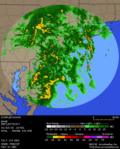
![]() by Frank_Wx Thu Sep 25, 2014 8:28 am
by Frank_Wx Thu Sep 25, 2014 8:28 am

You can see the rain bands are struggling to move north and that is because there is a lot of confluence in our area. I'm still expecting the rain to end by early to mid afternoon, and for Derek Jeter to play his final game
_________________
_______________________________________________________________________________________________________
CLICK HERE to view NJ Strong Snowstorm Classifications
Frank_Wx- Godzilla Seeker
- Posts : 21305
Reputation : 328
Join date : 2013-01-05
Age : 31
Location : Jersey City, NJ -
Re: Coastal Storm 9/25/14
![]() by docstox12 Thu Sep 25, 2014 9:05 am
by docstox12 Thu Sep 25, 2014 9:05 am
docstox12- Wx Statistician Guru
- Posts : 8502
Reputation : 222
Join date : 2013-01-07
Age : 73
Location : Monroe NY
Re: Coastal Storm 9/25/14
![]() by sroc4 Thu Sep 25, 2014 9:28 am
by sroc4 Thu Sep 25, 2014 9:28 am
You can see in the 96 hr loop the evolution of the moisture. Notice the heavier precip is beginning to thin out. Frank how do you get that loop to post on the page. It keeps telling me that the link is not supported. Are you using an external software to convert the loop to something that is able to to upload?
_________________
"In weather and in life, there's no winning and losing; there's only winning and learning."
WINTER 2012/2013 TOTALS 43.65"WINTER 2017/2018 TOTALS 62.85" WINTER 2022/2023 TOTALS 4.9"
WINTER 2013/2014 TOTALS 64.85"WINTER 2018/2019 TOTALS 14.25" WINTER 2023/2024 TOTALS 13.1"
WINTER 2014/2015 TOTALS 71.20"WINTER 2019/2020 TOTALS 6.35"
WINTER 2015/2016 TOTALS 35.00"WINTER 2020/2021 TOTALS 37.75"
WINTER 2016/2017 TOTALS 42.25"WINTER 2021/2022 TOTALS 31.65"
sroc4- Admin
- Posts : 8331
Reputation : 301
Join date : 2013-01-07
Location : Wading River, LI
Re: Coastal Storm 9/25/14
![]() by algae888 Thu Sep 25, 2014 10:27 am
by algae888 Thu Sep 25, 2014 10:27 am
algae888- Advanced Forecaster
- Posts : 5311
Reputation : 46
Join date : 2013-02-05
Age : 61
Location : mt. vernon, new york
Re: Coastal Storm 9/25/14
![]() by Math23x7 Thu Sep 25, 2014 10:50 am
by Math23x7 Thu Sep 25, 2014 10:50 am
http://models.weatherbell.com/hrrr/2014092513/nyc/hrrr_ref_nyc_loop.php
Math23x7- Wx Statistician Guru
- Posts : 2379
Reputation : 68
Join date : 2013-01-08
Re: Coastal Storm 9/25/14
![]() by Frank_Wx Thu Sep 25, 2014 11:26 am
by Frank_Wx Thu Sep 25, 2014 11:26 am
sroc4 wrote:http://weather.cod.edu/satrad/nexrad/index.php?type=OKX-N0Q-1-96
You can see in the 96 hr loop the evolution of the moisture. Notice the heavier precip is beginning to thin out. Frank how do you get that loop to post on the page. It keeps telling me that the link is not supported. Are you using an external software to convert the loop to something that is able to to upload?
No I just use my ipad. But if you want something to loop within the forum, it has to be a ".gif" URL. But you still copy and paste that URL in the IMG icon, two left of the Youtube icon.
_________________
_______________________________________________________________________________________________________
CLICK HERE to view NJ Strong Snowstorm Classifications
Frank_Wx- Godzilla Seeker
- Posts : 21305
Reputation : 328
Join date : 2013-01-05
Age : 31
Location : Jersey City, NJ -
Re: Coastal Storm 9/25/14
![]() by Frank_Wx Thu Sep 25, 2014 11:27 am
by Frank_Wx Thu Sep 25, 2014 11:27 am
Rain is starting to break up a bit. This will continue to weaken as the day goes on.
_________________
_______________________________________________________________________________________________________
CLICK HERE to view NJ Strong Snowstorm Classifications
Frank_Wx- Godzilla Seeker
- Posts : 21305
Reputation : 328
Join date : 2013-01-05
Age : 31
Location : Jersey City, NJ -
Re: Coastal Storm 9/25/14
![]() by Frank_Wx Thu Sep 25, 2014 11:29 am
by Frank_Wx Thu Sep 25, 2014 11:29 am
Math23x7 wrote:The 13Z HRRR shows a retrograde of the rain into NYC later on this afternoon. What are your thoughts on that?
http://models.weatherbell.com/hrrr/2014092513/nyc/hrrr_ref_nyc_loop.php
Not sure I buy into that Mike. There is not really a mechanism currently in the atmosphere capable of enhancing rainfall like that. This thing should slowly start dying. Such a cruel death.
_________________
_______________________________________________________________________________________________________
CLICK HERE to view NJ Strong Snowstorm Classifications
Frank_Wx- Godzilla Seeker
- Posts : 21305
Reputation : 328
Join date : 2013-01-05
Age : 31
Location : Jersey City, NJ -
Re: Coastal Storm 9/25/14
![]() by Dunnzoo Thu Sep 25, 2014 12:06 pm
by Dunnzoo Thu Sep 25, 2014 12:06 pm
_________________
Janet
Snowfall winter of 2023-2024 17.5"
Snowfall winter of 2022-2023 6.0"
Snowfall winter of 2021-2022 17.6" 1" sleet 2/25/22
Snowfall winter of 2020-2021 51.1"
Snowfall winter of 2019-2020 8.5"
Snowfall winter of 2018-2019 25.1"
Snowfall winter of 2017-2018 51.9"
Snowfall winter of 2016-2017 45.6"
Snowfall winter of 2015-2016 29.5"
Snowfall winter of 2014-2015 50.55"
Snowfall winter of 2013-2014 66.5"
Dunnzoo- Senior Enthusiast - Mod
- Posts : 4887
Reputation : 68
Join date : 2013-01-11
Age : 62
Location : Westwood, NJ
Re: Coastal Storm 9/25/14
![]() by SNOW MAN Thu Sep 25, 2014 12:18 pm
by SNOW MAN Thu Sep 25, 2014 12:18 pm

SNOW MAN- Senior Enthusiast
- Posts : 1361
Reputation : 25
Join date : 2013-01-13
Age : 64
Location : Marshalls Creek Pa.
Re: Coastal Storm 9/25/14
![]() by skinsfan1177 Thu Sep 25, 2014 12:32 pm
by skinsfan1177 Thu Sep 25, 2014 12:32 pm

skinsfan1177- Senior Enthusiast
- Posts : 4485
Reputation : 35
Join date : 2013-01-07
Age : 46
Location : Point Pleasant Boro
Re: Coastal Storm 9/25/14
![]() by amugs Thu Sep 25, 2014 12:49 pm
by amugs Thu Sep 25, 2014 12:49 pm
skinsfan1177 wrote:Yeah this storm wasnt bad at all here along coast rough seas thats about it rain was not an issue
,15" in the bucket - steadier rain as I write - 57* raw - models had a heck of a time with this - Frank, Scott,Al, Zoo good job - HP to the North sheared this out for us up here. I;ll take it and go from here
Skins - Toms River showing 1" as of 11AM? 9' seas reported as well.
_________________
Mugs
AKA:King: Snow Weenie
Self Proclaimed
WINTER 2014-15 : 55.12" +.02 for 6 coatings (avg. 35")
WINTER 2015-16 Total - 29.8" (Avg 35")
WINTER 2016-17 : 39.5" so far
amugs- Advanced Forecaster - Mod
- Posts : 15093
Reputation : 213
Join date : 2013-01-07
Age : 54
Location : Hillsdale,NJ
Re: Coastal Storm 9/25/14
![]() by Dunnzoo Thu Sep 25, 2014 1:21 pm
by Dunnzoo Thu Sep 25, 2014 1:21 pm
_________________
Janet
Snowfall winter of 2023-2024 17.5"
Snowfall winter of 2022-2023 6.0"
Snowfall winter of 2021-2022 17.6" 1" sleet 2/25/22
Snowfall winter of 2020-2021 51.1"
Snowfall winter of 2019-2020 8.5"
Snowfall winter of 2018-2019 25.1"
Snowfall winter of 2017-2018 51.9"
Snowfall winter of 2016-2017 45.6"
Snowfall winter of 2015-2016 29.5"
Snowfall winter of 2014-2015 50.55"
Snowfall winter of 2013-2014 66.5"
Dunnzoo- Senior Enthusiast - Mod
- Posts : 4887
Reputation : 68
Join date : 2013-01-11
Age : 62
Location : Westwood, NJ
Page 2 of 3 • 1, 2, 3 ![]()
|
|
|