
 Search
November 17th Storm Threat
Page 2 of 6 •  1, 2, 3, 4, 5, 6
 ![]()
Re: November 17th Storm Threat
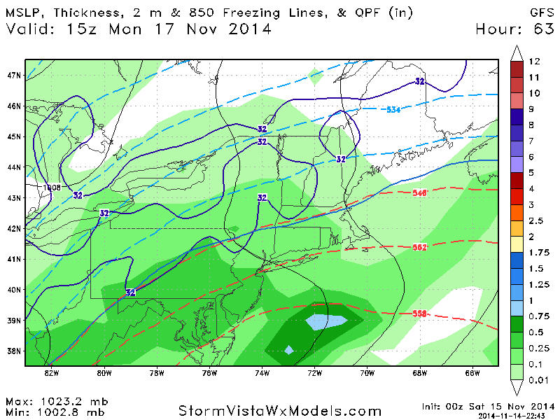
![]() by rb924119 Fri Nov 14, 2014 12:27 am
by rb924119 Fri Nov 14, 2014 12:27 am
rb924119- Meteorologist

- Posts : 6890
Join date : 2013-02-06
Re: November 17th Storm Threat
![]() by Frank_Wx Fri Nov 14, 2014 1:33 am
by Frank_Wx Fri Nov 14, 2014 1:33 am
Frank_Wx- Godzilla Seeker

- Posts : 21305
Join date : 2013-01-05 -

Re: November 17th Storm Threat
![]() by Frank_Wx Fri Nov 14, 2014 1:36 am
by Frank_Wx Fri Nov 14, 2014 1:36 am

Actually euro trended colder for the interior northeast, but no one is really from there (central PA) on this forum, haha. Northeast PA in rb and Snow Man territory have a good shot again.
_________________
_______________________________________________________________________________________________________
CLICK HERE to view NJ Strong Snowstorm Classifications

Frank_Wx- Godzilla Seeker
- Posts : 21305
Reputation : 328
Join date : 2013-01-05
Age : 31
Location : Jersey City, NJ -
Re: November 17th Storm Threat
![]() by docstox12 Fri Nov 14, 2014 5:32 am
by docstox12 Fri Nov 14, 2014 5:32 am
rb924119 wrote:Pike County, PA, elevation ~1800ft. If you want an exact location-follow 84 and literally directly between Scranton and Port Jervis is where I'm at lol
rb, know that area well, pass by on 84 on the way to Lake Wallenpaupack or down to Pecks Pond.Been going to Wallenpaupack nearly 40 years.Beautiful country out there.

docstox12- Wx Statistician Guru

- Posts : 8504
Reputation : 222
Join date : 2013-01-07
Age : 73
Location : Monroe NY
Re: November 17th Storm Threat
![]() by rb924119 Fri Nov 14, 2014 8:29 am
by rb924119 Fri Nov 14, 2014 8:29 am
rb924119- Meteorologist
- Posts : 6890
Reputation : 194
Join date : 2013-02-06
Age : 32
Location : Greentown, Pa
Re: November 17th Storm Threat
![]() by NjWeatherGuy Fri Nov 14, 2014 8:33 am
by NjWeatherGuy Fri Nov 14, 2014 8:33 am

NjWeatherGuy- Advanced Forecaster

- Posts : 4100
Reputation : 28
Join date : 2013-01-06
Location : Belle Mead, NJ
Re: November 17th Storm Threat
![]() by rb924119 Fri Nov 14, 2014 8:42 am
by rb924119 Fri Nov 14, 2014 8:42 am
rb924119- Meteorologist
- Posts : 6890
Reputation : 194
Join date : 2013-02-06
Age : 32
Location : Greentown, Pa
Re: November 17th Storm Threat
![]() by SoulSingMG Fri Nov 14, 2014 9:12 am
by SoulSingMG Fri Nov 14, 2014 9:12 am
NjWeatherGuy wrote:Bah cold rain.. Hate this setup when were in the cold rain sector.
Couldn't agree more. It's my least favorite weather. Maybe we'll see some backend snow...gonna get reallll chilly 'round here come Wed.

SoulSingMG- Senior Enthusiast

- Posts : 2853
Reputation : 74
Join date : 2013-12-11
Location : Long Island City, NY
Re: November 17th Storm Threat
![]() by aiannone Fri Nov 14, 2014 11:04 am
by aiannone Fri Nov 14, 2014 11:04 am
_________________
-Alex Iannone-

aiannone- Senior Enthusiast - Mod

- Posts : 4813
Reputation : 92
Join date : 2013-01-07
Location : Saint James, LI (Northwest Suffolk Co.)
Re: November 17th Storm Threat
![]() by jmanley32 Fri Nov 14, 2014 11:05 am
by jmanley32 Fri Nov 14, 2014 11:05 am

jmanley32- Senior Enthusiast
- Posts : 20516
Reputation : 108
Join date : 2013-12-12
Age : 42
Location : Yonkers, NY
Re: November 17th Storm Threat
![]() by rb924119 Fri Nov 14, 2014 11:07 am
by rb924119 Fri Nov 14, 2014 11:07 am
rb924119- Meteorologist
- Posts : 6890
Reputation : 194
Join date : 2013-02-06
Age : 32
Location : Greentown, Pa
Re: November 17th Storm Threat
![]() by jmanley32 Fri Nov 14, 2014 11:11 am
by jmanley32 Fri Nov 14, 2014 11:11 am
jmanley32- Senior Enthusiast
- Posts : 20516
Reputation : 108
Join date : 2013-12-12
Age : 42
Location : Yonkers, NY

aiannone- Senior Enthusiast - Mod
- Posts : 4813
Reputation : 92
Join date : 2013-01-07
Location : Saint James, LI (Northwest Suffolk Co.)

rb924119- Meteorologist
- Posts : 6890
Reputation : 194
Join date : 2013-02-06
Age : 32
Location : Greentown, Pa
Re: November 17th Storm Threat
![]() by aiannone Fri Nov 14, 2014 11:15 am
by aiannone Fri Nov 14, 2014 11:15 am
_________________
-Alex Iannone-
aiannone- Senior Enthusiast - Mod
- Posts : 4813
Reputation : 92
Join date : 2013-01-07
Location : Saint James, LI (Northwest Suffolk Co.)
Re: November 17th Storm Threat
![]() by rb924119 Fri Nov 14, 2014 3:10 pm
by rb924119 Fri Nov 14, 2014 3:10 pm
rb924119- Meteorologist
- Posts : 6890
Reputation : 194
Join date : 2013-02-06
Age : 32
Location : Greentown, Pa
Re: November 17th Storm Threat
![]() by rb924119 Fri Nov 14, 2014 3:14 pm
by rb924119 Fri Nov 14, 2014 3:14 pm
rb924119- Meteorologist
- Posts : 6890
Reputation : 194
Join date : 2013-02-06
Age : 32
Location : Greentown, Pa
Re: November 17th Storm Threat
![]() by NjWeatherGuy Fri Nov 14, 2014 3:42 pm
by NjWeatherGuy Fri Nov 14, 2014 3:42 pm
NjWeatherGuy- Advanced Forecaster
- Posts : 4100
Reputation : 28
Join date : 2013-01-06
Location : Belle Mead, NJ
Re: November 17th Storm Threat
![]() by aiannone Fri Nov 14, 2014 5:32 pm
by aiannone Fri Nov 14, 2014 5:32 pm
_________________
-Alex Iannone-
aiannone- Senior Enthusiast - Mod
- Posts : 4813
Reputation : 92
Join date : 2013-01-07
Location : Saint James, LI (Northwest Suffolk Co.)
Re: November 17th Storm Threat
![]() by aiannone Fri Nov 14, 2014 10:41 pm
by aiannone Fri Nov 14, 2014 10:41 pm
_________________
-Alex Iannone-
aiannone- Senior Enthusiast - Mod
- Posts : 4813
Reputation : 92
Join date : 2013-01-07
Location : Saint James, LI (Northwest Suffolk Co.)
Re: November 17th Storm Threat
![]() by aiannone Fri Nov 14, 2014 10:59 pm
by aiannone Fri Nov 14, 2014 10:59 pm


_________________
-Alex Iannone-
aiannone- Senior Enthusiast - Mod
- Posts : 4813
Reputation : 92
Join date : 2013-01-07
Location : Saint James, LI (Northwest Suffolk Co.)
Re: November 17th Storm Threat
![]() by amugs Fri Nov 14, 2014 11:00 pm
by amugs Fri Nov 14, 2014 11:00 pm
_________________
Mugs
AKA:King: Snow Weenie
Self Proclaimed
WINTER 2014-15 : 55.12" +.02 for 6 coatings (avg. 35")
WINTER 2015-16 Total - 29.8" (Avg 35")
WINTER 2016-17 : 39.5" so far

amugs- Advanced Forecaster - Mod
- Posts : 15093
Reputation : 213
Join date : 2013-01-07
Age : 54
Location : Hillsdale,NJ
Re: November 17th Storm Threat
![]() by aiannone Fri Nov 14, 2014 11:03 pm
by aiannone Fri Nov 14, 2014 11:03 pm
amugs wrote:http://www.tropicaltidbits.com/analysis/models/gfs/2014111500/gfs_mslp_pcpn_frzn_eus.htmlCONGRATS ALEX!!
Yupp looks like our first advisory level snow or dare i say Warning criteria snow looks to be on the way. Models are converging on this track it seems which is our "perfect scenario track" here at Lyndon!
_________________
-Alex Iannone-
aiannone- Senior Enthusiast - Mod
- Posts : 4813
Reputation : 92
Join date : 2013-01-07
Location : Saint James, LI (Northwest Suffolk Co.)
Re: November 17th Storm Threat
![]() by amugs Fri Nov 14, 2014 11:04 pm
by amugs Fri Nov 14, 2014 11:04 pm
You get 6" easy from this - enjoy!!
_________________
Mugs
AKA:King: Snow Weenie
Self Proclaimed
WINTER 2014-15 : 55.12" +.02 for 6 coatings (avg. 35")
WINTER 2015-16 Total - 29.8" (Avg 35")
WINTER 2016-17 : 39.5" so far
amugs- Advanced Forecaster - Mod
- Posts : 15093
Reputation : 213
Join date : 2013-01-07
Age : 54
Location : Hillsdale,NJ
Re: November 17th Storm Threat
![]() by aiannone Fri Nov 14, 2014 11:05 pm
by aiannone Fri Nov 14, 2014 11:05 pm
_________________
-Alex Iannone-
aiannone- Senior Enthusiast - Mod
- Posts : 4813
Reputation : 92
Join date : 2013-01-07
Location : Saint James, LI (Northwest Suffolk Co.)
Re: November 17th Storm Threat
![]() by amugs Fri Nov 14, 2014 11:08 pm
by amugs Fri Nov 14, 2014 11:08 pm
http://www.tropicaltidbits.com/analysis/models/gfsp/2014111500/gfsp_mslp_pcpn_frzn_eus.html
_________________
Mugs
AKA:King: Snow Weenie
Self Proclaimed
WINTER 2014-15 : 55.12" +.02 for 6 coatings (avg. 35")
WINTER 2015-16 Total - 29.8" (Avg 35")
WINTER 2016-17 : 39.5" so far
amugs- Advanced Forecaster - Mod
- Posts : 15093
Reputation : 213
Join date : 2013-01-07
Age : 54
Location : Hillsdale,NJ
Re: November 17th Storm Threat
![]() by amugs Fri Nov 14, 2014 11:09 pm
by amugs Fri Nov 14, 2014 11:09 pm
http://www.tropicaltidbits.com/analysis/models/gfsp/2014111500/gfsp_asnow_eus.html
_________________
Mugs
AKA:King: Snow Weenie
Self Proclaimed
WINTER 2014-15 : 55.12" +.02 for 6 coatings (avg. 35")
WINTER 2015-16 Total - 29.8" (Avg 35")
WINTER 2016-17 : 39.5" so far
amugs- Advanced Forecaster - Mod
- Posts : 15093
Reputation : 213
Join date : 2013-01-07
Age : 54
Location : Hillsdale,NJ
Page 2 of 6 • 1, 2, 3, 4, 5, 6 ![]()
|
|
|