
 Search
December 20th-21st Storm Threat
Page 4 of 5 •  1, 2, 3, 4, 5
 ![]()
Re: December 20th-21st Storm Threat
![]() by Mannyjaffe Tue Dec 16, 2014 10:20 am
by Mannyjaffe Tue Dec 16, 2014 10:20 am
Longtime lurker here from the 7online days.
I totally understand your frustration and laughed at your comment because it's pretty true. The one word you always hear on these forums is "patience."
So, forget about patience because if you're like me, you probably get pissed off every time a "potential" storm shows up on the models and gets talked about for 10 days and does little or nothing (9 out of 10 times at least)
We all want the super monster storm of the century but they just don't happen here all that much. However, I think that's what makes tracking here so fun. If we got these blizzards or whatever kind of storms you prefer all the time, they wouldn't be all that exciting. They wouldn't be epic masterpieces which we all pray for. They would be routine and my friend, nothing routine maintains our excitement for very long.
I look forward to experiencing a Macdaddyzilla of all zillas with you all in the near future but until then, we will all be praying for the big one together and hopefully learning more about the fascinating world of weather in the process.
Ok my speech is over lol I'll go back to reading all your In formative posts. Thanks for all you do!( Frank, Tom, sroc and the rest. It's a pleasure to follow this forum.
Manny
Mannyjaffe- Posts : 15
Join date : 2014-01-01
Re: December 20th-21st Storm Threat
![]() by amugs Tue Dec 16, 2014 10:40 am
by amugs Tue Dec 16, 2014 10:40 am
We have seen this so many times that within 84 hours we get changes - some good, some not to good.
We shall see.
amugs- Advanced Forecaster - Mod

- Posts : 15093
Join date : 2013-01-07
Re: December 20th-21st Storm Threat
![]() by Frank_Wx Tue Dec 16, 2014 10:41 am
by Frank_Wx Tue Dec 16, 2014 10:41 am
Anyway...the ensembles are still showing a storm along the coast. This threat is not over. It's all up to the western ridge. If we can time what happens downstream correctly before the ridge collapses we can get a storm. Keep in mind it's still pretty early.
_________________
_______________________________________________________________________________________________________
CLICK HERE to view NJ Strong Snowstorm Classifications

Frank_Wx- Godzilla Seeker

- Posts : 21305
Reputation : 328
Join date : 2013-01-05
Age : 31
Location : Jersey City, NJ -

Re: December 20th-21st Storm Threat
![]() by CPcantmeasuresnow Tue Dec 16, 2014 11:16 am
by CPcantmeasuresnow Tue Dec 16, 2014 11:16 am
Mannyjaffe wrote:Hey Syosnow,
Longtime lurker here from the 7online days.
I totally understand your frustration and laughed at your comment because it's pretty true. The one word you always hear on these forums is "patience."
So, forget about patience because if you're like me, you probably get pissed off every time a "potential" storm shows up on the models and gets talked about for 10 days and does little or nothing (9 out of 10 times at least)
We all want the super monster storm of the century but they just don't happen here all that much. However, I think that's what makes tracking here so fun. If we got these blizzards or whatever kind of storms you prefer all the time, they wouldn't be all that exciting. They wouldn't be epic masterpieces which we all pray for. They would be routine and my friend, nothing routine maintains our excitement for very long.
I look forward to experiencing a Macdaddyzilla of all zillas with you all in the near future but until then, we will all be praying for the big one together and hopefully learning more about the fascinating world of weather in the process.
Ok my speech is over lol I'll go back to reading all your In formative posts. Thanks for all you do!( Frank, Tom, sroc and the rest. It's a pleasure to follow this forum.
Manny
The monster storms don't show up anywhere very often no matter where you live.
I've lived in very cold places where 6 inch snowfalls are their blizzards, high winds, cold temperatures but ground visibility near zero from blowing snow causing the blizzard conditions.
We've had a good run of monster storms the last decade, several storms have seen 30 plus inches in parts of our area during that time but they'll always be the exception no matter where you live, unless that happens to be the Sierra Nevada or the snow belt of NY.

CPcantmeasuresnow- Wx Statistician Guru

- Posts : 7274
Reputation : 230
Join date : 2013-01-07
Age : 103
Location : Eastern Orange County, NY
Re: December 20th-21st Storm Threat
![]() by Frank_Wx Tue Dec 16, 2014 11:38 am
by Frank_Wx Tue Dec 16, 2014 11:38 am
We have to time this possible storm by getting the northern and southern stream interaction in before the PAC jet comes into the west coast
Possible? Yes. But I'll be honest the odds of a storm have taken a hit since models started showing this PAC jet.
_________________
_______________________________________________________________________________________________________
CLICK HERE to view NJ Strong Snowstorm Classifications
Frank_Wx- Godzilla Seeker
- Posts : 21305
Reputation : 328
Join date : 2013-01-05
Age : 31
Location : Jersey City, NJ -
Re: December 20th-21st Storm Threat
![]() by algae888 Tue Dec 16, 2014 12:23 pm
by algae888 Tue Dec 16, 2014 12:23 pm

algae888- Advanced Forecaster

- Posts : 5311
Reputation : 46
Join date : 2013-02-05
Age : 61
Location : mt. vernon, new york
Re: December 20th-21st Storm Threat
![]() by algae888 Tue Dec 16, 2014 12:38 pm
by algae888 Tue Dec 16, 2014 12:38 pm
algae888- Advanced Forecaster
- Posts : 5311
Reputation : 46
Join date : 2013-02-05
Age : 61
Location : mt. vernon, new york
Re: December 20th-21st Storm Threat
![]() by HectorO Tue Dec 16, 2014 12:45 pm
by HectorO Tue Dec 16, 2014 12:45 pm

HectorO- Pro Enthusiast

- Posts : 959
Reputation : 27
Join date : 2013-01-11
Re: December 20th-21st Storm Threat
![]() by sroc4 Tue Dec 16, 2014 1:20 pm
by sroc4 Tue Dec 16, 2014 1:20 pm
_________________
"In weather and in life, there's no winning and losing; there's only winning and learning."
WINTER 2012/2013 TOTALS 43.65"WINTER 2017/2018 TOTALS 62.85" WINTER 2022/2023 TOTALS 4.9"
WINTER 2013/2014 TOTALS 64.85"WINTER 2018/2019 TOTALS 14.25" WINTER 2023/2024 TOTALS 13.1"
WINTER 2014/2015 TOTALS 71.20"WINTER 2019/2020 TOTALS 6.35"
WINTER 2015/2016 TOTALS 35.00"WINTER 2020/2021 TOTALS 37.75"
WINTER 2016/2017 TOTALS 42.25"WINTER 2021/2022 TOTALS 31.65"

sroc4- Admin
- Posts : 8331
Reputation : 301
Join date : 2013-01-07
Location : Wading River, LI
Re: December 20th-21st Storm Threat
![]() by sroc4 Tue Dec 16, 2014 1:22 pm
by sroc4 Tue Dec 16, 2014 1:22 pm
HectorO wrote:Unless temps plan on dropping I don't see this weekend storm happening. Looks to actually start on Sunday and even then looks like it will be rain.
Temps wont need to start falling until Sat into Sunday.
_________________
"In weather and in life, there's no winning and losing; there's only winning and learning."
WINTER 2012/2013 TOTALS 43.65"WINTER 2017/2018 TOTALS 62.85" WINTER 2022/2023 TOTALS 4.9"
WINTER 2013/2014 TOTALS 64.85"WINTER 2018/2019 TOTALS 14.25" WINTER 2023/2024 TOTALS 13.1"
WINTER 2014/2015 TOTALS 71.20"WINTER 2019/2020 TOTALS 6.35"
WINTER 2015/2016 TOTALS 35.00"WINTER 2020/2021 TOTALS 37.75"
WINTER 2016/2017 TOTALS 42.25"WINTER 2021/2022 TOTALS 31.65"
sroc4- Admin
- Posts : 8331
Reputation : 301
Join date : 2013-01-07
Location : Wading River, LI
Re: December 20th-21st Storm Threat
![]() by sroc4 Tue Dec 16, 2014 1:24 pm
by sroc4 Tue Dec 16, 2014 1:24 pm
sroc4 wrote:HectorO wrote:Unless temps plan on dropping I don't see this weekend storm happening. Looks to actually start on Sunday and even then looks like it will be rain.
Temps wont need to start falling until Sat into Sunday.
If the two pieces phase cold shouldn't be too much of a concern. Imm coast maybe rain to snow
_________________
"In weather and in life, there's no winning and losing; there's only winning and learning."
WINTER 2012/2013 TOTALS 43.65"WINTER 2017/2018 TOTALS 62.85" WINTER 2022/2023 TOTALS 4.9"
WINTER 2013/2014 TOTALS 64.85"WINTER 2018/2019 TOTALS 14.25" WINTER 2023/2024 TOTALS 13.1"
WINTER 2014/2015 TOTALS 71.20"WINTER 2019/2020 TOTALS 6.35"
WINTER 2015/2016 TOTALS 35.00"WINTER 2020/2021 TOTALS 37.75"
WINTER 2016/2017 TOTALS 42.25"WINTER 2021/2022 TOTALS 31.65"
sroc4- Admin
- Posts : 8331
Reputation : 301
Join date : 2013-01-07
Location : Wading River, LI
Re: December 20th-21st Storm Threat
![]() by Frank_Wx Tue Dec 16, 2014 1:25 pm
by Frank_Wx Tue Dec 16, 2014 1:25 pm
_________________
_______________________________________________________________________________________________________
CLICK HERE to view NJ Strong Snowstorm Classifications
Frank_Wx- Godzilla Seeker
- Posts : 21305
Reputation : 328
Join date : 2013-01-05
Age : 31
Location : Jersey City, NJ -
Re: December 20th-21st Storm Threat
![]() by algae888 Tue Dec 16, 2014 1:27 pm
by algae888 Tue Dec 16, 2014 1:27 pm
sroc4 wrote:Euro already better than 00z
I agree. the 50-50 low is much stronger and the pac enregy weaker. the trough is neg at hr 96 however it looks warm.

12z today

yesterdays 12z
algae888- Advanced Forecaster
- Posts : 5311
Reputation : 46
Join date : 2013-02-05
Age : 61
Location : mt. vernon, new york
Re: December 20th-21st Storm Threat
![]() by Frank_Wx Tue Dec 16, 2014 1:28 pm
by Frank_Wx Tue Dec 16, 2014 1:28 pm


_________________
_______________________________________________________________________________________________________
CLICK HERE to view NJ Strong Snowstorm Classifications
Frank_Wx- Godzilla Seeker
- Posts : 21305
Reputation : 328
Join date : 2013-01-05
Age : 31
Location : Jersey City, NJ -
Re: December 20th-21st Storm Threat
![]() by sroc4 Tue Dec 16, 2014 1:31 pm
by sroc4 Tue Dec 16, 2014 1:31 pm
[img]
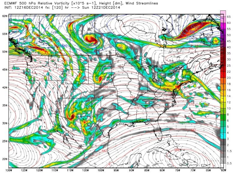 [/img]
[img]
 [/img]
_________________
"In weather and in life, there's no winning and losing; there's only winning and learning."
WINTER 2012/2013 TOTALS 43.65"WINTER 2017/2018 TOTALS 62.85" WINTER 2022/2023 TOTALS 4.9"
WINTER 2013/2014 TOTALS 64.85"WINTER 2018/2019 TOTALS 14.25" WINTER 2023/2024 TOTALS 13.1"
WINTER 2014/2015 TOTALS 71.20"WINTER 2019/2020 TOTALS 6.35"
WINTER 2015/2016 TOTALS 35.00"WINTER 2020/2021 TOTALS 37.75"
WINTER 2016/2017 TOTALS 42.25"WINTER 2021/2022 TOTALS 31.65"
sroc4- Admin
- Posts : 8331
Reputation : 301
Join date : 2013-01-07
Location : Wading River, LI
Re: December 20th-21st Storm Threat
![]() by Frank_Wx Tue Dec 16, 2014 1:33 pm
by Frank_Wx Tue Dec 16, 2014 1:33 pm
_________________
_______________________________________________________________________________________________________
CLICK HERE to view NJ Strong Snowstorm Classifications
Frank_Wx- Godzilla Seeker
- Posts : 21305
Reputation : 328
Join date : 2013-01-05
Age : 31
Location : Jersey City, NJ -
Re: December 20th-21st Storm Threat
![]() by Guest Tue Dec 16, 2014 1:45 pm
by Guest Tue Dec 16, 2014 1:45 pm
Frank_Wx wrote:Even if this does not turn into a big storm, I can still see how it is a minor event for some folks given the H5 energy coming over our area.
Hey Frank. I'm more than happy with minor events. I'll take a bunch of 2 to 4 events. Think I even said something like that to my LI buddy out in Wading River a week or so again. Yeah the big ones are what we all want but I'll take a few inches any day.
Guest- Guest
Re: December 20th-21st Storm Threat
![]() by amugs Tue Dec 16, 2014 1:56 pm
by amugs Tue Dec 16, 2014 1:56 pm
Great work Doc and Frank - grading Engineering tests - so not much to see on models this afternoon. Ensembles still showing a storm or did they back off this afternoon. I know not like yesterday but even if we had 1/3 or better half showing a minor to decent event then I think we may be in good shape.
_________________
Mugs
AKA:King: Snow Weenie
Self Proclaimed
WINTER 2014-15 : 55.12" +.02 for 6 coatings (avg. 35")
WINTER 2015-16 Total - 29.8" (Avg 35")
WINTER 2016-17 : 39.5" so far

amugs- Advanced Forecaster - Mod
- Posts : 15093
Reputation : 213
Join date : 2013-01-07
Age : 54
Location : Hillsdale,NJ
Re: December 20th-21st Storm Threat
![]() by gigs68 Tue Dec 16, 2014 2:00 pm
by gigs68 Tue Dec 16, 2014 2:00 pm
syosnow94 wrote:
Yeah the big ones are what we all want but I'll take a few inches any day.
That's what she said!

gigs68- Posts : 142
Reputation : 3
Join date : 2013-01-16
Location : Commack, NY (NW Suffolk)
Re: December 20th-21st Storm Threat
![]() by Frank_Wx Tue Dec 16, 2014 2:07 pm
by Frank_Wx Tue Dec 16, 2014 2:07 pm
gigs68 wrote:syosnow94 wrote:
Yeah the big ones are what we all want but I'll take a few inches any day.
That's what she said!
Haha!
_________________
_______________________________________________________________________________________________________
CLICK HERE to view NJ Strong Snowstorm Classifications
Frank_Wx- Godzilla Seeker
- Posts : 21305
Reputation : 328
Join date : 2013-01-05
Age : 31
Location : Jersey City, NJ -
Re: December 20th-21st Storm Threat
![]() by gigs68 Tue Dec 16, 2014 2:14 pm
by gigs68 Tue Dec 16, 2014 2:14 pm
Frank_Wx wrote:gigs68 wrote:syosnow94 wrote:
Yeah the big ones are what we all want but I'll take a few inches any day.
That's what she said!
Haha!
Sorry, Couldn't resist. It was just too easy.
gigs68- Posts : 142
Reputation : 3
Join date : 2013-01-16
Location : Commack, NY (NW Suffolk)
Re: December 20th-21st Storm Threat
![]() by sroc4 Tue Dec 16, 2014 2:16 pm
by sroc4 Tue Dec 16, 2014 2:16 pm
gigs68 wrote:Frank_Wx wrote:gigs68 wrote:syosnow94 wrote:
Yeah the big ones are what we all want but I'll take a few inches any day.
That's what she said!
Haha!
Sorry, Couldn't resist. It was just too easy.
LMAO
_________________
"In weather and in life, there's no winning and losing; there's only winning and learning."
WINTER 2012/2013 TOTALS 43.65"WINTER 2017/2018 TOTALS 62.85" WINTER 2022/2023 TOTALS 4.9"
WINTER 2013/2014 TOTALS 64.85"WINTER 2018/2019 TOTALS 14.25" WINTER 2023/2024 TOTALS 13.1"
WINTER 2014/2015 TOTALS 71.20"WINTER 2019/2020 TOTALS 6.35"
WINTER 2015/2016 TOTALS 35.00"WINTER 2020/2021 TOTALS 37.75"
WINTER 2016/2017 TOTALS 42.25"WINTER 2021/2022 TOTALS 31.65"
sroc4- Admin
- Posts : 8331
Reputation : 301
Join date : 2013-01-07
Location : Wading River, LI
Re: December 20th-21st Storm Threat
![]() by Frank_Wx Tue Dec 16, 2014 2:19 pm
by Frank_Wx Tue Dec 16, 2014 2:19 pm
amugs wrote:Good step by the euro though not big but a good step in the RIGHT direction - still plenty of time and like I said in a post at 10:40AM - the energy does not get fully sampled onshore until WED night at best 00z so the 6Z and more so 12z euro runs are big to see improvements IMO.
Great work Doc and Frank - grading Engineering tests - so not much to see on models this afternoon. Ensembles still showing a storm or did they back off this afternoon. I know not like yesterday but even if we had 1/3 or better half showing a minor to decent event then I think we may be in good shape.
The CMC Ensembles still show a strong coastal storm. Curious to see what euro ensembles say
_________________
_______________________________________________________________________________________________________
CLICK HERE to view NJ Strong Snowstorm Classifications
Frank_Wx- Godzilla Seeker
- Posts : 21305
Reputation : 328
Join date : 2013-01-05
Age : 31
Location : Jersey City, NJ -
Re: December 20th-21st Storm Threat
![]() by sroc4 Tue Dec 16, 2014 2:21 pm
by sroc4 Tue Dec 16, 2014 2:21 pm
Steve Dimartino says the same thing:
"The 12Z models continue to come out and continue to have the same problem, a poor lack of sampling. The GFS is all strained out at 500 MB with a poor representation of the disturbances over the Pacific this afternoon. The ECMWF is not much better although the far southeast storm track is now gone.
The overall theme this afternoon is that we need to wait another 24 hours before these models can be used with any confidence."
_________________
"In weather and in life, there's no winning and losing; there's only winning and learning."
WINTER 2012/2013 TOTALS 43.65"WINTER 2017/2018 TOTALS 62.85" WINTER 2022/2023 TOTALS 4.9"
WINTER 2013/2014 TOTALS 64.85"WINTER 2018/2019 TOTALS 14.25" WINTER 2023/2024 TOTALS 13.1"
WINTER 2014/2015 TOTALS 71.20"WINTER 2019/2020 TOTALS 6.35"
WINTER 2015/2016 TOTALS 35.00"WINTER 2020/2021 TOTALS 37.75"
WINTER 2016/2017 TOTALS 42.25"WINTER 2021/2022 TOTALS 31.65"
sroc4- Admin
- Posts : 8331
Reputation : 301
Join date : 2013-01-07
Location : Wading River, LI
Re: December 20th-21st Storm Threat
![]() by Guest Tue Dec 16, 2014 2:35 pm
by Guest Tue Dec 16, 2014 2:35 pm
I actually thought to myself while typing "should I put this in writing" Next time I'll add a disclaimer.gigs68 wrote:Frank_Wx wrote:gigs68 wrote:syosnow94 wrote:
Yeah the big ones are what we all want but I'll take a few inches any day.
That's what she said!
Haha!
Sorry, Couldn't resist. It was just too easy.
Guest- Guest
Re: December 20th-21st Storm Threat
![]() by nutleyblizzard Tue Dec 16, 2014 2:49 pm
by nutleyblizzard Tue Dec 16, 2014 2:49 pm
I was just about to type the same postsyosnow94 wrote:I actually thought to myself while typing "should I put this in writing" Next time I'll add a disclaimer.gigs68 wrote:Frank_Wx wrote:gigs68 wrote:syosnow94 wrote:
Yeah the big ones are what we all want but I'll take a few inches any day.
That's what she said!
Haha!
Sorry, Couldn't resist. It was just too easy.

nutleyblizzard- Senior Enthusiast

- Posts : 1952
Reputation : 41
Join date : 2014-01-30
Age : 58
Location : Nutley, new jersey
Re: December 20th-21st Storm Threat
![]() by Frank_Wx Tue Dec 16, 2014 3:09 pm
by Frank_Wx Tue Dec 16, 2014 3:09 pm
Lets see how things look by Thursday, but trends have not been good
_________________
_______________________________________________________________________________________________________
CLICK HERE to view NJ Strong Snowstorm Classifications
Frank_Wx- Godzilla Seeker
- Posts : 21305
Reputation : 328
Join date : 2013-01-05
Age : 31
Location : Jersey City, NJ -
Page 4 of 5 • 1, 2, 3, 4, 5 ![]()
|
|
|