
 Search
March 2nd Nor'easter Update
Page 11 of 40 •  1 ... 7 ... 10, 11, 12 ... 25 ... 40
 ![]()
Re: March 2nd Nor'easter Update
![]() by jmanley32 Thu Mar 01, 2018 5:25 am
by jmanley32 Thu Mar 01, 2018 5:25 am
jmanley32- Senior Enthusiast

- Posts : 20517
Join date : 2013-12-12
Re: March 2nd Nor'easter Update
![]() by jmanley32 Thu Mar 01, 2018 5:28 am
by jmanley32 Thu Mar 01, 2018 5:28 am
jmanley32- Senior Enthusiast
- Posts : 20517
Join date : 2013-12-12
Re: March 2nd Nor'easter Update
![]() by jmanley32 Thu Mar 01, 2018 5:32 am
by jmanley32 Thu Mar 01, 2018 5:32 am

jmanley32- Senior Enthusiast
- Posts : 20517
Reputation : 108
Join date : 2013-12-12
Age : 42
Location : Yonkers, NY
Re: March 2nd Nor'easter Update
![]() by jmanley32 Thu Mar 01, 2018 5:34 am
by jmanley32 Thu Mar 01, 2018 5:34 am
jmanley32- Senior Enthusiast
- Posts : 20517
Reputation : 108
Join date : 2013-12-12
Age : 42
Location : Yonkers, NY
Re: March 2nd Nor'easter Update
![]() by algae888 Thu Mar 01, 2018 5:52 am
by algae888 Thu Mar 01, 2018 5:52 am
Jon we're so close on all the models too close to feel any confidence with the forecast at this time I mean one or two degrees to overcome is not har with intense rate given the location of the low it's definitely going to be a nowcast for anyone from nassua border on Westjmanley32 wrote:Ugh 06 z nam not good for us Al. A few inches at best but go just north and totals start ramp up quick. Wow 70 mph gusts eastern CT on east that's crazy.

algae888- Advanced Forecaster

- Posts : 5311
Reputation : 46
Join date : 2013-02-05
Age : 61
Location : mt. vernon, new york
Re: March 2nd Nor'easter Update
![]() by jmanley32 Thu Mar 01, 2018 5:59 am
by jmanley32 Thu Mar 01, 2018 5:59 am
okay well it'll b a real nowcast for me as I won't be able check in on Fri much unless we get a snow day which I doubt. Early dismissal may be possible if the snow comes early enough.algae888 wrote:Jon we're so close on all the models too close to feel any confidence with the forecast at this time I mean one or two degrees to overcome is not har with intense rate given the location of the low it's definitely going to be a nowcast for anyone from nassua border on Westjmanley32 wrote:Ugh 06 z nam not good for us Al. A few inches at best but go just north and totals start ramp up quick. Wow 70 mph gusts eastern CT on east that's crazy.
jmanley32- Senior Enthusiast
- Posts : 20517
Reputation : 108
Join date : 2013-12-12
Age : 42
Location : Yonkers, NY
Re: March 2nd Nor'easter Update
![]() by docstox12 Thu Mar 01, 2018 6:06 am
by docstox12 Thu Mar 01, 2018 6:06 am

docstox12- Wx Statistician Guru

- Posts : 8507
Reputation : 222
Join date : 2013-01-07
Age : 73
Location : Monroe NY
Re: March 2nd Nor'easter Update
![]() by docstox12 Thu Mar 01, 2018 6:13 am
by docstox12 Thu Mar 01, 2018 6:13 am
docstox12- Wx Statistician Guru
- Posts : 8507
Reputation : 222
Join date : 2013-01-07
Age : 73
Location : Monroe NY
Re: March 2nd Nor'easter Update
![]() by jimv45 Thu Mar 01, 2018 6:16 am
by jimv45 Thu Mar 01, 2018 6:16 am
jimv45- Senior Enthusiast
- Posts : 1168
Reputation : 36
Join date : 2013-09-20
Location : Hopewell jct.
Re: March 2nd Nor'easter Update
![]() by weatherwatchermom Thu Mar 01, 2018 6:20 am
by weatherwatchermom Thu Mar 01, 2018 6:20 am
Good morning. FYI unless they call early dismissal in advance which is very rare..call while in school never happens to hard logistically to get kids home with parents working..my son in 7th grade and only once in kindergarten did he have early dissimissal due to hot weather at end of year was over 100 degrees...we knew in advance...have a good dayjmanley32 wrote:okay well it'll b a real nowcast for me as I won't be able check in on Fri much unless we get a snow day which I doubt. Early dismissal may be possible if the snow comes early enough.algae888 wrote:Jon we're so close on all the models too close to feel any confidence with the forecast at this time I mean one or two degrees to overcome is not har with intense rate given the location of the low it's definitely going to be a nowcast for anyone from nassua border on Westjmanley32 wrote:Ugh 06 z nam not good for us Al. A few inches at best but go just north and totals start ramp up quick. Wow 70 mph gusts eastern CT on east that's crazy.

weatherwatchermom- Senior Enthusiast
- Posts : 3750
Reputation : 77
Join date : 2014-11-25
Age : 60
Location : Hazlet Township, NJ
Re: March 2nd Nor'easter Update
![]() by jmanley32 Thu Mar 01, 2018 6:27 am
by jmanley32 Thu Mar 01, 2018 6:27 am
little diff where I work as the morning kids go home at 11:30am so they would just not have afternoon session. When I was a kid planty times it was called during day and that was public.weatherwatchermom wrote:Good morning. FYI unless they call early dismissal in advance which is very rare..call while in school never happens to hard logistically to get kids home with parents working..my son in 7th grade and only once in kindergarten did he have early dissimissal due to hot weather at end of year was over 100 degrees...we knew in advance...have a good dayjmanley32 wrote:okay well it'll b a real nowcast for me as I won't be able check in on Fri much unless we get a snow day which I doubt. Early dismissal may be possible if the snow comes early enough.algae888 wrote:Jon we're so close on all the models too close to feel any confidence with the forecast at this time I mean one or two degrees to overcome is not har with intense rate given the location of the low it's definitely going to be a nowcast for anyone from nassua border on Westjmanley32 wrote:Ugh 06 z nam not good for us Al. A few inches at best but go just north and totals start ramp up quick. Wow 70 mph gusts eastern CT on east that's crazy.
jmanley32- Senior Enthusiast
- Posts : 20517
Reputation : 108
Join date : 2013-12-12
Age : 42
Location : Yonkers, NY
Re: March 2nd Nor'easter Update
![]() by sroc4 Thu Mar 01, 2018 6:41 am
by sroc4 Thu Mar 01, 2018 6:41 am
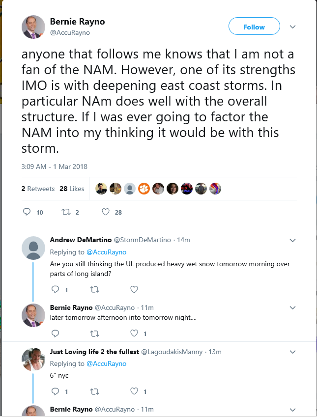
Here was a Bernie tweet from about 15 mins ago.
_________________
"In weather and in life, there's no winning and losing; there's only winning and learning."
WINTER 2012/2013 TOTALS 43.65"WINTER 2017/2018 TOTALS 62.85" WINTER 2022/2023 TOTALS 4.9"
WINTER 2013/2014 TOTALS 64.85"WINTER 2018/2019 TOTALS 14.25" WINTER 2023/2024 TOTALS 13.1"
WINTER 2014/2015 TOTALS 71.20"WINTER 2019/2020 TOTALS 6.35"
WINTER 2015/2016 TOTALS 35.00"WINTER 2020/2021 TOTALS 37.75"
WINTER 2016/2017 TOTALS 42.25"WINTER 2021/2022 TOTALS 31.65"

sroc4- Admin

- Posts : 8331
Reputation : 301
Join date : 2013-01-07
Location : Wading River, LI
Re: March 2nd Nor'easter Update
![]() by Guest Thu Mar 01, 2018 6:55 am
by Guest Thu Mar 01, 2018 6:55 am
Mist of the board. These models spitting out nothing. Then 6 hours later 16” are absurd. I trust the guys on here but I really hope I’m wrong and the 12z models change. Because after this last month of February torch /bust rain and 30’s would be a real kick in the groin. What a crapshow
Guest- Guest
Re: March 2nd Nor'easter Update
![]() by nutleyblizzard Thu Mar 01, 2018 6:59 am
by nutleyblizzard Thu Mar 01, 2018 6:59 am
Very complex and dynamic situation indeed. When you look at the H5 maps it just screams a major snowstorm, yet the surface maps for the most part does not reflect that. Mid level thermals are on the fence with this; any slight deviation with low placement and when the H5 low closes up will be key. Huge 12z runs today and even then we can most certainly see disagreements between the models. Its a forecasting nightmare for sure.sroc4 wrote:I don't trust any global for details in this tight with a storm this dynamic no matter what they say. The overall H5, H7 and H8 set up is relatively unchanged overnight. Ive said from the beginning the complexity of this storm will challenge every model including the hi res ones in tight. We are almost at the time where you switch to observations. I am still going to rely mostly on the timing and strgth of the upper and mid level features and not on snow maps output from any one model. I am still not confident in a snow map. I want to look at the 12z data first. I think if you drew a line through NYC SW-NE +/-35miles that is going to be the true battle zone for the real deal..again I don't trust any moidel to mail the dynamics of this storm. If there was ever going to be a now cast storm this is it.
Here was a Bernie tweet from about 15 mins ago.

nutleyblizzard- Senior Enthusiast
- Posts : 1952
Reputation : 41
Join date : 2014-01-30
Age : 58
Location : Nutley, new jersey
Re: March 2nd Nor'easter Update
![]() by jmanley32 Thu Mar 01, 2018 7:01 am
by jmanley32 Thu Mar 01, 2018 7:01 am
always like ur tgeraputic abslysis stock lol. Let's just wait and see what happens you are right. The models could all b wrong maybe things cool do quick we see much more snow. Maybe they don't and it's basically a tropical storm.sroc4 wrote:I don't trust any global for details in this tight with a storm this dynamic no matter what they say. The overall H5, H7 and H8 set up is relatively unchanged overnight. Ive said from the beginning the complexity of this storm will challenge every model including the hi res ones in tight. We are almost at the time where you switch to observations. I am still going to rely mostly on the timing and strgth of the upper and mid level features and not on snow maps output from any one model. I am still not confident in a snow map. I want to look at the 12z data first. I think if you drew a line through NYC SW-NE +/-35miles that is going to be the true battle zone for the real deal..again I don't trust any moidel to mail the dynamics of this storm. If there was ever going to be a now cast storm this is it.
Here was a Bernie tweet from about 15 mins ago.
jmanley32- Senior Enthusiast
- Posts : 20517
Reputation : 108
Join date : 2013-12-12
Age : 42
Location : Yonkers, NY
Re: March 2nd Nor'easter Update
![]() by bloc1357 Thu Mar 01, 2018 7:18 am
by bloc1357 Thu Mar 01, 2018 7:18 am
bloc1357- Pro Enthusiast

- Posts : 344
Reputation : 10
Join date : 2013-03-05
Age : 47
Location : West Babylon, NY - 11704
Re: March 2nd Nor'easter Update
![]() by RJB8525 Thu Mar 01, 2018 7:19 am
by RJB8525 Thu Mar 01, 2018 7:19 am

RJB8525- Senior Enthusiast
- Posts : 1994
Reputation : 28
Join date : 2013-02-06
Age : 38
Location : Hackettstown, NJ
Re: March 2nd Nor'easter Update
![]() by sroc4 Thu Mar 01, 2018 7:24 am
by sroc4 Thu Mar 01, 2018 7:24 am
_________________
"In weather and in life, there's no winning and losing; there's only winning and learning."
WINTER 2012/2013 TOTALS 43.65"WINTER 2017/2018 TOTALS 62.85" WINTER 2022/2023 TOTALS 4.9"
WINTER 2013/2014 TOTALS 64.85"WINTER 2018/2019 TOTALS 14.25" WINTER 2023/2024 TOTALS 13.1"
WINTER 2014/2015 TOTALS 71.20"WINTER 2019/2020 TOTALS 6.35"
WINTER 2015/2016 TOTALS 35.00"WINTER 2020/2021 TOTALS 37.75"
WINTER 2016/2017 TOTALS 42.25"WINTER 2021/2022 TOTALS 31.65"
sroc4- Admin
- Posts : 8331
Reputation : 301
Join date : 2013-01-07
Location : Wading River, LI
Re: March 2nd Nor'easter Update
![]() by jmanley32 Thu Mar 01, 2018 7:25 am
by jmanley32 Thu Mar 01, 2018 7:25 am
winds start kick up early am by 8 prolly already Gusty. Driven eain or snow depending on what happens. I'd just check with ur carrier before u leave the house.bloc1357 wrote:Still hoping to get out of Laguardia @ 8 AM tomorrow morning - Hopefully the wind holds off a bit till afternoon
jmanley32- Senior Enthusiast
- Posts : 20517
Reputation : 108
Join date : 2013-12-12
Age : 42
Location : Yonkers, NY
Re: March 2nd Nor'easter Update
![]() by bloc1357 Thu Mar 01, 2018 7:28 am
by bloc1357 Thu Mar 01, 2018 7:28 am
jmanley32 wrote:winds start kick up early am by 8 prolly already Gusty. Driven eain or snow depending on what happens. I'd just check with ur carrier before u leave the house.bloc1357 wrote:Still hoping to get out of Laguardia @ 8 AM tomorrow morning - Hopefully the wind holds off a bit till afternoon
Believe me I plan on...Trying to get away for a bachelor party weekend - Half of us leaving from JFK the others from LGA
bloc1357- Pro Enthusiast
- Posts : 344
Reputation : 10
Join date : 2013-03-05
Age : 47
Location : West Babylon, NY - 11704
Re: March 2nd Nor'easter Update
![]() by sroc4 Thu Mar 01, 2018 7:31 am
by sroc4 Thu Mar 01, 2018 7:31 am

_________________
"In weather and in life, there's no winning and losing; there's only winning and learning."
WINTER 2012/2013 TOTALS 43.65"WINTER 2017/2018 TOTALS 62.85" WINTER 2022/2023 TOTALS 4.9"
WINTER 2013/2014 TOTALS 64.85"WINTER 2018/2019 TOTALS 14.25" WINTER 2023/2024 TOTALS 13.1"
WINTER 2014/2015 TOTALS 71.20"WINTER 2019/2020 TOTALS 6.35"
WINTER 2015/2016 TOTALS 35.00"WINTER 2020/2021 TOTALS 37.75"
WINTER 2016/2017 TOTALS 42.25"WINTER 2021/2022 TOTALS 31.65"
sroc4- Admin
- Posts : 8331
Reputation : 301
Join date : 2013-01-07
Location : Wading River, LI
Re: March 2nd Nor'easter Update
![]() by jmanley32 Thu Mar 01, 2018 7:39 am
by jmanley32 Thu Mar 01, 2018 7:39 am
one my fav shows. What no Phil..osophies about it lol. I'm not go continue ur to worry till your throw in towel. Man I'm go miss 12z runs inmsy have sneak bathroom break lol what time is nam exactly again and when it's shown the storm not when it starts. Hoping see lots of hoots and hollers later. Frank must feel same way as he was leaning to do a map last night and after one comment on nam left rest of night. I found that odd. It's frustrating I'm sure even moreso for you all that do your forecasting which for this complex a system has been great final outcome being snow or rain. There's been no doubts bout the wind. Warnings up eastern long island eastern CT and mass 70 mph gusts! Still a watch here but my hunch is after 12z maybe latest 4pm update it goes to warning. May even see increase in highest gust maybe to 65 is my guess looking at the models. I don't see this being down graded to a wind advisory.sroc4 wrote:Stealing this from another board. But here is my first call for the storm. Subject to change.....but might not. lol
jmanley32- Senior Enthusiast
- Posts : 20517
Reputation : 108
Join date : 2013-12-12
Age : 42
Location : Yonkers, NY
rb924119- Meteorologist

- Posts : 6890
Reputation : 194
Join date : 2013-02-06
Age : 32
Location : Greentown, Pa
Re: March 2nd Nor'easter Update
![]() by crippo84 Thu Mar 01, 2018 8:20 am
by crippo84 Thu Mar 01, 2018 8:20 am

crippo84- Posts : 383
Reputation : 20
Join date : 2013-11-07
Age : 40
Location : East Village, NYC
Re: March 2nd Nor'easter Update
![]() by Guest Thu Mar 01, 2018 8:30 am
by Guest Thu Mar 01, 2018 8:30 am
rb924119 wrote:TRUST. THE. PROCESS.
Trusting the process isn't nearly as much fun as living and dieing with every blip on every model run.
Guest- Guest
Re: March 2nd Nor'easter Update
![]() by Frank_Wx Thu Mar 01, 2018 8:32 am
by Frank_Wx Thu Mar 01, 2018 8:32 am
_________________
_______________________________________________________________________________________________________
CLICK HERE to view NJ Strong Snowstorm Classifications

Frank_Wx- Godzilla Seeker
- Posts : 21305
Reputation : 328
Join date : 2013-01-05
Age : 31
Location : Jersey City, NJ -

Re: March 2nd Nor'easter Update
![]() by Scullybutcher Thu Mar 01, 2018 8:41 am
by Scullybutcher Thu Mar 01, 2018 8:41 am

Scullybutcher- Pro Enthusiast
- Posts : 543
Reputation : 16
Join date : 2013-02-06
Location : North Smithtown, western Suffolk county, long island
Page 11 of 40 • 1 ... 7 ... 10, 11, 12 ... 25 ... 40 ![]()
|
|
|