
 Search
Long Range Discussions 21.0
Page 9 of 15 •  1 ... 6 ... 8, 9, 10 ... 15
 ![]()
Re: Long Range Discussions 21.0
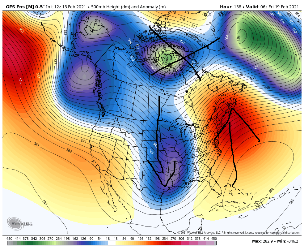
![]() by TheAresian Sat Feb 13, 2021 11:13 am
by TheAresian Sat Feb 13, 2021 11:13 am
TheAresian- Senior Enthusiast

- Posts : 145
Join date : 2019-11-13
Re: Long Range Discussions 21.0
![]() by heehaw453 Sat Feb 13, 2021 11:30 am
by heehaw453 Sat Feb 13, 2021 11:30 am
My take is to hope the -NAM state can load up again for end of February and into March then maybe we have a shot to go out in style. But if that doesn't occur, then I'd say not too much unless we get a very fortuitous setup in a short window.
heehaw453- Advanced Forecaster

- Posts : 3906
Join date : 2014-01-20
Re: Long Range Discussions 21.0
![]() by heehaw453 Sat Feb 13, 2021 11:33 am
by heehaw453 Sat Feb 13, 2021 11:33 am
TheAresian wrote:Mother Nature giveth and Mother Nature taketh away. Snow pack is going to take a beating by the end of next week.
I'm fine with that personally. It gaveth a whole lot in 2 week span and we'll have deep snow pack for 3 weeks. The past 2 weeks around here has looked like VT.
heehaw453- Advanced Forecaster
- Posts : 3906
Reputation : 86
Join date : 2014-01-20
Location : Bedminster Township, PA Elevation 600' ASL
Re: Long Range Discussions 21.0
![]() by TheAresian Sat Feb 13, 2021 12:08 pm
by TheAresian Sat Feb 13, 2021 12:08 pm
TheAresian- Senior Enthusiast
- Posts : 145
Reputation : 10
Join date : 2019-11-13
Location : Painted Post, NY
Re: Long Range Discussions 21.0
![]() by amugs Sat Feb 13, 2021 12:17 pm
by amugs Sat Feb 13, 2021 12:17 pm
Fun while it was here. Unless the Negative off the West moves further offshore and gets a PNA pumped to help.
_________________
Mugs
AKA:King: Snow Weenie
Self Proclaimed
WINTER 2014-15 : 55.12" +.02 for 6 coatings (avg. 35")
WINTER 2015-16 Total - 29.8" (Avg 35")
WINTER 2016-17 : 39.5" so far

amugs- Advanced Forecaster - Mod

- Posts : 15093
Reputation : 213
Join date : 2013-01-07
Age : 54
Location : Hillsdale,NJ
Re: Long Range Discussions 21.0
![]() by Irish Sat Feb 13, 2021 12:24 pm
by Irish Sat Feb 13, 2021 12:24 pm
amugs wrote:AO and NAO go bye bye, we lose them transient cd shot until we maybe see to reload. No positive on upcoming pattern. MJO phase 7 wave, N EPO disintegrates. All LP over Canada on last few runs at 500. Not being negative just disappointed. Models had tjisnpattwrn going and reinvigorating item until early March. The NAO and AO have been N since mid Jan but they were not in good locations for us here in a Nina base state. After this storm next one looks to cut and its same old pattern we had in Jan.
Fun while it was here. Unless the Negative off the West moves further offshore and gets a PNA pumped to help.
SPRING TIME!!! lol

Irish- Pro Enthusiast

- Posts : 788
Reputation : 19
Join date : 2019-01-16
Age : 45
Location : Old Bridge, NJ
Re: Long Range Discussions 21.0
![]() by amugs Sat Feb 13, 2021 12:34 pm
by amugs Sat Feb 13, 2021 12:34 pm
Irish wrote:amugs wrote:AO and NAO go bye bye, we lose them transient cd shot until we maybe see to reload. No positive on upcoming pattern. MJO phase 7 wave, N EPO disintegrates. All LP over Canada on last few runs at 500. Not being negative just disappointed. Models had tjisnpattwrn going and reinvigorating item until early March. The NAO and AO have been N since mid Jan but they were not in good locations for us here in a Nina base state. After this storm next one looks to cut and its same old pattern we had in Jan.
Fun while it was here. Unless the Negative off the West moves further offshore and gets a PNA pumped to help.
SPRING TIME!!! lol
Maybe but March if the pattern reloads yuo are not getting spring
This is what I mean by the what I stated above as well for Thursday Friday storm - this deep trough is to far west adn no blocking over teh top to push this east of us
_________________
Mugs
AKA:King: Snow Weenie
Self Proclaimed
WINTER 2014-15 : 55.12" +.02 for 6 coatings (avg. 35")
WINTER 2015-16 Total - 29.8" (Avg 35")
WINTER 2016-17 : 39.5" so far
amugs- Advanced Forecaster - Mod
- Posts : 15093
Reputation : 213
Join date : 2013-01-07
Age : 54
Location : Hillsdale,NJ
Re: Long Range Discussions 21.0
![]() by Irish Sat Feb 13, 2021 12:43 pm
by Irish Sat Feb 13, 2021 12:43 pm
amugs wrote:Irish wrote:amugs wrote:AO and NAO go bye bye, we lose them transient cd shot until we maybe see to reload. No positive on upcoming pattern. MJO phase 7 wave, N EPO disintegrates. All LP over Canada on last few runs at 500. Not being negative just disappointed. Models had tjisnpattwrn going and reinvigorating item until early March. The NAO and AO have been N since mid Jan but they were not in good locations for us here in a Nina base state. After this storm next one looks to cut and its same old pattern we had in Jan.
Fun while it was here. Unless the Negative off the West moves further offshore and gets a PNA pumped to help.
SPRING TIME!!! lol
Maybe but March if the pattern reloads yuo are not getting spring
This is what I mean by the what I stated above as well for Thursday Friday storm - this deep trough is to far west adn no blocking over teh top to push this east of us
Just having fun, I like most here, love winter and snow. Whatever happens, happens.
Irish- Pro Enthusiast
- Posts : 788
Reputation : 19
Join date : 2019-01-16
Age : 45
Location : Old Bridge, NJ
Re: Long Range Discussions 21.0
![]() by frank 638 Sat Feb 13, 2021 12:47 pm
by frank 638 Sat Feb 13, 2021 12:47 pm
frank 638- Senior Enthusiast
- Posts : 2825
Reputation : 37
Join date : 2016-01-01
Age : 40
Location : bronx ny
Re: Long Range Discussions 21.0
![]() by heehaw453 Sat Feb 13, 2021 1:28 pm
by heehaw453 Sat Feb 13, 2021 1:28 pm
amugs wrote:Irish wrote:amugs wrote:AO and NAO go bye bye, we lose them transient cd shot until we maybe see to reload. No positive on upcoming pattern. MJO phase 7 wave, N EPO disintegrates. All LP over Canada on last few runs at 500. Not being negative just disappointed. Models had tjisnpattwrn going and reinvigorating item until early March. The NAO and AO have been N since mid Jan but they were not in good locations for us here in a Nina base state. After this storm next one looks to cut and its same old pattern we had in Jan.
Fun while it was here. Unless the Negative off the West moves further offshore and gets a PNA pumped to help.
SPRING TIME!!! lol
Maybe but March if the pattern reloads yuo are not getting spring
This is what I mean by the what I stated above as well for Thursday Friday storm - this deep trough is to far west adn no blocking over teh top to push this east of us
March is a wild card no matter what the pattern. But particularly in La Nina. No one should think that if the rest of February craps the bed then March cannot produce. Not true. You don't need +PNA to get sig snow in March. Wavelengths can amplify w/out that kind of support. You just need some transient cold and a vigorous short wave. My guess is the white gold isn't done with us just yet. Now if you're on the coastal plain March is very tough to produce that's just climatology.
heehaw453- Advanced Forecaster
- Posts : 3906
Reputation : 86
Join date : 2014-01-20
Location : Bedminster Township, PA Elevation 600' ASL
Re: Long Range Discussions 21.0
![]() by amugs Sat Feb 13, 2021 1:54 pm
by amugs Sat Feb 13, 2021 1:54 pm
heehaw453 wrote:amugs wrote:Irish wrote:amugs wrote:AO and NAO go bye bye, we lose them transient cd shot until we maybe see to reload. No positive on upcoming pattern. MJO phase 7 wave, N EPO disintegrates. All LP over Canada on last few runs at 500. Not being negative just disappointed. Models had tjisnpattwrn going and reinvigorating item until early March. The NAO and AO have been N since mid Jan but they were not in good locations for us here in a Nina base state. After this storm next one looks to cut and its same old pattern we had in Jan.
Fun while it was here. Unless the Negative off the West moves further offshore and gets a PNA pumped to help.
SPRING TIME!!! lol
Maybe but March if the pattern reloads yuo are not getting spring
This is what I mean by the what I stated above as well for Thursday Friday storm - this deep trough is to far west adn no blocking over teh top to push this east of us
March is a wild card no matter what the pattern. But particularly in La Nina. No one should think that if the rest of February craps the bed then March cannot produce. Not true. You don't need +PNA to get sig snow in March. Wavelengths can amplify w/out that kind of support. You just need some transient cold and a vigorous short wave. My guess is the white gold isn't done with us just yet. Now if you're on the coastal plain March is very tough to produce that's just climatology.
Totally and when you have abundance of cold over Canada and a DEEEEEPP SNOWPACK up there it is very easy to tap that with a strong coastal. Winter is never over until it’s over look at 2018, last year as examples – yes we had SSWE that caused each and we can have another one that can produce similar have to look further at the models for this. Again if we see a moderation in the pattern it does not mean it's over. Not wish casting but weather truth. For the NYC Metro region and more so N&W.
_________________
Mugs
AKA:King: Snow Weenie
Self Proclaimed
WINTER 2014-15 : 55.12" +.02 for 6 coatings (avg. 35")
WINTER 2015-16 Total - 29.8" (Avg 35")
WINTER 2016-17 : 39.5" so far
amugs- Advanced Forecaster - Mod
- Posts : 15093
Reputation : 213
Join date : 2013-01-07
Age : 54
Location : Hillsdale,NJ
Re: Long Range Discussions 21.0
![]() by heehaw453 Sun Feb 14, 2021 5:02 am
by heehaw453 Sun Feb 14, 2021 5:02 am
heehaw453- Advanced Forecaster
- Posts : 3906
Reputation : 86
Join date : 2014-01-20
Location : Bedminster Township, PA Elevation 600' ASL
Re: Long Range Discussions 21.0
![]() by sroc4 Sun Feb 14, 2021 8:45 am
by sroc4 Sun Feb 14, 2021 8:45 am
sroc4 wrote:
......So when we get a banana HP set up like this with our low trying to plow through the Tenn valley into the Ohio valley I do not believe a cutter nor a coastal hugger ends up as our end product. Id be shocked if we didnt see a significant trend colder for the entire coverage area as we head into Sunday for the Tuesday system. A weaker primary transfering earlier and a LP track just inside to perhaps on the benchmark is my guess ATT simply based on the above stated experiences but again I dont know how it will end in the end. The coast of course will still need to worry about mixing issue(esp if inside the BM), and since it appears to be a pretty classic Miller B set up, an area of subsidence during the transfer is likely to screw someone. Should be interesting to see how this theory plays out over the next 3-4days. IMHO Tuesday has serious blockbuster potential.
WE TRACK!!

Here is the final excerpt from my write up from Thursday. I had such high hopes when I wrote this. Bottom line is this. Above look at that nice Banana HP that is 1036mb strong extending well down into New England. Below is the 00z run overnight. You can clearly see the differences. First is the strength is now only a 1030 HP. The second is the fact that it doesnt even get down to the Canadian boarder. The resistance for the Low to reform further off the coast is gone. You can see where it will track off the S NJ coast on or perhaps just over E LI towards the Cape which floods the area with the warmth. Why??

Well I also alluded to this several times before. About 3-5days out from the Big one that hit for the region at the beginning of the month is wen I think I personally first mentioned my concerns. That is there is a resistance in the air. The -AO/-NAO couplet has been the single reason for our success as defined by BN temps and AN Snow fall for pretty much all of us since the turn of Jan into Feb. Without it the last two weeks doesnt happen. Plain and simple. But the resistance to the -AO/-NAO has always been there. Here is an excerpt I wrote from about 3-4days out from the "big One".
sroc4 wrote:
The trend seems to be That the main energy seems to be under modeled in the medium range. Hopefully there’s enough relaxation in the PNA and EPO regions, and still enough resistance in the NAO and AO regions that we achieve baby bear, or at least close to it and not an overly amped system that cuts where the majority of us get the slop again.
First part of that quote cant be understated. It was also one of the reasons we hit on the superbowl too. No different with this set up. But back to the resistance.
The difference from the beginning of the month to now is as you can see below the AO/NAO are both going to positive. As much as +1 std deviation positive. The storm at the beginning of the month went from a deep neg state to a "less negative" state (-2.5 to about -0.5) providing enough resistance to get the track right and keep the cold locked in place. This set up is different. With them going positive, its not enough to keep the cold air in place, esp at the mid levels. As usual the southern system has trended stronger as we get in close. Without resistance to the warrmth, the mid levels flip like a switch, because the La Nina Base state in the background, and the MJO in 7 with amplitude. Third image below shows the trough going neg in the Mid CONUS. Without the -NAO/-AO this opens the flood gates to the SE ridge and a warm air mass compliments of enhancement from our strong southern system releasing massive amts of latent heat, which in turn pumps the SE ridge and raises heights. Our confluence, which locks in the cold is angled way to far SW to NE and is too far north resulting in the warm air source regions taking over.


Unfort with the base state of La Nina and the current state of the MJO you can see that with the NAO/AO forecast to remain positive to the end of the month this is going to lead to the pattern we had for much of Jan. Cutter, warm sector, cold behind, cutter, warm sector, cold behind. Nothing this week or for tthe foreseeable future excites me unfort. Until I see something different I likely will remain fairly quiet.
_________________
"In weather and in life, there's no winning and losing; there's only winning and learning."
WINTER 2012/2013 TOTALS 43.65"WINTER 2017/2018 TOTALS 62.85" WINTER 2022/2023 TOTALS 4.9"
WINTER 2013/2014 TOTALS 64.85"WINTER 2018/2019 TOTALS 14.25" WINTER 2023/2024 TOTALS 13.1"
WINTER 2014/2015 TOTALS 71.20"WINTER 2019/2020 TOTALS 6.35"
WINTER 2015/2016 TOTALS 35.00"WINTER 2020/2021 TOTALS 37.75"
WINTER 2016/2017 TOTALS 42.25"WINTER 2021/2022 TOTALS 31.65"

sroc4- Admin

- Posts : 8331
Reputation : 301
Join date : 2013-01-07
Location : Wading River, LI
heehaw453 likes this post
Re: Long Range Discussions 21.0
![]() by heehaw453 Sun Feb 14, 2021 11:09 am
by heehaw453 Sun Feb 14, 2021 11:09 am
We of course will see if this holds any water in later model runs. There is decent model agreement on a thump for now.
heehaw453- Advanced Forecaster
- Posts : 3906
Reputation : 86
Join date : 2014-01-20
Location : Bedminster Township, PA Elevation 600' ASL
sroc4 likes this post
Re: Long Range Discussions 21.0
![]() by heehaw453 Sun Feb 14, 2021 1:12 pm
by heehaw453 Sun Feb 14, 2021 1:12 pm
I like the boundary layer pull here from Tuesday's departing storm. We were not able to pull the boundary layer below us and consequentially most of us will not see any snow from Tuesday's storm. I'm looking at this trend because I think that can set us up for a thump. Look at how far this boundary layer as modeled by 12Z Euro today gets pulled. That tells me thump even if we go to slop at some point in the storm.

Last edited by heehaw453 on Sun Feb 14, 2021 1:29 pm; edited 1 time in total
heehaw453- Advanced Forecaster
- Posts : 3906
Reputation : 86
Join date : 2014-01-20
Location : Bedminster Township, PA Elevation 600' ASL
Re: Long Range Discussions 21.0
![]() by heehaw453 Sun Feb 14, 2021 1:24 pm
by heehaw453 Sun Feb 14, 2021 1:24 pm
heehaw453- Advanced Forecaster
- Posts : 3906
Reputation : 86
Join date : 2014-01-20
Location : Bedminster Township, PA Elevation 600' ASL
Re: Long Range Discussions 21.0
![]() by SENJsnowman Sun Feb 14, 2021 2:24 pm
by SENJsnowman Sun Feb 14, 2021 2:24 pm

SENJsnowman- Senior Enthusiast
- Posts : 1186
Reputation : 61
Join date : 2017-01-06
Age : 51
Location : Bayville, NJ
amugs likes this post
Re: Long Range Discussions 21.0
![]() by heehaw453 Sun Feb 14, 2021 2:35 pm
by heehaw453 Sun Feb 14, 2021 2:35 pm
SENJsnowman wrote:I think it was rb and sroc who took the time a few years back to explain about wind barbs and how they track where the air is being sourced from. And if I remember correctly, we can see from the barbs in heehaw's 850 map just how cold the source of our air is and how that air is coming straight for us. And thanks guys for the insight- or to whoever it was!!
Right that is the TPV sliding east and this was originally modelled to slide east earlier for Monday's storm. It didn't and stayed in central US and is why places in Tx and Tn that don't normally get sig snow got it. If the TPV is being modelled accurately for Thursday and can beat down the storm's westward trajectory enough then we'll do fine on Thursday. To me it's about that Atlantic ridge and how far it can be beaten down. Big IFs right now...
heehaw453- Advanced Forecaster
- Posts : 3906
Reputation : 86
Join date : 2014-01-20
Location : Bedminster Township, PA Elevation 600' ASL
SENJsnowman likes this post
Re: Long Range Discussions 21.0
![]() by heehaw453 Sun Feb 14, 2021 5:00 pm
by heehaw453 Sun Feb 14, 2021 5:00 pm
The TPV being this eastward also pushed the baroclinic zone much further south and east. I just hope the modelling is truly representing reality.
LOL maybe suppression at the end of the day will occur.

heehaw453- Advanced Forecaster
- Posts : 3906
Reputation : 86
Join date : 2014-01-20
Location : Bedminster Township, PA Elevation 600' ASL
Re: Long Range Discussions 21.0
![]() by jmanley32 Sun Feb 14, 2021 10:44 pm
by jmanley32 Sun Feb 14, 2021 10:44 pm

jmanley32- Senior Enthusiast
- Posts : 20516
Reputation : 108
Join date : 2013-12-12
Age : 42
Location : Yonkers, NY
Re: Long Range Discussions 21.0
![]() by heehaw453 Mon Feb 15, 2021 7:23 am
by heehaw453 Mon Feb 15, 2021 7:23 am
heehaw453- Advanced Forecaster
- Posts : 3906
Reputation : 86
Join date : 2014-01-20
Location : Bedminster Township, PA Elevation 600' ASL
Re: Long Range Discussions 21.0
![]() by Frank_Wx Mon Feb 15, 2021 9:14 am
by Frank_Wx Mon Feb 15, 2021 9:14 am
_________________
_______________________________________________________________________________________________________
CLICK HERE to view NJ Strong Snowstorm Classifications

Frank_Wx- Godzilla Seeker
- Posts : 21305
Reputation : 328
Join date : 2013-01-05
Age : 31
Location : Jersey City, NJ -

Re: Long Range Discussions 21.0
![]() by amugs Mon Feb 15, 2021 8:38 pm
by amugs Mon Feb 15, 2021 8:38 pm

_________________
Mugs
AKA:King: Snow Weenie
Self Proclaimed
WINTER 2014-15 : 55.12" +.02 for 6 coatings (avg. 35")
WINTER 2015-16 Total - 29.8" (Avg 35")
WINTER 2016-17 : 39.5" so far
amugs- Advanced Forecaster - Mod
- Posts : 15093
Reputation : 213
Join date : 2013-01-07
Age : 54
Location : Hillsdale,NJ
Re: Long Range Discussions 21.0
![]() by amugs Mon Feb 15, 2021 8:46 pm
by amugs Mon Feb 15, 2021 8:46 pm
-EPO, -AO and NAO

Delusional or onto something?
_________________
Mugs
AKA:King: Snow Weenie
Self Proclaimed
WINTER 2014-15 : 55.12" +.02 for 6 coatings (avg. 35")
WINTER 2015-16 Total - 29.8" (Avg 35")
WINTER 2016-17 : 39.5" so far
amugs- Advanced Forecaster - Mod
- Posts : 15093
Reputation : 213
Join date : 2013-01-07
Age : 54
Location : Hillsdale,NJ

Snow88- Senior Enthusiast
- Posts : 2193
Reputation : 4
Join date : 2013-01-09
Age : 35
Location : Brooklyn, NY
amugs likes this post
Re: Long Range Discussions 21.0
![]() by Frank_Wx Mon Feb 15, 2021 8:59 pm
by Frank_Wx Mon Feb 15, 2021 8:59 pm
amugs wrote:EPS weeklies
-EPO, -AO and NAO
Delusional or onto something?
If there is a second warming and displacement of the Strat PV then we'll see this pattern resurface
It may not be as extreme given it will happen in the month of March, but enough to cause issues
Climo is a factor in March
_________________
_______________________________________________________________________________________________________
CLICK HERE to view NJ Strong Snowstorm Classifications
Frank_Wx- Godzilla Seeker
- Posts : 21305
Reputation : 328
Join date : 2013-01-05
Age : 31
Location : Jersey City, NJ -
Re: Long Range Discussions 21.0
![]() by heehaw453 Tue Feb 16, 2021 1:33 pm
by heehaw453 Tue Feb 16, 2021 1:33 pm
Lots can change, but all modelling seems to have this shortwave.

heehaw453- Advanced Forecaster
- Posts : 3906
Reputation : 86
Join date : 2014-01-20
Location : Bedminster Township, PA Elevation 600' ASL
Page 9 of 15 • 1 ... 6 ... 8, 9, 10 ... 15 ![]()
|
|
|