
 Search
Long Range Thread 25.0
Page 36 of 40 •  1 ... 19 ... 35, 36, 37, 38, 39, 40
 ![]()
Re: Long Range Thread 25.0
![]() by CPcantmeasuresnow Sat Feb 18, 2023 7:56 pm
by CPcantmeasuresnow Sat Feb 18, 2023 7:56 pm
In keeping with my limited knowledge and the trusty weather app, and the last threat on the 23rd having morphed into the usual mild rainy event with highs in the upper 40’s let’s move on to the 25th.
Right now I’m forecast for a high of 32 with 2-6 inches of snow. A virtual blizzard of 88 for this winter. In Keeping with the consistent trends of this entire season by Monday or Tuesday this will be forecast for an inch or less of snow with highs in the mid 40’s. And I’m 50 miles north of NYC in the metros cold area.
CPcantmeasuresnow- Wx Statistician Guru

- Posts : 7274
Join date : 2013-01-07
docstox12 and heehaw453 like this post
Re: Long Range Thread 25.0
![]() by heehaw453 Sun Feb 19, 2023 11:52 am
by heehaw453 Sun Feb 19, 2023 11:52 am
I think the 25th's biggest obstacle is the weak s/w aided by the -PNA. Just may not get enough s/w development precip for snowfall. Probably will be cold enough, but end result may still be no snow OTG. So we fail when it's cold enough and of course we do well at failing with moisture rich cutters.CPcantmeasuresnow wrote:I can add nothing to the scientific analysis that Heehaw and Sroc bring to these setups so all I can add is this.
In keeping with my limited knowledge and the trusty weather app, and the last threat on the 23rd having morphed into the usual mild rainy event with highs in the upper 40’s let’s move on to the 25th.
Right now I’m forecast for a high of 32 with 2-6 inches of snow. A virtual blizzard of 88 for this winter. In Keeping with the consistent trends of this entire season by Monday or Tuesday this will be forecast for an inch or less of snow with highs in the mid 40’s. And I’m 50 miles north of NYC in the metros cold area.

heehaw453- Advanced Forecaster

- Posts : 3906
Join date : 2014-01-20
CPcantmeasuresnow and kalleg like this post
Re: Long Range Thread 25.0
![]() by heehaw453 Sun Feb 19, 2023 6:34 pm
by heehaw453 Sun Feb 19, 2023 6:34 pm


heehaw453- Advanced Forecaster
- Posts : 3906
Reputation : 86
Join date : 2014-01-20
Location : Bedminster Township, PA Elevation 600' ASL
CPcantmeasuresnow and SENJsnowman like this post
Re: Long Range Thread 25.0
![]() by heehaw453 Mon Feb 20, 2023 8:17 am
by heehaw453 Mon Feb 20, 2023 8:17 am
heehaw453- Advanced Forecaster
- Posts : 3906
Reputation : 86
Join date : 2014-01-20
Location : Bedminster Township, PA Elevation 600' ASL
kalleg likes this post
Re: Long Range Thread 25.0
![]() by heehaw453 Mon Feb 20, 2023 8:37 am
by heehaw453 Mon Feb 20, 2023 8:37 am

heehaw453- Advanced Forecaster
- Posts : 3906
Reputation : 86
Join date : 2014-01-20
Location : Bedminster Township, PA Elevation 600' ASL
Re: Long Range Thread 25.0
![]() by heehaw453 Mon Feb 20, 2023 5:52 pm
by heehaw453 Mon Feb 20, 2023 5:52 pm

heehaw453- Advanced Forecaster
- Posts : 3906
Reputation : 86
Join date : 2014-01-20
Location : Bedminster Township, PA Elevation 600' ASL
Re: Long Range Thread 25.0
![]() by heehaw453 Tue Feb 21, 2023 3:05 pm
by heehaw453 Tue Feb 21, 2023 3:05 pm

heehaw453- Advanced Forecaster
- Posts : 3906
Reputation : 86
Join date : 2014-01-20
Location : Bedminster Township, PA Elevation 600' ASL
Re: Long Range Thread 25.0
![]() by Irish Tue Feb 21, 2023 3:08 pm
by Irish Tue Feb 21, 2023 3:08 pm
heehaw453 wrote:This 2/28 storm will probably be a rain storm for our area.
Edited for time saving purposes.

Irish- Pro Enthusiast

- Posts : 788
Reputation : 19
Join date : 2019-01-16
Age : 45
Location : Old Bridge, NJ
CPcantmeasuresnow likes this post
Re: Long Range Thread 25.0
![]() by heehaw453 Tue Feb 21, 2023 4:06 pm
by heehaw453 Tue Feb 21, 2023 4:06 pm
Probably, but there's 2 things stand out with this. One is a rise in the PNA at the time of storm and a sig drop in the NAO. Those two things sucker me in longer than I should even bother. Most likely Miller B and SNE on north has the best shot at a snow storm. But the split in the ensembles is quite large at D6+. Models don't pick up on the effects of blocking well until 3-4 days out. The NAO drops are sometimes associated with Archambault events.Irish wrote:heehaw453 wrote:This 2/28 storm will probably be a rain storm for our area.
Edited for time saving purposes.


heehaw453- Advanced Forecaster
- Posts : 3906
Reputation : 86
Join date : 2014-01-20
Location : Bedminster Township, PA Elevation 600' ASL
CPcantmeasuresnow likes this post
Re: Long Range Thread 25.0
![]() by amugs Tue Feb 21, 2023 9:52 pm
by amugs Tue Feb 21, 2023 9:52 pm

_________________
Mugs
AKA:King: Snow Weenie
Self Proclaimed
WINTER 2014-15 : 55.12" +.02 for 6 coatings (avg. 35")
WINTER 2015-16 Total - 29.8" (Avg 35")
WINTER 2016-17 : 39.5" so far

amugs- Advanced Forecaster - Mod

- Posts : 15093
Reputation : 213
Join date : 2013-01-07
Age : 54
Location : Hillsdale,NJ
Re: Long Range Thread 25.0
![]() by heehaw453 Wed Feb 22, 2023 9:37 am
by heehaw453 Wed Feb 22, 2023 9:37 am


heehaw453- Advanced Forecaster
- Posts : 3906
Reputation : 86
Join date : 2014-01-20
Location : Bedminster Township, PA Elevation 600' ASL
Re: Long Range Thread 25.0
![]() by heehaw453 Wed Feb 22, 2023 11:02 am
by heehaw453 Wed Feb 22, 2023 11:02 am

heehaw453- Advanced Forecaster
- Posts : 3906
Reputation : 86
Join date : 2014-01-20
Location : Bedminster Township, PA Elevation 600' ASL
sroc4 likes this post
Re: Long Range Thread 25.0
![]() by heehaw453 Wed Feb 22, 2023 11:44 am
by heehaw453 Wed Feb 22, 2023 11:44 am
heehaw453- Advanced Forecaster
- Posts : 3906
Reputation : 86
Join date : 2014-01-20
Location : Bedminster Township, PA Elevation 600' ASL
CPcantmeasuresnow likes this post
Re: Long Range Thread 25.0
![]() by jmanley32 Wed Feb 22, 2023 1:32 pm
by jmanley32 Wed Feb 22, 2023 1:32 pm

jmanley32- Senior Enthusiast

- Posts : 20517
Reputation : 108
Join date : 2013-12-12
Age : 42
Location : Yonkers, NY
Re: Long Range Thread 25.0
![]() by sroc4 Wed Feb 22, 2023 1:41 pm
by sroc4 Wed Feb 22, 2023 1:41 pm
Jon I hope to God you are not even thinking about getting excited about anything beyond day 3.
_________________
"In weather and in life, there's no winning and losing; there's only winning and learning."
WINTER 2012/2013 TOTALS 43.65"WINTER 2017/2018 TOTALS 62.85" WINTER 2022/2023 TOTALS 4.9"
WINTER 2013/2014 TOTALS 64.85"WINTER 2018/2019 TOTALS 14.25" WINTER 2023/2024 TOTALS 13.1"
WINTER 2014/2015 TOTALS 71.20"WINTER 2019/2020 TOTALS 6.35"
WINTER 2015/2016 TOTALS 35.00"WINTER 2020/2021 TOTALS 37.75"
WINTER 2016/2017 TOTALS 42.25"WINTER 2021/2022 TOTALS 31.65"

sroc4- Admin

- Posts : 8331
Reputation : 301
Join date : 2013-01-07
Location : Wading River, LI
CPcantmeasuresnow likes this post
Re: Long Range Thread 25.0
![]() by heehaw453 Wed Feb 22, 2023 1:53 pm
by heehaw453 Wed Feb 22, 2023 1:53 pm
It's going to come down to the strength and orientation of the block and 50/50 IMO. A bit stronger and it develops that much further south as well as stalls out the low. Again, I think it's going to be close, but just may miss the mark. This hobby is rough on the psyche this winter.sroc4 wrote:Euro is tantalizing. How I loath this hobby sometimes.
Jon I hope to God you are not even thinking about getting excited about anything beyond day 3.
heehaw453- Advanced Forecaster
- Posts : 3906
Reputation : 86
Join date : 2014-01-20
Location : Bedminster Township, PA Elevation 600' ASL
CPcantmeasuresnow likes this post
Re: Long Range Thread 25.0
![]() by sroc4 Wed Feb 22, 2023 2:07 pm
by sroc4 Wed Feb 22, 2023 2:07 pm
heehaw453 wrote:It's going to come down to the strength and orientation of the block and 50/50 IMO. A bit stronger and it develops that much further south as well as stalls out the low. Again, I think it's going to be close, but just may miss the mark. This hobby is rough on the psyche this winter.sroc4 wrote:Euro is tantalizing. How I loath this hobby sometimes.
Jon I hope to God you are not even thinking about getting excited about anything beyond day 3.
Couldnt agree more. If that SOI persists in the negatives for the next several days, and or the OLR percolates in favorable locations AND we see colder trends I just may believe there is some merit there.
However, if the OLR persists over the Western Pac and the SOI begins to shift back into positive territory then there is a very good chance we see our -NAO trends more east based and or weaker, the 50/50 low moving out faster as a result, and the energy trending stronger such that the SE ridge flexes flooding mid levels with warmth out ahead, and the primary cuts too far N&W before any meaningful transfer. As we all know this has been our pattern/trend all season, but as stated earlier eventually the atmosphere is going to change its primary forcing. Is this that time? Watch the SOI, MJO, and OLR forecasts and they will likely tell you.
_________________
"In weather and in life, there's no winning and losing; there's only winning and learning."
WINTER 2012/2013 TOTALS 43.65"WINTER 2017/2018 TOTALS 62.85" WINTER 2022/2023 TOTALS 4.9"
WINTER 2013/2014 TOTALS 64.85"WINTER 2018/2019 TOTALS 14.25" WINTER 2023/2024 TOTALS 13.1"
WINTER 2014/2015 TOTALS 71.20"WINTER 2019/2020 TOTALS 6.35"
WINTER 2015/2016 TOTALS 35.00"WINTER 2020/2021 TOTALS 37.75"
WINTER 2016/2017 TOTALS 42.25"WINTER 2021/2022 TOTALS 31.65"
sroc4- Admin
- Posts : 8331
Reputation : 301
Join date : 2013-01-07
Location : Wading River, LI
heehaw453 likes this post
Re: Long Range Thread 25.0
![]() by heehaw453 Wed Feb 22, 2023 2:23 pm
by heehaw453 Wed Feb 22, 2023 2:23 pm
This is moving in the right direction on EPS. Whether or not it keeps moving that way is another matter. But this EPS would get 'r done IMO.sroc4 wrote:heehaw453 wrote:It's going to come down to the strength and orientation of the block and 50/50 IMO. A bit stronger and it develops that much further south as well as stalls out the low. Again, I think it's going to be close, but just may miss the mark. This hobby is rough on the psyche this winter.sroc4 wrote:Euro is tantalizing. How I loath this hobby sometimes.
Jon I hope to God you are not even thinking about getting excited about anything beyond day 3.
Couldnt agree more. If that SOI persists in the negatives for the next several days, and or the OLR percolates in favorable locations AND we see colder trends I just may believe there is some merit there.
However, if the OLR persists over the Western Pac and the SOI begins to shift back into positive territory then there is a very good chance we see our -NAO trends more east based and or weaker, the 50/50 low moving out faster as a result, and the energy trending stronger such that the SE ridge flexes flooding mid levels with warmth out ahead, and the primary cuts too far N&W before any meaningful transfer. As we all know this has been our pattern/trend all season, but as stated earlier eventually the atmosphere is going to change its primary forcing. Is this that time? Watch the SOI, MJO, and OLR forecasts and they will likely tell you.
Huge lean SE from the primary. Aided by strengthening block and robust far reaching 50/50 the storm would have no choice but to develop south and crawl.


heehaw453- Advanced Forecaster
- Posts : 3906
Reputation : 86
Join date : 2014-01-20
Location : Bedminster Township, PA Elevation 600' ASL
sroc4 and CPcantmeasuresnow like this post
Re: Long Range Thread 25.0
![]() by heehaw453 Wed Feb 22, 2023 3:17 pm
by heehaw453 Wed Feb 22, 2023 3:17 pm
heehaw453- Advanced Forecaster
- Posts : 3906
Reputation : 86
Join date : 2014-01-20
Location : Bedminster Township, PA Elevation 600' ASL
CPcantmeasuresnow likes this post
Re: Long Range Thread 25.0
![]() by CPcantmeasuresnow Wed Feb 22, 2023 4:46 pm
by CPcantmeasuresnow Wed Feb 22, 2023 4:46 pm
heehaw453 wrote:I'll make another observation on this. Based on some boards chatter folks in NE are thinking this is the big one. Sure it maybe, but a few more bumps south on the primary and this may become a LHV/LI/NYC special. I don't think the secondary is going to gain much latitude. Heights are too compressed. Once it explodes she's going east and possibly slightly south of east. It's one mean looking 50/50.
You and Sroc have to stop doing this to me. As I stare out at moderate snow that I know is becoming freezing rain tonight and eventually rain, you have me somewhat believing we could finally, at least in parts of our forum, get a decent snowfall next week.
What you both say makes a lot of sense but of course it’s still a long way off. Just because the way things have gone this year I’ll keep my expectations at nothing and assume this will take the path of every other storm this year and fizzle out into oblivion.
As always I hope I’m wrong.

CPcantmeasuresnow- Wx Statistician Guru
- Posts : 7274
Reputation : 230
Join date : 2013-01-07
Age : 103
Location : Eastern Orange County, NY
sroc4, docstox12 and dkodgis like this post
Re: Long Range Thread 25.0
![]() by heehaw453 Wed Feb 22, 2023 4:58 pm
by heehaw453 Wed Feb 22, 2023 4:58 pm
Need at least another 4-5 cycle runs of seeing the blocking tend stronger with more resistance on the primary. If that happens your area is going get something and maybe a lot of something. If not then it's a snow storm for CNE and NNE. I'm in your camp and it needs to be way more imminent than what we got now before believing it. But nonetheless we'll track it.CPcantmeasuresnow wrote:heehaw453 wrote:I'll make another observation on this. Based on some boards chatter folks in NE are thinking this is the big one. Sure it maybe, but a few more bumps south on the primary and this may become a LHV/LI/NYC special. I don't think the secondary is going to gain much latitude. Heights are too compressed. Once it explodes she's going east and possibly slightly south of east. It's one mean looking 50/50.
You and Sroc have to stop doing this to me. As I stare out at moderate snow that I know is becoming freezing rain tonight and eventually rain, you have me somewhat believing we could finally, at least in parts of our forum, get a decent snowfall next week.
What you both say makes a lot of sense but of course it’s still a long way off. Just because the way things have gone this year I’ll keep my expectations at nothing and assume this will take the path of every other storm this year and fizzle out into oblivion.
As always I hope I’m wrong.
heehaw453- Advanced Forecaster
- Posts : 3906
Reputation : 86
Join date : 2014-01-20
Location : Bedminster Township, PA Elevation 600' ASL
Re: Long Range Thread 25.0
![]() by heehaw453 Wed Feb 22, 2023 6:19 pm
by heehaw453 Wed Feb 22, 2023 6:19 pm

heehaw453- Advanced Forecaster
- Posts : 3906
Reputation : 86
Join date : 2014-01-20
Location : Bedminster Township, PA Elevation 600' ASL
Re: Long Range Thread 25.0
![]() by jmanley32 Wed Feb 22, 2023 6:41 pm
by jmanley32 Wed Feb 22, 2023 6:41 pm
re-read my post, not excited at all. Though below analysis gave me a little shred of hope I guess, honestly at this point I'm neutral, if it happens great if it doesn't great I don't have to break my unconditioned back shoveling lol. It is getting to the part of the year where I would rather have sustained warmth in 3 to 4 weeks or so and lets say the .1% chance we have of get buried in march happened then it would not leave until april.sroc4 wrote:Euro is tantalizing. How I loath this hobby sometimes.
Jon I hope to God you are not even thinking about getting excited about anything beyond day 3.
jmanley32- Senior Enthusiast
- Posts : 20517
Reputation : 108
Join date : 2013-12-12
Age : 42
Location : Yonkers, NY
Re: Long Range Thread 25.0
![]() by amugs Wed Feb 22, 2023 8:03 pm
by amugs Wed Feb 22, 2023 8:03 pm
Remember I said Jim Witt said March 3-5th intense storminess for east coast???? High energy sun cycle. It's gonna happen.
_________________
Mugs
AKA:King: Snow Weenie
Self Proclaimed
WINTER 2014-15 : 55.12" +.02 for 6 coatings (avg. 35")
WINTER 2015-16 Total - 29.8" (Avg 35")
WINTER 2016-17 : 39.5" so far
amugs- Advanced Forecaster - Mod
- Posts : 15093
Reputation : 213
Join date : 2013-01-07
Age : 54
Location : Hillsdale,NJ
Re: Long Range Thread 25.0
![]() by heehaw453 Wed Feb 22, 2023 8:40 pm
by heehaw453 Wed Feb 22, 2023 8:40 pm

heehaw453- Advanced Forecaster
- Posts : 3906
Reputation : 86
Join date : 2014-01-20
Location : Bedminster Township, PA Elevation 600' ASL
Re: Long Range Thread 25.0
![]() by amugs Wed Feb 22, 2023 9:28 pm
by amugs Wed Feb 22, 2023 9:28 pm
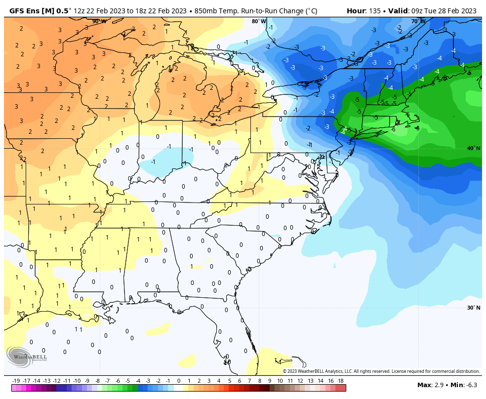
heehaw453 wrote:I want believe this latest EPS for next Tuesday. I really do. As the new Low takes over it gets an injection of energy blowing up the ULL aided by the PNA rise. I'd like to see that PNA rise a bit more forcing that ULL to dig more.
I'd like to see alot too but we have to take what we can get and hope the block is a tad stronger along with 50/50 thatbwould help. PAC is not ready to help until a few days later as it looks to transition.
_________________
Mugs
AKA:King: Snow Weenie
Self Proclaimed
WINTER 2014-15 : 55.12" +.02 for 6 coatings (avg. 35")
WINTER 2015-16 Total - 29.8" (Avg 35")
WINTER 2016-17 : 39.5" so far
amugs- Advanced Forecaster - Mod
- Posts : 15093
Reputation : 213
Join date : 2013-01-07
Age : 54
Location : Hillsdale,NJ
Re: Long Range Thread 25.0
![]() by amugs Wed Feb 22, 2023 9:32 pm
by amugs Wed Feb 22, 2023 9:32 pm
This is what I mean, a positive trend over the past 3 runs. Needs this to hold and keep ticking west with the ridge and the NAO block and 50/50 build the confluence to shove the SW more S. If we get these going then things improve on the surface depiction more.amugs wrote:heehaw453 wrote:I want believe this latest EPS for next Tuesday. I really do. As the new Low takes over it gets an injection of energy blowing up the ULL aided by the PNA rise. I'd like to see that PNA rise a bit more forcing that ULL to dig more.
I'd like to see alot too but we have to take what we can get and hope the block is a tad stronger along with 50/50 thatbwould help. PAC is not ready to help until a few days later as it looks to transition.
From 33nRain board Brooklyn

_________________
Mugs
AKA:King: Snow Weenie
Self Proclaimed
WINTER 2014-15 : 55.12" +.02 for 6 coatings (avg. 35")
WINTER 2015-16 Total - 29.8" (Avg 35")
WINTER 2016-17 : 39.5" so far
amugs- Advanced Forecaster - Mod
- Posts : 15093
Reputation : 213
Join date : 2013-01-07
Age : 54
Location : Hillsdale,NJ
Page 36 of 40 • 1 ... 19 ... 35, 36, 37, 38, 39, 40 ![]()
|
|
|