
 Search
1st Impacts Map for Pre-Thanksgiving Storm
4 posters

1st Impacts Map for Pre-Thanksgiving Storm
![]() by Frank_Wx Mon Nov 25, 2013 1:03 am
by Frank_Wx Mon Nov 25, 2013 1:03 am

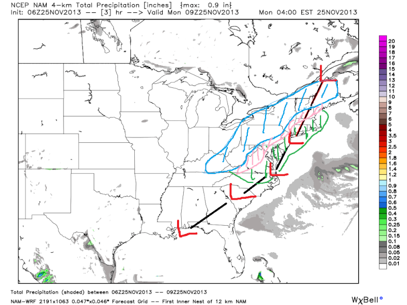
Here are my initial thoughts on the storm system to impact us mid-week. If needed, I will make a final map tomorrow night.
Overall, given the lack of phasing between both pieces of energy from different jet streams, I think a rather disorganized system will ride up just east of the Apps. Disorganized systems usually bring milder air from the south up along with them, and lack to produce their own cold air (dynamic cooling). Therefore, I think many people will see rain out of this, including the people who could see some accumulating snow.
Very cold air and gusty winds will follow behind it just in time for Thanksgiving Day. Could be areas of icing to worry about once the colder air moves in and temps. drop below freezing with saturated grounds from the rain.
Last edited by Frank_Wx on Mon Nov 25, 2013 9:42 pm; edited 1 time in total
_________________
_______________________________________________________________________________________________________
CLICK HERE to view NJ Strong Snowstorm Classifications

Frank_Wx- Godzilla Seeker

- Posts : 21305
Reputation : 328
Join date : 2013-01-05
Age : 31
Location : Jersey City, NJ -

Re: 1st Impacts Map for Pre-Thanksgiving Storm
![]() by docstox12 Mon Nov 25, 2013 6:26 am
by docstox12 Mon Nov 25, 2013 6:26 am
As of this morning, looks like you are spot on with this map,Frank.We definitely are on the warm side.Too bad, we have all this cold air and a potent storm, but the track is horrible for snow.
Then again, a lot of people are traveling for the Holiday and rain is easier to deal with than snow or slop.Personally, I'd rather have all rain or all snow, I hate driving in or shoveling slop.
We get much needed rain and maybe a re-set of the pattern to favor snow next time.
Then again, a lot of people are traveling for the Holiday and rain is easier to deal with than snow or slop.Personally, I'd rather have all rain or all snow, I hate driving in or shoveling slop.
We get much needed rain and maybe a re-set of the pattern to favor snow next time.

docstox12- Wx Statistician Guru

- Posts : 8501
Reputation : 222
Join date : 2013-01-07
Age : 73
Location : Monroe NY
Re: 1st Impacts Map for Pre-Thanksgiving Storm
![]() by sroc4 Mon Nov 25, 2013 7:11 am
by sroc4 Mon Nov 25, 2013 7:11 am
Took a break yesterday to spend time with the family and watch the heart breaking Giant loss. It does look like the details of the track are pretty clear with maybe a little wiggling last minute. Any last min wiggle; however, will not change the fact that for most of us a cold wet heavy rain is on the way with a mix for those in the higher elevations of NW NJ and N HV only least a brief time. I made this map zoomed out with a general idea of what will happen. It looks like Franks map is similar zoomed in with the details. It was fun to track none the less despite the lack of the "white gold" for most of us. Have a great week everyone, and a Fantastic Turkey day.

 " />
" />
" />_________________
"In weather and in life, there's no winning and losing; there's only winning and learning."
WINTER 2012/2013 TOTALS 43.65"WINTER 2017/2018 TOTALS 62.85" WINTER 2022/2023 TOTALS 4.9"
WINTER 2013/2014 TOTALS 64.85"WINTER 2018/2019 TOTALS 14.25" WINTER 2023/2024 TOTALS 13.1"
WINTER 2014/2015 TOTALS 71.20"WINTER 2019/2020 TOTALS 6.35"
WINTER 2015/2016 TOTALS 35.00"WINTER 2020/2021 TOTALS 37.75"
WINTER 2016/2017 TOTALS 42.25"WINTER 2021/2022 TOTALS 31.65"

sroc4- Admin
- Posts : 8331
Reputation : 301
Join date : 2013-01-07
Location : Wading River, LI
Re: 1st Impacts Map for Pre-Thanksgiving Storm
![]() by amugs Mon Nov 25, 2013 8:51 am
by amugs Mon Nov 25, 2013 8:51 am
BLAAHHHH!! WTF all this cold air before and after the storm and we torch during the storm - I hope this doesn't become the pattern or else  .............We need blocking of some sort to help this pattern.
_________________
Mugs
AKA:King: Snow Weenie
Self Proclaimed
WINTER 2014-15 : 55.12" +.02 for 6 coatings (avg. 35")
WINTER 2015-16 Total - 29.8" (Avg 35")
WINTER 2016-17 : 39.5" so far

amugs- Advanced Forecaster - Mod

- Posts : 15093
Reputation : 213
Join date : 2013-01-07
Age : 54
Location : Hillsdale,NJ
Permissions in this forum:
You cannot reply to topics in this forum|
|
|