
 Search
January 7, 2017 Storm Observations
Page 11 of 24 •  1 ... 7 ... 10, 11, 12 ... 17 ... 24
 ![]()
Re: January 7, 2017 Storm Observations
![]() by algae888 Sat Jan 07, 2017 9:50 am
by algae888 Sat Jan 07, 2017 9:50 am
algae888- Advanced Forecaster

- Posts : 5311
Join date : 2013-02-05
Cyanide02Z06- Posts : 23
Join date : 2015-01-25
Re: January 7, 2017 Storm Observations
![]() by jmanley32 Sat Jan 07, 2017 9:57 am
by jmanley32 Sat Jan 07, 2017 9:57 am
yep giggity so if 15 to 1 or possibly even higher on high end could see 8 plus.algae888 wrote:Steady light snow coating on the ground already latest hrrr showing 5 to 6 inches of snow for New York City at 10 to 1 ratio

jmanley32- Senior Enthusiast

- Posts : 20513
Reputation : 108
Join date : 2013-12-12
Age : 42
Location : Yonkers, NY
Re: January 7, 2017 Storm Observations
![]() by jmanley32 Sat Jan 07, 2017 10:00 am
by jmanley32 Sat Jan 07, 2017 10:00 am
jmanley32- Senior Enthusiast
- Posts : 20513
Reputation : 108
Join date : 2013-12-12
Age : 42
Location : Yonkers, NY
Re: January 7, 2017 Storm Observations
![]() by mmanisca Sat Jan 07, 2017 10:01 am
by mmanisca Sat Jan 07, 2017 10:01 am

mmanisca- Pro Enthusiast

- Posts : 298
Reputation : 3
Join date : 2013-01-23
Age : 65
Location : Deer Park, Long Island

skinsfan1177- Senior Enthusiast
- Posts : 4485
Reputation : 35
Join date : 2013-01-07
Age : 46
Location : Point Pleasant Boro
Re: January 7, 2017 Storm Observations
![]() by algae888 Sat Jan 07, 2017 10:03 am
by algae888 Sat Jan 07, 2017 10:03 am
Nws feels we could be 15 to 20 to 1 ratio. If we get those ratios New York City will see 6 to 9 inches of snow today expect winter storm warnings with the next updatejmanley32 wrote:yep giggity so if 15 to 1 or possibly even higher on high end could see 8 plus.algae888 wrote:Steady light snow coating on the ground already latest hrrr showing 5 to 6 inches of snow for New York City at 10 to 1 ratio

algae888- Advanced Forecaster
- Posts : 5311
Reputation : 46
Join date : 2013-02-05
Age : 61
Location : mt. vernon, new york
Re: January 7, 2017 Storm Observations
![]() by aiannone Sat Jan 07, 2017 10:04 am
by aiannone Sat Jan 07, 2017 10:04 am
_________________
-Alex Iannone-

aiannone- Senior Enthusiast - Mod

- Posts : 4813
Reputation : 92
Join date : 2013-01-07
Location : Saint James, LI (Northwest Suffolk Co.)
Re: January 7, 2017 Storm Observations
![]() by amugs Sat Jan 07, 2017 10:05 am
by amugs Sat Jan 07, 2017 10:05 am
OKX latest:
NEAR TERM /THROUGH TONIGHT/ LIGHT SNOW OVER-SPREADING THE REGION ON SCHEDULE AS OF 14Z. NO CHANGES TO FORECAST. CONCERN IS FOR HIGHER AMOUNTS DUE TO THE "FLUFF" FACTOR AND 0.4 TO 0.5 QPF FOR NYC AND 1.0" ON EASTERN LI - WHICH WOULD PUT THEM INTO THE 6+ AMOUNTS. ALSO NE JERSEY, N. WESTCHESTER AND PUTNAM WILL LIKELY NEED AN ADVISORY. OTHERWISE, 180 KT JET IN THE 12Z OKX SOUNDING - NOT A COUPLED JET STRUCTURE, BUT A HECK OF AN ENTRANCE REGION DRIVING A TEXTBOOK AGEOSTROPHIC DIRECTION CIRCULATION (SEE UCCELLINI AND JOHNSON, 1979). OVERALL, A VERY POWDERY SNOW WILL LESSEN IMPACTS (AND MAKE FOR EASIER SHOVELING).
Umm ya think????
_________________
Mugs
AKA:King: Snow Weenie
Self Proclaimed
WINTER 2014-15 : 55.12" +.02 for 6 coatings (avg. 35")
WINTER 2015-16 Total - 29.8" (Avg 35")
WINTER 2016-17 : 39.5" so far

amugs- Advanced Forecaster - Mod
- Posts : 15093
Reputation : 213
Join date : 2013-01-07
Age : 54
Location : Hillsdale,NJ
Re: January 7, 2017 Storm Observations
![]() by jldio Sat Jan 07, 2017 10:05 am
by jldio Sat Jan 07, 2017 10:05 am
jldio- Posts : 19
Reputation : 0
Join date : 2013-02-11
Age : 56
Location : Wayne, NJ
Re: January 7, 2017 Storm Observations
![]() by jmanley32 Sat Jan 07, 2017 10:06 am
by jmanley32 Sat Jan 07, 2017 10:06 am
20 to 1 would b 10 to 12! I said wsw wouldn't b posted for some areas until it was already snowing.algae888 wrote:Nws feels we could be 15 to 20 to 1 ratio. If we get those ratios New York City will see 6 to 9 inches of snow today expect winter storm warnings with the next updatejmanley32 wrote:yep giggity so if 15 to 1 or possibly even higher on high end could see 8 plus.algae888 wrote:Steady light snow coating on the ground already latest hrrr showing 5 to 6 inches of snow for New York City at 10 to 1 ratio
jmanley32- Senior Enthusiast
- Posts : 20513
Reputation : 108
Join date : 2013-12-12
Age : 42
Location : Yonkers, NY
Re: January 7, 2017 Storm Observations
![]() by Lnda23 Sat Jan 07, 2017 10:09 am
by Lnda23 Sat Jan 07, 2017 10:09 am

Lnda23- Posts : 30
Reputation : 3
Join date : 2013-01-08
Location : Garwood, NJ
Re: January 7, 2017 Storm Observations
![]() by jmanley32 Sat Jan 07, 2017 10:10 am
by jmanley32 Sat Jan 07, 2017 10:10 am
jmanley32- Senior Enthusiast
- Posts : 20513
Reputation : 108
Join date : 2013-12-12
Age : 42
Location : Yonkers, NY
Re: January 7, 2017 Storm Observations
![]() by Radz Sat Jan 07, 2017 10:12 am
by Radz Sat Jan 07, 2017 10:12 am

Radz- Pro Enthusiast
- Posts : 1028
Reputation : 17
Join date : 2013-01-12
Location : Cortlandt Manor NY
Re: January 7, 2017 Storm Observations
![]() by amugs Sat Jan 07, 2017 10:15 am
by amugs Sat Jan 07, 2017 10:15 am
YESSSS FRANK STORM MODE 1ST ONE OF THIS WINTER SEASON !!! Woo hooo!!
_________________
Mugs
AKA:King: Snow Weenie
Self Proclaimed
WINTER 2014-15 : 55.12" +.02 for 6 coatings (avg. 35")
WINTER 2015-16 Total - 29.8" (Avg 35")
WINTER 2016-17 : 39.5" so far
amugs- Advanced Forecaster - Mod
- Posts : 15093
Reputation : 213
Join date : 2013-01-07
Age : 54
Location : Hillsdale,NJ
Re: January 7, 2017 Storm Observations
![]() by snow247 Sat Jan 07, 2017 10:15 am
by snow247 Sat Jan 07, 2017 10:15 am
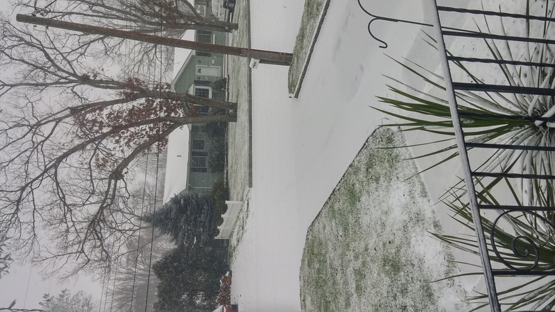
Not expecting more than C-1" here. Would be extremely surprised with anything more.

snow247- Pro Enthusiast
- Posts : 2417
Reputation : 0
Join date : 2014-08-27
Location : Mount Ivy, NY - Elevation 545'
Re: January 7, 2017 Storm Observations
![]() by SENJsnowman Sat Jan 07, 2017 10:18 am
by SENJsnowman Sat Jan 07, 2017 10:18 am
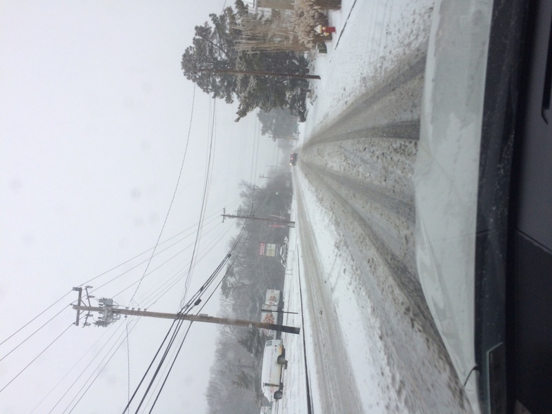
nujerzeedevil wrote:Moderate snowfall here in Bayville, Ocean County. About 1"+ on the ground thus far.
I'm also in Bayville...looks like 2" on the ground already with a full days of mod/heavy snow yet to come. Looks like for the Shore this is 'our storm', as Bernie Rayno would say!
SENJsnowman- Senior Enthusiast
- Posts : 1186
Reputation : 61
Join date : 2017-01-06
Age : 51
Location : Bayville, NJ
Re: January 7, 2017 Storm Observations
![]() by amugs Sat Jan 07, 2017 10:18 am
by amugs Sat Jan 07, 2017 10:18 am

_________________
Mugs
AKA:King: Snow Weenie
Self Proclaimed
WINTER 2014-15 : 55.12" +.02 for 6 coatings (avg. 35")
WINTER 2015-16 Total - 29.8" (Avg 35")
WINTER 2016-17 : 39.5" so far
amugs- Advanced Forecaster - Mod
- Posts : 15093
Reputation : 213
Join date : 2013-01-07
Age : 54
Location : Hillsdale,NJ
Re: January 7, 2017 Storm Observations
![]() by Vinnydula Sat Jan 07, 2017 10:19 am
by Vinnydula Sat Jan 07, 2017 10:19 am

Vinnydula- Pro Enthusiast
- Posts : 778
Reputation : 8
Join date : 2013-12-12
Location : Dobbs ferry
Re: January 7, 2017 Storm Observations
![]() by oldtimer Sat Jan 07, 2017 10:20 am
by oldtimer Sat Jan 07, 2017 10:20 am
oldtimer- Senior Enthusiast
- Posts : 1103
Reputation : 14
Join date : 2013-01-16
Age : 78
Location : Port Jefferson Station Suffolk County
Re: January 7, 2017 Storm Observations
![]() by CPcantmeasuresnow Sat Jan 07, 2017 10:20 am
by CPcantmeasuresnow Sat Jan 07, 2017 10:20 am
I've actually seen a few flakes in the last 5 minutes so expectations for me have already been exceeded.
Hope S & E jackpot, I'll be tracking the conservancy measurements as always.

CPcantmeasuresnow- Wx Statistician Guru

- Posts : 7274
Reputation : 230
Join date : 2013-01-07
Age : 103
Location : Eastern Orange County, NY
Re: January 7, 2017 Storm Observations
![]() by nujerzeedevil Sat Jan 07, 2017 10:21 am
by nujerzeedevil Sat Jan 07, 2017 10:21 am
URGENT - WINTER WEATHER MESSAGE
NATIONAL WEATHER SERVICE MOUNT HOLLY NJ
943 AM EST SAT JAN 7 2017
...MODERATE TO HEAVY SNOW WILL CONTINUE INTO THE AFTERNOON...
.LOW PRESSURE LOCATED OFF THE NORTH CAROLINA COAST THIS MORNING
WILL STRENGTHEN AS IT TRACKS NORTHEASTWARD. THE CENTER OF THE
STORM IS FORECAST TO BE LOCATED ABOUT 300 MILES OFF THE NEW JERSEY
COAST EARLY THIS EVENING.
DEZ002-MDZ019-020-NJZ020>022-025>027-072300-
/O.CON.KPHI.WS.W.0001.000000T0000Z-170107T2300Z/
KENT-TALBOT-CAROLINE-OCEAN-CUMBERLAND-ATLANTIC-COASTAL ATLANTIC-
COASTAL OCEAN-SOUTHEASTERN BURLINGTON-
INCLUDING THE CITIES OF...DOVER...EASTON...DENTON...JACKSON...
MILLVILLE...HAMMONTON...ATLANTIC CITY...LONG BEACH ISLAND...
WHARTON STATE FOREST
943 AM EST SAT JAN 7 2017
...WINTER STORM WARNING REMAINS IN EFFECT UNTIL 6 PM EST THIS
EVENING...
* LOCATION...PARTS OF SOUTHEASTERN NEW JERSEY...CENTRAL DELAWARE
AND PARTS OF EASTERN MARYLAND.
* HAZARD TYPE...SNOW.
* SNOW ACCUMULATIONS...5 TO 10 INCHES WITH THE HIGHEST AMOUNTS
ALONG THE NEW JERSEY COAST.
* TIMING...SNOW WILL PERSIST THROUGH MOST OF THE AFTERNOON BEFORE
TAPERING OFF FROM WEST TO EAST BY EARLY EVENING. A PERIOD OF
MODERATE TO HEAVY SNOW WILL OCCUR LATE THIS MORNING AND EARLY
THIS AFTERNOON WHEN SNOWFALL RATES OF ONE TO TWO INCHES PER
HOUR ARE EXPECTED.
* IMPACTS...TRAVEL WILL BE VERY HAZARDOUS TODAY WITH SNOW COVERED
ROADS AND POOR VISIBILITY. EVEN INTERSTATES OR HIGHWAYS WILL BE
SNOW COVERED AND SLIPPERY AT THE HEIGHT OF THE STORM.
* WINDS...NORTH 15 TO 20 MPH WITH GUSTS AROUND 30 MPH ALONG THE
COAST.
* VISIBILITY...ONE HALF MILE OR LESS AT TIMES.
* TEMPERATURES...MID 20S.
PRECAUTIONARY/PREPAREDNESS ACTIONS...
A WINTER STORM WARNING MEANS THAT SIGNIFICANT AMOUNTS OF SNOW ARE
EXPECTED. STRONG WINDS ARE ALSO POSSIBLE ALONG THE COAST. THIS
WILL MAKE TRAVEL VERY HAZARDOUS.

nujerzeedevil- Posts : 121
Reputation : 14
Join date : 2013-12-30
Location : Bayville, NJ
Re: January 7, 2017 Storm Observations
![]() by oldtimer Sat Jan 07, 2017 10:25 am
by oldtimer Sat Jan 07, 2017 10:25 am
oldtimer- Senior Enthusiast
- Posts : 1103
Reputation : 14
Join date : 2013-01-16
Age : 78
Location : Port Jefferson Station Suffolk County

docstox12- Wx Statistician Guru
- Posts : 8502
Reputation : 222
Join date : 2013-01-07
Age : 73
Location : Monroe NY
Re: January 7, 2017 Storm Observations
![]() by Dunnzoo Sat Jan 07, 2017 10:28 am
by Dunnzoo Sat Jan 07, 2017 10:28 am
_________________
Janet
Snowfall winter of 2023-2024 17.5"
Snowfall winter of 2022-2023 6.0"
Snowfall winter of 2021-2022 17.6" 1" sleet 2/25/22
Snowfall winter of 2020-2021 51.1"
Snowfall winter of 2019-2020 8.5"
Snowfall winter of 2018-2019 25.1"
Snowfall winter of 2017-2018 51.9"
Snowfall winter of 2016-2017 45.6"
Snowfall winter of 2015-2016 29.5"
Snowfall winter of 2014-2015 50.55"
Snowfall winter of 2013-2014 66.5"

Dunnzoo- Senior Enthusiast - Mod
- Posts : 4887
Reputation : 68
Join date : 2013-01-11
Age : 62
Location : Westwood, NJ
Re: January 7, 2017 Storm Observations
![]() by jmanley32 Sat Jan 07, 2017 10:28 am
by jmanley32 Sat Jan 07, 2017 10:28 am
close 758 miles to bermuda and bermuda is way se of NJ, so 300miles east of nj will give us a good swath of snow, if it was 200 miles or less this would be a crazy storm.oldtimer wrote:300 miles of the Jersey coast late this afternoon That's half way to Bermuda lol
jmanley32- Senior Enthusiast
- Posts : 20513
Reputation : 108
Join date : 2013-12-12
Age : 42
Location : Yonkers, NY
Re: January 7, 2017 Storm Observations
![]() by amugs Sat Jan 07, 2017 10:34 am
by amugs Sat Jan 07, 2017 10:34 am
Yup old timer if I fall short first 2 drinks fir you on me at get together !oldtimer wrote:Mugs Is 6" a lock for me? Central Suffork County
Well well well those who ride the gfs is the last one to the paerty and now snowiest let's see what upton and the tv pro mets do!

_________________
Mugs
AKA:King: Snow Weenie
Self Proclaimed
WINTER 2014-15 : 55.12" +.02 for 6 coatings (avg. 35")
WINTER 2015-16 Total - 29.8" (Avg 35")
WINTER 2016-17 : 39.5" so far
amugs- Advanced Forecaster - Mod
- Posts : 15093
Reputation : 213
Join date : 2013-01-07
Age : 54
Location : Hillsdale,NJ
Page 11 of 24 • 1 ... 7 ... 10, 11, 12 ... 17 ... 24 ![]()
|
|
|