
 Search
BLOG: Roidzilla Could Impact Area Tuesday March 14th
Page 20 of 25 •  1 ... 11 ... 19, 20, 21 ... 25
 ![]()
Re: BLOG: Roidzilla Could Impact Area Tuesday March 14th
![]() by Frank_Wx Sat Mar 11, 2017 2:58 am
by Frank_Wx Sat Mar 11, 2017 2:58 am

Frank_Wx- Godzilla Seeker

- Posts : 21305
Join date : 2013-01-05 -

Re: BLOG: Roidzilla Could Impact Area Tuesday March 14th
![]() by Frank_Wx Sat Mar 11, 2017 2:58 am
by Frank_Wx Sat Mar 11, 2017 2:58 am

Frank_Wx- Godzilla Seeker
- Posts : 21305
Join date : 2013-01-05 -
Re: BLOG: Roidzilla Could Impact Area Tuesday March 14th
![]() by Frank_Wx Sat Mar 11, 2017 3:02 am
by Frank_Wx Sat Mar 11, 2017 3:02 am

_________________
_______________________________________________________________________________________________________
CLICK HERE to view NJ Strong Snowstorm Classifications

Frank_Wx- Godzilla Seeker
- Posts : 21305
Reputation : 328
Join date : 2013-01-05
Age : 31
Location : Jersey City, NJ -
Re: BLOG: Roidzilla Could Impact Area Tuesday March 14th
![]() by Frank_Wx Sat Mar 11, 2017 3:07 am
by Frank_Wx Sat Mar 11, 2017 3:07 am

_________________
_______________________________________________________________________________________________________
CLICK HERE to view NJ Strong Snowstorm Classifications
Frank_Wx- Godzilla Seeker
- Posts : 21305
Reputation : 328
Join date : 2013-01-05
Age : 31
Location : Jersey City, NJ -
Re: BLOG: Roidzilla Could Impact Area Tuesday March 14th
![]() by Frank_Wx Sat Mar 11, 2017 3:08 am
by Frank_Wx Sat Mar 11, 2017 3:08 am
.png.01d08d7831761b8656d4646862e0c0b3.png)
_________________
_______________________________________________________________________________________________________
CLICK HERE to view NJ Strong Snowstorm Classifications
Frank_Wx- Godzilla Seeker
- Posts : 21305
Reputation : 328
Join date : 2013-01-05
Age : 31
Location : Jersey City, NJ -
Re: BLOG: Roidzilla Could Impact Area Tuesday March 14th
![]() by Frank_Wx Sat Mar 11, 2017 3:14 am
by Frank_Wx Sat Mar 11, 2017 3:14 am

_________________
_______________________________________________________________________________________________________
CLICK HERE to view NJ Strong Snowstorm Classifications
Frank_Wx- Godzilla Seeker
- Posts : 21305
Reputation : 328
Join date : 2013-01-05
Age : 31
Location : Jersey City, NJ -
Re: BLOG: Roidzilla Could Impact Area Tuesday March 14th
![]() by SoulSingMG Sat Mar 11, 2017 3:17 am
by SoulSingMG Sat Mar 11, 2017 3:17 am
Frank_Wx wrote:Agree with this
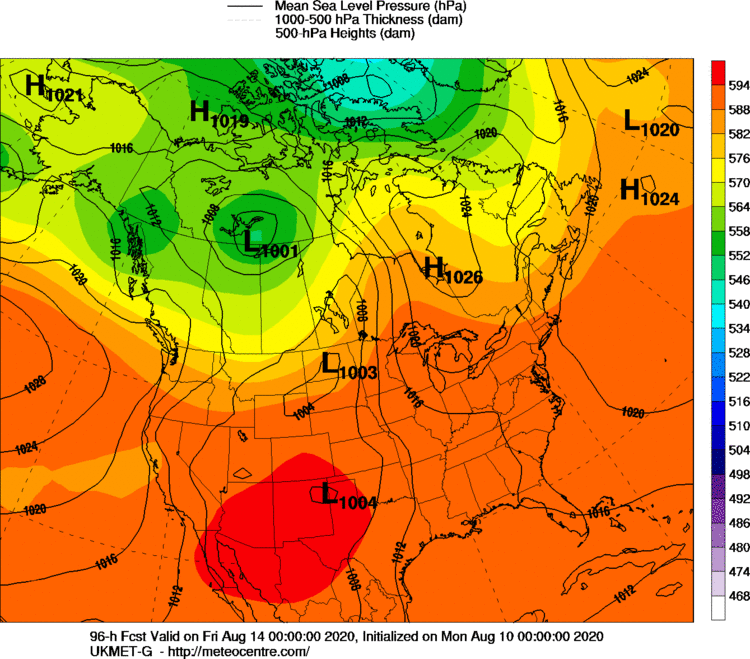
Ah! A weather map from my home state of New Hampshire!
I can't get over the Euro ENS.

SoulSingMG- Senior Enthusiast

- Posts : 2853
Reputation : 74
Join date : 2013-12-11
Location : Long Island City, NY
Re: BLOG: Roidzilla Could Impact Area Tuesday March 14th
![]() by 2004blackwrx Sat Mar 11, 2017 5:18 am
by 2004blackwrx Sat Mar 11, 2017 5:18 am
2004blackwrx- Pro Enthusiast

- Posts : 576
Reputation : 9
Join date : 2013-01-14
Location : Wappinger NY
Re: BLOG: Roidzilla Could Impact Area Tuesday March 14th
![]() by nutleyblizzard Sat Mar 11, 2017 5:29 am
by nutleyblizzard Sat Mar 11, 2017 5:29 am

GFS caves towards the EURO!!! Huge run!!!

nutleyblizzard- Senior Enthusiast
- Posts : 1952
Reputation : 41
Join date : 2014-01-30
Age : 58
Location : Nutley, new jersey
Re: BLOG: Roidzilla Could Impact Area Tuesday March 14th
![]() by SoulSingMG Sat Mar 11, 2017 5:35 am
by SoulSingMG Sat Mar 11, 2017 5:35 am
nutleyblizzard wrote:
GFS caves towards the EURO!!! Huge run!!!
WOW. I don't think I've ever been more excited about a storm in my adult life.
SoulSingMG- Senior Enthusiast
- Posts : 2853
Reputation : 74
Join date : 2013-12-11
Location : Long Island City, NY
Re: BLOG: Roidzilla Could Impact Area Tuesday March 14th
![]() by dkodgis Sat Mar 11, 2017 5:44 am
by dkodgis Sat Mar 11, 2017 5:44 am

dkodgis- Senior Enthusiast
- Posts : 2501
Reputation : 98
Join date : 2013-12-29
Re: BLOG: Roidzilla Could Impact Area Tuesday March 14th
![]() by Guest Sat Mar 11, 2017 5:45 am
by Guest Sat Mar 11, 2017 5:45 am
Guest- Guest
Re: BLOG: Roidzilla Could Impact Area Tuesday March 14th
![]() by Radz Sat Mar 11, 2017 5:45 am
by Radz Sat Mar 11, 2017 5:45 am

Radz- Pro Enthusiast
- Posts : 1028
Reputation : 17
Join date : 2013-01-12
Location : Cortlandt Manor NY
Re: BLOG: Roidzilla Could Impact Area Tuesday March 14th
![]() by Radz Sat Mar 11, 2017 5:58 am
by Radz Sat Mar 11, 2017 5:58 am

TheAresian wrote:Does anybody have the Euro snow map for the New England region?
Radz- Pro Enthusiast
- Posts : 1028
Reputation : 17
Join date : 2013-01-12
Location : Cortlandt Manor NY
Re: BLOG: Roidzilla Could Impact Area Tuesday March 14th
![]() by Guest Sat Mar 11, 2017 6:09 am
by Guest Sat Mar 11, 2017 6:09 am
Guest- Guest
Re: BLOG: Roidzilla Could Impact Area Tuesday March 14th
![]() by Radz Sat Mar 11, 2017 6:15 am
by Radz Sat Mar 11, 2017 6:15 am
TheAresian wrote:Thanks, Radz. Let's just lock this in and be done with it. I'm not sure how much more of this my heart can take.
Even with all the model runs merging on a consensus, it'll still be now casting till the very end with the R/S line so close in proximity. Won't truly be over oil its over unfortunately, but I like the odds at this point!!
Radz- Pro Enthusiast
- Posts : 1028
Reputation : 17
Join date : 2013-01-12
Location : Cortlandt Manor NY
Re: BLOG: Roidzilla Could Impact Area Tuesday March 14th
![]() by skinsfan1177 Sat Mar 11, 2017 6:24 am
by skinsfan1177 Sat Mar 11, 2017 6:24 am


skinsfan1177- Senior Enthusiast
- Posts : 4485
Reputation : 35
Join date : 2013-01-07
Age : 46
Location : Point Pleasant Boro
Re: BLOG: Roidzilla Could Impact Area Tuesday March 14th
![]() by SENJsnowman Sat Mar 11, 2017 6:27 am
by SENJsnowman Sat Mar 11, 2017 6:27 am
SENJsnowman- Senior Enthusiast
- Posts : 1186
Reputation : 61
Join date : 2017-01-06
Age : 51
Location : Bayville, NJ
Re: BLOG: Roidzilla Could Impact Area Tuesday March 14th
![]() by Guest Sat Mar 11, 2017 6:28 am
by Guest Sat Mar 11, 2017 6:28 am
Guest- Guest
Re: BLOG: Roidzilla Could Impact Area Tuesday March 14th
![]() by track17 Sat Mar 11, 2017 6:31 am
by track17 Sat Mar 11, 2017 6:31 am
track17- Posts : 454
Reputation : 4
Join date : 2016-01-09
Re: BLOG: Roidzilla Could Impact Area Tuesday March 14th
![]() by skinsfan1177 Sat Mar 11, 2017 6:32 am
by skinsfan1177 Sat Mar 11, 2017 6:32 am
skinsfan1177- Senior Enthusiast
- Posts : 4485
Reputation : 35
Join date : 2013-01-07
Age : 46
Location : Point Pleasant Boro
Re: BLOG: Roidzilla Could Impact Area Tuesday March 14th
![]() by Radz Sat Mar 11, 2017 6:34 am
by Radz Sat Mar 11, 2017 6:34 am
SENJsnowman wrote:Thanks for posting the map Radz...the Euro is calling for robust totals along the coast...any idea why this map is giving GFS-like amounts for the whole coastline?
Assuming it takes mixing at the coast into consideration...
Radz- Pro Enthusiast
- Posts : 1028
Reputation : 17
Join date : 2013-01-12
Location : Cortlandt Manor NY
Re: BLOG: Roidzilla Could Impact Area Tuesday March 14th
![]() by Radz Sat Mar 11, 2017 6:38 am
by Radz Sat Mar 11, 2017 6:38 am
TheAresian wrote:15 inches at 10 to 1!!! With local temps not expected to break mid to upper 20s, this could be even bigger!!!!!
I'm guessing a pretty heavy wet snow fall especially near the coast, i'm keeping my expectations conservative on ratios and hoping we over perform!
Radz- Pro Enthusiast
- Posts : 1028
Reputation : 17
Join date : 2013-01-12
Location : Cortlandt Manor NY
Re: BLOG: Roidzilla Could Impact Area Tuesday March 14th
![]() by billg315 Sat Mar 11, 2017 6:40 am
by billg315 Sat Mar 11, 2017 6:40 am

billg315- Advanced Forecaster - Mod

- Posts : 4466
Reputation : 185
Join date : 2015-01-24
Age : 50
Location : Flemington, NJ
Re: BLOG: Roidzilla Could Impact Area Tuesday March 14th
![]() by nutleyblizzard Sat Mar 11, 2017 6:42 am
by nutleyblizzard Sat Mar 11, 2017 6:42 am
nutleyblizzard- Senior Enthusiast
- Posts : 1952
Reputation : 41
Join date : 2014-01-30
Age : 58
Location : Nutley, new jersey
Re: BLOG: Roidzilla Could Impact Area Tuesday March 14th
![]() by Guest Sat Mar 11, 2017 6:44 am
by Guest Sat Mar 11, 2017 6:44 am
Guest- Guest
Page 20 of 25 • 1 ... 11 ... 19, 20, 21 ... 25 ![]()
|
|
|