
 Search
Long Range Thread 24.0
Page 3 of 21 •  1, 2, 3, 4 ... 12 ... 21
 ![]()
Re: Long Range Thread 24.0
![]() by sroc4 Mon Jan 31, 2022 9:22 am
by sroc4 Mon Jan 31, 2022 9:22 am
mikeypizano wrote:amugs wrote:Monday next time frame Rb pointed out - BINGO!!
Shouldn't we get though Friday storm first?

Nothing wrong with pointing out things on the table in the LR thread
sroc4- Admin

- Posts : 8331
Join date : 2013-01-07
mmanisca likes this post
Re: Long Range Thread 24.0
![]() by mikeypizano Mon Jan 31, 2022 9:27 am
by mikeypizano Mon Jan 31, 2022 9:27 am
sroc4 wrote:mikeypizano wrote:amugs wrote:Monday next time frame Rb pointed out - BINGO!!
Shouldn't we get though Friday storm first?
Nothing wrong with pointing out things on the table in the LR thread
But doesn't it get skewed from the first system?
mikeypizano- Pro Enthusiast

- Posts : 1118
Join date : 2017-01-05
Re: Long Range Thread 24.0
![]() by sroc4 Mon Jan 31, 2022 9:50 am
by sroc4 Mon Jan 31, 2022 9:50 am
mikeypizano wrote:sroc4 wrote:mikeypizano wrote:amugs wrote:Monday next time frame Rb pointed out - BINGO!!
Shouldn't we get though Friday storm first?
Nothing wrong with pointing out things on the table in the LR thread
But doesn't it get skewed from the first system?
Sometimes absolutely. Usually though its when we have a dynamic system that might reshuffle things in its wake after it moves off into the N Atlantic. This system in particular is really just a front that where exactly sets up the weak waves of low pressure will dictate where any wintry precip falls. You are probably correct in stating that it could absolutely still affect how that next bit of energy proceeds for Monday. I guess my point is at this point that Monday system only recently popped up on the radar. Nothing wrong with pointing it out.
_________________
"In weather and in life, there's no winning and losing; there's only winning and learning."
WINTER 2012/2013 TOTALS 43.65"WINTER 2017/2018 TOTALS 62.85" WINTER 2022/2023 TOTALS 4.9"
WINTER 2013/2014 TOTALS 64.85"WINTER 2018/2019 TOTALS 14.25" WINTER 2023/2024 TOTALS 13.1"
WINTER 2014/2015 TOTALS 71.20"WINTER 2019/2020 TOTALS 6.35"
WINTER 2015/2016 TOTALS 35.00"WINTER 2020/2021 TOTALS 37.75"
WINTER 2016/2017 TOTALS 42.25"WINTER 2021/2022 TOTALS 31.65"

sroc4- Admin
- Posts : 8331
Reputation : 301
Join date : 2013-01-07
Location : Wading River, LI
mmanisca likes this post
Re: Long Range Thread 24.0
![]() by amugs Mon Jan 31, 2022 10:11 am
by amugs Mon Jan 31, 2022 10:11 am
_________________
Mugs
AKA:King: Snow Weenie
Self Proclaimed
WINTER 2014-15 : 55.12" +.02 for 6 coatings (avg. 35")
WINTER 2015-16 Total - 29.8" (Avg 35")
WINTER 2016-17 : 39.5" so far

amugs- Advanced Forecaster - Mod

- Posts : 15093
Reputation : 213
Join date : 2013-01-07
Age : 54
Location : Hillsdale,NJ
Re: Long Range Thread 24.0
![]() by mikeypizano Mon Jan 31, 2022 10:25 am
by mikeypizano Mon Jan 31, 2022 10:25 am
sroc4 wrote:mikeypizano wrote:sroc4 wrote:mikeypizano wrote:amugs wrote:Monday next time frame Rb pointed out - BINGO!!
Shouldn't we get though Friday storm first?
Nothing wrong with pointing out things on the table in the LR thread
But doesn't it get skewed from the first system?
Sometimes absolutely. Usually though its when we have a dynamic system that might reshuffle things in its wake after it moves off into the N Atlantic. This system in particular is really just a front that where exactly sets up the weak waves of low pressure will dictate where any wintry precip falls. You are probably correct in stating that it could absolutely still affect how that next bit of energy proceeds for Monday. I guess my point is at this point that Monday system only recently popped up on the radar. Nothing wrong with pointing it out.
Ahh ok.
amugs wrote:Would be devastating IF it verifies!!
If this does, I am blaming you ok? :p

mikeypizano- Pro Enthusiast
- Posts : 1118
Reputation : 66
Join date : 2017-01-05
Age : 35
Location : Wilkes-Barre/Scranton, PA
amugs and RJB8525 like this post
Re: Long Range Thread 24.0
![]() by mmanisca Mon Jan 31, 2022 10:59 am
by mmanisca Mon Jan 31, 2022 10:59 am

mmanisca- Pro Enthusiast
- Posts : 299
Reputation : 3
Join date : 2013-01-23
Age : 65
Location : Deer Park, Long Island
amugs likes this post
Re: Long Range Thread 24.0
![]() by heehaw453 Mon Jan 31, 2022 11:05 am
by heehaw453 Mon Jan 31, 2022 11:05 am
Edit. GFS caves the low levels quickly but 850's it's trying to be more stubborn with. I doubt it. Highly doubt it.
Last edited by heehaw453 on Mon Jan 31, 2022 11:09 am; edited 1 time in total
heehaw453- Advanced Forecaster

- Posts : 3906
Reputation : 86
Join date : 2014-01-20
Location : Bedminster Township, PA Elevation 600' ASL
Re: Long Range Thread 24.0
![]() by aiannone Mon Jan 31, 2022 11:06 am
by aiannone Mon Jan 31, 2022 11:06 am

_________________
-Alex Iannone-

aiannone- Senior Enthusiast - Mod
- Posts : 4814
Reputation : 92
Join date : 2013-01-07
Location : Saint James, LI (Northwest Suffolk Co.)
Re: Long Range Thread 24.0
![]() by heehaw453 Mon Jan 31, 2022 11:17 am
by heehaw453 Mon Jan 31, 2022 11:17 am
Edit.
This is kind of like the opposite of WAA where it's USUALLY under modeled with how quickly the column will warm at a given layer. I can't tell you how many times i hear "pingers" much sooner than models would say.
Last edited by heehaw453 on Mon Jan 31, 2022 11:37 am; edited 2 times in total
heehaw453- Advanced Forecaster
- Posts : 3906
Reputation : 86
Join date : 2014-01-20
Location : Bedminster Township, PA Elevation 600' ASL
Re: Long Range Thread 24.0
![]() by SoulSingMG Mon Jan 31, 2022 11:34 am
by SoulSingMG Mon Jan 31, 2022 11:34 am

But who's up for getting over 3 inches of sleet?


SoulSingMG- Senior Enthusiast

- Posts : 2853
Reputation : 74
Join date : 2013-12-11
Location : Long Island City, NY
RJB8525 likes this post
Re: Long Range Thread 24.0
![]() by weatherwatchermom Mon Jan 31, 2022 11:41 am
by weatherwatchermom Mon Jan 31, 2022 11:41 am
SoulSingMG wrote:Thankfully, ice accretion outputs from models rarely pan out, though the signal for a significant ice event across a large portion of the country does exist. Incidentally, I am still hard-pressed to find history of an ice storm (>.25 accretion) in New York City proper. I literally cannot find history of one (if anyone else cares to take a stab at it..)
But who's up for getting over 3 inches of sleet?
Yikes

weatherwatchermom- Senior Enthusiast
- Posts : 3750
Reputation : 77
Join date : 2014-11-25
Age : 60
Location : Hazlet Township, NJ

SoulSingMG- Senior Enthusiast
- Posts : 2853
Reputation : 74
Join date : 2013-12-11
Location : Long Island City, NY
Re: Long Range Thread 24.0
![]() by rb924119 Mon Jan 31, 2022 11:49 am
by rb924119 Mon Jan 31, 2022 11:49 am
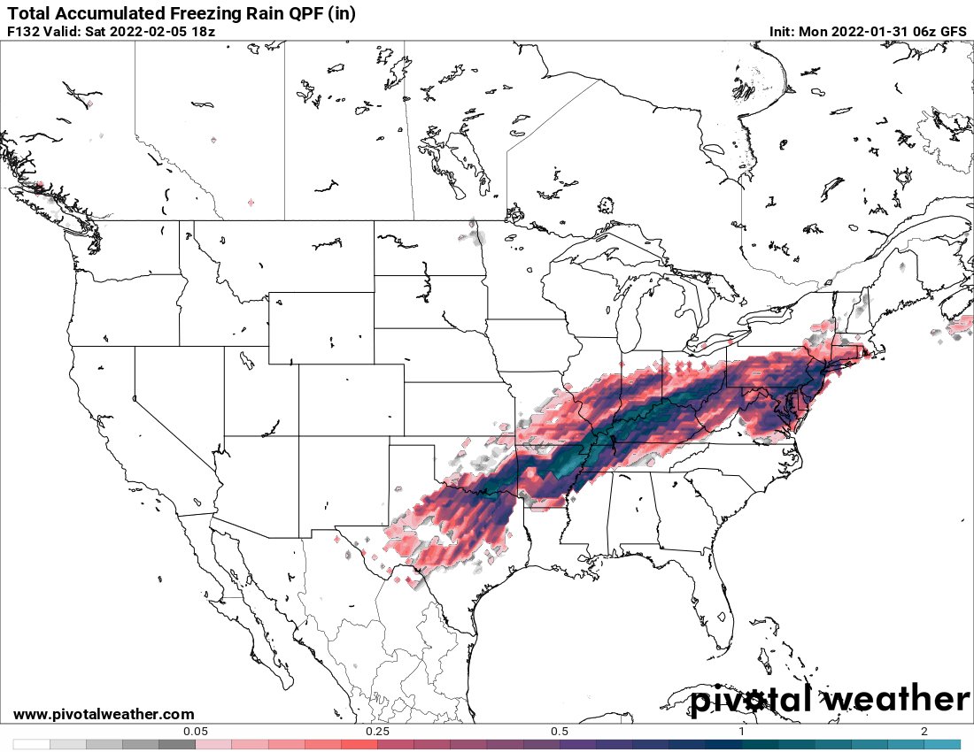
As for the storm track, when you look at the press from the low-level cold air (as has been posted and demonstrated with the maps of the surface pressure anomalies), that is undeniably true. To have substantially higher pressure to the northwest of this system versus to the southeast and not expect the low-level boundary to trend further south would be akin to expecting water not to leak through a screen lol however, it’s the evolution aloft that needs to be watched to figure out how this storm evolves. Does the trough hold together and mature, or, does it shear out?
Yesterday I noted that the look of the West Coast ridge didn’t look like one that would support an inland cutter type track with a consolidating and strengthening low, but a more sheared and strung out system as the southern portion sags behind and hangs back in the Southwest (which has been a seasonal tendency this year, as previously stated by Frank), and the northern stream is allowed to progress and knock the northwestern flank of the ridge down. Trying to get a little bit better handle on this setup while I eat my breakfast, but I think that idea has merit, though it’s not going to be able to benefit all of us. I’ll have more on this at some point, but as a preview, my preliminary-preliminary thinking is that if you’re between the latitudes of I-195 and I-80 (or slightly north), that’s the icing zone, with snow north and rain south.

rb924119- Meteorologist

- Posts : 6890
Reputation : 194
Join date : 2013-02-06
Age : 32
Location : Greentown, Pa
SoulSingMG and Zhukov1945 like this post
Re: Long Range Thread 24.0
![]() by jmanley32 Mon Jan 31, 2022 11:53 am
by jmanley32 Mon Jan 31, 2022 11:53 am
That would put millions in the dark, my god thats a lot of frz especially over central US.amugs wrote:Would be devastating IF it verifies!!

jmanley32- Senior Enthusiast
- Posts : 20517
Reputation : 108
Join date : 2013-12-12
Age : 42
Location : Yonkers, NY
Re: Long Range Thread 24.0
![]() by jmanley32 Mon Jan 31, 2022 11:57 am
by jmanley32 Mon Jan 31, 2022 11:57 am
thanks for including 5 miles north of yonkers lol, so its basically 50/50 for my area on ice or/snow. Prefer snow over a major ice storm. We had a pretty sig ice storm a few yrs ago and I think was in feb, lost power and had numerous trees down with 1/10thrb924119 wrote:One thing that I will say about this, is that in my opinion, this is not a widespread freezing rain/sleet event for most. This is going to be a very steep front through the column, which will keep the expanse of the warm nose aloft (the +0C portion of it) limited on the cold side of the front, and should lead to a narrow zone (30-50 miles wide) of freezing rain/sleet. The problem is whoever ends up in that zone will see some pretty impressive accretion.
As for the storm track, when you look at the press from the low-level cold air (as has been posted and demonstrated with the maps of the surface pressure anomalies), that is undeniably true. To have substantially higher pressure to the northwest of this system versus to the southeast and not expect the low-level boundary to trend further south would be akin to expecting water not to leak through a screen lol however, it’s the evolution aloft that needs to be watched to figure out how this storm evolves. Does the trough hold together and mature, or, does it shear out?
Yesterday I noted that the look of the West Coast ridge didn’t look like one that would support an inland cutter type track with a consolidating and strengthening low, but a more sheared and strung out system as the southern portion sags behind and hangs back in the Southwest (which has been a seasonal tendency this year, as previously stated by Frank), and the northern stream is allowed to progress and knock the northwestern flank of the ridge down. Trying to get a little bit better handle on this setup while I eat my breakfast, but I think that idea has merit, though it’s not going to be able to benefit all of us. I’ll have more on this at some point, but as a preview, my preliminary-preliminary thinking is that if you’re between the latitudes of I-195 and I-80 (or slightly north), that’s the icing zone, with snow north and rain south.
jmanley32- Senior Enthusiast
- Posts : 20517
Reputation : 108
Join date : 2013-12-12
Age : 42
Location : Yonkers, NY
Re: Long Range Thread 24.0
![]() by amugs Mon Jan 31, 2022 12:09 pm
by amugs Mon Jan 31, 2022 12:09 pm
SoulSingMG wrote:Thankfully, ice accretion outputs from models rarely pan out, though the signal for a significant ice event across a large portion of the country does exist. Incidentally, I am still hard-pressed to find history of an ice storm (>.25 accretion) in New York City proper. I literally cannot find history of one (if anyone else cares to take a stab at it..)
But who's up for getting over 3 inches of sleet?
Soul my man I mentioned in banter 1994 MLK storm was a MAJOR Ice event same set up - HUGE arctic high and front - went from heavy rain to heavy ice to snow. Crippled teh area for a week.
Valentines 2007 major ice event with 3-5" of sleet in NNJ and about 1-2" in NYC.
You have a STJ still at play and as I said earlier this morning a huge very strong arctic HP that will just DRILL the cold down the plain. DO NOT UNDERESTIMATE this cold - it is extremely cold source and dense (like some ........). You lay a deep snowpack down and it does wonders - look back to 13-14,14-15 and 17-18. The storms follow teh gradian and do not go N but lag south. This is is a very interesting adn yet dangerous set up. We are 84 hours away.
NAM actually from 6 to 12Z make a significant jump S. LR NAM but it cans niff these out like Hee Haw stated.
Also, we have 2-7, 29/10, 2-12/13 as possible storms on the horizon.
CFS for February - buckle up peeps! Right in line with Rb thoughts.

_________________
Mugs
AKA:King: Snow Weenie
Self Proclaimed
WINTER 2014-15 : 55.12" +.02 for 6 coatings (avg. 35")
WINTER 2015-16 Total - 29.8" (Avg 35")
WINTER 2016-17 : 39.5" so far
amugs- Advanced Forecaster - Mod
- Posts : 15093
Reputation : 213
Join date : 2013-01-07
Age : 54
Location : Hillsdale,NJ
rb924119 and SoulSingMG like this post
Re: Long Range Thread 24.0
![]() by Frank_Wx Mon Jan 31, 2022 12:12 pm
by Frank_Wx Mon Jan 31, 2022 12:12 pm
https://www.njstrongweatherforum.com/t1090-monitoring-february-4th#173187
_________________
_______________________________________________________________________________________________________
CLICK HERE to view NJ Strong Snowstorm Classifications

Frank_Wx- Godzilla Seeker
- Posts : 21305
Reputation : 328
Join date : 2013-01-05
Age : 31
Location : Jersey City, NJ -

rb924119 likes this post
Re: Long Range Thread 24.0
![]() by amugs Mon Jan 31, 2022 12:27 pm
by amugs Mon Jan 31, 2022 12:27 pm
Look at that NAO -IF SOMEONE ON HERE SAYS SUPPRESSION _ I may have to take a trip with the boyz and schmief you behind teh wood shed!!

_________________
Mugs
AKA:King: Snow Weenie
Self Proclaimed
WINTER 2014-15 : 55.12" +.02 for 6 coatings (avg. 35")
WINTER 2015-16 Total - 29.8" (Avg 35")
WINTER 2016-17 : 39.5" so far
amugs- Advanced Forecaster - Mod
- Posts : 15093
Reputation : 213
Join date : 2013-01-07
Age : 54
Location : Hillsdale,NJ
Re: Long Range Thread 24.0
![]() by Frank_Wx Mon Jan 31, 2022 12:28 pm
by Frank_Wx Mon Jan 31, 2022 12:28 pm
_________________
_______________________________________________________________________________________________________
CLICK HERE to view NJ Strong Snowstorm Classifications
Frank_Wx- Godzilla Seeker
- Posts : 21305
Reputation : 328
Join date : 2013-01-05
Age : 31
Location : Jersey City, NJ -
Re: Long Range Thread 24.0
![]() by mmanisca Mon Jan 31, 2022 1:20 pm
by mmanisca Mon Jan 31, 2022 1:20 pm
SoulSingMG wrote:Thankfully, ice accretion outputs from models rarely pan out, though the signal for a significant ice event across a large portion of the country does exist. Incidentally, I am still hard-pressed to find history of an ice storm (>.25 accretion) in New York City proper. I literally cannot find history of one (if anyone else cares to take a stab at it..)
But who's up for getting over 3 inches of sleet?

I cant tell you the amount of ice, but this was in 1978 a little before the great Blizzard of 1978, maybe a few weeks or so prior, I dont remember. This was a heck of an ice storm here on Long Island.. Thought I'd share these with you. We had another ice storm, I believe in 1977, but not sure.
mmanisca- Pro Enthusiast
- Posts : 299
Reputation : 3
Join date : 2013-01-23
Age : 65
Location : Deer Park, Long Island
amugs likes this post
Re: Long Range Thread 24.0
![]() by aiannone Mon Jan 31, 2022 2:00 pm
by aiannone Mon Jan 31, 2022 2:00 pm

_________________
-Alex Iannone-
aiannone- Senior Enthusiast - Mod
- Posts : 4814
Reputation : 92
Join date : 2013-01-07
Location : Saint James, LI (Northwest Suffolk Co.)
Re: Long Range Thread 24.0
![]() by amugs Mon Jan 31, 2022 2:10 pm
by amugs Mon Jan 31, 2022 2:10 pm
aiannone wrote:Interesting take lol...
Didn't they learn from last year??? or 2014 or 2015.
Time will tell
_________________
Mugs
AKA:King: Snow Weenie
Self Proclaimed
WINTER 2014-15 : 55.12" +.02 for 6 coatings (avg. 35")
WINTER 2015-16 Total - 29.8" (Avg 35")
WINTER 2016-17 : 39.5" so far
amugs- Advanced Forecaster - Mod
- Posts : 15093
Reputation : 213
Join date : 2013-01-07
Age : 54
Location : Hillsdale,NJ
Re: Long Range Thread 24.0
![]() by amugs Mon Jan 31, 2022 2:54 pm
by amugs Mon Jan 31, 2022 2:54 pm
3k NAM
Temps

Precipitation

_________________
Mugs
AKA:King: Snow Weenie
Self Proclaimed
WINTER 2014-15 : 55.12" +.02 for 6 coatings (avg. 35")
WINTER 2015-16 Total - 29.8" (Avg 35")
WINTER 2016-17 : 39.5" so far
amugs- Advanced Forecaster - Mod
- Posts : 15093
Reputation : 213
Join date : 2013-01-07
Age : 54
Location : Hillsdale,NJ
Re: Long Range Thread 24.0
![]() by amugs Mon Jan 31, 2022 3:12 pm
by amugs Mon Jan 31, 2022 3:12 pm
_________________
Mugs
AKA:King: Snow Weenie
Self Proclaimed
WINTER 2014-15 : 55.12" +.02 for 6 coatings (avg. 35")
WINTER 2015-16 Total - 29.8" (Avg 35")
WINTER 2016-17 : 39.5" so far
amugs- Advanced Forecaster - Mod
- Posts : 15093
Reputation : 213
Join date : 2013-01-07
Age : 54
Location : Hillsdale,NJ
heehaw453 likes this post
Re: Long Range Thread 24.0
![]() by Irish Mon Jan 31, 2022 5:14 pm
by Irish Mon Jan 31, 2022 5:14 pm
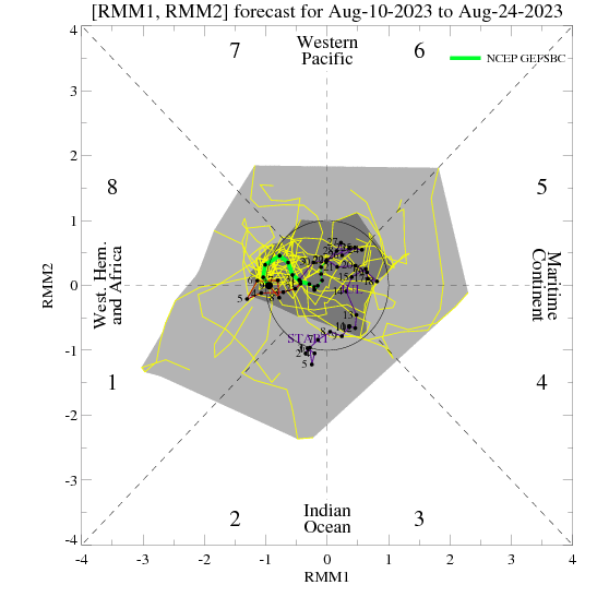
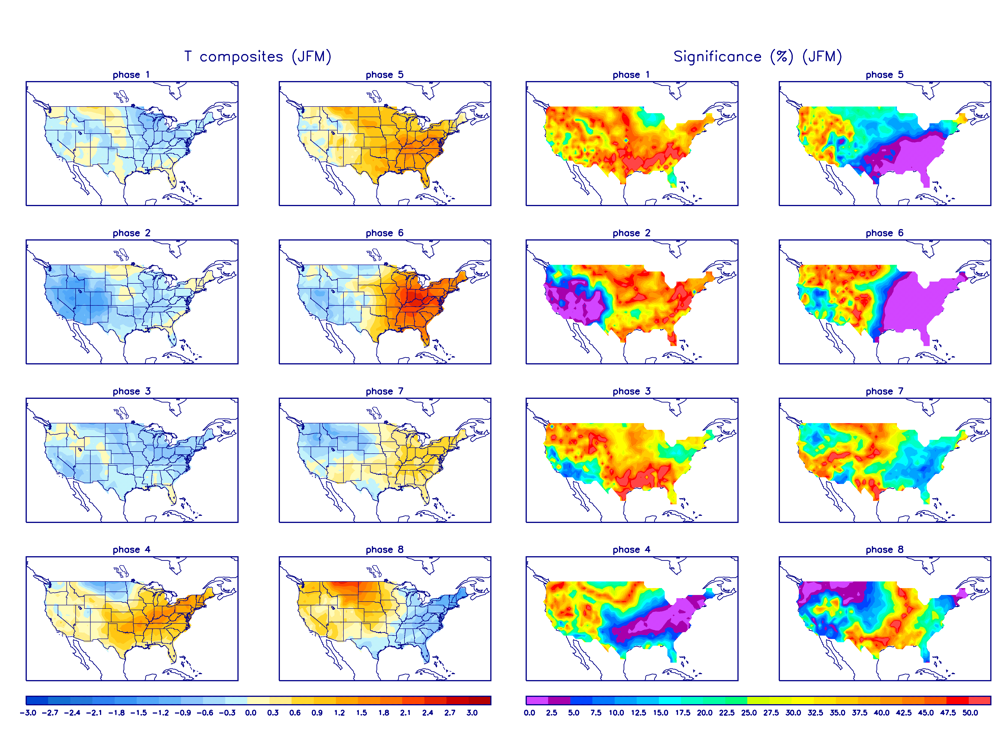
amugs wrote:GFS maybe seeing the phase 3 of the MJO which coincides to the map with the NAO blocking
Man, I never know what the hell these maps are trying to tell me.

Irish- Pro Enthusiast
- Posts : 788
Reputation : 19
Join date : 2019-01-16
Age : 45
Location : Old Bridge, NJ
Re: Long Range Thread 24.0
![]() by sroc4 Mon Jan 31, 2022 5:23 pm
by sroc4 Mon Jan 31, 2022 5:23 pm
Irish wrote:amugs wrote:GFS maybe seeing the phase 3 of the MJO which coincides to the map with the NAO blocking
Man, I never know what the hell these maps are trying to tell me.
Irish ask and yee shall receive. Click on the link below. Several years ago I did a write up on what the MJO is. Read through. I hope it answers at least some questions.
https://www.njstrongweatherforum.com/t511-what-is-the-mjo-really
_________________
"In weather and in life, there's no winning and losing; there's only winning and learning."
WINTER 2012/2013 TOTALS 43.65"WINTER 2017/2018 TOTALS 62.85" WINTER 2022/2023 TOTALS 4.9"
WINTER 2013/2014 TOTALS 64.85"WINTER 2018/2019 TOTALS 14.25" WINTER 2023/2024 TOTALS 13.1"
WINTER 2014/2015 TOTALS 71.20"WINTER 2019/2020 TOTALS 6.35"
WINTER 2015/2016 TOTALS 35.00"WINTER 2020/2021 TOTALS 37.75"
WINTER 2016/2017 TOTALS 42.25"WINTER 2021/2022 TOTALS 31.65"
sroc4- Admin
- Posts : 8331
Reputation : 301
Join date : 2013-01-07
Location : Wading River, LI
Frank_Wx, amugs, weatherwatchermom and Irish like this post
Re: Long Range Thread 24.0
![]() by amugs Mon Jan 31, 2022 6:29 pm
by amugs Mon Jan 31, 2022 6:29 pm
Irish wrote:amugs wrote:GFS maybe seeing the phase 3 of the MJO which coincides to the map with the NAO blocking
Man, I never know what the hell these maps are trying to tell me.
It means a cold n stormy pattern for the east
_________________
Mugs
AKA:King: Snow Weenie
Self Proclaimed
WINTER 2014-15 : 55.12" +.02 for 6 coatings (avg. 35")
WINTER 2015-16 Total - 29.8" (Avg 35")
WINTER 2016-17 : 39.5" so far
amugs- Advanced Forecaster - Mod
- Posts : 15093
Reputation : 213
Join date : 2013-01-07
Age : 54
Location : Hillsdale,NJ
Irish likes this post
Page 3 of 21 • 1, 2, 3, 4 ... 12 ... 21 ![]()
|
|
|