Feb 9th-10th Storm Final Discussion/Observations
+43
shawnerak
jbnyy224
Dtone
colosa4
Math23x7
WeatherBob
mako460
Nyi1058
Taffy
devsman
WOLVES1
algae888
essexcountypete
Scullybutcher
tigernumba1
oldtimer
cooladi
Dunnzoo
docstox12
deadrabbit79
HectorO
SNOW MAN
pdubz
Vinnydula
Artechmetals
Grselig
amugs
dsix85
Quietace
thgstang
Mathgod55
mmanisca
jmanley32
aiannone
Frank_Wx
SoulSingMG
nutleyblizzard
RJB8525
CPcantmeasuresnow
shabsies
skinsfan1177
NjWeatherGuy
sroc4
47 posters
Page 8 of 15
Page 8 of 15 •  1 ... 5 ... 7, 8, 9 ... 11 ... 15
 Re: Feb 9th-10th Storm Final Discussion/Observations
Almost no precip at all on the GFS for this system.
Quietace- Meteorologist - Mod

- Posts : 3687
Join date : 2013-01-07
 Re: Feb 9th-10th Storm Final Discussion/Observations
Quietace wrote:Almost no precip at all on the GFS for this system.
Demoralizing.
 Re: Feb 9th-10th Storm Final Discussion/Observations
So this storm is looking like nothing?? Ugh so do we give up at this point or could tomorrows runs bring it back?

tigernumba1- Posts : 298
Reputation : 1
Join date : 2013-11-22
Age : 29
Location : East Northport, NY, 11731
 Re: Feb 9th-10th Storm Final Discussion/Observations
I dont like the odds. Coastal Low is way OTS to far south with almost no chance of a phase and NS energy is weaker and produces very limited precip over the area when it moves into the area.tigernumba1 wrote:So this storm is looking like nothing?? Ugh so do we give up at this point or could tomorrows runs bring it back?

Quietace- Meteorologist - Mod

- Posts : 3687
Reputation : 33
Join date : 2013-01-07
Age : 27
Location : Point Pleasant, NJ
 Re: Feb 9th-10th Storm Final Discussion/Observations
If it is a minor event what kind of snow fall totals are we looking at ?

SNOW MAN- Senior Enthusiast

- Posts : 1361
Reputation : 25
Join date : 2013-01-13
Age : 64
Location : Marshalls Creek Pa.
 Re: Feb 9th-10th Storm Final Discussion/Observations
SNOW MAN wrote:If it is a minor event what kind of snow fall totals are we looking at ?
We'll have to see if there will be enough energy to even bring a minor snowfall event. We'll know much more by tomorrow. Possibly a 1-3 type deal.
_________________
_______________________________________________________________________________________________________
CLICK HERE to view NJ Strong Snowstorm Classifications
 Re: Feb 9th-10th Storm Final Discussion/Observations
Thanks Frank.

SNOW MAN- Senior Enthusiast

- Posts : 1361
Reputation : 25
Join date : 2013-01-13
Age : 64
Location : Marshalls Creek Pa.
 Re: Feb 9th-10th Storm Final Discussion/Observations
amugs wrote:There is a complex ULL just now coming ashore along the Pacific Northwest coast. It has several shortwaves embedded in its rotation. The models sends several of these waves eastward, one after another. Right now most guidance sharpens the first in the series. But a few of the GEFS and SREF members key on another wave right on the heels of the first - and develop a moderate impact coastal low. I think this follow up wave bears watching. It would be more like a Sun. night into Mon timeframe. This wave is in a better position to amplify with respect the longwave trof axis. And it's possible the ULL coming ashore might cause some model changes. I've seen numerous cases where models alternatively amplified one wave and then suddenly another, when they were in close proximity. Potential exist and like I said earlier the SREFS Would get my MJO ( no pun intended here) flowing!! I am anticipating the 00Z runs tonight! Would it be frickin kick in the arse if we get a moderate coastal that would shock most pro mets. I read the pages of discussion and no no this is above board!! Ha ha ha! Took my break like I said last night and ready to roll if need be.
mugs 6z nam has this storm. its almost like you read the models mind. lol

algae888- Advanced Forecaster

- Posts : 5311
Reputation : 46
Join date : 2013-02-05
Age : 61
Location : mt. vernon, new york
 Re: Feb 9th-10th Storm Final Discussion/Observations
so the 6z nam showed more of a storm?

skinsfan1177- Senior Enthusiast

- Posts : 4485
Reputation : 35
Join date : 2013-01-07
Age : 46
Location : Point Pleasant Boro
 Re: Feb 9th-10th Storm Final Discussion/Observations
Bill Evans just tweeted this "I have some concerns for Monday's AM Commute NYC! New NAM Model showing snow for overnight Sunday into Monday AM. Something to Keep In Mind!" how strong did the model show the storm?
pdubz- Pro Enthusiast

- Posts : 539
Reputation : 0
Join date : 2013-09-24
Age : 32
Location : Port Washington,NY (L.I)
 Re: Feb 9th-10th Storm Final Discussion/Observations
6z gfs doesnt have it but the sref has precip for monday. we will see what the models do today

algae888- Advanced Forecaster

- Posts : 5311
Reputation : 46
Join date : 2013-02-05
Age : 61
Location : mt. vernon, new york
 Re: Feb 9th-10th Storm Final Discussion/Observations
pdubz wrote:Bill Evans just tweeted this "I have some concerns for Monday's AM Commute NYC! New NAM Model showing snow for overnight Sunday into Monday AM. Something to Keep In Mind!" how strong did the model show the storm?
the second s/w on the nam appears to be stronger now, just like amugs descibed a few posts back. it seems like the sref and nam are picking it up but i would like to see other models like the euro, gfs or cmc show it also before i get to excited. but something to watch

algae888- Advanced Forecaster

- Posts : 5311
Reputation : 46
Join date : 2013-02-05
Age : 61
Location : mt. vernon, new york
 Re: Feb 9th-10th Storm Final Discussion/Observations
just heard accu weather radio meteoroligist mention his concern for monday. maybe things will get interesting today

algae888- Advanced Forecaster

- Posts : 5311
Reputation : 46
Join date : 2013-02-05
Age : 61
Location : mt. vernon, new york
 Re: Feb 9th-10th Storm Final Discussion/Observations
amugs wrote:There is a complex ULL just now coming ashore along the Pacific Northwest coast. It has several shortwaves embedded in its rotation. The models sends several of these waves eastward, one after another. Right now most guidance sharpens the first in the series. But a few of the GEFS and SREF members key on another wave right on the heels of the first - and develop a moderate impact coastal low. I think this follow up wave bears watching. It would be more like a Sun. night into Mon timeframe. This wave is in a better position to amplify with respect the longwave trof axis. And it's possible the ULL coming ashore might cause some model changes. I've seen numerous cases where models alternatively amplified one wave and then suddenly another, when they were in close proximity. Potential exist and like I said earlier the SREFS Would get my MJO ( no pun intended here) flowing!! I am anticipating the 00Z runs tonight! Would it be frickin kick in the arse if we get a moderate coastal that would shock most pro mets. I read the pages of discussion and no no this is above board!! Ha ha ha! Took my break like I said last night and ready to roll if need be.
Mugs: If this verifys you are a freakin genius.

CPcantmeasuresnow- Wx Statistician Guru

- Posts : 7274
Reputation : 230
Join date : 2013-01-07
Age : 103
Location : Eastern Orange County, NY
 Re: Feb 9th-10th Storm Final Discussion/Observations
Euro was similar in the 6z NAM focusing on the second NS vort.
While the evolution on the Euro and NAM are a little different, they both do have a developing low pressure transfer to our south from the clipper, with the Euro farther south with the low as it was holding Precip back to our south, which might have skewed the track and intensity on the run.
Interesting developments and i would like to see the GFS and GEM pick up on this.
Their is so much energy in the United States that it wouldn't surprise me this happened.

Quietace- Meteorologist - Mod

- Posts : 3687
Reputation : 33
Join date : 2013-01-07
Age : 27
Location : Point Pleasant, NJ
 Re: Feb 9th-10th Storm Final Discussion/Observations
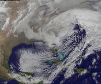
Several SREF members continue to show the northern stream clipper deeping rapidly and gaining moisture as it approaches the coast with some members being very aggressive. This is still the threat to watch IMO.
NjWeatherGuy- Advanced Forecaster

- Posts : 4100
Reputation : 28
Join date : 2013-01-06
Location : Belle Mead, NJ
 Re: Feb 9th-10th Storm Final Discussion/Observations
CPcantmeasuresnow wrote:amugs wrote:There is a complex ULL just now coming ashore along the Pacific Northwest coast. It has several shortwaves embedded in its rotation. The models sends several of these waves eastward, one after another. Right now most guidance sharpens the first in the series. But a few of the GEFS and SREF members key on another wave right on the heels of the first - and develop a moderate impact coastal low. I think this follow up wave bears watching. It would be more like a Sun. night into Mon timeframe. This wave is in a better position to amplify with respect the longwave trof axis. And it's possible the ULL coming ashore might cause some model changes. I've seen numerous cases where models alternatively amplified one wave and then suddenly another, when they were in close proximity. Potential exist and like I said earlier the SREFS Would get my MJO ( no pun intended here) flowing!! I am anticipating the 00Z runs tonight! Would it be frickin kick in the arse if we get a moderate coastal that would shock most pro mets. I read the pages of discussion and no no this is above board!! Ha ha ha! Took my break like I said last night and ready to roll if need be.
Mugs: If this verifys you are a freakin genius.
It has to be those new antibiotics.

essexcountypete- Pro Enthusiast

- Posts : 783
Reputation : 12
Join date : 2013-12-09
Location : Bloomfield, NJ
 Re: Feb 9th-10th Storm Final Discussion/Observations
Back to normal weather with a little bit of humor. I've been watching since abc and learned a lot from you guys and wanted to take the time to say thank you.

WOLVES1- Posts : 103
Reputation : 0
Join date : 2013-01-10
Age : 52
Location : Malverne NY
 Re: Feb 9th-10th Storm Final Discussion/Observations
essexcountypete wrote:CPcantmeasuresnow wrote:amugs wrote:There is a complex ULL just now coming ashore along the Pacific Northwest coast. It has several shortwaves embedded in its rotation. The models sends several of these waves eastward, one after another. Right now most guidance sharpens the first in the series. But a few of the GEFS and SREF members key on another wave right on the heels of the first - and develop a moderate impact coastal low. I think this follow up wave bears watching. It would be more like a Sun. night into Mon timeframe. This wave is in a better position to amplify with respect the longwave trof axis. And it's possible the ULL coming ashore might cause some model changes. I've seen numerous cases where models alternatively amplified one wave and then suddenly another, when they were in close proximity. Potential exist and like I said earlier the SREFS Would get my MJO ( no pun intended here) flowing!! I am anticipating the 00Z runs tonight! Would it be frickin kick in the arse if we get a moderate coastal that would shock most pro mets. I read the pages of discussion and no no this is above board!! Ha ha ha! Took my break like I said last night and ready to roll if need be.
Mugs: If this verifys you are a freakin genius.
It has to be those new antibiotics.
CP & Pete - they are same one prescribed to Aroid - I mean Arod!! HAHAHA!!
Okay the SREFS where whowing a little something last night before I went to bed an dthis morning I ma seeing the GEFS showing a few panels giving us the coastal I wrote up last night. The SREFS today and tomorrow and other models hopefully will REALLY pick up on this and then here we go....
GFS ENS Mean - .25 -. 50 QPF for our area - LI looks to do best QPF wise - AGAIN!!

_________________
Mugs
AKA:King: Snow Weenie
Self Proclaimed
WINTER 2014-15 : 55.12" +.02 for 6 coatings (avg. 35")
WINTER 2015-16 Total - 29.8" (Avg 35")
WINTER 2016-17 : 39.5" so far

amugs- Advanced Forecaster - Mod

- Posts : 15093
Reputation : 213
Join date : 2013-01-07
Age : 54
Location : Hillsdale,NJ
 Re: Feb 9th-10th Storm Final Discussion/Observations
Its a great group over here Always something to learn and great knowledge They know how to explain things so we can get some understanding of what is being said And the graphics Wow To Wolves
oldtimer- Senior Enthusiast

- Posts : 1103
Reputation : 14
Join date : 2013-01-16
Age : 78
Location : Port Jefferson Station Suffolk County
 Re: Feb 9th-10th Storm Final Discussion/Observations
So where there is SREFS, there's hope? 

Taffy- Pro Enthusiast

- Posts : 530
Reputation : 19
Join date : 2013-10-06
Location : Hopkinton, MA
 Re: Feb 9th-10th Storm Final Discussion/Observations
essexcountypete wrote:CPcantmeasuresnow wrote:amugs wrote:There is a complex ULL just now coming ashore along the Pacific Northwest coast. It has several shortwaves embedded in its rotation. The models sends several of these waves eastward, one after another. Right now most guidance sharpens the first in the series. But a few of the GEFS and SREF members key on another wave right on the heels of the first - and develop a moderate impact coastal low. I think this follow up wave bears watching. It would be more like a Sun. night into Mon timeframe. This wave is in a better position to amplify with respect the longwave trof axis. And it's possible the ULL coming ashore might cause some model changes. I've seen numerous cases where models alternatively amplified one wave and then suddenly another, when they were in close proximity. Potential exist and like I said earlier the SREFS Would get my MJO ( no pun intended here) flowing!! I am anticipating the 00Z runs tonight! Would it be frickin kick in the arse if we get a moderate coastal that would shock most pro mets. I read the pages of discussion and no no this is above board!! Ha ha ha! Took my break like I said last night and ready to roll if need be.
Mugs: If this verifys you are a freakin genius.
It has to be those new antibiotics.
CP and Pete - I guess they are the same ones Aroid (ARod) took??? The 12Z runs will start to tell us more but the SREFS have led the way for these storms in sniffing them out within this range - we shall see.. Here is the GEFS mean - and a few panels on the GFS are showing that vort that I explained coming to fruition as a moderate coastal.

_________________
Mugs
AKA:King: Snow Weenie
Self Proclaimed
WINTER 2014-15 : 55.12" +.02 for 6 coatings (avg. 35")
WINTER 2015-16 Total - 29.8" (Avg 35")
WINTER 2016-17 : 39.5" so far

amugs- Advanced Forecaster - Mod

- Posts : 15093
Reputation : 213
Join date : 2013-01-07
Age : 54
Location : Hillsdale,NJ
 Re: Feb 9th-10th Storm Final Discussion/Observations
amugs wrote:essexcountypete wrote:CPcantmeasuresnow wrote:amugs wrote:There is a complex ULL just now coming ashore along the Pacific Northwest coast. It has several shortwaves embedded in its rotation. The models sends several of these waves eastward, one after another. Right now most guidance sharpens the first in the series. But a few of the GEFS and SREF members key on another wave right on the heels of the first - and develop a moderate impact coastal low. I think this follow up wave bears watching. It would be more like a Sun. night into Mon timeframe. This wave is in a better position to amplify with respect the longwave trof axis. And it's possible the ULL coming ashore might cause some model changes. I've seen numerous cases where models alternatively amplified one wave and then suddenly another, when they were in close proximity. Potential exist and like I said earlier the SREFS Would get my MJO ( no pun intended here) flowing!! I am anticipating the 00Z runs tonight! Would it be frickin kick in the arse if we get a moderate coastal that would shock most pro mets. I read the pages of discussion and no no this is above board!! Ha ha ha! Took my break like I said last night and ready to roll if need be.
Mugs: If this verifys you are a freakin genius.
It has to be those new antibiotics.
CP & Pete - they are same one prescribed to Aroid - I mean Arod!! HAHAHA!!
Okay the SREFS where whowing a little something last night before I went to bed an dthis morning I ma seeing the GEFS showing a few panels giving us the coastal I wrote up last night. The SREFS today and tomorrow and other models hopefully will REALLY pick up on this and then here we go....
GFS ENS Mean - .25 -. 50 QPF for our area - LI looks to do best QPF wise - AGAIN!!
WOW ! Mugs a lot of typo's in this post I don't know if it's Antibiotics or your just getting revved up over the models. But you still may be a genius ! lol

SNOW MAN- Senior Enthusiast

- Posts : 1361
Reputation : 25
Join date : 2013-01-13
Age : 64
Location : Marshalls Creek Pa.
 Re: Feb 9th-10th Storm Final Discussion/Observations
Holy - I apologize everyone just got up and they are some strong muds. I mean meds!!
And I posted the same info twice - better call the doctor.
And I posted the same info twice - better call the doctor.
_________________
Mugs
AKA:King: Snow Weenie
Self Proclaimed
WINTER 2014-15 : 55.12" +.02 for 6 coatings (avg. 35")
WINTER 2015-16 Total - 29.8" (Avg 35")
WINTER 2016-17 : 39.5" so far

amugs- Advanced Forecaster - Mod

- Posts : 15093
Reputation : 213
Join date : 2013-01-07
Age : 54
Location : Hillsdale,NJ
 Re: Feb 9th-10th Storm Final Discussion/Observations
amugs wrote:Holy - I apologize everyone just got up and they are some strong muds. I mean meds!!
And I posted the same info twice - better call the doctor.
3 Times Mugs but who's counting, it's not like I obsess about numbers or anything.
Slow up on the coffee buddy, and keep up the good work.

CPcantmeasuresnow- Wx Statistician Guru

- Posts : 7274
Reputation : 230
Join date : 2013-01-07
Age : 103
Location : Eastern Orange County, NY
 Re: Feb 9th-10th Storm Final Discussion/Observations
It looks like a northwest trend is trying to happen on the models. Would love to see the 12z GFS make a big stride today. At hours 84, the nam has a nice north to south oriented ridge in the west, while the GFS had the ridge offshore in the pacific. The energy consolidates better on the nam, hence the storm.
This looks like it has been pushed back to Monday now. So I wouldn't discount anything until tomorrow. Remember, this season models seem to bring thing back just 2 days before.
This looks like it has been pushed back to Monday now. So I wouldn't discount anything until tomorrow. Remember, this season models seem to bring thing back just 2 days before.
_________________
_______________________________________________________________________________________________________
CLICK HERE to view NJ Strong Snowstorm Classifications
 Re: Feb 9th-10th Storm Final Discussion/Observations
"So I wouldn't discount anything until tomorrow. Remember, this season models seem to bring thing back just 2 days before."Frank_Wx wrote:It looks like a northwest trend is trying to happen on the models. Would love to see the 12z GFS make a big stride today. At hours 84, the nam has a nice north to south oriented ridge in the west, while the GFS had the ridge offshore in the pacific. The energy consolidates better on the nam, hence the storm.
This looks like it has been pushed back to Monday now. So I wouldn't discount anything until tomorrow. Remember, this season models seem to bring thing back just 2 days before.
This is the most logical phrase from our Fearless Weather Weenie Leader of this Winter Season
This pattern has been a nightmare for mets this winter and there are some many vorts in the pipleline once again so to speak that the models are just struggling with all these pieces of energy and they are so close together(some) that it can't decipher what is what IMO.
_________________
Mugs
AKA:King: Snow Weenie
Self Proclaimed
WINTER 2014-15 : 55.12" +.02 for 6 coatings (avg. 35")
WINTER 2015-16 Total - 29.8" (Avg 35")
WINTER 2016-17 : 39.5" so far

amugs- Advanced Forecaster - Mod

- Posts : 15093
Reputation : 213
Join date : 2013-01-07
Age : 54
Location : Hillsdale,NJ
Page 8 of 15 •  1 ... 5 ... 7, 8, 9 ... 11 ... 15
Page 8 of 15
Permissions in this forum:
You cannot reply to topics in this forum|
|
|

 Home
Home