Official Long Range Thread 4.0
+29
Snow88
carvin1079
Artechmetals
Vinnydula
Isotherm
Radz
Quietace
CPcantmeasuresnow
1190ftalt
HectorO
devsman
aiannone
NjWeatherGuy
Analog96
nutleyblizzard
Math23x7
dsix85
Sunflowers138
skinsfan1177
amugs
mako460
rb924119
SoulSingMG
Dunnzoo
sroc4
algae888
jmanley32
docstox12
Frank_Wx
33 posters
Page 3 of 42
Page 3 of 42 •  1, 2, 3, 4 ... 22 ... 42
 Re: Official Long Range Thread 4.0
Here is my take on the new but most exciting pattern change. It is becoming pretty obvious that initial warm forecasts made for November are definitely going to be wrong. Yes, the month will start out about to slightly above average, but the Aleutian Low is going to retrograde to the west quicker than initially thought. This as well as other factors may try to lead to some high-latitude blocking as well. Euo showing low swinging off the ne coast and then stalling over Greenland giving us a block.
Instead of a warm November 1-15 and average to maybe slightly below November 16-30 like originally thought, it may be something like a slightly above to average November 1-7, but pretty cold for much of the month after that.
I think we see our fair share of coastal s and a good shot at snow in this pattern from mid month to the end accumulating maybe but a bk end squall is more likely - I think we start to see the stj come into play as well. Just one man's thoughts on this exciting pattern change.
I the using his iPad auto or react posting maps etc do not like it. Beggars can't be choosers right?
amugs- Advanced Forecaster - Mod

- Posts : 15093
Join date : 2013-01-07
 Re: Official Long Range Thread 4.0
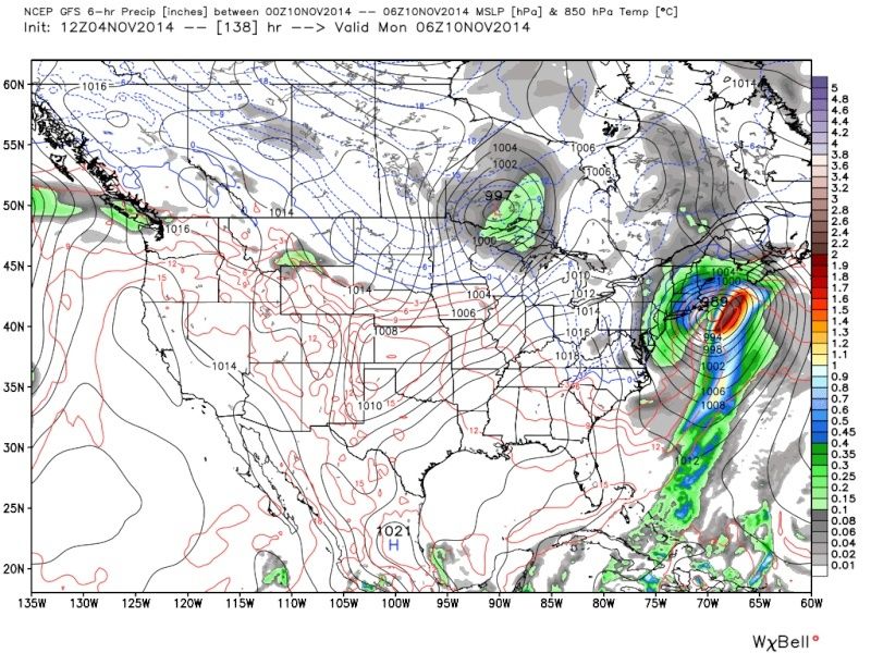
mugs that sub 980 LP on Euro is no joke, if that were to happen that would def me a MECS if not more. Interested to see if its continued on future models or if its that pattern change thats making models have a hard time.
jmanley32- Senior Enthusiast

- Posts : 20517
Join date : 2013-12-12
 Re: Official Long Range Thread 4.0
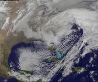
Close up. So pretty


_________________
_______________________________________________________________________________________________________
CLICK HERE to view NJ Strong Snowstorm Classifications
 Re: Official Long Range Thread 4.0
Frank, for futurecasting purposes only.. if all the conditions are there for a MECS, what would the duration and possible snow totals be for this beast out on LI?
dsix85- Pro Enthusiast

- Posts : 349
Reputation : 8
Join date : 2014-01-01
Location : New York
 Re: Official Long Range Thread 4.0
So pretty yet so dangerous, thats one insane storm.

jmanley32- Senior Enthusiast

- Posts : 20517
Reputation : 108
Join date : 2013-12-12
Age : 42
Location : Yonkers, NY
 Re: Official Long Range Thread 4.0
Correct me if I am wrong Frank but that would need to be a bit more south to give our area snow yes? I noted the snow map and it give southern areas snow but not down to the coast. And to note the other models do not show a solution like this. What is your take on the Euro showing this first, more or less validity (I know its far out) but in terms of model trends on accuracy.

jmanley32- Senior Enthusiast

- Posts : 20517
Reputation : 108
Join date : 2013-12-12
Age : 42
Location : Yonkers, NY
 Re: Official Long Range Thread 4.0
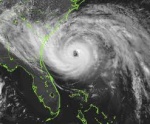
The CMC shows something tropical weak (north of Puerto Rico) coming towards the US, is that going to have any effect with any of these systems?

jmanley32- Senior Enthusiast

- Posts : 20517
Reputation : 108
Join date : 2013-12-12
Age : 42
Location : Yonkers, NY
 Re: Official Long Range Thread 4.0
dsix85 wrote:Frank, for futurecasting purposes only.. if all the conditions are there for a MECS, what would the duration and possible snow totals be for this beast out on LI?
If this were to happen tomorrow it would be 3-4 inches of rain and winds near hurricane force. But don't worry, this is just a fantasy storm that is likely not to happen.
jmanley32 wrote:Correct me if I am wrong Frank but that would need to be a bit more south to give our area snow yes? I noted the snow map and it give southern areas snow but not down to the coast. And to note the other models do not show a solution like this. What is your take on the Euro showing this first, more or less validity (I know its far out) but in terms of model trends on accuracy.
It's all rain. For it to be snow would have to phase sooner. I'm watching the storm for the end of this week for now. Could be decent rain. Will update that tomorrow
_________________
_______________________________________________________________________________________________________
CLICK HERE to view NJ Strong Snowstorm Classifications
 Re: Official Long Range Thread 4.0
Frank_Wx wrote:Close up. So pretty
I checked the 850 mb temps and surface temps for this timeframe and they are both too warm for snow. But they're are just to our west
Math23x7- Wx Statistician Guru

- Posts : 2379
Reputation : 68
Join date : 2013-01-08
 Re: Official Long Range Thread 4.0
For the most part, if you want to see any significant snows in our area, you need to wait till thanksgiving and beyond. Good to see the continued threats with these coastal lows though. I believe this weather forum will be going nuts in about a month.

nutleyblizzard- Senior Enthusiast

- Posts : 1952
Reputation : 41
Join date : 2014-01-30
Age : 58
Location : Nutley, new jersey
 Re: Official Long Range Thread 4.0
Never say Never Frank, its not impossible and would be bad, but could be fantasy storm. BUT it is the Euro and I put more stance in Euro than other models first. Thursday looks like it could be potent rain and wind maker too.

jmanley32- Senior Enthusiast

- Posts : 20517
Reputation : 108
Join date : 2013-12-12
Age : 42
Location : Yonkers, NY
 Re: Official Long Range Thread 4.0
I never said never. And it's not could be a fantasy storm. It is a fantasy storm.
_________________
_______________________________________________________________________________________________________
CLICK HERE to view NJ Strong Snowstorm Classifications
 Re: Official Long Range Thread 4.0
dsix85 wrote:Frank, for futurecasting purposes only.. if all the conditions are there for a MECS, what would the duration and possible snow totals be for this beast out on LI?
This time of year things have to be perfect for us to get accumulations on LI because if there is any east or northeasterly component to the winds the warm waters off the Atlantic warms the column and we get rain. Even diff inland. The coastal plain should not expect any snow until after early to mid December IMO unless things work out perfectly (I'm not ruling out that things can't be perfect). Dynamics of a storm that was shown on yesterday's 12z Euro could have the ability to draw in cold air on its own, but track and phase still have to be perfect. First things first, this is still a fantasy storm. Teleconnections favorable but still fluctuating. We won't know details about this storm until Thursady storm gets ironed out. Thursday storm will affect the down stream pattern, which in turn will affect the theat around the 10-12th. For now we examine the 500mb charts only for this threat until later this week. The details of rain or snow totals and even winds are futile as it will change drastically from run to run day to day. These details are difficult to predict 2days out let alone 7-10 days.
_________________
"In weather and in life, there's no winning and losing; there's only winning and learning."
WINTER 2012/2013 TOTALS 43.65"WINTER 2017/2018 TOTALS 62.85" WINTER 2022/2023 TOTALS 4.9"
WINTER 2013/2014 TOTALS 64.85"WINTER 2018/2019 TOTALS 14.25" WINTER 2023/2024 TOTALS 13.1"
WINTER 2014/2015 TOTALS 71.20"WINTER 2019/2020 TOTALS 6.35"
WINTER 2015/2016 TOTALS 35.00"WINTER 2020/2021 TOTALS 37.75"
WINTER 2016/2017 TOTALS 42.25"WINTER 2021/2022 TOTALS 31.65"

sroc4- Admin

- Posts : 8331
Reputation : 301
Join date : 2013-01-07
Location : Wading River, LI
 Re: Official Long Range Thread 4.0
Well since it is a fantasy storm and believe it not to happen like 00z euro. I was surprised the euro pulled a cmc.
Sounds like a plan sroc. What is Thursday looking like just some cold rain or is it going to be windy again. Nws did mention a tightening gradient but that was for sat.
Sounds like a plan sroc. What is Thursday looking like just some cold rain or is it going to be windy again. Nws did mention a tightening gradient but that was for sat.

jmanley32- Senior Enthusiast

- Posts : 20517
Reputation : 108
Join date : 2013-12-12
Age : 42
Location : Yonkers, NY
 Re: Official Long Range Thread 4.0
the weather is certainly going to get interesting this month probably after the 10th. although probably to warm for snow we should see a stormy period with well below normal temps. also I have been reading about the opi (October pattern index) which is supposedly very accurate (90%). I know very little about it but it indicates what the ao will be for the coming winter. a neg opi In October leads to a neg. ao in winter a +opi a pos. ao. well the opi has been neg the whole month of oct. add in the sai which is at record levels and there is a pretty good bet the ao will be neg most of this winter. this most likely will lead to a trough in the east with below normal temps. my concern last month was that we would not have the same cold air we had last winter, however now it looks like we may be to cold and suppressing storms to our south. but to balance that out some we do have warm sst in the western atlantic which could lead to mixing issues at the coast. wow what an interesting time it is exciting and can't wait to see how all these ingredients turn out for our winter. BTW enjoy this week I do not think we will see the 60's again until spring.

algae888- Advanced Forecaster

- Posts : 5311
Reputation : 46
Join date : 2013-02-05
Age : 61
Location : mt. vernon, new york
 Re: Official Long Range Thread 4.0
One thing seems for certain, no matter what model you use or what your biases might be: The period from Nov 10-15 is going to be COLD based on latest data!
Analog96- Meteorologist

- Posts : 156
Reputation : 1
Join date : 2014-03-12
Location : Elizabeth, NJ
 Re: Official Long Range Thread 4.0
Interesting stat from another board that I thought would be good to know
OP 52 NESIS storms by month. Hopefully this November we can have the first Nov storm to make list(only month with out a Kocin storm)
OCT--1
NOV--0
DEC--8
JAN--13
FEB--21
MAR--8
APR--1
OP 52 NESIS storms by month. Hopefully this November we can have the first Nov storm to make list(only month with out a Kocin storm)
OCT--1
NOV--0
DEC--8
JAN--13
FEB--21
MAR--8
APR--1
_________________
Mugs
AKA:King: Snow Weenie
Self Proclaimed
WINTER 2014-15 : 55.12" +.02 for 6 coatings (avg. 35")
WINTER 2015-16 Total - 29.8" (Avg 35")
WINTER 2016-17 : 39.5" so far

amugs- Advanced Forecaster - Mod

- Posts : 15093
Reputation : 213
Join date : 2013-01-07
Age : 54
Location : Hillsdale,NJ
 Re: Official Long Range Thread 4.0
Frank I have the latest ENSO readings: areas 1@2:+0.6, area 3:+0.9, area 3.4:+0.6, area 4:+0.8. It looks like our El Nino has been migrating westward, with areas 1@2 cooling off. Since our best El Nino winters are western based, this only adds fuel to the fire with all our teleconnections starting to fall into place.

nutleyblizzard- Senior Enthusiast

- Posts : 1952
Reputation : 41
Join date : 2014-01-30
Age : 58
Location : Nutley, new jersey
 Re: Official Long Range Thread 4.0
nutleyblizzard wrote:Frank I have the latest ENSO readings: areas 1@2:+0.6, area 3:+0.9, area 3.4:+0.6, area 4:+0.8. It looks like our El Nino has been migrating westward, with areas 1@2 cooling off. Since our best El Nino winters are western based, this only adds fuel to the fire with all our teleconnections starting to fall into place.
Tremendous new - we won't torch as the CFSv2 said last month - the model is blah too far out!
_________________
Mugs
AKA:King: Snow Weenie
Self Proclaimed
WINTER 2014-15 : 55.12" +.02 for 6 coatings (avg. 35")
WINTER 2015-16 Total - 29.8" (Avg 35")
WINTER 2016-17 : 39.5" so far

amugs- Advanced Forecaster - Mod

- Posts : 15093
Reputation : 213
Join date : 2013-01-07
Age : 54
Location : Hillsdale,NJ
 Re: Official Long Range Thread 4.0
nutleyblizzard wrote:Frank I have the latest ENSO readings: areas 1@2:+0.6, area 3:+0.9, area 3.4:+0.6, area 4:+0.8. It looks like our El Nino has been migrating westward, with areas 1@2 cooling off. Since our best El Nino winters are western based, this only adds fuel to the fire with all our teleconnections starting to fall into place.
Thanks for that. I'm beginning to put together ENSO research for the winter outlook now
_________________
_______________________________________________________________________________________________________
CLICK HERE to view NJ Strong Snowstorm Classifications
 Re: Official Long Range Thread 4.0
mugs was reading about that, never knew there was a rating scale for snowstorms, why do you think there has never been one in November? And what makes you think this might be the year, just out of curiousity.

jmanley32- Senior Enthusiast

- Posts : 20517
Reputation : 108
Join date : 2013-12-12
Age : 42
Location : Yonkers, NY
 Re: Official Long Range Thread 4.0
Let's hope we're not setting ourselves up for failure. I've learned a long time ago just because we have the "perfect pattern", doesn't mean it will produce. Like I mentioned in an earlier post, I think we can make a run at a record breaking season, but with winter storms not only do you need the proper teleconnections, you also need luck and timing. One thing you can't ignore though is the ever increasing potential that seems to be in store for us in the weeks and months ahead.Frank_Wx wrote:nutleyblizzard wrote:Frank I have the latest ENSO readings: areas 1@2:+0.6, area 3:+0.9, area 3.4:+0.6, area 4:+0.8. It looks like our El Nino has been migrating westward, with areas 1@2 cooling off. Since our best El Nino winters are western based, this only adds fuel to the fire with all our teleconnections starting to fall into place.
Thanks for that. I'm beginning to put together ENSO research for the winter outlook now

nutleyblizzard- Senior Enthusiast

- Posts : 1952
Reputation : 41
Join date : 2014-01-30
Age : 58
Location : Nutley, new jersey
 Re: Official Long Range Thread 4.0
nutleyblizzard wrote:Let's hope we're not setting ourselves up for failure. I've learned a long time ago just because we have the "perfect pattern", doesn't mean it will produce. Like I mentioned in an earlier post, I think we can make a run at a record breaking season, but with winter storms not only do you need the proper teleconnections, you also need luck and timing. One thing you can't ignore though is the ever increasing potential that seems to be in store for us in the weeks and months ahead.Frank_Wx wrote:nutleyblizzard wrote:Frank I have the latest ENSO readings: areas 1@2:+0.6, area 3:+0.9, area 3.4:+0.6, area 4:+0.8. It looks like our El Nino has been migrating westward, with areas 1@2 cooling off. Since our best El Nino winters are western based, this only adds fuel to the fire with all our teleconnections starting to fall into place.
Thanks for that. I'm beginning to put together ENSO research for the winter outlook now
Well said
_________________
"In weather and in life, there's no winning and losing; there's only winning and learning."
WINTER 2012/2013 TOTALS 43.65"WINTER 2017/2018 TOTALS 62.85" WINTER 2022/2023 TOTALS 4.9"
WINTER 2013/2014 TOTALS 64.85"WINTER 2018/2019 TOTALS 14.25" WINTER 2023/2024 TOTALS 13.1"
WINTER 2014/2015 TOTALS 71.20"WINTER 2019/2020 TOTALS 6.35"
WINTER 2015/2016 TOTALS 35.00"WINTER 2020/2021 TOTALS 37.75"
WINTER 2016/2017 TOTALS 42.25"WINTER 2021/2022 TOTALS 31.65"

sroc4- Admin

- Posts : 8331
Reputation : 301
Join date : 2013-01-07
Location : Wading River, LI
 Re: Official Long Range Thread 4.0
sroc4 wrote:dsix85 wrote:Frank, for futurecasting purposes only.. if all the conditions are there for a MECS, what would the duration and possible snow totals be for this beast out on LI?
This time of year things have to be perfect for us to get accumulations on LI because if there is any east or northeasterly component to the winds the warm waters off the Atlantic warms the column and we get rain. Even diff inland. The coastal plain should not expect any snow until after early to mid December IMO unless things work out perfectly (I'm not ruling out that things can't be perfect). Dynamics of a storm that was shown on yesterday's 12z Euro could have the ability to draw in cold air on its own, but track and phase still have to be perfect. First things first, this is still a fantasy storm. Teleconnections favorable but still fluctuating. We won't know details about this storm until Thursady storm gets ironed out. Thursday storm will affect the down stream pattern, which in turn will affect the theat around the 10-12th. For now we examine the 500mb charts only for this threat until later this week. The details of rain or snow totals and even winds are futile as it will change drastically from run to run day to day. These details are difficult to predict 2days out let alone 7-10 days.
This.... The setup really does need to be perfect. I wouldnt count on snow on the coastal plain under several hundred feet of elevation until at the very least early December or late November in the case of light snow shower like accumulations which we saw some of last year.

NjWeatherGuy- Advanced Forecaster

- Posts : 4100
Reputation : 28
Join date : 2013-01-06
Location : Belle Mead, NJ
 Re: Official Long Range Thread 4.0
12z GFS has a beautiful coastal around 132-138 hrs, (BTW what do we consider long range, as in hours out?) Not quite close enough to give us much but CT gets it and eastern LI, but its too warm for snow. Things could change but thats almost within 5 days, we will see.


jmanley32- Senior Enthusiast

- Posts : 20517
Reputation : 108
Join date : 2013-12-12
Age : 42
Location : Yonkers, NY
 Re: Official Long Range Thread 4.0
Long Range is as long as you want it to be...when an event gets within 5-7 days, we will make a separate thread for significant events...
_________________
Janet
Snowfall winter of 2023-2024 17.5"
Snowfall winter of 2022-2023 6.0"
Snowfall winter of 2021-2022 17.6" 1" sleet 2/25/22
Snowfall winter of 2020-2021 51.1"
Snowfall winter of 2019-2020 8.5"
Snowfall winter of 2018-2019 25.1"
Snowfall winter of 2017-2018 51.9"
Snowfall winter of 2016-2017 45.6"
Snowfall winter of 2015-2016 29.5"
Snowfall winter of 2014-2015 50.55"
Snowfall winter of 2013-2014 66.5"

Dunnzoo- Senior Enthusiast - Mod

- Posts : 4892
Reputation : 68
Join date : 2013-01-11
Age : 62
Location : Westwood, NJ
 Re: Official Long Range Thread 4.0
Dunzoo, so is the 10th a possible thread then as it is within 5-7 days, both euro and GFS showing a coastal very close.

jmanley32- Senior Enthusiast

- Posts : 20517
Reputation : 108
Join date : 2013-12-12
Age : 42
Location : Yonkers, NY
Page 3 of 42 •  1, 2, 3, 4 ... 22 ... 42
Page 3 of 42
Permissions in this forum:
You cannot reply to topics in this forum|
|
|

 Home
Home