
 Search
Tracking Hurricane Irma
Page 30 of 35 •  1 ... 16 ... 29, 30, 31 ... 35
 ![]()
Re: Tracking Hurricane Irma
![]() by sroc4 Tue Sep 05, 2017 2:56 pm
by sroc4 Tue Sep 05, 2017 2:56 pm
EXTENDED OUTLOOK. NOTE...ERRORS FOR TRACK HAVE AVERAGED NEAR 150 NM
ON DAY 4 AND 200 NM ON DAY 5...AND FOR INTENSITY NEAR 15 KT EACH DAY
sroc4- Admin

- Posts : 8331
Join date : 2013-01-07
Re: Tracking Hurricane Irma
![]() by Frank_Wx Tue Sep 05, 2017 3:00 pm
by Frank_Wx Tue Sep 05, 2017 3:00 pm
sabamfa wrote:When will we have a better idea of FL impacts? Father in law lives in Fort Myers Beach....about 50 miles north of Marco Island.
Thursday
sroc4 wrote:From the NHC:
EXTENDED OUTLOOK. NOTE...ERRORS FOR TRACK HAVE AVERAGED NEAR 150 NM
ON DAY 4 AND 200 NM ON DAY 5...AND FOR INTENSITY NEAR 15 KT EACH DAY

I find this graphic pretty fascinating. It shows all the tracks of Cat 5 hurricanes in history. Theme is almost all miss Cuba.

Frank_Wx- Godzilla Seeker
- Posts : 21305
Join date : 2013-01-05 -

Re: Tracking Hurricane Irma
![]() by sabamfa Tue Sep 05, 2017 3:04 pm
by sabamfa Tue Sep 05, 2017 3:04 pm
Frank_Wx wrote:sabamfa wrote:When will we have a better idea of FL impacts? Father in law lives in Fort Myers Beach....about 50 miles north of Marco Island.
Thursday
Thank you, Frank!
sabamfa- Pro Enthusiast

- Posts : 246
Reputation : 2
Join date : 2013-11-05
Age : 37
Location : Wayne, NJ
Re: Tracking Hurricane Irma
![]() by Frank_Wx Tue Sep 05, 2017 3:08 pm
by Frank_Wx Tue Sep 05, 2017 3:08 pm


_________________
_______________________________________________________________________________________________________
CLICK HERE to view NJ Strong Snowstorm Classifications

Frank_Wx- Godzilla Seeker
- Posts : 21305
Reputation : 328
Join date : 2013-01-05
Age : 31
Location : Jersey City, NJ -
Re: Tracking Hurricane Irma
![]() by sroc4 Tue Sep 05, 2017 3:09 pm
by sroc4 Tue Sep 05, 2017 3:09 pm
sabamfa wrote:sroc4 wrote:From the NHC:
EXTENDED OUTLOOK. NOTE...ERRORS FOR TRACK HAVE AVERAGED NEAR 150 NM
ON DAY 4 AND 200 NM ON DAY 5...AND FOR INTENSITY NEAR 15 KT EACH DAY
Whats this supposed to mean Frank..lol
_________________
"In weather and in life, there's no winning and losing; there's only winning and learning."
WINTER 2012/2013 TOTALS 43.65"WINTER 2017/2018 TOTALS 62.85" WINTER 2022/2023 TOTALS 4.9"
WINTER 2013/2014 TOTALS 64.85"WINTER 2018/2019 TOTALS 14.25" WINTER 2023/2024 TOTALS 13.1"
WINTER 2014/2015 TOTALS 71.20"WINTER 2019/2020 TOTALS 6.35"
WINTER 2015/2016 TOTALS 35.00"WINTER 2020/2021 TOTALS 37.75"
WINTER 2016/2017 TOTALS 42.25"WINTER 2021/2022 TOTALS 31.65"

sroc4- Admin
- Posts : 8331
Reputation : 301
Join date : 2013-01-07
Location : Wading River, LI
Re: Tracking Hurricane Irma
![]() by Frank_Wx Tue Sep 05, 2017 3:12 pm
by Frank_Wx Tue Sep 05, 2017 3:12 pm
sroc4 wrote:Frank_Wx wrote:sabamfa wrote:sroc4 wrote:From the NHC:
EXTENDED OUTLOOK. NOTE...ERRORS FOR TRACK HAVE AVERAGED NEAR 150 NM
ON DAY 4 AND 200 NM ON DAY 5...AND FOR INTENSITY NEAR 15 KT EACH DAY
Whats this supposed to mean Frank..lol
200NM on Day 5 - mine as well stick with a 4-day forecast. That's a big spread.
_________________
_______________________________________________________________________________________________________
CLICK HERE to view NJ Strong Snowstorm Classifications
Frank_Wx- Godzilla Seeker
- Posts : 21305
Reputation : 328
Join date : 2013-01-05
Age : 31
Location : Jersey City, NJ -
Re: Tracking Hurricane Irma
![]() by sroc4 Tue Sep 05, 2017 3:18 pm
by sroc4 Tue Sep 05, 2017 3:18 pm
Look at the size of that eye wall. I spent 2.5 yrs living on the Island of St. Kitts. I still know people there. Even though the center is foecasted to pass just to the north with that eyewall as big as it is they may still feel the full brunt. St Kitts is the little island that looks like a drum stick pointing SE to NW in the Northern Lesser Antilles. God speed to all the people and animals on those islands.
_________________
"In weather and in life, there's no winning and losing; there's only winning and learning."
WINTER 2012/2013 TOTALS 43.65"WINTER 2017/2018 TOTALS 62.85" WINTER 2022/2023 TOTALS 4.9"
WINTER 2013/2014 TOTALS 64.85"WINTER 2018/2019 TOTALS 14.25" WINTER 2023/2024 TOTALS 13.1"
WINTER 2014/2015 TOTALS 71.20"WINTER 2019/2020 TOTALS 6.35"
WINTER 2015/2016 TOTALS 35.00"WINTER 2020/2021 TOTALS 37.75"
WINTER 2016/2017 TOTALS 42.25"WINTER 2021/2022 TOTALS 31.65"
sroc4- Admin
- Posts : 8331
Reputation : 301
Join date : 2013-01-07
Location : Wading River, LI
Re: Tracking Hurricane Irma
![]() by sroc4 Tue Sep 05, 2017 3:29 pm
by sroc4 Tue Sep 05, 2017 3:29 pm

_________________
"In weather and in life, there's no winning and losing; there's only winning and learning."
WINTER 2012/2013 TOTALS 43.65"WINTER 2017/2018 TOTALS 62.85" WINTER 2022/2023 TOTALS 4.9"
WINTER 2013/2014 TOTALS 64.85"WINTER 2018/2019 TOTALS 14.25" WINTER 2023/2024 TOTALS 13.1"
WINTER 2014/2015 TOTALS 71.20"WINTER 2019/2020 TOTALS 6.35"
WINTER 2015/2016 TOTALS 35.00"WINTER 2020/2021 TOTALS 37.75"
WINTER 2016/2017 TOTALS 42.25"WINTER 2021/2022 TOTALS 31.65"
sroc4- Admin
- Posts : 8331
Reputation : 301
Join date : 2013-01-07
Location : Wading River, LI
Re: Tracking Hurricane Irma
![]() by sroc4 Tue Sep 05, 2017 3:33 pm
by sroc4 Tue Sep 05, 2017 3:33 pm

_________________
"In weather and in life, there's no winning and losing; there's only winning and learning."
WINTER 2012/2013 TOTALS 43.65"WINTER 2017/2018 TOTALS 62.85" WINTER 2022/2023 TOTALS 4.9"
WINTER 2013/2014 TOTALS 64.85"WINTER 2018/2019 TOTALS 14.25" WINTER 2023/2024 TOTALS 13.1"
WINTER 2014/2015 TOTALS 71.20"WINTER 2019/2020 TOTALS 6.35"
WINTER 2015/2016 TOTALS 35.00"WINTER 2020/2021 TOTALS 37.75"
WINTER 2016/2017 TOTALS 42.25"WINTER 2021/2022 TOTALS 31.65"
sroc4- Admin
- Posts : 8331
Reputation : 301
Join date : 2013-01-07
Location : Wading River, LI
Re: Tracking Hurricane Irma
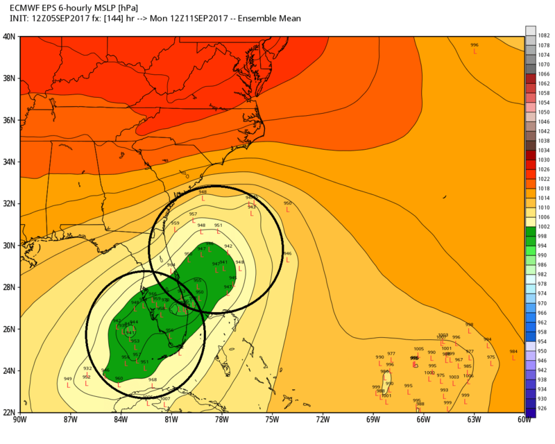
![]() by Frank_Wx Tue Sep 05, 2017 3:35 pm
by Frank_Wx Tue Sep 05, 2017 3:35 pm
sroc4 wrote:Still an interesting spread on the Ensembles:
Madonne - maybe tomorrow we'll see some consistency?
_________________
_______________________________________________________________________________________________________
CLICK HERE to view NJ Strong Snowstorm Classifications
Frank_Wx- Godzilla Seeker
- Posts : 21305
Reputation : 328
Join date : 2013-01-05
Age : 31
Location : Jersey City, NJ -
Re: Tracking Hurricane Irma
![]() by Guest Tue Sep 05, 2017 3:36 pm
by Guest Tue Sep 05, 2017 3:36 pm
sroc4 wrote:Lets see if in the next few frames Jose creates a Fujiwhara effect and pulls her back off the coast...SE ward


Wouldn't the stronger system which will be Irma "pull" on the weaker system (Jose) instead of what you posted which is the exact opposite. Plus I have to admit I'm rather bummed that we do not appear to be getting hit with this beast.
Guest- Guest
Re: Tracking Hurricane Irma
![]() by Frank_Wx Tue Sep 05, 2017 3:37 pm
by Frank_Wx Tue Sep 05, 2017 3:37 pm

_________________
_______________________________________________________________________________________________________
CLICK HERE to view NJ Strong Snowstorm Classifications
Frank_Wx- Godzilla Seeker
- Posts : 21305
Reputation : 328
Join date : 2013-01-05
Age : 31
Location : Jersey City, NJ -
Re: Tracking Hurricane Irma
![]() by Frank_Wx Tue Sep 05, 2017 3:38 pm
by Frank_Wx Tue Sep 05, 2017 3:38 pm

_________________
_______________________________________________________________________________________________________
CLICK HERE to view NJ Strong Snowstorm Classifications
Frank_Wx- Godzilla Seeker
- Posts : 21305
Reputation : 328
Join date : 2013-01-05
Age : 31
Location : Jersey City, NJ -
Re: Tracking Hurricane Irma
![]() by Frank_Wx Tue Sep 05, 2017 3:41 pm
by Frank_Wx Tue Sep 05, 2017 3:41 pm
syosnow94 wrote:sroc4 wrote:Lets see if in the next few frames Jose creates a Fujiwhara effect and pulls her back off the coast...SE ward
Wouldn't the stronger system which will be Irma "pull" on the weaker system (Jose) instead of what you posted which is the exact opposite. Plus I have to admit I'm rather bummed that we do not appear to be getting hit with this beast.
As Scott mentioned earlier, it depends how strong Jose gets. If he deepens into, lets say, a Cat 3 or 4 hurricane, then he will have enough power to lure Irma away from the coast and put her on a more easterly track. I personally don't think we'll see much of a Fujiwhara Effect from these two. I think there will be too much separation. But worth monitoring!
_________________
_______________________________________________________________________________________________________
CLICK HERE to view NJ Strong Snowstorm Classifications
Frank_Wx- Godzilla Seeker
- Posts : 21305
Reputation : 328
Join date : 2013-01-05
Age : 31
Location : Jersey City, NJ -
Re: Tracking Hurricane Irma
![]() by sroc4 Tue Sep 05, 2017 3:46 pm
by sroc4 Tue Sep 05, 2017 3:46 pm
syosnow94 wrote:sroc4 wrote:Lets see if in the next few frames Jose creates a Fujiwhara effect and pulls her back off the coast...SE ward
Wouldn't the stronger system which will be Irma "pull" on the weaker system (Jose) instead of what you posted which is the exact opposite. Plus I have to admit I'm rather bummed that we do not appear to be getting hit with this beast.
Not necessarily Jimmy. Hurricane Joaquin in Oct 2015 was a perfect example of a weaker system (trough in Atlantic) pulling the strings on what appeared to be the more dominant feature , the ULL in the SE CONUS. In that case the trough in the Atlantic did just enough to prevent the capture and sling shot to the coast. See here for detailed maps and discussion about that: https://www.njstrongweatherforum.com/t585-a-discussion-on-the-track-of-major-hurricane-joaquin-oct-2nd-2015
In this case IF the turn north occurs earlier and the track is the eastern half or just off the EC of Fla and Jose is stronger than modeled it will have a wider effect on its surrounding environment. It may be just enough to create that Fujiwhara effect where two trop entities movement are influenced by each other such that they rotate around a focal point somehwre in the center between the two entities. Here is the exact definition: http://www.hko.gov.hk/education/edu01met/wxphe/ele_fujiwhara_e.htm That focal point could be closer to one vs the other depending on the strength of the two entities.
_________________
"In weather and in life, there's no winning and losing; there's only winning and learning."
WINTER 2012/2013 TOTALS 43.65"WINTER 2017/2018 TOTALS 62.85" WINTER 2022/2023 TOTALS 4.9"
WINTER 2013/2014 TOTALS 64.85"WINTER 2018/2019 TOTALS 14.25" WINTER 2023/2024 TOTALS 13.1"
WINTER 2014/2015 TOTALS 71.20"WINTER 2019/2020 TOTALS 6.35"
WINTER 2015/2016 TOTALS 35.00"WINTER 2020/2021 TOTALS 37.75"
WINTER 2016/2017 TOTALS 42.25"WINTER 2021/2022 TOTALS 31.65"
sroc4- Admin
- Posts : 8331
Reputation : 301
Join date : 2013-01-07
Location : Wading River, LI
Re: Tracking Hurricane Irma
![]() by sroc4 Tue Sep 05, 2017 3:51 pm
by sroc4 Tue Sep 05, 2017 3:51 pm
Note: I'm not saying there will def be interaction between Irma and Jose, but like frank said its worth monitoring since the track of Irma is still somewhat up in the air and the track and intensity of Jose are as well. Well see
Pretend Joaquin is like a tennis ball sitting in the center of a mattress and the two areas of LP to the east and west are like two bowling balls that you place on the mattress on either side of the tennis ball. Both bowling balls will create an indentation in the mattress. Depending on how close the tennis ball is to either one will dicate if it rolls towards one vs the other. What models had a tough time seeing is that the LP to the NE over the Atlantic ocean had been tuging on Joaquin holding him back and forcing it further south than originally thought. As a result the center remained over VERY warm waters. As a consequence he rapidly intensified (which models didnt see) going from a tropical storm to a category 3 and now 4 hurricane in less than 36-48hrs. Again not a single model saw such intensification a few days ago.
_________________
"In weather and in life, there's no winning and losing; there's only winning and learning."
WINTER 2012/2013 TOTALS 43.65"WINTER 2017/2018 TOTALS 62.85" WINTER 2022/2023 TOTALS 4.9"
WINTER 2013/2014 TOTALS 64.85"WINTER 2018/2019 TOTALS 14.25" WINTER 2023/2024 TOTALS 13.1"
WINTER 2014/2015 TOTALS 71.20"WINTER 2019/2020 TOTALS 6.35"
WINTER 2015/2016 TOTALS 35.00"WINTER 2020/2021 TOTALS 37.75"
WINTER 2016/2017 TOTALS 42.25"WINTER 2021/2022 TOTALS 31.65"
sroc4- Admin
- Posts : 8331
Reputation : 301
Join date : 2013-01-07
Location : Wading River, LI
Re: Tracking Hurricane Irma
![]() by jmanley32 Tue Sep 05, 2017 4:11 pm
by jmanley32 Tue Sep 05, 2017 4:11 pm
we prolly won't get the beast when has St like that ever happened up here other than 1938 but until she's dissipated in the us or out of here I'm not taking the possibility off the table. This cat 5 can have a mind of their own. Maybe the block is gone or she plows right through it.syosnow94 wrote:sroc4 wrote:Lets see if in the next few frames Jose creates a Fujiwhara effect and pulls her back off the coast...SE ward
Wouldn't the stronger system which will be Irma "pull" on the weaker system (Jose) instead of what you posted which is the exact opposite. Plus I have to admit I'm rather bummed that we do not appear to be getting hit with this beast.

jmanley32- Senior Enthusiast

- Posts : 20516
Reputation : 108
Join date : 2013-12-12
Age : 42
Location : Yonkers, NY
Re: Tracking Hurricane Irma
![]() by sroc4 Tue Sep 05, 2017 5:21 pm
by sroc4 Tue Sep 05, 2017 5:21 pm

To a slight lesser degree the GFS does the same thing, and is why you saw the 12z take a track along the EC of Fla. Come Thursday into Friday the Euro has no interaction with the mean trough and actually takes Irma on a WSW track after the Thursday early Friday time frame towards Cuba before then feeling the weakness thanks to the energy I have circled and a track along the WC of Fla.

So in summary if Irma feels the mean trough at all, and this should be seen by Thursday into Friday we will see the track start to shift north of the current forecast track. If she does not feel the mean trough then she will likely take that western track into the western half of Fla or the eastern GOM like Ray (rb) has discussed. At this time both scenarios have sound reasoning and probability at this time with may just a slight edge in model support leaning towards the more western soln.
_________________
"In weather and in life, there's no winning and losing; there's only winning and learning."
WINTER 2012/2013 TOTALS 43.65"WINTER 2017/2018 TOTALS 62.85" WINTER 2022/2023 TOTALS 4.9"
WINTER 2013/2014 TOTALS 64.85"WINTER 2018/2019 TOTALS 14.25" WINTER 2023/2024 TOTALS 13.1"
WINTER 2014/2015 TOTALS 71.20"WINTER 2019/2020 TOTALS 6.35"
WINTER 2015/2016 TOTALS 35.00"WINTER 2020/2021 TOTALS 37.75"
WINTER 2016/2017 TOTALS 42.25"WINTER 2021/2022 TOTALS 31.65"
sroc4- Admin
- Posts : 8331
Reputation : 301
Join date : 2013-01-07
Location : Wading River, LI
Re: Tracking Hurricane Irma
![]() by Disneyprincess1592 Tue Sep 05, 2017 5:29 pm
by Disneyprincess1592 Tue Sep 05, 2017 5:29 pm
Disneyprincess1592- Posts : 34
Reputation : 0
Join date : 2017-08-31
Re: Tracking Hurricane Irma
![]() by Sanchize06 Tue Sep 05, 2017 5:45 pm
by Sanchize06 Tue Sep 05, 2017 5:45 pm
Sanchize06- Senior Enthusiast
- Posts : 1041
Reputation : 21
Join date : 2013-02-05
Location : Union Beach, NJ
Re: Tracking Hurricane Irma
![]() by Sanchize06 Tue Sep 05, 2017 5:48 pm
by Sanchize06 Tue Sep 05, 2017 5:48 pm
Sanchize06- Senior Enthusiast
- Posts : 1041
Reputation : 21
Join date : 2013-02-05
Location : Union Beach, NJ
Re: Tracking Hurricane Irma
![]() by jmanley32 Tue Sep 05, 2017 5:51 pm
by jmanley32 Tue Sep 05, 2017 5:51 pm
jmanley32- Senior Enthusiast
- Posts : 20516
Reputation : 108
Join date : 2013-12-12
Age : 42
Location : Yonkers, NY

skinsfan1177- Senior Enthusiast
- Posts : 4485
Reputation : 35
Join date : 2013-01-07
Age : 46
Location : Point Pleasant Boro
Re: Tracking Hurricane Irma
![]() by Sanchize06 Tue Sep 05, 2017 5:56 pm
by Sanchize06 Tue Sep 05, 2017 5:56 pm

Sanchize06- Senior Enthusiast
- Posts : 1041
Reputation : 21
Join date : 2013-02-05
Location : Union Beach, NJ
skinsfan1177- Senior Enthusiast
- Posts : 4485
Reputation : 35
Join date : 2013-01-07
Age : 46
Location : Point Pleasant Boro
Re: Tracking Hurricane Irma
![]() by jmanley32 Tue Sep 05, 2017 6:01 pm
by jmanley32 Tue Sep 05, 2017 6:01 pm
jmanley32- Senior Enthusiast
- Posts : 20516
Reputation : 108
Join date : 2013-12-12
Age : 42
Location : Yonkers, NY
Re: Tracking Hurricane Irma
![]() by Sanchize06 Tue Sep 05, 2017 6:02 pm
by Sanchize06 Tue Sep 05, 2017 6:02 pm
skinsfan1177 wrote:Huge north turn at 102
Yep, almost due north now at hr 108
Sanchize06- Senior Enthusiast
- Posts : 1041
Reputation : 21
Join date : 2013-02-05
Location : Union Beach, NJ
Page 30 of 35 • 1 ... 16 ... 29, 30, 31 ... 35 ![]()
|
|
|