
 Search
Long Range Thread 25.0
Page 35 of 40 •  1 ... 19 ... 34, 35, 36 ... 40
 ![]()
Re: Long Range Thread 25.0
![]() by amugs Wed Feb 15, 2023 12:19 pm
by amugs Wed Feb 15, 2023 12:19 pm
"Houston,...The Eagle has landed." Well maybe not the distance from the earth to the moon but the GFS is predicting that impacts from #PolarVortex disruption currently at 70,000 feet in the atmosphere will reach the surface in two weeks. Blog goes public with update later today. pic.twitter.com/UmEUfMizKq
— Judah Cohen (@judah47) February 15, 2023
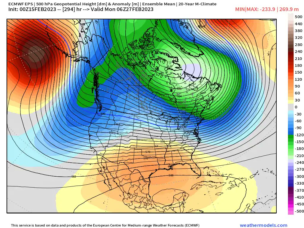
End of February and 1st weesk of March we can see these effects - how much remains to be seen. It tries to recover but can't and may take us through April with these effects if it does stabilize and then get destroyed.
amugs- Advanced Forecaster - Mod

- Posts : 15093
Join date : 2013-01-07
Re: Long Range Thread 25.0
![]() by amugs Wed Feb 15, 2023 12:21 pm
by amugs Wed Feb 15, 2023 12:21 pm
Last edited by amugs on Wed Feb 15, 2023 5:59 pm; edited 1 time in total
amugs- Advanced Forecaster - Mod
- Posts : 15093
Join date : 2013-01-07
Re: Long Range Thread 25.0
![]() by amugs Wed Feb 15, 2023 2:51 pm
by amugs Wed Feb 15, 2023 2:51 pm
_________________
Mugs
AKA:King: Snow Weenie
Self Proclaimed
WINTER 2014-15 : 55.12" +.02 for 6 coatings (avg. 35")
WINTER 2015-16 Total - 29.8" (Avg 35")
WINTER 2016-17 : 39.5" so far

amugs- Advanced Forecaster - Mod
- Posts : 15093
Reputation : 213
Join date : 2013-01-07
Age : 54
Location : Hillsdale,NJ
phil155 likes this post
Re: Long Range Thread 25.0
![]() by CPcantmeasuresnow Thu Feb 16, 2023 6:25 am
by CPcantmeasuresnow Thu Feb 16, 2023 6:25 am
I’m sure the next threat, even the term makes me laugh uncontrollable now, will eventually follow the same path.
At this point and I’m serious, you can take any March through April pattern changes and stick em where the sun don’t shine.
In 1972-1973 at least we were still ice skating and where I live there was snow on the ground for two or three weeks these temperatures are nuts. And actually very concerning ecologically for plants that will bloom way early if this keeps up.

CPcantmeasuresnow- Wx Statistician Guru

- Posts : 7274
Reputation : 230
Join date : 2013-01-07
Age : 103
Location : Eastern Orange County, NY
docstox12 likes this post
Re: Long Range Thread 25.0
![]() by sroc4 Thu Feb 16, 2023 7:36 am
by sroc4 Thu Feb 16, 2023 7:36 am
sroc4 wrote:Just a very broad stroked comment here. First inside 10-12 days means nothing to me. Bill this is not a knock on you at all. This winter in particular inside 3-5days is when we can take this seriously. That said there are a few things going on right now that might, and I stressed might, allow for a different outcome in the time frame between the 22nd-March 1st. The possibility of different forcing mechanisms to the atmosphere at play here is a real thing.
That is all
Sooooooooo.........
2 more of my cents here. When looking at the forcing mechanisms Im not sure I am seeing the change necessary to "make a difference" with respect to outcome. Two things:
First: The SOI. https://www.longpaddock.qld.gov.au/soi/
For awhile, maybe on the order of 3 weeks, we have a legit change on the trop Pac trade winds where the daily values were coming in at single digits and negative values such that you can see by the red line(30day running avg) had steadily decreased. However; notice that for about the last 10days or so that red line has steadily increased yet again.

To spell it out more simply with the SOI finally going towards neutral, should it have remained there, would have meant the background state of the La Nina, which tends to promote the SE ridge(bad), would have been less influential should other drivers become more favorable. Unfort for us for at least the last month the Strat polar Vortex had strengthened and shifted to the wrong side of the N Hemisphere(bad), and the MJO(prob strongest influence to our pattern over the last month) was making a mod strong run through the warmest of the phases(phases 3-4-5-6-7).
Second: The MJO which I touched upon above. As mentioned it took a tour through all the warm phases; the result of which has been this exceptionally warm and snowless pattern. Of course this was combined with the background state of La Nina. They aligned to make it "extra special". Now a couple of few days ago the MJO forecasts decided to "tickle" us in some fun places lending us to believe that It may make it out into phase 8 which is def a cold phase.
The result of this has been what we have seen on the models in that long range. The idea of a storm track that may lead to some actual wintery precip for the area. Problem is MJO forecasts are shifting yet again. Buuuuuuttttt..................The signal into the colder phases is trending weaker and weaker, and the GFS is even suggesting that we head back out into 6 again which is as warm as it gets. The euro and if you look at the extended forecasts f the euro and a few of the others want it to collapse into the center before re-emerging back out and making a run in some of the colder phases ie: 8-1-2 perhaps. Needless to say at the moment I am not buying any of that until I see it.


As we have seen so often as we head in tighter we see our forecasts try to fall back into what has been relatively well established pattern. The La Nina is def weakening as seen by some of the changes in the SST in the trop Pac; however, the pas 10 days of SOI data suggests that its influence on he background state still isnt quite ready to let go. So while there may be a touch of MJO forcing, even if its a short window, into more favorable phases I worry that the back ground state of the Nina will still lead to storm tracks the want to be too far west. Undermodeled energy in the LR that trends stronger as we get closer. The stronger energy to our west raises the heights out infront because the Nina back ground state promotes it. If the MJO influences and the shift in the strat forcings arent potent enough we once again do not overcome the slop for the interior and higher elevations and cold wet rain for the coast scenario. Yup it will be colder than it is now, but who cares.
_________________
"In weather and in life, there's no winning and losing; there's only winning and learning."
WINTER 2012/2013 TOTALS 43.65"WINTER 2017/2018 TOTALS 62.85" WINTER 2022/2023 TOTALS 4.9"
WINTER 2013/2014 TOTALS 64.85"WINTER 2018/2019 TOTALS 14.25" WINTER 2023/2024 TOTALS 13.1"
WINTER 2014/2015 TOTALS 71.20"WINTER 2019/2020 TOTALS 6.35"
WINTER 2015/2016 TOTALS 35.00"WINTER 2020/2021 TOTALS 37.75"
WINTER 2016/2017 TOTALS 42.25"WINTER 2021/2022 TOTALS 31.65"

sroc4- Admin

- Posts : 8331
Reputation : 301
Join date : 2013-01-07
Location : Wading River, LI
docstox12, CPcantmeasuresnow and heehaw453 like this post
Re: Long Range Thread 25.0
![]() by heehaw453 Thu Feb 16, 2023 8:56 am
by heehaw453 Thu Feb 16, 2023 8:56 am

heehaw453- Advanced Forecaster

- Posts : 3906
Reputation : 86
Join date : 2014-01-20
Location : Bedminster Township, PA Elevation 600' ASL
sroc4, docstox12 and kalleg like this post
Re: Long Range Thread 25.0
![]() by billg315 Thu Feb 16, 2023 11:32 am
by billg315 Thu Feb 16, 2023 11:32 am

billg315- Advanced Forecaster - Mod
- Posts : 4464
Reputation : 185
Join date : 2015-01-24
Age : 50
Location : Flemington, NJ
CPcantmeasuresnow likes this post
Re: Long Range Thread 25.0
![]() by amugs Thu Feb 16, 2023 11:58 am
by amugs Thu Feb 16, 2023 11:58 am

We have reached SSWE status. Now what this wil translate too is anyones guess but this is the last straw IMO peeps.
Next year with an El Nino coming in should be better.
_________________
Mugs
AKA:King: Snow Weenie
Self Proclaimed
WINTER 2014-15 : 55.12" +.02 for 6 coatings (avg. 35")
WINTER 2015-16 Total - 29.8" (Avg 35")
WINTER 2016-17 : 39.5" so far
amugs- Advanced Forecaster - Mod
- Posts : 15093
Reputation : 213
Join date : 2013-01-07
Age : 54
Location : Hillsdale,NJ
SENJsnowman likes this post
Re: Long Range Thread 25.0
![]() by heehaw453 Thu Feb 16, 2023 11:59 am
by heehaw453 Thu Feb 16, 2023 11:59 am
heehaw453- Advanced Forecaster
- Posts : 3906
Reputation : 86
Join date : 2014-01-20
Location : Bedminster Township, PA Elevation 600' ASL
CPcantmeasuresnow and billg315 like this post
Re: Long Range Thread 25.0
![]() by CPcantmeasuresnow Thu Feb 16, 2023 12:32 pm
by CPcantmeasuresnow Thu Feb 16, 2023 12:32 pm
I’ll never say no to a significant snowfall in any month but after three months of the worst winter possible, at least I hope so anything worse than this would be Myrtle Beach’s winter, anything at this point is more of a middle finger from Mother Nature than a blessing.
CPcantmeasuresnow- Wx Statistician Guru
- Posts : 7274
Reputation : 230
Join date : 2013-01-07
Age : 103
Location : Eastern Orange County, NY
docstox12 and billg315 like this post
Re: Long Range Thread 25.0
![]() by heehaw453 Fri Feb 17, 2023 8:44 am
by heehaw453 Fri Feb 17, 2023 8:44 am

heehaw453- Advanced Forecaster
- Posts : 3906
Reputation : 86
Join date : 2014-01-20
Location : Bedminster Township, PA Elevation 600' ASL
CPcantmeasuresnow and phil155 like this post
Re: Long Range Thread 25.0
![]() by jmanley32 Fri Feb 17, 2023 9:11 am
by jmanley32 Fri Feb 17, 2023 9:11 am

jmanley32- Senior Enthusiast

- Posts : 20513
Reputation : 108
Join date : 2013-12-12
Age : 42
Location : Yonkers, NY
Re: Long Range Thread 25.0
![]() by CPcantmeasuresnow Fri Feb 17, 2023 10:48 am
by CPcantmeasuresnow Fri Feb 17, 2023 10:48 am
jmanley32 wrote:The snow maps for around the end of the month yesterday and today range from 0 to 50 inches lol, i know likely the 0 will be the case.
I saw that. The 40-50 inches was centered around NW NJ and southeast NY, with 0 over Boston.
Long range maps most years are useless. This year they are absolutely positively useless.
CPcantmeasuresnow- Wx Statistician Guru
- Posts : 7274
Reputation : 230
Join date : 2013-01-07
Age : 103
Location : Eastern Orange County, NY
Re: Long Range Thread 25.0
![]() by jmanley32 Fri Feb 17, 2023 12:52 pm
by jmanley32 Fri Feb 17, 2023 12:52 pm
Ya not even a fantasy map, gave me 0 excitement. On my years here I have learned more and more that these LR massive snow dumps never happen. And sorry but if there is a storm of that magnitude you can keep it, I in no way want 4 ft snow 1st week march.CPcantmeasuresnow wrote:jmanley32 wrote:The snow maps for around the end of the month yesterday and today range from 0 to 50 inches lol, i know likely the 0 will be the case.
I saw that. The 40-50 inches was centered around NW NJ and southeast NY, with 0 over Boston.
Long range maps most years are useless. This year they are absolutely positively useless.
jmanley32- Senior Enthusiast
- Posts : 20513
Reputation : 108
Join date : 2013-12-12
Age : 42
Location : Yonkers, NY
mmanisca likes this post
Re: Long Range Thread 25.0
![]() by heehaw453 Fri Feb 17, 2023 12:57 pm
by heehaw453 Fri Feb 17, 2023 12:57 pm

heehaw453- Advanced Forecaster
- Posts : 3906
Reputation : 86
Join date : 2014-01-20
Location : Bedminster Township, PA Elevation 600' ASL
Re: Long Range Thread 25.0
![]() by Irish Fri Feb 17, 2023 4:10 pm
by Irish Fri Feb 17, 2023 4:10 pm

Irish- Pro Enthusiast

- Posts : 788
Reputation : 19
Join date : 2019-01-16
Age : 45
Location : Old Bridge, NJ
Re: Long Range Thread 25.0
![]() by heehaw453 Fri Feb 17, 2023 5:41 pm
by heehaw453 Fri Feb 17, 2023 5:41 pm
heehaw453- Advanced Forecaster
- Posts : 3906
Reputation : 86
Join date : 2014-01-20
Location : Bedminster Township, PA Elevation 600' ASL
MattyICE likes this post
Re: Long Range Thread 25.0
![]() by CPcantmeasuresnow Fri Feb 17, 2023 9:18 pm
by CPcantmeasuresnow Fri Feb 17, 2023 9:18 pm
Irish wrote:I can't even believe that we're at this point, heading into March with absolutely nothing to speak of to this point, hoping we get some help to salvage an awful winter.
I don’t think anything at this point can salvage this mess.
Once December January and February are written off and this historically bad, it would take a historic March like 1888 to even get this Winter to a D+.
CPcantmeasuresnow- Wx Statistician Guru
- Posts : 7274
Reputation : 230
Join date : 2013-01-07
Age : 103
Location : Eastern Orange County, NY
docstox12 and Irish like this post
Re: Long Range Thread 25.0
![]() by CPcantmeasuresnow Fri Feb 17, 2023 10:48 pm
by CPcantmeasuresnow Fri Feb 17, 2023 10:48 pm
heehaw453 wrote:I want to believe the 18Z GFS for the last 3 days of February. I want to believe in snow again.
Good Lord man snap out of it. Hit yourself in the head, throw a bucket of cold water over yourself, but don't let that model take you down the path to Hell again. You know it will be showing 46 with a wind swept rain for month end by Presidents Day.
CPcantmeasuresnow- Wx Statistician Guru
- Posts : 7274
Reputation : 230
Join date : 2013-01-07
Age : 103
Location : Eastern Orange County, NY
sroc4, docstox12, kalleg, heehaw453 and weatherwatchermom like this post
Re: Long Range Thread 25.0
![]() by heehaw453 Sat Feb 18, 2023 7:28 am
by heehaw453 Sat Feb 18, 2023 7:28 am

heehaw453- Advanced Forecaster
- Posts : 3906
Reputation : 86
Join date : 2014-01-20
Location : Bedminster Township, PA Elevation 600' ASL
CPcantmeasuresnow likes this post
Re: Long Range Thread 25.0
![]() by sroc4 Sat Feb 18, 2023 7:32 am
by sroc4 Sat Feb 18, 2023 7:32 am
_________________
"In weather and in life, there's no winning and losing; there's only winning and learning."
WINTER 2012/2013 TOTALS 43.65"WINTER 2017/2018 TOTALS 62.85" WINTER 2022/2023 TOTALS 4.9"
WINTER 2013/2014 TOTALS 64.85"WINTER 2018/2019 TOTALS 14.25" WINTER 2023/2024 TOTALS 13.1"
WINTER 2014/2015 TOTALS 71.20"WINTER 2019/2020 TOTALS 6.35"
WINTER 2015/2016 TOTALS 35.00"WINTER 2020/2021 TOTALS 37.75"
WINTER 2016/2017 TOTALS 42.25"WINTER 2021/2022 TOTALS 31.65"
sroc4- Admin
- Posts : 8331
Reputation : 301
Join date : 2013-01-07
Location : Wading River, LI
CPcantmeasuresnow, kalleg, Grselig, heehaw453 and weatherwatchermom like this post
Re: Long Range Thread 25.0
![]() by heehaw453 Sat Feb 18, 2023 12:17 pm
by heehaw453 Sat Feb 18, 2023 12:17 pm
heehaw453- Advanced Forecaster
- Posts : 3906
Reputation : 86
Join date : 2014-01-20
Location : Bedminster Township, PA Elevation 600' ASL
sroc4, docstox12, CPcantmeasuresnow, kalleg and weatherwatchermom like this post
Re: Long Range Thread 25.0
![]() by Grselig Sat Feb 18, 2023 12:36 pm
by Grselig Sat Feb 18, 2023 12:36 pm
sroc4 wrote:Normally this would belong in the banter thread but there always exceptions to every rule. When looking at the LR transition to the SR just listen to the lyrics and breathe deep and slow.
I know its banter. But truly wise words. Hug the family. Enjoy what we have. Love them Wilbuys'. Still nice to have Lynn and Dylan around!

Grselig- Senior Enthusiast
- Posts : 1408
Reputation : 140
Join date : 2013-03-04
Age : 54
Location : Wayne NJ
sroc4, docstox12, CPcantmeasuresnow and weatherwatchermom like this post
Re: Long Range Thread 25.0
![]() by heehaw453 Sat Feb 18, 2023 1:54 pm
by heehaw453 Sat Feb 18, 2023 1:54 pm

heehaw453- Advanced Forecaster
- Posts : 3906
Reputation : 86
Join date : 2014-01-20
Location : Bedminster Township, PA Elevation 600' ASL
Re: Long Range Thread 25.0
![]() by heehaw453 Sat Feb 18, 2023 6:07 pm
by heehaw453 Sat Feb 18, 2023 6:07 pm

heehaw453- Advanced Forecaster
- Posts : 3906
Reputation : 86
Join date : 2014-01-20
Location : Bedminster Township, PA Elevation 600' ASL
CPcantmeasuresnow likes this post
Re: Long Range Thread 25.0
![]() by CPcantmeasuresnow Sat Feb 18, 2023 7:56 pm
by CPcantmeasuresnow Sat Feb 18, 2023 7:56 pm
In keeping with my limited knowledge and the trusty weather app, and the last threat on the 23rd having morphed into the usual mild rainy event with highs in the upper 40’s let’s move on to the 25th.
Right now I’m forecast for a high of 32 with 2-6 inches of snow. A virtual blizzard of 88 for this winter. In Keeping with the consistent trends of this entire season by Monday or Tuesday this will be forecast for an inch or less of snow with highs in the mid 40’s. And I’m 50 miles north of NYC in the metros cold area.
CPcantmeasuresnow- Wx Statistician Guru
- Posts : 7274
Reputation : 230
Join date : 2013-01-07
Age : 103
Location : Eastern Orange County, NY
docstox12 and heehaw453 like this post
Re: Long Range Thread 25.0
![]() by heehaw453 Sun Feb 19, 2023 11:52 am
by heehaw453 Sun Feb 19, 2023 11:52 am
I think the 25th's biggest obstacle is the weak s/w aided by the -PNA. Just may not get enough s/w development precip for snowfall. Probably will be cold enough, but end result may still be no snow OTG. So we fail when it's cold enough and of course we do well at failing with moisture rich cutters.CPcantmeasuresnow wrote:I can add nothing to the scientific analysis that Heehaw and Sroc bring to these setups so all I can add is this.
In keeping with my limited knowledge and the trusty weather app, and the last threat on the 23rd having morphed into the usual mild rainy event with highs in the upper 40’s let’s move on to the 25th.
Right now I’m forecast for a high of 32 with 2-6 inches of snow. A virtual blizzard of 88 for this winter. In Keeping with the consistent trends of this entire season by Monday or Tuesday this will be forecast for an inch or less of snow with highs in the mid 40’s. And I’m 50 miles north of NYC in the metros cold area.

heehaw453- Advanced Forecaster
- Posts : 3906
Reputation : 86
Join date : 2014-01-20
Location : Bedminster Township, PA Elevation 600' ASL
CPcantmeasuresnow and kalleg like this post
Page 35 of 40 • 1 ... 19 ... 34, 35, 36 ... 40 ![]()
|
|
|