FEB 13th Pre V-Day Storm Part II
+40
hyde345
richb521
SENJsnowman
tomsriversnowstorm
jimv45
WeatherBob
MattyICE
DAYBLAZER
dkodgis
crippo84
jurzdevil
nutleyblizzard
phil155
Coachgriff
Carvin
1190ftalt
silentwreck
emokid51783
NJBear
Dunnzoo
2004blackwrx
brownie
weatherwatchermom
snowday111
billg315
DWay
sroc4
Irish
essexcountypete
GreyBeard
frank 638
Goalscore1
mmanisca
heehaw453
amugs
CPcantmeasuresnow
aiannone
jmanley32
docstox12
Frank_Wx
44 posters
Page 6 of 15
Page 6 of 15 •  1 ... 5, 6, 7 ... 10 ... 15
 Re: FEB 13th Pre V-Day Storm Part II
Lightly snowing and sleeting roads are getting slushy
frank 638- Senior Enthusiast

- Posts : 2843
Join date : 2016-01-01
 Re: FEB 13th Pre V-Day Storm Part II
Officially snowing in NYC, everything is getting covered!
silentwreck- Posts : 45
Join date : 2023-12-18

billg315- Advanced Forecaster - Mod

- Posts : 4483
Reputation : 185
Join date : 2015-01-24
Age : 50
Location : Flemington, NJ
Irish likes this post
heehaw453- Advanced Forecaster

- Posts : 3906
Reputation : 86
Join date : 2014-01-20
Location : Bedminster Township, PA Elevation 600' ASL
silentwreck likes this post
heehaw453- Advanced Forecaster

- Posts : 3906
Reputation : 86
Join date : 2014-01-20
Location : Bedminster Township, PA Elevation 600' ASL
 Re: FEB 13th Pre V-Day Storm Part II
I agree heehaw. 4” imby would be a double into the gap. 6” a home run. Anything over 8” and this storm is a grand slam (and a coup for the GFS lol).

billg315- Advanced Forecaster - Mod

- Posts : 4483
Reputation : 185
Join date : 2015-01-24
Age : 50
Location : Flemington, NJ
docstox12 and heehaw453 like this post
 Re: FEB 13th Pre V-Day Storm Part II
It is the RadarScope app. Precip Depiction setting.

billg315- Advanced Forecaster - Mod

- Posts : 4483
Reputation : 185
Join date : 2015-01-24
Age : 50
Location : Flemington, NJ
heehaw453 likes this post
 Re: FEB 13th Pre V-Day Storm Part II
30.6 here and heavy snow. Did not expect to wake up and see this. The power of lowered or in this case almost no expectations.
Haven't gone out to measure but grass completely covered and plow just went through. Eyeballing, as Doc would say, at least 2.5 inches so far. I'm about 12 miles south of 84 so not sure how sharp the cutoff is there. Looks to be snowing at a fair clip all the way up to Poughkeepsie on radar.
Haven't gone out to measure but grass completely covered and plow just went through. Eyeballing, as Doc would say, at least 2.5 inches so far. I'm about 12 miles south of 84 so not sure how sharp the cutoff is there. Looks to be snowing at a fair clip all the way up to Poughkeepsie on radar.

CPcantmeasuresnow- Wx Statistician Guru

- Posts : 7274
Reputation : 230
Join date : 2013-01-07
Age : 103
Location : Eastern Orange County, NY
docstox12, heehaw453 and billg315 like this post
 Re: FEB 13th Pre V-Day Storm Part II
Incredible that it still shows my area with a foot. The next 7 hours must really get going or this is gonna bust for this area. I'm reading some up north already have 3 inches on the ground. Very nice!

Irish- Pro Enthusiast

- Posts : 788
Reputation : 19
Join date : 2019-01-16
Age : 45
Location : Old Bridge, NJ
 Re: FEB 13th Pre V-Day Storm Part II
I still think GFS is overdone - maybe by a few inches in the max areas. But if this really did achieve 1-2” per hour rates, would only take 4 hours of that heavy snow (which we may get from 7-11 am) to get 4-8” on top of whatever comes before or after that.

billg315- Advanced Forecaster - Mod

- Posts : 4483
Reputation : 185
Join date : 2015-01-24
Age : 50
Location : Flemington, NJ
Irish likes this post
heehaw453- Advanced Forecaster

- Posts : 3906
Reputation : 86
Join date : 2014-01-20
Location : Bedminster Township, PA Elevation 600' ASL
Irish likes this post
heehaw453- Advanced Forecaster

- Posts : 3906
Reputation : 86
Join date : 2014-01-20
Location : Bedminster Township, PA Elevation 600' ASL
CPcantmeasuresnow likes this post
 Re: FEB 13th Pre V-Day Storm Part II
30.4° and snowing moderately here 12 miles south if I84. Intensity down in the last 15 minutes.
4.0 inches officially as of 5:15 am. Don't know what happened between midnight and five but wish I'd been up to see it. This has already exceeded my greatly lowered expectations from last night. Plows already been through and street covered again.
4.0 inches officially as of 5:15 am. Don't know what happened between midnight and five but wish I'd been up to see it. This has already exceeded my greatly lowered expectations from last night. Plows already been through and street covered again.

CPcantmeasuresnow- Wx Statistician Guru

- Posts : 7274
Reputation : 230
Join date : 2013-01-07
Age : 103
Location : Eastern Orange County, NY
sroc4, docstox12, heehaw453, billg315 and Irish like this post
 Re: FEB 13th Pre V-Day Storm Part II
Dropped to 31.5 with heavy snow. I expected to have to fight above freezing surface temps. Pleasantly surprised
heehaw453- Advanced Forecaster

- Posts : 3906
Reputation : 86
Join date : 2014-01-20
Location : Bedminster Township, PA Elevation 600' ASL
 Re: FEB 13th Pre V-Day Storm Part II
Same here. Thought at 5 am I’d wake up to 34* wet pavement and light snow. Instead 32* moderate snow and everything is snow covered.heehaw453 wrote:Dropped to 31.5 with heavy snow. I expected to have to fight above freezing surface temps. Pleasantly surprised

billg315- Advanced Forecaster - Mod

- Posts : 4483
Reputation : 185
Join date : 2015-01-24
Age : 50
Location : Flemington, NJ
docstox12 and heehaw453 like this post
 Re: FEB 13th Pre V-Day Storm Part II
There are times when the antecedent air mass is less important and less need for the big banana H which I usually look for to get sig snow. Track and n/s interaction can compensate for that and this case looks to be doing so.
heehaw453- Advanced Forecaster

- Posts : 3906
Reputation : 86
Join date : 2014-01-20
Location : Bedminster Township, PA Elevation 600' ASL
 Re: FEB 13th Pre V-Day Storm Part II
Gonna have to snow very hard in next five hours for Brooklyn my to get 3”this storm is fast
Carvin- Posts : 44
Reputation : 2
Join date : 2019-01-09
 Re: FEB 13th Pre V-Day Storm Part II
Snow and sleet here in middlesex county, everything is covered with an icy snowy mix. If this does change to heavy snow as expected the roads will be a disaster
phil155- Pro Enthusiast

- Posts : 483
Reputation : 4
Join date : 2019-12-16
heehaw453- Advanced Forecaster

- Posts : 3906
Reputation : 86
Join date : 2014-01-20
Location : Bedminster Township, PA Elevation 600' ASL
 Re: FEB 13th Pre V-Day Storm Part II
Deer Park
33 with some light snow and sleet. A light coating on the grass and cars..
33 with some light snow and sleet. A light coating on the grass and cars..

mmanisca- Pro Enthusiast

- Posts : 299
Reputation : 3
Join date : 2013-01-23
Age : 65
Location : Deer Park, Long Island
 Re: FEB 13th Pre V-Day Storm Part II
They just closed schools for the day in Edison.phil155 wrote:Snow and sleet here in middlesex county, everything is covered with an icy snowy mix. If this does change to heavy snow as expected the roads will be a disaster

Irish- Pro Enthusiast

- Posts : 788
Reputation : 19
Join date : 2019-01-16
Age : 45
Location : Old Bridge, NJ
phil155 likes this post

billg315- Advanced Forecaster - Mod

- Posts : 4483
Reputation : 185
Join date : 2015-01-24
Age : 50
Location : Flemington, NJ
heehaw453 likes this post
 Re: FEB 13th Pre V-Day Storm Part II
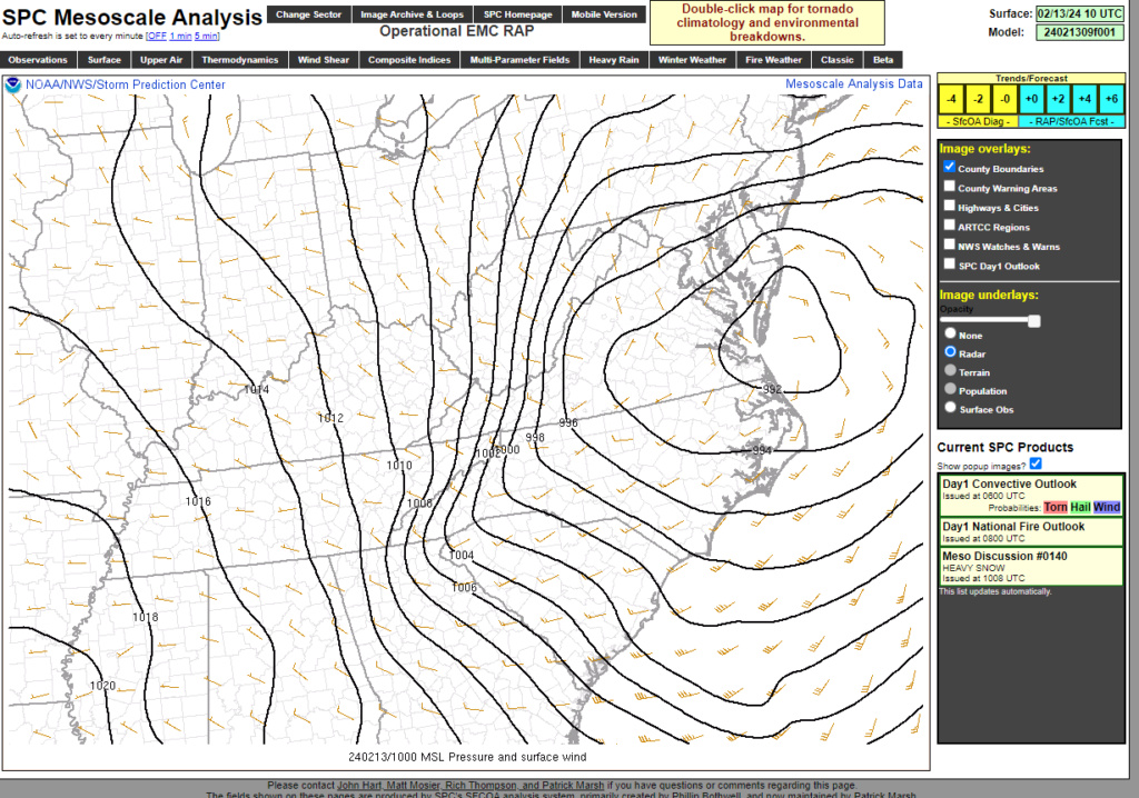
The wind direction around that Low due to its placement is NNE. That can’t be underestimated either.
31* here, moderate Snow, NNE wind 10 mph, gusts 21mph.
31* here, moderate Snow, NNE wind 10 mph, gusts 21mph.

billg315- Advanced Forecaster - Mod

- Posts : 4483
Reputation : 185
Join date : 2015-01-24
Age : 50
Location : Flemington, NJ
docstox12 and CPcantmeasuresnow like this post
 Re: FEB 13th Pre V-Day Storm Part II
Radar is impressive and expansive with this system.
Heavy snow 31.2/31.0 winds gusting to 25 maybe 30 mph. Have to measure but approaching 1.5" seems reasonable.
It's going to probably look blizzard like at times as this storm cranks.
Heavy snow 31.2/31.0 winds gusting to 25 maybe 30 mph. Have to measure but approaching 1.5" seems reasonable.
It's going to probably look blizzard like at times as this storm cranks.
heehaw453- Advanced Forecaster

- Posts : 3906
Reputation : 86
Join date : 2014-01-20
Location : Bedminster Township, PA Elevation 600' ASL
docstox12 and CPcantmeasuresnow like this post
 Re: FEB 13th Pre V-Day Storm Part II
Irish wrote:They just closed schools for the day in Edison.phil155 wrote:Snow and sleet here in middlesex county, everything is covered with an icy snowy mix. If this does change to heavy snow as expected the roads will be a disaster
All snow now
phil155- Pro Enthusiast

- Posts : 483
Reputation : 4
Join date : 2019-12-16
docstox12 and Irish like this post
 Re: FEB 13th Pre V-Day Storm Part II
CPcantmeasuresnow wrote:30.4° and snowing moderately here 12 miles south if I84. Intensity down in the last 15 minutes.
4.0 inches officially as of 5:15 am. Don't know what happened between midnight and five but wish I'd been up to see it. This has already exceeded my greatly lowered expectations from last night. Plows already been through and street covered again.
Same here CP, 4 inches, 30 degrees moderate snow.I had the call of nature around 3:45 and there was an eyeballed 1 1/2 inches OTG then so must have started around 2 am.Sure looked like we were going to be scrooed on this yesterday with the rapid southern shifting.So, with that being said:
Snowstorm check on nowcast day:
1) Is there snow on the ground? Yes, 4 inches CHECK
2) Does the radar look juicy? At least 4 or 5 hours of 1/2 plus per hour rate CHECK
3)Cold weather for a week ahead for a good snowpack and a refresh Clipper or two? CHECK
Let's see if we can get to 6 , a victory for us considering the dire straits of yesterday.
Hope the South and East crew get their 8 plus radar looks very good for them as well.

docstox12- Wx Statistician Guru

- Posts : 8530
Reputation : 222
Join date : 2013-01-07
Age : 73
Location : Monroe NY
CPcantmeasuresnow, essexcountypete and billg315 like this post
 Re: FEB 13th Pre V-Day Storm Part II
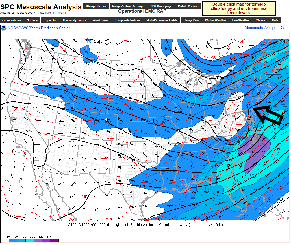
This storm has become a forecasting nightmare. Just when it looked like we were going to have an under performer with all the cutbacks on snow totals yesterday afternoon/evening, lo and behold the storm has seemingly done a head fake and the meso models have been bumping north overnight. Quicker closure of the ULL and negative tilt of the trough can work wonders.

nutleyblizzard- Senior Enthusiast

- Posts : 1954
Reputation : 41
Join date : 2014-01-30
Age : 58
Location : Nutley, new jersey
Page 6 of 15 •  1 ... 5, 6, 7 ... 10 ... 15
Page 6 of 15
Permissions in this forum:
You cannot reply to topics in this forum|
|
|

 Home
Home


