
 Search
Long Range Thread 13.0
Page 30 of 40 •  1 ... 16 ... 29, 30, 31 ... 35 ... 40
 ![]()
Re: Long Range Thread 13.0
![]() by Frank_Wx Sun Jan 15, 2017 4:35 pm
by Frank_Wx Sun Jan 15, 2017 4:35 pm

Frank_Wx- Godzilla Seeker

- Posts : 21305
Join date : 2013-01-05 -

Re: Long Range Thread 13.0
![]() by billg315 Sun Jan 15, 2017 4:44 pm
by billg315 Sun Jan 15, 2017 4:44 pm
Frank_Wx wrote:The PAC ridging keeps trending stronger on the EPS. It's literally arousing.
Yeah you can see it rising out there clearly. That's the ridge I'm referring to. lol
billg315- Advanced Forecaster - Mod

- Posts : 4469
Join date : 2015-01-24
Re: Long Range Thread 13.0
![]() by nutleyblizzard Sun Jan 15, 2017 5:05 pm
by nutleyblizzard Sun Jan 15, 2017 5:05 pm
Taken verbatim, if we don't see a MECS if not a HECS with the upcoming pattern change I'd be stunned. That's textbook right there.Frank_Wx wrote:The PAC ridging keeps trending stronger on the EPS. It's literally arousing.

nutleyblizzard- Senior Enthusiast

- Posts : 1952
Reputation : 41
Join date : 2014-01-30
Age : 58
Location : Nutley, new jersey
Re: Long Range Thread 13.0
![]() by CPcantmeasuresnow Sun Jan 15, 2017 5:25 pm
by CPcantmeasuresnow Sun Jan 15, 2017 5:25 pm
nutleyblizzard wrote:Taken verbatim, if we don't see a MECS if not a HECS with the upcoming pattern change I'd be stunned. That's textbook right there.Frank_Wx wrote:The PAC ridging keeps trending stronger on the EPS. It's literally arousing.
An area wide Mothrazilla at a minimum.

CPcantmeasuresnow- Wx Statistician Guru

- Posts : 7274
Reputation : 230
Join date : 2013-01-07
Age : 103
Location : Eastern Orange County, NY
Re: Long Range Thread 13.0
![]() by Math23x7 Sun Jan 15, 2017 5:27 pm
by Math23x7 Sun Jan 15, 2017 5:27 pm
CPcantmeasuresnow wrote:
An area wide Mothrazilla at a minimum.
And The Conservancy will still record a trace of snow out of this. Facts.
Math23x7- Wx Statistician Guru
- Posts : 2379
Reputation : 68
Join date : 2013-01-08
Re: Long Range Thread 13.0
![]() by rb924119 Sun Jan 15, 2017 5:49 pm
by rb924119 Sun Jan 15, 2017 5:49 pm
rb924119- Meteorologist

- Posts : 6890
Reputation : 194
Join date : 2013-02-06
Age : 32
Location : Greentown, Pa
Re: Long Range Thread 13.0
![]() by Dunnzoo Sun Jan 15, 2017 5:57 pm
by Dunnzoo Sun Jan 15, 2017 5:57 pm

_________________
Janet
Snowfall winter of 2023-2024 17.5"
Snowfall winter of 2022-2023 6.0"
Snowfall winter of 2021-2022 17.6" 1" sleet 2/25/22
Snowfall winter of 2020-2021 51.1"
Snowfall winter of 2019-2020 8.5"
Snowfall winter of 2018-2019 25.1"
Snowfall winter of 2017-2018 51.9"
Snowfall winter of 2016-2017 45.6"
Snowfall winter of 2015-2016 29.5"
Snowfall winter of 2014-2015 50.55"
Snowfall winter of 2013-2014 66.5"

Dunnzoo- Senior Enthusiast - Mod
- Posts : 4892
Reputation : 68
Join date : 2013-01-11
Age : 62
Location : Westwood, NJ
Re: Long Range Thread 13.0
![]() by dad4twoboys Sun Jan 15, 2017 6:04 pm
by dad4twoboys Sun Jan 15, 2017 6:04 pm
Dunnzoo wrote:Let's find a bar near the park and measure it ourselves when it comes. I think we have a few trained spotters on here (myself included) that could send in the reports.....screw the conservancy
Why not call the conservancy and ask them what bar their staff goes to to hang out during the snowstorms.


dad4twoboys- Pro Enthusiast

- Posts : 200
Reputation : 12
Join date : 2013-01-08
Location : Brewster, New York -
Re: Long Range Thread 13.0
![]() by Frank_Wx Sun Jan 15, 2017 6:35 pm
by Frank_Wx Sun Jan 15, 2017 6:35 pm
_________________
_______________________________________________________________________________________________________
CLICK HERE to view NJ Strong Snowstorm Classifications

Frank_Wx- Godzilla Seeker
- Posts : 21305
Reputation : 328
Join date : 2013-01-05
Age : 31
Location : Jersey City, NJ -
Re: Long Range Thread 13.0
![]() by sroc4 Sun Jan 15, 2017 6:49 pm
by sroc4 Sun Jan 15, 2017 6:49 pm
Isotherm wrote:After examining the data this morning, the following looks reasonable to me:
1) The initial wave-1 assault on the stratospheric vortex Jan 22-24 will be insufficient in inducing an official warming event. Meridional heat flux and momentum flux becomes more zonal by D10, reflective of a slight decrease in tropospheric wave driving. However, as I have mentioned, the tropospheric precursor pattern will begin to strengthen the Aleutian stratospheric high once again, setting the stage for another increase in wave-1 amplitudes, probably to at least 1400 gpm at 10hpa by the very end of January. This will act to increase geopotential heights across Canada, North America, and the polar regions, with the vortex displaced off-pole. The question becomes, will the wave forcing be sufficiently potent to close the deal? Namely, a continued push of the vortex into Europe w/ a classic displacement event. This will aid in determining the longevity of the upcoming pattern.
2) MJO robust / coherent propagation through P1-2 (see WWB) will result in the lagged tropospheric result with the development of mean troughing in Nino-esque locations. The Aleutian trough and concomitant W Canadian / AK ridging will act contemporaneously with the displacement activity through the stratosphere to raise geopotential heights in the EPO/PNA domains.
3) The AO and NAO will remain largely positive through the beginning of February, reflective of the aforementioned circumstances.
4) The period of favorability should peak in the first 10-11 days of February as the MJO forcing impacts the troposphere, coupled with the stratospheric progression. In the first 10 days of February, a snowstorm is highly probable somewhere in the Eastern US.
5) Beyond February 10th-11th, there are two possible pathways. The low frequency / interseasonal Nina walker cell should return coincident with the decay of the MJO, possibly leading to a worsening of the Pacific pattern as we approach mid February. The question would then become - do we hand off favorability to the Atlantic? This will only be the case if wave driving is sufficiently strong to induce the full SSW in early February. Otherwise, the off-pole displacement will be subsequently be followed by reconsolidation of the vortex at the pol and lowering geopotential heights by week 3. The outcome of the stratosphere is indeterminate, but there will be enough displacement activity to produce a conducive regime for early Feb.
Conclusion: the largest window of opportunity of the winter thus far begins near the end of Jan, through the second week of Feb. The pattern may turn more unfavorable thereafter, but I cannot guarantee that right now.
Tom this is your most encouraging update thus far. Ill take it!!
_________________
"In weather and in life, there's no winning and losing; there's only winning and learning."
WINTER 2012/2013 TOTALS 43.65"WINTER 2017/2018 TOTALS 62.85" WINTER 2022/2023 TOTALS 4.9"
WINTER 2013/2014 TOTALS 64.85"WINTER 2018/2019 TOTALS 14.25" WINTER 2023/2024 TOTALS 13.1"
WINTER 2014/2015 TOTALS 71.20"WINTER 2019/2020 TOTALS 6.35"
WINTER 2015/2016 TOTALS 35.00"WINTER 2020/2021 TOTALS 37.75"
WINTER 2016/2017 TOTALS 42.25"WINTER 2021/2022 TOTALS 31.65"

sroc4- Admin
- Posts : 8331
Reputation : 301
Join date : 2013-01-07
Location : Wading River, LI
Re: Long Range Thread 13.0
![]() by sroc4 Sun Jan 15, 2017 6:57 pm
by sroc4 Sun Jan 15, 2017 6:57 pm
rb924119 wrote:Thank you, Scott haha
You bet Ray. You were the first one that I heard discuss this pattern in your video on the 9th. It may not end up a snow event for us, but its looking more and more likely New England gets a snow storm.

_________________
"In weather and in life, there's no winning and losing; there's only winning and learning."
WINTER 2012/2013 TOTALS 43.65"WINTER 2017/2018 TOTALS 62.85" WINTER 2022/2023 TOTALS 4.9"
WINTER 2013/2014 TOTALS 64.85"WINTER 2018/2019 TOTALS 14.25" WINTER 2023/2024 TOTALS 13.1"
WINTER 2014/2015 TOTALS 71.20"WINTER 2019/2020 TOTALS 6.35"
WINTER 2015/2016 TOTALS 35.00"WINTER 2020/2021 TOTALS 37.75"
WINTER 2016/2017 TOTALS 42.25"WINTER 2021/2022 TOTALS 31.65"
sroc4- Admin
- Posts : 8331
Reputation : 301
Join date : 2013-01-07
Location : Wading River, LI
Re: Long Range Thread 13.0
![]() by Armando Salvadore Sun Jan 15, 2017 7:20 pm
by Armando Salvadore Sun Jan 15, 2017 7:20 pm

Armando Salvadore- Advanced Forecaster

- Posts : 171
Reputation : 0
Join date : 2016-12-23
Location : Springfield, NJ
Re: Long Range Thread 13.0
![]() by Frank_Wx Sun Jan 15, 2017 7:26 pm
by Frank_Wx Sun Jan 15, 2017 7:26 pm
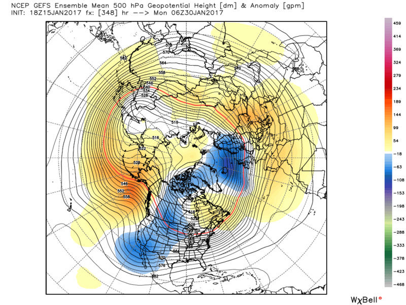
Armando Salvadore wrote:Hm, there are discrepancies amongst the GEFS and EPS for the end of the month (18z GEFS/ 12z EPS). However, given the GEFS MJO forecast amplitude and the SOI switch which enhances the pattern adjustment, i think i'd lean more on the EPS suite here. I also believe the GEFS is just slow on adjusting to the intraseasonal forcing that is going to occur. Then again, it literally shows a WQBO/-ENSO composite with Aleutian ridging and a mean trough axis over the west. Anyway, as i've said, i believe the EPS has a better handle on this.
Someone on twitter said the GEFS and EPS are at odds. I disagree. Both show blocking returning to the Pacific except the GEFS don't have the PNA. As long as the MJO wave propagates as expected, the PNA should spike.
_________________
_______________________________________________________________________________________________________
CLICK HERE to view NJ Strong Snowstorm Classifications
Frank_Wx- Godzilla Seeker
- Posts : 21305
Reputation : 328
Join date : 2013-01-05
Age : 31
Location : Jersey City, NJ -
Re: Long Range Thread 13.0
![]() by Armando Salvadore Sun Jan 15, 2017 8:14 pm
by Armando Salvadore Sun Jan 15, 2017 8:14 pm
Here is the 12z EPS
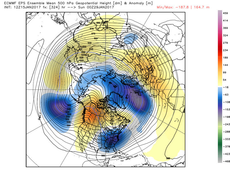
Big difference is what they do with that Aleutian vortex. GEFS seems to have a very weak signal and is allocated west of Hawaii while the EPS is much more amplified, and south of alaska. The tropical forcing propagation argues for a look like what the EPS has, which is why i said i side more with the ECMWF suite. I believe the GEFS does correct more east with the trough axis, but hey that look is still a cold and stormy depiction. Both still show pacific blocking as you mentioned Frank. That is a no brainer given what will be happening over the west pacific.
Armando Salvadore- Advanced Forecaster
- Posts : 171
Reputation : 0
Join date : 2016-12-23
Location : Springfield, NJ
Re: Long Range Thread 13.0
![]() by sroc4 Sun Jan 15, 2017 8:58 pm
by sroc4 Sun Jan 15, 2017 8:58 pm
Armando Salvadore wrote:Here is the 18z GEFS mean.
Here is the 12z EPS
Big difference is what they do with that Aleutian vortex. GEFS seems to have a very weak signal and is allocated west of Hawaii while the EPS is much more amplified, and south of alaska. The tropical forcing propagation argues for a look like what the EPS has, which is why i said i side more with the ECMWF suite. I believe the GEFS does correct more east with the trough axis, but hey that look is still a cold and stormy depiction. Both still show pacific blocking as you mentioned Frank. That is a no brainer given what will be happening over the west pacific.
They look at odds to me. Honestly if the Aleutian trough is correct on the EPS you get the +PNA/-EPO couplet go up; however, if the GEFS is correct the most anomalous thing on that map is the persistent -PNA trough. The -EPO is showing here which will lead to similar pattern evolution to what we've seen thus far; ie: big cold pool building in western Canada a piece of which breaks off and digs into the central plains and heads east from there, but the -PNA keeps the mean trough in the SW CONUS.
Honestly looking at the MSLP Anomaly maps for the equatorial Pac for the next 10days the -SOI does not look to back down that much against the base state which should lead to enhanced convection on or near the date line. The -SOI (HP in the Darwin area relative to lower pressure in Tahiti) should provide the conditions in the trop Pac for the MJO to enhance the Aleutian trough as depicted by the EPS package.
I am going to try not to over analyze the LR models because they will, as they typically do, take time to see the big picture when changes are amiss. When you have such stark differences as seen above you have to ask yourself which is handling it better. If the MJO strength and phases are correct then the GEFS package is at odds with its own MJO forecast by leaving the mean trough in the SW. Since both EPS an GEFS MJO forecasts are very similar in evolution, coming out in phases 8-1-2, I have to believe the EPS is handling the look of the LR much better. Again this far out we cant go crazy with models run to run, but rather follow the progression of the SOI index, the MJO, and the wave 1 attack on the horizon to the stratosphere.
_________________
"In weather and in life, there's no winning and losing; there's only winning and learning."
WINTER 2012/2013 TOTALS 43.65"WINTER 2017/2018 TOTALS 62.85" WINTER 2022/2023 TOTALS 4.9"
WINTER 2013/2014 TOTALS 64.85"WINTER 2018/2019 TOTALS 14.25" WINTER 2023/2024 TOTALS 13.1"
WINTER 2014/2015 TOTALS 71.20"WINTER 2019/2020 TOTALS 6.35"
WINTER 2015/2016 TOTALS 35.00"WINTER 2020/2021 TOTALS 37.75"
WINTER 2016/2017 TOTALS 42.25"WINTER 2021/2022 TOTALS 31.65"
sroc4- Admin
- Posts : 8331
Reputation : 301
Join date : 2013-01-07
Location : Wading River, LI
Re: Long Range Thread 13.0
![]() by Armando Salvadore Sun Jan 15, 2017 9:04 pm
by Armando Salvadore Sun Jan 15, 2017 9:04 pm
Armando Salvadore- Advanced Forecaster
- Posts : 171
Reputation : 0
Join date : 2016-12-23
Location : Springfield, NJ
Re: Long Range Thread 13.0
![]() by rb924119 Sun Jan 15, 2017 9:35 pm
by rb924119 Sun Jan 15, 2017 9:35 pm
rb924119- Meteorologist
- Posts : 6890
Reputation : 194
Join date : 2013-02-06
Age : 32
Location : Greentown, Pa
Re: Long Range Thread 13.0
![]() by Isotherm Sun Jan 15, 2017 10:03 pm
by Isotherm Sun Jan 15, 2017 10:03 pm
Isotherm- Advanced Forecaster
- Posts : 231
Reputation : 4
Join date : 2014-09-01
Age : 33
Location : Monmouth County, NJ -
Re: Long Range Thread 13.0
![]() by skinsfan1177 Mon Jan 16, 2017 7:07 am
by skinsfan1177 Mon Jan 16, 2017 7:07 am

skinsfan1177- Senior Enthusiast
- Posts : 4485
Reputation : 35
Join date : 2013-01-07
Age : 46
Location : Point Pleasant Boro

skinsfan1177- Senior Enthusiast
- Posts : 4485
Reputation : 35
Join date : 2013-01-07
Age : 46
Location : Point Pleasant Boro
Re: Long Range Thread 13.0
![]() by nutleyblizzard Mon Jan 16, 2017 7:47 am
by nutleyblizzard Mon Jan 16, 2017 7:47 am
nutleyblizzard- Senior Enthusiast
- Posts : 1952
Reputation : 41
Join date : 2014-01-30
Age : 58
Location : Nutley, new jersey
Re: Long Range Thread 13.0
![]() by algae888 Mon Jan 16, 2017 8:07 am
by algae888 Mon Jan 16, 2017 8:07 am
yes nut and also this weekend we need to watch as now all models have systems going under us. they are not handling the anomalous ridging in e/ Canada very well. no +10 departures on euro for cpk this entire week. nws forecast has on day at 50* rest in the mid 40's. fun times aheadnutleyblizzard wrote:Big changes from last nights long range 00z GEFS. Much better ridging out west and toughiness east. More in line with EPS. Major pattern reversal is coming folks!
edit: nws disco conveys my thinking...
Models are in good agreement on ridging building Wednesday night
through Thursday across the eastern states as the trough moves
offshore. As ridging continues to build into Friday, another upper
trough will dig towards the north Atlantic from SE Canada. With this
pattern aloft, high pressure will build over the region Thursday
into Friday. Above normal temperatures continue in the middle and
upper 40s. Some readings near 50 are possible in the NYC metro. The
warmest air in this pattern appears to stay well to the south of the
Tri-State as we will be under the influence of NW flow aloft and
light N to NE flow at the surface.
Energy from slow moving upper trough across the SW US and Plains is
progged to eject out towards the Ohio Valley on Friday and then get
caught underneath strengthening ridging aloft. This energy may
approach Friday night and bring enough moisture for precipitation.
However there is a large amount of spread on the amount of lift
available as well as the strength of the energy as it gets to the
coast. Despite this potential energy bringing a brief chance of
precipitation Friday night, anomalous ridging continues to build
aloft. The ridge axis may move offshore Sunday as a more significant
upper trough and low pressure approach from the west. Temperatures 5-
10 degrees above normal continue this weekend.
Last edited by algae888 on Mon Jan 16, 2017 9:04 am; edited 1 time in total

algae888- Advanced Forecaster
- Posts : 5311
Reputation : 46
Join date : 2013-02-05
Age : 61
Location : mt. vernon, new york
Re: Long Range Thread 13.0
![]() by Frank_Wx Mon Jan 16, 2017 8:39 am
by Frank_Wx Mon Jan 16, 2017 8:39 am
The pattern after the 27th will rock. Snowstorm signal growing stronger.

_________________
_______________________________________________________________________________________________________
CLICK HERE to view NJ Strong Snowstorm Classifications
Frank_Wx- Godzilla Seeker
- Posts : 21305
Reputation : 328
Join date : 2013-01-05
Age : 31
Location : Jersey City, NJ -
Re: Long Range Thread 13.0
![]() by Frank_Wx Mon Jan 16, 2017 9:08 am
by Frank_Wx Mon Jan 16, 2017 9:08 am

_________________
_______________________________________________________________________________________________________
CLICK HERE to view NJ Strong Snowstorm Classifications
Frank_Wx- Godzilla Seeker
- Posts : 21305
Reputation : 328
Join date : 2013-01-05
Age : 31
Location : Jersey City, NJ -
Re: Long Range Thread 13.0
![]() by Frank_Wx Mon Jan 16, 2017 9:13 am
by Frank_Wx Mon Jan 16, 2017 9:13 am


_________________
_______________________________________________________________________________________________________
CLICK HERE to view NJ Strong Snowstorm Classifications
Frank_Wx- Godzilla Seeker
- Posts : 21305
Reputation : 328
Join date : 2013-01-05
Age : 31
Location : Jersey City, NJ -
Re: Long Range Thread 13.0
![]() by Frank_Wx Mon Jan 16, 2017 9:20 am
by Frank_Wx Mon Jan 16, 2017 9:20 am
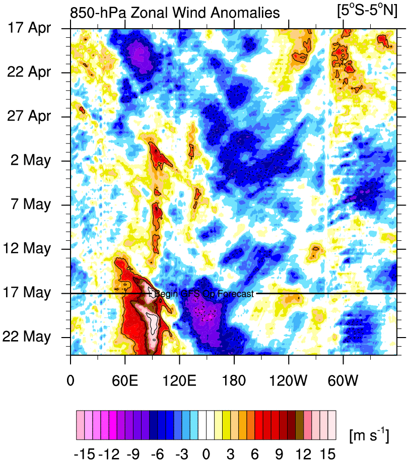
Interesting ENSO battle taking place at 200hPa
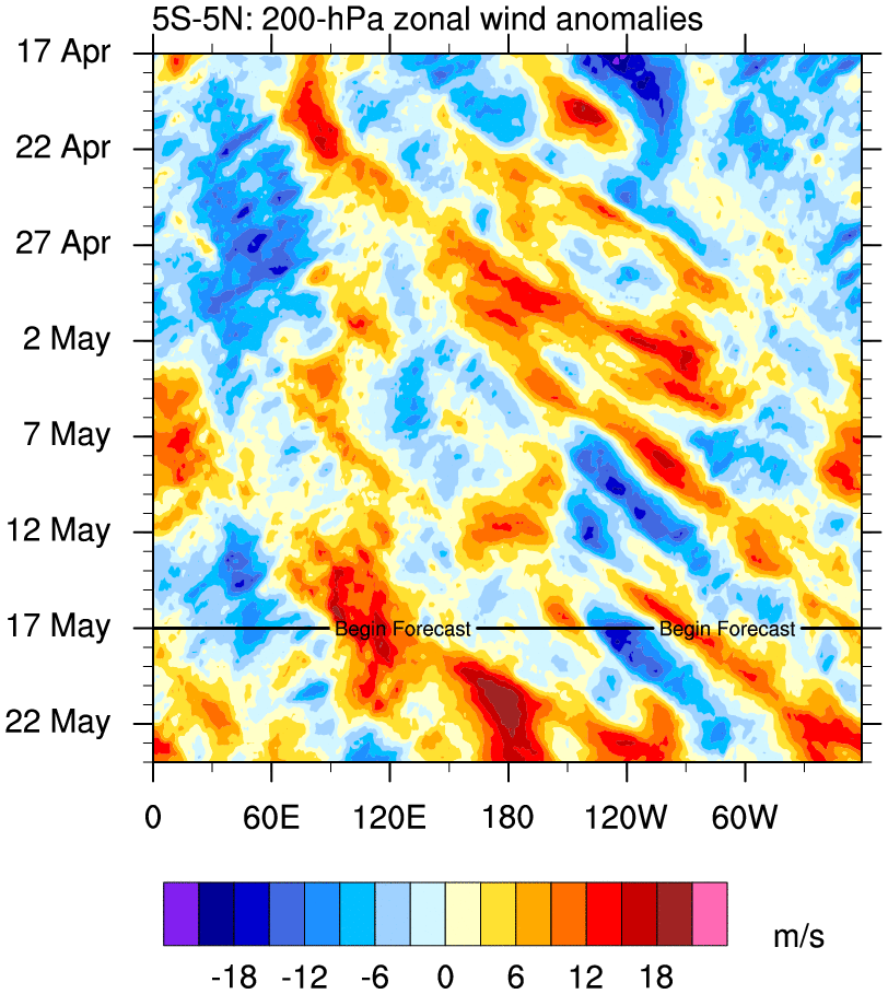
Convection apparent...


_________________
_______________________________________________________________________________________________________
CLICK HERE to view NJ Strong Snowstorm Classifications
Frank_Wx- Godzilla Seeker
- Posts : 21305
Reputation : 328
Join date : 2013-01-05
Age : 31
Location : Jersey City, NJ -
Re: Long Range Thread 13.0
![]() by rb924119 Mon Jan 16, 2017 10:07 am
by rb924119 Mon Jan 16, 2017 10:07 am
Last edited by rb924119 on Mon Jan 16, 2017 10:15 am; edited 1 time in total
rb924119- Meteorologist
- Posts : 6890
Reputation : 194
Join date : 2013-02-06
Age : 32
Location : Greentown, Pa
Page 30 of 40 • 1 ... 16 ... 29, 30, 31 ... 35 ... 40 ![]()
|
|
|