
 Search
March 14, 2017 Roidzilla 1st Call Snow Map / Synopsis
Page 32 of 33 •  1 ... 17 ... 31, 32, 33
 ![]()
Re: March 14, 2017 Roidzilla 1st Call Snow Map / Synopsis
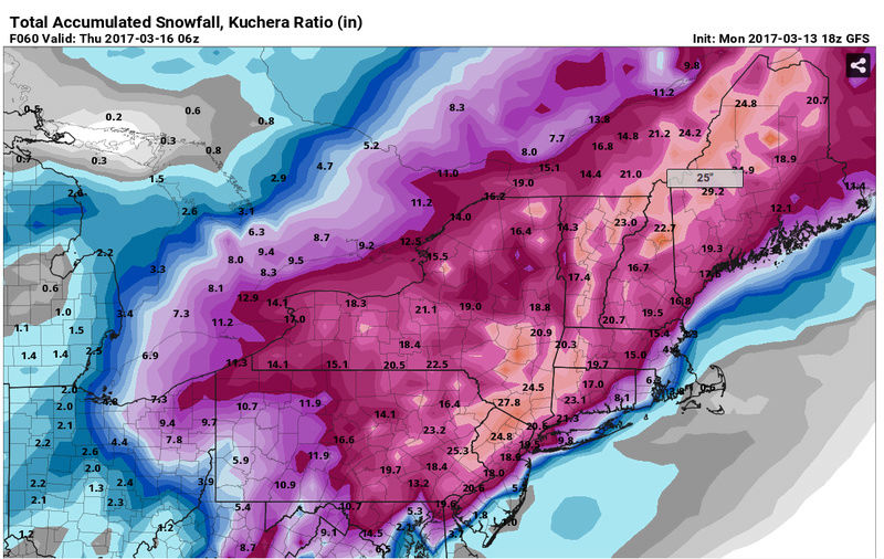
![]() by Guest Mon Mar 13, 2017 5:05 pm
by Guest Mon Mar 13, 2017 5:05 pm
Guest- Guest
Re: March 14, 2017 Roidzilla 1st Call Snow Map / Synopsis
![]() by Dtone Mon Mar 13, 2017 5:08 pm
by Dtone Mon Mar 13, 2017 5:08 pm
crippo84 wrote:frank 638 wrote:lee was saying for brooklyn there can be 10 inches while the bronx can have near 20 inches of snow
I live on the west side of Manhattan - Hells Kitchen. My girl lives in Brooklyn. She wants me to come and get snowed in at her place. I think I'm going to pass so I can avoid the changeover as much as possible.
Yes this fascination with snow is sickening. Not sure how I'll ever be able to explain it so thinking of a different excuse.
No way lol. Southern Queens and Brooklyn stay away.
Last edited by Dtone on Mon Mar 13, 2017 5:09 pm; edited 1 time in total
Dtone- Wx Statistician Guru

- Posts : 1738
Join date : 2013-08-26
Re: March 14, 2017 Roidzilla 1st Call Snow Map / Synopsis
![]() by Guest Mon Mar 13, 2017 5:08 pm
by Guest Mon Mar 13, 2017 5:08 pm
Guest- Guest
Re: March 14, 2017 Roidzilla 1st Call Snow Map / Synopsis
![]() by RJB8525 Mon Mar 13, 2017 5:11 pm
by RJB8525 Mon Mar 13, 2017 5:11 pm
hurrysundown23 wrote:Tonight
Snow, mainly after midnight. The snow could be heavy at times. Low around 28. Northeast wind 7 to 16 mph. Chance of precipitation is 90%. Total nighttime snow accumulation of 3 to 5 inches possible.
TuesdaySnow.
The snow could be heavy at times. Areas of blowing snow. High near 33. Windy, with a northeast wind 30 to 32 mph, with gusts as high as 49 mph. Chance of precipitation is 100%. New snow accumulation of 10 to 16 inches possible.
This the most updated from NOAA again no rain or sleet swhich to me is SWEET...SAYREVILLE TO GET PUNDED FOLKS!
for me
Tonight Snow, mainly after 1am. The snow could be heavy at times. Low around 24. Light and variable wind becoming northeast 5 to 8 mph after midnight. Chance of precipitation is 80%. Total nighttime snow accumulation of 3 to 7 inches possible.
Tuesday Snow. The snow could be heavy at times. Areas of blowing snow. High near 28. Blustery, with a northeast wind 18 to 24 mph, with gusts as high as 37 mph. Chance of precipitation is 100%. New snow accumulation of 14 to 20 inches possible.
Tuesday Night Snow showers likely, mainly before 7pm. The snow could be heavy at times. Areas of blowing snow after 9pm. Cloudy, with a low around 17. Northwest wind 13 to 18 mph decreasing to 7 to 12 mph after midnight. Chance of precipitation is 60%. New snow accumulation of 1 to 3 inches possible.

RJB8525- Senior Enthusiast

- Posts : 1994
Reputation : 28
Join date : 2013-02-06
Age : 38
Location : Hackettstown, NJ
Re: March 14, 2017 Roidzilla 1st Call Snow Map / Synopsis
![]() by CPcantmeasuresnow Mon Mar 13, 2017 5:13 pm
by CPcantmeasuresnow Mon Mar 13, 2017 5:13 pm
TheAresian wrote:Damn CP. You're getting a little salty as time goes on.
Just having some fun.
This storm is driving me over the edge. I apologize to anyone in advance for anything I may have done wrong during the last 5 days.

CPcantmeasuresnow- Wx Statistician Guru
- Posts : 7274
Reputation : 230
Join date : 2013-01-07
Age : 103
Location : Eastern Orange County, NY
Re: March 14, 2017 Roidzilla 1st Call Snow Map / Synopsis
![]() by Dtone Mon Mar 13, 2017 5:14 pm
by Dtone Mon Mar 13, 2017 5:14 pm
syosnow94 wrote:Doesn't make sense but NWS has me in Syosset for 3-5" tonight and 9-13" tomorrow with mixing. Probability is for me to expect 15". Totally does not jive with today's runs
Yeah NWS been sticking with the big snow numbers.
They did drop tues forecast for me from 12 - 16 to 10 -14 plus possible ice.
But they have up to 7 inches tonight now so it comes out about the same.
Dtone- Wx Statistician Guru
- Posts : 1738
Reputation : 9
Join date : 2013-08-26
Location : Bronx, NY
Re: March 14, 2017 Roidzilla 1st Call Snow Map / Synopsis
![]() by Guest Mon Mar 13, 2017 5:15 pm
by Guest Mon Mar 13, 2017 5:15 pm
Guest- Guest
Re: March 14, 2017 Roidzilla 1st Call Snow Map / Synopsis
![]() by RJB8525 Mon Mar 13, 2017 5:16 pm
by RJB8525 Mon Mar 13, 2017 5:16 pm

RJB8525- Senior Enthusiast
- Posts : 1994
Reputation : 28
Join date : 2013-02-06
Age : 38
Location : Hackettstown, NJ
Re: March 14, 2017 Roidzilla 1st Call Snow Map / Synopsis
![]() by GNSnow Mon Mar 13, 2017 5:17 pm
by GNSnow Mon Mar 13, 2017 5:17 pm
TonightRJB8525 wrote:hurrysundown23 wrote:Tonight
Snow, mainly after midnight. The snow could be heavy at times. Low around 28. Northeast wind 7 to 16 mph. Chance of precipitation is 90%. Total nighttime snow accumulation of 3 to 5 inches possible.
TuesdaySnow.
The snow could be heavy at times. Areas of blowing snow. High near 33. Windy, with a northeast wind 30 to 32 mph, with gusts as high as 49 mph. Chance of precipitation is 100%. New snow accumulation of 10 to 16 inches possible.
This the most updated from NOAA again no rain or sleet swhich to me is SWEET...SAYREVILLE TO GET PUNDED FOLKS!
for me
Tonight Snow, mainly after 1am. The snow could be heavy at times. Low around 24. Light and variable wind becoming northeast 5 to 8 mph after midnight. Chance of precipitation is 80%. Total nighttime snow accumulation of 3 to 7 inches possible.
Tuesday Snow. The snow could be heavy at times. Areas of blowing snow. High near 28. Blustery, with a northeast wind 18 to 24 mph, with gusts as high as 37 mph. Chance of precipitation is 100%. New snow accumulation of 14 to 20 inches possible.
Tuesday Night Snow showers likely, mainly before 7pm. The snow could be heavy at times. Areas of blowing snow after 9pm. Cloudy, with a low around 17. Northwest wind 13 to 18 mph decreasing to 7 to 12 mph after midnight. Chance of precipitation is 60%. New snow accumulation of 1 to 3 inches possible.
Snow likely, mainly after 2am. The snow could be heavy at times. Increasing clouds, with a low around 26. Wind chill values between 20 and 25. Southeast wind 6 to 9 mph becoming east after midnight. Chance of precipitation is 60%. Total nighttime snow accumulation of 3 to 5 inches possible.
Tuesday
Snow and sleet before 3pm, then snow between 3pm and 5pm, then snow likely, possibly mixed with freezing drizzle after 5pm. The snow could be heavy at times. Areas of blowing snow after 9am. Temperature falling to around 26 by 5pm. Wind chill values between 10 and 15. Windy, with a northeast wind 26 to 31 mph increasing to 32 to 37 mph in the afternoon. Winds could gust as high as 50 mph. Chance of precipitation is 100%. Little or no ice accumulation expected. New snow and sleet accumulation of 8 to 12 inches possible.
Tuesday Night
Snow and freezing drizzle likely before 11pm, then a chance of snow between 11pm and 4am. Areas of blowing snow before 1am. Mostly cloudy, with a low around 20. Wind chill values between 10 and 15. Blustery, with a northwest wind 20 to 25 mph decreasing to 11 to 16 mph after midnight. Winds could gust as high as 37 mph. Chance of precipitation is 60%. Little or no ice accumulation expected. New snow accumulation of less than one inch possible.
GNSnow- Posts : 2
Reputation : 0
Join date : 2017-03-13
Re: March 14, 2017 Roidzilla 1st Call Snow Map / Synopsis
![]() by CPcantmeasuresnow Mon Mar 13, 2017 5:17 pm
by CPcantmeasuresnow Mon Mar 13, 2017 5:17 pm
syosnow94 wrote:Doesn't make sense but NWS has me in Syosset for 3-5" tonight and 9-13" tomorrow with mixing. Probability is for me to expect 15". Totally does not jive with today's runs
hopefully they know something
CPcantmeasuresnow- Wx Statistician Guru
- Posts : 7274
Reputation : 230
Join date : 2013-01-07
Age : 103
Location : Eastern Orange County, NY
Re: March 14, 2017 Roidzilla 1st Call Snow Map / Synopsis
![]() by DAYBLAZER Mon Mar 13, 2017 5:22 pm
by DAYBLAZER Mon Mar 13, 2017 5:22 pm
Tonight Snow, mainly after midnight. The snow could be heavy at times. Low around 23. Light and variable wind becoming northeast 5 to 8 mph after midnight. Chance of precipitation is 90%. Total nighttime snow accumulation of 3 to 7 inches possible.
Tuesday Snow. The snow could be heavy at times. Areas of blowing snow. High near 27. Blustery, with a north wind 21 to 23 mph, with gusts as high as 36 mph. Chance of precipitation is 100%. New snow accumulation of 13 to 19 inches possible.

DAYBLAZER- Posts : 228
Reputation : 20
Join date : 2017-03-12
Location : Hopatcong, NJ Sussex County
Re: March 14, 2017 Roidzilla 1st Call Snow Map / Synopsis
![]() by CPcantmeasuresnow Mon Mar 13, 2017 5:22 pm
by CPcantmeasuresnow Mon Mar 13, 2017 5:22 pm
Tonight
Snow likely, mainly after 1am. Increasing clouds, with a low around 21. Wind chill values between 10 and 15. Light and variable wind becoming east 5 to 7 mph after midnight. Chance of precipitation is 70%. Total nighttime snow accumulation of 3 to 5 inches possible.
Tuesday
Snow. The snow could be heavy at times. Areas of blowing snow. High near 24. Wind chill values between 5 and 10. Blustery, with a north wind 17 to 22 mph, with gusts as high as 38 mph. Chance of precipitation is 100%. New snow accumulation of 16 to 22 inches possible.
Tuesday Night
Snow likely, mainly before 8pm. Areas of blowing snow before midnight. Mostly cloudy, with a low around 15. Wind chill values between 5 and 10. Northwest wind 9 to 18 mph, with gusts as high as 29 mph. Chance of precipitation is 60%. New snow accumulation of 1 to 2 inches possible.
CPcantmeasuresnow- Wx Statistician Guru
- Posts : 7274
Reputation : 230
Join date : 2013-01-07
Age : 103
Location : Eastern Orange County, NY
Re: March 14, 2017 Roidzilla 1st Call Snow Map / Synopsis
![]() by Ekhalikar Mon Mar 13, 2017 5:24 pm
by Ekhalikar Mon Mar 13, 2017 5:24 pm
Tonight Snow likely, mainly after 2am. The snow could be heavy at times. Increasing clouds, with a low around 22. Southeast wind around 6 mph becoming light and variable. Chance of precipitation is 70%. Total nighttime snow accumulation of 3 to 5 inches possible.
Tuesday Snow before 5pm, then snow likely, possibly mixed with freezing drizzle. The snow could be heavy at times. Areas of blowing snow after 9am. High near 26. Wind chill values between 10 and 15. Blustery, with a northeast wind 17 to 23 mph, with gusts as high as 37 mph. Chance of precipitation is 100%. Little or no ice accumulation expected. New snow accumulation of 16 to 22 inches possible.
Ekhalikar- Posts : 11
Reputation : 0
Join date : 2017-03-10
Re: March 14, 2017 Roidzilla 1st Call Snow Map / Synopsis
![]() by Sanchize06 Mon Mar 13, 2017 5:29 pm
by Sanchize06 Mon Mar 13, 2017 5:29 pm
Sanchize06- Senior Enthusiast
- Posts : 1041
Reputation : 21
Join date : 2013-02-05
Location : Union Beach, NJ
Re: March 14, 2017 Roidzilla 1st Call Snow Map / Synopsis
![]() by Sferra01 Mon Mar 13, 2017 5:32 pm
by Sferra01 Mon Mar 13, 2017 5:32 pm
Sferra01- Posts : 46
Reputation : 0
Join date : 2013-01-13
Location : Kings Park, NY
Re: March 14, 2017 Roidzilla 1st Call Snow Map / Synopsis
![]() by algae888 Mon Mar 13, 2017 5:34 pm
by algae888 Mon Mar 13, 2017 5:34 pm

algae888- Advanced Forecaster

- Posts : 5311
Reputation : 46
Join date : 2013-02-05
Age : 61
Location : mt. vernon, new york
Re: March 14, 2017 Roidzilla 1st Call Snow Map / Synopsis
![]() by Sanchize06 Mon Mar 13, 2017 5:37 pm
by Sanchize06 Mon Mar 13, 2017 5:37 pm
Sanchize06- Senior Enthusiast
- Posts : 1041
Reputation : 21
Join date : 2013-02-05
Location : Union Beach, NJ
Re: March 14, 2017 Roidzilla 1st Call Snow Map / Synopsis
![]() by jmanley32 Mon Mar 13, 2017 5:38 pm
by jmanley32 Mon Mar 13, 2017 5:38 pm
al we are what about 15 miles inland so on cusp basically? U been busy I guess for such a big storm I'd expect a lot more Posts from u. U stoked?algae888 wrote:Anyone 15 plus miles Due West and north of Manhattan should stay all snow. For the city and nearby Western and Northern suburbs is going to be some mixing probably with sleet not rain which would cut accumulations down some but still a solid snowfall for them. all the areas East and Southeast and even Northeast into Southern Connecticut needs the storm to shift 25 or so miles to see big snows. This is still possible with the storm this intense. It's going to be crazy watching the rain snow line tomorrow

jmanley32- Senior Enthusiast
- Posts : 20516
Reputation : 108
Join date : 2013-12-12
Age : 42
Location : Yonkers, NY
Re: March 14, 2017 Roidzilla 1st Call Snow Map / Synopsis
![]() by Sanchize06 Mon Mar 13, 2017 5:38 pm
by Sanchize06 Mon Mar 13, 2017 5:38 pm

Sanchize06- Senior Enthusiast
- Posts : 1041
Reputation : 21
Join date : 2013-02-05
Location : Union Beach, NJ
Re: March 14, 2017 Roidzilla 1st Call Snow Map / Synopsis
![]() by snowday111 Mon Mar 13, 2017 5:47 pm
by snowday111 Mon Mar 13, 2017 5:47 pm
snowday111- Posts : 92
Reputation : 1
Join date : 2013-01-07
Location : Monroe Twp. NJ (Middlesex County)
Re: March 14, 2017 Roidzilla 1st Call Snow Map / Synopsis
![]() by Guest Mon Mar 13, 2017 5:48 pm
by Guest Mon Mar 13, 2017 5:48 pm
Guest- Guest
Re: March 14, 2017 Roidzilla 1st Call Snow Map / Synopsis
![]() by nujerzeedevil Mon Mar 13, 2017 5:51 pm
by nujerzeedevil Mon Mar 13, 2017 5:51 pm
So much hope and so much dejection in one post lolSENJsnowman wrote:aiannone wrote:Mt holly going all snow and expanded Blizzard Warnings
I saw that...they still have Toms River and a bit south as all snow and 7-13" total. Don't see how that can last through the next update. Jake, Jerzee, Track and Larry, there's a ray of hope!
Edit: Just saw we've been downgraded to WSWarning
Thank you SENJ

nujerzeedevil- Posts : 121
Reputation : 14
Join date : 2013-12-30
Location : Bayville, NJ
Re: March 14, 2017 Roidzilla 1st Call Snow Map / Synopsis
![]() by Guest Mon Mar 13, 2017 5:53 pm
by Guest Mon Mar 13, 2017 5:53 pm
Guest- Guest
Re: March 14, 2017 Roidzilla 1st Call Snow Map / Synopsis
![]() by RJB8525 Mon Mar 13, 2017 5:55 pm
by RJB8525 Mon Mar 13, 2017 5:55 pm
Christie declared his state of emergency
RJB8525- Senior Enthusiast
- Posts : 1994
Reputation : 28
Join date : 2013-02-06
Age : 38
Location : Hackettstown, NJ
Re: March 14, 2017 Roidzilla 1st Call Snow Map / Synopsis
![]() by Guest Mon Mar 13, 2017 5:55 pm
by Guest Mon Mar 13, 2017 5:55 pm
Guest- Guest
Re: March 14, 2017 Roidzilla 1st Call Snow Map / Synopsis
![]() by Armando Salvadore Mon Mar 13, 2017 6:01 pm
by Armando Salvadore Mon Mar 13, 2017 6:01 pm

Armando Salvadore- Advanced Forecaster
- Posts : 171
Reputation : 0
Join date : 2016-12-23
Location : Springfield, NJ
Re: March 14, 2017 Roidzilla 1st Call Snow Map / Synopsis
![]() by jmanley32 Mon Mar 13, 2017 6:03 pm
by jmanley32 Mon Mar 13, 2017 6:03 pm
cuomo needs to do so.RJB8525 wrote:that GFS map bolds better for NYC right?
Christie declared his state of emergency
jmanley32- Senior Enthusiast
- Posts : 20516
Reputation : 108
Join date : 2013-12-12
Age : 42
Location : Yonkers, NY
Page 32 of 33 • 1 ... 17 ... 31, 32, 33 ![]()
|
|
|