
 Search
2017-18 Winter Discussion thread
+16
Snow88
HectorO
weatherwatchermom
mikeypizano
Frank_Wx
dkodgis
sroc4
docstox12
algae888
CPcantmeasuresnow
frank 638
jmanley32
amugs
Isotherm
SENJsnowman
Math23x7
20 posters
Page 6 of 6 •  1, 2, 3, 4, 5, 6
Re: 2017-18 Winter Discussion thread
![]() by algae888 Fri Nov 03, 2017 5:17 pm
by algae888 Fri Nov 03, 2017 5:17 pm
Oh shoot@ i read it wrong. Probably because of lack of sleep as I've been working overtime at work lately. Anyway we don't want to see get too strong that would have been a positive sign if it kind of fell slighly
algae888- Advanced Forecaster

- Posts : 5311
Join date : 2013-02-05
Re: 2017-18 Winter Discussion thread
![]() by amugs Fri Nov 03, 2017 11:11 pm
by amugs Fri Nov 03, 2017 11:11 pm
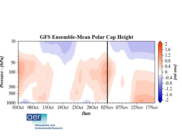
Latest showing a poleward Heat Flux by this chart from Dr Cohen that he put out yesterday.
Scott, it is a fugly loo lk on the GEFS for sure but the LR looks to be better as we progress through the week. Next weekend is Lomond much more late fall winteris looking. How long it holds remains to be seen but I see the Negative EPO as a good sign. Low solar and a N QBO which we don't have a clue idea how it works in depth but most indicators show from limited research that it has aN effect on the NAO to be more in a negative phase and also in conjuction helps with a more N AO state.
Euro next Sunday let's see where it goes from here the next few days.

amugs- Advanced Forecaster - Mod

- Posts : 15093
Join date : 2013-01-07
Re: 2017-18 Winter Discussion thread
![]() by amugs Fri Nov 03, 2017 11:34 pm
by amugs Fri Nov 03, 2017 11:34 pm
East Based La Nina bottom one is for an EB Nina with an EB QBO
QBO composite for Dec umm where does one sign??

QBO composite for Dec umm where does one sign??
_________________
Mugs
AKA:King: Snow Weenie
Self Proclaimed
WINTER 2014-15 : 55.12" +.02 for 6 coatings (avg. 35")
WINTER 2015-16 Total - 29.8" (Avg 35")
WINTER 2016-17 : 39.5" so far

amugs- Advanced Forecaster - Mod
- Posts : 15093
Reputation : 213
Join date : 2013-01-07
Age : 54
Location : Hillsdale,NJ
Re: 2017-18 Winter Discussion thread
![]() by Math23x7 Sat Nov 04, 2017 12:04 am
by Math23x7 Sat Nov 04, 2017 12:04 am
I have seen weather enthusiasts using 1995-96 as an analog, especially given that it was a warm October in the east with a La Nina.
What they need to know is that by early November 1995, the -NAO/-AO couplet was in full swing and would have an influence in the overall pattern for much of the following five months. If this winter is going to even resemble 1995-96, we need the blocking to develop first.
Heck, October 2007 was also a warm October in the east with a La Nina. How come nobody is using 2007-08 as an analog (NYC had 11.9" of snow the entire winter)?
Math23x7- Wx Statistician Guru

- Posts : 2379
Reputation : 68
Join date : 2013-01-08
Re: 2017-18 Winter Discussion thread
![]() by algae888 Sat Nov 04, 2017 6:55 am
by algae888 Sat Nov 04, 2017 6:55 am
Mike most of the winter forecast that I have read are using 2007 and 8 as an analog if you think about that year it was a very gradient set up with areas on the Connecticut Massachusetts Border North had a very good winter if it's the same set up and drop that gradient a hundred miles south we also could have a good winter here. I believe we will be very close to that gradient this year so areas in central Southern Jersey South may have a tough Winter We are on the border and areas North could have a very good one that's the way I'm looking at it right nowMath23x7 wrote:I have seen weather enthusiasts using 1995-96 as an analog, especially given that it was a warm October in the east with a La Nina.
What they need to know is that by early November 1995, the -NAO/-AO couplet was in full swing and would have an influence in the overall pattern for much of the following five months. If this winter is going to even resemble 1995-96, we need the blocking to develop first.
Heck, October 2007 was also a warm October in the east with a La Nina. How come nobody is using 2007-08 as an analog (NYC had 11.9" of snow the entire winter)?

algae888- Advanced Forecaster
- Posts : 5311
Reputation : 46
Join date : 2013-02-05
Age : 61
Location : mt. vernon, new york
Re: 2017-18 Winter Discussion thread
![]() by amugs Sun Nov 05, 2017 7:54 am
by amugs Sun Nov 05, 2017 7:54 am
From Vendor Weather who has done a good job with winter forecasts the past few years.
https://www.vencoreweather.com/20172018-winter-outlook
https://www.vencoreweather.com/20172018-winter-outlook
_________________
Mugs
AKA:King: Snow Weenie
Self Proclaimed
WINTER 2014-15 : 55.12" +.02 for 6 coatings (avg. 35")
WINTER 2015-16 Total - 29.8" (Avg 35")
WINTER 2016-17 : 39.5" so far
amugs- Advanced Forecaster - Mod
- Posts : 15093
Reputation : 213
Join date : 2013-01-07
Age : 54
Location : Hillsdale,NJ
Re: 2017-18 Winter Discussion thread
![]() by Isotherm Tue Nov 07, 2017 2:04 pm
by Isotherm Tue Nov 07, 2017 2:04 pm
A few inquiries to ponder:
[1] Are the geopotential height rises progged by model guidance over the NATL consistent with current hemispheric and global physical forcing mechanisms?
[2] If yes, are those forcing mechanisms indicative of an ephemeral pulse of favorability, or will they persist overall for the duration of the cold season?
[3] With respect to any seasonal guidance suggestive of a mean -NAO/AO pattern, what factors have or have not altered over the past year which would enable that guidance to verify? Conversely, concerning any seasonal guidance indicative of a mean +NAO/AO - are the variables which aided in inducing a stronger than normal vortex still present?
NAO prognostication is multifactorial, so it is important to examine all factors.
My opinion is that there is a legitimate phase change occurring, due in part to positive feedback with vortex weakening via wave 2 forcing, which, contemporaneously with poleward -AAM propagation and other top-down factors such as easterly shear stress, will permit a response in the troposphere. However, in the medium to longer term, the tropospheric pattern begins to evolve such that it projects more strongly onto a vortex intensification precursor. This will complicate matters down the road, specifically with regards to the extent to which the upcoming -NAO action center persists. That question will be parsed out as we get a little closer; let's first enter the medium range of block initiation.
Isotherm- Advanced Forecaster
- Posts : 231
Reputation : 4
Join date : 2014-09-01
Age : 33
Location : Monmouth County, NJ -

Re: 2017-18 Winter Discussion thread
![]() by dkodgis Tue Nov 07, 2017 8:27 pm
by dkodgis Tue Nov 07, 2017 8:27 pm
This is why I love this board. I don't often read and not understand what I read. Time to write that tuition check. 

dkodgis- Senior Enthusiast

- Posts : 2494
Reputation : 98
Join date : 2013-12-29
Re: 2017-18 Winter Discussion thread
![]() by Isotherm Wed Nov 08, 2017 11:23 am
by Isotherm Wed Nov 08, 2017 11:23 am
It appears to me that the upcoming NATL block initiation is due - at least in part - to the circum-global propagation of upper divergence associated with the prior MJO forcing. We recently had a robust phase 8 disturbance, which, while it weakened significantly into the COD on the CPC diagrams, one can still track the eastward propagation of the -VP through the Atlantic and into Africa October 30-Nov7th. This signal induces planetary wave propagation usually resulting in sufficient turbulence to influence the NAO modality approximately 7-10 days later - which, to no surprise, seems to be initiating circa the 13th-15th of November. The forcing for the -NAO is certainly there, but does it have the maintenance power of some of our impressive early blocking stretches such as 2010, 2009, 1995?
Isotherm- Advanced Forecaster
- Posts : 231
Reputation : 4
Join date : 2014-09-01
Age : 33
Location : Monmouth County, NJ -
Page 6 of 6 • 1, 2, 3, 4, 5, 6
Permissions in this forum:
You cannot reply to topics in this forum