02/20 Snow Event - Largest Snowfall Since November?
+28
nutleyblizzard
Dunnzoo
frank 638
Fededle22
Aiosamoney21
DAYBLAZER
moleson
oldtimer
CPcantmeasuresnow
sroc4
Roger92
docstox12
dkodgis
amugs
Snow88
weatherwatchermom
bobjohnsonforthehall
RJB8525
brownie
aiannone
heehaw453
algae888
billg315
SoulSingMG
SENJsnowman
rb924119
hyde345
Frank_Wx
32 posters
Page 1 of 5 • 1, 2, 3, 4, 5 
 02/20 Snow Event - Largest Snowfall Since November?
There are two things I can't believe as I type this:
1. For some people this could be their largest snowfall event since the November snowstorm. Let that sink in. All of December, January and most of February pass and 3-6" could be our largest event since then. Mamma mia!
2. Damn Governor Phil Murphy declares a State of Emergency for NJ for EVERY winter storm. Every one. The last one where barely .10" of sleet fell he declared a SOE. Come on, dude.
The storm looks impressive.
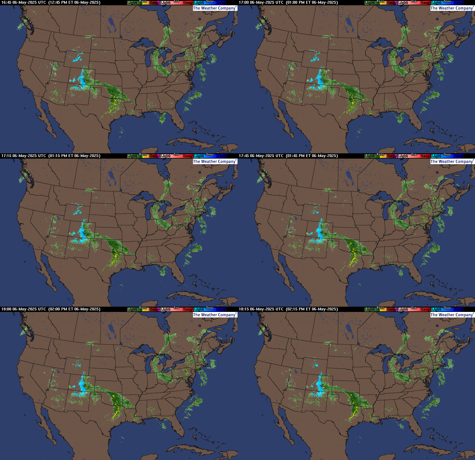
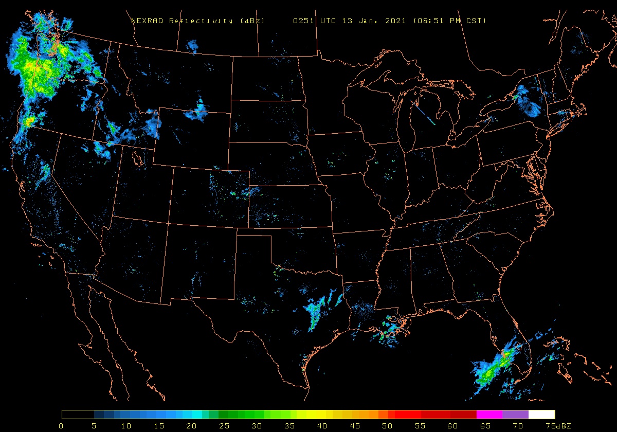
Right now the Northeast is under the influence of a huge 1036mb High Pressure centered over NY. Notice how the winds are coming from the north-northwest. Boundary layer temps are plenty of cold right now. Most low's tonight are forecasted to be in the upper teens to low 20's. Point I am making is the cold air is well entrenched from this HP to our north.
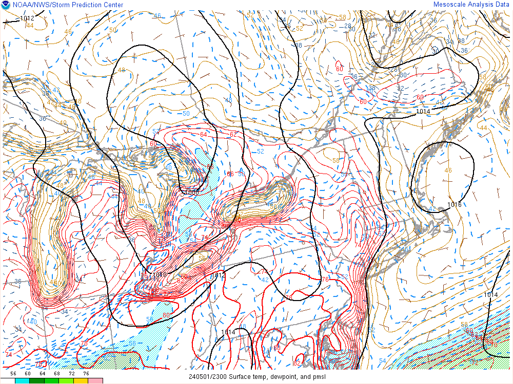
And then there is this 300mb jet streak over New England. As the storm approaches from the southwest, hence the term southwest flow event, it may run into some instability and cause enhanced precip rates.

Some short-res models do show intense bands coming across east-central and central NJ during the afternoon hours.
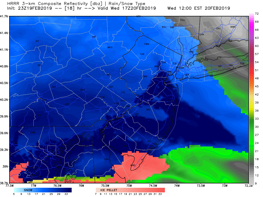
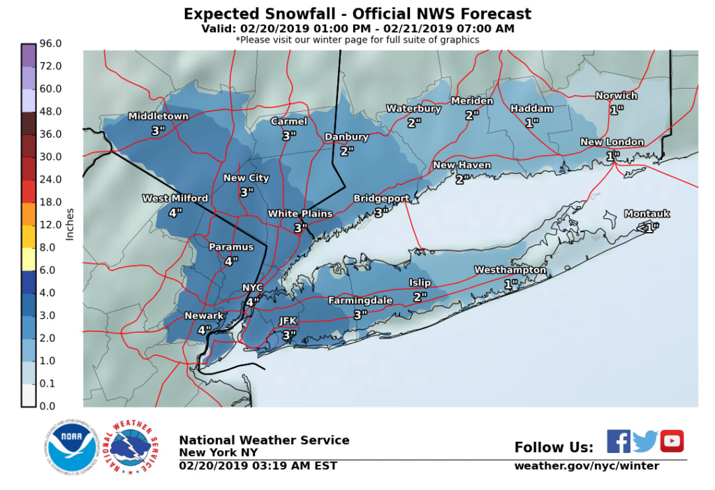
Make no mistake, the best dynamics and best lift will happen well to our south & west toward western and central PA. We're simply too far from the best action to see high snow amounts from this system. But I do think, for our area, this went from a 1-2" storm to a decent 3-5" in some places S&W of NYC. Here is my thinking based off current observations and latest guidance.
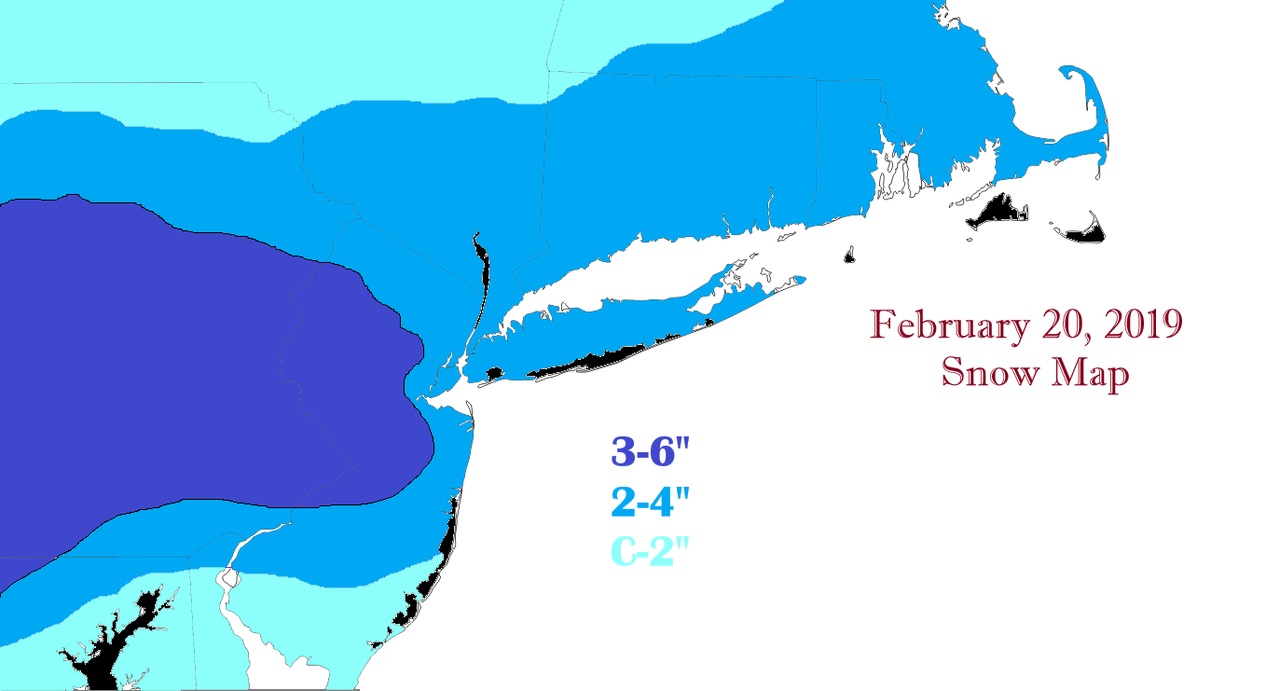
Everyone will initially suffer from virga, but I do think those N&W of NYC will particularly struggle with it until the High begins to shift east. But these are my thoughts for now.
Happy Tracking! Ciao for now.
1. For some people this could be their largest snowfall event since the November snowstorm. Let that sink in. All of December, January and most of February pass and 3-6" could be our largest event since then. Mamma mia!
2. Damn Governor Phil Murphy declares a State of Emergency for NJ for EVERY winter storm. Every one. The last one where barely .10" of sleet fell he declared a SOE. Come on, dude.
The storm looks impressive.


Right now the Northeast is under the influence of a huge 1036mb High Pressure centered over NY. Notice how the winds are coming from the north-northwest. Boundary layer temps are plenty of cold right now. Most low's tonight are forecasted to be in the upper teens to low 20's. Point I am making is the cold air is well entrenched from this HP to our north.

And then there is this 300mb jet streak over New England. As the storm approaches from the southwest, hence the term southwest flow event, it may run into some instability and cause enhanced precip rates.

Some short-res models do show intense bands coming across east-central and central NJ during the afternoon hours.

Make no mistake, the best dynamics and best lift will happen well to our south & west toward western and central PA. We're simply too far from the best action to see high snow amounts from this system. But I do think, for our area, this went from a 1-2" storm to a decent 3-5" in some places S&W of NYC. Here is my thinking based off current observations and latest guidance.

Everyone will initially suffer from virga, but I do think those N&W of NYC will particularly struggle with it until the High begins to shift east. But these are my thoughts for now.
Happy Tracking! Ciao for now.
_________________
_______________________________________________________________________________________________________
CLICK HERE to view NJ Strong Snowstorm Classifications
 Re: 02/20 Snow Event - Largest Snowfall Since November?
Like the map, Frank. I agree N&W will struggle big time with dry air and north of 84 I think we only see 1 or 2 before changeover. NYC metro sees 2 or 3, S&W of there does well.
hyde345- Pro Enthusiast

- Posts : 1082
Reputation : 48
Join date : 2013-01-08
Location : Hyde Park, NY
 Re: 02/20 Snow Event - Largest Snowfall Since November?
Nice Frank!!! My own opinion remains unchanged, however; anywhere east of D.C’s longitude will see light snow amounts (a general 1-3”/2-4”) event then fairly quickly going over to slop. I do not buy these higher totals being projected by some modeling/forecast outlets.
rb924119- Meteorologist

- Posts : 6928
Reputation : 194
Join date : 2013-02-06
Age : 32
Location : Greentown, Pa
 Re: 02/20 Snow Event - Largest Snowfall Since November?
Thanks Frank for the write up! I believe our highest single snowfall down here in central/northern Ocean County is like 2.5-3". Lol! Tomorrow could be our top haul yet!
The only thing more ridiculous than that is...I don't think it will be!! I think we'll hit 2-2.5" or so. We'll get that primarily in 3-4 hours (noon - 4 pm) which is cool and it looks like we'll able to fashion another legit family snow day out of it (timing is gooooooood on that end...), but the warm air is coming to the Shore from 2/3 of its flank at the same time. The change time has crept up and I think that's a bad sign too.
Still, I'll be way happy to get at least 2" tomorrow afternoon.
I'm going to look at the latest guidance and try to post what I see as it relates to the coastal plain and temps, it is late tho...
SENJsnowman- Senior Enthusiast

- Posts : 1189
Reputation : 61
Join date : 2017-01-06
Age : 51
Location : Bayville, NJ

SoulSingMG- Senior Enthusiast

- Posts : 2853
Reputation : 74
Join date : 2013-12-11
Location : Long Island City, NY
rb924119- Meteorologist

- Posts : 6928
Reputation : 194
Join date : 2013-02-06
Age : 32
Location : Greentown, Pa
 Re: 02/20 Snow Event - Largest Snowfall Since November?
rb, looks like the sr models all reduced their totals to about 2-3" tops for most of our region. Some now show NNJ/NEPA as the jackpot zones of 4-6".
Early dismissal for Berkeley Township schools...sooo nice living in a small town, where they can afford to wait and make sensible decisions in real time.
So, just from a selfish standpoint, that makes my day. Today WILL BE a fun snow day at Casa Lebo.
Early dismissal for Berkeley Township schools...sooo nice living in a small town, where they can afford to wait and make sensible decisions in real time.
So, just from a selfish standpoint, that makes my day. Today WILL BE a fun snow day at Casa Lebo.

SENJsnowman- Senior Enthusiast

- Posts : 1189
Reputation : 61
Join date : 2017-01-06
Age : 51
Location : Bayville, NJ
 Re: 02/20 Snow Event - Largest Snowfall Since November?
Looking at the lower layers of the atmosphere, the coast gets warm at the surface and the ocean winds do start to come on shore at 10 m.
Maybe harder snow rates can overcome that a bit.
Here is 700 mb and 850 mb wind directions, both seem to blow offshore.


As the 10 m the winds are coming onshore, things are pretty warm at the surface...not a good look at all here, and it's early, too (about 5 pm). Again, thinking the harder rates will overcome this, but not the lighter snowfall.


All things considered 1.5-2" along the coast seems about right under the circumstances...
Maybe harder snow rates can overcome that a bit.
Here is 700 mb and 850 mb wind directions, both seem to blow offshore.


As the 10 m the winds are coming onshore, things are pretty warm at the surface...not a good look at all here, and it's early, too (about 5 pm). Again, thinking the harder rates will overcome this, but not the lighter snowfall.


All things considered 1.5-2" along the coast seems about right under the circumstances...
SENJsnowman- Senior Enthusiast

- Posts : 1189
Reputation : 61
Join date : 2017-01-06
Age : 51
Location : Bayville, NJ
 Re: 02/20 Snow Event - Largest Snowfall Since November?
I’m thinking generally 1-3” across most of Central and North NJ. In areas where a heavy band sets up before the changeover you may hit 4”. I think initial snow will be light and with sun angle (late Feb sun angle = mid October; the sun angle for Nov storm = mid-Jan. so it was heading into its weakest phase and not a factor) snow may not accumulate on pavement in late morn/early afternoon until it gets moderate in intensity. If that High slides east it will open up the warm air tap and we’ll change a little quicker than modeled.

billg315- Advanced Forecaster - Mod

- Posts : 4483
Reputation : 185
Join date : 2015-01-24
Age : 50
Location : Flemington, NJ

billg315- Advanced Forecaster - Mod

- Posts : 4483
Reputation : 185
Join date : 2015-01-24
Age : 50
Location : Flemington, NJ
 Re: 02/20 Snow Event - Largest Snowfall Since November?
My current dew point is 13* and humidity 54% so air is fairly dry to say the least.

billg315- Advanced Forecaster - Mod

- Posts : 4483
Reputation : 185
Join date : 2015-01-24
Age : 50
Location : Flemington, NJ
 Re: 02/20 Snow Event - Largest Snowfall Since November?
Bill I agree ...I’m discounting any possible accumulation for the first hour of snowfall or the last hour. But there SHOULD be a nice 3-4 hour window for decent accumulating snow.
It’s so funny, I can’t get hyped, cuz at best it’s a duck fart storm followed by rain and warm.
But at the same time, no matter how much I downplay it, this could very well be my biggest snowfall for the season...so I guess I am hyped!
Here’s what I know: it’s gonna snow! I can feel it and I can smell it. It’s happening TODAY!
SENJsnowman- Senior Enthusiast

- Posts : 1189
Reputation : 61
Join date : 2017-01-06
Age : 51
Location : Bayville, NJ
 Re: 02/20 Snow Event - Largest Snowfall Since November?
Have to see how intense the bands are that role through between about 2 and 6 p.m. If snow starts lightly around noon, but doesn't get steady and start accumulating until about 1-2 p.m. and then changes to sleet and then quickly rain after 6 p.m., you are only going to get 4-5 hours of real snow accumulation. So if you look at it that way, IF it accumulated at an inch an hour that whole time (which is a good clip) you would get 4-5" max. But it probably won't snow at that clip the whole time and therefore 2 or 3" is more realistic. But, if before the snow changes, you get a good band or cell in an area that produces 1" an hour snow, you could maybe hit 4" in those locations (5" if it was a really intense 2" an hour band). You are just having to squeeze a lot out of this in a short time.

billg315- Advanced Forecaster - Mod

- Posts : 4483
Reputation : 185
Join date : 2015-01-24
Age : 50
Location : Flemington, NJ
 Re: 02/20 Snow Event - Largest Snowfall Since November?
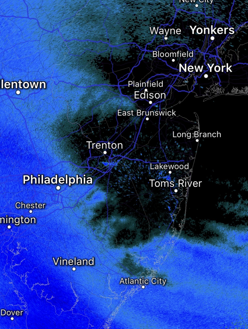
Light snow has commenced in Philadelphia at 9 am. If it can overcome the dry air, Central NJ could see the first flakes around 11 a.m., but still will take awhile thereafter to pick up in intensity. So I doubt you see steady snow until after noon. Northern NJ and NYC may not see flakes until between noon and 1 p.m.

billg315- Advanced Forecaster - Mod

- Posts : 4483
Reputation : 185
Join date : 2015-01-24
Age : 50
Location : Flemington, NJ
 Re: 02/20 Snow Event - Largest Snowfall Since November?
After the first hour even 90 min of snow, the radar looks stout! This could basically amount to a giant 3 hour long squall
SENJsnowman- Senior Enthusiast

- Posts : 1189
Reputation : 61
Join date : 2017-01-06
Age : 51
Location : Bayville, NJ

billg315- Advanced Forecaster - Mod

- Posts : 4483
Reputation : 185
Join date : 2015-01-24
Age : 50
Location : Flemington, NJ
 Re: 02/20 Snow Event - Largest Snowfall Since November?
System overachieving down south even reports of thunder and lightning in parts of Maryland in West Virginia. 3 to 6 in already on the ground in DC and Maryland and Virginia. Reports of 2 to 3 in an hour snowfall rates

algae888- Advanced Forecaster

- Posts : 5311
Reputation : 46
Join date : 2013-02-05
Age : 62
Location : mt. vernon, new york
 Re: 02/20 Snow Event - Largest Snowfall Since November?
Light snow has commenced here 26/10. NWS has 4" as of their 9 AM briefing for EPA. I think that is reasonable based on observations and radar. Let's see how it goes...
heehaw453- Advanced Forecaster

- Posts : 3906
Reputation : 86
Join date : 2014-01-20
Location : Bedminster Township, PA Elevation 600' ASL
 Re: 02/20 Snow Event - Largest Snowfall Since November?
24/16 here in Binghamton. NWS calling for 1-2" before the changeover
27/13 on LI. NWS calling for 1-3" before the changeover
27/13 on LI. NWS calling for 1-3" before the changeover
_________________
-Alex Iannone-

aiannone- Senior Enthusiast - Mod

- Posts : 4815
Reputation : 92
Join date : 2013-01-07
Location : Saint James, LI (Northwest Suffolk Co.)
 Re: 02/20 Snow Event - Largest Snowfall Since November?
algae888 wrote:System overachieving down south even reports of thunder and lightning in parts of Maryland in West Virginia. 3 to 6 in already on the ground in DC and Maryland and Virginia. Reports of 2 to 3 in an hour snowfall rates
Both the overachieving in the DC area and the fact that it is still falling as snow in DC and Maryland are very reminiscent of the November storm. Let's see if this one over-performs for us as well.

billg315- Advanced Forecaster - Mod

- Posts : 4483
Reputation : 185
Join date : 2015-01-24
Age : 50
Location : Flemington, NJ
 Re: 02/20 Snow Event - Largest Snowfall Since November?
Moderate snow. Cold surface is rendering completely covered blacktop and sidewalks in minutes. Just love a cold surface when it snows...
heehaw453- Advanced Forecaster

- Posts : 3906
Reputation : 86
Join date : 2014-01-20
Location : Bedminster Township, PA Elevation 600' ASL
 Re: 02/20 Snow Event - Largest Snowfall Since November?
29* and Cloudy here. Air is still a bit dry, but as some of those heavier radar echos move in I think it will saturate. One thing that will definitely help accumulation is if this thing comes out of the gates gangbusters and we don't have two hours of light snow to deal with before it accumulates. As heehaw pointed out, if it goes to moderate snow quickly, it will accumulate on paved surfaces quickly.

billg315- Advanced Forecaster - Mod

- Posts : 4483
Reputation : 185
Join date : 2015-01-24
Age : 50
Location : Flemington, NJ
 Re: 02/20 Snow Event - Largest Snowfall Since November?
Heavy snow! Came in like a wall and there's plenty of goodness behind it.
heehaw453- Advanced Forecaster

- Posts : 3906
Reputation : 86
Join date : 2014-01-20
Location : Bedminster Township, PA Elevation 600' ASL
 Re: 02/20 Snow Event - Largest Snowfall Since November?
Decent snow in ocean county already. Sticking to cars and cars and frozen dirt. Big time early start and very moderate snow already
Wow!
Wow!
SENJsnowman- Senior Enthusiast

- Posts : 1189
Reputation : 61
Join date : 2017-01-06
Age : 51
Location : Bayville, NJ
 Re: 02/20 Snow Event - Largest Snowfall Since November?
As expected I am under radar returns right now, but it is just cloudy. So the battle between the dry air and the precipitation is under way. From the reports I'm hearing to my west (heehaw) and south (SENJ) I'd expect the snow to win that battle here in the next hour and go rather quickly to a moderate to heavy snow. That, for those hoping for an overachiever here, is good news.

billg315- Advanced Forecaster - Mod

- Posts : 4483
Reputation : 185
Join date : 2015-01-24
Age : 50
Location : Flemington, NJ
Page 1 of 5 • 1, 2, 3, 4, 5 
Permissions in this forum:
You cannot reply to topics in this forum|
|
|

 Home
Home
