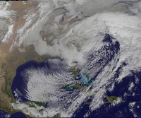
March 20th Storm
+16
Fededle22
skinsfan1177
Grselig
Dunnzoo
CPcantmeasuresnow
snow247
chrism
docstox12
NjWeatherGuy
jmanley32
algae888
rb924119
sroc4
amugs
oldtimer
Frank_Wx
20 posters
Page 2 of 4 •  1, 2, 3, 4
 Re: March 20th Storm
12z runs seem to show 4-6 in this neck of the woods which would be robust for this time of year and a nice final storm and a good trend. Question is can it hold for 2 days because I cant see how it trends a whole lot better. Dont want to see trends start to burn us in the wrong direction.
NjWeatherGuy- Advanced Forecaster

- Posts : 4100
Join date : 2013-01-06
 Re: March 20th Storm
A word from the meteorlogical prophet Scott!!
AMEN!!!
AMEN!!!
amugs- Advanced Forecaster - Mod

- Posts : 15093
Join date : 2013-01-07
 Re: March 20th Storm
rb924119 wrote:rb924119 wrote:sroc4 wrote:Hey rb or whomever. Do you recall where the discussion about the jet streak quadrants that rb wrote up are. If so can seine let me know?
It starts here and then goes through a few more of the following pages. I think there's also another discussion about other synoptic-scale forcing here too. I can't remember, though lol
https://www.njstrongweatherforum.com/t496p50-sunday-monday-snowstorm-2nd-call-snow-map
Here's the second discussion:
https://www.njstrongweatherforum.com/t496p150-sunday-monday-snowstorm-2nd-call-snow-map
Perfect! Thanks rb. I will eventually move this to the education thread.
_________________
"In weather and in life, there's no winning and losing; there's only winning and learning."
WINTER 2012/2013 TOTALS 43.65"WINTER 2017/2018 TOTALS 62.85" WINTER 2022/2023 TOTALS 4.9"
WINTER 2013/2014 TOTALS 64.85"WINTER 2018/2019 TOTALS 14.25" WINTER 2023/2024 TOTALS 13.1"
WINTER 2014/2015 TOTALS 71.20"WINTER 2019/2020 TOTALS 6.35"
WINTER 2015/2016 TOTALS 35.00"WINTER 2020/2021 TOTALS 37.75"
WINTER 2016/2017 TOTALS 42.25"WINTER 2021/2022 TOTALS 31.65"

sroc4- Admin

- Posts : 8331
Reputation : 301
Join date : 2013-01-07
Location : Wading River, LI
 Re: March 20th Storm
NWS has me maybe 2 to 3, Inaccuweather 3 to 6.Will be colder up here so it should be all snow and stick.This could get me above 70 inches for the season, pretty darn good since we missed Juno.

docstox12- Wx Statistician Guru

- Posts : 8504
Reputation : 222
Join date : 2013-01-07
Age : 73
Location : Monroe NY
 Re: March 20th Storm
EURO a little warm at surface, but if precip is coming down at a steady rate I think it should stick on colder surface or side roads. Not sure about main roads. 850's warm up toward the end.


Either way, this looks like a solid 3-6" event as of now but will have to take a closer look at the upper levels tonight when I make my snow map.


Either way, this looks like a solid 3-6" event as of now but will have to take a closer look at the upper levels tonight when I make my snow map.
_________________
_______________________________________________________________________________________________________
CLICK HERE to view NJ Strong Snowstorm Classifications
 Re: March 20th Storm
Hmmm, I haven't done a thorough investigation, but it would seem that the numbers that the globals are putting out for this event seem overdone, quite a bit, in fact. Here are my reasons:
1) H3 jet streak, while located favorably, is relatively weak and highly elongated. This reduces the amount of synoptic-scale forcing for ascent in our area
2) H5 is only a strip of shear vorticity, and is associated with a WEAKENING shortwave. This will likely lead to a decrease in the forcing for ascent that it provides as it continues eastward.
3) Low-level warm air advection is not that strong, given that a gradient of ~8*C exists over a horizontal distance of approximately 300 miles (northern Virginia into northeastern Pennsylvania) at the 850 hPa level. Doing the math, this equates to a drop of 1*C per 40 miles (about). Combine this with a quartering upglide of about 20-30 knots (isentropic lift) for much of the area, with the best lift (30-40 knots of more perpendicular flow to the pressure surfaces) occurring over southern PA/Mid-Atlantic coast, I think we just see steady light precipitation at best, with much of it ending by sunset as the front rolls through.
The problem lies in the fact that where the best low-level forcing will be occurring, it will be too warm for snow, but in the areas that will be, they will likely not see the best precipitation rates. I am thinking a general 1-3/2-4" type event right now, with mixing issues along the coastal plain.
rb924119- Meteorologist

- Posts : 6890
Reputation : 194
Join date : 2013-02-06
Age : 32
Location : Greentown, Pa
 Re: March 20th Storm
rb924119 wrote:Hmmm, I haven't done a thorough investigation, but it would seem that the numbers that the globals are putting out for this event seem overdone, quite a bit, in fact. Here are my reasons:
1) H3 jet streak, while located favorably, is relatively weak and highly elongated. This reduces the amount of synoptic-scale forcing for ascent in our area
2) H5 is only a strip of shear vorticity, and is associated with a WEAKENING shortwave. This will likely lead to a decrease in the forcing for ascent that it provides as it continues eastward.
3) Low-level warm air advection is not that strong, given that a gradient of ~8*C exists over a horizontal distance of approximately 300 miles (northern Virginia into northeastern Pennsylvania) at the 850 hPa level. Doing the math, this equates to a drop of 1*C per 40 miles (about). Combine this with a quartering upglide of about 20-30 knots (isentropic lift) for much of the area, with the best lift (30-40 knots of more perpendicular flow to the pressure surfaces) occurring over southern PA/Mid-Atlantic coast, I think we just see steady light precipitation at best, with much of it ending by sunset as the front rolls through.
The problem lies in the fact that where the best low-level forcing will be occurring, it will be too warm for snow, but in the areas that will be, they will likely not see the best precipitation rates. I am thinking a general 1-3/2-4" type event right now, with mixing issues along the coastal plain.
I have not even looked at upper air yet, so I can not agree or disagree with your analysis right now. But I will say that it's valid and I would not be surprised if this event trends warmer. Will have to take a closer look tonight
_________________
_______________________________________________________________________________________________________
CLICK HERE to view NJ Strong Snowstorm Classifications
 Re: March 20th Storm
15Z SREFS!!!


Last edited by amugs on Wed Mar 18, 2015 3:15 pm; edited 1 time in total
_________________
Mugs
AKA:King: Snow Weenie
Self Proclaimed
WINTER 2014-15 : 55.12" +.02 for 6 coatings (avg. 35")
WINTER 2015-16 Total - 29.8" (Avg 35")
WINTER 2016-17 : 39.5" so far

amugs- Advanced Forecaster - Mod

- Posts : 15093
Reputation : 213
Join date : 2013-01-07
Age : 54
Location : Hillsdale,NJ
 Re: March 20th Storm
Compare to 9Z SREFS!


_________________
Mugs
AKA:King: Snow Weenie
Self Proclaimed
WINTER 2014-15 : 55.12" +.02 for 6 coatings (avg. 35")
WINTER 2015-16 Total - 29.8" (Avg 35")
WINTER 2016-17 : 39.5" so far

amugs- Advanced Forecaster - Mod

- Posts : 15093
Reputation : 213
Join date : 2013-01-07
Age : 54
Location : Hillsdale,NJ
 Re: March 20th Storm
I think Long gets a coating-2 at most
chrism- Posts : 14
Reputation : 0
Join date : 2015-01-02
 Re: March 20th Storm
chrism wrote:I think Long gets a coating-2 at most
You think Long............................Island?
_________________
"In weather and in life, there's no winning and losing; there's only winning and learning."
WINTER 2012/2013 TOTALS 43.65"WINTER 2017/2018 TOTALS 62.85" WINTER 2022/2023 TOTALS 4.9"
WINTER 2013/2014 TOTALS 64.85"WINTER 2018/2019 TOTALS 14.25" WINTER 2023/2024 TOTALS 13.1"
WINTER 2014/2015 TOTALS 71.20"WINTER 2019/2020 TOTALS 6.35"
WINTER 2015/2016 TOTALS 35.00"WINTER 2020/2021 TOTALS 37.75"
WINTER 2016/2017 TOTALS 42.25"WINTER 2021/2022 TOTALS 31.65"

sroc4- Admin

- Posts : 8331
Reputation : 301
Join date : 2013-01-07
Location : Wading River, LI
 Re: March 20th Storm
Haha,what a lame typo,sorry guys,yes Long Island gets a coating to 2 inches
chrism- Posts : 14
Reputation : 0
Join date : 2015-01-02
 Re: March 20th Storm
FRI INTO SAT...
12Z GFS/ECMWF COMING INTO SOME AGREEMENT INTO WEEKEND. WE
DISCOUNTED 12Z NAM GIVEN ITS MORE SUPPRESSED SOLUTION WHICH DOES
NOT FIT LARGER SCALE PATTERN IN PLACE.
CONFIDENCE NOT AS HIGH AS WE WOULD LIKE FOR FRI INTO SAT.
TYPICALLY THESE LATE SEASON EVENTS CAN THROW A LOT OF COMPLICATING
FACTORS INTO MIX AND THIS IS NO EXCEPTION...INCLUDING HIGHER SUN
ANGLE AND AMOUNT OF LOW LEVEL WARMING AND POTENTIAL FOR AN
ISOTHERMAL ENVIRONMENT IN WHICH PRECIPITATION TYPE BECOMES VERY
DEPENDENT ON INTENSITY.
DESPITE SURFACE HIGH BEING LOCATED TO OUR E WHICH TENDS TO FAVOR
WARMER SOLUTION AND FASTER CHANGE TO RAIN...MODELS DO INDICATE
GOOD COLD AIR DAMMING SIGNATURE INTO AT LEAST INTERIOR WHICH
SHOULD KEEP COLD LOCKED IN LONGER...ESPECIALLY GIVEN NORTHERLY LOW
LEVEL AGEOSTROPHIC FLOW. IT IS ALSO RATHER COLD ALOFT WITH 925 MB
TEMPERATURES BELOW ZERO THROUGH AT LEAST FIRST HALF OF FRI NIGHT.
ALTHOUGH THERE ARE TRACK DIFFERENCES BETWEEN ECMWF AND GFS /WITH
ECMWF A BIT CLOSER TO COAST/ THERMAL PROFILES ARE ACTUALLY RATHER
CLOSE. THIS WOULD FAVOR SNOW AT ONSET FRI AFTERNOON AND EVENING...
BEFORE TRANSITION TO RAIN/SNOW MIX INTO NE NJ...NYC AND LONG
ISLAND FRI NIGHT AND POSSIBLY INTO COASTAL CT AS WELL. RIGHT NOW
LOCATIONS FARTHER N LOOK TO REMAIN MOSTLY SNOW.
AS FAR AS ACCUMULATIONS...WE ARE MOST LIKELY LOOKING AT AN
ADVISORY-LEVEL EVENT WITH HIGHER TOTALS FOCUSED ACROSS LOWER
HUDSON VALLEY AND POSSIBLY PORTIONS OF S CT AWAY FROM COAST.
HOWEVER SINCE SNOW SHOULD BEGIN FRI AFTERNOON THERE IS EXPECTED TO
BE SOME IMPACT TO FRI EVENING RUSH HOUR.
SUN THROUGH WED...
COLD FRONT PASSES THROUGH EARLY SUN MORNING...FOLLOWED BY DRY BUT
SEASONABLY COLD WEATHER AS HIGH PRESSURE DOMINATES INTO EARLY NEXT
WEEK. THERE IS SOME POTENTIAL OF YET ANOTHER COASTAL LOW BY TUE OR
WED...BUT CONFIDENCE IS OBVIOUSLY LOW ONE WEEK OUT AND IT MAY VERY
WELL REMAIN OFFSHORE.

snow247- Pro Enthusiast

- Posts : 2417
Reputation : 0
Join date : 2014-08-27
Location : Mount Ivy, NY - Elevation 545'
 Re: March 20th Storm
Careful, if it keeps up could trend warm for us and snow further north, its pretty marginal as it is.amugs wrote:15Z SREFS!!!

NjWeatherGuy- Advanced Forecaster

- Posts : 4100
Reputation : 28
Join date : 2013-01-06
Location : Belle Mead, NJ
 Re: March 20th Storm
I doubt it will trend north, everything seems to trend south lately.

snow247- Pro Enthusiast

- Posts : 2417
Reputation : 0
Join date : 2014-08-27
Location : Mount Ivy, NY - Elevation 545'
 Re: March 20th Storm
Exactly, snow.Look at that storm for next week.CNJ south and east get blasted while we are yet again on the northern fringe.Uncanny!

docstox12- Wx Statistician Guru

- Posts : 8504
Reputation : 222
Join date : 2013-01-07
Age : 73
Location : Monroe NY
 Re: March 20th Storm
Thats got more then enough time to trend to a friggin glc or there could be no storm at all. These spring setups are very delicate and climo always favorites northern areas over coastal plain. Yes i know what happened last year with the pv but i doubt the cold will be that suppressing. EURO has a SWFE which is a hit from CNJ north.docstox12 wrote:Exactly, snow.Look at that storm for next week.CNJ south and east get blasted while we are yet again on the northern fringe.Uncanny!

NjWeatherGuy- Advanced Forecaster

- Posts : 4100
Reputation : 28
Join date : 2013-01-06
Location : Belle Mead, NJ
 Re: March 20th Storm
Uptons map is very elevation dependent, 2-3 for most and spotty 3-4 areas in northern higher mountains/hills.

snow247- Pro Enthusiast

- Posts : 2417
Reputation : 0
Join date : 2014-08-27
Location : Mount Ivy, NY - Elevation 545'
 Re: March 20th Storm
tehe he...Upton. Starting now we should count how many times that snowfall map changes. The over under is 4 by Friday 10pm


_________________
"In weather and in life, there's no winning and losing; there's only winning and learning."
WINTER 2012/2013 TOTALS 43.65"WINTER 2017/2018 TOTALS 62.85" WINTER 2022/2023 TOTALS 4.9"
WINTER 2013/2014 TOTALS 64.85"WINTER 2018/2019 TOTALS 14.25" WINTER 2023/2024 TOTALS 13.1"
WINTER 2014/2015 TOTALS 71.20"WINTER 2019/2020 TOTALS 6.35"
WINTER 2015/2016 TOTALS 35.00"WINTER 2020/2021 TOTALS 37.75"
WINTER 2016/2017 TOTALS 42.25"WINTER 2021/2022 TOTALS 31.65"

sroc4- Admin

- Posts : 8331
Reputation : 301
Join date : 2013-01-07
Location : Wading River, LI
 Re: March 20th Storm
sroc4 wrote:tehe he...Upton. Starting now we should count how many times that snowfall map changes. The over under is 4 by Friday 10pm
I'd agree with this map as it stands now.
rb924119- Meteorologist

- Posts : 6890
Reputation : 194
Join date : 2013-02-06
Age : 32
Location : Greentown, Pa
 Re: March 20th Storm
NjWeatherGuy wrote:Careful, if it keeps up could trend warm for us and snow further north, its pretty marginal as it is.amugs wrote:15Z SREFS!!!
None of this dark green will ever hit the ground north of the TZ bridge even if it shows up as 30dbz bands on the radar. I learned that from the last storm. Expect nothing recieve nothing.

CPcantmeasuresnow- Wx Statistician Guru

- Posts : 7274
Reputation : 230
Join date : 2013-01-07
Age : 103
Location : Eastern Orange County, NY
 Re: March 20th Storm
rb924119 wrote:sroc4 wrote:tehe he...Upton. Starting now we should count how many times that snowfall map changes. The over under is 4 by Friday 10pm
I'd agree with this map as it stands now.
that map is from 8am this morning. In there disco upton mentions advisory level snow which i believe is at least 3". Their map should change shortly. Prob 3-4" for most

algae888- Advanced Forecaster

- Posts : 5311
Reputation : 46
Join date : 2013-02-05
Age : 61
Location : mt. vernon, new york
 Re: March 20th Storm
FOR the love of GOD UPTON! Playing the climo song here I see. I think they will be upping their snowfall amounts as we move closer to Friday due to the cold air that is taking hold with this -EPO - god I love that weather indicy along with its mutual partner +PNA!! The - NAO has a lot to be determined imb!
Prophet Scott Says over/under 4 - my bet is even money (4)!!
WPC says 4 - hahaha - inches that is!

Prophet Scott Says over/under 4 - my bet is even money (4)!!
WPC says 4 - hahaha - inches that is!

_________________
Mugs
AKA:King: Snow Weenie
Self Proclaimed
WINTER 2014-15 : 55.12" +.02 for 6 coatings (avg. 35")
WINTER 2015-16 Total - 29.8" (Avg 35")
WINTER 2016-17 : 39.5" so far

amugs- Advanced Forecaster - Mod

- Posts : 15093
Reputation : 213
Join date : 2013-01-07
Age : 54
Location : Hillsdale,NJ
 Re: March 20th Storm
Mt. Holly doing the same mugs, look at their map, 3+ confined to higher elevations in NWNJ, safe inital call with time to trend, if storm holds we know itll tick up each update in southern regions.

NjWeatherGuy- Advanced Forecaster

- Posts : 4100
Reputation : 28
Join date : 2013-01-06
Location : Belle Mead, NJ
 Re: March 20th Storm
Just like that 18z NAM trended significantly south, lol model madness, must be why nobodys talking about it or posting maps haha.

NjWeatherGuy- Advanced Forecaster

- Posts : 4100
Reputation : 28
Join date : 2013-01-06
Location : Belle Mead, NJ
 Re: March 20th Storm
dat NAM 

_________________
"In weather and in life, there's no winning and losing; there's only winning and learning."
WINTER 2012/2013 TOTALS 43.65"WINTER 2017/2018 TOTALS 62.85" WINTER 2022/2023 TOTALS 4.9"
WINTER 2013/2014 TOTALS 64.85"WINTER 2018/2019 TOTALS 14.25" WINTER 2023/2024 TOTALS 13.1"
WINTER 2014/2015 TOTALS 71.20"WINTER 2019/2020 TOTALS 6.35"
WINTER 2015/2016 TOTALS 35.00"WINTER 2020/2021 TOTALS 37.75"
WINTER 2016/2017 TOTALS 42.25"WINTER 2021/2022 TOTALS 31.65"

sroc4- Admin

- Posts : 8331
Reputation : 301
Join date : 2013-01-07
Location : Wading River, LI

snow247- Pro Enthusiast

- Posts : 2417
Reputation : 0
Join date : 2014-08-27
Location : Mount Ivy, NY - Elevation 545'
Page 2 of 4 •  1, 2, 3, 4
Permissions in this forum:
You cannot reply to topics in this forum|
|
|

 Home
Home