Hurricane Hermine Discussion Part 2
+42
WeatherJeff1224
Dunnzoo
Mathgod55
jake732
track17
lisalamb
Artechmetals
GreyBeard
RJB8525
Cyanide02Z06
jwalsh
hyde345
Dtone
Chris3379
Quietace
docstox12
algae888
billg315
pdubz
SoulSingMG
Snow88
oldtimer
HectorO
Joe Snow
NjWeatherGuy
frank 638
aiannone
Grselig
roccuweather
sroc4
WeatherBob
Math23x7
snow247
nutleyblizzard
jmanley32
amugs
Frank_Wx
weatherwatchermom
rb924119
dsix85
skinsfan1177
Sanchize06
46 posters
Page 26 of 35
Page 26 of 35 •  1 ... 14 ... 25, 26, 27 ... 30 ... 35
 Re: Hurricane Hermine Discussion Part 2
Well poo lol I guess I pretty much knew this yesterday. Everyone have a gr8 holiday and I'm sure c we will b tracking something new in the coming weeks. Why do I still have a warning with no changes still expecting ts winds etc?
jmanley32- Senior Enthusiast

- Posts : 20513
Join date : 2013-12-12
 Re: Hurricane Hermine Discussion Part 2
weatherwatchermom wrote:Thank goodness for the coastal town s...I am not unhappy..there is a difference in wishing for a blizzard with 50 feet of snow(I know there are safety risks too) than a hurricane that destroys people s lives....it is great and frustrating for all that analyze....all of us that invested hours..you all tracking and others waited with baited breath to read the next post...but it will be interesting to me to see the analysis that I know you guys will do of what happened...there are a lot of great minds on this forum.....there will be many upset people who cut vacations short who will not listen the next time...hope you all get some rest and recharge for the next one
A 50 feet of snow blizzard here would have killed us all and done more than Sandy and all other storms combined. We could have had a light tropical storm come around and give us some rainfall and wind, it wasnt necessairly modeled to be strong (although a few model members made it strong) just normal media hype and bs anytime any possibility is on the horizon. I dont like the stigma now that the NJ coast cannot handle any tropical system and anyone who hopes for tropical action up here is evil. We made it through Floyd, Irene, many others fine, Sandy was a totally different, a transitioning deepening hybrid with an extremely tight and low pressure and very high winds spread out over a very large area causing a surge topped ONLY by Katrina (since about the last 50 years, Camille)) and this is not a hurricane prepped area. But we did pull throught it and as an NJ resident who visited the shore areas multiple times it took a while, but but many of the areas destroyed were rebuilt, infrastructure re-fortified to new standards and stilt requirements. We could have handled it, Jersey strong.
NjWeatherGuy- Advanced Forecaster

- Posts : 4100
Join date : 2013-01-06
 Re: Hurricane Hermine Discussion Part 2
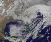
IR loop seems to show the center still racing to the E/ENE
http://www.ssd.noaa.gov/PS/TROP/floaters/09L/imagery/jsl_lalo-animated.gif
http://www.ssd.noaa.gov/PS/TROP/floaters/09L/imagery/jsl_lalo-animated.gif
NjWeatherGuy- Advanced Forecaster

- Posts : 4100
Reputation : 28
Join date : 2013-01-06
Location : Belle Mead, NJ
 Re: Hurricane Hermine Discussion Part 2
On a side note. I'm out on a golf course in the north shore of Long Island. NE winds sustained 15 gusting to near 30 and increasing. Sunny
Guest- Guest
 Re: Hurricane Hermine Discussion Part 2
syosnow94 wrote:On a side note. I'm out on a golf course in the north shore of Long Island. NE winds sustained 15 gusting to near 30 and increasing. Sunny
Yeah my wind forecast busted today, was a little breezy and mostly cloudy yesterday, today mostly sunny and maybe a few mph sustained maybe gusts to 5 lol

NjWeatherGuy- Advanced Forecaster

- Posts : 4100
Reputation : 28
Join date : 2013-01-06
Location : Belle Mead, NJ
 Re: Hurricane Hermine Discussion Part 2
I'm actually surprised at the strength of the wind so early onNjWeatherGuy wrote:syosnow94 wrote:On a side note. I'm out on a golf course in the north shore of Long Island. NE winds sustained 15 gusting to near 30 and increasing. Sunny
Yeah my wind forecast busted today, was a little breezy and mostly cloudy yesterday, today mostly sunny and maybe a few mph sustained maybe gusts to 5 lol
Guest- Guest
 Re: Hurricane Hermine Discussion Part 2
NjWeatherGuy wrote:weatherwatchermom wrote:Thank goodness for the coastal town s...I am not unhappy..there is a difference in wishing for a blizzard with 50 feet of snow(I know there are safety risks too) than a hurricane that destroys people s lives....it is great and frustrating for all that analyze....all of us that invested hours..you all tracking and others waited with baited breath to read the next post...but it will be interesting to me to see the analysis that I know you guys will do of what happened...there are a lot of great minds on this forum.....there will be many upset people who cut vacations short who will not listen the next time...hope you all get some rest and recharge for the next one
A 50 feet of snow blizzard here would have killed us all and done more than Sandy and all other storms combined. We could have had a light tropical storm come around and give us some rainfall and wind, it wasnt necessairly modeled to be strong (although a few model members made it strong) just normal media hype and bs anytime any possibility is on the horizon. I dont like the stigma now that the NJ coast cannot handle any tropical system and anyone who hopes for tropical action up here is evil. We made it through Floyd, Irene, many others fine, Sandy was a totally different, a transitioning deepening hybrid with an extremely tight and low pressure and very high winds spread out over a very large area causing a surge topped ONLY by Katrina (since about the last 50 years, Camille)) and this is not a hurricane prepped area. But we did pull throught it and as an NJ resident who visited the shore areas multiple times it took a while, but but many of the areas destroyed were rebuilt, infrastructure re-fortified to new standards and stilt requirements. We could have handled it, Jersey strong.
Nj..please I offer an apology...my words were not meant to criticize or offend....maybe I should have had coffee before I wrote them I of course would not wish 50 feet if snow either...it was just tongue in cheek..I love weather watching(more snow than tropical) and do not have the skill to track like all of you..but I feel the thrill anticipation of a storm strong or not, but never want harm to come to anyone..just like you or anyone else on this site...I live at the shore..I too saw the destruction and devastation.. there was infrastructure that was fortunately put in place by my town..in the 70's that is the only reason I still have a home today.I think we are very resilient in Nj..and we do get a bad wrap..for coast and many other things..again..if my words offended..I apologize...

weatherwatchermom- Senior Enthusiast

- Posts : 3738
Reputation : 77
Join date : 2014-11-25
Age : 60
Location : Hazlet Township, NJ
 Re: Hurricane Hermine Discussion Part 2
Weathermom, I am not on of those people easily offended or that need "trigger warnings" at all. Your post did not offend me, but it reiterated something many other people have been saying ever since Sandy and it grinds my gears a bit, thats all.

NjWeatherGuy- Advanced Forecaster

- Posts : 4100
Reputation : 28
Join date : 2013-01-06
Location : Belle Mead, NJ
 Re: Hurricane Hermine Discussion Part 2
Nam way further east
Storm over
Onto the next one
Storm over
Onto the next one

Snow88- Senior Enthusiast

- Posts : 2193
Reputation : 4
Join date : 2013-01-09
Age : 35
Location : Brooklyn, NY
 Re: Hurricane Hermine Discussion Part 2
Still dont know how new runs are initalizing with the low in the right position and doing this... from 6z today. Maps just came out a short time ago.
http://meteocentre.com/models/explorateur.php?lang=en&map=na&run=06&mod=arpege&stn=PNMPR&comp=1&run2=06&mod2=arpege&stn2=PNMPR&hh2=060&fixhh=1&stn2_type=prog&mode=latest&yyyy=latest&mm=latest&dd=latest&hh=054
http://meteocentre.com/models/explorateur.php?mod=arpege&run=06&stn=WG10m&hh=054&map=na&stn2=UV10m&run2=06&mod2=arpege&hh2=054&comp=1&fixhh=1&lang=en&yyyy=latest&mm=latest&dd=latest&mode=latest&stn2_type=prog&date_type=dateo
Maybe thats why its called the MF-ARPEGE and nobody's heard of it.

NjWeatherGuy- Advanced Forecaster

- Posts : 4100
Reputation : 28
Join date : 2013-01-06
Location : Belle Mead, NJ
 Re: Hurricane Hermine Discussion Part 2
Snow88 wrote:Nam way further east
Storm over
Onto the next one
I never like to use definite terms, especially when it comes to something as volatile as weather and especially large storms, especially tropical storms and blocking troughs and what have you involved, they're very complex setups. I'd say with current storm position and trends I wholeheartedly agree with you, but, looks can be deceiving, and the model runs that do still bring it back (and there are some) bring it closest to the area between around hrs 36-54ish depending on model. Remember the blizzard of 2016? All models, in general, besides the NAM had the storm slam us, then as it got closer it trended SE, SE, SE, most were screaming bust but the NAM was consistent, most said toss the NAM as being the NAM, but low and behold, just HOURS before the storm guidance shifted to match surface obs and the storm did get captured and closed but the models had a very poor handle on the situation, that was also a type of blocking setup (what were dealing with now). Same situation with Sandy almost 4 years ago now. While I've been very dismissive of this storm because I didnt like the trajectory from the beginning, and as of now my thinking seems to be verifying, its still a blocking setup. Moral of the story, do not put all faith into the models now and we still have another day or so for things to change if it does indeed decide to turn back, we'll know what it's doing for sure then. But now its simply premature and it really isn't over until it's over. But I do bet 99/1 odds it stays far enough out to sea to not cause problems, but I could be wrong.

NjWeatherGuy- Advanced Forecaster

- Posts : 4100
Reputation : 28
Join date : 2013-01-06
Location : Belle Mead, NJ
 Re: Hurricane Hermine Discussion Part 2
Lets see if there's any shift in motion here as I read in another board the 250mb trough energies combined and should capture the system shortly afterward, happened early this morning, issue is that the storm sped up while over land and really flew off the NC coast lagging the upper level trough energies behind it but supposedly its caught up now. Lets see if it changes direction in the next several hours. Current SPC mesoscale analysis, as yoy can see (if checking in the morning) it's about to "go off the SPC grid", does the center low isobar go out of range or start coming back NW and maybe back W? Let's see.
http://www.spc.noaa.gov/exper/mesoanalysis/new/viewsector.php?sector=16
http://www.spc.noaa.gov/exper/mesoanalysis/new/viewsector.php?sector=16

NjWeatherGuy- Advanced Forecaster

- Posts : 4100
Reputation : 28
Join date : 2013-01-06
Location : Belle Mead, NJ
 Re: Hurricane Hermine Discussion Part 2
978 low on the 4k nam
http://www.tropicaltidbits.com/analysis/models/?model=nam4km®ion=us&pkg=ref_frzn&runtime=2016090412&fh=36&xpos=0&ypos=813
Much further west than the 12k Nam
http://www.tropicaltidbits.com/analysis/models/?model=nam4km®ion=us&pkg=ref_frzn&runtime=2016090412&fh=36&xpos=0&ypos=813
Much further west than the 12k Nam

Snow88- Senior Enthusiast

- Posts : 2193
Reputation : 4
Join date : 2013-01-09
Age : 35
Location : Brooklyn, NY
 Re: Hurricane Hermine Discussion Part 2
WOW. WHat an about face overall. Clearing skies yesterday should have been teh tell tale sign overall. Good job by all. Hey better to be prepared for the worst and hope for the best! Models did poorly and the EURO I want to punch in the face - landfall at Cape May - showed teh westward movement and then an easterly projection all within 24 hours - crazy.
No NAO block or frontal system and it slides OTS up here, we get those and we are in ALA Sandy, Irene, David etc.
Time to enjoy the weekend and get off this computer. Have a great one everybody
No NAO block or frontal system and it slides OTS up here, we get those and we are in ALA Sandy, Irene, David etc.
Time to enjoy the weekend and get off this computer. Have a great one everybody
_________________
Mugs
AKA:King: Snow Weenie
Self Proclaimed
WINTER 2014-15 : 55.12" +.02 for 6 coatings (avg. 35")
WINTER 2015-16 Total - 29.8" (Avg 35")
WINTER 2016-17 : 39.5" so far

amugs- Advanced Forecaster - Mod

- Posts : 15093
Reputation : 213
Join date : 2013-01-07
Age : 54
Location : Hillsdale,NJ
 Re: Hurricane Hermine Discussion Part 2
9z SREF are interesting
http://mp1.met.psu.edu/~fxg1/SREF21PRSNE_9z/srefloop.html#picture
http://mp1.met.psu.edu/~fxg1/SREF21PRSNE_9z/srefloop.html#picture

NjWeatherGuy- Advanced Forecaster

- Posts : 4100
Reputation : 28
Join date : 2013-01-06
Location : Belle Mead, NJ
 Re: Hurricane Hermine Discussion Part 2
Snow88 wrote:978 low on the 4k nam
http://www.tropicaltidbits.com/analysis/models/?model=nam4km®ion=us&pkg=ref_frzn&runtime=2016090412&fh=36&xpos=0&ypos=813
Much further west than the 12k Nam
BTW the 4K nailed Hermine's track into Florida.

Joe Snow- Pro Enthusiast

- Posts : 924
Reputation : 7
Join date : 2014-02-12
Age : 62
Location : Sanford Florida, Fmrly Kings Park, NY
 Re: Hurricane Hermine Discussion Part 2
Snow88 wrote:978 low on the 4k nam
http://www.tropicaltidbits.com/analysis/models/?model=nam4km®ion=us&pkg=ref_frzn&runtime=2016090412&fh=36&xpos=0&ypos=813
Much further west than the 12k Nam
The NAM strings out the H5 vort up and down the coast but offshore, doesn't look right. I feel like the models are struggling with this bigtime, even in the SR, as with most blocking involved setups. While not looking great at the moment, I wouldnt drop my guard and stop watching the runs just yet mugs.

NjWeatherGuy- Advanced Forecaster

- Posts : 4100
Reputation : 28
Join date : 2013-01-06
Location : Belle Mead, NJ
 Re: Hurricane Hermine Discussion Part 2
Over 2 inches of rain for cape cod on the nam

Snow88- Senior Enthusiast

- Posts : 2193
Reputation : 4
Join date : 2013-01-09
Age : 35
Location : Brooklyn, NY
 Re: Hurricane Hermine Discussion Part 2
The fact the 4k and the 12k NAM are far different raise questions to the handling of the storm by the model which has been inconsistent by all models to say the least. Closest 4k comes has a low 980s to 970s about if you drew a line south from the twin forks of LI and east from ACY. Closest 12k comes is about if you drew a line east of LBI and south from Martha's Vineyard... and its only in the 990s.

NjWeatherGuy- Advanced Forecaster

- Posts : 4100
Reputation : 28
Join date : 2013-01-06
Location : Belle Mead, NJ
 Re: Hurricane Hermine Discussion Part 2
syosnow94 wrote:I can here Doc, cP and the other"inlanders" right now. South And East
YOU must be picking up via ESP my thoughts on this and my dread that this will be the pattern YET AGAIN, for the upcoming winter,lol!
Anyhoo, nice outdoor party at Mom's today is ON because this baby followed the pathway Frank and Doc so ably illustrated above.A tip o' the hat to Tom,his instincts were spot on here.
70.5 nice degrees, 58%, 30.03 R and light breeze.

docstox12- Wx Statistician Guru

- Posts : 8504
Reputation : 222
Join date : 2013-01-07
Age : 73
Location : Monroe NY
 Re: Hurricane Hermine Discussion Part 2
NjWeatherGuy wrote:The fact the 4k and the 12k NAM are far different raise questions to the handling of the storm by the model which has been inconsistent by all models to say the least. Closest 4k comes has a low 980s to 970s about if you drew a line south from the twin forks of LI and east from ACY. Closest 12k comes is about if you drew a line east of LBI and south from Martha's Vineyard... and its only in the 990s.
Had the 8/30 12Z 4 km NAM verified, Hermine would have gone down to 923(!) mb in the Gulf:

Math23x7- Wx Statistician Guru

- Posts : 2379
Reputation : 68
Join date : 2013-01-08
 Re: Hurricane Hermine Discussion Part 2
All the current data you could ever want on HERMINE............
http://rammb.cira.colostate.edu/products/tc_realtime/storm.asp?storm_identifier=AL092016
Enjoy
http://rammb.cira.colostate.edu/products/tc_realtime/storm.asp?storm_identifier=AL092016
Enjoy

Joe Snow- Pro Enthusiast

- Posts : 924
Reputation : 7
Join date : 2014-02-12
Age : 62
Location : Sanford Florida, Fmrly Kings Park, NY
 Re: Hurricane Hermine Discussion Part 2
http://rammb.cira.colostate.edu/products/tc_realtime/loop.asp?product=16kmgwvp&storm_identifier=AL092016&starting_image=2016AL09_16KMGWVP_201609022045.GIF

Joe Snow- Pro Enthusiast

- Posts : 924
Reputation : 7
Join date : 2014-02-12
Age : 62
Location : Sanford Florida, Fmrly Kings Park, NY
 Re: Hurricane Hermine Discussion Part 2
GFS is about like the NAM but weaker, wants come back, but nope, took too long to wander out into the Atlantic and is kicked out by a broad weak area of high pressure to the southwest approaching. GFS just stalls and kills it or so it appears through 40 something hours over 1000mb and just sitting well SE of LI dissipating

NjWeatherGuy- Advanced Forecaster

- Posts : 4100
Reputation : 28
Join date : 2013-01-06
Location : Belle Mead, NJ
 Re: Hurricane Hermine Discussion Part 2
I can't even see 4 ft above normal tides on the jersey coast. The winds will be out of the North or NNW. That will negate to a degree the push of the water to the coast emanating from the stalled storm. Looks like LI sound could see the highest tides due to the wind vector with a more east component per the GFS.

WeatherBob- Meteorologist

- Posts : 683
Reputation : 83
Join date : 2013-12-13
Location : Caldwell, NJ - NW Essex County - Altitude 500 FT
 Re: Hurricane Hermine Discussion Part 2
Math23x7 wrote:NjWeatherGuy wrote:The fact the 4k and the 12k NAM are far different raise questions to the handling of the storm by the model which has been inconsistent by all models to say the least. Closest 4k comes has a low 980s to 970s about if you drew a line south from the twin forks of LI and east from ACY. Closest 12k comes is about if you drew a line east of LBI and south from Martha's Vineyard... and its only in the 990s.
Had the 8/30 12Z 4 km NAM verified, Hermine would have gone down to 923(!) mb in the Gulf:
Not implying either is better! Just a curiosity. However I do recall the 4k NAM nailing the blizzard of 2016 when the 12k OP was way bullish with like 5+" of QPF in the jackpot zones (my area) that ended up getting probably 2-3" worth.

NjWeatherGuy- Advanced Forecaster

- Posts : 4100
Reputation : 28
Join date : 2013-01-06
Location : Belle Mead, NJ
 Re: Hurricane Hermine Discussion Part 2
https://earth.nullschool.net/#current/wind/surface/level/overlay=mean_sea_level_pressure/orthographic=-71.42,45.06,1351/loc=-74.068,40.462

weatherwatchermom- Senior Enthusiast

- Posts : 3738
Reputation : 77
Join date : 2014-11-25
Age : 60
Location : Hazlet Township, NJ
Page 26 of 35 •  1 ... 14 ... 25, 26, 27 ... 30 ... 35
Page 26 of 35
Permissions in this forum:
You cannot reply to topics in this forum|
|
|

 Home
Home