
 Search
Dec 16-17 Snow/Ice potential storm
Page 2 of 11 •  1, 2, 3, ... 9, 10, 11
 ![]()
Re: Dec 16-17 Snow/Ice potential storm
![]() by jmanley32 Sat Dec 14, 2019 2:11 pm
by jmanley32 Sat Dec 14, 2019 2:11 pm
Do you guys see this being snow to ice or is there a chance its all snow? With those ice numbers if it was all snow I think we would be taking godzilla amounts in some areas or close. 3-5 with 0.5 LE from the ice if was snow would add another 5 to 6 inches.amugs wrote:Anthony Masiello
@antmasiello
After our midday burst of snow/sleet over E PA/NJ, mid levels begin to warm during the evening. However, low level winds appear to remain N/NE into the I-95 corridor. The potential exists for prolonged ZR into the night, even close to the cities.
Think about this case, for example: a quick FGEN snow/sleet accum for northern Mid Atlantic Monday could help keep the warm front suppressed during the evening/night as the surface cyclone tracks offshore. That can hold colder surfaces, esp. if there's a little speed to NE flow.
Wind Map from PB on 33& Rain site - wind barbs are out of the N/NE - the mid levels dont warm under that flow and that goes to the city
If true this BIGLY is trouble

jmanley32- Senior Enthusiast

- Posts : 20535
Join date : 2013-12-12
Re: Dec 16-17 Snow/Ice potential storm
![]() by jmanley32 Sat Dec 14, 2019 2:26 pm
by jmanley32 Sat Dec 14, 2019 2:26 pm
jmanley32- Senior Enthusiast
- Posts : 20535
Join date : 2013-12-12
Re: Dec 16-17 Snow/Ice potential storm
![]() by hyde345 Sat Dec 14, 2019 2:28 pm
by hyde345 Sat Dec 14, 2019 2:28 pm
amugs wrote:Sorry but the track is further south again by about 25 miles this run and the block is growing thus pressing on teh storm and allowing the CAD to hang in and drive a tad more south.
The EURO is locked peeps and I have been on this with it since Wednesday, last week when I posted on it for my bday - well not an ice storm as such but a snowstorm - dont doubt Big Momma and her love for Mugs LOL!
Yup, the Euro has been consistent for 3 days now. GFS, as usual, has caved. Shocker.

hyde345- Pro Enthusiast

- Posts : 1082
Reputation : 48
Join date : 2013-01-08
Location : Hyde Park, NY
Re: Dec 16-17 Snow/Ice potential storm
![]() by jmanley32 Sat Dec 14, 2019 2:40 pm
by jmanley32 Sat Dec 14, 2019 2:40 pm
12z 12km NAM is nothing to really get worried about either, little snow and very little ice compared to Euro. Doesnt Euro tend to overdo ice and wind? Watch this end up being nothing.

jmanley32- Senior Enthusiast
- Posts : 20535
Reputation : 108
Join date : 2013-12-12
Age : 43
Location : Yonkers, NY
Re: Dec 16-17 Snow/Ice potential storm
![]() by hyde345 Sat Dec 14, 2019 2:50 pm
by hyde345 Sat Dec 14, 2019 2:50 pm
jmanley32 wrote:Except the GFS gives no snow, and much less ice. I am not going by the goofus though, the Euro and now SR models have more consensus and its almost all SR model time anyways. Looks like we are in for a rough few days potentially, I still will not buy into this yet.
12z 12km NAM is nothing to really get worried about either, little snow and very little ice compared to Euro. Doesnt Euro tend to overdo ice and wind? Watch this end up being nothing.
GFS caved as far as the intensity and track of the low. A few days ago it had a much stronger primary headed to the Great Lakes which was fugazy. It sucks.
hyde345- Pro Enthusiast
- Posts : 1082
Reputation : 48
Join date : 2013-01-08
Location : Hyde Park, NY
Re: Dec 16-17 Snow/Ice potential storm
![]() by Frank_Wx Sat Dec 14, 2019 4:59 pm
by Frank_Wx Sat Dec 14, 2019 4:59 pm
_________________
_______________________________________________________________________________________________________
CLICK HERE to view NJ Strong Snowstorm Classifications

Frank_Wx- Godzilla Seeker

- Posts : 21305
Reputation : 328
Join date : 2013-01-05
Age : 32
Location : Jersey City, NJ -

Re: Dec 16-17 Snow/Ice potential storm
![]() by aiannone Sat Dec 14, 2019 6:04 pm
by aiannone Sat Dec 14, 2019 6:04 pm

_________________
-Alex Iannone-

aiannone- Senior Enthusiast - Mod

- Posts : 4815
Reputation : 92
Join date : 2013-01-07
Location : Saint James, LI (Northwest Suffolk Co.)
Re: Dec 16-17 Snow/Ice potential storm
![]() by aiannone Sat Dec 14, 2019 6:29 pm
by aiannone Sat Dec 14, 2019 6:29 pm

_________________
-Alex Iannone-
aiannone- Senior Enthusiast - Mod
- Posts : 4815
Reputation : 92
Join date : 2013-01-07
Location : Saint James, LI (Northwest Suffolk Co.)
Re: Dec 16-17 Snow/Ice potential storm
![]() by frank 638 Sat Dec 14, 2019 6:41 pm
by frank 638 Sat Dec 14, 2019 6:41 pm
I hope this stays as all snow and I will be very happy with 3 to 6 inches I know it’s going to change to freezing rain and rain I’d rather have sleet then Freezing rain.aiannone wrote:
frank 638- Senior Enthusiast
- Posts : 2843
Reputation : 37
Join date : 2016-01-01
Age : 40
Location : bronx ny
Re: Dec 16-17 Snow/Ice potential storm
![]() by jmanley32 Sat Dec 14, 2019 9:24 pm
by jmanley32 Sat Dec 14, 2019 9:24 pm
00z is a non event, at 03z tues. when it was snowing and icing pretty hard on Euro and 12z nam the radar is now dry, there is a very brief bit of snow to no precip, whats going on with that? Its not like it moves a different way it just poof disappears very unlike the Euro, maybe Frank is right and the Euro was just flat out wrong, i guess that would mean the GFS CMC and earlier NAM runs were wrong too. If so would be a epic fail on al lthe models parts. Or am I missing ST?
jmanley32- Senior Enthusiast
- Posts : 20535
Reputation : 108
Join date : 2013-12-12
Age : 43
Location : Yonkers, NY
Re: Dec 16-17 Snow/Ice potential storm
![]() by jmanley32 Sat Dec 14, 2019 9:38 pm
by jmanley32 Sat Dec 14, 2019 9:38 pm
jmanley32- Senior Enthusiast
- Posts : 20535
Reputation : 108
Join date : 2013-12-12
Age : 43
Location : Yonkers, NY
Re: Dec 16-17 Snow/Ice potential storm
![]() by jmanley32 Sat Dec 14, 2019 9:44 pm
by jmanley32 Sat Dec 14, 2019 9:44 pm


jmanley32- Senior Enthusiast
- Posts : 20535
Reputation : 108
Join date : 2013-12-12
Age : 43
Location : Yonkers, NY
Re: Dec 16-17 Snow/Ice potential storm
![]() by jmanley32 Sat Dec 14, 2019 9:50 pm
by jmanley32 Sat Dec 14, 2019 9:50 pm

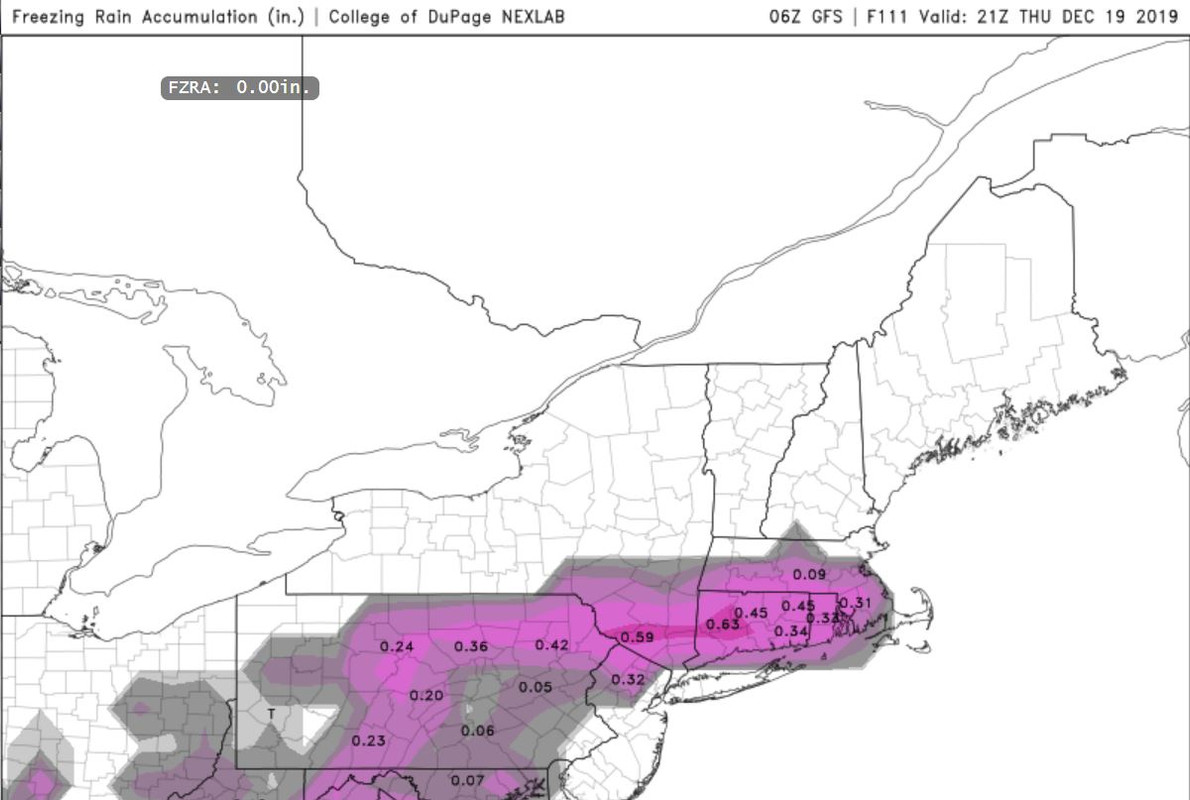
BTW on the tail of that precip there is ice accretion of 1.85!!! Holy crap!!
Last edited by jmanley32 on Sat Dec 14, 2019 9:55 pm; edited 2 times in total
jmanley32- Senior Enthusiast
- Posts : 20535
Reputation : 108
Join date : 2013-12-12
Age : 43
Location : Yonkers, NY
Re: Dec 16-17 Snow/Ice potential storm
![]() by hyde345 Sat Dec 14, 2019 9:54 pm
by hyde345 Sat Dec 14, 2019 9:54 pm
hyde345- Pro Enthusiast
- Posts : 1082
Reputation : 48
Join date : 2013-01-08
Location : Hyde Park, NY
Re: Dec 16-17 Snow/Ice potential storm
![]() by jmanley32 Sat Dec 14, 2019 9:55 pm
by jmanley32 Sat Dec 14, 2019 9:55 pm
Right?! I was like wth? Starts Tuesday and ends late at night about 11pm, appears NAM has a new totally different LP that pops off coast that gives us a storm a day later.hyde345 wrote:I think the nam is on crack. No other model is showing anything like this.
jmanley32- Senior Enthusiast
- Posts : 20535
Reputation : 108
Join date : 2013-12-12
Age : 43
Location : Yonkers, NY
Re: Dec 16-17 Snow/Ice potential storm
![]() by jmanley32 Sat Dec 14, 2019 10:01 pm
by jmanley32 Sat Dec 14, 2019 10:01 pm
jmanley32- Senior Enthusiast
- Posts : 20535
Reputation : 108
Join date : 2013-12-12
Age : 43
Location : Yonkers, NY
Re: Dec 16-17 Snow/Ice potential storm
![]() by heehaw453 Sat Dec 14, 2019 10:26 pm
by heehaw453 Sat Dec 14, 2019 10:26 pm
We have the initial WAA thump as our shot to get several inches. If that fails, then it's going to be under 1" for most. Euro has been showing a lot of ice and I think storm continues to tick south. Not sold on those ice amounts Euro is showning ATTM.
heehaw453- Advanced Forecaster

- Posts : 3906
Reputation : 86
Join date : 2014-01-20
Location : Bedminster Township, PA Elevation 600' ASL
Re: Dec 16-17 Snow/Ice potential storm
![]() by jmanley32 Sun Dec 15, 2019 1:37 am
by jmanley32 Sun Dec 15, 2019 1:37 am
jmanley32- Senior Enthusiast
- Posts : 20535
Reputation : 108
Join date : 2013-12-12
Age : 43
Location : Yonkers, NY
Re: Dec 16-17 Snow/Ice potential storm
![]() by jmanley32 Sun Dec 15, 2019 1:40 am
by jmanley32 Sun Dec 15, 2019 1:40 am
and you were 100% correct I knew a crazy ice storm wouldn't happen. And it looks like we do miss out on that WAA so it'll be under a inch. Mugs won't be happy to see these changes.heehaw453 wrote:NAM is out of its range at the end. However, low pressure will most likely develop off the NJ coast and intensify. Coastal NE could get clipped with that. Euro tries to show that too to a certain extent. Also, that coastal low could slow down and blow up more than currently modeled due to blocking.
We have the initial WAA thump as our shot to get several inches. If that fails, then it's going to be under 1" for most. Euro has been showing a lot of ice and I think storm continues to tick south. Not sold on those ice amounts Euro is showning ATTM.
jmanley32- Senior Enthusiast
- Posts : 20535
Reputation : 108
Join date : 2013-12-12
Age : 43
Location : Yonkers, NY
Re: Dec 16-17 Snow/Ice potential storm
![]() by billg315 Sun Dec 15, 2019 3:09 am
by billg315 Sun Dec 15, 2019 3:09 am

billg315- Advanced Forecaster - Mod
- Posts : 4483
Reputation : 185
Join date : 2015-01-24
Age : 50
Location : Flemington, NJ
Re: Dec 16-17 Snow/Ice potential storm
![]() by jmanley32 Sun Dec 15, 2019 7:12 am
by jmanley32 Sun Dec 15, 2019 7:12 am
but did you see the over night runs? This comes in on Tuesday now and exits late Tuesday night Monday is not really going to be much if anything from that waa or are you not buying the new runs?billg315 wrote:Right now across North Jersey I think the bigger story with this system may be ice than snow. While it looks to start as snow Monday midday, I doubt we’ll see more than a couple inches before it turns to sleet/frz rain. But temps really struggle on some models to get much above freezing even after upper levels warm so Monday into Tuesday icing is a concern. Sometimes a little ice is a bigger deal than a lot of snow.
jmanley32- Senior Enthusiast
- Posts : 20535
Reputation : 108
Join date : 2013-12-12
Age : 43
Location : Yonkers, NY
Re: Dec 16-17 Snow/Ice potential storm
![]() by heehaw453 Sun Dec 15, 2019 7:28 am
by heehaw453 Sun Dec 15, 2019 7:28 am
Surface temps will be slow to rise above freezing. This as billg said is the main threat. That being said they hover close enough such that prodigious ice is much harder to accrete. In the LHV and NW NJ though upper 20's could make a huge difference on accretion. I would most concerned in those areas.
heehaw453- Advanced Forecaster
- Posts : 3906
Reputation : 86
Join date : 2014-01-20
Location : Bedminster Township, PA Elevation 600' ASL
Re: Dec 16-17 Snow/Ice potential storm
![]() by Dunnzoo Sun Dec 15, 2019 10:09 am
by Dunnzoo Sun Dec 15, 2019 10:09 am


_________________
Janet
Snowfall winter of 2023-2024 17.5"
Snowfall winter of 2022-2023 6.0"
Snowfall winter of 2021-2022 17.6" 1" sleet 2/25/22
Snowfall winter of 2020-2021 51.1"
Snowfall winter of 2019-2020 8.5"
Snowfall winter of 2018-2019 25.1"
Snowfall winter of 2017-2018 51.9"
Snowfall winter of 2016-2017 45.6"
Snowfall winter of 2015-2016 29.5"
Snowfall winter of 2014-2015 50.55"
Snowfall winter of 2013-2014 66.5"

Dunnzoo- Senior Enthusiast - Mod
- Posts : 4905
Reputation : 68
Join date : 2013-01-11
Age : 62
Location : Westwood, NJ
Re: Dec 16-17 Snow/Ice potential storm
![]() by Frank_Wx Sun Dec 15, 2019 10:10 am
by Frank_Wx Sun Dec 15, 2019 10:10 am
The main event moved to Tuesday morning where significant icing is forecasted in NW NJ into SNY. Another snowstorm is likely for Mikey in Albany and across Upstate NY.
These are daunting numbers on the GFS and they are supported by the NAM too.

My official forecast is a C-1" of snow thru CNJ/SNJ/NNJ/NYC Metro and .10"-.30" of ice for NW NJ and SNY. Snow will turn to rain for pretty much everyone except it will be freeing rain for the aforementioned areas.
_________________
_______________________________________________________________________________________________________
CLICK HERE to view NJ Strong Snowstorm Classifications
Frank_Wx- Godzilla Seeker
- Posts : 21305
Reputation : 328
Join date : 2013-01-05
Age : 32
Location : Jersey City, NJ -
Re: Dec 16-17 Snow/Ice potential storm
![]() by jimv45 Sun Dec 15, 2019 10:36 am
by jimv45 Sun Dec 15, 2019 10:36 am
jimv45- Senior Enthusiast
- Posts : 1168
Reputation : 36
Join date : 2013-09-20
Location : Hopewell jct.
Re: Dec 16-17 Snow/Ice potential storm
![]() by hyde345 Sun Dec 15, 2019 11:15 am
by hyde345 Sun Dec 15, 2019 11:15 am
jimv45 wrote:I am about an hour from Mike expecting mostly snow here in Saugerties. Hope no ice. Some of those ice predictions are scary to my south hope snow or rain for those folks.
Jim, you are likely to see sleet and ZR also especially on Tuesday as areas south of Albany will see some mixing. Hopefully you can get an inch or 2 of snow also in beginning and when low tracks east and precip turns back to snow. It's gonna be a mess for me.
hyde345- Pro Enthusiast
- Posts : 1082
Reputation : 48
Join date : 2013-01-08
Location : Hyde Park, NY
Re: Dec 16-17 Snow/Ice potential storm
![]() by hyde345 Sun Dec 15, 2019 11:24 am
by hyde345 Sun Dec 15, 2019 11:24 am
hyde345- Pro Enthusiast
- Posts : 1082
Reputation : 48
Join date : 2013-01-08
Location : Hyde Park, NY
Page 2 of 11 • 1, 2, 3, ... 9, 10, 11 ![]()
|
|
|