
 Search
DECEMBER 16th 17th 2020 Snow Threat???
Page 17 of 24 •  1 ... 10 ... 16, 17, 18 ... 20 ... 24
 ![]()
Re: DECEMBER 16th 17th 2020 Snow Threat???
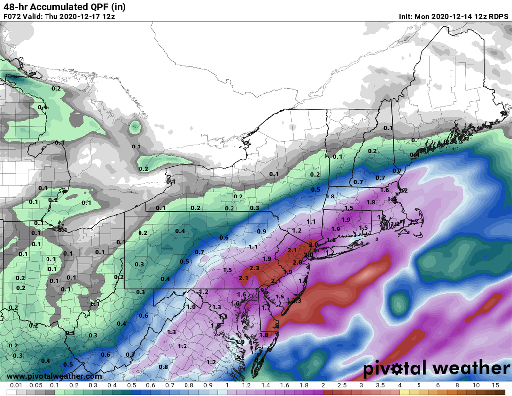
![]() by aiannone Mon Dec 14, 2020 10:27 am
by aiannone Mon Dec 14, 2020 10:27 am

aiannone- Senior Enthusiast - Mod

- Posts : 4813
Join date : 2013-01-07
Re: DECEMBER 16th 17th 2020 Snow Threat???
![]() by rb924119 Mon Dec 14, 2020 10:33 am
by rb924119 Mon Dec 14, 2020 10:33 am
nutleyblizzard wrote:I have to disagree with you RB. We have a strong high along with a powerhouse 50/50 low. I can’t see a primary low plow right into that. The Nam showed some improvements with stronger confluence and a bit better H5 setup. I take it as a positive for us. Man I love this hobby. Onto the Gfs.rb924119 wrote:Frank_Wx wrote:In my opinion, the small shift S-SE on the NAM was not enough. The general idea is we get very heavy snow before dry slotting and/or changeover to mix. It's still a big difference compared to just 24 hours ago.
Agree, Frank. The surface depictions are wrong, I don’t know what else to say. You have mid-level closed lows passing to our west/overhead and then even northwest of us at H5, embedded in deep-layer southwesterly flow; you aren’t going to magically see those circulations stop dead and jump due east. Sorry. If anything, they will eventually arc, but not before they reach and/or exceed our latitude. And this is actually projected quite well on the QPF maps getting the banding well to our north and west with the dry slot showing up for us. People can say that it shifted east and colder, but dynamically speaking it didn’t at all. And, in these setups, warm air advancement aloft always outpaces modeling, so I would a quicker transition from snow to slop.
That’s fine, you can disagree, I won’t get upset
rb924119- Meteorologist

- Posts : 6889
Join date : 2013-02-06
Re: DECEMBER 16th 17th 2020 Snow Threat???
![]() by rb924119 Mon Dec 14, 2020 10:36 am
by rb924119 Mon Dec 14, 2020 10:36 am
rb924119- Meteorologist
- Posts : 6889
Reputation : 194
Join date : 2013-02-06
Age : 32
Location : Greentown, Pa
Re: DECEMBER 16th 17th 2020 Snow Threat???
![]() by jmanley32 Mon Dec 14, 2020 10:38 am
by jmanley32 Mon Dec 14, 2020 10:38 am
that still gives nyc tristate 6+ doesnt look mainly rain there.aiannone wrote:aiannone wrote:ICON mostly rain for NYC and LI. Mixing in NNJ and SCT otherwise jackpot is up towards 684


jmanley32- Senior Enthusiast

- Posts : 20513
Reputation : 108
Join date : 2013-12-12
Age : 42
Location : Yonkers, NY
Re: DECEMBER 16th 17th 2020 Snow Threat???
![]() by jmanley32 Mon Dec 14, 2020 10:39 am
by jmanley32 Mon Dec 14, 2020 10:39 am
a NW shift is not what we wanna see on southern folks, but as that stands im in the jackpot, but trends seem to be in the wrong direction, im hoping in a perfect world GFS comes a bit north and the others hold serve, and the icon meh.aiannone wrote:12Z RGEM. Did bump slightly NW but kept LI and NYC all snow. Nice stripe of 12+
jmanley32- Senior Enthusiast
- Posts : 20513
Reputation : 108
Join date : 2013-12-12
Age : 42
Location : Yonkers, NY
Re: DECEMBER 16th 17th 2020 Snow Threat???
![]() by Frank_Wx Mon Dec 14, 2020 10:44 am
by Frank_Wx Mon Dec 14, 2020 10:44 am
_________________
_______________________________________________________________________________________________________
CLICK HERE to view NJ Strong Snowstorm Classifications

Frank_Wx- Godzilla Seeker

- Posts : 21305
Reputation : 328
Join date : 2013-01-05
Age : 31
Location : Jersey City, NJ -

Re: DECEMBER 16th 17th 2020 Snow Threat???
![]() by Frank_Wx Mon Dec 14, 2020 10:46 am
by Frank_Wx Mon Dec 14, 2020 10:46 am

_________________
_______________________________________________________________________________________________________
CLICK HERE to view NJ Strong Snowstorm Classifications
Frank_Wx- Godzilla Seeker
- Posts : 21305
Reputation : 328
Join date : 2013-01-05
Age : 31
Location : Jersey City, NJ -
Re: DECEMBER 16th 17th 2020 Snow Threat???
![]() by aiannone Mon Dec 14, 2020 10:48 am
by aiannone Mon Dec 14, 2020 10:48 am
_________________
-Alex Iannone-

aiannone- Senior Enthusiast - Mod
- Posts : 4813
Reputation : 92
Join date : 2013-01-07
Location : Saint James, LI (Northwest Suffolk Co.)
Re: DECEMBER 16th 17th 2020 Snow Threat???
![]() by aiannone Mon Dec 14, 2020 10:48 am
by aiannone Mon Dec 14, 2020 10:48 am

_________________
-Alex Iannone-
aiannone- Senior Enthusiast - Mod
- Posts : 4813
Reputation : 92
Join date : 2013-01-07
Location : Saint James, LI (Northwest Suffolk Co.)
Re: DECEMBER 16th 17th 2020 Snow Threat???
![]() by aiannone Mon Dec 14, 2020 10:51 am
by aiannone Mon Dec 14, 2020 10:51 am


_________________
-Alex Iannone-
aiannone- Senior Enthusiast - Mod
- Posts : 4813
Reputation : 92
Join date : 2013-01-07
Location : Saint James, LI (Northwest Suffolk Co.)
Re: DECEMBER 16th 17th 2020 Snow Threat???
![]() by Frank_Wx Mon Dec 14, 2020 10:52 am
by Frank_Wx Mon Dec 14, 2020 10:52 am
_________________
_______________________________________________________________________________________________________
CLICK HERE to view NJ Strong Snowstorm Classifications
Frank_Wx- Godzilla Seeker
- Posts : 21305
Reputation : 328
Join date : 2013-01-05
Age : 31
Location : Jersey City, NJ -
Re: DECEMBER 16th 17th 2020 Snow Threat???
![]() by Frank_Wx Mon Dec 14, 2020 10:53 am
by Frank_Wx Mon Dec 14, 2020 10:53 am
_________________
_______________________________________________________________________________________________________
CLICK HERE to view NJ Strong Snowstorm Classifications
Frank_Wx- Godzilla Seeker
- Posts : 21305
Reputation : 328
Join date : 2013-01-05
Age : 31
Location : Jersey City, NJ -
Re: DECEMBER 16th 17th 2020 Snow Threat???
![]() by Frank_Wx Mon Dec 14, 2020 10:55 am
by Frank_Wx Mon Dec 14, 2020 10:55 am


_________________
_______________________________________________________________________________________________________
CLICK HERE to view NJ Strong Snowstorm Classifications
Frank_Wx- Godzilla Seeker
- Posts : 21305
Reputation : 328
Join date : 2013-01-05
Age : 31
Location : Jersey City, NJ -
Re: DECEMBER 16th 17th 2020 Snow Threat???
![]() by aiannone Mon Dec 14, 2020 10:59 am
by aiannone Mon Dec 14, 2020 10:59 am
_________________
-Alex Iannone-
aiannone- Senior Enthusiast - Mod
- Posts : 4813
Reputation : 92
Join date : 2013-01-07
Location : Saint James, LI (Northwest Suffolk Co.)
Re: DECEMBER 16th 17th 2020 Snow Threat???
![]() by CPcantmeasuresnow Mon Dec 14, 2020 11:01 am
by CPcantmeasuresnow Mon Dec 14, 2020 11:01 am
I was at 5 inches last run and it put me at 10 this run.

CPcantmeasuresnow- Wx Statistician Guru

- Posts : 7274
Reputation : 230
Join date : 2013-01-07
Age : 103
Location : Eastern Orange County, NY
Re: DECEMBER 16th 17th 2020 Snow Threat???
![]() by bobjohnsonforthehall Mon Dec 14, 2020 11:01 am
by bobjohnsonforthehall Mon Dec 14, 2020 11:01 am
Frank_Wx wrote:06z EURO vs 12z GFS
General agreement on the heaviest snow areas but big difference on the northern extent.

bobjohnsonforthehall- Posts : 311
Reputation : 19
Join date : 2016-10-02
Location : Flemington NJ
Re: DECEMBER 16th 17th 2020 Snow Threat???
![]() by jmanley32 Mon Dec 14, 2020 11:06 am
by jmanley32 Mon Dec 14, 2020 11:06 am
that looks like it would also include Hudson Valley and lower Westchester no? Same dark shaded area over us too. Oh and a page back or so soul posted the ratio map that shows just that though not quite 30 8nches but close. Included this area too which would cripple yonkers. I def can't complain about too much snow cuz last year I complained we hardly saw any lolFrank_Wx wrote:The RGEM would drop 3 feet of snow over NNJ with this type of H7 forcing
Last edited by jmanley32 on Mon Dec 14, 2020 11:08 am; edited 1 time in total
jmanley32- Senior Enthusiast
- Posts : 20513
Reputation : 108
Join date : 2013-12-12
Age : 42
Location : Yonkers, NY
Re: DECEMBER 16th 17th 2020 Snow Threat???
![]() by heehaw453 Mon Dec 14, 2020 11:08 am
by heehaw453 Mon Dec 14, 2020 11:08 am
The only thing I'm somewhat confident in now is that SE Jersey is not in the game for big snows. Atlantic, Cape May, Southern Ocean.
It's always a nail biter with these big events, albeit the consistency of the modeling since Day 5 is very rare thing. Ensembles and Ops.
heehaw453- Advanced Forecaster

- Posts : 3906
Reputation : 86
Join date : 2014-01-20
Location : Bedminster Township, PA Elevation 600' ASL
Re: DECEMBER 16th 17th 2020 Snow Threat???
![]() by aiannone Mon Dec 14, 2020 11:14 am
by aiannone Mon Dec 14, 2020 11:14 am
_________________
-Alex Iannone-
aiannone- Senior Enthusiast - Mod
- Posts : 4813
Reputation : 92
Join date : 2013-01-07
Location : Saint James, LI (Northwest Suffolk Co.)
Re: DECEMBER 16th 17th 2020 Snow Threat???
![]() by billg315 Mon Dec 14, 2020 11:16 am
by billg315 Mon Dec 14, 2020 11:16 am
The NAM is what worries me now. And rb. I have night terrors during the daytime right now inspired by rb and the NAM. lol

billg315- Advanced Forecaster - Mod
- Posts : 4462
Reputation : 185
Join date : 2015-01-24
Age : 50
Location : Flemington, NJ
rb924119 likes this post
Re: DECEMBER 16th 17th 2020 Snow Threat???
![]() by Frank_Wx Mon Dec 14, 2020 11:19 am
by Frank_Wx Mon Dec 14, 2020 11:19 am
heehaw453 wrote:I would not toss the GFS at this point. The goal posts IMO are set. Where the 500/700/850 lows eventually pass could very well be over Cape May or right over NYC. The closer to the latter the worse it is for the I95. At 2+ day out absolutely nothing is set in stone and the I95 could get a crushing snowfall out of this. A matter of 50 miles could make all the difference.
The only thing I'm somewhat confident in now is that SE Jersey is not in the game for big snows. Atlantic, Cape May, Southern Ocean.
It's always a nail biter with these big events, albeit the consistency of the modeling since Day 5 is very rare thing. Ensembles and Ops.
Agree. 12z GEFS did come NW a bit.
I think we're on the verge of seeing models come to a compromise. Meaning, the NAM is likely an outlier being too far NW, and the EURO probably going to adjust slightly SE of its 06z run and meet the GFS in the middle.
_________________
_______________________________________________________________________________________________________
CLICK HERE to view NJ Strong Snowstorm Classifications
Frank_Wx- Godzilla Seeker
- Posts : 21305
Reputation : 328
Join date : 2013-01-05
Age : 31
Location : Jersey City, NJ -
Re: DECEMBER 16th 17th 2020 Snow Threat???
![]() by aiannone Mon Dec 14, 2020 11:21 am
by aiannone Mon Dec 14, 2020 11:21 am

_________________
-Alex Iannone-
aiannone- Senior Enthusiast - Mod
- Posts : 4813
Reputation : 92
Join date : 2013-01-07
Location : Saint James, LI (Northwest Suffolk Co.)
Re: DECEMBER 16th 17th 2020 Snow Threat???
![]() by dsix85 Mon Dec 14, 2020 11:25 am
by dsix85 Mon Dec 14, 2020 11:25 am
dsix85- Pro Enthusiast

- Posts : 349
Reputation : 8
Join date : 2014-01-01
Location : New York
Re: DECEMBER 16th 17th 2020 Snow Threat???
![]() by billg315 Mon Dec 14, 2020 11:27 am
by billg315 Mon Dec 14, 2020 11:27 am
Almost certainly.dsix85 wrote:Wherever the heaviest bands set up, do we see rates around 1-2"/hour?
billg315- Advanced Forecaster - Mod
- Posts : 4462
Reputation : 185
Join date : 2015-01-24
Age : 50
Location : Flemington, NJ
Re: DECEMBER 16th 17th 2020 Snow Threat???
![]() by heehaw453 Mon Dec 14, 2020 11:35 am
by heehaw453 Mon Dec 14, 2020 11:35 am
heehaw453- Advanced Forecaster
- Posts : 3906
Reputation : 86
Join date : 2014-01-20
Location : Bedminster Township, PA Elevation 600' ASL
Re: DECEMBER 16th 17th 2020 Snow Threat???
![]() by SENJsnowman Mon Dec 14, 2020 11:37 am
by SENJsnowman Mon Dec 14, 2020 11:37 am
Jan ‘16, Ocean County was told to expect a ton of mixing and we were forecast at 1-3” as of the night before. The storm ticked East a smidge, we thumped, then dry slotted, then thumped some more and finished at 16-17”. I see this set up (from a forecast/surface map standpoint) possibly setting up the same way.
And HeeHaw, I agree that LBI (how ironic!!) seems to be the cut off for this storm and most storms for Tri-state weather as opposed to more of the Delmarva weather. I’m about halfway down the state coastline and at the northern 1/3 marker of Ocean County, just 20 miles N of LBI. I basically live on the border of the two climates and usually have razor thin margins on storm track!
But 48 hrs, and I feel like Ocean Cty is right there in the game. Losing by a little bit, and time is starting to tick, but here we are nonetheless. Right in the game!!
SENJsnowman- Senior Enthusiast
- Posts : 1186
Reputation : 61
Join date : 2017-01-06
Age : 51
Location : Bayville, NJ
Re: DECEMBER 16th 17th 2020 Snow Threat???
![]() by jmanley32 Mon Dec 14, 2020 11:47 am
by jmanley32 Mon Dec 14, 2020 11:47 am
where do I sign? That's hot. Lol. Frank I agree almost always the models converge on some kind of compromise. Is it still possible to see a Godzilla or like rgem a frsnkzilla? I know probably but is there a chance as Jim Carrey would say lolaiannone wrote:12z CMC calms the coasties nerves. Pushes the r/s line right to fire island but stops. sometimes you have to smell the rain to get the best snow!
Last edited by jmanley32 on Mon Dec 14, 2020 11:49 am; edited 1 time in total
jmanley32- Senior Enthusiast
- Posts : 20513
Reputation : 108
Join date : 2013-12-12
Age : 42
Location : Yonkers, NY
Page 17 of 24 • 1 ... 10 ... 16, 17, 18 ... 20 ... 24 ![]()
|
|
|