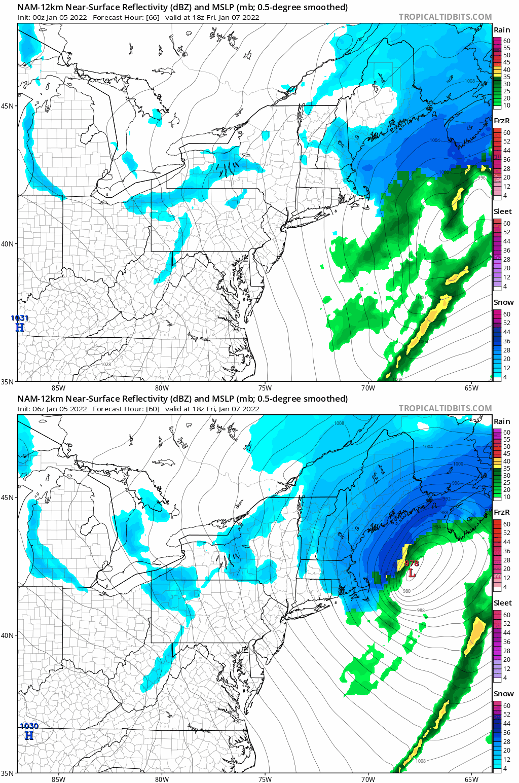
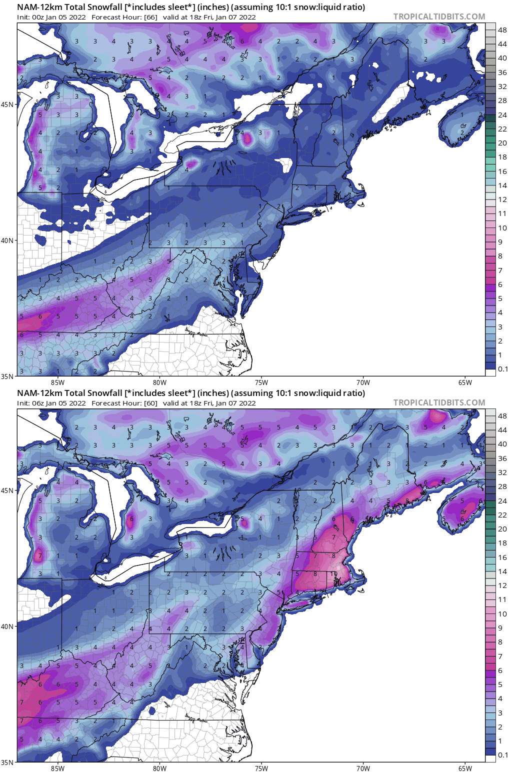
January 7th 2022 Snowstorm Threat
+41
WeatherBob
skinsfan1177
SENJsnowman
brownie
Scullybutcher
Radz
frank 638
crippo84
algae888
bluebythec
2004blackwrx
bobjohnsonforthehall
weatherwatchermom
dkodgis
Irish
emokid51783
Dunnzoo
mmanisca
Math23x7
essexcountypete
rb924119
obsessedwithweather
docstox12
mikeypizano
hyde345
Snow88
Sanchize06
jmanley32
nutleyblizzard
GreyBeard
billg315
sroc4
CPcantmeasuresnow
MattyICE
aiannone
phil155
SoulSingMG
amugs
heehaw453
dsix85
Frank_Wx
45 posters
Page 2 of 15
Page 2 of 15 •  1, 2, 3 ... 8 ... 15
 Re: January 7th 2022 Snowstorm Threat
If the wave spacing is affecting the sharpness of the 500mb trough then I totally agree. But i would attribute that to the west coast ridge too. It's clear based on what i'm looking at that when the trough digs and sharpens it's able to provide the good space so that the s/w energy can be pulled up the coast. When that trough is flatter is fills up the space and kicks it out. It may just depend on if the energy is vigorous or not. Garbage s/w and nothing may matter for us.
Last edited by heehaw453 on Tue Jan 04, 2022 4:12 pm; edited 1 time in total
heehaw453- Advanced Forecaster

- Posts : 3906
Join date : 2014-01-20
CPcantmeasuresnow- Wx Statistician Guru

- Posts : 7274
Join date : 2013-01-07
 Re: January 7th 2022 Snowstorm Threat
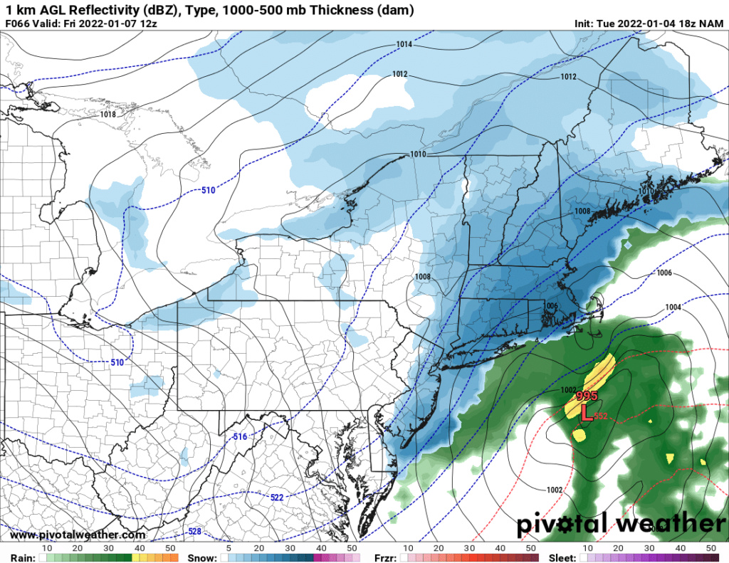
When in doubt in ICON we trust:

_________________
"In weather and in life, there's no winning and losing; there's only winning and learning."
WINTER 2012/2013 TOTALS 43.65"WINTER 2017/2018 TOTALS 62.85" WINTER 2022/2023 TOTALS 4.9"
WINTER 2013/2014 TOTALS 64.85"WINTER 2018/2019 TOTALS 14.25" WINTER 2023/2024 TOTALS 13.1"
WINTER 2014/2015 TOTALS 71.20"WINTER 2019/2020 TOTALS 6.35"
WINTER 2015/2016 TOTALS 35.00"WINTER 2020/2021 TOTALS 37.75"
WINTER 2016/2017 TOTALS 42.25"WINTER 2021/2022 TOTALS 31.65"

sroc4- Admin

- Posts : 8354
Reputation : 302
Join date : 2013-01-07
Location : Wading River, LI
 Re: January 7th 2022 Snowstorm Threat
sroc4 wrote:When in doubt in ICON we trust:
Always my go-to.

billg315- Advanced Forecaster - Mod

- Posts : 4483
Reputation : 185
Join date : 2015-01-24
Age : 50
Location : Flemington, NJ
 Re: January 7th 2022 Snowstorm Threat
NWS seems to be onboard for a minor event. My local forecast is saying 1-3". They rarely predict totals this far out.
GreyBeard- Senior Enthusiast

- Posts : 725
Reputation : 34
Join date : 2014-02-12
Location : eastern nassau county
 Re: January 7th 2022 Snowstorm Threat
_________________
Mugs
AKA:King: Snow Weenie
Self Proclaimed
WINTER 2014-15 : 55.12" +.02 for 6 coatings (avg. 35")
WINTER 2015-16 Total - 29.8" (Avg 35")
WINTER 2016-17 : 39.5" so far

amugs- Advanced Forecaster - Mod

- Posts : 15095
Reputation : 213
Join date : 2013-01-07
Age : 54
Location : Hillsdale,NJ
 Re: January 7th 2022 Snowstorm Threat
Upton:
Energy will be moving onshore of the Pacific northwest coast
Wednesday and this will amplify a trough over the central states to
the southern Appalachians Thursday into Thursday night. The latest
forecast trend is for a deeper trough, and therefore passing a
little farther to the south, as the associated surface low deepens
and moves off the mid Atlantic Thursday night. Upper jet streaks and
a developing strong low level jet will allow the low to deepen
quickly from late Thursday night into Friday afternoon as the low
passes to the south and then east of Long Island. Currently the low
tracks is just to the east of the benchmark Friday morning. With this
track the heaviest precipitation remains offshore. There will br
cold air in place, and the evening will be mainly snow. Some rain
may mix in along the coast and eastern Long Island at the beginning
Thursday night, and again later Friday. Timing has the bulk of the
snow falling late Thursday night into early Friday morning, with
advisory level snowfall likely across the forecast region, with the
highest totals across northeastern New Jersey, New York City, and
Long Island. Snow ratio look to be about average at 10 to 1 through
the majority of the event. However, a shift of the low track farther
to the north and west could bring higher snowfall totals as the
pcpn likely remains all snow. With the progressive flow the
storm will be quick moving and the precipitation will be ending
during the day Friday.
_________________
-Alex Iannone-

aiannone- Senior Enthusiast - Mod

- Posts : 4815
Reputation : 92
Join date : 2013-01-07
Location : Saint James, LI (Northwest Suffolk Co.)
 Re: January 7th 2022 Snowstorm Threat
_________________
-Alex Iannone-

aiannone- Senior Enthusiast - Mod

- Posts : 4815
Reputation : 92
Join date : 2013-01-07
Location : Saint James, LI (Northwest Suffolk Co.)
amugs, Judy Margolis and GreyBeard like this post
 Re: January 7th 2022 Snowstorm Threat
_________________
Mugs
AKA:King: Snow Weenie
Self Proclaimed
WINTER 2014-15 : 55.12" +.02 for 6 coatings (avg. 35")
WINTER 2015-16 Total - 29.8" (Avg 35")
WINTER 2016-17 : 39.5" so far

amugs- Advanced Forecaster - Mod

- Posts : 15095
Reputation : 213
Join date : 2013-01-07
Age : 54
Location : Hillsdale,NJ
heehaw453- Advanced Forecaster

- Posts : 3906
Reputation : 86
Join date : 2014-01-20
Location : Bedminster Township, PA Elevation 600' ASL
phil155 likes this post
 Re: January 7th 2022 Snowstorm Threat
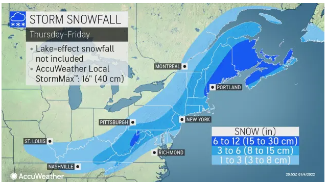
NWS Mt Holly first snow map is consistent with Accuweather: 3-4” statewide in NJ with a band of 4-6” along the I-95, with the heavier band location still uncertain. That seems where consensus is headed and would be a nice event given what little winter most of us have had so far.

billg315- Advanced Forecaster - Mod

- Posts : 4483
Reputation : 185
Join date : 2015-01-24
Age : 50
Location : Flemington, NJ
 Re: January 7th 2022 Snowstorm Threat
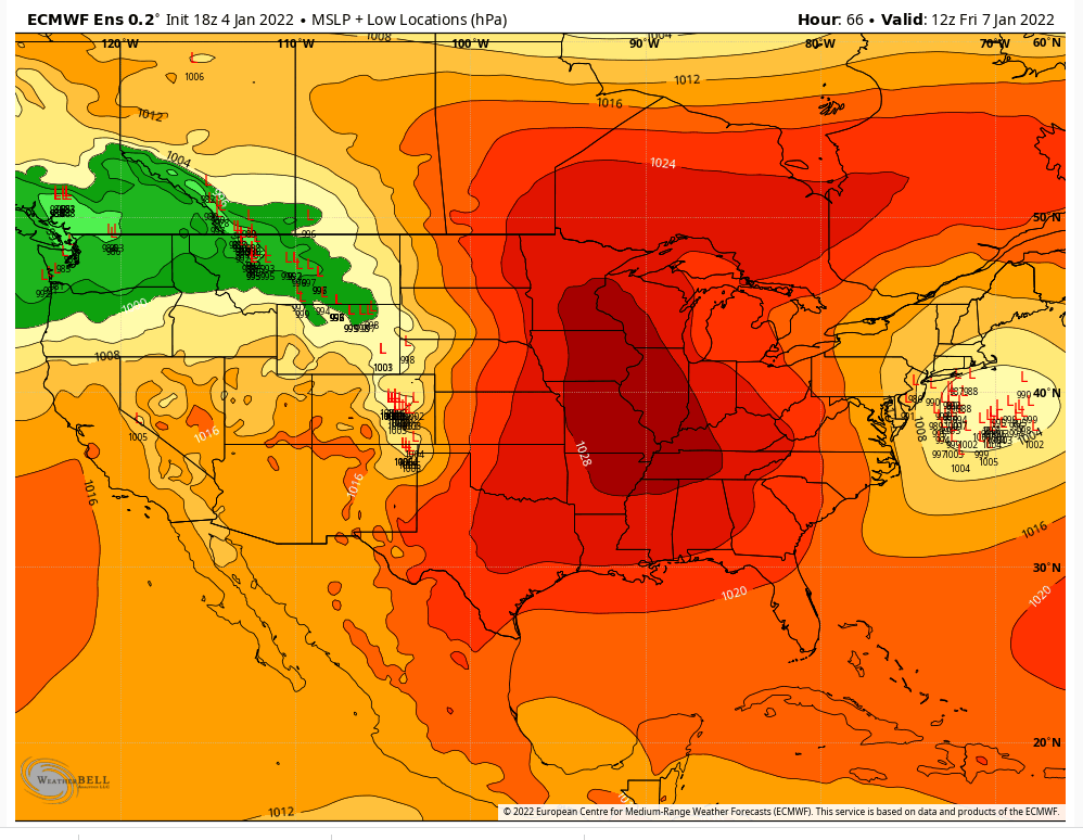
Nice shift west on the 18z EPS compared to 12z.

SoulSingMG- Senior Enthusiast

- Posts : 2853
Reputation : 74
Join date : 2013-12-11
Location : Long Island City, NY
 Re: January 7th 2022 Snowstorm Threat
I guess they’re not buying into the 12Z model runs. Neither am I. Even with a progressive pattern, the vort is impressive which will in all likelihood cause the trough to go negative. I expect a correction westward at 0z.

nutleyblizzard- Senior Enthusiast

- Posts : 1954
Reputation : 41
Join date : 2014-01-30
Age : 58
Location : Nutley, new jersey

nutleyblizzard- Senior Enthusiast

- Posts : 1954
Reputation : 41
Join date : 2014-01-30
Age : 58
Location : Nutley, new jersey
heehaw453- Advanced Forecaster

- Posts : 3906
Reputation : 86
Join date : 2014-01-20
Location : Bedminster Township, PA Elevation 600' ASL
 Re: January 7th 2022 Snowstorm Threat
where do i sign? I would be happy with uptons call right now, anything more would be gravy. really hope to get to take my daughter on her first sledding this year.

jmanley32- Senior Enthusiast

- Posts : 20535
Reputation : 108
Join date : 2013-12-12
Age : 43
Location : Yonkers, NY
 Re: January 7th 2022 Snowstorm Threat
_________________
Mugs
AKA:King: Snow Weenie
Self Proclaimed
WINTER 2014-15 : 55.12" +.02 for 6 coatings (avg. 35")
WINTER 2015-16 Total - 29.8" (Avg 35")
WINTER 2016-17 : 39.5" so far

amugs- Advanced Forecaster - Mod

- Posts : 15095
Reputation : 213
Join date : 2013-01-07
Age : 54
Location : Hillsdale,NJ

aiannone- Senior Enthusiast - Mod

- Posts : 4815
Reputation : 92
Join date : 2013-01-07
Location : Saint James, LI (Northwest Suffolk Co.)

nutleyblizzard- Senior Enthusiast

- Posts : 1954
Reputation : 41
Join date : 2014-01-30
Age : 58
Location : Nutley, new jersey

aiannone- Senior Enthusiast - Mod

- Posts : 4815
Reputation : 92
Join date : 2013-01-07
Location : Saint James, LI (Northwest Suffolk Co.)
 Re: January 7th 2022 Snowstorm Threat
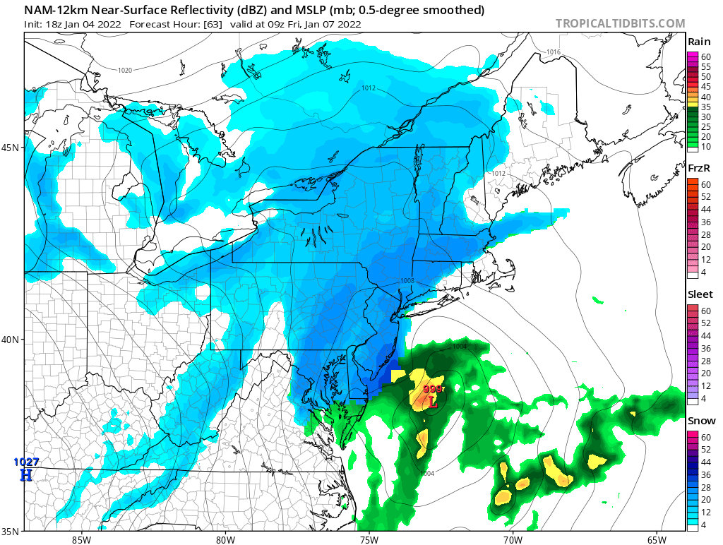
Aside from the NAM, some pretty good runs so far late this afternoon and tonight. Like the idea of a 2-4/3-6" type of event for most on the board
Sanchize06- Senior Enthusiast

- Posts : 1041
Reputation : 21
Join date : 2013-02-05
Location : Union Beach, NJ
SENJsnowman likes this post
 Re: January 7th 2022 Snowstorm Threat
More west leaning members on the 0z GEFS compared to 18z.


Sanchize06- Senior Enthusiast

- Posts : 1041
Reputation : 21
Join date : 2013-02-05
Location : Union Beach, NJ
SENJsnowman likes this post
 Re: January 7th 2022 Snowstorm Threat
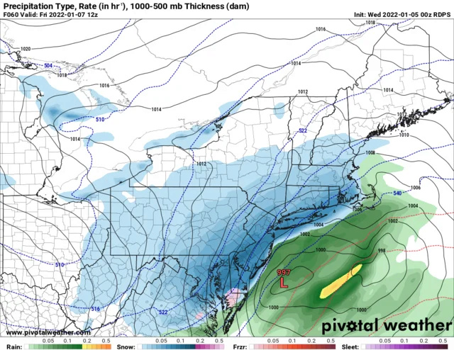
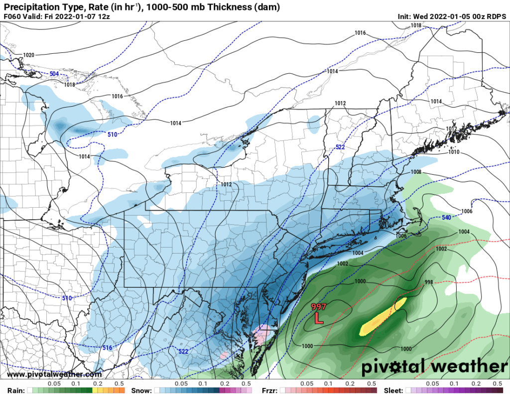
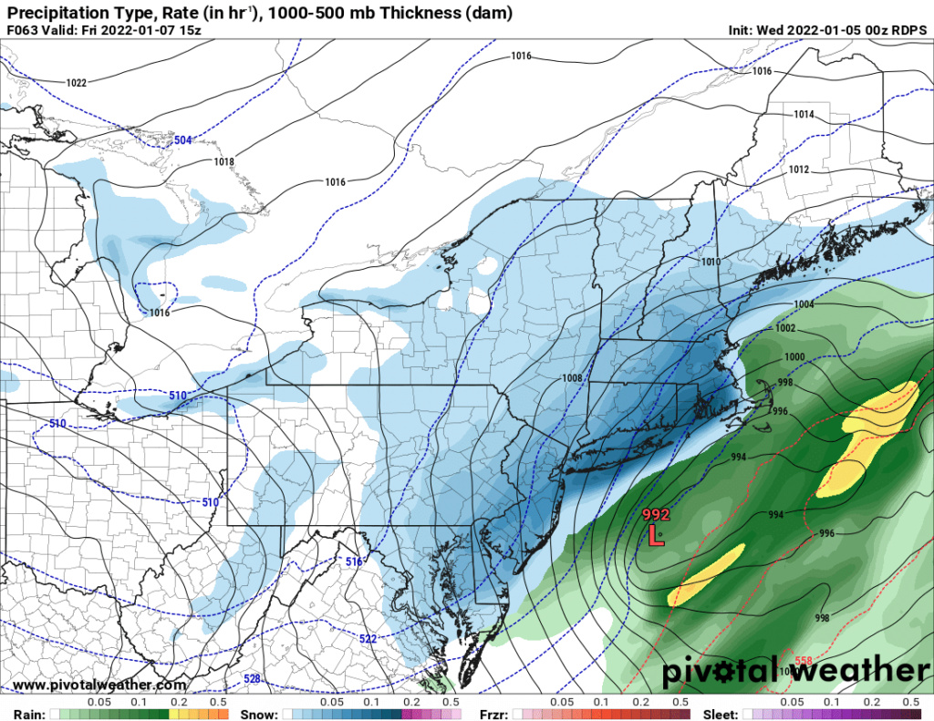
CMC showing one of the best case scenarios. Widespread 4-6". Coast seems in the best spot here, even the more amped western solutions are cold enough to keep everyone snow. No real mixing issue with the western solutions unless the low goes over you
Sanchize06- Senior Enthusiast

- Posts : 1041
Reputation : 21
Join date : 2013-02-05
Location : Union Beach, NJ

SoulSingMG- Senior Enthusiast

- Posts : 2853
Reputation : 74
Join date : 2013-12-11
Location : Long Island City, NY
CPcantmeasuresnow and Sanchize06 like this post
 Re: January 7th 2022 Snowstorm Threat
Gefs is further east
I think 2-4 inches is a fair call right now for NYC
I think 2-4 inches is a fair call right now for NYC

Snow88- Senior Enthusiast

- Posts : 2193
Reputation : 4
Join date : 2013-01-09
Age : 35
Location : Brooklyn, NY
 Re: January 7th 2022 Snowstorm Threat
6z Euro is west, looking a bit more like the meso models. Pretty much just leaves the GFS in the eastern camp
Sanchize06- Senior Enthusiast

- Posts : 1041
Reputation : 21
Join date : 2013-02-05
Location : Union Beach, NJ
 Re: January 7th 2022 Snowstorm Threat
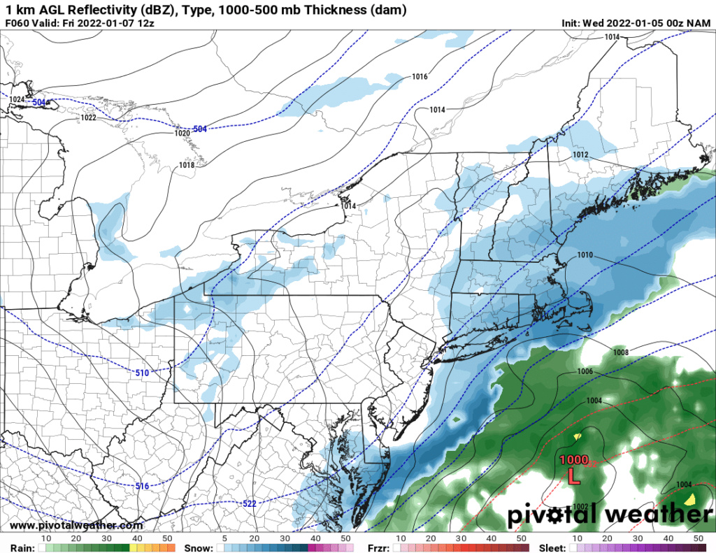
As one would expect guidance on the track is all over the place. Some hugging the coast and others east of the BM. 06Z Euro op is BM track, but ensembles are well east of BM. More clarity today's runs most likely. Due to the cold temps I think 2-4" is reasonable expectation and any more depends on the strength of the s/w. If that is vigorous it will will tend to hug the coast more (as per Canadian) and parts of the area will have a shot at 6".
heehaw453- Advanced Forecaster

- Posts : 3906
Reputation : 86
Join date : 2014-01-20
Location : Bedminster Township, PA Elevation 600' ASL
Page 2 of 15 •  1, 2, 3 ... 8 ... 15
Page 2 of 15
Permissions in this forum:
You cannot reply to topics in this forum
 Home
Home