
 Search
Update #3: Final Snow Map, Ice Accretion, Flash Freeze
Page 1 of 6 • 1, 2, 3, 4, 5, 6 ![]()

Update #3: Final Snow Map, Ice Accretion, Flash Freeze
![]() by Frank_Wx Sun Feb 01, 2015 1:37 am
by Frank_Wx Sun Feb 01, 2015 1:37 am

The size of this storm impresses me. There are thunderstorms circulating around the low level center that are colliding with the cold air to the north. This is giving parts of the Midwest insane snowfall rates. I drew in the likely path this storm is likely to take. Once it cuts into western PA, that is going to warm temps. up along the east coast. However, there is a blocking High to our north. Once the primary feels the effects of the HP, it will transfer its energy to the coast and develop a secondary low pressure system which will pass to our east. This is where the process becomes convoluted and brings havoc to making a forecast. How far north the primary gets, when and where the transfer happens, and how strong this storm gets all play a role in how much snow will fall in specific areas.

In all honesty, this is going to be one of those storms where nowcasting will be essential. There are too many different scenarios in place here where someone could see an extended period of sleet or freezing rain, while area just 10-20 miles south could be in plain rain. What I do expect to happen is impressive snow to fall between the hours of 3am-6am for NYC Metro. Most guidance insists on impressive VV's during this time frame that could bring snowfall rates near 2" per hour. That is part of the reason why I went with 4-8" for NYC. I do think the low end of that scale is attainable. Isolated areas in the red will see snow amounts greater than 12". That is likely to be elevation based and also due to the higher snow ratios. What we have to look during the day on Monday is to see if any rain or freezing rain that is falling changes back over to snow once the secondary low takes over and track east of us. This is a plausible solution and shown on some guidance which could increase snowfall amounts along the immediate coast, including NYC.

I'm not very confident releasing ice maps but I felt one was in order here. The areas shaded in dark pink, note that I said "possible" meaning that it's not a sure thing. I do believe at least .10" of ice is likely in the lighter pink shaded regions. Once mid-layers warm up, the snow will gradually change to sleet/rain but surface is probably still below freezing. Once that liquid hits the ground it's going to ice over, or changeover to freezing rain just above the surface. Either way, not a pleasant situation and it does not get better.

Once this storm pulls away, it is going to drag down tremendously cold air into the region. Temps. will plummet into the single digits and near 0 degrees north and west of NYC. The consequence? Well, if your area got rain or freezing rain during the day the ground is now saturated. With temps. crashing below freezing, those saturated grounds are going to freeze over. Please be very conscience of this when your commute Tuesday morning. The storm is expected to end by mid-afternoon Monday, so some drying will occur, but it's still worth mentioning in my opinion. Just trying to give you the heads up.
In sum, this is a complex setup (surprise surprise) and one that I think will have to be monitored as the day goes on Monday. If need be, I will even make an emergency updated snow map early Monday if I see the storm trending differently. And to be clear, that would be for better or worse. We'll have to see how this all plays out. Have a great Superbowl Sunday. Please stay safe!
Frank
_________________
_______________________________________________________________________________________________________
CLICK HERE to view NJ Strong Snowstorm Classifications

Frank_Wx- Godzilla Seeker

- Posts : 21305
Reputation : 328
Join date : 2013-01-05
Age : 31
Location : Jersey City, NJ -

Re: Update #3: Final Snow Map, Ice Accretion, Flash Freeze
![]() by SoulSingMG Sun Feb 01, 2015 4:49 am
by SoulSingMG Sun Feb 01, 2015 4:49 am

SoulSingMG- Senior Enthusiast

- Posts : 2853
Reputation : 74
Join date : 2013-12-11
Location : Long Island City, NY
Re: Update #3: Final Snow Map, Ice Accretion, Flash Freeze
![]() by Sunflowers138 Sun Feb 01, 2015 5:48 am
by Sunflowers138 Sun Feb 01, 2015 5:48 am
Great write up Frank, thanks to you, and everyone else!, who makes this board fun and informational!
Sunflowers138- Posts : 76
Reputation : 0
Join date : 2013-01-14
Re: Update #3: Final Snow Map, Ice Accretion, Flash Freeze
![]() by jmanley32 Sun Feb 01, 2015 6:11 am
by jmanley32 Sun Feb 01, 2015 6:11 am

jmanley32- Senior Enthusiast
- Posts : 20513
Reputation : 108
Join date : 2013-12-12
Age : 42
Location : Yonkers, NY
Re: Update #3: Final Snow Map, Ice Accretion, Flash Freeze
![]() by SoulSingMG Sun Feb 01, 2015 6:14 am
by SoulSingMG Sun Feb 01, 2015 6:14 am
jmanley32 wrote:Just woke up see soul what did I tell ya. 4 to 8 and yikes 1/4 ice which was upped from.1 to .25 storm will be interesting for sure. Could get dangerous monday and again tues morning. Frank I know this is a crap shoot but that darker ice area or any of it for th as t fact is me if u were to guess will this effect travel.in the am monday or be during the day? Wil it be wise for me to travel to work Monday morning if I have to?
You sure did, buddy. I am just used to Watches going down to Advisories when north of here goes up to a Warning and we stay at a Watch haha.
At any rate, as much as I nay-say an ice storm here in the city, this map (Accretion, NAM 06z) is very disconcerting if it ever were to come to fruition.

SoulSingMG- Senior Enthusiast
- Posts : 2853
Reputation : 74
Join date : 2013-12-11
Location : Long Island City, NY
Re: Update #3: Final Snow Map, Ice Accretion, Flash Freeze
![]() by jmanley32 Sun Feb 01, 2015 6:24 am
by jmanley32 Sun Feb 01, 2015 6:24 am
jmanley32- Senior Enthusiast
- Posts : 20513
Reputation : 108
Join date : 2013-12-12
Age : 42
Location : Yonkers, NY
Re: Update #3: Final Snow Map, Ice Accretion, Flash Freeze
![]() by SoulSingMG Sun Feb 01, 2015 6:26 am
by SoulSingMG Sun Feb 01, 2015 6:26 am
jmanley32 wrote:Omg over a inch jesus that's more than concerning but all ate saying a quarter which is bad enough a half inch or more and my area would b a disaster.
I will say, after being thru two of the worst New England ice storms in history, once you crest .25 accretion, the s____ starts to hit the fan QUICK. Anything about that is just too much weight for tree limbs and lines, etc.
SoulSingMG- Senior Enthusiast
- Posts : 2853
Reputation : 74
Join date : 2013-12-11
Location : Long Island City, NY
Re: Update #3: Final Snow Map, Ice Accretion, Flash Freeze
![]() by jmanley32 Sun Feb 01, 2015 6:27 am
by jmanley32 Sun Feb 01, 2015 6:27 am
jmanley32- Senior Enthusiast
- Posts : 20513
Reputation : 108
Join date : 2013-12-12
Age : 42
Location : Yonkers, NY
Re: Update #3: Final Snow Map, Ice Accretion, Flash Freeze
![]() by jmanley32 Sun Feb 01, 2015 6:52 am
by jmanley32 Sun Feb 01, 2015 6:52 am
jmanley32- Senior Enthusiast
- Posts : 20513
Reputation : 108
Join date : 2013-12-12
Age : 42
Location : Yonkers, NY
Re: Update #3: Final Snow Map, Ice Accretion, Flash Freeze
![]() by docstox12 Sun Feb 01, 2015 6:56 am
by docstox12 Sun Feb 01, 2015 6:56 am
Totally nowcast as NWS mentions mid LI could be an area where temps get up into the 40's east.A lot less snow for coastal areas as rain will wash it away.Big question there is back end snow from the secondary low.They mention the flash freeze when temps crash as the low moves away.Tuesday morning will be terrible in those mix areas.
Jogs 10-20 miles N or S will have consequences.We'll see.

docstox12- Wx Statistician Guru

- Posts : 8502
Reputation : 222
Join date : 2013-01-07
Age : 73
Location : Monroe NY
Re: Update #3: Final Snow Map, Ice Accretion, Flash Freeze
![]() by docstox12 Sun Feb 01, 2015 6:58 am
by docstox12 Sun Feb 01, 2015 6:58 am
jmanley32 wrote:06z came so far north its all rain for nyc and into westchester wow, that throws a wrench in everyones forecast, lp goes right over nyc and across ct dang, i hope thats wrong.
NWS mentioned this as a possibility and forecast then would have to be "drastically altered". They are hedging.
docstox12- Wx Statistician Guru
- Posts : 8502
Reputation : 222
Join date : 2013-01-07
Age : 73
Location : Monroe NY
Re: Update #3: Final Snow Map, Ice Accretion, Flash Freeze
![]() by jmanley32 Sun Feb 01, 2015 7:00 am
by jmanley32 Sun Feb 01, 2015 7:00 am

jmanley32- Senior Enthusiast
- Posts : 20513
Reputation : 108
Join date : 2013-12-12
Age : 42
Location : Yonkers, NY
Re: Update #3: Final Snow Map, Ice Accretion, Flash Freeze
![]() by elkiehound Sun Feb 01, 2015 7:12 am
by elkiehound Sun Feb 01, 2015 7:12 am

elkiehound- Posts : 56
Reputation : 1
Join date : 2013-12-09
Location : Ringoes NJ
Re: Update #3: Final Snow Map, Ice Accretion, Flash Freeze
![]() by docstox12 Sun Feb 01, 2015 7:15 am
by docstox12 Sun Feb 01, 2015 7:15 am
docstox12- Wx Statistician Guru
- Posts : 8502
Reputation : 222
Join date : 2013-01-07
Age : 73
Location : Monroe NY
Re: Update #3: Final Snow Map, Ice Accretion, Flash Freeze
![]() by sroc4 Sun Feb 01, 2015 7:31 am
by sroc4 Sun Feb 01, 2015 7:31 am
[img]
 [/img]
_________________
"In weather and in life, there's no winning and losing; there's only winning and learning."
WINTER 2012/2013 TOTALS 43.65"WINTER 2017/2018 TOTALS 62.85" WINTER 2022/2023 TOTALS 4.9"
WINTER 2013/2014 TOTALS 64.85"WINTER 2018/2019 TOTALS 14.25" WINTER 2023/2024 TOTALS 13.1"
WINTER 2014/2015 TOTALS 71.20"WINTER 2019/2020 TOTALS 6.35"
WINTER 2015/2016 TOTALS 35.00"WINTER 2020/2021 TOTALS 37.75"
WINTER 2016/2017 TOTALS 42.25"WINTER 2021/2022 TOTALS 31.65"

sroc4- Admin
- Posts : 8331
Reputation : 301
Join date : 2013-01-07
Location : Wading River, LI
Re: Update #3: Final Snow Map, Ice Accretion, Flash Freeze
![]() by docstox12 Sun Feb 01, 2015 8:12 am
by docstox12 Sun Feb 01, 2015 8:12 am
Nowcast will be a blast on this one.
docstox12- Wx Statistician Guru
- Posts : 8502
Reputation : 222
Join date : 2013-01-07
Age : 73
Location : Monroe NY
Re: Update #3: Final Snow Map, Ice Accretion, Flash Freeze
![]() by CPcantmeasuresnow Sun Feb 01, 2015 8:22 am
by CPcantmeasuresnow Sun Feb 01, 2015 8:22 am

CPcantmeasuresnow- Wx Statistician Guru
- Posts : 7274
Reputation : 230
Join date : 2013-01-07
Age : 103
Location : Eastern Orange County, NY
Re: Update #3: Final Snow Map, Ice Accretion, Flash Freeze
![]() by Frank_Wx Sun Feb 01, 2015 8:29 am
by Frank_Wx Sun Feb 01, 2015 8:29 am
_________________
_______________________________________________________________________________________________________
CLICK HERE to view NJ Strong Snowstorm Classifications
Frank_Wx- Godzilla Seeker
- Posts : 21305
Reputation : 328
Join date : 2013-01-05
Age : 31
Location : Jersey City, NJ -
Re: Update #3: Final Snow Map, Ice Accretion, Flash Freeze
![]() by Frank_Wx Sun Feb 01, 2015 8:36 am
by Frank_Wx Sun Feb 01, 2015 8:36 am

_________________
_______________________________________________________________________________________________________
CLICK HERE to view NJ Strong Snowstorm Classifications
Frank_Wx- Godzilla Seeker
- Posts : 21305
Reputation : 328
Join date : 2013-01-05
Age : 31
Location : Jersey City, NJ -
Re: Update #3: Final Snow Map, Ice Accretion, Flash Freeze
![]() by Frank_Wx Sun Feb 01, 2015 8:37 am
by Frank_Wx Sun Feb 01, 2015 8:37 am

http://tempest.aos.wisc.edu/radar/us3compjs.html
_________________
_______________________________________________________________________________________________________
CLICK HERE to view NJ Strong Snowstorm Classifications
Frank_Wx- Godzilla Seeker
- Posts : 21305
Reputation : 328
Join date : 2013-01-05
Age : 31
Location : Jersey City, NJ -
Re: Update #3: Final Snow Map, Ice Accretion, Flash Freeze
![]() by lglickman1 Sun Feb 01, 2015 8:38 am
by lglickman1 Sun Feb 01, 2015 8:38 am
lglickman1- Pro Enthusiast

- Posts : 319
Reputation : 0
Join date : 2013-02-05
Location : New Rochelle, NY
Re: Update #3: Final Snow Map, Ice Accretion, Flash Freeze
![]() by Frank_Wx Sun Feb 01, 2015 8:38 am
by Frank_Wx Sun Feb 01, 2015 8:38 am

_________________
_______________________________________________________________________________________________________
CLICK HERE to view NJ Strong Snowstorm Classifications
Frank_Wx- Godzilla Seeker
- Posts : 21305
Reputation : 328
Join date : 2013-01-05
Age : 31
Location : Jersey City, NJ -
Re: Update #3: Final Snow Map, Ice Accretion, Flash Freeze
![]() by Frank_Wx Sun Feb 01, 2015 8:39 am
by Frank_Wx Sun Feb 01, 2015 8:39 am
lglickman1 wrote:Meaning if it gets further east before it cuts because the polar high supresses it more then we wouldnt see as much warm air being brought into the system?
Correct
_________________
_______________________________________________________________________________________________________
CLICK HERE to view NJ Strong Snowstorm Classifications
Frank_Wx- Godzilla Seeker
- Posts : 21305
Reputation : 328
Join date : 2013-01-05
Age : 31
Location : Jersey City, NJ -
Re: Update #3: Final Snow Map, Ice Accretion, Flash Freeze
![]() by sroc4 Sun Feb 01, 2015 8:39 am
by sroc4 Sun Feb 01, 2015 8:39 am
Here you can see the PV is currently situated over the NE Hudson Bay. Ideally it should be a little further S. You can see the trough digging into the nations heart land with the pink on the back side indicating it will deepen. Nice block into Greenland with the confluence in the Canadian Maritime. Personally I would like to see the area to our NE over Novia Scotia close off.
http://earth.nullschool.net/#current/wind/isobaric/500hPa/orthographic=-92.07,44.84,1024
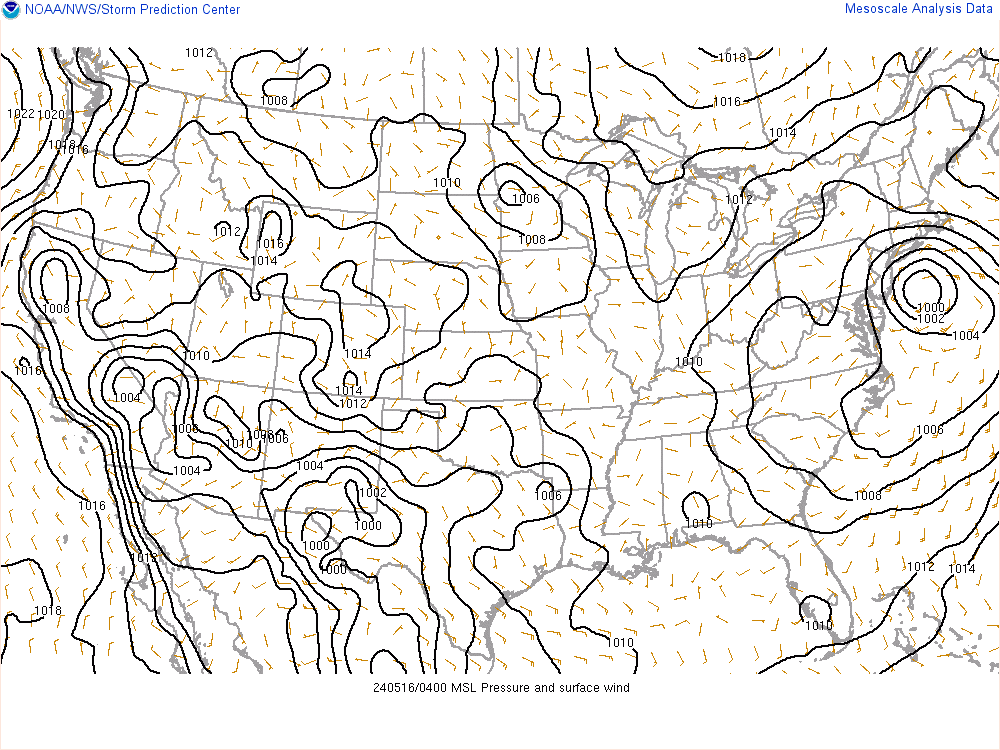
Here you can see our Primary LP forming.
http://earth.nullschool.net/#current/wind/surface/level/overlay=mean_sea_level_pressure/orthographic=-92.07,44.84,1024
_________________
"In weather and in life, there's no winning and losing; there's only winning and learning."
WINTER 2012/2013 TOTALS 43.65"WINTER 2017/2018 TOTALS 62.85" WINTER 2022/2023 TOTALS 4.9"
WINTER 2013/2014 TOTALS 64.85"WINTER 2018/2019 TOTALS 14.25" WINTER 2023/2024 TOTALS 13.1"
WINTER 2014/2015 TOTALS 71.20"WINTER 2019/2020 TOTALS 6.35"
WINTER 2015/2016 TOTALS 35.00"WINTER 2020/2021 TOTALS 37.75"
WINTER 2016/2017 TOTALS 42.25"WINTER 2021/2022 TOTALS 31.65"
sroc4- Admin
- Posts : 8331
Reputation : 301
Join date : 2013-01-07
Location : Wading River, LI
Re: Update #3: Final Snow Map, Ice Accretion, Flash Freeze
![]() by lglickman1 Sun Feb 01, 2015 8:50 am
by lglickman1 Sun Feb 01, 2015 8:50 am
lglickman1- Pro Enthusiast
- Posts : 319
Reputation : 0
Join date : 2013-02-05
Location : New Rochelle, NY
Page 1 of 6 • 1, 2, 3, 4, 5, 6 ![]()
|
|
|