
 Search
February 17th Storm: 1st Call Snow Map and Observations
Page 9 of 16 •  1 ... 6 ... 8, 9, 10 ... 12 ... 16
 ![]()
Re: February 17th Storm: 1st Call Snow Map and Observations
![]() by snow247 Mon Feb 16, 2015 10:09 pm
by snow247 Mon Feb 16, 2015 10:09 pm

snow247- Pro Enthusiast

- Posts : 2417
Join date : 2014-08-27
Re: February 17th Storm: 1st Call Snow Map and Observations
![]() by snow247 Mon Feb 16, 2015 10:10 pm
by snow247 Mon Feb 16, 2015 10:10 pm

snow247- Pro Enthusiast
- Posts : 2417
Join date : 2014-08-27
Re: February 17th Storm: 1st Call Snow Map and Observations
![]() by NjWeatherGuy Mon Feb 16, 2015 10:11 pm
by NjWeatherGuy Mon Feb 16, 2015 10:11 pm

NjWeatherGuy- Advanced Forecaster

- Posts : 4100
Reputation : 28
Join date : 2013-01-06
Location : Belle Mead, NJ
Re: February 17th Storm: 1st Call Snow Map and Observations
![]() by snow247 Mon Feb 16, 2015 10:20 pm
by snow247 Mon Feb 16, 2015 10:20 pm
"The models are all wrong. I'm telling you there's a propagation of a wave along the northern axis of the precip shield somewhere in the mid-levels. It could be as simple as stray vorticity maxima in the STJ/PJ wave interacting with the record cold cAA. Remember, this has its roots in the STJ and has a deep GOM moisture fetch. "

snow247- Pro Enthusiast
- Posts : 2417
Reputation : 0
Join date : 2014-08-27
Location : Mount Ivy, NY - Elevation 545'
Re: February 17th Storm: 1st Call Snow Map and Observations
![]() by amugs Mon Feb 16, 2015 10:22 pm
by amugs Mon Feb 16, 2015 10:22 pm
_________________
Mugs
AKA:King: Snow Weenie
Self Proclaimed
WINTER 2014-15 : 55.12" +.02 for 6 coatings (avg. 35")
WINTER 2015-16 Total - 29.8" (Avg 35")
WINTER 2016-17 : 39.5" so far

amugs- Advanced Forecaster - Mod

- Posts : 15093
Reputation : 213
Join date : 2013-01-07
Age : 54
Location : Hillsdale,NJ
Re: February 17th Storm: 1st Call Snow Map and Observations
![]() by snow247 Mon Feb 16, 2015 10:24 pm
by snow247 Mon Feb 16, 2015 10:24 pm
NjWeatherGuy wrote:Dry air is carving out a hole in the heart of the system into VA, I am concerned. SREFS have been slowly backing down all day, maybe the CMC was onto something.
Appears to be filling in now.
snow247- Pro Enthusiast
- Posts : 2417
Reputation : 0
Join date : 2014-08-27
Location : Mount Ivy, NY - Elevation 545'
Re: February 17th Storm: 1st Call Snow Map and Observations
![]() by Dunnzoo Mon Feb 16, 2015 10:25 pm
by Dunnzoo Mon Feb 16, 2015 10:25 pm
_________________
Janet
Snowfall winter of 2023-2024 17.5"
Snowfall winter of 2022-2023 6.0"
Snowfall winter of 2021-2022 17.6" 1" sleet 2/25/22
Snowfall winter of 2020-2021 51.1"
Snowfall winter of 2019-2020 8.5"
Snowfall winter of 2018-2019 25.1"
Snowfall winter of 2017-2018 51.9"
Snowfall winter of 2016-2017 45.6"
Snowfall winter of 2015-2016 29.5"
Snowfall winter of 2014-2015 50.55"
Snowfall winter of 2013-2014 66.5"

Dunnzoo- Senior Enthusiast - Mod
- Posts : 4886
Reputation : 68
Join date : 2013-01-11
Age : 62
Location : Westwood, NJ
Re: February 17th Storm: 1st Call Snow Map and Observations
![]() by snow247 Mon Feb 16, 2015 10:25 pm
by snow247 Mon Feb 16, 2015 10:25 pm
"The models are all wrong. I'm telling you there's a propagation of a wave along the northern axis of the precip shield somewhere in the mid-levels. It could be as simple as stray vorticity maxima in the STJ/PJ wave interacting with the record cold cAA. Remember, this has its roots in the STJ and has a deep GOM moisture fetch.
I mean, come on guys, not one piece of data had anything CLOSE to this!
I'm not purporting NYC gets 6-10" here, but there is going to be major busts on the northern side of this."
snow247- Pro Enthusiast
- Posts : 2417
Reputation : 0
Join date : 2014-08-27
Location : Mount Ivy, NY - Elevation 545'
Re: February 17th Storm: 1st Call Snow Map and Observations
![]() by Frank_Wx Mon Feb 16, 2015 10:26 pm
by Frank_Wx Mon Feb 16, 2015 10:26 pm
_________________
_______________________________________________________________________________________________________
CLICK HERE to view NJ Strong Snowstorm Classifications

Frank_Wx- Godzilla Seeker

- Posts : 21305
Reputation : 328
Join date : 2013-01-05
Age : 31
Location : Jersey City, NJ -

Re: February 17th Storm: 1st Call Snow Map and Observations
![]() by snow247 Mon Feb 16, 2015 10:29 pm
by snow247 Mon Feb 16, 2015 10:29 pm
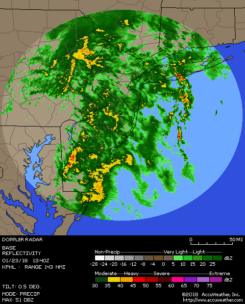
Frank_Wx wrote:Anyone else impressed with current radar? Definitely think central NJ will see good snow. At least 4".
Yes and I agree.
snow247- Pro Enthusiast
- Posts : 2417
Reputation : 0
Join date : 2014-08-27
Location : Mount Ivy, NY - Elevation 545'
Re: February 17th Storm: 1st Call Snow Map and Observations
![]() by Frank_Wx Mon Feb 16, 2015 10:46 pm
by Frank_Wx Mon Feb 16, 2015 10:46 pm
_________________
_______________________________________________________________________________________________________
CLICK HERE to view NJ Strong Snowstorm Classifications
Frank_Wx- Godzilla Seeker
- Posts : 21305
Reputation : 328
Join date : 2013-01-05
Age : 31
Location : Jersey City, NJ -
Re: February 17th Storm: 1st Call Snow Map and Observations
![]() by Yschiff Mon Feb 16, 2015 10:48 pm
by Yschiff Mon Feb 16, 2015 10:48 pm
Yschiff- Posts : 139
Reputation : 1
Join date : 2014-01-04
Location : Far Rockaway New York
Re: February 17th Storm: 1st Call Snow Map and Observations
![]() by Frank_Wx Mon Feb 16, 2015 10:49 pm
by Frank_Wx Mon Feb 16, 2015 10:49 pm

_________________
_______________________________________________________________________________________________________
CLICK HERE to view NJ Strong Snowstorm Classifications
Frank_Wx- Godzilla Seeker
- Posts : 21305
Reputation : 328
Join date : 2013-01-05
Age : 31
Location : Jersey City, NJ -
Re: February 17th Storm: 1st Call Snow Map and Observations
![]() by Frank_Wx Mon Feb 16, 2015 10:49 pm
by Frank_Wx Mon Feb 16, 2015 10:49 pm
Yschiff wrote:Frank do you think the jfk area could see 3-6"?
No, 4 max.
_________________
_______________________________________________________________________________________________________
CLICK HERE to view NJ Strong Snowstorm Classifications
Frank_Wx- Godzilla Seeker
- Posts : 21305
Reputation : 328
Join date : 2013-01-05
Age : 31
Location : Jersey City, NJ -
Re: February 17th Storm: 1st Call Snow Map and Observations
![]() by Vinnydula Mon Feb 16, 2015 10:50 pm
by Vinnydula Mon Feb 16, 2015 10:50 pm

Vinnydula- Pro Enthusiast
- Posts : 778
Reputation : 8
Join date : 2013-12-12
Location : Dobbs ferry
Re: February 17th Storm: 1st Call Snow Map and Observations
![]() by RJB8525 Mon Feb 16, 2015 10:51 pm
by RJB8525 Mon Feb 16, 2015 10:51 pm

RJB8525- Senior Enthusiast

- Posts : 1994
Reputation : 28
Join date : 2013-02-06
Age : 38
Location : Hackettstown, NJ
Re: February 17th Storm: 1st Call Snow Map and Observations
![]() by Frank_Wx Mon Feb 16, 2015 10:51 pm
by Frank_Wx Mon Feb 16, 2015 10:51 pm
Vinnydula wrote:Looks like it's coming right for nyc
The heaviest returns are heading toward CNJ
_________________
_______________________________________________________________________________________________________
CLICK HERE to view NJ Strong Snowstorm Classifications
Frank_Wx- Godzilla Seeker
- Posts : 21305
Reputation : 328
Join date : 2013-01-05
Age : 31
Location : Jersey City, NJ -
Re: February 17th Storm: 1st Call Snow Map and Observations
![]() by Frank_Wx Mon Feb 16, 2015 10:53 pm
by Frank_Wx Mon Feb 16, 2015 10:53 pm
_________________
_______________________________________________________________________________________________________
CLICK HERE to view NJ Strong Snowstorm Classifications
Frank_Wx- Godzilla Seeker
- Posts : 21305
Reputation : 328
Join date : 2013-01-05
Age : 31
Location : Jersey City, NJ -
Re: February 17th Storm: 1st Call Snow Map and Observations
![]() by Frank_Wx Mon Feb 16, 2015 10:56 pm
by Frank_Wx Mon Feb 16, 2015 10:56 pm

_________________
_______________________________________________________________________________________________________
CLICK HERE to view NJ Strong Snowstorm Classifications
Frank_Wx- Godzilla Seeker
- Posts : 21305
Reputation : 328
Join date : 2013-01-05
Age : 31
Location : Jersey City, NJ -
Re: February 17th Storm: 1st Call Snow Map and Observations
![]() by NjWeatherGuy Mon Feb 16, 2015 10:57 pm
by NjWeatherGuy Mon Feb 16, 2015 10:57 pm
NjWeatherGuy- Advanced Forecaster
- Posts : 4100
Reputation : 28
Join date : 2013-01-06
Location : Belle Mead, NJ
Re: February 17th Storm: 1st Call Snow Map and Observations
![]() by rb924119 Mon Feb 16, 2015 10:57 pm
by rb924119 Mon Feb 16, 2015 10:57 pm
rb924119- Meteorologist

- Posts : 6889
Reputation : 194
Join date : 2013-02-06
Age : 32
Location : Greentown, Pa
Re: February 17th Storm: 1st Call Snow Map and Observations
![]() by NjWeatherGuy Mon Feb 16, 2015 10:58 pm
by NjWeatherGuy Mon Feb 16, 2015 10:58 pm
NjWeatherGuy- Advanced Forecaster
- Posts : 4100
Reputation : 28
Join date : 2013-01-06
Location : Belle Mead, NJ
Re: February 17th Storm: 1st Call Snow Map and Observations
![]() by Frank_Wx Mon Feb 16, 2015 11:03 pm
by Frank_Wx Mon Feb 16, 2015 11:03 pm

_________________
_______________________________________________________________________________________________________
CLICK HERE to view NJ Strong Snowstorm Classifications
Frank_Wx- Godzilla Seeker
- Posts : 21305
Reputation : 328
Join date : 2013-01-05
Age : 31
Location : Jersey City, NJ -
Re: February 17th Storm: 1st Call Snow Map and Observations
![]() by snow247 Mon Feb 16, 2015 11:05 pm
by snow247 Mon Feb 16, 2015 11:05 pm
Guy in State College already reporting almost an inch, was that expected for there?
snow247- Pro Enthusiast
- Posts : 2417
Reputation : 0
Join date : 2014-08-27
Location : Mount Ivy, NY - Elevation 545'
Re: February 17th Storm: 1st Call Snow Map and Observations
![]() by Frank_Wx Mon Feb 16, 2015 11:06 pm
by Frank_Wx Mon Feb 16, 2015 11:06 pm
_________________
_______________________________________________________________________________________________________
CLICK HERE to view NJ Strong Snowstorm Classifications
Frank_Wx- Godzilla Seeker
- Posts : 21305
Reputation : 328
Join date : 2013-01-05
Age : 31
Location : Jersey City, NJ -

snow247- Pro Enthusiast
- Posts : 2417
Reputation : 0
Join date : 2014-08-27
Location : Mount Ivy, NY - Elevation 545'
Re: February 17th Storm: 1st Call Snow Map and Observations
![]() by amugs Mon Feb 16, 2015 11:07 pm
by amugs Mon Feb 16, 2015 11:07 pm
_________________
Mugs
AKA:King: Snow Weenie
Self Proclaimed
WINTER 2014-15 : 55.12" +.02 for 6 coatings (avg. 35")
WINTER 2015-16 Total - 29.8" (Avg 35")
WINTER 2016-17 : 39.5" so far
amugs- Advanced Forecaster - Mod
- Posts : 15093
Reputation : 213
Join date : 2013-01-07
Age : 54
Location : Hillsdale,NJ
Page 9 of 16 • 1 ... 6 ... 8, 9, 10 ... 12 ... 16 ![]()
|
|
|