
 Search
Possible Snowstorm Thursday, February 9th
Page 9 of 26 •  1 ... 6 ... 8, 9, 10 ... 17 ... 26
 ![]()
Re: Possible Snowstorm Thursday, February 9th
![]() by jmanley32 Mon Feb 06, 2017 10:17 pm
by jmanley32 Mon Feb 06, 2017 10:17 pm
jmanley32- Senior Enthusiast

- Posts : 20513
Join date : 2013-12-12
Re: Possible Snowstorm Thursday, February 9th
![]() by SoulSingMG Mon Feb 06, 2017 10:18 pm
by SoulSingMG Mon Feb 06, 2017 10:18 pm
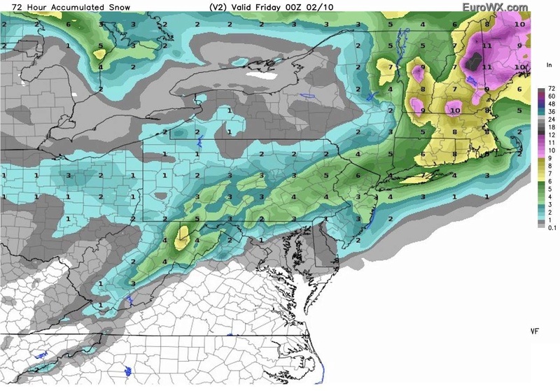
jmanley32 wrote:Get that green in here haha, thats a prettier picture than the wxbell snowmap. Wxbell shows about 6 for city and inland about 30 miles or so b4 it ups.SoulSingMG wrote:amugs wrote:
Ahh. Not sure what all the sad posts are about for this run/the coast but this shows 6-12 for nyc metro ;-)

Some greens WOULD be nice lol... 17" on that run over my hometown in New Hampshire!
SoulSingMG- Senior Enthusiast
- Posts : 2853
Join date : 2013-12-11


jmanley32- Senior Enthusiast
- Posts : 20513
Reputation : 108
Join date : 2013-12-12
Age : 42
Location : Yonkers, NY
Re: Possible Snowstorm Thursday, February 9th
![]() by jmanley32 Mon Feb 06, 2017 10:24 pm
by jmanley32 Mon Feb 06, 2017 10:24 pm
Last edited by jmanley32 on Mon Feb 06, 2017 10:30 pm; edited 1 time in total
jmanley32- Senior Enthusiast
- Posts : 20513
Reputation : 108
Join date : 2013-12-12
Age : 42
Location : Yonkers, NY
Re: Possible Snowstorm Thursday, February 9th
![]() by jmanley32 Mon Feb 06, 2017 10:27 pm
by jmanley32 Mon Feb 06, 2017 10:27 pm
This will be a disasterous commute, the heart of this storm as shown right now falls on rush hour. NO not everyone can work from home or has a choice to take off.
jmanley32- Senior Enthusiast
- Posts : 20513
Reputation : 108
Join date : 2013-12-12
Age : 42
Location : Yonkers, NY
Re: Possible Snowstorm Thursday, February 9th
![]() by jmanley32 Mon Feb 06, 2017 10:37 pm
by jmanley32 Mon Feb 06, 2017 10:37 pm
jmanley32- Senior Enthusiast
- Posts : 20513
Reputation : 108
Join date : 2013-12-12
Age : 42
Location : Yonkers, NY
Re: Possible Snowstorm Thursday, February 9th
![]() by Snow88 Mon Feb 06, 2017 10:45 pm
by Snow88 Mon Feb 06, 2017 10:45 pm

Snow88- Senior Enthusiast
- Posts : 2193
Reputation : 4
Join date : 2013-01-09
Age : 35
Location : Brooklyn, NY
Re: Possible Snowstorm Thursday, February 9th
![]() by jmanley32 Mon Feb 06, 2017 10:46 pm
by jmanley32 Mon Feb 06, 2017 10:46 pm
nws already said discounting gfs. this go b sr models ftw!Snow88 wrote:GFS is no Nam through 48 hours
jmanley32- Senior Enthusiast
- Posts : 20513
Reputation : 108
Join date : 2013-12-12
Age : 42
Location : Yonkers, NY
Re: Possible Snowstorm Thursday, February 9th
![]() by Snow88 Mon Feb 06, 2017 10:49 pm
by Snow88 Mon Feb 06, 2017 10:49 pm
Snow88- Senior Enthusiast
- Posts : 2193
Reputation : 4
Join date : 2013-01-09
Age : 35
Location : Brooklyn, NY
jmanley32- Senior Enthusiast
- Posts : 20513
Reputation : 108
Join date : 2013-12-12
Age : 42
Location : Yonkers, NY
Re: Possible Snowstorm Thursday, February 9th
![]() by Frank_Wx Mon Feb 06, 2017 11:01 pm
by Frank_Wx Mon Feb 06, 2017 11:01 pm
Listen, the ensembles for both the GFS and EURO suites have been more impressive than the OPs. Not to mention short range guidance such as NAM and SREF are bullish. Not to mention the energy won't be best sampled until Wednesday 12z. I'm thinking positive thoughts st the moment that this will be a Mothrazilla
_________________
_______________________________________________________________________________________________________
CLICK HERE to view NJ Strong Snowstorm Classifications

Frank_Wx- Godzilla Seeker

- Posts : 21305
Reputation : 328
Join date : 2013-01-05
Age : 31
Location : Jersey City, NJ -

Re: Possible Snowstorm Thursday, February 9th
![]() by Armando Salvadore Mon Feb 06, 2017 11:11 pm
by Armando Salvadore Mon Feb 06, 2017 11:11 pm

Armando Salvadore- Advanced Forecaster

- Posts : 171
Reputation : 0
Join date : 2016-12-23
Location : Springfield, NJ
Re: Possible Snowstorm Thursday, February 9th
![]() by hyde345 Mon Feb 06, 2017 11:14 pm
by hyde345 Mon Feb 06, 2017 11:14 pm

hyde345- Pro Enthusiast

- Posts : 1082
Reputation : 48
Join date : 2013-01-08
Location : Hyde Park, NY
Re: Possible Snowstorm Thursday, February 9th
![]() by SoulSingMG Mon Feb 06, 2017 11:22 pm
by SoulSingMG Mon Feb 06, 2017 11:22 pm

SoulSingMG- Senior Enthusiast
- Posts : 2853
Reputation : 74
Join date : 2013-12-11
Location : Long Island City, NY
Re: Possible Snowstorm Thursday, February 9th
![]() by jmanley32 Mon Feb 06, 2017 11:22 pm
by jmanley32 Mon Feb 06, 2017 11:22 pm
jmanley32- Senior Enthusiast
- Posts : 20513
Reputation : 108
Join date : 2013-12-12
Age : 42
Location : Yonkers, NY
Re: Possible Snowstorm Thursday, February 9th
![]() by jmanley32 Mon Feb 06, 2017 11:38 pm
by jmanley32 Mon Feb 06, 2017 11:38 pm
jmanley32- Senior Enthusiast
- Posts : 20513
Reputation : 108
Join date : 2013-12-12
Age : 42
Location : Yonkers, NY
Re: Possible Snowstorm Thursday, February 9th
![]() by rb924119 Mon Feb 06, 2017 11:45 pm
by rb924119 Mon Feb 06, 2017 11:45 pm
rb924119- Meteorologist

- Posts : 6889
Reputation : 194
Join date : 2013-02-06
Age : 32
Location : Greentown, Pa
Re: Possible Snowstorm Thursday, February 9th
![]() by SoulSingMG Mon Feb 06, 2017 11:47 pm
by SoulSingMG Mon Feb 06, 2017 11:47 pm
rb924119 wrote:UKMET COMES IN AS THE NAM'S TWIN!!!!!!!!!!!!!
That's all I needed to see tonight. GAME ON.
SoulSingMG- Senior Enthusiast
- Posts : 2853
Reputation : 74
Join date : 2013-12-11
Location : Long Island City, NY
Re: Possible Snowstorm Thursday, February 9th
![]() by jmanley32 Mon Feb 06, 2017 11:51 pm
by jmanley32 Mon Feb 06, 2017 11:51 pm
does wxbell have maps for ukmet? ive never seen them listed.rb924119 wrote:UKMET COMES IN AS THE NAM'S TWIN!!!!!!!!!!!!!
jmanley32- Senior Enthusiast
- Posts : 20513
Reputation : 108
Join date : 2013-12-12
Age : 42
Location : Yonkers, NY
Re: Possible Snowstorm Thursday, February 9th
![]() by rb924119 Tue Feb 07, 2017 12:10 am
by rb924119 Tue Feb 07, 2017 12:10 am
jmanley32 wrote:does wxbell have maps for ukmet? ive never seen them listed.rb924119 wrote:UKMET COMES IN AS THE NAM'S TWIN!!!!!!!!!!!!!
I don't believe so. You can view it here:
http://meteocentre.com/numerical-weather-prediction/forecast-systems.php?lang=en&map=na&run=00&mod=ukmet&mode=latest&yyyy=latest&mm=latest&dd=latest
UKMET verbatim would be almost identical to the NAM, except a little drier. 850hPa closed low goes right over ACY.
rb924119- Meteorologist
- Posts : 6889
Reputation : 194
Join date : 2013-02-06
Age : 32
Location : Greentown, Pa
Re: Possible Snowstorm Thursday, February 9th
![]() by rb924119 Tue Feb 07, 2017 12:12 am
by rb924119 Tue Feb 07, 2017 12:12 am


Good night all!!
rb924119- Meteorologist
- Posts : 6889
Reputation : 194
Join date : 2013-02-06
Age : 32
Location : Greentown, Pa

Radz- Pro Enthusiast
- Posts : 1028
Reputation : 17
Join date : 2013-01-12
Location : Cortlandt Manor NY
Re: Possible Snowstorm Thursday, February 9th
![]() by algae888 Tue Feb 07, 2017 4:10 am
by algae888 Tue Feb 07, 2017 4:10 am


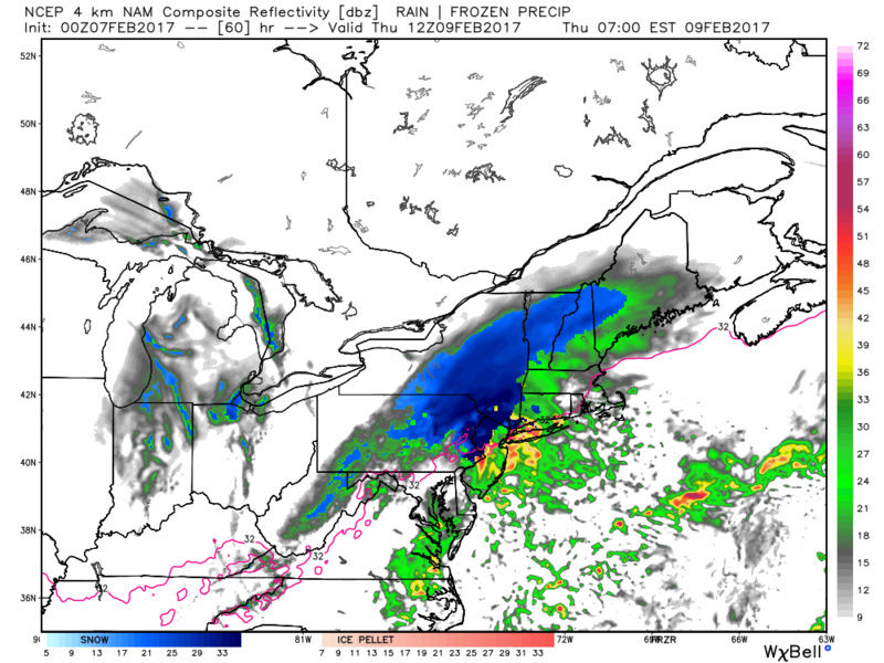
para gfs 0z..


algae888- Advanced Forecaster
- Posts : 5311
Reputation : 46
Join date : 2013-02-05
Age : 61
Location : mt. vernon, new york
Re: Possible Snowstorm Thursday, February 9th
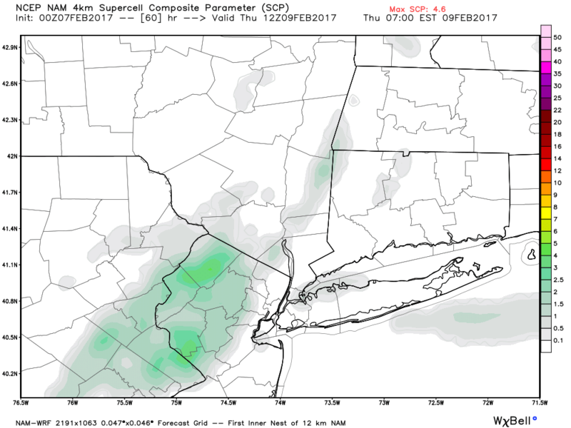
![]() by algae888 Tue Feb 07, 2017 4:11 am
by algae888 Tue Feb 07, 2017 4:11 am

algae888- Advanced Forecaster
- Posts : 5311
Reputation : 46
Join date : 2013-02-05
Age : 61
Location : mt. vernon, new york
Re: Possible Snowstorm Thursday, February 9th
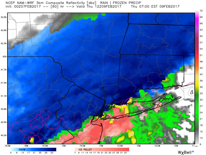
![]() by algae888 Tue Feb 07, 2017 4:15 am
by algae888 Tue Feb 07, 2017 4:15 am
Wednesday Night
Rain likely before 1am, then snow. Low around 32. Northwest wind 7 to 11 mph. Chance of precipitation is 90%. New snow accumulation of 1 to 3 inches possible.
Thursday
Snow, mainly before 1pm. Temperature falling to around 28 by 5pm. Chance of precipitation is 90%. New snow accumulation of 2 to 4 inches possible.
algae888- Advanced Forecaster
- Posts : 5311
Reputation : 46
Join date : 2013-02-05
Age : 61
Location : mt. vernon, new york
Re: Possible Snowstorm Thursday, February 9th
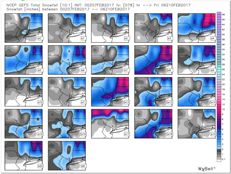
![]() by algae888 Tue Feb 07, 2017 4:45 am
by algae888 Tue Feb 07, 2017 4:45 am
*Potential for the heaviest snowfall of the season so far for
the I95 and I78 corridors 05z-21z Thursday**
Hazards: None yet but contemplated a watch. But lack of model
consensus/forecaster confidence resulted in waiting another
forecast period before reconsidering a WATCH for the period 05z
/Thursday-21z Thursday. Timing of the snow/temperatures dropping
below freezing with the Thursday morning commute argues for
probable widespread Thursday morning delays, even if this not a
5 to 7 inch 12 hour warning event.
Thursday...Snow north and rain south changing to snow. Amounts
greatest I-78 region north and probably the largest snowfall of the
winter so far in parts of eastern Pa and northern NJ. cold. Snowfall
rates of an inch an hour possible during the morning in the
I78-180 region. As for the ending time...uncertainty. For now we
say snow ends south midday. Elsewhere in the north snow tapers
to flurries anytime early afternoon to sunset. Wind turns north
northwest and gusts 20-30 mph in the afternoon. Temperatures
steady or falling from 7am readings (calendar day highs at 1201AM).
algae888- Advanced Forecaster
- Posts : 5311
Reputation : 46
Join date : 2013-02-05
Age : 61
Location : mt. vernon, new york
Re: Possible Snowstorm Thursday, February 9th
![]() by algae888 Tue Feb 07, 2017 4:52 am
by algae888 Tue Feb 07, 2017 4:52 am


algae888- Advanced Forecaster
- Posts : 5311
Reputation : 46
Join date : 2013-02-05
Age : 61
Location : mt. vernon, new york
Page 9 of 26 • 1 ... 6 ... 8, 9, 10 ... 17 ... 26 ![]()
|
|
|