
 Search
March 7th-8th 2018 Storm Potential
Page 18 of 19 •  1 ... 10 ... 17, 18, 19
 ![]()
Re: March 7th-8th 2018 Storm Potential
![]() by sroc4 Mon Mar 05, 2018 4:31 pm
by sroc4 Mon Mar 05, 2018 4:31 pm
Was thinking same thing. There are probably disagreements among forecasters since its the coast. I bet they are collaborating with other offices.WeatherBob wrote:Uptown not out with forecast discussion and it 4:30 pm. Very ominous!!!!!
sroc4- Admin

- Posts : 8354
Join date : 2013-01-07


RJB8525- Senior Enthusiast

- Posts : 1994
Join date : 2013-02-06
Re: March 7th-8th 2018 Storm Potential
![]() by billg315 Mon Mar 05, 2018 4:33 pm
by billg315 Mon Mar 05, 2018 4:33 pm
.LONG TERM /TUESDAY NIGHT THROUGH MONDAY/...
Highlights...High impact winter storm along and northwest of
I-95 Tue Night into Wed. Another storm system late this weekend
into early next week.
Overview/Model Preferences...We leaned toward the model solutions
that are further west nearer to the coast. The NAM/GFS have been
consistently in this camp, the 12Z ECMWF has trended much further to
the west today, and the CMC continues trending west as well. For
precip, the NAM looked too wet. We expect generally 3/4" to 1.5
inches of liquid, with the highest amounts near the Jersey Shore.
This will translate into snow further northwest, especially over
and to the west of I-95.
Hazards...Confidence is increasing in a high impact snowfall event
in the I-95 corridor and points northwest, with the highest snowfall
amounts occuring Wed afternoon and evening, particularly around the
Wed Evening rush hour. Snowfall rates may approach 2 inches per
hour, particularly northwest of Philadelphia in the Lehigh Valley
and Southern Poconos. Snowfall amounts ranging from 6 inches to over
1 foot are possible here. The snowfall will have a higher liquid
content closer to the I-95 corridor and points southeast, although
the wind will not be as big of a factor compared to the last event.
Nonethless, additional tree damage and power outages are possible,
which would impact recovery efforts. The Winter Storm has been
expanded southeast from Cecil County MD and New Castle Delaware into
the I-95 corridor and points northwest. Forecast amounts in the I-95
corridor are highly uncertain, so this area was also included in the
watch.

billg315- Advanced Forecaster - Mod

- Posts : 4483
Reputation : 185
Join date : 2015-01-24
Age : 50
Location : Flemington, NJ

adamfitz1969- Posts : 122
Reputation : 14
Join date : 2018-03-01
Age : 54
Location : Tarrytown
Re: March 7th-8th 2018 Storm Potential
![]() by Guest Mon Mar 05, 2018 4:35 pm
by Guest Mon Mar 05, 2018 4:35 pm
jmanley32 wrote:Anyone have the discussion for upton no not taking this lightly but NYC sees similar impscts and nw
Uptown has me on LI for a Winter Storm Watch like they did this morning, but they cut down on expected amounts by 1-3” island wide. . My WSW is for 4-7”
Guest- Guest
Re: March 7th-8th 2018 Storm Potential
![]() by RJB8525 Mon Mar 05, 2018 4:36 pm
by RJB8525 Mon Mar 05, 2018 4:36 pm

RJB8525- Senior Enthusiast
- Posts : 1994
Reputation : 28
Join date : 2013-02-06
Age : 38
Location : Hackettstown, NJ
Re: March 7th-8th 2018 Storm Potential
![]() by billg315 Mon Mar 05, 2018 4:37 pm
by billg315 Mon Mar 05, 2018 4:37 pm
RJB8525 wrote:Wow Bill, Mt Holly already talking about next one lol
LOL! I know. That caught my eye too. They say nothing else about it. They just throw it in there ominously, like, "Oh by the way another hit coming Sunday, just so you know."
billg315- Advanced Forecaster - Mod
- Posts : 4483
Reputation : 185
Join date : 2015-01-24
Age : 50
Location : Flemington, NJ
Re: March 7th-8th 2018 Storm Potential
![]() by amugs Mon Mar 05, 2018 4:39 pm
by amugs Mon Mar 05, 2018 4:39 pm

_________________
Mugs
AKA:King: Snow Weenie
Self Proclaimed
WINTER 2014-15 : 55.12" +.02 for 6 coatings (avg. 35")
WINTER 2015-16 Total - 29.8" (Avg 35")
WINTER 2016-17 : 39.5" so far

amugs- Advanced Forecaster - Mod
- Posts : 15095
Reputation : 213
Join date : 2013-01-07
Age : 54
Location : Hillsdale,NJ
Re: March 7th-8th 2018 Storm Potential
![]() by Angela0621 Mon Mar 05, 2018 4:42 pm
by Angela0621 Mon Mar 05, 2018 4:42 pm

Angela0621- Posts : 43
Reputation : 0
Join date : 2013-11-08
Location : Eatontown, NJ
Re: March 7th-8th 2018 Storm Potential
![]() by billg315 Mon Mar 05, 2018 4:47 pm
by billg315 Mon Mar 05, 2018 4:47 pm
Angela0621 wrote:What is everyone thinking for the coast around Eatontown?
As of right now, subject to change I think you start with light rain just after midnight Tuesday into Wednesday. It may waffle between snow and rain between about 6 a.m. and noon, but then I think you go back to all snow in the afternoon and it snows into Wednesday evening. The start as rain and mixing early will keep totals down, but the back end snow may get you a few inches.
billg315- Advanced Forecaster - Mod
- Posts : 4483
Reputation : 185
Join date : 2015-01-24
Age : 50
Location : Flemington, NJ
Re: March 7th-8th 2018 Storm Potential
![]() by weatherwatchermom Mon Mar 05, 2018 4:47 pm
by weatherwatchermom Mon Mar 05, 2018 4:47 pm
What an hour?? I thought that was ice mixing inamugs wrote:3k NAM HOLY NAM- that pink/purple is 3-4" snow fall rates maybe 5"

weatherwatchermom- Senior Enthusiast
- Posts : 3793
Reputation : 78
Join date : 2014-11-25
Location : Hazlet Township, NJ
Re: March 7th-8th 2018 Storm Potential
![]() by Frank_Wx Mon Mar 05, 2018 4:49 pm
by Frank_Wx Mon Mar 05, 2018 4:49 pm
_________________
_______________________________________________________________________________________________________
CLICK HERE to view NJ Strong Snowstorm Classifications

Frank_Wx- Godzilla Seeker
- Posts : 21305
Reputation : 328
Join date : 2013-01-05
Age : 32
Location : Jersey City, NJ -

Re: March 7th-8th 2018 Storm Potential
![]() by billg315 Mon Mar 05, 2018 4:49 pm
by billg315 Mon Mar 05, 2018 4:49 pm
weatherwatchermom wrote:What an hour?? I thought that was ice mixing inamugs wrote:3k NAM HOLY NAM- that pink/purple is 3-4" snow fall rates maybe 5"
Haha, I did a double take on that initially too. But, nope, that's the heaviest snow echoes. lol. look at the top of the snow chart on the right.
billg315- Advanced Forecaster - Mod
- Posts : 4483
Reputation : 185
Join date : 2015-01-24
Age : 50
Location : Flemington, NJ
Re: March 7th-8th 2018 Storm Potential
![]() by Frank_Wx Mon Mar 05, 2018 4:50 pm
by Frank_Wx Mon Mar 05, 2018 4:50 pm
_________________
_______________________________________________________________________________________________________
CLICK HERE to view NJ Strong Snowstorm Classifications
Frank_Wx- Godzilla Seeker
- Posts : 21305
Reputation : 328
Join date : 2013-01-05
Age : 32
Location : Jersey City, NJ -
Re: March 7th-8th 2018 Storm Potential
![]() by Dunnzoo Mon Mar 05, 2018 4:50 pm
by Dunnzoo Mon Mar 05, 2018 4:50 pm
amugs wrote:Who wants some Candy??

Hey mugs, since you'll have a snow day, I'm counting on your measurements! I don't think I can trust my boys to do it for me!
_________________
Janet
Snowfall winter of 2023-2024 17.5"
Snowfall winter of 2022-2023 6.0"
Snowfall winter of 2021-2022 17.6" 1" sleet 2/25/22
Snowfall winter of 2020-2021 51.1"
Snowfall winter of 2019-2020 8.5"
Snowfall winter of 2018-2019 25.1"
Snowfall winter of 2017-2018 51.9"
Snowfall winter of 2016-2017 45.6"
Snowfall winter of 2015-2016 29.5"
Snowfall winter of 2014-2015 50.55"
Snowfall winter of 2013-2014 66.5"

Dunnzoo- Senior Enthusiast - Mod
- Posts : 4905
Reputation : 68
Join date : 2013-01-11
Age : 62
Location : Westwood, NJ
Re: March 7th-8th 2018 Storm Potential
![]() by billg315 Mon Mar 05, 2018 4:52 pm
by billg315 Mon Mar 05, 2018 4:52 pm
billg315- Advanced Forecaster - Mod
- Posts : 4483
Reputation : 185
Join date : 2015-01-24
Age : 50
Location : Flemington, NJ
.png.14e69318a22e6e3e561911f16e5129c8.png)
adamfitz1969- Posts : 122
Reputation : 14
Join date : 2018-03-01
Age : 54
Location : Tarrytown
Re: March 7th-8th 2018 Storm Potential
![]() by algae888 Mon Mar 05, 2018 4:53 pm
by algae888 Mon Mar 05, 2018 4:53 pm
That's incredible 15 to 20 in for New York City on the rgemFrank_Wx wrote:50mm of snow

algae888- Advanced Forecaster

- Posts : 5311
Reputation : 46
Join date : 2013-02-05
Age : 62
Location : mt. vernon, new york
Re: March 7th-8th 2018 Storm Potential
![]() by billg315 Mon Mar 05, 2018 4:56 pm
by billg315 Mon Mar 05, 2018 4:56 pm
billg315- Advanced Forecaster - Mod
- Posts : 4483
Reputation : 185
Join date : 2015-01-24
Age : 50
Location : Flemington, NJ
Re: March 7th-8th 2018 Storm Potential
![]() by jmanley32 Mon Mar 05, 2018 5:02 pm
by jmanley32 Mon Mar 05, 2018 5:02 pm
Al 3km too looks like we may really cash in this time!algae888 wrote:That's incredible 15 to 20 in for New York City on the rgemFrank_Wx wrote:50mm of snow

jmanley32- Senior Enthusiast
- Posts : 20535
Reputation : 108
Join date : 2013-12-12
Age : 43
Location : Yonkers, NY
Re: March 7th-8th 2018 Storm Potential
![]() by lglickman1 Mon Mar 05, 2018 5:03 pm
by lglickman1 Mon Mar 05, 2018 5:03 pm
lglickman1- Pro Enthusiast

- Posts : 319
Reputation : 0
Join date : 2013-02-05
Location : New Rochelle, NY
Re: March 7th-8th 2018 Storm Potential
![]() by jmanley32 Mon Mar 05, 2018 5:04 pm
by jmanley32 Mon Mar 05, 2018 5:04 pm
oh sesy Mama Mia!! Bullseye!! Soul we in business if that verifies. See I said Sr models were go pump out big totals let's hope this holds.adamfitz1969 wrote:
jmanley32- Senior Enthusiast
- Posts : 20535
Reputation : 108
Join date : 2013-12-12
Age : 43
Location : Yonkers, NY
Re: March 7th-8th 2018 Storm Potential
![]() by crippo84 Mon Mar 05, 2018 5:04 pm
by crippo84 Mon Mar 05, 2018 5:04 pm
12z NAM and GFS, which
close off the upper low earlier, have nudged the track of the
surface low closer to the coast from the 00z run. The 12z GGEM and
ECMWF meanwhile close the upper low later, resulting in a farther
offshore track and colder thermal profile. With an overall NW trend
of the storm track, leaning towards the NAM/GFS camp and thermal
profiles.
With the storm tracking so close to us along with surface E-ENE
winds, whether it be boundary layer temps or temps aloft, what
starts out as snow therefore mixes rain over coastal areas mainly
Weds aftn/evening. Parts of LI and SE likely even see a total
changeover to rain for some of the time. PCPN would start late
Tuesday night, with the heaviest PCPN probably occurring the
afternoon to early evening hours. PCPN should end everywhere by
daybreak on Thursday.

crippo84- Posts : 383
Reputation : 20
Join date : 2013-11-07
Age : 40
Location : East Village, NYC
.gif.4eef09d9112b743a8ec8f5d40190aad7.gif)
adamfitz1969- Posts : 122
Reputation : 14
Join date : 2018-03-01
Age : 54
Location : Tarrytown
Re: March 7th-8th 2018 Storm Potential
![]() by sroc4 Mon Mar 05, 2018 5:12 pm
by sroc4 Mon Mar 05, 2018 5:12 pm
lglickman1 wrote:Is it clear at this point if the immediate coast will have mixing issues? Or still up in the air?
It is the battle ground. If GFS and 12z are corect with LP track then coast will mix. If the Euro/CMC/Ukie are correct coast may mix little but not much
_________________
"In weather and in life, there's no winning and losing; there's only winning and learning."
WINTER 2012/2013 TOTALS 43.65"WINTER 2017/2018 TOTALS 62.85" WINTER 2022/2023 TOTALS 4.9"
WINTER 2013/2014 TOTALS 64.85"WINTER 2018/2019 TOTALS 14.25" WINTER 2023/2024 TOTALS 13.1"
WINTER 2014/2015 TOTALS 71.20"WINTER 2019/2020 TOTALS 6.35"
WINTER 2015/2016 TOTALS 35.00"WINTER 2020/2021 TOTALS 37.75"
WINTER 2016/2017 TOTALS 42.25"WINTER 2021/2022 TOTALS 31.65"

sroc4- Admin
- Posts : 8354
Reputation : 302
Join date : 2013-01-07
Location : Wading River, LI
Re: March 7th-8th 2018 Storm Potential
![]() by jmanley32 Mon Mar 05, 2018 5:16 pm
by jmanley32 Mon Mar 05, 2018 5:16 pm
Jesus 40 to 50 mm qpf I'm in bullseyeadamfitz1969 wrote:
jmanley32- Senior Enthusiast
- Posts : 20535
Reputation : 108
Join date : 2013-12-12
Age : 43
Location : Yonkers, NY
Re: March 7th-8th 2018 Storm Potential
![]() by rb924119 Mon Mar 05, 2018 5:25 pm
by rb924119 Mon Mar 05, 2018 5:25 pm
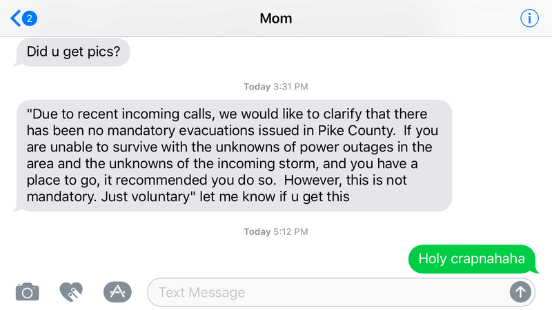
This is how serious it still is in parts of PA and probably into NY. This is from my mom she received from a friend who received that as an email from the State. We live in Pike Cty. Lol
Last edited by rb924119 on Mon Mar 05, 2018 5:29 pm; edited 1 time in total
rb924119- Meteorologist

- Posts : 6928
Reputation : 194
Join date : 2013-02-06
Age : 32
Location : Greentown, Pa
Page 18 of 19 • 1 ... 10 ... 17, 18, 19 ![]()
|
|
|