March Madness! Spring Snowstorm Observations
+77
Artechmetals
snowlover78
Lnda23
cooladi
Dtone
WeatherBob
mancave25
snemiroff
Dunnzoo
dad4twoboys
jldio
Radz
Sparky Sparticles
lisalamb
petep10
heehaw453
toople
jake732
Snow88
Joe Snow
2004blackwrx
SENJsnowman
devsman
oldtimer
freezerburn
docstox12
brownie
HeresL
Math23x7
mwilli5783
SkiSeadooJoe
hurrysundown23
frank 638
emokid51783
Vinnydula
mikeypizano
Aiosamoney21
richb521
GreyBeard
Carter bk
sroc4
bluebythec
dkodgis
Angela0621
deadrabbit79
bobjohnsonforthehall
larryrock72
skinsfan1177
Smittyaj623
rb924119
nujerzeedevil
shawnerak
bloc1357
gigs68
jjlane25
Grselig
nutleyblizzard
essexcountypete
mmanisca
dsix85
crippo84
RJB8525
jimv45
algae888
Scullybutcher
Quietace
adamfitz1969
aiannone
amugs
billg315
Taffy
jmanley32
weatherwatchermom
CPcantmeasuresnow
SoulSingMG
Sanchize06
Frank_Wx
81 posters
Page 38 of 40
Page 38 of 40 •  1 ... 20 ... 37, 38, 39, 40
 Re: March Madness! Spring Snowstorm Observations
what time is this storm going to happen i am getting tired of this light snow with coating on the ground
frank 638- Senior Enthusiast

- Posts : 2843
Join date : 2016-01-01
 Re: March Madness! Spring Snowstorm Observations
SoulSingMG wrote:sroc4 wrote:rb924119 wrote:SoulSingMG wrote:Going back to bed :-(
He's just trying to verify his already busted forecast of 3-6" lol as WeatherBob et Al. have been saying, you have to watch the mid-levels, and they aren't here yet. considering the heaviest banding is already located OVER MARYLAND, DELAWARE, AND SE PA, I THINK HIS STATEMENT OF THE HEAVIEST BANDING OVER THE WATER IS DISPROVEN, just like Steve D lmao
Thank you rb!!! Folks listen...maybe even screen shot this post and post it for them to see. Both of these guys are missing something here. The 500mb and 700mb lows are still well inland.
This was ALWAYS a two wave system the second of which was never going to get going until afternoon Wed. There are two surface low pressure centers as a result of this. With two centers you will have competition for where the surface winds want to go in between them. As a result of divergence in between these two centers you will not get consistent convection. This is going to change as we go through the afternoon and evening hours.
The h5 energy that wave one and generated the subsequent SLP, is being sheared by the confluence and the surface low conts to sit off the coast. However; it is going to cont to weaken throughout the day. Why??? Because.... The 500mb low is going to deepen as it slides off the coast...first E then head NE as it passes south of LI It is then and only then that we will see the new primary take over and be tugged back west some towards the strengthening ULL. Exactly how far south the H5 ULL passes willl determine if what they say is correct. So while they may be right in the end, they will be wrong in their reasoning. We have to wait and see A) what track does the H5 ULL take, and B) how strong does it get. These guys are Cranky and Stubborn the 8th and 9th dwarfs.
Lol! I am laughing out loud. Thanks tho—this actually makes more sense to me. Could this mean the HRRR for example is "chasing" the wrong (1st) wave energy hence the eastern runs of late?
God I hope so.
But I'll leave the scientific analysis to Sroc.

CPcantmeasuresnow- Wx Statistician Guru

- Posts : 7274
Reputation : 230
Join date : 2013-01-07
Age : 103
Location : Eastern Orange County, NY
 Re: March Madness! Spring Snowstorm Observations
i just dont get how im still rain..what a stupid bust so far for me
 Re: March Madness! Spring Snowstorm Observations
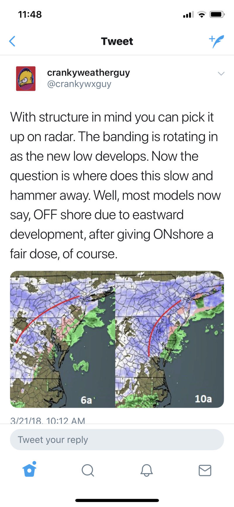
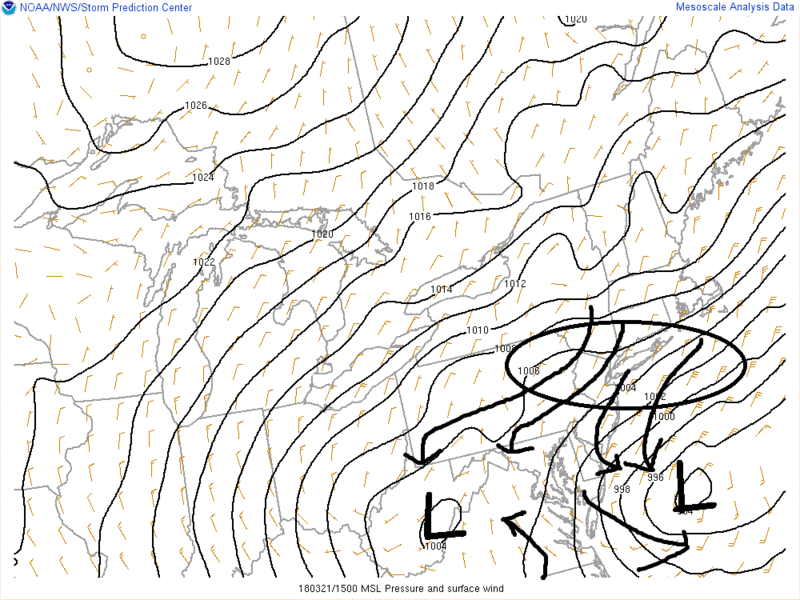
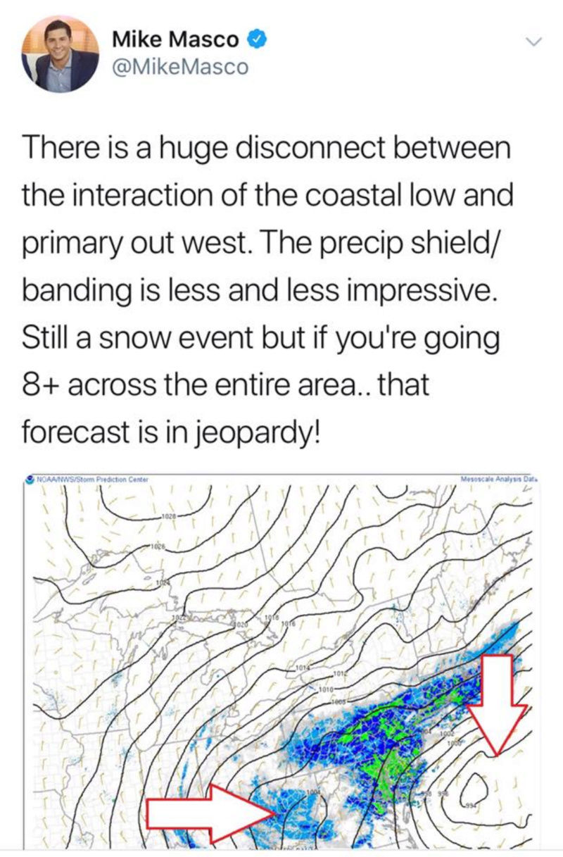
This is what I was referring to

_________________
-Alex Iannone-

aiannone- Senior Enthusiast - Mod

- Posts : 4815
Reputation : 92
Join date : 2013-01-07
Location : Saint James, LI (Northwest Suffolk Co.)
 Re: March Madness! Spring Snowstorm Observations
The surface Lows are not phasing per se. The track and deepening of the H5 ULL will determine where the newest primary center of surface low pressure will form. And no the inland low IS NOT stronger than modeled. it is well within the avg of where the models had it at this time.
_________________
"In weather and in life, there's no winning and losing; there's only winning and learning."
WINTER 2012/2013 TOTALS 43.65"WINTER 2017/2018 TOTALS 62.85" WINTER 2022/2023 TOTALS 4.9"
WINTER 2013/2014 TOTALS 64.85"WINTER 2018/2019 TOTALS 14.25" WINTER 2023/2024 TOTALS 13.1"
WINTER 2014/2015 TOTALS 71.20"WINTER 2019/2020 TOTALS 6.35"
WINTER 2015/2016 TOTALS 35.00"WINTER 2020/2021 TOTALS 37.75"
WINTER 2016/2017 TOTALS 42.25"WINTER 2021/2022 TOTALS 31.65"

sroc4- Admin

- Posts : 8354
Reputation : 302
Join date : 2013-01-07
Location : Wading River, LI
 Re: March Madness! Spring Snowstorm Observations
Heavy snow 3+ inches
snowlover78- Posts : 99
Reputation : 5
Join date : 2016-01-20
Location : Plumstead, Ocean County, NJ
 Re: March Madness! Spring Snowstorm Observations
sroc4 wrote:The surface Lows are not phasing per se. The track and deepening of the H5 ULL will determine where the newest primary center of surface low pressure will form. And no the inland low IS NOT stronger than modeled. it is well within the avg of where the models had it at this time.
Thanks for that explanation Scott
_________________
-Alex Iannone-

aiannone- Senior Enthusiast - Mod

- Posts : 4815
Reputation : 92
Join date : 2013-01-07
Location : Saint James, LI (Northwest Suffolk Co.)
 Re: March Madness! Spring Snowstorm Observations
aiannone wrote:This is what I was referring to
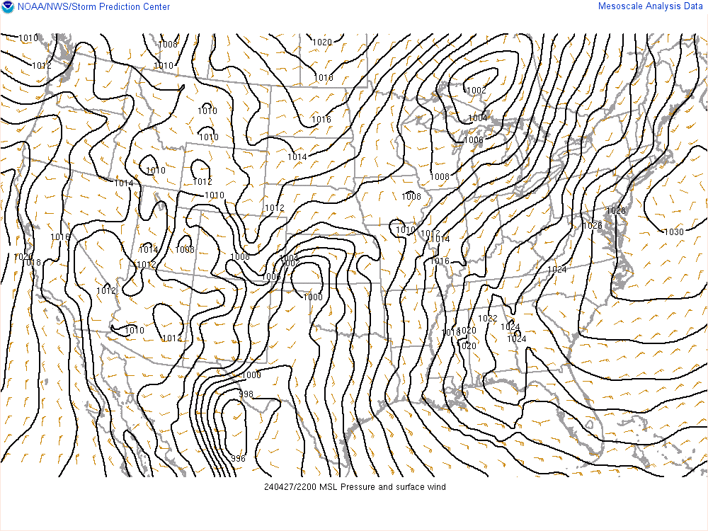
But look now
_________________
"In weather and in life, there's no winning and losing; there's only winning and learning."
WINTER 2012/2013 TOTALS 43.65"WINTER 2017/2018 TOTALS 62.85" WINTER 2022/2023 TOTALS 4.9"
WINTER 2013/2014 TOTALS 64.85"WINTER 2018/2019 TOTALS 14.25" WINTER 2023/2024 TOTALS 13.1"
WINTER 2014/2015 TOTALS 71.20"WINTER 2019/2020 TOTALS 6.35"
WINTER 2015/2016 TOTALS 35.00"WINTER 2020/2021 TOTALS 37.75"
WINTER 2016/2017 TOTALS 42.25"WINTER 2021/2022 TOTALS 31.65"

sroc4- Admin

- Posts : 8354
Reputation : 302
Join date : 2013-01-07
Location : Wading River, LI
 Re: March Madness! Spring Snowstorm Observations
Frank_Wx wrote:Brooklyn already has 4" of snow...
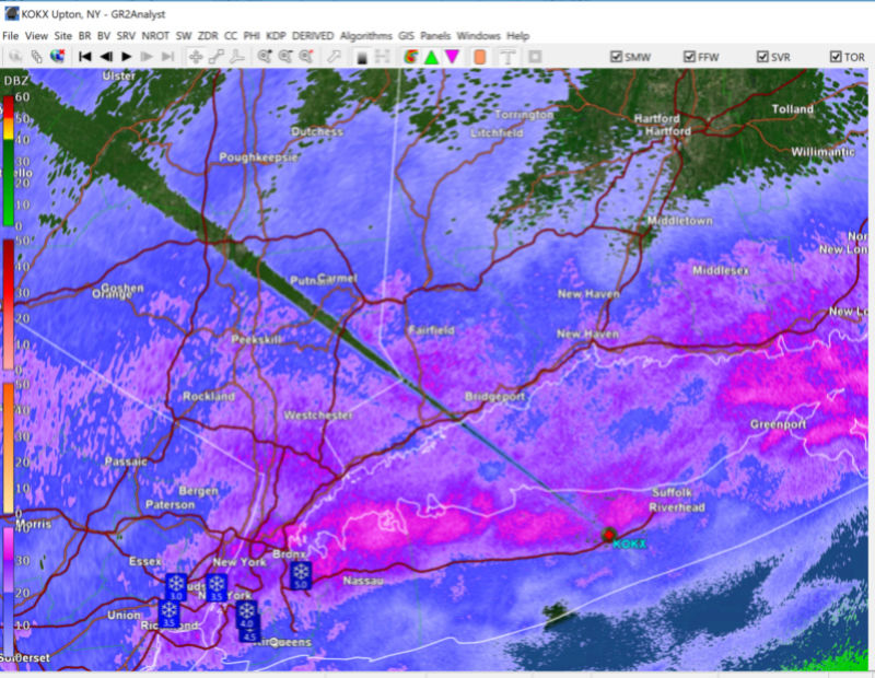
Yeah I don't see what all the fuss is about. Still snowing heavily here in Brooklyn - I can confirm that 4 inches. Look at the band that just refuses to dissipate over NYC. This has been a hell of an appetizer - but always room for the main course later

crippo84- Posts : 383
Reputation : 20
Join date : 2013-11-07
Age : 40
Location : East Village, NYC
 Re: March Madness! Spring Snowstorm Observations
Very fine flakes here in Livingston still light snow
Artechmetals- Pro Enthusiast

- Posts : 571
Reputation : 3
Join date : 2014-01-01
Age : 57
Location : Wayne , NJ

Vinnydula- Pro Enthusiast

- Posts : 778
Reputation : 8
Join date : 2013-12-12
Location : Dobbs ferry
 Re: March Madness! Spring Snowstorm Observations
Big Flakes under this band

_________________
-Alex Iannone-

aiannone- Senior Enthusiast - Mod

- Posts : 4815
Reputation : 92
Join date : 2013-01-07
Location : Saint James, LI (Northwest Suffolk Co.)
 Re: March Madness! Spring Snowstorm Observations
sroc4 wrote:The surface Lows are not phasing per se. The track and deepening of the H5 ULL will determine where the newest primary center of surface low pressure will form. And no the inland low IS NOT stronger than modeled. it is well within the avg of where the models had it at this time.
I actually don't think they were ever suppose to "phase" (outside of 10 day old runs I believe). Does anyone know if the HRRR, RGEM etc has current obs on point when they begin their run?

SoulSingMG- Senior Enthusiast

- Posts : 2853
Reputation : 74
Join date : 2013-12-11
Location : Long Island City, NY
 Re: March Madness! Spring Snowstorm Observations
back to moderate snow

RJB8525- Senior Enthusiast

- Posts : 1994
Reputation : 28
Join date : 2013-02-06
Age : 38
Location : Hackettstown, NJ
 Re: March Madness! Spring Snowstorm Observations
I don't get how it's not snowing in the Bronx less than 5 minutes from me when it's snowing heavily here everything cofrank 638 wrote:what time is this storm going to happen i am getting tired of this light snow with coating on the ground
ver including the roads over 2in on the ground heaviest snow of the day so far

algae888- Advanced Forecaster

- Posts : 5311
Reputation : 46
Join date : 2013-02-05
Age : 62
Location : mt. vernon, new york
 Re: March Madness! Spring Snowstorm Observations
aiannone wrote:sroc4 wrote:rb924119 wrote:SoulSingMG wrote:Going back to bed :-(
He's just trying to verify his already busted forecast of 3-6" lol as WeatherBob et Al. have been saying, you have to watch the mid-levels, and they aren't here yet. considering the heaviest banding is already located OVER MARYLAND, DELAWARE, AND SE PA, I THINK HIS STATEMENT OF THE HEAVIEST BANDING OVER THE WATER IS DISPROVEN, just like Steve D lmao
Thank you rb!!! Folks listen...maybe even screen shot this post and post it for them to see. Both of these guys are missing something here. The 500mb and 700mb lows are still well inland.
This was ALWAYS a two wave system the second of which was never going to get going until afternoon Wed. There are two surface low pressure centers as a result of this. With two centers you will have competition for where the surface winds want to go in between them. As a result of divergence in between these two centers you will not get consistent convection. This is going to change as we go through the afternoon and evening hours.
The h5 energy that wave one and generated the subsequent SLP, is being sheared by the confluence and the surface low conts to sit off the coast. However; it is going to cont to weaken throughout the day. Why??? Because.... The 500mb low is going to deepen as it slides off the coast...first E then head NE as it passes south of LI It is then and only then that we will see the new primary take over and be tugged back west some towards the strengthening ULL. Exactly how far south the H5 ULL passes willl determine if what they say is correct. So while they may be right in the end, they will be wrong in their reasoning. We have to wait and see A) what track does the H5 ULL take, and B) how strong does it get. These guys are Cranky and Stubborn the 8th and 9th dwarfs.
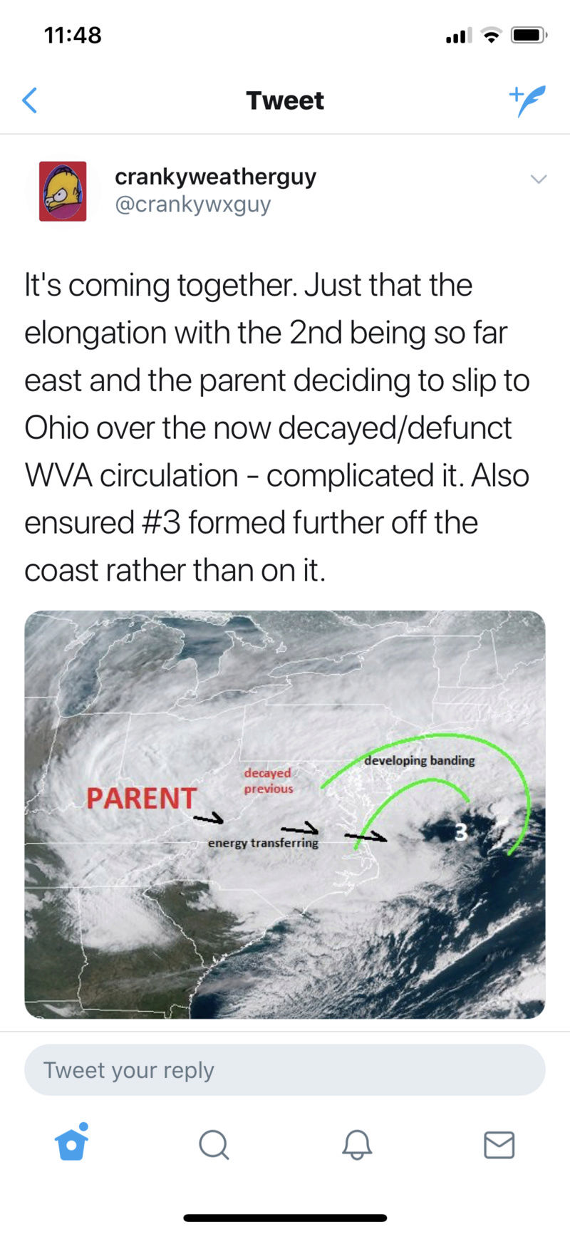
I agree with your anaylsis, but can you guys comment on this part of their theory. They mentioned the initial low that is inland is stronger than modeled, which in combination with an elongated low off the coast, it's causing that elongated low to be shoved further east, and therefore their phase to occur further off the coast.
The phase has already happened lmao it happened last night and earlier this morning. That's why the trough went negative and is now closed off and strengthening. The phase isn't out over the water. "Phasing" has NOTHING to do with surface features; it's all aloft. So for them to even be saying this is not even scientifically accurate, hence our collective frustration lmao
And no, Soul, I was not yelling at you lmao just trying to sternly get my point across aha
rb924119- Meteorologist

- Posts : 6928
Reputation : 194
Join date : 2013-02-06
Age : 32
Location : Greentown, Pa
 Re: March Madness! Spring Snowstorm Observations
sroc4 wrote:rb924119 wrote:SoulSingMG wrote:Going back to bed :-(
He's just trying to verify his already busted forecast of 3-6" lol as WeatherBob et Al. have been saying, you have to watch the mid-levels, and they aren't here yet. considering the heaviest banding is already located OVER MARYLAND, DELAWARE, AND SE PA, I THINK HIS STATEMENT OF THE HEAVIEST BANDING OVER THE WATER IS DISPROVEN, just like Steve D lmao
Thank you rb!!! Folks listen...maybe even screen shot this post and post it for them to see. Both of these guys are missing something here. The 500mb and 700mb lows are still well inland.
This was ALWAYS a two wave system the second of which was never going to get going until afternoon Wed. There are two surface low pressure centers as a result of this. With two centers you will have competition for where the surface winds want to go in between them. As a result yo get divergence in between these two centers rather than convergence and frontogenesis and you will not get consistent convection or banding..hence the fragmented bands. This is going to change as we go through the afternoon and evening hours.
The h5 energy that wave one and generated the subsequent SLP, is being sheared by the confluence and the surface low conts to sit off the coast. However; it is going to cont to weaken throughout the day. Why??? Because.... The 500mb low is going to deepen as it slides off the coast...first E then head NE as it passes south of LI It is then and only then that we will see the new primary take over and be tugged back west some towards the strengthening ULL. Exactly how far south the H5 ULL passes willl determine if what they say is correct. So while they may be right in the end, they will be wrong in their reasoning. We have to wait and see A) what track does the H5 ULL take, and B) how strong does it get. These guys are Cranky and Stubborn the 8th and 9th dwarfs.
Thanks, definitely needed this. I think getting screwed on the last 3 nor'easters is making me bias haha
Sanchize06- Senior Enthusiast

- Posts : 1041
Reputation : 21
Join date : 2013-02-05
Location : Union Beach, NJ
 Re: March Madness! Spring Snowstorm Observations
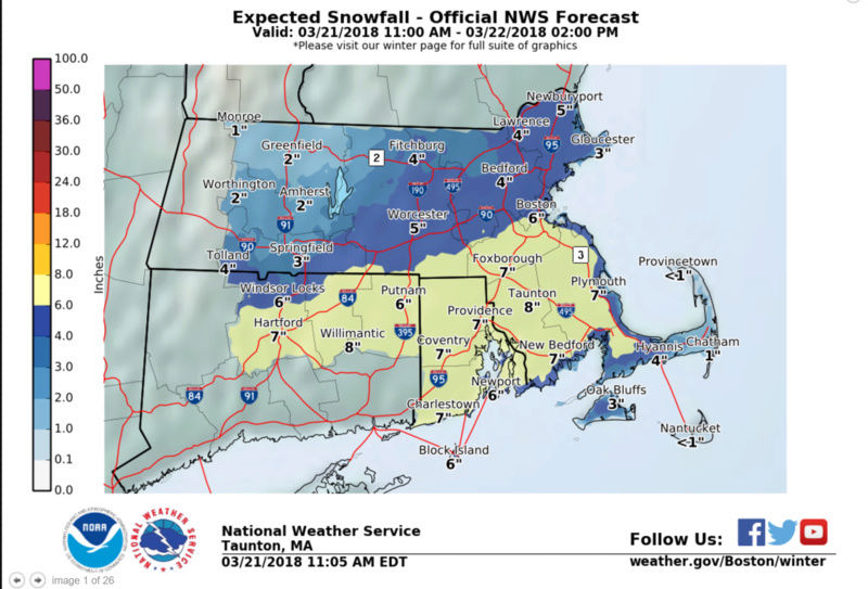
Taunton just dropped totals

_________________
-Alex Iannone-

aiannone- Senior Enthusiast - Mod

- Posts : 4815
Reputation : 92
Join date : 2013-01-07
Location : Saint James, LI (Northwest Suffolk Co.)
 Re: March Madness! Spring Snowstorm Observations
Had very light snow about an hour ago, and now, absolutely nothing!
marin1804- Posts : 11
Reputation : 0
Join date : 2013-12-30
Location : Brewster, NY
 Re: March Madness! Spring Snowstorm Observations
I agree it is snowing and snowing heavily now. Please wait it is coming big time. This is just an appetizer.
snowlover78- Posts : 99
Reputation : 5
Join date : 2016-01-20
Location : Plumstead, Ocean County, NJ
 Re: March Madness! Spring Snowstorm Observations
Snow has picked up again. I currently have 3''.

nutleyblizzard- Senior Enthusiast

- Posts : 1954
Reputation : 41
Join date : 2014-01-30
Age : 58
Location : Nutley, new jersey
 Re: March Madness! Spring Snowstorm Observations
While I am on the edge of glory over here about to forecast sunny skies and 80° later this afternoon, Governor Cuomo just issued a state of emergency for New York State.
Last edited by SoulSingMG on Wed Mar 21, 2018 12:47 pm; edited 3 times in total

SoulSingMG- Senior Enthusiast

- Posts : 2853
Reputation : 74
Join date : 2013-12-11
Location : Long Island City, NY
 Re: March Madness! Spring Snowstorm Observations
aiannone wrote:Taunton just dropped totals
_________________
"In weather and in life, there's no winning and losing; there's only winning and learning."
WINTER 2012/2013 TOTALS 43.65"WINTER 2017/2018 TOTALS 62.85" WINTER 2022/2023 TOTALS 4.9"
WINTER 2013/2014 TOTALS 64.85"WINTER 2018/2019 TOTALS 14.25" WINTER 2023/2024 TOTALS 13.1"
WINTER 2014/2015 TOTALS 71.20"WINTER 2019/2020 TOTALS 6.35"
WINTER 2015/2016 TOTALS 35.00"WINTER 2020/2021 TOTALS 37.75"
WINTER 2016/2017 TOTALS 42.25"WINTER 2021/2022 TOTALS 31.65"

sroc4- Admin

- Posts : 8354
Reputation : 302
Join date : 2013-01-07
Location : Wading River, LI
 Re: March Madness! Spring Snowstorm Observations
just started to snow again coming down pretty good now i just want a foot already is that to much to ask lolalgae888 wrote:I don't get how it's not snowing in the Bronx less than 5 minutes from me when it's snowing heavily here everything cofrank 638 wrote:what time is this storm going to happen i am getting tired of this light snow with coating on the ground
ver including the roads over 2in on the ground heaviest snow of the day so far
frank 638- Senior Enthusiast

- Posts : 2843
Reputation : 37
Join date : 2016-01-01
Age : 40
Location : bronx ny
 Re: March Madness! Spring Snowstorm Observations
same here Al snowing lightly roads just wet. If this is it I'm go scream! There is a little on cars sidewalks etc.algae888 wrote:I don't get how it's not snowing in the Bronx less than 5 minutes from me when it's snowing heavily here everything cofrank 638 wrote:what time is this storm going to happen i am getting tired of this light snow with coating on the ground
ver including the roads over 2in on the ground heaviest snow of the day so far

jmanley32- Senior Enthusiast

- Posts : 20535
Reputation : 108
Join date : 2013-12-12
Age : 43
Location : Yonkers, NY
 Re: March Madness! Spring Snowstorm Observations
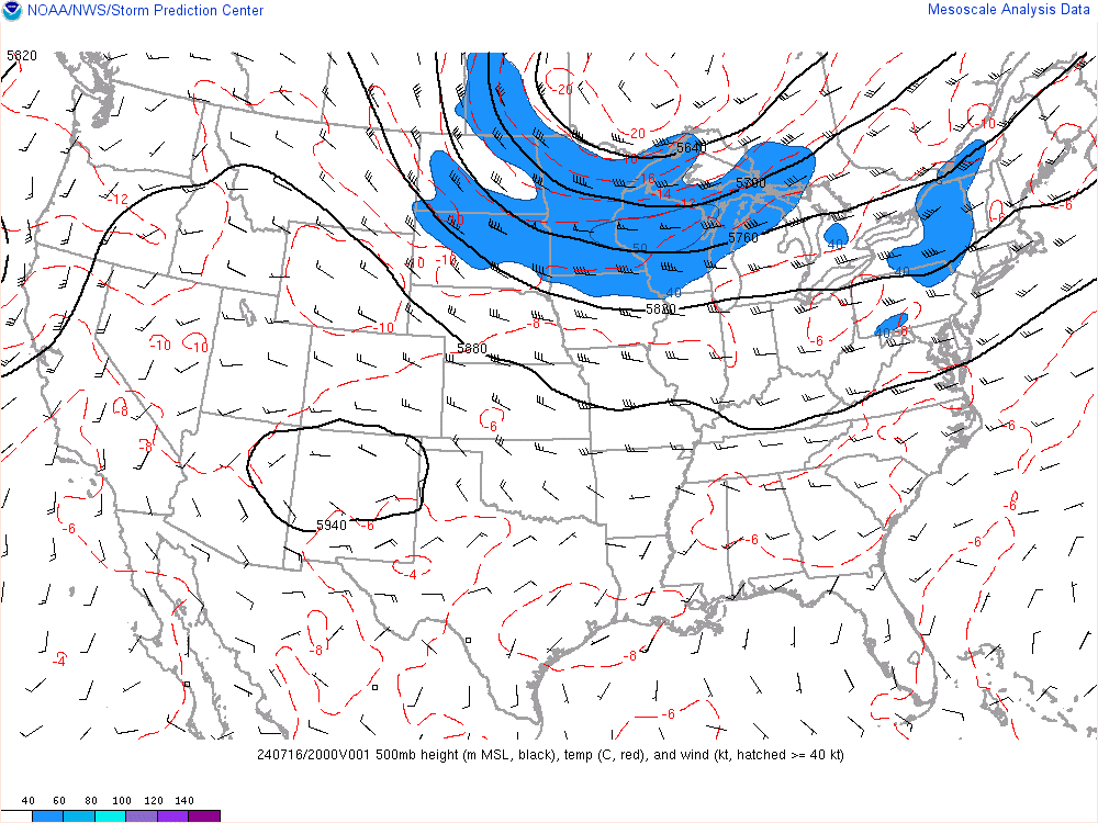
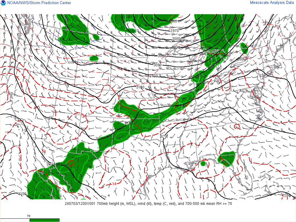
TO FURTHER PROVE OUR POINT:
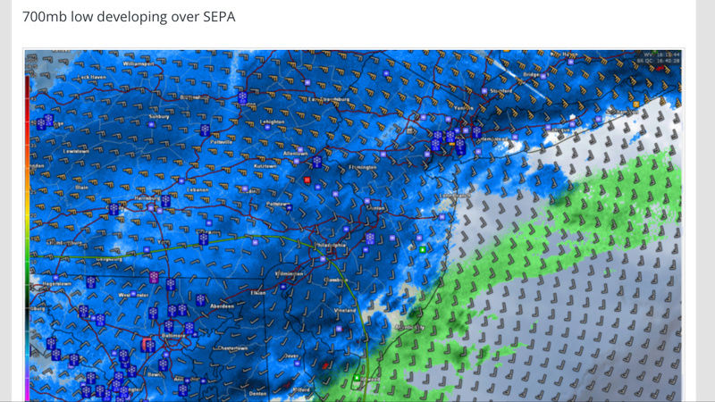
SUPPORTED BY REAL-TIME WATER VAPOR IMAGERY, NOT MODELING. EFF THESE GOD DARN HORRIBLE MODELS. ITS CALLED NOWCASTING FOR A GOD DARN REASON.

SUPPORTED BY REAL-TIME WATER VAPOR IMAGERY, NOT MODELING. EFF THESE GOD DARN HORRIBLE MODELS. ITS CALLED NOWCASTING FOR A GOD DARN REASON.
rb924119- Meteorologist

- Posts : 6928
Reputation : 194
Join date : 2013-02-06
Age : 32
Location : Greentown, Pa
Page 38 of 40 •  1 ... 20 ... 37, 38, 39, 40
Page 38 of 40
Permissions in this forum:
You cannot reply to topics in this forum|
|
|

 Home
Home
