
 Search
Long Range Discussions 21.0
Page 6 of 15 •  1 ... 5, 6, 7 ... 10 ... 15
 ![]()
Re: Long Range Discussions 21.0
![]() by amugs Wed Feb 10, 2021 1:32 pm
by amugs Wed Feb 10, 2021 1:32 pm
amugs- Advanced Forecaster - Mod

- Posts : 15095
Join date : 2013-01-07
Re: Long Range Discussions 21.0
![]() by amugs Wed Feb 10, 2021 1:32 pm
by amugs Wed Feb 10, 2021 1:32 pm

OH this would be bad - has anyone seen the ZR adn Sleet maps for Texas through the Mid Atlantic this weekend - it is an absolute disaster - better pray it doesn't happen or else mass swaths of population are in trouble

Last edited by amugs on Wed Feb 10, 2021 1:50 pm; edited 1 time in total
amugs- Advanced Forecaster - Mod
- Posts : 15095
Join date : 2013-01-07
CPcantmeasuresnow and essexcountypete like this post
Re: Long Range Discussions 21.0
![]() by aiannone Wed Feb 10, 2021 1:35 pm
by aiannone Wed Feb 10, 2021 1:35 pm

_________________
-Alex Iannone-

aiannone- Senior Enthusiast - Mod
- Posts : 4815
Reputation : 92
Join date : 2013-01-07
Location : Saint James, LI (Northwest Suffolk Co.)
Re: Long Range Discussions 21.0
![]() by heehaw453 Wed Feb 10, 2021 1:35 pm
by heehaw453 Wed Feb 10, 2021 1:35 pm
Saturday night through Tuesday several opportunities for frozen precip. The storm tracks will determine how much mid-level cold will be able to stay around. Low level cold will be present, so it's either a lot of ice and/or snow.
heehaw453- Advanced Forecaster

- Posts : 3906
Reputation : 86
Join date : 2014-01-20
Location : Bedminster Township, PA Elevation 600' ASL
Re: Long Range Discussions 21.0
![]() by heehaw453 Wed Feb 10, 2021 1:37 pm
by heehaw453 Wed Feb 10, 2021 1:37 pm
aiannone wrote:DON'T LOOK!
Euro is actually moved more towards a coastal idea. CMC, Ukie and GFSv16 are in the coastal camp now. Should be interesting.
heehaw453- Advanced Forecaster
- Posts : 3906
Reputation : 86
Join date : 2014-01-20
Location : Bedminster Township, PA Elevation 600' ASL
Re: Long Range Discussions 21.0
![]() by mmanisca Wed Feb 10, 2021 3:34 pm
by mmanisca Wed Feb 10, 2021 3:34 pm
National Weather Service New York NY
330 PM EST Wed Feb 10 2021
NJZ004-006-103>108-NYZ072>075-078>081-176>179-111000-
/O.NEW.KOKX.WW.Y.0005.210211T0300Z-210211T1500Z/
Eastern Passaic-Hudson-Western Bergen-Eastern Bergen-
Western Essex-Eastern Essex-Western Union-Eastern Union-
New York (Manhattan)-Bronx-Richmond (Staten Island)-
Kings (Brooklyn)-Northwestern Suffolk-Northeastern Suffolk-
Southwestern Suffolk-Southeastern Suffolk-Northern Queens-
Northern Nassau-Southern Queens-Southern Nassau-
330 PM EST Wed Feb 10 2021
...WINTER WEATHER ADVISORY IN EFFECT FROM 10 PM THIS EVENING TO
10 AM EST THURSDAY...
* WHAT...Snow expected. Total snow accumulations of 2 to 3
inches.
* WHERE...New York City, Long Island, and most of northeast New
Jersey.
* WHEN...From 10 PM this evening to 10 AM EST Thursday.
* IMPACTS...Plan on slippery road conditions. Hazardous conditions
will likely impact the morning commute.
PRECAUTIONARY/PREPAREDNESS ACTIONS...
Slow down and use caution while traveling.
Check local Department of Transportation information services for
the latest road conditions.

mmanisca- Pro Enthusiast

- Posts : 299
Reputation : 3
Join date : 2013-01-23
Age : 65
Location : Deer Park, Long Island
Re: Long Range Discussions 21.0
![]() by jmanley32 Wed Feb 10, 2021 3:36 pm
by jmanley32 Wed Feb 10, 2021 3:36 pm
If the Bronx gets 2-3 inches and I do not I would be very surprised I am closer to the Bronx than I am westchester (I am in westchester but a 2 minute walk down the road and I am in the city.) We will see.mmanisca wrote:URGENT - WINTER WEATHER MESSAGE
National Weather Service New York NY
330 PM EST Wed Feb 10 2021
NJZ004-006-103>108-NYZ072>075-078>081-176>179-111000-
/O.NEW.KOKX.WW.Y.0005.210211T0300Z-210211T1500Z/
Eastern Passaic-Hudson-Western Bergen-Eastern Bergen-
Western Essex-Eastern Essex-Western Union-Eastern Union-
New York (Manhattan)-Bronx-Richmond (Staten Island)-
Kings (Brooklyn)-Northwestern Suffolk-Northeastern Suffolk-
Southwestern Suffolk-Southeastern Suffolk-Northern Queens-
Northern Nassau-Southern Queens-Southern Nassau-
330 PM EST Wed Feb 10 2021
...WINTER WEATHER ADVISORY IN EFFECT FROM 10 PM THIS EVENING TO
10 AM EST THURSDAY...
* WHAT...Snow expected. Total snow accumulations of 2 to 3
inches.
* WHERE...New York City, Long Island, and most of northeast New
Jersey.
* WHEN...From 10 PM this evening to 10 AM EST Thursday.
* IMPACTS...Plan on slippery road conditions. Hazardous conditions
will likely impact the morning commute.
PRECAUTIONARY/PREPAREDNESS ACTIONS...
Slow down and use caution while traveling.
Check local Department of Transportation information services for
the latest road conditions.

jmanley32- Senior Enthusiast

- Posts : 20535
Reputation : 108
Join date : 2013-12-12
Age : 43
Location : Yonkers, NY
Re: Long Range Discussions 21.0
![]() by Irish Wed Feb 10, 2021 3:40 pm
by Irish Wed Feb 10, 2021 3:40 pm
Old Bridge, NJ Weather
Weather Alerts-Old Bridge, NJ
Winter Weather Advisory from WED 7:00 PM EST until THU 12:00 PM EST
Action Recommended
Execute a pre-planned activity identified in the instructions
Issued By
Philadelphia - PA, US, National Weather Service
Affected Area
Portions of central and northern New Jersey and southeast Pennsylvania
Description
...WINTER WEATHER ADVISORY IN EFFECT FROM 7 PM THIS EVENING TO NOON EST THURSDAY...
WHAT...Snow expected. Total snow accumulations of 2 to 4 inches.
WHERE...Portions of central and northern New Jersey and southeast Pennsylvania.
WHEN...From 7 PM this evening to noon EST Thursday.
IMPACTS...Plan on slippery road conditions. The hazardous conditions could impact the morning commute.
ADDITIONAL DETAILS...Snow is forecast to move in from the west by late this evening, continuing through the Thursday morning commute, before shifting east of the area by the midday hours. Although snow rates will not be particularly high, temperatures are expected to be below freezing, so roads and sidewalks are expected to become snow-covered.
PRECAUTIONARY/PREPAREDNESS ACTIONS...
Slow down and use caution while traveling.
The latest road conditions for the state you are calling from can be obtained by calling 5 1 1.

Irish- Pro Enthusiast
- Posts : 788
Reputation : 19
Join date : 2019-01-16
Age : 45
Location : Old Bridge, NJ
Re: Long Range Discussions 21.0
![]() by jmanley32 Wed Feb 10, 2021 4:01 pm
by jmanley32 Wed Feb 10, 2021 4:01 pm
jmanley32- Senior Enthusiast
- Posts : 20535
Reputation : 108
Join date : 2013-12-12
Age : 43
Location : Yonkers, NY
amugs likes this post
Re: Long Range Discussions 21.0
![]() by jmanley32 Wed Feb 10, 2021 4:02 pm
by jmanley32 Wed Feb 10, 2021 4:02 pm
that could get ugly, not much movement to south and the coast would have quite a ice storm, the further inland the worse it would be due to thicker forestry.aiannone wrote:DON'T LOOK!
jmanley32- Senior Enthusiast
- Posts : 20535
Reputation : 108
Join date : 2013-12-12
Age : 43
Location : Yonkers, NY
Re: Long Range Discussions 21.0
![]() by amugs Wed Feb 10, 2021 4:56 pm
by amugs Wed Feb 10, 2021 4:56 pm
_________________
Mugs
AKA:King: Snow Weenie
Self Proclaimed
WINTER 2014-15 : 55.12" +.02 for 6 coatings (avg. 35")
WINTER 2015-16 Total - 29.8" (Avg 35")
WINTER 2016-17 : 39.5" so far

amugs- Advanced Forecaster - Mod
- Posts : 15095
Reputation : 213
Join date : 2013-01-07
Age : 54
Location : Hillsdale,NJ
Re: Long Range Discussions 21.0
![]() by amugs Wed Feb 10, 2021 5:25 pm
by amugs Wed Feb 10, 2021 5:25 pm

_________________
Mugs
AKA:King: Snow Weenie
Self Proclaimed
WINTER 2014-15 : 55.12" +.02 for 6 coatings (avg. 35")
WINTER 2015-16 Total - 29.8" (Avg 35")
WINTER 2016-17 : 39.5" so far
amugs- Advanced Forecaster - Mod
- Posts : 15095
Reputation : 213
Join date : 2013-01-07
Age : 54
Location : Hillsdale,NJ
Re: Long Range Discussions 21.0
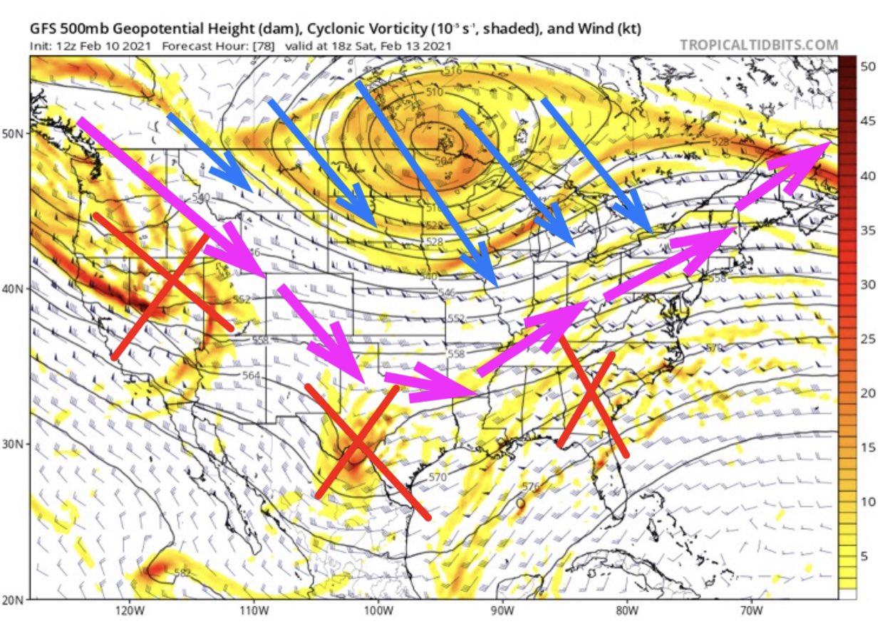
![]() by Frank_Wx Wed Feb 10, 2021 5:56 pm
by Frank_Wx Wed Feb 10, 2021 5:56 pm
heehaw453 wrote:aiannone wrote:DON'T LOOK!
Euro is actually moved more towards a coastal idea. CMC, Ukie and GFSv16 are in the coastal camp now. Should be interesting.
48 hour H5 trend map shows heights trending stronger / more amped along the coast ahead of a developing primary in the central part of the country. There’s just enough phasing to deepen the primary and keep it strong enough for it to push through banana High blocking to the north. However, either better trends with the Highs (trend stronger and/or south), or weaker trends with the primary, would flatten heights along the coast and increase the chances for significant snow Tuesday next week. I feel optimistic about that happening given the overall base state of the pattern.

_________________
_______________________________________________________________________________________________________
CLICK HERE to view NJ Strong Snowstorm Classifications

Frank_Wx- Godzilla Seeker

- Posts : 21305
Reputation : 328
Join date : 2013-01-05
Age : 32
Location : Jersey City, NJ -

Re: Long Range Discussions 21.0
![]() by TheAresian Wed Feb 10, 2021 7:30 pm
by TheAresian Wed Feb 10, 2021 7:30 pm
TheAresian- Senior Enthusiast
- Posts : 145
Reputation : 10
Join date : 2019-11-13
Location : Painted Post, NY
Frank_Wx, sroc4, SNOW MAN, rb924119, essexcountypete and SENJsnowman like this post
Re: Long Range Discussions 21.0
![]() by Frank_Wx Thu Feb 11, 2021 7:23 am
by Frank_Wx Thu Feb 11, 2021 7:23 am
Look at the primary low over Ohio and how it has trended weaker while the secondary takes over much earlier. This keeps cold air locked into our area. The banana high setup to the north is acting as our block this time around, while replenishing our area with arctic cold.

_________________
_______________________________________________________________________________________________________
CLICK HERE to view NJ Strong Snowstorm Classifications
Frank_Wx- Godzilla Seeker
- Posts : 21305
Reputation : 328
Join date : 2013-01-05
Age : 32
Location : Jersey City, NJ -
Re: Long Range Discussions 21.0
![]() by CPcantmeasuresnow Thu Feb 11, 2021 8:02 am
by CPcantmeasuresnow Thu Feb 11, 2021 8:02 am


CPcantmeasuresnow- Wx Statistician Guru

- Posts : 7274
Reputation : 230
Join date : 2013-01-07
Age : 103
Location : Eastern Orange County, NY
Re: Long Range Discussions 21.0
![]() by heehaw453 Thu Feb 11, 2021 8:13 am
by heehaw453 Thu Feb 11, 2021 8:13 am
And there's this every time the Weather Channel App has said "watching a potential winter storm", I've gotten significant snow this season.
heehaw453- Advanced Forecaster
- Posts : 3906
Reputation : 86
Join date : 2014-01-20
Location : Bedminster Township, PA Elevation 600' ASL
CPcantmeasuresnow and SENJsnowman like this post
Re: Long Range Discussions 21.0
![]() by amugs Thu Feb 11, 2021 8:53 am
by amugs Thu Feb 11, 2021 8:53 am

_________________
Mugs
AKA:King: Snow Weenie
Self Proclaimed
WINTER 2014-15 : 55.12" +.02 for 6 coatings (avg. 35")
WINTER 2015-16 Total - 29.8" (Avg 35")
WINTER 2016-17 : 39.5" so far
amugs- Advanced Forecaster - Mod
- Posts : 15095
Reputation : 213
Join date : 2013-01-07
Age : 54
Location : Hillsdale,NJ
Re: Long Range Discussions 21.0
![]() by amugs Thu Feb 11, 2021 10:55 am
by amugs Thu Feb 11, 2021 10:55 am
.png.705c6cb07cf7ad62c6fab959b180a91b.png)
_________________
Mugs
AKA:King: Snow Weenie
Self Proclaimed
WINTER 2014-15 : 55.12" +.02 for 6 coatings (avg. 35")
WINTER 2015-16 Total - 29.8" (Avg 35")
WINTER 2016-17 : 39.5" so far
amugs- Advanced Forecaster - Mod
- Posts : 15095
Reputation : 213
Join date : 2013-01-07
Age : 54
Location : Hillsdale,NJ
Re: Long Range Discussions 21.0
![]() by jmanley32 Thu Feb 11, 2021 11:12 am
by jmanley32 Thu Feb 11, 2021 11:12 am
jmanley32- Senior Enthusiast
- Posts : 20535
Reputation : 108
Join date : 2013-12-12
Age : 43
Location : Yonkers, NY
Re: Long Range Discussions 21.0
![]() by aiannone Thu Feb 11, 2021 11:17 am
by aiannone Thu Feb 11, 2021 11:17 am
amugs wrote:Sorry Alex not a good look for you but if we can get this puppy to push SE which I feel it will at this range then you guys will be fine too. SNJ not so much at this time but lots of time
Ooof yea, no coastal hugger please
_________________
-Alex Iannone-
aiannone- Senior Enthusiast - Mod
- Posts : 4815
Reputation : 92
Join date : 2013-01-07
Location : Saint James, LI (Northwest Suffolk Co.)
Re: Long Range Discussions 21.0
![]() by CPcantmeasuresnow Thu Feb 11, 2021 11:19 am
by CPcantmeasuresnow Thu Feb 11, 2021 11:19 am

CPcantmeasuresnow- Wx Statistician Guru
- Posts : 7274
Reputation : 230
Join date : 2013-01-07
Age : 103
Location : Eastern Orange County, NY
Re: Long Range Discussions 21.0
![]() by docstox12 Thu Feb 11, 2021 11:23 am
by docstox12 Thu Feb 11, 2021 11:23 am
CPcantmeasuresnow wrote:12Z GFS for 1:00 PM on Tuesday. Obviously this will most likely waver back and forth. This is alot of sleet and freezing rain in Jersey, CT and PA though. The HV teeters right on that line of heavy snow or sleet.
Wow, right CP.Half my roof gets sleet, the other half snow.Let's hope for SE tick on this one.

docstox12- Wx Statistician Guru
- Posts : 8530
Reputation : 222
Join date : 2013-01-07
Age : 73
Location : Monroe NY
Re: Long Range Discussions 21.0
![]() by CPcantmeasuresnow Thu Feb 11, 2021 11:23 am
by CPcantmeasuresnow Thu Feb 11, 2021 11:23 am

CPcantmeasuresnow- Wx Statistician Guru
- Posts : 7274
Reputation : 230
Join date : 2013-01-07
Age : 103
Location : Eastern Orange County, NY
Re: Long Range Discussions 21.0
![]() by phil155 Thu Feb 11, 2021 11:27 am
by phil155 Thu Feb 11, 2021 11:27 am
phil155- Pro Enthusiast
- Posts : 483
Reputation : 4
Join date : 2019-12-16

TheAresian- Senior Enthusiast
- Posts : 145
Reputation : 10
Join date : 2019-11-13
Location : Painted Post, NY
amugs likes this post
Re: Long Range Discussions 21.0
![]() by phil155 Thu Feb 11, 2021 11:37 am
by phil155 Thu Feb 11, 2021 11:37 am
phil155- Pro Enthusiast
- Posts : 483
Reputation : 4
Join date : 2019-12-16
Page 6 of 15 • 1 ... 5, 6, 7 ... 10 ... 15 ![]()
|
|
|