
 Search
Long Range Discussion 22.0
Page 11 of 31 •  1 ... 7 ... 10, 11, 12 ... 21 ... 31
 ![]()
Re: Long Range Discussion 22.0
![]() by docstox12 Sat Dec 11, 2021 9:31 am
by docstox12 Sat Dec 11, 2021 9:31 am
docstox12- Wx Statistician Guru

- Posts : 8502
Join date : 2013-01-07
SENJsnowman likes this post
Re: Long Range Discussion 22.0
![]() by amugs Sat Dec 11, 2021 9:41 am
by amugs Sat Dec 11, 2021 9:41 am

amugs- Advanced Forecaster - Mod

- Posts : 15093
Join date : 2013-01-07
Re: Long Range Discussion 22.0
![]() by sroc4 Sat Dec 11, 2021 10:07 am
by sroc4 Sat Dec 11, 2021 10:07 am
Frank_Wx wrote:Above normal temps are expected through the next 10 days - however - there’s a small window of opportunity appearing on the models next Sunday into Monday. A pseudo-ridge over the PNA ridge thanks to digging piece of upper energy off the west coast, may sneak a piece of polar energy into our area and possibly giving us our first accumulating snowfall event of the season. I placed the SCI at 5% as we wait and see what transpires next week.
As per usual in a crappy pattern we will be searching for baby bear. As of now there will be 3 main areas to focus on regarding this threat.
First. There will be a weak LP and great lakes cutter develop, warm out ahead, that lifts NE on Saturday, labeled 3 on the image below. As the upper level energy lifts out, it will head towards the 50/50 region, (50N latitude/50W longitude) give or take. This energy will without question be important to provide confluence ahead of the approaching energy to help lock in some cold air for our system to work with and to create enough of a bottleneck in the flow to allow the pieces to come together. It MUST be in at least close to an ideal position in order for our next approaching system to have enough cold air to work with.
This brings us to the second area(s) to monitor the evolution of. I have labeled energy 1, (northern energy), and energy 2, (southern energy). The N energy will dig into the plains while the S energy will eject out of the south. The timing and interactions between these two energies relative to each other is the second area of focus. Typically we want 2 out ahead of 1 with cold air in place in our area.

And the 3rd area to watch the evolution of is the area labeled 4 below and its strength, timing, and interactions with the pseudo PNA ridge Frank mentioned.

So regarding the first point. If 3 ends up to far NE in the Mid Atlantic there will be no pseudo blocking out ahead and/or there isn't anything to lock the cold in place ahead of our system and the SE ridge flexes back, heights raise ahead of the system along the EC(maroon circle), and the warm air invades.
Regarding point 2. If the energy 1&2 interact to early and strongly then we run the risk of raising heights out ahead(ESP if energy 3 is too far N&E), and we get the cutter and we are warm sectored. If the S energy is not out ahead enough then the N energy could act to steer it S&E and OTS like we just saw with the last system. We want just enough interaction to lift a LP up the coast, but also off the coast a little to avoid warm air invasion.
Regarding point 3. If the timing of the energy 4 is too fast then it will act to de-amplify the PNA ridge making the energy labeled 1&2 more diff to interact the way we want.
Again when the Pac pattern sucks, AND the Atlantic pattern sucks it will make it very difficult for things to come together just right. There are any number of things or combo of things involving Energy 3 to the NE, or how energy 1&2 interact in the central CONUS, or how energy 4 interacts with the PNA ridge out west, that can screw things up for our coverage area. Also keep in mind like the last system we tracked we had model runs that for a short period in the medium range showed baby bear. But remember baby bear solns in the long and medium range MUST be taken with a grain of salt until we get in tight to crunch time when we have a pattern like we currently have. That said it has snowed in shitty patterns before and it will again, so....
We Track!!!

_________________
"In weather and in life, there's no winning and losing; there's only winning and learning."
WINTER 2012/2013 TOTALS 43.65"WINTER 2017/2018 TOTALS 62.85" WINTER 2022/2023 TOTALS 4.9"
WINTER 2013/2014 TOTALS 64.85"WINTER 2018/2019 TOTALS 14.25" WINTER 2023/2024 TOTALS 13.1"
WINTER 2014/2015 TOTALS 71.20"WINTER 2019/2020 TOTALS 6.35"
WINTER 2015/2016 TOTALS 35.00"WINTER 2020/2021 TOTALS 37.75"
WINTER 2016/2017 TOTALS 42.25"WINTER 2021/2022 TOTALS 31.65"

sroc4- Admin

- Posts : 8331
Reputation : 301
Join date : 2013-01-07
Location : Wading River, LI
rb924119 likes this post
Re: Long Range Discussion 22.0
![]() by sroc4 Sat Dec 11, 2021 10:30 am
by sroc4 Sat Dec 11, 2021 10:30 am
That is all.
_________________
"In weather and in life, there's no winning and losing; there's only winning and learning."
WINTER 2012/2013 TOTALS 43.65"WINTER 2017/2018 TOTALS 62.85" WINTER 2022/2023 TOTALS 4.9"
WINTER 2013/2014 TOTALS 64.85"WINTER 2018/2019 TOTALS 14.25" WINTER 2023/2024 TOTALS 13.1"
WINTER 2014/2015 TOTALS 71.20"WINTER 2019/2020 TOTALS 6.35"
WINTER 2015/2016 TOTALS 35.00"WINTER 2020/2021 TOTALS 37.75"
WINTER 2016/2017 TOTALS 42.25"WINTER 2021/2022 TOTALS 31.65"
sroc4- Admin
- Posts : 8331
Reputation : 301
Join date : 2013-01-07
Location : Wading River, LI
rb924119 and weatherwatchermom like this post
Re: Long Range Discussion 22.0
![]() by weatherwatchermom Sat Dec 11, 2021 10:35 am
by weatherwatchermom Sat Dec 11, 2021 10:35 am
sroc4 wrote:As an aside, IF we get towards mid to late week and things are looking promising for this threat I WILL NOT be the one to start its own thread. The last system was looking great until I started the new thread. Literally models immediately shifted after I did so. I hang my head in shame.
That is all.

That and Dunzoo..do not buy a snow blower!!!! until spring for next year please


weatherwatchermom- Senior Enthusiast

- Posts : 3735
Reputation : 77
Join date : 2014-11-25
Age : 60
Location : Hazlet Township, NJ
sroc4, rb924119 and dkodgis like this post
Re: Long Range Discussion 22.0
![]() by Dunnzoo Sat Dec 11, 2021 12:02 pm
by Dunnzoo Sat Dec 11, 2021 12:02 pm
weatherwatchermom wrote:sroc4 wrote:As an aside, IF we get towards mid to late week and things are looking promising for this threat I WILL NOT be the one to start its own thread. The last system was looking great until I started the new thread. Literally models immediately shifted after I did so. I hang my head in shame.
That is all.
That and Dunzoo..do not buy a snow blower!!!! until spring for next year please
Ok, I'll take mugsy up on his offer of a loaner!
_________________
Janet
Snowfall winter of 2023-2024 17.5"
Snowfall winter of 2022-2023 6.0"
Snowfall winter of 2021-2022 17.6" 1" sleet 2/25/22
Snowfall winter of 2020-2021 51.1"
Snowfall winter of 2019-2020 8.5"
Snowfall winter of 2018-2019 25.1"
Snowfall winter of 2017-2018 51.9"
Snowfall winter of 2016-2017 45.6"
Snowfall winter of 2015-2016 29.5"
Snowfall winter of 2014-2015 50.55"
Snowfall winter of 2013-2014 66.5"

Dunnzoo- Senior Enthusiast - Mod
- Posts : 4887
Reputation : 68
Join date : 2013-01-11
Age : 62
Location : Westwood, NJ
sroc4, amugs and rb924119 like this post
Re: Long Range Discussion 22.0
![]() by amugs Sat Dec 11, 2021 12:24 pm
by amugs Sat Dec 11, 2021 12:24 pm
The wave that Rb has referred so articulate in his video is nosing into the dateline and to its east just like he said would happen - !!!! Raystrodomaus !!!

_________________
Mugs
AKA:King: Snow Weenie
Self Proclaimed
WINTER 2014-15 : 55.12" +.02 for 6 coatings (avg. 35")
WINTER 2015-16 Total - 29.8" (Avg 35")
WINTER 2016-17 : 39.5" so far

amugs- Advanced Forecaster - Mod
- Posts : 15093
Reputation : 213
Join date : 2013-01-07
Age : 54
Location : Hillsdale,NJ
rb924119 likes this post
Re: Long Range Discussion 22.0
![]() by Frank_Wx Sun Dec 12, 2021 9:47 am
by Frank_Wx Sun Dec 12, 2021 9:47 am
_________________
_______________________________________________________________________________________________________
CLICK HERE to view NJ Strong Snowstorm Classifications

Frank_Wx- Godzilla Seeker
- Posts : 21305
Reputation : 328
Join date : 2013-01-05
Age : 31
Location : Jersey City, NJ -

Re: Long Range Discussion 22.0
![]() by heehaw453 Sun Dec 12, 2021 12:24 pm
by heehaw453 Sun Dec 12, 2021 12:24 pm
heehaw453- Advanced Forecaster

- Posts : 3906
Reputation : 86
Join date : 2014-01-20
Location : Bedminster Township, PA Elevation 600' ASL
SENJsnowman likes this post

rb924119- Meteorologist

- Posts : 6889
Reputation : 194
Join date : 2013-02-06
Age : 32
Location : Greentown, Pa
Grselig, heehaw453 and weatherwatchermom like this post
Re: Long Range Discussion 22.0
![]() by Frank_Wx Sun Dec 12, 2021 10:07 pm
by Frank_Wx Sun Dec 12, 2021 10:07 pm
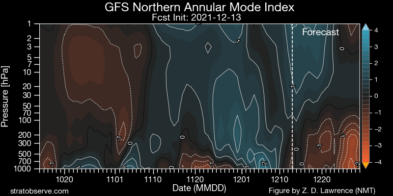
Also, look how wild some of the ensemble members are going with the MJO. This is a sign of model mahem

_________________
_______________________________________________________________________________________________________
CLICK HERE to view NJ Strong Snowstorm Classifications
Frank_Wx- Godzilla Seeker
- Posts : 21305
Reputation : 328
Join date : 2013-01-05
Age : 31
Location : Jersey City, NJ -
rb924119 likes this post
Re: Long Range Discussion 22.0
![]() by Frank_Wx Sun Dec 12, 2021 10:10 pm
by Frank_Wx Sun Dec 12, 2021 10:10 pm


_________________
_______________________________________________________________________________________________________
CLICK HERE to view NJ Strong Snowstorm Classifications
Frank_Wx- Godzilla Seeker
- Posts : 21305
Reputation : 328
Join date : 2013-01-05
Age : 31
Location : Jersey City, NJ -
rb924119 and heehaw453 like this post

rb924119- Meteorologist
- Posts : 6889
Reputation : 194
Join date : 2013-02-06
Age : 32
Location : Greentown, Pa
phil155 likes this post
Re: Long Range Discussion 22.0
![]() by amugs Mon Dec 13, 2021 12:24 pm
by amugs Mon Dec 13, 2021 12:24 pm
This chart above show teh heat flux - orangy colors - this will help perturb knock around the Polar Vortex, weaken it and help dislodge cold air. It's a forecast and hopefully it continues as we move forward.
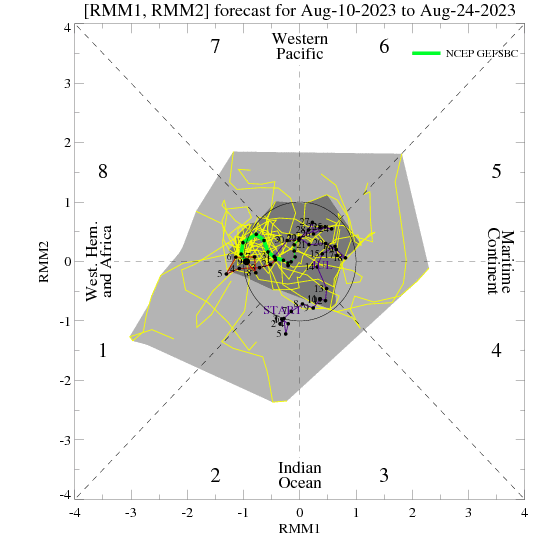
Here is the MJO forecast as it is in 7 and heads into the golden phase of 8 for EAST COAST SNWO WEENEIS!
_________________
Mugs
AKA:King: Snow Weenie
Self Proclaimed
WINTER 2014-15 : 55.12" +.02 for 6 coatings (avg. 35")
WINTER 2015-16 Total - 29.8" (Avg 35")
WINTER 2016-17 : 39.5" so far
amugs- Advanced Forecaster - Mod
- Posts : 15093
Reputation : 213
Join date : 2013-01-07
Age : 54
Location : Hillsdale,NJ
rb924119 likes this post
Re: Long Range Discussion 22.0
![]() by amugs Mon Dec 13, 2021 6:23 pm
by amugs Mon Dec 13, 2021 6:23 pm
Oops pic.twitter.com/0fxsrT1cTX
— Eric Webb (@webberweather) December 13, 2021
_________________
Mugs
AKA:King: Snow Weenie
Self Proclaimed
WINTER 2014-15 : 55.12" +.02 for 6 coatings (avg. 35")
WINTER 2015-16 Total - 29.8" (Avg 35")
WINTER 2016-17 : 39.5" so far
amugs- Advanced Forecaster - Mod
- Posts : 15093
Reputation : 213
Join date : 2013-01-07
Age : 54
Location : Hillsdale,NJ

rb924119- Meteorologist
- Posts : 6889
Reputation : 194
Join date : 2013-02-06
Age : 32
Location : Greentown, Pa

Irish- Pro Enthusiast

- Posts : 788
Reputation : 19
Join date : 2019-01-16
Age : 45
Location : Old Bridge, NJ
Re: Long Range Discussion 22.0
![]() by rb924119 Mon Dec 13, 2021 8:57 pm
by rb924119 Mon Dec 13, 2021 8:57 pm
Irish wrote:rb924119 wrote:
What does this mean?
A winter-weather weeny’s dream lmaooo ridge out west, trough in the eastern U.S., and lots of Atlantic domain blockiness centered during the month of January. To be honest, though, I’ve not used this in the past, so I’m not sure how well it’ll perform. But it fits with my longstanding ideas
rb924119- Meteorologist
- Posts : 6889
Reputation : 194
Join date : 2013-02-06
Age : 32
Location : Greentown, Pa
weatherwatchermom, Irish and phil155 like this post
Re: Long Range Discussion 22.0
![]() by rb924119 Tue Dec 14, 2021 1:06 am
by rb924119 Tue Dec 14, 2021 1:06 am
rb924119- Meteorologist
- Posts : 6889
Reputation : 194
Join date : 2013-02-06
Age : 32
Location : Greentown, Pa
phil155 likes this post
Re: Long Range Discussion 22.0
![]() by rb924119 Tue Dec 14, 2021 1:07 am
by rb924119 Tue Dec 14, 2021 1:07 am
rb924119- Meteorologist
- Posts : 6889
Reputation : 194
Join date : 2013-02-06
Age : 32
Location : Greentown, Pa
phil155 likes this post
Re: Long Range Discussion 22.0
![]() by heehaw453 Tue Dec 14, 2021 8:49 am
by heehaw453 Tue Dec 14, 2021 8:49 am

heehaw453- Advanced Forecaster
- Posts : 3906
Reputation : 86
Join date : 2014-01-20
Location : Bedminster Township, PA Elevation 600' ASL
sroc4 likes this post
Re: Long Range Discussion 22.0
![]() by sroc4 Tue Dec 14, 2021 9:05 am
by sroc4 Tue Dec 14, 2021 9:05 am
_________________
"In weather and in life, there's no winning and losing; there's only winning and learning."
WINTER 2012/2013 TOTALS 43.65"WINTER 2017/2018 TOTALS 62.85" WINTER 2022/2023 TOTALS 4.9"
WINTER 2013/2014 TOTALS 64.85"WINTER 2018/2019 TOTALS 14.25" WINTER 2023/2024 TOTALS 13.1"
WINTER 2014/2015 TOTALS 71.20"WINTER 2019/2020 TOTALS 6.35"
WINTER 2015/2016 TOTALS 35.00"WINTER 2020/2021 TOTALS 37.75"
WINTER 2016/2017 TOTALS 42.25"WINTER 2021/2022 TOTALS 31.65"
sroc4- Admin
- Posts : 8331
Reputation : 301
Join date : 2013-01-07
Location : Wading River, LI
Re: Long Range Discussion 22.0
![]() by amugs Tue Dec 14, 2021 9:27 am
by amugs Tue Dec 14, 2021 9:27 am


_________________
Mugs
AKA:King: Snow Weenie
Self Proclaimed
WINTER 2014-15 : 55.12" +.02 for 6 coatings (avg. 35")
WINTER 2015-16 Total - 29.8" (Avg 35")
WINTER 2016-17 : 39.5" so far
amugs- Advanced Forecaster - Mod
- Posts : 15093
Reputation : 213
Join date : 2013-01-07
Age : 54
Location : Hillsdale,NJ
Re: Long Range Discussion 22.0
![]() by amugs Tue Dec 14, 2021 9:28 am
by amugs Tue Dec 14, 2021 9:28 am
_________________
Mugs
AKA:King: Snow Weenie
Self Proclaimed
WINTER 2014-15 : 55.12" +.02 for 6 coatings (avg. 35")
WINTER 2015-16 Total - 29.8" (Avg 35")
WINTER 2016-17 : 39.5" so far
amugs- Advanced Forecaster - Mod
- Posts : 15093
Reputation : 213
Join date : 2013-01-07
Age : 54
Location : Hillsdale,NJ
Dunnzoo likes this post
Re: Long Range Discussion 22.0
![]() by rb924119 Tue Dec 14, 2021 11:28 am
by rb924119 Tue Dec 14, 2021 11:28 am
rb924119- Meteorologist
- Posts : 6889
Reputation : 194
Join date : 2013-02-06
Age : 32
Location : Greentown, Pa
phil155 likes this post
Re: Long Range Discussion 22.0
![]() by rb924119 Tue Dec 14, 2021 7:42 pm
by rb924119 Tue Dec 14, 2021 7:42 pm
On top of that, this is a PHENOMENAL thread that deserves a read. Same results, slightly different angle of analysis:
rb924119- Meteorologist
- Posts : 6889
Reputation : 194
Join date : 2013-02-06
Age : 32
Location : Greentown, Pa
MattyICE likes this post
Re: Long Range Discussion 22.0
![]() by amugs Tue Dec 14, 2021 8:52 pm
by amugs Tue Dec 14, 2021 8:52 pm
_________________
Mugs
AKA:King: Snow Weenie
Self Proclaimed
WINTER 2014-15 : 55.12" +.02 for 6 coatings (avg. 35")
WINTER 2015-16 Total - 29.8" (Avg 35")
WINTER 2016-17 : 39.5" so far
amugs- Advanced Forecaster - Mod
- Posts : 15093
Reputation : 213
Join date : 2013-01-07
Age : 54
Location : Hillsdale,NJ
rb924119 likes this post
Page 11 of 31 • 1 ... 7 ... 10, 11, 12 ... 21 ... 31 ![]()
|
|
|