Long Range Discussion 23.0
+45
mikeypizano
bobjohnsonforthehall
Dunnzoo
Scullybutcher
Math23x7
adamfitz1969
Joe Snow
Koroptim
dkodgis
Grselig
bloc1357
Carvin
chief7
essexcountypete
lisalamb
dolphins222
aiannone
emokid51783
hurrysundown23
docstox12
algae888
SoulSingMG
Snow88
Irish
CPcantmeasuresnow
frank 638
weatherwatchermom
dsix85
nutleyblizzard
crippo84
Zhukov1945
Ronfdny
MattyICE
mmanisca
sroc4
jmanley32
richb521
SENJsnowman
lglickman1
phil155
amugs
heehaw453
Radz
rb924119
Frank_Wx
49 posters
Page 4 of 26
Page 4 of 26 •  1, 2, 3, 4, 5 ... 15 ... 26
 Re: Long Range Discussion 23.0
CPcantmeasuresnow- Wx Statistician Guru

- Posts : 7274
Join date : 2013-01-07
 Re: Long Range Discussion 23.0
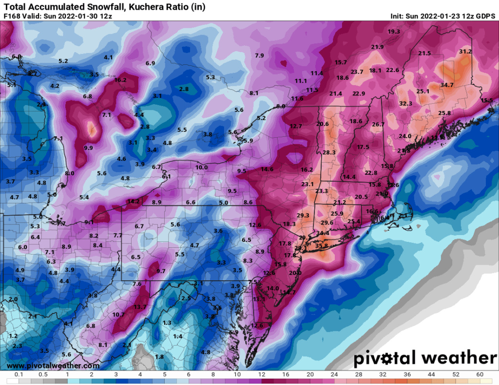
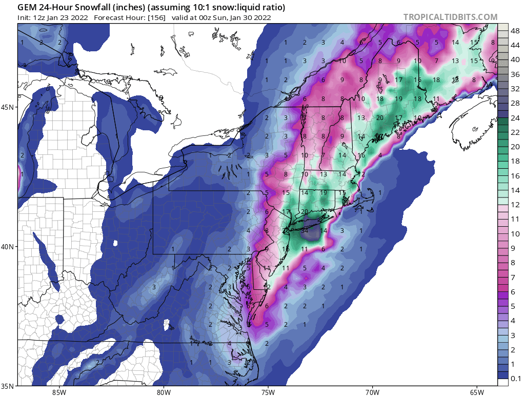
I have been unimpressed with the performance of the Canadian models both meso and global for sometime. The global seems to latch on to an idea a few days after the GFS/Euro already dismiss it. Is this threat dead, certainly not, but I believe very unlikely we get a direct hit.
heehaw453- Advanced Forecaster

- Posts : 3906
Join date : 2014-01-20
CPcantmeasuresnow likes this post
heehaw453- Advanced Forecaster

- Posts : 3906
Reputation : 86
Join date : 2014-01-20
Location : Bedminster Township, PA Elevation 600' ASL
heehaw453- Advanced Forecaster

- Posts : 3906
Reputation : 86
Join date : 2014-01-20
Location : Bedminster Township, PA Elevation 600' ASL
 Re: Long Range Discussion 23.0
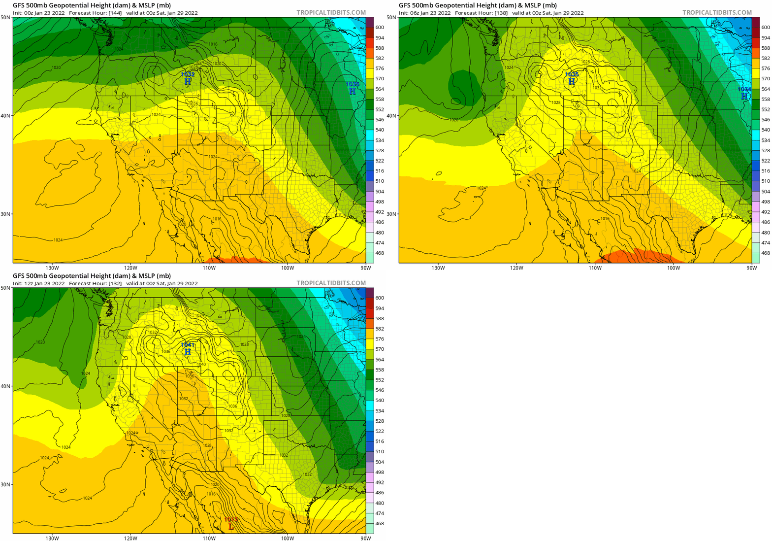
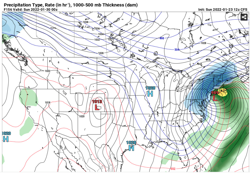
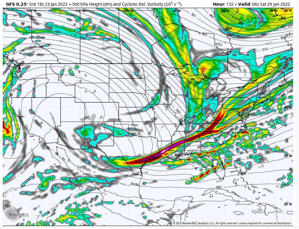
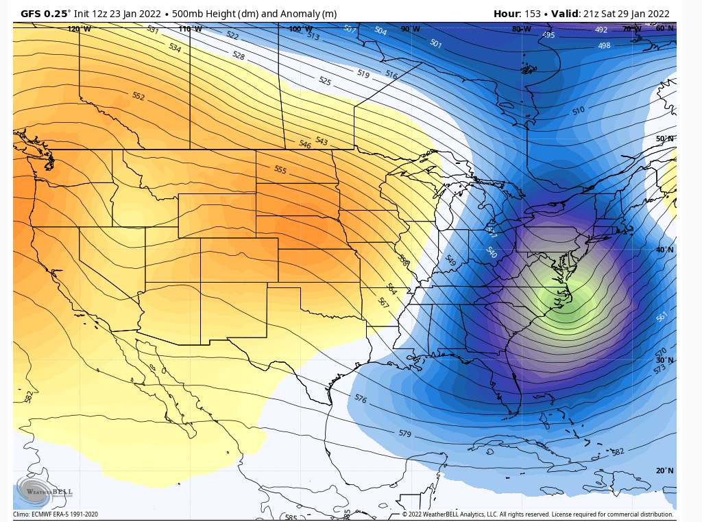
If you look at the ULL location on the 12z GFS it's really in a decent location when you look at the heights. That ought to be BM or even inside, but the issue is the lack of consolidation with its mid-levels. Look at all the bumps to its NE meaning its disorganized and not at a point where it can come up. If this was better consolidated you'd have a blizzard. That's why the progressive flow hurts us because it doesn't give that time.

heehaw453- Advanced Forecaster

- Posts : 3906
Reputation : 86
Join date : 2014-01-20
Location : Bedminster Township, PA Elevation 600' ASL
CPcantmeasuresnow likes this post
 Re: Long Range Discussion 23.0
I think there are enough pieces at play though to be excited at the though of a potential HECS- I get we’ve been burned by the progressive nature of the pattern but I’m hopeful something gives
dsix85- Pro Enthusiast

- Posts : 349
Reputation : 8
Join date : 2014-01-01
Location : New York
 Re: Long Range Discussion 23.0
I think there are enough pieces at play though to be excited at the though of a potential HECS- I get we’ve been burned by the progressive nature of the pattern but I’m hopeful something gives
dsix85- Pro Enthusiast

- Posts : 349
Reputation : 8
Join date : 2014-01-01
Location : New York
CPcantmeasuresnow and phil155 like this post
 Re: Long Range Discussion 23.0
dsix85 wrote:I think there are enough pieces at play though to be excited at the though of a potential HECS- I get we’ve been burned by the progressive nature of the pattern but I’m hopeful something gives
Yeah and I'm showing something at D6 which no doubt will change considerably by D3. I think though I'm at peace with this one just not working out. It's been that kind of season.
heehaw453- Advanced Forecaster

- Posts : 3906
Reputation : 86
Join date : 2014-01-20
Location : Bedminster Township, PA Elevation 600' ASL
CPcantmeasuresnow and phil155 like this post
 Re: Long Range Discussion 23.0
All good points. I think another potential positive to take a look towards is how the early/mid-week system pulls out. While we can’t just pull a -NAO out of nowhere maybe there’s a way for the first system to establish itself as a sort of pseudo and transient 50/50 Low. Anything to slow that flow down, as heehaw said.
MattyICE- Advanced Forecaster

- Posts : 249
Reputation : 6
Join date : 2017-11-10
Age : 38
Location : Clifton, NJ (Eastern Passaic County)
CPcantmeasuresnow likes this post
 Re: Long Range Discussion 23.0
Good point Matty. If there’s a way for that system to slow down and stall somewhere off the east coast and create a traffic jam
Of sorts maybe it puts the breaks on the progressive flow
Of sorts maybe it puts the breaks on the progressive flow
dsix85- Pro Enthusiast

- Posts : 349
Reputation : 8
Join date : 2014-01-01
Location : New York
CPcantmeasuresnow and MattyICE like this post
 Re: Long Range Discussion 23.0
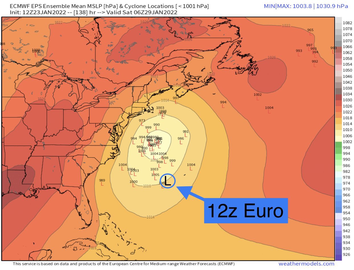
This is telling by the Euro - OP is such an outlier against its own ENS support. RED FLAG!

_________________
Mugs
AKA:King: Snow Weenie
Self Proclaimed
WINTER 2014-15 : 55.12" +.02 for 6 coatings (avg. 35")
WINTER 2015-16 Total - 29.8" (Avg 35")
WINTER 2016-17 : 39.5" so far

amugs- Advanced Forecaster - Mod

- Posts : 15095
Reputation : 213
Join date : 2013-01-07
Age : 54
Location : Hillsdale,NJ
heehaw453- Advanced Forecaster

- Posts : 3906
Reputation : 86
Join date : 2014-01-20
Location : Bedminster Township, PA Elevation 600' ASL

nutleyblizzard- Senior Enthusiast

- Posts : 1954
Reputation : 41
Join date : 2014-01-30
Age : 58
Location : Nutley, new jersey
 Re: Long Range Discussion 23.0
Is it fair to say today has been an overall positive trend for next weekend?
dsix85- Pro Enthusiast

- Posts : 349
Reputation : 8
Join date : 2014-01-01
Location : New York
 Re: Long Range Discussion 23.0
I’ve kept quiet lately because we know models will change run to run. However, this is the single most positive trends I’ve seen and it needs to continue if this storm stands a chance. I’ve said all along the reason I like this time frame (or did like this time frame) was the +PNA and east based -NAO. Over the last 2-3 days, we have seen modeling trend significantly worse with these features. Meaning the NAO is more positive and the PNA is more negative. Without these, kiss the storm goodbye.
There’s a small little short wave crashing into the ridge off the Pacific and it’s causing the PNA ridge to roll forward. If we can keep this short wave west or slow it down it would increase odds of a major snowstorm next week by nearly two fold.
_________________
_______________________________________________________________________________________________________
CLICK HERE to view NJ Strong Snowstorm Classifications
 Re: Long Range Discussion 23.0
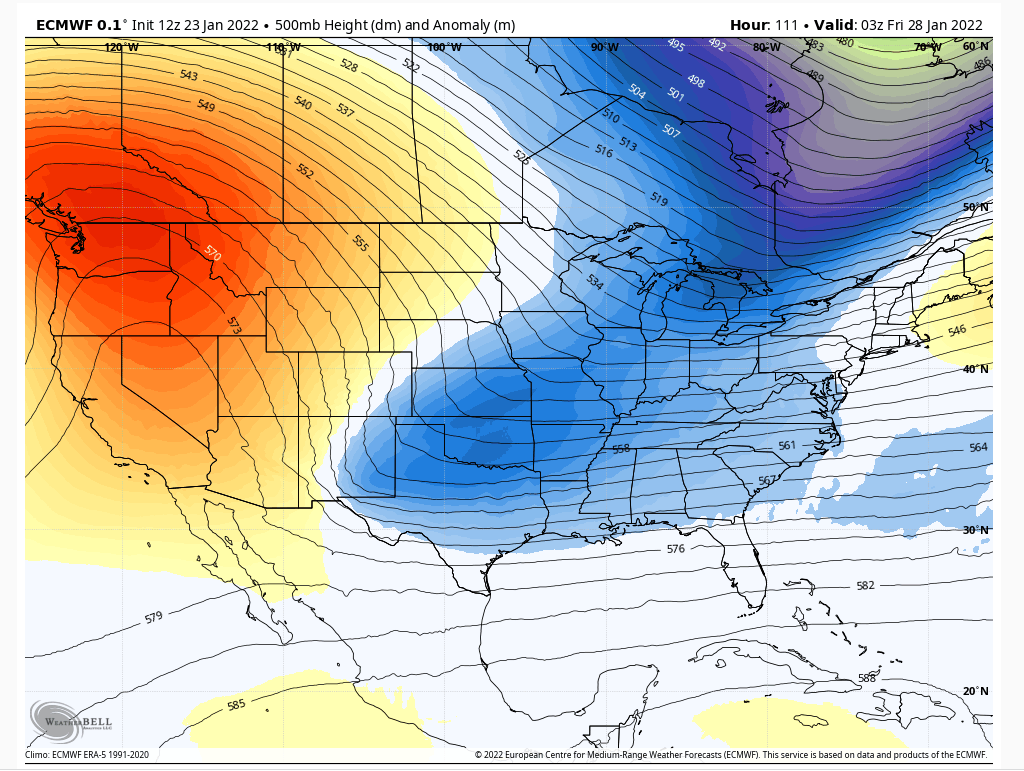
Euro seems to be holding southern energy back which plays into its bias. Correct that and this woulda been a big run.
heehaw453 wrote:If you look at the ULL location on the 12z GFS it's really in a decent location when you look at the heights. That ought to be BM or even inside, but the issue is the lack of consolidation with its mid-levels. Look at all the bumps to its NE meaning its disorganized and not at a point where it can come up. If this was better consolidated you'd have a blizzard. That's why the progressive flow hurts us because it doesn't give that time.
Also easy to correct.
After seeing these trends I should take another two days off and see where we are on Wednesday. All of these things are easy to fix but models won’t solve them for quite some time.
_________________
_______________________________________________________________________________________________________
CLICK HERE to view NJ Strong Snowstorm Classifications
heehaw453 likes this post
heehaw453- Advanced Forecaster

- Posts : 3906
Reputation : 86
Join date : 2014-01-20
Location : Bedminster Township, PA Elevation 600' ASL
 Re: Long Range Discussion 23.0
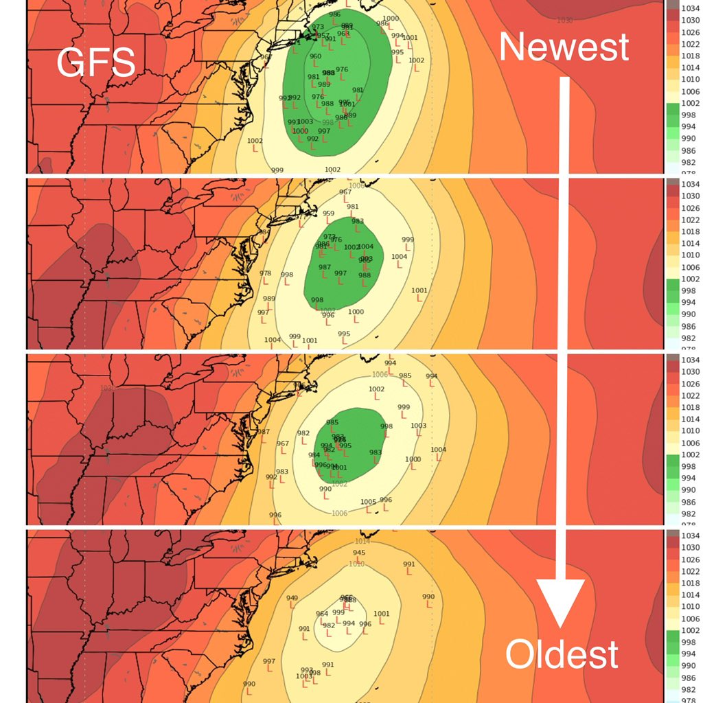
IMO looking at GFS which has been the winner it is continually more and a more OTS mess, I personally am guessing this will be a complete miss and am making peace with that now, if something changes on 28th or 29th then ill get back in on it but even day 2 or 1 things can go bad.

jmanley32- Senior Enthusiast

- Posts : 20535
Reputation : 108
Join date : 2013-12-12
Age : 43
Location : Yonkers, NY
phil155 likes this post
 Re: Long Range Discussion 23.0
Jmanley- go enjoy the football brother and step away from the board. Great that you already checked out on next weekends threat but we all know if this trends favorably for us you’ll be back on the bandwagon. Enjoy brother.
dsix85- Pro Enthusiast

- Posts : 349
Reputation : 8
Join date : 2014-01-01
Location : New York
jmanley32, Irish and phil155 like this post
 Re: Long Range Discussion 23.0
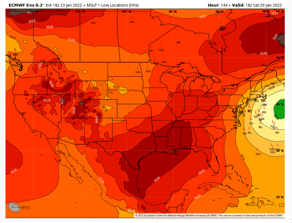
So one observation for today is that the operational gfs continues to be an extreme eastern/OTS outlier when compared to its own ensembles, which are much more favorable for hope for a snowier solution. The same can be said for the Euro and it’s respective ensembles. This is typically a red flag and at least makes one wonder if the ops will trend more towards the ensembles. But last storm - it actually was the the opposite. The operational runs insisted on a overamplified and inland storm and the ensembles gradually came to the OPS. I read that the ops are run at a higher resolution than the ensembles and can resolve nuances better. So typically I’d be happy that the ops are such stark outliers - but this winter, who the hell knows. But another factor to keep an eye on this week!
MattyICE- Advanced Forecaster

- Posts : 249
Reputation : 6
Join date : 2017-11-10
Age : 38
Location : Clifton, NJ (Eastern Passaic County)
SENJsnowman likes this post
 Re: Long Range Discussion 23.0
Of course, and I have not checked in much over the past 5 days. I do not watch sports not my thing but I def have plenty of other things to do. Of course I will be back if something looks good.dsix85 wrote:Jmanley- go enjoy the football brother and step away from the board. Great that you already checked out on next weekends threat but we all know if this trends favorably for us you’ll be back on the bandwagon. Enjoy brother.

jmanley32- Senior Enthusiast

- Posts : 20535
Reputation : 108
Join date : 2013-12-12
Age : 43
Location : Yonkers, NY
 Re: Long Range Discussion 23.0
Very true and you have a valid point, I forgot the skew between the two on both models, def a red flag. Which will be right? Your guess is as good as mine, obviously we know model hugging isn't going to do anything which is why I check them far less than ever before this year and wait to see what you guys post of value.MattyICE wrote:So one observation for today is that the operational gfs continues to be an extreme eastern/OTS outlier when compared to its own ensembles, which are much more favorable for hope for a snowier solution. The same can be said for the Euro and it’s respective ensembles. This is typically a red flag and at least makes one wonder if the ops will trend more towards the ensembles. But last storm - it actually was the the opposite. The operational runs insisted on a overamplified and inland storm and the ensembles gradually came to the OPS. I read that the ops are run at a higher resolution than the ensembles and can resolve nuances better. So typically I’d be happy that the ops are such stark outliers - but this winter, who the hell knows. But another factor to keep an eye on this week!

jmanley32- Senior Enthusiast

- Posts : 20535
Reputation : 108
Join date : 2013-12-12
Age : 43
Location : Yonkers, NY
 Re: Long Range Discussion 23.0
I'd pay money for something with low probability but still potential to track over an extended period of guaranteed cold and dry or wet and warm. It's just a secret addiction of mine.

crippo84- Posts : 383
Reputation : 20
Join date : 2013-11-07
Age : 40
Location : East Village, NYC
 Re: Long Range Discussion 23.0
jmanley32 wrote:Of course, and I have not checked in much over the past 5 days. I do not watch sports not my thing but I def have plenty of other things to do. Of course I will be back if something looks good.dsix85 wrote:Jmanley- go enjoy the football brother and step away from the board. Great that you already checked out on next weekends threat but we all know if this trends favorably for us you’ll be back on the bandwagon. Enjoy brother.
Something told me this was the case.
We'll see what happens with next weekend's storm...

Irish- Pro Enthusiast

- Posts : 788
Reputation : 19
Join date : 2019-01-16
Age : 45
Location : Old Bridge, NJ
heehaw453- Advanced Forecaster

- Posts : 3906
Reputation : 86
Join date : 2014-01-20
Location : Bedminster Township, PA Elevation 600' ASL
Irish likes this post
 Re: Long Range Discussion 23.0
_________________
Mugs
AKA:King: Snow Weenie
Self Proclaimed
WINTER 2014-15 : 55.12" +.02 for 6 coatings (avg. 35")
WINTER 2015-16 Total - 29.8" (Avg 35")
WINTER 2016-17 : 39.5" so far

amugs- Advanced Forecaster - Mod

- Posts : 15095
Reputation : 213
Join date : 2013-01-07
Age : 54
Location : Hillsdale,NJ
 Re: Long Range Discussion 23.0
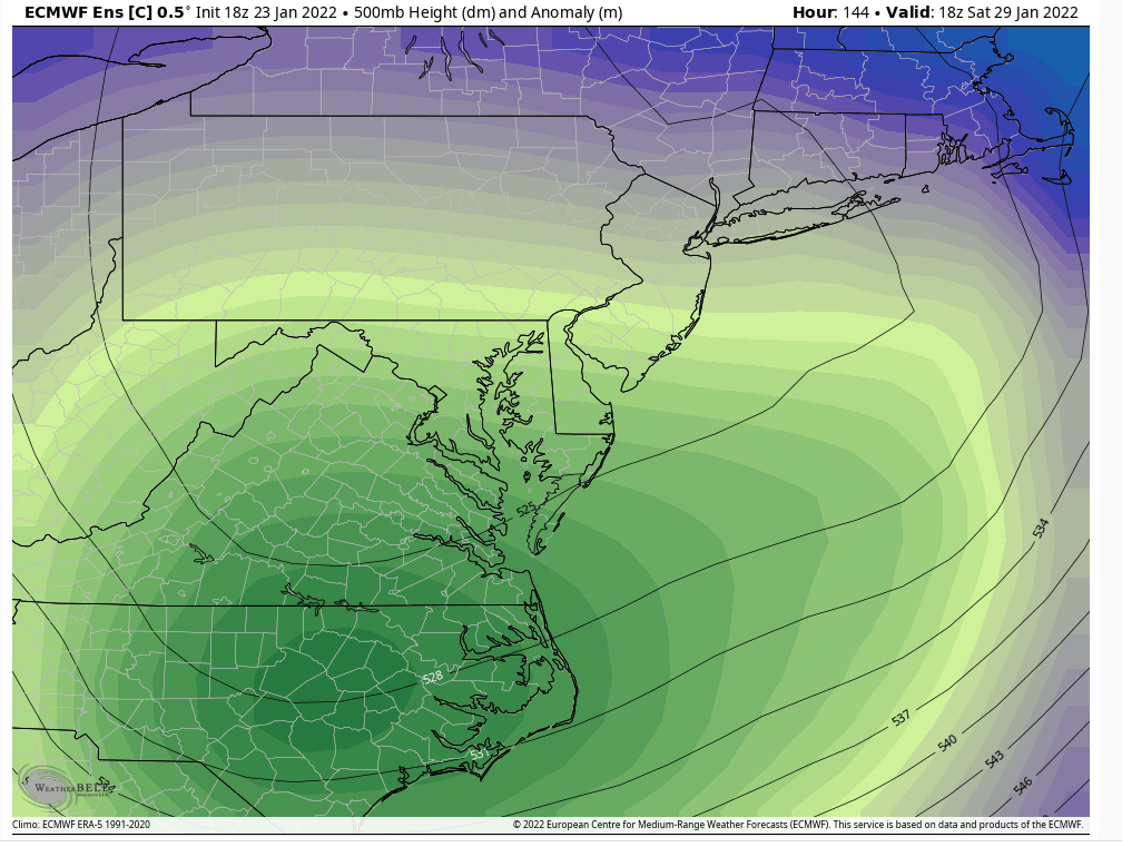
The EPS control mean slp is slightly inside the BM and it's a bomb that drops 24 mb in 12 hours. This is the ULL and I think if we trend to something like this then it's possible the ULL gets captured and rapid consolidation and intensification can occur with the mid-levels. This latitude of an ULL exit off the coast is ideal IF we can get consolidation of the storm and that's what i start seeing. This would most likely tilt the trough more negative than neutral.

Last edited by heehaw453 on Sun Jan 23, 2022 8:46 pm; edited 1 time in total
heehaw453- Advanced Forecaster

- Posts : 3906
Reputation : 86
Join date : 2014-01-20
Location : Bedminster Township, PA Elevation 600' ASL
Page 4 of 26 •  1, 2, 3, 4, 5 ... 15 ... 26
Page 4 of 26
Permissions in this forum:
You cannot reply to topics in this forum|
|
|

 Home
Home