Long Range Thread 27.0
+40
Artechmetals
essexcountypete
Carvin
hyde345
kalleg
uanswer2me
billg315
Radz
crippo84
Koroptim
Wheezer
chief7
GreyBeard
CPcantmeasuresnow
dsix85
toople
phil155
algae888
deadrabbit79
HectorO
Frozen.9
MattyICE
JT33
brownie
Irish
aiannone
Dunnzoo
SENJsnowman
tomsriversnowstorm
nutleyblizzard
jmanley32
frank 638
dkodgis
docstox12
heehaw453
Frank_Wx
amugs
rb924119
weatherwatchermom
sroc4
44 posters
Page 37 of 40
Page 37 of 40 •  1 ... 20 ... 36, 37, 38, 39, 40
 Re: Long Range Thread 27.0
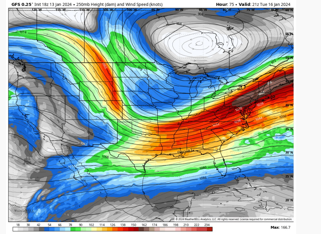
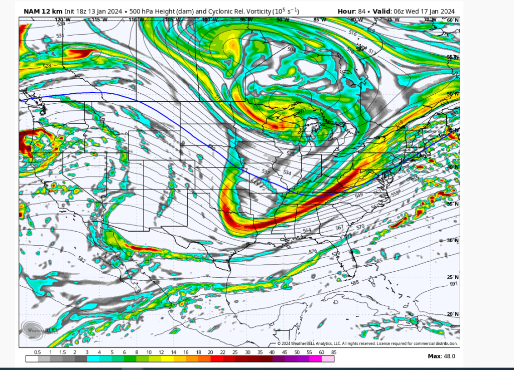
The 18Z NAM IMO shows how a few inches are possible with this Tuesday. The more that 500mb trough digs the higher the heights on the EC which will bring the energy more up and not out. The other models are close enough with energy to warrant attention IMO. The trough has to dig for anything meaningful IMO.

heehaw453- Advanced Forecaster

- Posts : 3907
Join date : 2014-01-20
CPcantmeasuresnow likes this post
heehaw453- Advanced Forecaster

- Posts : 3907
Join date : 2014-01-20
CPcantmeasuresnow likes this post
 Re: Long Range Thread 27.0
As another positive. Outside of the immediate coast temps will probably be mid 20's which is ideal for snow to stick. IT would be wonderful if we had steady light/moderate snowfall that paints the landscape and sticks around for many days. I'm hoping we can pick up a few inches for everyone's sentiment...
heehaw453- Advanced Forecaster

- Posts : 3907
Reputation : 86
Join date : 2014-01-20
Location : Bedminster Township, PA Elevation 600' ASL
docstox12 and CPcantmeasuresnow like this post
heehaw453- Advanced Forecaster

- Posts : 3907
Reputation : 86
Join date : 2014-01-20
Location : Bedminster Township, PA Elevation 600' ASL
heehaw453- Advanced Forecaster

- Posts : 3907
Reputation : 86
Join date : 2014-01-20
Location : Bedminster Township, PA Elevation 600' ASL
 Re: Long Range Thread 27.0
This looks a bit better for South Jersey but I’ll take a few inches here

dkodgis- Senior Enthusiast

- Posts : 2661
Reputation : 98
Join date : 2013-12-29
 Re: Long Range Thread 27.0
Great to see the GFS improve over previous runs. Latest NAM run is also encouraging, esp for those who missed out on any snow last week.
Maybe the wipers are heading back in the positive direction. I'm certainly not saying the windshield wiper effect is in play, as the setup might not improve beyond what it's presently showing, buuuuuuut, if it is, now is the time for the pendulum to start swinging back.
I have noticed, at least I think I've noticed, that most folk lose sight of the windshield wiper effect as it's happening, and take a more deterministic view of the bad trend. Of course, the flip side to that is people like me who use the wiper effect to hold on to false hope instead of accepting the reality of the situation. But either way, what will be, will be, and...
We Track!

SENJsnowman- Senior Enthusiast

- Posts : 1195
Reputation : 61
Join date : 2017-01-06
Age : 51
Location : Long Branch, NJ
docstox12, CPcantmeasuresnow and nancy-j-s like this post
heehaw453- Advanced Forecaster

- Posts : 3907
Reputation : 86
Join date : 2014-01-20
Location : Bedminster Township, PA Elevation 600' ASL
 Re: Long Range Thread 27.0
SENJsnowman wrote:Great to see the GFS improve over previous runs. Latest NAM run is also encouraging, esp for those who missed out on any snow last week.
Maybe the wipers are heading back in the positive direction. I'm certainly not saying the windshield wiper effect is in play, as the setup might not improve beyond what it's presently showing, buuuuuuut, if it is, now is the time for the pendulum to start swinging back.
I have noticed, at least I think I've noticed, that most folk lose sight of the windshield wiper effect as it's happening, and take a more deterministic view of the bad trend. Of course, the flip side to that is people like me who use the wiper effect to hold on to false hope instead of accepting the reality of the situation. But either way, what will be, will be, and...
We Track!
The data will and is getting more fidelity so to me this is much better than having great runs yesterday and starting to go off a cliff today. But I believe tomorrow much more truth will be told.
heehaw453- Advanced Forecaster

- Posts : 3907
Reputation : 86
Join date : 2014-01-20
Location : Bedminster Township, PA Elevation 600' ASL
CPcantmeasuresnow and SENJsnowman like this post
 Re: Long Range Thread 27.0
Certainly trending better. Was a dustng to an inch, now showing 2-4.

Irish- Pro Enthusiast

- Posts : 788
Reputation : 19
Join date : 2019-01-16
Age : 46
Location : Old Bridge, NJ
docstox12 and CPcantmeasuresnow like this post
 Re: Long Range Thread 27.0
Is that TWC? Pointless to use them, or NWS for that. It changes ona dime. I am purely just going to wait and seee what happens, thats all we can do with the way things are. It is what it is as they say.Irish wrote:Certainly trending better. Was a dustng to an inch, now showing 2-4.

jmanley32- Senior Enthusiast

- Posts : 20635
Reputation : 108
Join date : 2013-12-12
Age : 43
Location : Yonkers, NY
 Re: Long Range Thread 27.0
Yes, and I agree. The only reason I look is to see if any change has occurred. Even if it's TWC, It's rather see totals go up, than down.jmanley32 wrote:Is that TWC? Pointless to use them, or NWS for that. It changes ona dime. I am purely just going to wait and seee what happens, thats all we can do with the way things are. It is what it is as they say.Irish wrote:Certainly trending better. Was a dustng to an inch, now showing 2-4.

Irish- Pro Enthusiast

- Posts : 788
Reputation : 19
Join date : 2019-01-16
Age : 46
Location : Old Bridge, NJ
 Re: Long Range Thread 27.0
I think this is going to be a 1-3/2-4 type event for basically everybody. Another light/moderate event possible on Friday.

hyde345- Pro Enthusiast

- Posts : 1082
Reputation : 48
Join date : 2013-01-08
Location : Hyde Park, NY
phil155 likes this post
 Re: Long Range Thread 27.0
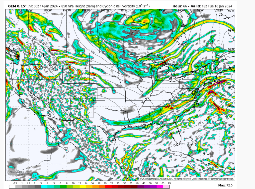
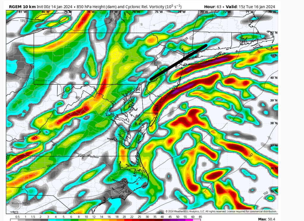
00Z RGEM. There is a fair amount of mid-level energy tucked into the coast. I think it'll create a baroclinc zone and if you are on the cold side of it this has 3-5" potential. Have to watch the mid-level energy with this one. My guess is RGEM just a bit too tucked as there is TPV pressing as well as 500mb trough is more neutral tilt. I would air on the side of colder thermals than warmer ones with this setup.

heehaw453- Advanced Forecaster

- Posts : 3907
Reputation : 86
Join date : 2014-01-20
Location : Bedminster Township, PA Elevation 600' ASL
sroc4 and weatherwatchermom like this post
heehaw453- Advanced Forecaster

- Posts : 3907
Reputation : 86
Join date : 2014-01-20
Location : Bedminster Township, PA Elevation 600' ASL
heehaw453- Advanced Forecaster

- Posts : 3907
Reputation : 86
Join date : 2014-01-20
Location : Bedminster Township, PA Elevation 600' ASL
 Re: Long Range Thread 27.0
Things slowly cont to juice up ever so slightly along the coast regarding QPF. And It could be my bias speaking here but Nam looks to be holding some energy back and trying to interact. Northern and southern streams.
_________________
"In weather and in life, there's no winning and losing; there's only winning and learning."
WINTER 2012/2013 TOTALS 43.65"WINTER 2017/2018 TOTALS 62.85" WINTER 2022/2023 TOTALS 4.9"
WINTER 2013/2014 TOTALS 64.85"WINTER 2018/2019 TOTALS 14.25" WINTER 2023/2024 TOTALS 13.1"
WINTER 2014/2015 TOTALS 71.20"WINTER 2019/2020 TOTALS 6.35"
WINTER 2015/2016 TOTALS 35.00"WINTER 2020/2021 TOTALS 37.75"
WINTER 2016/2017 TOTALS 42.25"WINTER 2021/2022 TOTALS 31.65"

sroc4- Admin

- Posts : 8441
Reputation : 302
Join date : 2013-01-07
Location : Wading River, LI
weatherwatchermom and SENJsnowman like this post
 Re: Long Range Thread 27.0
The mesos are tucked on the mid-level energy. For I95 and points SE it'll be important that it stays a bit more offshore. The precip will be there just a matter of mid-level energy placement on this...
heehaw453- Advanced Forecaster

- Posts : 3907
Reputation : 86
Join date : 2014-01-20
Location : Bedminster Township, PA Elevation 600' ASL
 Re: Long Range Thread 27.0
heehaw453 wrote:The mesos are tucked on the mid-level energy. For I95 and points SE it'll be important that it stays a bit more offshore. The precip will be there just a matter of mid-level energy placement on this...
Just trying to understand, so we're getting a shot of arctic air and the coast still might allow warmth in to taint?

Irish- Pro Enthusiast

- Posts : 788
Reputation : 19
Join date : 2019-01-16
Age : 46
Location : Old Bridge, NJ
 Re: Long Range Thread 27.0
Irish wrote:heehaw453 wrote:The mesos are tucked on the mid-level energy. For I95 and points SE it'll be important that it stays a bit more offshore. The precip will be there just a matter of mid-level energy placement on this...
Just trying to understand, so we're getting a shot of arctic air and the coast still might allow warmth in to taint?
Honestly I am not concerned about rain in this one up here in north central nj. Not really in the least I think it is snow or nothing for the vast overwhelming majority of us
phil155- Pro Enthusiast

- Posts : 494
Reputation : 4
Join date : 2019-12-16
 Re: Long Range Thread 27.0
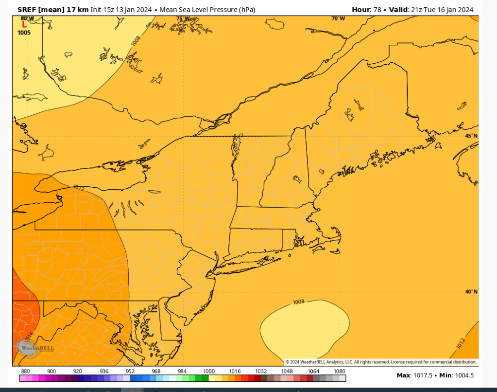
We don't have a strong H anchored over Quebec pumping in fresh cold air with this. There will be a tendency for the storm to want to warm areas closer to the surface on its approach. Still think I95 sees an inch or two at least. But I believe the 3"+ will be NW of I95.
heehaw453- Advanced Forecaster

- Posts : 3907
Reputation : 86
Join date : 2014-01-20
Location : Bedminster Township, PA Elevation 600' ASL
 Re: Long Range Thread 27.0
Irish wrote:heehaw453 wrote:The mesos are tucked on the mid-level energy. For I95 and points SE it'll be important that it stays a bit more offshore. The precip will be there just a matter of mid-level energy placement on this...
Just trying to understand, so we're getting a shot of arctic air and the coast still might allow warmth in to taint?
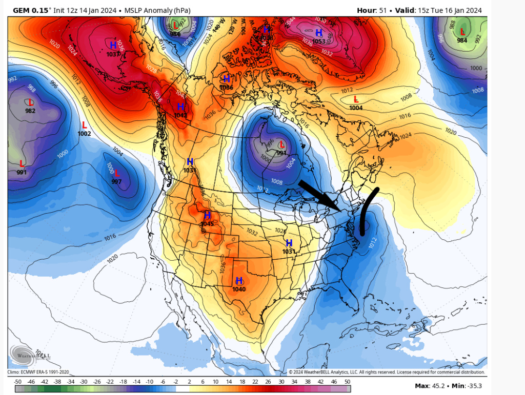
There's no strong H to the north pumping in fresh cold air. If the storm approaches closely like mesos are progged then it will taint especially I95 and points SE.
Where the circle is you'd want some H pumping in cold air on the storm's approach to reinforce the cold air.

heehaw453- Advanced Forecaster

- Posts : 3907
Reputation : 86
Join date : 2014-01-20
Location : Bedminster Township, PA Elevation 600' ASL
Irish likes this post
 Re: Long Range Thread 27.0
Another point is the mesos are at odds with the global models on that warming aspect, but mesos are normally the ones you'd rely on for granular temperature assessment.
heehaw453- Advanced Forecaster

- Posts : 3907
Reputation : 86
Join date : 2014-01-20
Location : Bedminster Township, PA Elevation 600' ASL
Irish likes this post
 Re: Long Range Thread 27.0
heehaw453 wrote:Another point is the mesos are at odds with the global models on that warming aspect, but mesos are normally the ones you'd rely on for granular temperature assessment.
Mesos are still just atthe edge of their wheel house; esp for the nuanced temp profiles. A quick glance at some of the dew points and if there is enough dbz overhead it will cool the column. And the euro should have the resolution to see this and I believe is. Well see. By 12z tomorrow we will stat to fine tune some of those details.
_________________
"In weather and in life, there's no winning and losing; there's only winning and learning."
WINTER 2012/2013 TOTALS 43.65"WINTER 2017/2018 TOTALS 62.85" WINTER 2022/2023 TOTALS 4.9"
WINTER 2013/2014 TOTALS 64.85"WINTER 2018/2019 TOTALS 14.25" WINTER 2023/2024 TOTALS 13.1"
WINTER 2014/2015 TOTALS 71.20"WINTER 2019/2020 TOTALS 6.35"
WINTER 2015/2016 TOTALS 35.00"WINTER 2020/2021 TOTALS 37.75"
WINTER 2016/2017 TOTALS 42.25"WINTER 2021/2022 TOTALS 31.65"

sroc4- Admin

- Posts : 8441
Reputation : 302
Join date : 2013-01-07
Location : Wading River, LI
 Re: Long Range Thread 27.0
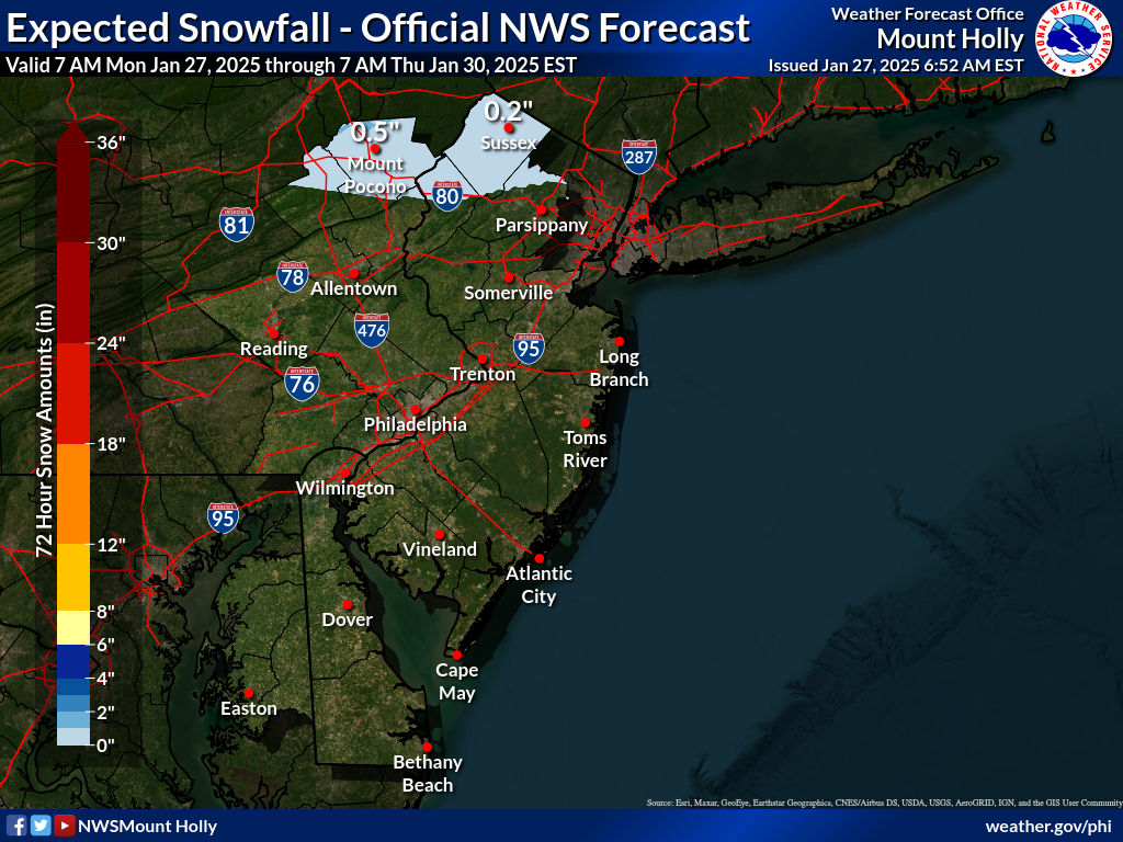
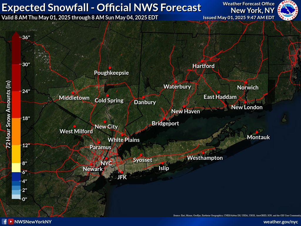
A general 1-3 seems very reasonable to me; with a ceiling of about 4-5" isolated Maybe depending on some nuance and trends.


_________________
"In weather and in life, there's no winning and losing; there's only winning and learning."
WINTER 2012/2013 TOTALS 43.65"WINTER 2017/2018 TOTALS 62.85" WINTER 2022/2023 TOTALS 4.9"
WINTER 2013/2014 TOTALS 64.85"WINTER 2018/2019 TOTALS 14.25" WINTER 2023/2024 TOTALS 13.1"
WINTER 2014/2015 TOTALS 71.20"WINTER 2019/2020 TOTALS 6.35"
WINTER 2015/2016 TOTALS 35.00"WINTER 2020/2021 TOTALS 37.75"
WINTER 2016/2017 TOTALS 42.25"WINTER 2021/2022 TOTALS 31.65"

sroc4- Admin

- Posts : 8441
Reputation : 302
Join date : 2013-01-07
Location : Wading River, LI
jmanley32 and heehaw453 like this post
 Re: Long Range Thread 27.0
Small amplification above I95

dkodgis- Senior Enthusiast

- Posts : 2661
Reputation : 98
Join date : 2013-12-29
jmanley32 likes this post
 Re: Long Range Thread 27.0
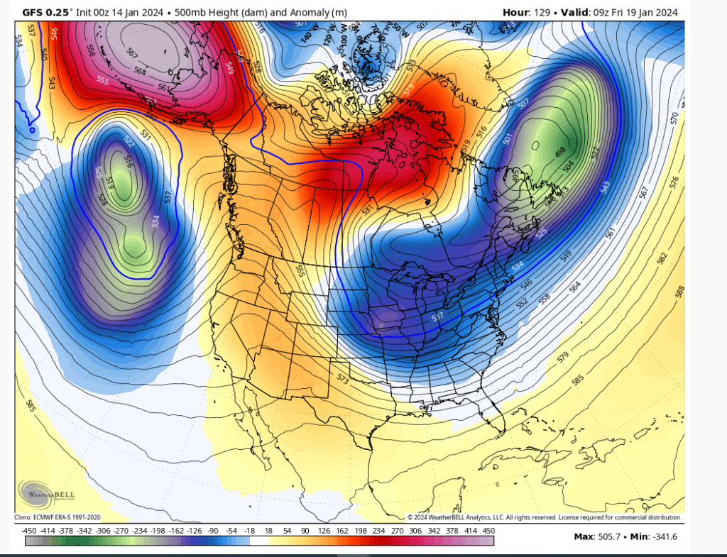
I think the 12Z Canadian Global has the right idea with the track. There will be some resistance to pull north due to the TPV and the storm is not going to want to go into that resistance, but avoid it. I see slightly inside BM track but not coastal hugger like some of the meso's are showing. That being the case the immediate Jersey Shore will mix due to an easterly fetch but if that gets to I95 I have doubts. Just think the Canadian has been making most sense.

heehaw453- Advanced Forecaster

- Posts : 3907
Reputation : 86
Join date : 2014-01-20
Location : Bedminster Township, PA Elevation 600' ASL
sroc4 likes this post
Page 37 of 40 •  1 ... 20 ... 36, 37, 38, 39, 40
Page 37 of 40
Permissions in this forum:
You cannot reply to topics in this forum|
|
|

 Home
Home