
 Search
Official Long Range Thread 2.0
Page 24 of 41 •  1 ... 13 ... 23, 24, 25 ... 32 ... 41
 ![]()
Re: Official Long Range Thread 2.0
![]() by amugs Fri Mar 07, 2014 8:50 am
by amugs Fri Mar 07, 2014 8:50 am
quote="docstox12"]NWS]http://tinypic.com/view.php?pic=b7ctww&s=8#.UxnOEJ0o51s[/img[/img]quote="docstox12"]NWS
It's not over yet, folks.Just amazing how old man winter refuses to budge.Still almost a foot of snowpack with huge piles on streets and lots, albeit grey, black and dingy.Maybe these snow showers on the weekend will dress it up a bit.[/quote]
CP for your records from UNC W
2013-14 has 32 days with a max 32 or lower now...the average is 19 since 1930...1976-77 and 1917-18 had the most days 32 or lower with 45......
#....winter....since 1930
45 in 1976-77
42 in 1977-78
39 in 1935-36
38 in 1933-34
32 in 2013-14
32 in 1947-48
31 in 2002-03
31 in 1993-94
30 in 1995-96
30 in 1980-81
the average days the minimum was 32 or lower is 75 since 1930...We have that now and will add at least seven more days...Since 1990 KNYC is averaging around 65 days with a minimum 32 or lower...
amugs- Advanced Forecaster - Mod

- Posts : 15093
Join date : 2013-01-07
Re: Official Long Range Thread 2.0
![]() by Sparky Sparticles Fri Mar 07, 2014 8:52 am
by Sparky Sparticles Fri Mar 07, 2014 8:52 am
docstox12 wrote:
I'm thinking I'll be trout fishing in the snow in April this year,LOL!
Since I started reading this forum and rattling off the best posts to my hsband, he predicts we'll have snow on Easter (Apr 20th) and, as a joke, said we'll have more when he takes some vacation time in August. Yeah, I smacked him for that one.
Looking out my window at the snowpack, grey sky and cold makes me think it's January 7th and not March!
We got one of our cars out completely now, and less parking spaces have coatings of ice so there's less chance of getting stuck in them, but my station wagon and about 5 others vehicles are still stuck parked diagonally with a foot or more of solid ice piled behind them. That stuff is so hard it bends shovels and ice choppers! We won't get out for a few more weeks.
Sparky Sparticles- Posts : 124
Join date : 2014-02-11
Re: Official Long Range Thread 2.0
![]() by amugs Fri Mar 07, 2014 10:00 am
by amugs Fri Mar 07, 2014 10:00 am
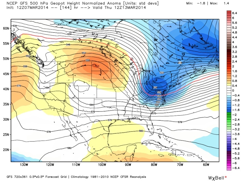
UNCERTAINTY CONTINUES FOR THE MID WEEK PERIOD WITH THE INTERACTION OF PAC SHORT WAVE ENERGY WITH THE NORTHERN BRANCH OF THE POLAR JET. SIGNIFICANT SPREAD CONTINUES WITH THE MAGNITUDE OF PHASING AND RESULTANT TROUGHING...WITH SENSITIVITY LYING IN PAC ENERGY ENTERING THE WESTERN US LATE IN THE WEEKEND/EARLY NEXT WEEK AND ITS INTERACTION WITH A NORTHERN STREAM TROUGH DIGGING AROUND A SE SINKING POLAR VORTEX. WITH THE LOW PREDICTABILITY THIS FAR OUT...NO SIGNIFICANT CHANGES TO THE FORECAST IN THIS TIME PERIOD. A GENERAL SCENARIO OF LOW PRESSURE DEVELOPING ACROSS ACROSS THE MID SECTION OF THE COUNTRY TUE...AND THEN ACROSS TN VALLEY WED...PASSING OFF THE MID ATLANTIC COAST WED NIGHT INTO THU. WITH FAIRLY GOOD AGREEMENT IN A POLAR FRONTAL PASSAGE TUESDAY NIGHT...A COLD SCENARIO IS PREFERRED...WITH THE TRACK/INTENSITY OF LOW DETERMINING ALL SNOW VS A WINTRY MIX. IT IS STILL TOO EARLY TO DETERMINE THE SIGNIFICANCE OF THIS SYSTEM...BUT WILL CONTINUE TO BE MONITORED
_________________
Mugs
AKA:King: Snow Weenie
Self Proclaimed
WINTER 2014-15 : 55.12" +.02 for 6 coatings (avg. 35")
WINTER 2015-16 Total - 29.8" (Avg 35")
WINTER 2016-17 : 39.5" so far

amugs- Advanced Forecaster - Mod
- Posts : 15093
Reputation : 213
Join date : 2013-01-07
Age : 54
Location : Hillsdale,NJ
Re: Official Long Range Thread 2.0
![]() by jmanley32 Fri Mar 07, 2014 10:54 am
by jmanley32 Fri Mar 07, 2014 10:54 am

jmanley32- Senior Enthusiast

- Posts : 20513
Reputation : 108
Join date : 2013-12-12
Age : 42
Location : Yonkers, NY
Re: Official Long Range Thread 2.0
![]() by jmanley32 Fri Mar 07, 2014 10:57 am
by jmanley32 Fri Mar 07, 2014 10:57 am
jmanley32- Senior Enthusiast
- Posts : 20513
Reputation : 108
Join date : 2013-12-12
Age : 42
Location : Yonkers, NY
Re: Official Long Range Thread 2.0
![]() by jmanley32 Fri Mar 07, 2014 10:58 am
by jmanley32 Fri Mar 07, 2014 10:58 am
jmanley32- Senior Enthusiast
- Posts : 20513
Reputation : 108
Join date : 2013-12-12
Age : 42
Location : Yonkers, NY
Re: Official Long Range Thread 2.0
![]() by skinsfan1177 Fri Mar 07, 2014 11:28 am
by skinsfan1177 Fri Mar 07, 2014 11:28 am

skinsfan1177- Senior Enthusiast
- Posts : 4485
Reputation : 35
Join date : 2013-01-07
Age : 46
Location : Point Pleasant Boro
Re: Official Long Range Thread 2.0
![]() by SNOW MAN Fri Mar 07, 2014 11:59 am
by SNOW MAN Fri Mar 07, 2014 11:59 am


SNOW MAN- Senior Enthusiast
- Posts : 1361
Reputation : 25
Join date : 2013-01-13
Age : 64
Location : Marshalls Creek Pa.
Re: Official Long Range Thread 2.0
![]() by jmanley32 Fri Mar 07, 2014 12:15 pm
by jmanley32 Fri Mar 07, 2014 12:15 pm
jmanley32- Senior Enthusiast
- Posts : 20513
Reputation : 108
Join date : 2013-12-12
Age : 42
Location : Yonkers, NY
Re: Official Long Range Thread 2.0
![]() by essexcountypete Fri Mar 07, 2014 12:29 pm
by essexcountypete Fri Mar 07, 2014 12:29 pm
SNOW MAN wrote:Just watched Henry's video. His gut feeling is we're only going to have a wave of LP not a big storm...
Seriously, best news of the week. I'm a firm believer in the HMNCT (Henry Margusity Negative Correlation Therory). I'd take that as the most positive signal so far for a winter storm.

essexcountypete- Pro Enthusiast

- Posts : 783
Reputation : 12
Join date : 2013-12-09
Location : Bloomfield, NJ
Re: Official Long Range Thread 2.0
![]() by jmanley32 Fri Mar 07, 2014 12:30 pm
by jmanley32 Fri Mar 07, 2014 12:30 pm
jmanley32- Senior Enthusiast
- Posts : 20513
Reputation : 108
Join date : 2013-12-12
Age : 42
Location : Yonkers, NY
Re: Official Long Range Thread 2.0
![]() by jmanley32 Fri Mar 07, 2014 12:31 pm
by jmanley32 Fri Mar 07, 2014 12:31 pm
jmanley32- Senior Enthusiast
- Posts : 20513
Reputation : 108
Join date : 2013-12-12
Age : 42
Location : Yonkers, NY
Re: Official Long Range Thread 2.0
![]() by docstox12 Fri Mar 07, 2014 12:34 pm
by docstox12 Fri Mar 07, 2014 12:34 pm
essexcountypete wrote:SNOW MAN wrote:Just watched Henry's video. His gut feeling is we're only going to have a wave of LP not a big storm...
Seriously, best news of the week. I'm a firm believer in the HMNCT (Henry Margusity Negative Correlation Therory). I'd take that as the most positive signal so far for a winter storm.
If I had an indicator as accuirate as that for my trading operations, I'd be in the serious chips,LOL!
He pumped last week's big snowstorm and it busted out in the NYC area.
HENRY PUMPS=YOU BUST
HENRY BUST=BIG SNOW DUMP

docstox12- Wx Statistician Guru

- Posts : 8504
Reputation : 222
Join date : 2013-01-07
Age : 73
Location : Monroe NY
Re: Official Long Range Thread 2.0
![]() by docstox12 Fri Mar 07, 2014 12:36 pm
by docstox12 Fri Mar 07, 2014 12:36 pm
jmanley32 wrote:I know its too early to make specifics but this is a more general setup question. Is it possible its going to be too warm next Wed? I read somewhere that it was, I sure hope not! The PV looks to be far enough south to sustain cold. Certainly is cold enough and the warmup tomorrow as I understand can have a effect on it getting colder.
NWS for my area feels it will be an all snow event.If a big coastal gets wound up and it's on the BM, it will drag in the colder air to keep it all snow.
docstox12- Wx Statistician Guru
- Posts : 8504
Reputation : 222
Join date : 2013-01-07
Age : 73
Location : Monroe NY
Re: Official Long Range Thread 2.0
![]() by jmanley32 Fri Mar 07, 2014 12:37 pm
by jmanley32 Fri Mar 07, 2014 12:37 pm
jmanley32- Senior Enthusiast
- Posts : 20513
Reputation : 108
Join date : 2013-12-12
Age : 42
Location : Yonkers, NY
Re: Official Long Range Thread 2.0
![]() by jmanley32 Fri Mar 07, 2014 12:39 pm
by jmanley32 Fri Mar 07, 2014 12:39 pm
jmanley32- Senior Enthusiast
- Posts : 20513
Reputation : 108
Join date : 2013-12-12
Age : 42
Location : Yonkers, NY
Re: Official Long Range Thread 2.0
![]() by essexcountypete Fri Mar 07, 2014 12:39 pm
by essexcountypete Fri Mar 07, 2014 12:39 pm
essexcountypete- Pro Enthusiast
- Posts : 783
Reputation : 12
Join date : 2013-12-09
Location : Bloomfield, NJ
Re: Official Long Range Thread 2.0
![]() by docstox12 Fri Mar 07, 2014 12:44 pm
by docstox12 Fri Mar 07, 2014 12:44 pm
docstox12- Wx Statistician Guru
- Posts : 8504
Reputation : 222
Join date : 2013-01-07
Age : 73
Location : Monroe NY
Re: Official Long Range Thread 2.0
![]() by Grselig Fri Mar 07, 2014 12:59 pm
by Grselig Fri Mar 07, 2014 12:59 pm
essexcountypete wrote:HM prediction has inspired me to adopt a new late night icon as my avatar. Out with Zamfir, in with the smiling Boxcar Willie.
Pete. Remember Ace Cannon. Wtbs ad. Saxophonist. Man was a genius

Grselig- Senior Enthusiast
- Posts : 1408
Reputation : 140
Join date : 2013-03-04
Age : 54
Location : Wayne NJ
Re: Official Long Range Thread 2.0
![]() by sroc4 Fri Mar 07, 2014 1:07 pm
by sroc4 Fri Mar 07, 2014 1:07 pm
 " />
" />Blah
[img]
 [/img]
_________________
"In weather and in life, there's no winning and losing; there's only winning and learning."
WINTER 2012/2013 TOTALS 43.65"WINTER 2017/2018 TOTALS 62.85" WINTER 2022/2023 TOTALS 4.9"
WINTER 2013/2014 TOTALS 64.85"WINTER 2018/2019 TOTALS 14.25" WINTER 2023/2024 TOTALS 13.1"
WINTER 2014/2015 TOTALS 71.20"WINTER 2019/2020 TOTALS 6.35"
WINTER 2015/2016 TOTALS 35.00"WINTER 2020/2021 TOTALS 37.75"
WINTER 2016/2017 TOTALS 42.25"WINTER 2021/2022 TOTALS 31.65"

sroc4- Admin

- Posts : 8331
Reputation : 301
Join date : 2013-01-07
Location : Wading River, LI
Re: Official Long Range Thread 2.0
![]() by SoulSingMG Fri Mar 07, 2014 1:32 pm
by SoulSingMG Fri Mar 07, 2014 1:32 pm

SoulSingMG- Senior Enthusiast
- Posts : 2853
Reputation : 74
Join date : 2013-12-11
Location : Long Island City, NY
Re: Official Long Range Thread 2.0
![]() by jmanley32 Fri Mar 07, 2014 1:47 pm
by jmanley32 Fri Mar 07, 2014 1:47 pm
jmanley32- Senior Enthusiast
- Posts : 20513
Reputation : 108
Join date : 2013-12-12
Age : 42
Location : Yonkers, NY
Re: Official Long Range Thread 2.0
![]() by jmanley32 Fri Mar 07, 2014 1:49 pm
by jmanley32 Fri Mar 07, 2014 1:49 pm
jmanley32- Senior Enthusiast
- Posts : 20513
Reputation : 108
Join date : 2013-12-12
Age : 42
Location : Yonkers, NY
Re: Official Long Range Thread 2.0
![]() by SNOW MAN Fri Mar 07, 2014 2:01 pm
by SNOW MAN Fri Mar 07, 2014 2:01 pm
jmanley32 wrote:Is this the Henry from Accu? Have never heard of him otherwise, is he nutorious for getting the forecasts the opposite.
It certainly would be that Henry.
SNOW MAN- Senior Enthusiast
- Posts : 1361
Reputation : 25
Join date : 2013-01-13
Age : 64
Location : Marshalls Creek Pa.
Re: Official Long Range Thread 2.0
![]() by SNOW MAN Fri Mar 07, 2014 2:08 pm
by SNOW MAN Fri Mar 07, 2014 2:08 pm
And noted that it's 5 days out and there's a lot of details to be worked out. I'd say that's a fair statement.
SNOW MAN- Senior Enthusiast
- Posts : 1361
Reputation : 25
Join date : 2013-01-13
Age : 64
Location : Marshalls Creek Pa.
Re: Official Long Range Thread 2.0
![]() by SoulSingMG Fri Mar 07, 2014 2:12 pm
by SoulSingMG Fri Mar 07, 2014 2:12 pm
jmanley32 wrote:Yuck soul, I saw a huge bomb. But couldn't it start off that way and change to snow if pulls in cold air?
Historically speaking, if a low is that strong just inside the BM, we would turn to snow here in the city faster than what the EURO is showing now. A shift east in the low's track, and we would be looking at quite an event.
SoulSingMG- Senior Enthusiast
- Posts : 2853
Reputation : 74
Join date : 2013-12-11
Location : Long Island City, NY
Re: Official Long Range Thread 2.0
![]() by sroc4 Fri Mar 07, 2014 2:14 pm
by sroc4 Fri Mar 07, 2014 2:14 pm
_________________
"In weather and in life, there's no winning and losing; there's only winning and learning."
WINTER 2012/2013 TOTALS 43.65"WINTER 2017/2018 TOTALS 62.85" WINTER 2022/2023 TOTALS 4.9"
WINTER 2013/2014 TOTALS 64.85"WINTER 2018/2019 TOTALS 14.25" WINTER 2023/2024 TOTALS 13.1"
WINTER 2014/2015 TOTALS 71.20"WINTER 2019/2020 TOTALS 6.35"
WINTER 2015/2016 TOTALS 35.00"WINTER 2020/2021 TOTALS 37.75"
WINTER 2016/2017 TOTALS 42.25"WINTER 2021/2022 TOTALS 31.65"
sroc4- Admin
- Posts : 8331
Reputation : 301
Join date : 2013-01-07
Location : Wading River, LI
Page 24 of 41 • 1 ... 13 ... 23, 24, 25 ... 32 ... 41 ![]()
|
|
|