
 Search
Official Long Range Thread 2.0
Page 38 of 41 •  1 ... 20 ... 37, 38, 39, 40, 41
 ![]()

Frank_Wx- Godzilla Seeker

- Posts : 21305
Join date : 2013-01-05 -


Frank_Wx- Godzilla Seeker
- Posts : 21305
Join date : 2013-01-05 -
Re: Official Long Range Thread 2.0
![]() by SoulSingMG Thu Mar 20, 2014 12:59 am
by SoulSingMG Thu Mar 20, 2014 12:59 am
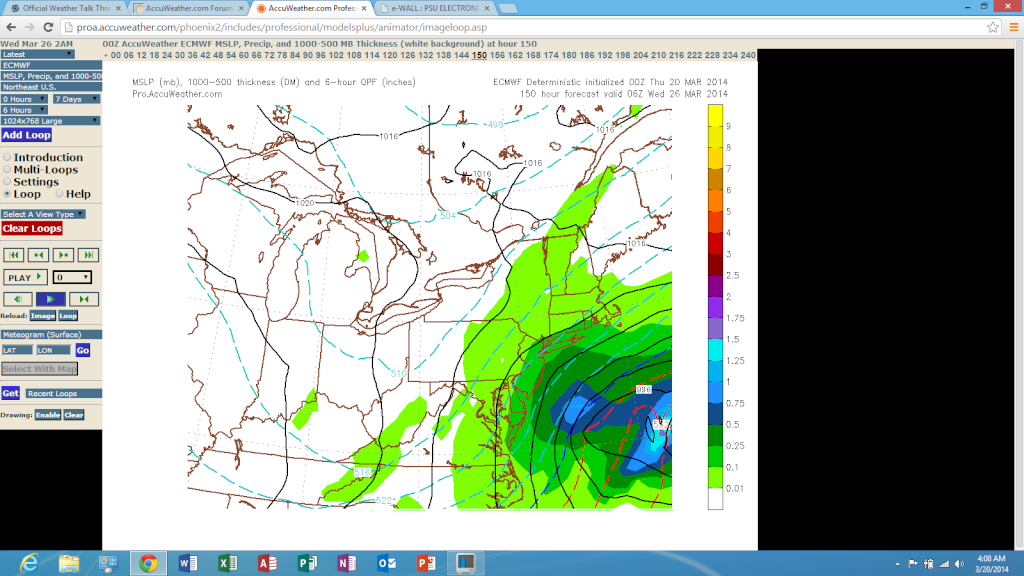
Frank_Wx wrote:00z Canadian...
What the hell is THAT?!

SoulSingMG- Senior Enthusiast

- Posts : 2853
Reputation : 74
Join date : 2013-12-11
Location : Long Island City, NY
Re: Official Long Range Thread 2.0
![]() by Frank_Wx Thu Mar 20, 2014 1:00 am
by Frank_Wx Thu Mar 20, 2014 1:00 am

_________________
_______________________________________________________________________________________________________
CLICK HERE to view NJ Strong Snowstorm Classifications

Frank_Wx- Godzilla Seeker
- Posts : 21305
Reputation : 328
Join date : 2013-01-05
Age : 31
Location : Jersey City, NJ -
Re: Official Long Range Thread 2.0
![]() by Frank_Wx Thu Mar 20, 2014 1:01 am
by Frank_Wx Thu Mar 20, 2014 1:01 am

_________________
_______________________________________________________________________________________________________
CLICK HERE to view NJ Strong Snowstorm Classifications
Frank_Wx- Godzilla Seeker
- Posts : 21305
Reputation : 328
Join date : 2013-01-05
Age : 31
Location : Jersey City, NJ -
Re: Official Long Range Thread 2.0
![]() by Frank_Wx Thu Mar 20, 2014 1:02 am
by Frank_Wx Thu Mar 20, 2014 1:02 am
_________________
_______________________________________________________________________________________________________
CLICK HERE to view NJ Strong Snowstorm Classifications
Frank_Wx- Godzilla Seeker
- Posts : 21305
Reputation : 328
Join date : 2013-01-05
Age : 31
Location : Jersey City, NJ -
Re: Official Long Range Thread 2.0
![]() by NjWeatherGuy Thu Mar 20, 2014 1:17 am
by NjWeatherGuy Thu Mar 20, 2014 1:17 am
SoulSingMG wrote:Frank_Wx wrote:00z Canadian...
What the hell is THAT?!
Hmmmmmmmmm, am I a genie?

lol, and excuse me, on that map I get about 10 lol

NjWeatherGuy- Advanced Forecaster

- Posts : 4100
Reputation : 28
Join date : 2013-01-06
Location : Belle Mead, NJ
Re: Official Long Range Thread 2.0
![]() by Frank_Wx Thu Mar 20, 2014 1:18 am
by Frank_Wx Thu Mar 20, 2014 1:18 am
_________________
_______________________________________________________________________________________________________
CLICK HERE to view NJ Strong Snowstorm Classifications
Frank_Wx- Godzilla Seeker
- Posts : 21305
Reputation : 328
Join date : 2013-01-05
Age : 31
Location : Jersey City, NJ -
Re: Official Long Range Thread 2.0
![]() by NjWeatherGuy Thu Mar 20, 2014 1:25 am
by NjWeatherGuy Thu Mar 20, 2014 1:25 am
Frank_Wx wrote:Haha that is funny
Pulling an all nighter to get some work done, waiting to see if GEFS ensembles are any improvement, definitely want to see GGEM ensembles.
NjWeatherGuy- Advanced Forecaster
- Posts : 4100
Reputation : 28
Join date : 2013-01-06
Location : Belle Mead, NJ
Re: Official Long Range Thread 2.0
![]() by NjWeatherGuy Thu Mar 20, 2014 1:29 am
by NjWeatherGuy Thu Mar 20, 2014 1:29 am
http://weather.gc.ca/ensemble/charts_e.html?Hour=144&Day=&RunTime=00&Type=pnm
NjWeatherGuy- Advanced Forecaster
- Posts : 4100
Reputation : 28
Join date : 2013-01-06
Location : Belle Mead, NJ


NjWeatherGuy- Advanced Forecaster
- Posts : 4100
Reputation : 28
Join date : 2013-01-06
Location : Belle Mead, NJ
Re: Official Long Range Thread 2.0
![]() by Frank_Wx Thu Mar 20, 2014 1:32 am
by Frank_Wx Thu Mar 20, 2014 1:32 am
NjWeatherGuy wrote:Frank_Wx wrote:Haha that is funny
Pulling an all nighter to get some work done, waiting to see if GEFS ensembles are any improvement, definitely want to see GGEM ensembles.
Cant post but the GEFS looks like the OP. Have not seen individuals though
_________________
_______________________________________________________________________________________________________
CLICK HERE to view NJ Strong Snowstorm Classifications
Frank_Wx- Godzilla Seeker
- Posts : 21305
Reputation : 328
Join date : 2013-01-05
Age : 31
Location : Jersey City, NJ -
Re: Official Long Range Thread 2.0
![]() by NjWeatherGuy Thu Mar 20, 2014 4:07 am
by NjWeatherGuy Thu Mar 20, 2014 4:07 am
http://mp1.met.psu.edu/~fxg1/ENSPRS_0z/ensloopnew.html
NjWeatherGuy- Advanced Forecaster
- Posts : 4100
Reputation : 28
Join date : 2013-01-06
Location : Belle Mead, NJ
NjWeatherGuy- Advanced Forecaster
- Posts : 4100
Reputation : 28
Join date : 2013-01-06
Location : Belle Mead, NJ
Re: Official Long Range Thread 2.0
![]() by pdubz Thu Mar 20, 2014 4:58 am
by pdubz Thu Mar 20, 2014 4:58 am
...SENSIBLE WEATHER HIGHLIGHTS...
OVER THE WEST...MOST AREAS EXCEPT FOR THE EXTREME NORTH SHOULD SEE
TEMPS 5-15F ABOVE NORMAL INTO MIDWEEK. EXPECT MAINLY DRY
CONDITIONS THIS WEEKEND INTO EARLY NEXT WEEK WITH PACIFIC MOISTURE
FINALLY REACHING THE WEST COAST AND FILTERING PCPN AND COOLING
TEMPS INCREASINGLY INLAND TUE-THU.
FROM THE PLAINS INTO THE EAST ANTICIPATE MULTIPLE DAYS WITH BROAD
COVERAGE OF TEMPS 10-20F BELOW NORMAL WITH LOCALLY GREATER
ANOMALIES POSSIBLE. SUCH DEPARTURES FROM NORMAL SHOULD BE
SOMEWHAT MORE EXPANSIVE FOR MAX TEMPS VERSUS LOW TEMPS GIVEN WINDS
AND SOME CLOUDS/MSTR AWAY FROM TWO COLD SFC HIGHS DROPPING SWD
FROM CANADA. SEVERAL UPSTREAM SHORTWAVES MAY SUPPORT PERIODIC
POCKETS OF SNOW WHERE AIR IS SUFFICIENTLY COLD WHILE
MOISTURE/IMPULSES EMBEDDED IN SRN STREAM FLOW MAY GENERATE PASSING
AREAS OF RAINFALL OVER THE FAR SOUTH.
IN THIS PATTERN THERE MEANWHILE REMAINS SIGNIFICANT POTENTIAL FOR
UNUSUALLY FAR SOUTHWARD EXTENT OF WINTRY PRECIPITATION FOR LATE
MARCH. THE BEST CONSENSUS FOR WRN ATLANTIC COASTAL STORM
INTENSIFICATION TUE-WED GIVES THE MID-ATLANTIC AND NORTHEAST THE
HIGHEST THREAT OF MEANINGFUL LATE SEASON SNOW/WIND.
SCHICHTEL
http://www.hpc.ncep.noaa.gov/discussions/hpcdiscussions.php?disc=pmdepd

pdubz- Pro Enthusiast

- Posts : 539
Reputation : 0
Join date : 2013-09-24
Age : 32
Location : Port Washington,NY (L.I)
Re: Official Long Range Thread 2.0
![]() by algae888 Thu Mar 20, 2014 5:14 am
by algae888 Thu Mar 20, 2014 5:14 am
TELECONNECTION PATTERN IS TRYING TO GET A PNA SWITCH WHICH DOES
ENHANCE PCPN CHANCES. THE NAO IS FCST TO REMAIN POSITIVE, WHICH IT
HAS BEEN SINCE JANUARY 19TH. SO WHILE THE LATTER HAS NOT STOPPED
THE SNOW, THE ESCAPE HATCH ITS PROVIDING WOULD SUGGEST A MORE
PROGRESSIVE SOLUTION.
it looks like the only chance we have with this storm is if the trough becomes neg (at the right time) and pulls the storm west. otherwise their is nothing to stop or slow it down and it goes harmlessly out to our east. with all this cold if we only had some blocking what a winter it could have been. still a good winter but it could have been one to remember.

algae888- Advanced Forecaster
- Posts : 5311
Reputation : 46
Join date : 2013-02-05
Age : 61
Location : mt. vernon, new york
Re: Official Long Range Thread 2.0
![]() by NjWeatherGuy Thu Mar 20, 2014 5:18 am
by NjWeatherGuy Thu Mar 20, 2014 5:18 am
algae888 wrote:from mt holly
TELECONNECTION PATTERN IS TRYING TO GET A PNA SWITCH WHICH DOES
ENHANCE PCPN CHANCES. THE NAO IS FCST TO REMAIN POSITIVE, WHICH IT
HAS BEEN SINCE JANUARY 19TH. SO WHILE THE LATTER HAS NOT STOPPED
THE SNOW, THE ESCAPE HATCH ITS PROVIDING WOULD SUGGEST A MORE
PROGRESSIVE SOLUTION.
it looks like the only chance we have with this storm is if the trough becomes neg (at the right time) and pulls the storm west. otherwise their is nothing to stop or slow it down and it goes harmlessly out to our east. with all this cold if we only had some blocking what a winter it could have been. still a good winter but it could have been one to remember.
Trough axis needs to be a bit further west. As time gets closer downstream things can change which could allow that. But it could also stay just as progressive or even more than it is now, it really is a waiting game for now. Signals are not great but we'll see.
NjWeatherGuy- Advanced Forecaster
- Posts : 4100
Reputation : 28
Join date : 2013-01-06
Location : Belle Mead, NJ
Re: Official Long Range Thread 2.0
![]() by docstox12 Thu Mar 20, 2014 5:43 am
by docstox12 Thu Mar 20, 2014 5:43 am
CPcantmeasuresnow wrote:amugs wrote:SNOW MAN wrote:They mentioned this possible storm for the middle of next week on NBC Nightly News tonight. They showed a graphic from TWC and said don't put your snow removal equipment away just yet. Oh boy if that isn't the ultimate KOD I don't know what is. LOL !
Here we go and then JB willpost a 20" snowmap and FB goes viral and we kiss it all goodbye!! HAHAHA!!
ANYWAY, JOIN ME IN RAISING A GLASS TO THE OFFICIAL END OF WINTER ON ITS LAST FULL DAY TODAY - EVEN THOUGH I HAVE THE FLU I AM KSWAND WILL RAISE A GLASS WITH ALL MY FELLOW SPIRES AND LADS OF MY FICTITIOUS KINGDOM WE MADE THIS YEAR ON THIS WONDERFUL BOARD AND GIVE CHEERS TO THE VERY GOOD WINTER IT WAS OVERALL !!
Three Cheers for Old Man Winter Everyone -
Let's hope he can lay us a bigor a
bomb next week.
It will never even get that far your Highness
I've got to keep it real your Highness
I'm just the messenger.
Hilarious, CP and I agree with you.
The pattern the last 6 weeks is for snowstorms to move south.I'm not getting excited with these long range models that show snowstorms hitting our area and then get jerked around.I'll check into this the day of the storm,if any.

docstox12- Wx Statistician Guru

- Posts : 8502
Reputation : 222
Join date : 2013-01-07
Age : 73
Location : Monroe NY
Re: Official Long Range Thread 2.0
![]() by jmanley32 Thu Mar 20, 2014 6:29 am
by jmanley32 Thu Mar 20, 2014 6:29 am

jmanley32- Senior Enthusiast
- Posts : 20513
Reputation : 108
Join date : 2013-12-12
Age : 42
Location : Yonkers, NY
Re: Official Long Range Thread 2.0
![]() by NjWeatherGuy Thu Mar 20, 2014 6:32 am
by NjWeatherGuy Thu Mar 20, 2014 6:32 am
jmanley32 wrote:06z GFS still has a bomb albeit offshore but coming northerly similar to last couple runs. 977mb at deepest with 90mph wind gusts according to instantwxmaps! Snow does touch NYC CT and MA with like 2-4 inches most towards cape cod. If we can get that westward movement like Frank was saying we will really be in for it depending on how far it moves west, if any.
That doesn't quite sound right, the wind gust part
NjWeatherGuy- Advanced Forecaster
- Posts : 4100
Reputation : 28
Join date : 2013-01-06
Location : Belle Mead, NJ
Re: Official Long Range Thread 2.0
![]() by jmanley32 Thu Mar 20, 2014 6:36 am
by jmanley32 Thu Mar 20, 2014 6:36 am
http://www.instantweathermaps.com/GFS-php/showmap-conussfc.php?run=2014032006&time=INSTANT&var=GUSTM&hour=156
not near us, just was stating how strong the darn thing gets. But I have heard instantwxmaps can exaggerate numbers.
Upton:
THE HIGH MOVES
EAST ON TUESDAY WITH UNCERTAINTY INCREASING DUE TO POTENTIAL LOW
PRESSURE DEVELOPMENT ALONG THE SOUTHEAST COAST. THE GFS/ECMWF/CMC
AND ENSEMBLES ALL SHOW THIS LOW DEVELOPING TUESDAY MORNING AND
MOVING NE TOWARDS A LOCATION SE OF THE 40N/70W BENCHMARK BY EARLY
WEDNESDAY MORNING. THE UNCERTAINTY LIES FROM THE EVOLUTION OF THE
LONGWAVE TROUGH AND PHASING OF ENERGY WITHIN THE TROUGH. THE ECMWF
HAS HAD A TENDENCY TO OVER AMPLIFY SYSTEMS IN THE MEDIUM RANGE THIS
WINTER. HOWEVER...THE LATEST GFS...SEVERAL OF ITS ENSEMBLE MEMBERS
AND THE CMC DO SHOW A COMPARABLE STRENGTH WITH DIFFERENCES IN THE
TIMING OF ENERGY PHASING AND TRACK. WITH THIS POTENTIAL SYSTEM ON
DAY 6...DID NOT MAKE MANY CHANGES TO THE PREVIOUS FORECAST WHICH
GENERALLY SHOWS CHANCE FOR RAIN/SNOW MIX TUESDAY AFTERNOON WITH A
CHANCE OF SNOW TUESDAY NIGHT INTO WEDNESDAY MORNING.
jmanley32- Senior Enthusiast
- Posts : 20513
Reputation : 108
Join date : 2013-12-12
Age : 42
Location : Yonkers, NY
Re: Official Long Range Thread 2.0
![]() by NjWeatherGuy Thu Mar 20, 2014 6:37 am
by NjWeatherGuy Thu Mar 20, 2014 6:37 am
jmanley32 wrote:well thats what instant wxmaps shows as the highest winds as it pulls away:
http://www.instantweathermaps.com/GFS-php/showmap-conussfc.php?run=2014032006&time=INSTANT&var=GUSTM&hour=156
not near us, just was stating how strong the darn thing gets. But I have heard instantwxmaps can exaggerate numbers.
Upton:
THE HIGH MOVES
EAST ON TUESDAY WITH UNCERTAINTY INCREASING DUE TO POTENTIAL LOW
PRESSURE DEVELOPMENT ALONG THE SOUTHEAST COAST. THE GFS/ECMWF/CMC
AND ENSEMBLES ALL SHOW THIS LOW DEVELOPING TUESDAY MORNING AND
MOVING NE TOWARDS A LOCATION SE OF THE 40N/70W BENCHMARK BY EARLY
WEDNESDAY MORNING. THE UNCERTAINTY LIES FROM THE EVOLUTION OF THE
LONGWAVE TROUGH AND PHASING OF ENERGY WITHIN THE TROUGH. THE ECMWF
HAS HAD A TENDENCY TO OVER AMPLIFY SYSTEMS IN THE MEDIUM RANGE THIS
WINTER. HOWEVER...THE LATEST GFS...SEVERAL OF ITS ENSEMBLE MEMBERS
AND THE CMC DO SHOW A COMPARABLE STRENGTH WITH DIFFERENCES IN THE
TIMING OF ENERGY PHASING AND TRACK. WITH THIS POTENTIAL SYSTEM ON
DAY 6...DID NOT MAKE MANY CHANGES TO THE PREVIOUS FORECAST WHICH
GENERALLY SHOWS CHANCE FOR RAIN/SNOW MIX TUESDAY AFTERNOON WITH A
CHANCE OF SNOW TUESDAY NIGHT INTO WEDNESDAY MORNING.
That's wrong, shows much of the country pretty windy despite widely spaced isobars in many locations. Those wind gusts would be above Sandy level which is ridiculous because Sandy was over 30mb stronger.
NjWeatherGuy- Advanced Forecaster
- Posts : 4100
Reputation : 28
Join date : 2013-01-06
Location : Belle Mead, NJ
Re: Official Long Range Thread 2.0
![]() by jmanley32 Thu Mar 20, 2014 6:39 am
by jmanley32 Thu Mar 20, 2014 6:39 am
jmanley32- Senior Enthusiast
- Posts : 20513
Reputation : 108
Join date : 2013-12-12
Age : 42
Location : Yonkers, NY
Re: Official Long Range Thread 2.0
![]() by jmanley32 Thu Mar 20, 2014 6:41 am
by jmanley32 Thu Mar 20, 2014 6:41 am
Last edited by jmanley32 on Thu Mar 20, 2014 6:45 am; edited 1 time in total
jmanley32- Senior Enthusiast
- Posts : 20513
Reputation : 108
Join date : 2013-12-12
Age : 42
Location : Yonkers, NY
Re: Official Long Range Thread 2.0
![]() by jmanley32 Thu Mar 20, 2014 6:44 am
by jmanley32 Thu Mar 20, 2014 6:44 am
Yes its for hurricanes but gives you a general idea of winds to mb, way at the bottom.
http://weather.org/conversion.htm
jmanley32- Senior Enthusiast
- Posts : 20513
Reputation : 108
Join date : 2013-12-12
Age : 42
Location : Yonkers, NY
Re: Official Long Range Thread 2.0
![]() by NjWeatherGuy Thu Mar 20, 2014 7:03 am
by NjWeatherGuy Thu Mar 20, 2014 7:03 am
NjWeatherGuy- Advanced Forecaster
- Posts : 4100
Reputation : 28
Join date : 2013-01-06
Location : Belle Mead, NJ
Re: Official Long Range Thread 2.0
![]() by jmanley32 Thu Mar 20, 2014 7:08 am
by jmanley32 Thu Mar 20, 2014 7:08 am
http://en.wikipedia.org/wiki/March_2010_North_American_winter_storm
look at the NY section, so if 75-85mph happened with 993mb then 977 certainly could put out 90mph and this was also a march storm and I remember it well the winds reaked havok here, giant trees uprooted.
Last edited by jmanley32 on Thu Mar 20, 2014 7:13 am; edited 1 time in total
jmanley32- Senior Enthusiast
- Posts : 20513
Reputation : 108
Join date : 2013-12-12
Age : 42
Location : Yonkers, NY
Page 38 of 41 • 1 ... 20 ... 37, 38, 39, 40, 41 ![]()
|
|
|