Update #2: 1st Call Snow Map, Intense Winter Storm Coming
+37
Taffy
snow247
Pauledangerously
Nyi1058
elkiehound
weatherwatchermom
NjWeatherGuy
leimatt95
nutleyblizzard
WOLVES1
mancave25
deadrabbit79
Dunnzoo
tigernumba1
aiannone
algae888
Math23x7
jimv45
RJB8525
devsman
amugs
Dtone
oldtimer
CPcantmeasuresnow
Sferra01
Philliesfan
Quietace
sroc4
gigs68
rb924119
billg315
jmanley32
skinsfan1177
docstox12
SoulSingMG
SNOW MAN
Frank_Wx
41 posters
Page 15 of 23
Page 15 of 23 •  1 ... 9 ... 14, 15, 16 ... 19 ... 23
 Re: Update #2: 1st Call Snow Map, Intense Winter Storm Coming
jmanley32 wrote:sroc unfortunate? It's a foregone thing? Foregone means no longer a issue, so your thinking no ice?
Jman foregone means its inevitable, and thats unfortunate: Not no longer an issue.
foregone conclusion
n
1. an inevitable result or conclusion
sroc4- Admin

- Posts : 8331
Join date : 2013-01-07
 Re: Update #2: 1st Call Snow Map, Intense Winter Storm Coming
Doc cp relax 10 to 14 mix possible for a time north of 84 should do good.
jimv45- Senior Enthusiast

- Posts : 1168
Join date : 2013-09-20
 Re: Update #2: 1st Call Snow Map, Intense Winter Storm Coming
jmanley32 wrote:dtone and that could be conservative, if above posted maps are right. NYC may steer clear but we may not, how far north in the bx are u?
Around Allerton..NE Bx
Dtone- Wx Statistician Guru

- Posts : 1738
Reputation : 9
Join date : 2013-08-26
Location : Bronx, NY
 Re: Update #2: 1st Call Snow Map, Intense Winter Storm Coming
SIGNIFICANT UNCERTAINTY LIES IN P-TYPE...PARTICULARLY ALONG THE
COAST...WITH A SPREAD OF ABOUT 50 MILES BETWEEN OPERATIONAL
SOLUTIONS AND ENSEMBLE MEANS IN HOW CLOSE TO THE COAST THE LOW
GETS AND THE POSITION OF THE TIGHT THERMAL GRADIENT ACROSS THE
REGION. SBU ENSEMBLE SENSITIVITY SHOWING THIS N/S TRACK UNCERTAINTY
IN THE 00Z GEFS/CMCE/ECMWF ENSEMBLES...WITH SENSITIVITY LYING IN
DEGREE OF PHASING/INTERACTION BETWEEN NORTHERN STREAM SHORTWAVE
ENERGY DROPPING DOWN THROUGH MONTANA AND THE CUTOFF UPPER LOW OVER
THE SW US...AND RESULTANT STRENGTH OF TROUGH APPROACHING THE EAST
COAST SUNDAY NIGHT/MONDAY AND UPSTREAM RIDGING. A STRONGER
TROUGH...MEANING MORE UPSTREAM RIDGING...AND A FURTHER NORTH
TRACK. THIS INTERACTION IS NOT COMPLETE FOR ANOTHER 24 HOURS...SO
COULD TAKE UNTIL THEN FOR CONFIDENCE IN P-TYPE FORECAST INCREASES.
WITH CONFLUENT FLOW ACROSS NORTHERN NEW ENGLAND/SE CANADA...ARCTIC
HIGH SHOULD BE LOCKED INTO THAT AREA. PREFER TIGHTER THERMAL
STRUCTURE ALOFT OF NAM/ECMWF/CAN VERSUS MORE DIFFUSE THERMAL
STRUCTURE OF GFS IN THIS SITUATION...BUT QUESTION IS LOCATION OF
THIS BAROCLINIC ZONE. MODEL SOLUTIONS POINTING TO DIFFERING
DEGREES OF WARMING IN THE 800-950 LAYER MON MORNING INTO EARLY
AFT...BUT TREND IS TOWARDS MORE WARMING.
WITH THIS SAID...NORTHWEST TIER OF THE TRI-STATE LOOKS TO BE
MAINLY SNOW. BIGGEST FORECAST CHALLENGE IS FOR COAST...ESPECIALLY
NYC/NJ/LI...IN AMOUNT OF SLEET/FZRA/RA VERSUS SNOW. 12Z GFS/GEFS
ARE FURTHER NORTH WITH LOW TRACK...JUST SOUTH OF LI MONDAY
AFTERNOON...WHICH WOULD IMPLY MORE IN THE WAY OF WARMING
ALOFT...AND MORE IN WAY MIXING WITH SLEET AND FREEZING RAIN AND
EVEN RAIN FOR LI/NYC. 12Z GEM HAS TRENDED IN THAT DIRECTION AS
WELL. 12Z NAM...WOULD POINT TO MAINLY SNOW FOR CT AND LOWER HUDSON
VALLEY...WITH A MIX OF SIGNIFICANT SNOW/SLEET ACCUM FOR
NYC/LI/METRO NJ. 00Z ECMWF...IS SIMILARLY COLDER AND A BIT FARTHER
SOUTH AS WITH THE NAM. HAVE TAKEN A MIDDLE OF THE ROAD SOLUTION
BASED ON THE UNCERTAINTY...WITH A SLIGHTLY WETTER AND WARMER
FORECAST.
EVEN WITH CONTINUED NORTHWARD TREND...HIGHEST CONFIDENCE IN
SIGNIFICANT SNOW/SLEET/ICE ACROSS INTERIOR NE NJ...AND MOST OF THE
LOWER HUDSON VALLEY AND CT. HAVE UPGRADED TO WARNING THERE FOR 5
TO 10 INCHES OF SNOW/SLEET AND UP TO 1/4 INCH OF ICE. INTERIOR
PORTIONS OF LOWER HUDSON VALLEY AND SW CT...MORE IN THE 8 TO 14
INCH RANGE WITH LESS ICE/SLEET
This means we have to wait to 6x before we know or it is a noecsdt. Look at the uncertainty in the discussion.
Get ready for a wold ride over the next 24 hours!
_________________
Mugs
AKA:King: Snow Weenie
Self Proclaimed
WINTER 2014-15 : 55.12" +.02 for 6 coatings (avg. 35")
WINTER 2015-16 Total - 29.8" (Avg 35")
WINTER 2016-17 : 39.5" so far

amugs- Advanced Forecaster - Mod

- Posts : 15093
Reputation : 213
Join date : 2013-01-07
Age : 54
Location : Hillsdale,NJ
 Re: Update #2: 1st Call Snow Map, Intense Winter Storm Coming
what a mess: upton disco.
EVEN WITH CONTINUED NORTHWARD TREND...HIGHEST CONFIDENCE IN
SIGNIFICANT SNOW/SLEET/ICE ACROSS INTERIOR NE NJ...AND MOST OF THE
LOWER HUDSON VALLEY AND CT. HAVE UPGRADED TO WARNING THERE FOR 5
TO 10 INCHES OF SNOW/SLEET AND UP TO 1/4 INCH OF ICE. INTERIOR
PORTIONS OF LOWER HUDSON VALLEY AND SW CT...MORE IN THE 8 TO 14
INCH RANGE WITH LESS ICE/SLEET.
EVEN FOR NYC/NJ METRO AND LI...COULD SEE A QUICK 3 TO 5 INCH
SNOWFALL ON THE FRONT END WITH SOUTHERN STREAM MOISTURE AND STRONG
LIFT LATE SUN NIGHT/EARLY MON MORNING BEFORE ANY MIXING. AFTER
CHANGEOVER...A PROLONGED PERIOD OF FZRA/SLEET (1/4 INCH OF ICE)
POSSIBLE FOR NORTHERN HALF OF LI/NYC AND NE NJ...WITH COLD AIR
DRAINAGE DOWN THE RIVER VALLEYS. HAVE MAINTAINED A WATCH HERE WITH
UNCERTAINTY IF WE CHANGEOVER TO MORE RAIN...PARTICULARLY FOR SOUTH
COASTAL AREAS. THE ONE ASPECT TO KEEP IN MIND IS IF COASTAL AREAS
DO GO OVER TO RAIN...THERE IS POTENTIAL FOR URBAN FLOODING ISSUES.
SEE HYDROLOGY SECTION FOR MORE INFO.
ANY RAIN/MIXED PRECIP SHOULD GRADUALLY CHANGE BACK TO SNOW FROM NW
TO SE MONDAY AFTERNOON/EVE. EVEN SOME SIGNAL OF DEFORMATION BANDING
ON THE BACKSIDE...WITH ACCUMULATING SNOW BACK DOWN TO THE COAST.
WITH COLD AIR CRASHING BACK DOWN TO THE COAST...POTENTIAL FOR
FLASH FREEZE CONDITIONS FOR MONDAY EVENING COMMUTE FOR CITY/COAST
IN WAKE OF A WASHING RAIN. SO TO SAY THE LEAST...A COMPLICATED
FORECAST FOR THE NYC/NJ METRO AND LONG ISLAND...WHICH COULD STILL
SEE SIGNIFICANT IMPACTS EVEN IF IT IS NOT ALL FROZEN.

jmanley32- Senior Enthusiast

- Posts : 20513
Reputation : 108
Join date : 2013-12-12
Age : 42
Location : Yonkers, NY
 Re: Update #2: 1st Call Snow Map, Intense Winter Storm Coming
mugs u read my mind lol, you get so excited, you need to spell check lol a "a noecsdt" nowcast?

jmanley32- Senior Enthusiast

- Posts : 20513
Reputation : 108
Join date : 2013-12-12
Age : 42
Location : Yonkers, NY
 Re: Update #2: 1st Call Snow Map, Intense Winter Storm Coming
You know, I just thought of something. The models screwed up the timing of the interaction of the last storm by a good six or more hours which allowed the low to track further east. Instead of an earlier phase, it was later. I seem to remember that happening a lot with Miller Bs in the models. Who's to say they aren't modeling it too soon again?
rb924119- Meteorologist

- Posts : 6889
Reputation : 194
Join date : 2013-02-06
Age : 32
Location : Greentown, Pa
 Re: Update #2: 1st Call Snow Map, Intense Winter Storm Coming
Thanks but I am mobile and the dam auto correct and my fat thumbs cause me tisues. Dam it issues!!
_________________
Mugs
AKA:King: Snow Weenie
Self Proclaimed
WINTER 2014-15 : 55.12" +.02 for 6 coatings (avg. 35")
WINTER 2015-16 Total - 29.8" (Avg 35")
WINTER 2016-17 : 39.5" so far

amugs- Advanced Forecaster - Mod

- Posts : 15093
Reputation : 213
Join date : 2013-01-07
Age : 54
Location : Hillsdale,NJ
 Re: Update #2: 1st Call Snow Map, Intense Winter Storm Coming
Looking at the skew-t's, NYC might be 32.5-33F or so at its warmest point around 12z. Snow to freezing rain, briefly rain, then back to ZR by 15z, sleet at 18z, maybe ending as snow. So overall, even though the mid levels are warm, the surface indicates predominately frozen still for NYC. This is going to become headache of s a storm. Nothing etched in stone yet peeps. Just got in from my sons games and okay we may not get 8-14 of snow but I saw EPWA map and I think they are very close to it for us up here in NNJ and LHV. CNJ and SNJ this is not your storm unless we see a shift,
The problem being we will have an ice storm up here in NNJ and LHV with a flash freeze - reminiscent of the MLK storm of 1994/. WSW will be up for us.
The problem being we will have an ice storm up here in NNJ and LHV with a flash freeze - reminiscent of the MLK storm of 1994/. WSW will be up for us.
_________________
Mugs
AKA:King: Snow Weenie
Self Proclaimed
WINTER 2014-15 : 55.12" +.02 for 6 coatings (avg. 35")
WINTER 2015-16 Total - 29.8" (Avg 35")
WINTER 2016-17 : 39.5" so far

amugs- Advanced Forecaster - Mod

- Posts : 15093
Reputation : 213
Join date : 2013-01-07
Age : 54
Location : Hillsdale,NJ
 Re: Update #2: 1st Call Snow Map, Intense Winter Storm Coming
Expect it to shift back south overnight, not a lot, but enough. We are not looking at this box from the right angle. This is a blue collar winter. We are going to have to work hard for every inch. NYC N will accumulate (whatever that is) and will be added to our totals for the year. I will have another map in the morning with my thoughts. I suggest everyone check back in the morning. We are def on pace to reaching avg and maybe above avg snowfall in CPK and that's all I have to say about that believe it or not. There are several good looks in the LR for storm potential. Blue Collar baby..its how I grew up.
Scotts Super Bowl Storm. Down by 3, under two minutes to go, with no timeouts. Need a field goal to tie, and a TD for the win. Both are still attainable. 1st an ten Ball on our own 20yrd line in the hands of Brady or Wilson, both capable of leading the charge. Hut Hut..HIKE!
Scotts Super Bowl Storm. Down by 3, under two minutes to go, with no timeouts. Need a field goal to tie, and a TD for the win. Both are still attainable. 1st an ten Ball on our own 20yrd line in the hands of Brady or Wilson, both capable of leading the charge. Hut Hut..HIKE!
_________________
"In weather and in life, there's no winning and losing; there's only winning and learning."
WINTER 2012/2013 TOTALS 43.65"WINTER 2017/2018 TOTALS 62.85" WINTER 2022/2023 TOTALS 4.9"
WINTER 2013/2014 TOTALS 64.85"WINTER 2018/2019 TOTALS 14.25" WINTER 2023/2024 TOTALS 13.1"
WINTER 2014/2015 TOTALS 71.20"WINTER 2019/2020 TOTALS 6.35"
WINTER 2015/2016 TOTALS 35.00"WINTER 2020/2021 TOTALS 37.75"
WINTER 2016/2017 TOTALS 42.25"WINTER 2021/2022 TOTALS 31.65"

sroc4- Admin

- Posts : 8331
Reputation : 301
Join date : 2013-01-07
Location : Wading River, LI
 Re: Update #2: 1st Call Snow Map, Intense Winter Storm Coming
jimv45 wrote:Doc cp relax 10 to 14 mix possible for a time north of 84 should do good.
It's possible north of I84, the problem is we're 15 miles south of I84, mixing will be a major problem, even up by you Jim. I'd say you max at 10 maybe 12 in southern Dutchess, 8 here if we're lucky, more like 4-6 with lots of sleet and FRZ afterwards.
And I hope I'm wrong

CPcantmeasuresnow- Wx Statistician Guru

- Posts : 7274
Reputation : 230
Join date : 2013-01-07
Age : 103
Location : Eastern Orange County, NY
 Re: Update #2: 1st Call Snow Map, Intense Winter Storm Coming
18z GFS has no frz for area, all snow, except NYC nearly all rain (small amount of snow maybe a inch or two), thank god its the 18z crap.

jmanley32- Senior Enthusiast

- Posts : 20513
Reputation : 108
Join date : 2013-12-12
Age : 42
Location : Yonkers, NY
 Re: Update #2: 1st Call Snow Map, Intense Winter Storm Coming
jmanley32 wrote:18z GFS has no frz for area, all snow, except NYC nearly all rain (small amount of snow maybe a inch or two), thank god its the 18z crap.
I dont buy the 18z runs being bad, i think thats a figment of our weenie imagination..
NjWeatherGuy- Advanced Forecaster

- Posts : 4100
Reputation : 28
Join date : 2013-01-06
Location : Belle Mead, NJ
 Re: Update #2: 1st Call Snow Map, Intense Winter Storm Coming
okay well, then totally sucks for southern wc south, all rain basically.

jmanley32- Senior Enthusiast

- Posts : 20513
Reputation : 108
Join date : 2013-12-12
Age : 42
Location : Yonkers, NY
 Re: Update #2: 1st Call Snow Map, Intense Winter Storm Coming
Cp I am north of 84 but I think your in it to
jimv45- Senior Enthusiast

- Posts : 1168
Reputation : 36
Join date : 2013-09-20
Location : Hopewell jct.
 Re: Update #2: 1st Call Snow Map, Intense Winter Storm Coming
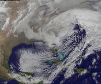
Current storm position is... Yeah... Not so hot looking for snow in our area, confluence is going to have to work.hard to keep it at that latitute, drift a little north and were all rain.

NjWeatherGuy- Advanced Forecaster

- Posts : 4100
Reputation : 28
Join date : 2013-01-06
Location : Belle Mead, NJ
 Re: Update #2: 1st Call Snow Map, Intense Winter Storm Coming
Lets go with sroc outlook, the fat lady has not sung, we have big snows, to big ice storm to all rain on the table past 2 days, IMO who knows at this point, maybe at 00z the models will go back south, this is interesting to look at nonetheless.

jmanley32- Senior Enthusiast

- Posts : 20513
Reputation : 108
Join date : 2013-12-12
Age : 42
Location : Yonkers, NY
 Re: Update #2: 1st Call Snow Map, Intense Winter Storm Coming
LOL...The Weather Channel...
3-5 NYC
12-18 Boston
3-5 NYC
12-18 Boston

SoulSingMG- Senior Enthusiast

- Posts : 2853
Reputation : 74
Join date : 2013-12-11
Location : Long Island City, NY
 Re: Update #2: 1st Call Snow Map, Intense Winter Storm Coming
SoulSingMG wrote:LOL...The Weather Channel...
3-5 NYC
12-18 Boston
Makes me hate boston even more lol
Aiosamoney21- Posts : 86
Reputation : 1
Join date : 2014-02-09
Age : 32
Location : Norwood NJ
 Re: Update #2: 1st Call Snow Map, Intense Winter Storm Coming
I'll be leaving NYC at midnight tomorrow to drive to Portsmouth, NH. THAT will be riveting. Oh, they are expecting a foot of snow there by Monday night too.

SoulSingMG- Senior Enthusiast

- Posts : 2853
Reputation : 74
Join date : 2013-12-11
Location : Long Island City, NY
 Re: Update #2: 1st Call Snow Map, Intense Winter Storm Coming
SoulSingMG wrote:LOL...The Weather Channel...
3-5 NYC
12-18 Boston
That's a good forecast right now
_________________
_______________________________________________________________________________________________________
CLICK HERE to view NJ Strong Snowstorm Classifications
 Re: Update #2: 1st Call Snow Map, Intense Winter Storm Coming
Frank_Wx wrote:SoulSingMG wrote:LOL...The Weather Channel...
3-5 NYC
12-18 Boston
That's a good forecast right now
Noooo, we will get at least 6" in Central Park. ;-)

SoulSingMG- Senior Enthusiast

- Posts : 2853
Reputation : 74
Join date : 2013-12-11
Location : Long Island City, NY
 Re: Update #2: 1st Call Snow Map, Intense Winter Storm Coming
SoulSingMG wrote:Frank_Wx wrote:SoulSingMG wrote:LOL...The Weather Channel...
3-5 NYC
12-18 Boston
That's a good forecast right now
Noooo, we will get at least 6" in Central Park. ;-)
They would only be one inch off then haha
_________________
_______________________________________________________________________________________________________
CLICK HERE to view NJ Strong Snowstorm Classifications
 Re: Update #2: 1st Call Snow Map, Intense Winter Storm Coming
Frank_Wx wrote:SoulSingMG wrote:Frank_Wx wrote:SoulSingMG wrote:LOL...The Weather Channel...
3-5 NYC
12-18 Boston
That's a good forecast right now
Noooo, we will get at least 6" in Central Park. ;-)
They would only be one inch off then haha
Lol, this is true. Looks real messy monday morning, regardless. Jeff Smith mentioned that despite precip falling as sleet/freezing rain in the city, the temperature could actually be dropping at the same time...

SoulSingMG- Senior Enthusiast

- Posts : 2853
Reputation : 74
Join date : 2013-12-11
Location : Long Island City, NY
 Re: Update #2: 1st Call Snow Map, Intense Winter Storm Coming
so has a mayor ever canceled NYC public schools when Ice has accumulated? Cause this can be a real problem.

devsman- Pro Enthusiast

- Posts : 424
Reputation : 4
Join date : 2014-01-01
Age : 48
Location : merrick, ny (south shore of Long Island)
 Re: Update #2: 1st Call Snow Map, Intense Winter Storm Coming
devsman wrote:so has a mayor ever canceled NYC public schools when Ice has accumulated? Cause this can be a real problem.
I know i sound like a broken record of Frozen, but Let it Go. ;-)
Ice will not accumulate much in the city. It just never does, historically speaking. I would be the first one to admit I was wrong if it comes to fruition though. Just don't expect it...more snow, then sleet. then rain despite the temp then back to snow. I don't expect much accretion.

SoulSingMG- Senior Enthusiast

- Posts : 2853
Reputation : 74
Join date : 2013-12-11
Location : Long Island City, NY
 Re: Update #2: 1st Call Snow Map, Intense Winter Storm Coming
the city in manhattan? I agree. But the boroughs? I work in northern queens by the throgs neck bridge. Subways keep manhattan streets warmer. outer boroughs, not so much.

devsman- Pro Enthusiast

- Posts : 424
Reputation : 4
Join date : 2014-01-01
Age : 48
Location : merrick, ny (south shore of Long Island)
Page 15 of 23 •  1 ... 9 ... 14, 15, 16 ... 19 ... 23
Page 15 of 23
Permissions in this forum:
You cannot reply to topics in this forum|
|
|

 Home
Home