
 Search
Long Range Thread 17.0
Page 32 of 41 •  1 ... 17 ... 31, 32, 33 ... 36 ... 41
 ![]()
Re: Long Range Thread 17.0
![]() by algae888 Sun Jan 06, 2019 2:40 pm
by algae888 Sun Jan 06, 2019 2:40 pm
Today's euro is very close for next weekend if you look at the UK met it looks similar a hour 144 as far out as it goes true the GFS and CMC are a miss new GFS similar to the euro still a ways to go with this one and with a pattern in flux models will not have a handle on this for a few days but yes it's been very frustrating usually we can score a decent event even in a crappy pattern but we've been very unlucky there are no guarantees for snow even with good patterns but our chances do increasehyde345 wrote:amugs wrote:hyde345 wrote:I see nothing storm wise for the next 10 days except for some piddly crap Monday night. That takes us into mid January and counting. Very.very disappointing winter so far. I am so sick of rain and temps in the 40's.
Hyde with all due respect what models are you looking at? We have the GEFS and GEPS and along withe EURO suite showing an arctic front moving though here Thursday and crashing temps into a much more winter regime that is setting up the following weeks.
Jan 13-15th time frame again to watch for a storm as skins posted.
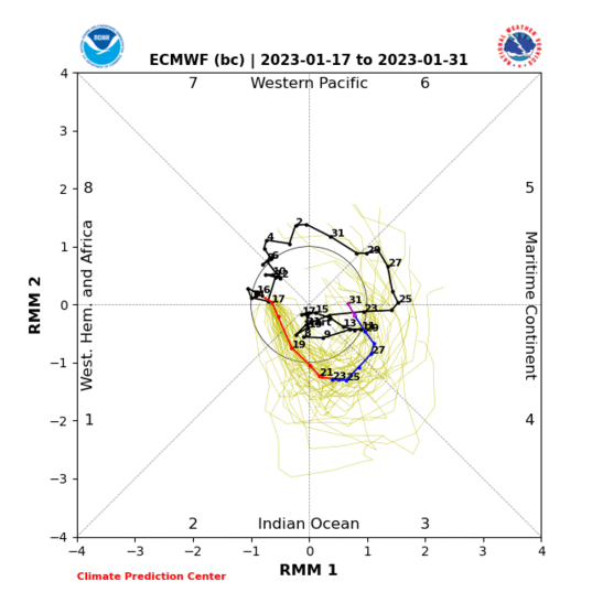
MJO into phase 8 this week - a 3 day lag then it starts it affects
Mugs, Im looking at Euro, GFS, FV3-GFS, and CMC operationals that I can see on tropical tidbits. I know there is a pattern change in the works with a change to colder temps and chances but I don't see any real chances for significant snow threats for the next 10 days and I guess Im getting a little impatient.

algae888- Advanced Forecaster

- Posts : 5311
Join date : 2013-02-05
Re: Long Range Thread 17.0
![]() by algae888 Sun Jan 06, 2019 2:41 pm
by algae888 Sun Jan 06, 2019 2:41 pm
algae888- Advanced Forecaster
- Posts : 5311
Join date : 2013-02-05
Re: Long Range Thread 17.0
![]() by algae888 Sun Jan 06, 2019 2:43 pm
by algae888 Sun Jan 06, 2019 2:43 pm

algae888- Advanced Forecaster
- Posts : 5311
Reputation : 46
Join date : 2013-02-05
Age : 61
Location : mt. vernon, new york
Re: Long Range Thread 17.0
![]() by HectorO Sun Jan 06, 2019 5:04 pm
by HectorO Sun Jan 06, 2019 5:04 pm
algae888 wrote:We will get our first true Arctic airmass since early to mid December this Wednesday and Thursday so hopefully we can get the cold entrenched and then the snow will come
I feel like since November lol. That was similar, to what we'll see this week.

HectorO- Pro Enthusiast

- Posts : 959
Reputation : 27
Join date : 2013-01-11
Re: Long Range Thread 17.0
![]() by skinsfan1177 Sun Jan 06, 2019 5:25 pm
by skinsfan1177 Sun Jan 06, 2019 5:25 pm

I'm liking this threat more and more and it's improved dramatically.

skinsfan1177- Senior Enthusiast

- Posts : 4485
Reputation : 35
Join date : 2013-01-07
Age : 46
Location : Point Pleasant Boro

skinsfan1177- Senior Enthusiast
- Posts : 4485
Reputation : 35
Join date : 2013-01-07
Age : 46
Location : Point Pleasant Boro


SoulSingMG- Senior Enthusiast
- Posts : 2853
Reputation : 74
Join date : 2013-12-11
Location : Long Island City, NY
Re: Long Range Thread 17.0
![]() by frank 638 Sun Jan 06, 2019 7:16 pm
by frank 638 Sun Jan 06, 2019 7:16 pm
yes we do please let this be trueSoulSingMG wrote:Because we friggin DESERVE it.
frank 638- Senior Enthusiast
- Posts : 2824
Reputation : 37
Join date : 2016-01-01
Age : 40
Location : bronx ny
Re: Long Range Thread 17.0
![]() by Guest Sun Jan 06, 2019 7:27 pm
by Guest Sun Jan 06, 2019 7:27 pm
SoulSingMG wrote:Because we friggin DESERVE it.
Funny. Never good to see this this far out anyway. Weather changes every run and we can only go one way from here.
Guest- Guest
Re: Long Range Thread 17.0
![]() by skinsfan1177 Sun Jan 06, 2019 8:59 pm
by skinsfan1177 Sun Jan 06, 2019 8:59 pm
syosnow94 wrote:SoulSingMG wrote:Because we friggin DESERVE it.
Funny. Never good to see this this far out anyway. Weather changes every run and we can only go one way from here.
Actually those numbers may push more south in coming days
skinsfan1177- Senior Enthusiast
- Posts : 4485
Reputation : 35
Join date : 2013-01-07
Age : 46
Location : Point Pleasant Boro
Re: Long Range Thread 17.0
![]() by Frank_Wx Sun Jan 06, 2019 9:49 pm
by Frank_Wx Sun Jan 06, 2019 9:49 pm
syosnow94 wrote:Tuesday looks to be dead IMHO. Redevelopment is too far N and E. The MJO forecast does look awesome though. Lets hope these trends stick. I’m still skeptical after the last month
I don't blame your skepticism. But yes, MJO is now in phase 7 and could be in phase 8 by Monday or Tuesday. Good things coming!
algae888 wrote:We are now starting to see dramatic changes across all guidance and tele connectors. Here are just a few. negative SOI negative East Asian Mountain torque that isotherm loves to talk about which should cause a ne pac jet retraction and alaskan ridge/-epo., mjo heading into cold phases 500mb reversal over the Arctic with the AO getting significantly negative, continue destruction of the polar vortex that will not consolidate anytime soon I'm thinking a quick Pattern change that last for weeks maybe right through the end of winter love to hear what others think
Nice post here.
Basically everything we've been talking about, from MJO to Stratosphere, is beginning gain momentum on almost all guidance. We will see an arctic blast later this week and multiple storm chances next week. There will be plenty of cold air to work with.
The SOI is an awesome story. I'll detail more tomorrow. But El Nino is returning in a big way.
_________________
_______________________________________________________________________________________________________
CLICK HERE to view NJ Strong Snowstorm Classifications

Frank_Wx- Godzilla Seeker

- Posts : 21305
Reputation : 328
Join date : 2013-01-05
Age : 31
Location : Jersey City, NJ -

Re: Long Range Thread 17.0
![]() by Guest Mon Jan 07, 2019 6:40 am
by Guest Mon Jan 07, 2019 6:40 am
skinsfan1177 wrote:syosnow94 wrote:SoulSingMG wrote:Because we friggin DESERVE it.
Funny. Never good to see this this far out anyway. Weather changes every run and we can only go one way from here.
Actually those numbers may push more south in coming days
How can this map show these amounts and you feel they can push more south when the NWS has the storm out to sea with no more than .2” qpf?
Guest- Guest
Re: Long Range Thread 17.0
![]() by skinsfan1177 Mon Jan 07, 2019 7:20 am
by skinsfan1177 Mon Jan 07, 2019 7:20 am
skinsfan1177- Senior Enthusiast
- Posts : 4485
Reputation : 35
Join date : 2013-01-07
Age : 46
Location : Point Pleasant Boro
Re: Long Range Thread 17.0
![]() by jmanley32 Mon Jan 07, 2019 7:31 am
by jmanley32 Mon Jan 07, 2019 7:31 am

jmanley32- Senior Enthusiast
- Posts : 20516
Reputation : 108
Join date : 2013-12-12
Age : 42
Location : Yonkers, NY
Re: Long Range Thread 17.0
![]() by skinsfan1177 Mon Jan 07, 2019 7:34 am
by skinsfan1177 Mon Jan 07, 2019 7:34 am
there are a lot of big hittersjmanley32 wrote:Take a look at the regular gfs...giggity. This may be a viable threat for a mecs or maybe more. But a mecs is more than I expect at this time.
skinsfan1177- Senior Enthusiast
- Posts : 4485
Reputation : 35
Join date : 2013-01-07
Age : 46
Location : Point Pleasant Boro
Re: Long Range Thread 17.0
![]() by Frank_Wx Mon Jan 07, 2019 7:47 am
by Frank_Wx Mon Jan 07, 2019 7:47 am

Keep in mind El Nino is just about to get going. The southern piece of energy associated with this set-up is not that potent. The Sub-Tropical Jet has just started its engine. It will take some time for it to warm-up then take off.

But the northern piece of energy does looks pretty potent. As you know, if the 2 phase - which has a chance thanks to the +PNA ridge - then we could see a snowstorm Sunday into Monday.
It is about 1 week away. We have time to see how things play out. If the ridge breaks down this storm has no shot. We do NOT have Atlantic blocking (-NAO), so without this ridge we will have no storm. Simple as that.
_________________
_______________________________________________________________________________________________________
CLICK HERE to view NJ Strong Snowstorm Classifications
Frank_Wx- Godzilla Seeker
- Posts : 21305
Reputation : 328
Join date : 2013-01-05
Age : 31
Location : Jersey City, NJ -
Re: Long Range Thread 17.0
![]() by rb924119 Mon Jan 07, 2019 10:46 am
by rb924119 Mon Jan 07, 2019 10:46 am
rb924119- Meteorologist

- Posts : 6890
Reputation : 194
Join date : 2013-02-06
Age : 32
Location : Greentown, Pa
Re: Long Range Thread 17.0
![]() by nutleyblizzard Mon Jan 07, 2019 11:16 am
by nutleyblizzard Mon Jan 07, 2019 11:16 am

nutleyblizzard- Senior Enthusiast
- Posts : 1952
Reputation : 41
Join date : 2014-01-30
Age : 58
Location : Nutley, new jersey
Re: Long Range Thread 17.0
![]() by algae888 Mon Jan 07, 2019 11:20 am
by algae888 Mon Jan 07, 2019 11:20 am
CMC is much improved to not as good looking as the GFS but very close to itnutleyblizzard wrote:Huge hit on the 12z GFS for this weekend!!!
algae888- Advanced Forecaster
- Posts : 5311
Reputation : 46
Join date : 2013-02-05
Age : 61
Location : mt. vernon, new york
Re: Long Range Thread 17.0
![]() by dkodgis Mon Jan 07, 2019 11:33 am
by dkodgis Mon Jan 07, 2019 11:33 am

dkodgis- Senior Enthusiast
- Posts : 2501
Reputation : 98
Join date : 2013-12-29
Re: Long Range Thread 17.0
![]() by nutleyblizzard Mon Jan 07, 2019 11:35 am
by nutleyblizzard Mon Jan 07, 2019 11:35 am
CMC actually is much stronger than the GFS. It bombs out to 972mb in the gulf of Maine. The run looked wonky to me though. The western flank of the storm looked weak with a bombing out low thus us missing the heaviest snows. In any case we are 6 days away from a potential significant event.algae888 wrote:CMC is much improved to not as good looking as the GFS but very close to itnutleyblizzard wrote:Huge hit on the 12z GFS for this weekend!!!
Last edited by nutleyblizzard on Mon Jan 07, 2019 11:37 am; edited 1 time in total
nutleyblizzard- Senior Enthusiast
- Posts : 1952
Reputation : 41
Join date : 2014-01-30
Age : 58
Location : Nutley, new jersey
Re: Long Range Thread 17.0
![]() by algae888 Mon Jan 07, 2019 11:36 am
by algae888 Mon Jan 07, 2019 11:36 am
algae888- Advanced Forecaster
- Posts : 5311
Reputation : 46
Join date : 2013-02-05
Age : 61
Location : mt. vernon, new york
Re: Long Range Thread 17.0
![]() by Frank_Wx Mon Jan 07, 2019 11:48 am
by Frank_Wx Mon Jan 07, 2019 11:48 am

_________________
_______________________________________________________________________________________________________
CLICK HERE to view NJ Strong Snowstorm Classifications
Frank_Wx- Godzilla Seeker
- Posts : 21305
Reputation : 328
Join date : 2013-01-05
Age : 31
Location : Jersey City, NJ -
Re: Long Range Thread 17.0
![]() by Frank_Wx Mon Jan 07, 2019 11:54 am
by Frank_Wx Mon Jan 07, 2019 11:54 am
rb924119 wrote:Still do not like this threat, at all, for our region. Central and or southern Mid-Atlantic is the place to be for this one, I think.
What are your reasons for not liking this threat?
+PNA, huge north Atlantic High, STJ (albeit weak) and arctic energy
_________________
_______________________________________________________________________________________________________
CLICK HERE to view NJ Strong Snowstorm Classifications
Frank_Wx- Godzilla Seeker
- Posts : 21305
Reputation : 328
Join date : 2013-01-05
Age : 31
Location : Jersey City, NJ -
Re: Long Range Thread 17.0
![]() by amugs Mon Jan 07, 2019 11:59 am
by amugs Mon Jan 07, 2019 11:59 am
The ridge out west is being pumped - is this what you are disagreeing with?
I have to say I wish it were Friday 12z or even Saturday than Monday - my one concern.
This is beautiful though:

_________________
Mugs
AKA:King: Snow Weenie
Self Proclaimed
WINTER 2014-15 : 55.12" +.02 for 6 coatings (avg. 35")
WINTER 2015-16 Total - 29.8" (Avg 35")
WINTER 2016-17 : 39.5" so far

amugs- Advanced Forecaster - Mod

- Posts : 15093
Reputation : 213
Join date : 2013-01-07
Age : 54
Location : Hillsdale,NJ
Re: Long Range Thread 17.0
![]() by jmanley32 Mon Jan 07, 2019 12:19 pm
by jmanley32 Mon Jan 07, 2019 12:19 pm
jmanley32- Senior Enthusiast
- Posts : 20516
Reputation : 108
Join date : 2013-12-12
Age : 42
Location : Yonkers, NY
Page 32 of 41 • 1 ... 17 ... 31, 32, 33 ... 36 ... 41 ![]()
|
|
|