
 Search
Official Long Range Thread 5.0
Page 12 of 40 •  1 ... 7 ... 11, 12, 13 ... 26 ... 40
 ![]()
Re: Official Long Range Thread 5.0
![]() by sroc4 Sat Dec 20, 2014 7:00 am
by sroc4 Sat Dec 20, 2014 7:00 am
 " />
" />Image compliments of Rich Hoffman News 12
sroc4- Admin

- Posts : 8331
Join date : 2013-01-07
Re: Official Long Range Thread 5.0
![]() by docstox12 Sat Dec 20, 2014 7:05 am
by docstox12 Sat Dec 20, 2014 7:05 am
sroc4 wrote:This is for CP and anyone else still sad about December and who is standing at the edge of the bridge contemplating the proverbial snow weenie mass suicide. Do you remember how warm it was in December 2013? Do you happen to remember the temperature for CP on the 20, 21st, and 22nd of last year? Check the image. Thats right your eyes are not deceiving you...50's 60's and yes 70's. Remember it's not even winter yet. That starts tomorrow. The cold and snow will come...Step away from the edge everyone...step AWAY from the edge.
Image compliments of Rich Hoffman News 12
Good work,Doc, sanity and reason backed by fact!
Winter starts tomorrow and there are three full months of possible snow time coming.
docstox12- Wx Statistician Guru

- Posts : 8504
Join date : 2013-01-07
Re: Official Long Range Thread 5.0
![]() by CPcantmeasuresnow Sat Dec 20, 2014 7:36 am
by CPcantmeasuresnow Sat Dec 20, 2014 7:36 am
Pattern change? We shall see, I'm like everyone else and still hoping.
BTW that 70 last year was only the 3rd time in 145 years it ever topped 70 in CPK in December. That was weird I'll grant you that. I'll grant you one other thing, after that 70 degree last year soon after we did go into a nice prolonged period of cold and snow.

CPcantmeasuresnow- Wx Statistician Guru
- Posts : 7274
Reputation : 230
Join date : 2013-01-07
Age : 103
Location : Eastern Orange County, NY
Re: Official Long Range Thread 5.0
![]() by sroc4 Sat Dec 20, 2014 8:15 am
by sroc4 Sat Dec 20, 2014 8:15 am
CPcantmeasuresnow wrote:One thing you forgot to point out in that chart Doc, Central Park also had 8.6 inches of snow before Christmas last December, this year 1.0 inch. I stand by statement, that this December blows.
Pattern change? We shall see, I'm like everyone else and still hoping.
BTW that 70 last year was only the 3rd time in 145 years it ever topped 70 in CPK in December. That was weird I'll grant you that. I'll grant you one other thing, after that 70 degree last year soon after we did go into a nice prolonged period of cold and snow.
Exactly. Trust me if this winter ends up with avg or below avg snowfall for my area I will be as disappointed as the next snow weenie, but to give up before the winter solstice as many seem to have done is ludicrous IMHO.
_________________
"In weather and in life, there's no winning and losing; there's only winning and learning."
WINTER 2012/2013 TOTALS 43.65"WINTER 2017/2018 TOTALS 62.85" WINTER 2022/2023 TOTALS 4.9"
WINTER 2013/2014 TOTALS 64.85"WINTER 2018/2019 TOTALS 14.25" WINTER 2023/2024 TOTALS 13.1"
WINTER 2014/2015 TOTALS 71.20"WINTER 2019/2020 TOTALS 6.35"
WINTER 2015/2016 TOTALS 35.00"WINTER 2020/2021 TOTALS 37.75"
WINTER 2016/2017 TOTALS 42.25"WINTER 2021/2022 TOTALS 31.65"

sroc4- Admin
- Posts : 8331
Reputation : 301
Join date : 2013-01-07
Location : Wading River, LI
Re: Official Long Range Thread 5.0
![]() by amugs Sat Dec 20, 2014 8:28 am
by amugs Sat Dec 20, 2014 8:28 am
To the shortest sunlight day of the year tomorrow and let the winter begin. May that cutter reboot our pattern and clean out this crap set up we r in. - EPO, NAO and AO pay a lengthy visit while the west coast torches under a nice ridge and mr nino keeps the juice flowing our way.
You can dethrone me by saying this BUT we actually need this strong cutter to change the pattern so syosnow - you and me and everyone else who wants a white Xmas boo hoo but .......... this storm may be our Xmas present going forward.
_________________
Mugs
AKA:King: Snow Weenie
Self Proclaimed
WINTER 2014-15 : 55.12" +.02 for 6 coatings (avg. 35")
WINTER 2015-16 Total - 29.8" (Avg 35")
WINTER 2016-17 : 39.5" so far

amugs- Advanced Forecaster - Mod

- Posts : 15093
Reputation : 213
Join date : 2013-01-07
Age : 54
Location : Hillsdale,NJ
Re: Official Long Range Thread 5.0
![]() by Snow88 Sat Dec 20, 2014 10:31 am
by Snow88 Sat Dec 20, 2014 10:31 am


Snow88- Senior Enthusiast

- Posts : 2193
Reputation : 4
Join date : 2013-01-09
Age : 35
Location : Brooklyn, NY
Re: Official Long Range Thread 5.0
![]() by Math23x7 Sat Dec 20, 2014 4:04 pm
by Math23x7 Sat Dec 20, 2014 4:04 pm
Math23x7- Wx Statistician Guru
- Posts : 2379
Reputation : 68
Join date : 2013-01-08
Re: Official Long Range Thread 5.0
![]() by skinsfan1177 Sat Dec 20, 2014 7:23 pm
by skinsfan1177 Sat Dec 20, 2014 7:23 pm

skinsfan1177- Senior Enthusiast
- Posts : 4485
Reputation : 35
Join date : 2013-01-07
Age : 46
Location : Point Pleasant Boro
Re: Official Long Range Thread 5.0
![]() by Guest Sat Dec 20, 2014 8:25 pm
by Guest Sat Dec 20, 2014 8:25 pm
skinsfan1177 wrote:Everybody is on edge waiting to see what will happen after the Christmas storm. I for one believe the pattern will change for us snow weenies.
Hope so. NWS has us in mid to upper 40'3 all the way through the 28th.
Guest- Guest
Re: Official Long Range Thread 5.0
![]() by Frank_Wx Sat Dec 20, 2014 8:27 pm
by Frank_Wx Sat Dec 20, 2014 8:27 pm
The EPS locks in a -NAO between the 26th and 31st of December while also maintaining a -EPO signal.
I would much prefer the EPS solution, so we'll have to check back after the weekend and see where things trended.
And for those curious, the GFS-PARA looks more like the EPS though it's more east-based than the EURO (EPS looks slightly east-based as well).
Attached Images


_________________
_______________________________________________________________________________________________________
CLICK HERE to view NJ Strong Snowstorm Classifications

Frank_Wx- Godzilla Seeker
- Posts : 21305
Reputation : 328
Join date : 2013-01-05
Age : 31
Location : Jersey City, NJ -

Re: Official Long Range Thread 5.0
![]() by Guest Sat Dec 20, 2014 10:22 pm
by Guest Sat Dec 20, 2014 10:22 pm
Sunday Night Mostly cloudy, with a low around 31. North wind around 6 mph.
Monday A chance of rain after noon. Partly sunny, with a high near 44. Wind chill values between 30 and 40. Calm wind becoming east around 6 mph in the afternoon. Chance of precipitation is 30%.
Monday Night A chance of rain. Cloudy, with a low around 39. East wind 3 to 5 mph. Chance of precipitation is 50%.
Tuesday A chance of rain. Cloudy, with a high near 48. Chance of precipitation is 50%.
Tuesday Night Rain likely. Cloudy, with a low around 46. Chance of precipitation is 70%.
Wednesday Rain. High near 57. Chance of precipitation is 90%.
Wednesday Night Rain. Low around 42. Breezy. Chance of precipitation is 90%.
Christmas Day Partly sunny, with a high near 47. Breezy.
Thursday Night Mostly clear, with a low around 34.
Friday Sunny, with a high near 47.
Friday Night Partly cloudy, with a low around 37.
Saturday A chance of rain. Mostly cloudy, with a high near 48. Chance of precipitation is 30%.
That's significantly above average forecast through the 28th
Guest- Guest
Re: Official Long Range Thread 5.0
![]() by nutleyblizzard Sun Dec 21, 2014 6:07 am
by nutleyblizzard Sun Dec 21, 2014 6:07 am

nutleyblizzard- Senior Enthusiast
- Posts : 1952
Reputation : 41
Join date : 2014-01-30
Age : 58
Location : Nutley, new jersey
Re: Official Long Range Thread 5.0
![]() by jmanley32 Sun Dec 21, 2014 6:50 am
by jmanley32 Sun Dec 21, 2014 6:50 am

jmanley32- Senior Enthusiast
- Posts : 20513
Reputation : 108
Join date : 2013-12-12
Age : 42
Location : Yonkers, NY
Re: Official Long Range Thread 5.0
![]() by Frank_Wx Sun Dec 21, 2014 11:01 am
by Frank_Wx Sun Dec 21, 2014 11:01 am
Why is this important? Well, the PV will not split and is likely to remain bottled up in the Arctic (+AO). While the period between Dec. 28th-Jan. 8th looks cold with some storm threats, I'm becoming concerned that mid January could be warm.
But that's way out in time and things can still change. Let's try and see if we can get something in the aforementioned period after Xmas.
_________________
_______________________________________________________________________________________________________
CLICK HERE to view NJ Strong Snowstorm Classifications
Frank_Wx- Godzilla Seeker
- Posts : 21305
Reputation : 328
Join date : 2013-01-05
Age : 31
Location : Jersey City, NJ -
Re: Official Long Range Thread 5.0
![]() by Frank_Wx Sun Dec 21, 2014 11:13 am
by Frank_Wx Sun Dec 21, 2014 11:13 am
Negative developments overnight. Maybe it was a blimp. Who knows
_________________
_______________________________________________________________________________________________________
CLICK HERE to view NJ Strong Snowstorm Classifications
Frank_Wx- Godzilla Seeker
- Posts : 21305
Reputation : 328
Join date : 2013-01-05
Age : 31
Location : Jersey City, NJ -
Re: Official Long Range Thread 5.0
![]() by CPcantmeasuresnow Sun Dec 21, 2014 11:21 am
by CPcantmeasuresnow Sun Dec 21, 2014 11:21 am
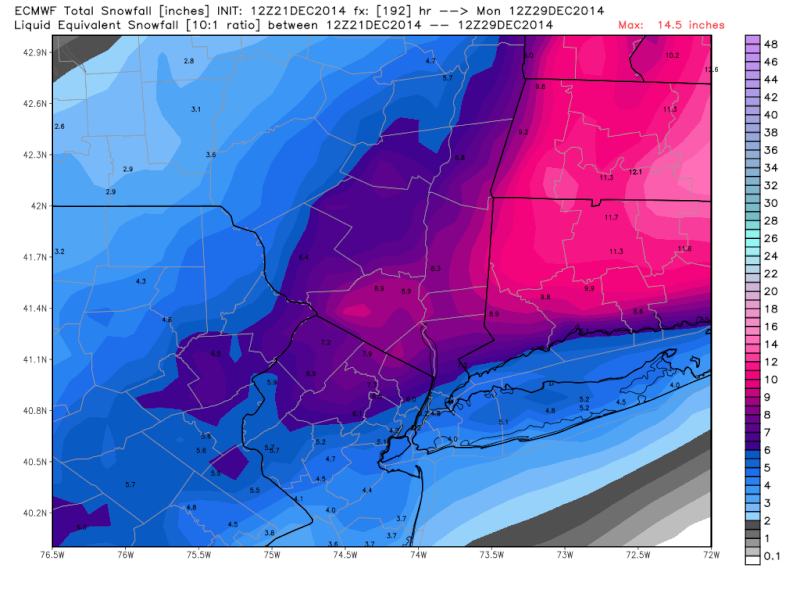
jmanley32 wrote:Yep big storm around 30/31st 990mb to 978 into candaian maritimes that is inside benchmark and snow for many, coast is rain/ice to snow, and again a weaker storm on Jan 4th.
Jman:
To start talking about snow inland,and rain ice to snow on the coast for a storm 10 days out, if there is a storm at all, is just a waste of time. Let's be real here.
CPcantmeasuresnow- Wx Statistician Guru
- Posts : 7274
Reputation : 230
Join date : 2013-01-07
Age : 103
Location : Eastern Orange County, NY
Re: Official Long Range Thread 5.0
![]() by jmanley32 Sun Dec 21, 2014 11:30 am
by jmanley32 Sun Dec 21, 2014 11:30 am
jmanley32- Senior Enthusiast
- Posts : 20513
Reputation : 108
Join date : 2013-12-12
Age : 42
Location : Yonkers, NY
Re: Official Long Range Thread 5.0
![]() by CPcantmeasuresnow Sun Dec 21, 2014 11:42 am
by CPcantmeasuresnow Sun Dec 21, 2014 11:42 am
Like I've been saying all year I don't take any of them seriously anymore until they're 3 days out, and even then with a grain of salt.
CPcantmeasuresnow- Wx Statistician Guru
- Posts : 7274
Reputation : 230
Join date : 2013-01-07
Age : 103
Location : Eastern Orange County, NY
Re: Official Long Range Thread 5.0
![]() by docstox12 Sun Dec 21, 2014 11:53 am
by docstox12 Sun Dec 21, 2014 11:53 am

docstox12- Wx Statistician Guru
- Posts : 8504
Reputation : 222
Join date : 2013-01-07
Age : 73
Location : Monroe NY
Re: Official Long Range Thread 5.0
![]() by skinsfan1177 Sun Dec 21, 2014 11:58 am
by skinsfan1177 Sun Dec 21, 2014 11:58 am
skinsfan1177- Senior Enthusiast
- Posts : 4485
Reputation : 35
Join date : 2013-01-07
Age : 46
Location : Point Pleasant Boro
Re: Official Long Range Thread 5.0
![]() by jmanley32 Sun Dec 21, 2014 12:47 pm
by jmanley32 Sun Dec 21, 2014 12:47 pm
jmanley32- Senior Enthusiast
- Posts : 20513
Reputation : 108
Join date : 2013-12-12
Age : 42
Location : Yonkers, NY
Re: Official Long Range Thread 5.0
![]() by jmanley32 Sun Dec 21, 2014 12:48 pm
by jmanley32 Sun Dec 21, 2014 12:48 pm
jmanley32- Senior Enthusiast
- Posts : 20513
Reputation : 108
Join date : 2013-12-12
Age : 42
Location : Yonkers, NY
Re: Official Long Range Thread 5.0
![]() by Frank_Wx Sun Dec 21, 2014 1:41 pm
by Frank_Wx Sun Dec 21, 2014 1:41 pm
_________________
_______________________________________________________________________________________________________
CLICK HERE to view NJ Strong Snowstorm Classifications
Frank_Wx- Godzilla Seeker
- Posts : 21305
Reputation : 328
Join date : 2013-01-05
Age : 31
Location : Jersey City, NJ -
Re: Official Long Range Thread 5.0
![]() by Guest Sun Dec 21, 2014 2:17 pm
by Guest Sun Dec 21, 2014 2:17 pm
Frank_Wx wrote:12z Euro today shows a rain to snow storm for the area on the 28th. Again, the period after Xmas to about the 6th-8th of Jan. bares watching as we go into a winter pattern by then. The question becomes can we keep it past the 8th? At this point I'm sure most of us would take out 10-day winter pattern even if it is transient.
YES I WOULD!!!!!
Guest- Guest
Re: Official Long Range Thread 5.0
![]() by Frank_Wx Sun Dec 21, 2014 4:16 pm
by Frank_Wx Sun Dec 21, 2014 4:16 pm
_________________
_______________________________________________________________________________________________________
CLICK HERE to view NJ Strong Snowstorm Classifications
Frank_Wx- Godzilla Seeker
- Posts : 21305
Reputation : 328
Join date : 2013-01-05
Age : 31
Location : Jersey City, NJ -
Re: Official Long Range Thread 5.0
![]() by jmanley32 Sun Dec 21, 2014 5:36 pm
by jmanley32 Sun Dec 21, 2014 5:36 pm
jmanley32- Senior Enthusiast
- Posts : 20513
Reputation : 108
Join date : 2013-12-12
Age : 42
Location : Yonkers, NY
Re: Official Long Range Thread 5.0
![]() by jmanley32 Sun Dec 21, 2014 5:40 pm
by jmanley32 Sun Dec 21, 2014 5:40 pm
jmanley32- Senior Enthusiast
- Posts : 20513
Reputation : 108
Join date : 2013-12-12
Age : 42
Location : Yonkers, NY
Page 12 of 40 • 1 ... 7 ... 11, 12, 13 ... 26 ... 40 ![]()
|
|
|