Long Range Thread 9.0
+51
Sparky Sparticles
track17
Grselig
snowday111
2004blackwrx
Joe Snow
GreyBeard
devsman
Mathgod55
deadrabbit79
jimv45
Taffy
Biggin23
crippo84
SNOW MAN
lglickman1
Dtone
Artechmetals
Dunnzoo
Vinnydula
Bkdude
SoulSingMG
oldtimer
Quietace
billg315
Math23x7
snow247
jake732
rb924119
Snowfall
Abba701
nutleyblizzard
Radz
RJB8525
justin92
chief7
hyde345
weatherwatchermom
CPcantmeasuresnow
frank 638
HectorO
Snow88
jmanley32
sroc4
skinsfan1177
algae888
amugs
docstox12
Frank_Wx
NjWeatherGuy
dsix85
55 posters
Page 4 of 40
Page 4 of 40 •  1, 2, 3, 4, 5 ... 22 ... 40
 Re: Long Range Thread 9.0
Latest numbers:
Nino tanking in the east.
1.6, 2.6, 2.7, 1.5.
1.2 and 3 have cooled by .8 and .4*c, 3.4 and 4 by .3*c. hopefully this will cause convection to be centered near the DL and help keep the trough south of the Aleutians. olr lr maps say yes. we shall see if this can save our winter.
Nino tanking in the east.
1.6, 2.6, 2.7, 1.5.
1.2 and 3 have cooled by .8 and .4*c, 3.4 and 4 by .3*c. hopefully this will cause convection to be centered near the DL and help keep the trough south of the Aleutians. olr lr maps say yes. we shall see if this can save our winter.
algae888- Advanced Forecaster

- Posts : 5311
Join date : 2013-02-05
 Re: Long Range Thread 9.0
algae888 wrote:Latest numbers:
Nino tanking in the east.
1.6, 2.6, 2.7, 1.5.
1.2 and 3 have cooled by .8 and .4*c, 3.4 and 4 by .3*c. hopefully this will cause convection to be centered near the DL and help keep the trough south of the Aleutians. olr lr maps say yes. we shall see if this can save our winter.
What winter?
CPcantmeasuresnow- Wx Statistician Guru

- Posts : 7274
Join date : 2013-01-07
 Re: Long Range Thread 9.0
I know cp it's been very frustrating so far. my thoughts have always been on 1 or 2 major snowstorms for our area. if we do not get these we will almost certainly have less than ave snow for our area. we will not nickel and dime our way through like last year. hopefully things break in our favor.CPcantmeasuresnow wrote:algae888 wrote:Latest numbers:
Nino tanking in the east.
1.6, 2.6, 2.7, 1.5.
1.2 and 3 have cooled by .8 and .4*c, 3.4 and 4 by .3*c. hopefully this will cause convection to be centered near the DL and help keep the trough south of the Aleutians. olr lr maps say yes. we shall see if this can save our winter.
What winter?

algae888- Advanced Forecaster

- Posts : 5311
Reputation : 46
Join date : 2013-02-05
Age : 61
Location : mt. vernon, new york
 Re: Long Range Thread 9.0
algae888 wrote:Latest numbers:
Nino tanking in the east.
1.6, 2.6, 2.7, 1.5.
1.2 and 3 have cooled by .8 and .4*c, 3.4 and 4 by .3*c. hopefully this will cause convection to be centered near the DL and help keep the trough south of the Aleutians. olr lr maps say yes. we shall see if this can save our winter.
It is changing as we write or has - it has been awful so far to say the least but as i said and have been pounding home here and showing since frickin Oct that will collapse from east to west rapidly - would have loved to see this a month ago but not happening so I take what big Momma is going to give and that is a great second half. As per my discussion with another one of my ex students who is pro met (posted in banter what his thesis is on) last night he said - the Pac Nino is collapsing rapidly as we speak and the convection of Thunderstorms will and are firing up between 155w and 180 (dateline). This will pull that death vortex over the Aleutians (feedback) SSW to the 150 W. this will in turn allow the EPO to go N and teh PNA to go + along with what he is seeing as a nice -AO and the PV effecting us by as Frank said the 2nd half of winter - 3rd to 4th week. He believes from research that the NAO goes NEG in teh means teh 2nd half and is usually the last chip to go. He thinks teh Karant Sea Ridge is going to be a very big player for us teh second half building this cross arctic bridge through Hudson bay region. Listen is it there yes it is but this is a process and the snow we are all hoping for will come hopefully sooner but lets get the cold air source going first here since the STJ is here already. MJO is forecaster to be on our side going forward so that is another plus.
_________________
Mugs
AKA:King: Snow Weenie
Self Proclaimed
WINTER 2014-15 : 55.12" +.02 for 6 coatings (avg. 35")
WINTER 2015-16 Total - 29.8" (Avg 35")
WINTER 2016-17 : 39.5" so far

amugs- Advanced Forecaster - Mod

- Posts : 15093
Reputation : 213
Join date : 2013-01-07
Age : 54
Location : Hillsdale,NJ
 Re: Long Range Thread 9.0
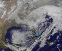
Anybody else notice the GFS running incredibly slow lately? Its like the page and hour images take 5 minutes to load while its running.
NjWeatherGuy- Advanced Forecaster

- Posts : 4100
Reputation : 28
Join date : 2013-01-06
Location : Belle Mead, NJ
 Re: Long Range Thread 9.0
NjWeatherGuy wrote:Anybody else notice the GFS running incredibly slow lately? Its like the page and hour images take 5 minutes to load while its running.
It has been very slow lately.

hyde345- Pro Enthusiast

- Posts : 1082
Reputation : 48
Join date : 2013-01-08
Location : Hyde Park, NY
 Re: Long Range Thread 9.0
Dissapointing run too as far as the white stuff is concerned. Just not enough cold air.

hyde345- Pro Enthusiast

- Posts : 1082
Reputation : 48
Join date : 2013-01-08
Location : Hyde Park, NY
 Re: Long Range Thread 9.0
It could be showing a transition period we're ultimately in.

NjWeatherGuy- Advanced Forecaster

- Posts : 4100
Reputation : 28
Join date : 2013-01-06
Location : Belle Mead, NJ
 Re: Long Range Thread 9.0
Folks,
The model runs are going to waver like syo and docstox catching a fish as they pull it in!! They are going to flop all over the place. Just read an earthlight and Isotherm post and as I have said numerous times they OP's will show numerous solutions and are not handlingteh transition that Frank has spoken, written about. You will drive yourself to !!! may not be a bad thing for some but in an evolution pattern change the Stratosphere is going to play a major role as it is evolving into a winter pattern itself along with the Trop forcing out near the dateline and Siberian snow pack (HP). The -EPO and +PNA will be in the means for teh rest of winter as will the -AO may it relax a bit sure as every pattern does but will it be like a Dec hell no. Once we lock in come teh latter part of Jan then teh OP's will be better as of now they are fricking ridiculous.
Ens Ens Ens
Earthlights Post - read it and have patience for crying all night!!
I simply don't understand the whistle blowing alarmists on this forum which is largely why I haven't posted in four days. That being said, I'll chime in here. There are two things to consider. First of all, tropical forcing remains focused near the dateline with the best OLR anomalies well west of where both A) Long range models projected it to be a few months ago and B ) Farther west than the other Nino years which were used as analogs by warm agenda folks. With that being said, the models trying to slide the Aleutian low farther east rapidly are likely incorrect and doing so progressively. The GFS, for one, has been absolutely atrocious in handling tropical forcing and convection. It's MJO forecasts have been some of the worst I have ever seen.(Stop humping the GFS!!!) This tropical forcing bias to the east likely explains its propensity to slide the Aleutian trough too far east, too fast.
Second of all, I simply do not understand the idea that a Gulf of Alaska trough is all that bad to begin within. Or possibly people aren't taking the time to understand that the atmosphere doesn't work in definitions. There is a negative connotation with the acronym "GOA Low" and that seems to have spread like wildfire. Instead, lets take the time to understand this: If a Aleutian low extends east or southeast for a time and remains amplified, it can actually amplify the PNA into British Columbia and the Arctic Circle (EPO) and help us -- ESPECIALLY if we have high latitude ridging or above normal heights, which we currently do. Why don't we all go back and look at Boxing Day 2010 as an example. There was a tremendous, anomalous, large trough in the Gulf of Alaska which helped pump up the PNA. Consider now that this is the same thing we are all fearing and crying about.
The GOA low can additionally help to enhance high latitude blocking. Wave breaking patterns downstream can help to enhance ridging into the true NAO regions, as the PNA ridge builds and the EPO ridge is pumped up via the enhanced and more amplified wave field. The one thing we don't want to see is a totally de-amplified west coast trough which would come via a screaming Pac Jet. I have only seen this on one model run -- otherwise no ensembles are showing this and we should be very happy about that. This is a function of the high latitude blocking keeping the tropospheric pattern more amplified.
With the high latitude ridging/above normal heights being modeled (AGAIN, THIS IS NOT SOME KIND OF UTOPIAN DREAM, IT IS REALITY), a GOA Low can actually help us if it is positioned correctly. With that being said, I will fade into the background again until you all stop flopping around and blowing whistles over OP runs. The same thing still stands from November when myself, Isotherm, Frank, etc put out our forecasts. It's coming in Mid to late January, and it's still coming. I'll have a full post up tonight.
I will share when he does.
The model runs are going to waver like syo and docstox catching a fish as they pull it in!! They are going to flop all over the place. Just read an earthlight and Isotherm post and as I have said numerous times they OP's will show numerous solutions and are not handlingteh transition that Frank has spoken, written about. You will drive yourself to
 !!! may not be a bad thing for some but in an evolution pattern change the Stratosphere is going to play a major role as it is evolving into a winter pattern itself along with the Trop forcing out near the dateline and Siberian snow pack (HP). The -EPO and +PNA will be in the means for teh rest of winter as will the -AO may it relax a bit sure as every pattern does but will it be like a Dec hell no. Once we lock in come teh latter part of Jan then teh OP's will be better as of now they are fricking ridiculous.
 Ens Ens Ens
Earthlights Post - read it and have patience for crying all night!!
I simply don't understand the whistle blowing alarmists on this forum which is largely why I haven't posted in four days. That being said, I'll chime in here. There are two things to consider. First of all, tropical forcing remains focused near the dateline with the best OLR anomalies well west of where both A) Long range models projected it to be a few months ago and B ) Farther west than the other Nino years which were used as analogs by warm agenda folks. With that being said, the models trying to slide the Aleutian low farther east rapidly are likely incorrect and doing so progressively. The GFS, for one, has been absolutely atrocious in handling tropical forcing and convection. It's MJO forecasts have been some of the worst I have ever seen.(Stop humping the GFS!!!) This tropical forcing bias to the east likely explains its propensity to slide the Aleutian trough too far east, too fast.
Second of all, I simply do not understand the idea that a Gulf of Alaska trough is all that bad to begin within. Or possibly people aren't taking the time to understand that the atmosphere doesn't work in definitions. There is a negative connotation with the acronym "GOA Low" and that seems to have spread like wildfire. Instead, lets take the time to understand this: If a Aleutian low extends east or southeast for a time and remains amplified, it can actually amplify the PNA into British Columbia and the Arctic Circle (EPO) and help us -- ESPECIALLY if we have high latitude ridging or above normal heights, which we currently do. Why don't we all go back and look at Boxing Day 2010 as an example. There was a tremendous, anomalous, large trough in the Gulf of Alaska which helped pump up the PNA. Consider now that this is the same thing we are all fearing and crying about.
The GOA low can additionally help to enhance high latitude blocking. Wave breaking patterns downstream can help to enhance ridging into the true NAO regions, as the PNA ridge builds and the EPO ridge is pumped up via the enhanced and more amplified wave field. The one thing we don't want to see is a totally de-amplified west coast trough which would come via a screaming Pac Jet. I have only seen this on one model run -- otherwise no ensembles are showing this and we should be very happy about that. This is a function of the high latitude blocking keeping the tropospheric pattern more amplified.
With the high latitude ridging/above normal heights being modeled (AGAIN, THIS IS NOT SOME KIND OF UTOPIAN DREAM, IT IS REALITY), a GOA Low can actually help us if it is positioned correctly. With that being said, I will fade into the background again until you all stop flopping around and blowing whistles over OP runs. The same thing still stands from November when myself, Isotherm, Frank, etc put out our forecasts. It's coming in Mid to late January, and it's still coming. I'll have a full post up tonight.
I will share when he does.
_________________
Mugs
AKA:King: Snow Weenie
Self Proclaimed
WINTER 2014-15 : 55.12" +.02 for 6 coatings (avg. 35")
WINTER 2015-16 Total - 29.8" (Avg 35")
WINTER 2016-17 : 39.5" so far

amugs- Advanced Forecaster - Mod

- Posts : 15093
Reputation : 213
Join date : 2013-01-07
Age : 54
Location : Hillsdale,NJ
 Re: Long Range Thread 9.0
I knew the 2nd storm would end up being too warm, as of now verbatim another rainstorm, if anything. Sigh, I dunno how much I will be on here if this keeps up....

jmanley32- Senior Enthusiast

- Posts : 20512
Reputation : 108
Join date : 2013-12-12
Age : 42
Location : Yonkers, NY
 Re: Long Range Thread 9.0
Mugs, your above post makes sense and I understand we need to be patient. It just looks like the weekend systems may not have enough cold air source to work with but I fully anticipate that not being the case as we head into the second half of January.

hyde345- Pro Enthusiast

- Posts : 1082
Reputation : 48
Join date : 2013-01-08
Location : Hyde Park, NY
 Re: Long Range Thread 9.0
gfs ensembles still showing storm 2 further south and east. I do not know if it will still be cold enough for most of us but n/w areas should not give up on this one..

op

ens.

ind. members

op

ens.

ind. members

algae888- Advanced Forecaster

- Posts : 5311
Reputation : 46
Join date : 2013-02-05
Age : 61
Location : mt. vernon, new york
 Re: Long Range Thread 9.0
Canadian ens further east than op and gfs ens...

ens

op

ens

op

algae888- Advanced Forecaster

- Posts : 5311
Reputation : 46
Join date : 2013-02-05
Age : 61
Location : mt. vernon, new york
 Re: Long Range Thread 9.0
Canadian 500mb op and ensembles...

op

ens.

op

ens.

algae888- Advanced Forecaster

- Posts : 5311
Reputation : 46
Join date : 2013-02-05
Age : 61
Location : mt. vernon, new york
 Re: Long Range Thread 9.0
euro is basically a cold front for storm 2. could be setting stage for something later. looks plenty cold starting next Monday. lets see what ensembles say.

algae888- Advanced Forecaster

- Posts : 5311
Reputation : 46
Join date : 2013-02-05
Age : 61
Location : mt. vernon, new york
 Re: Long Range Thread 9.0
Ens run
.png)
.png)
_________________
Mugs
AKA:King: Snow Weenie
Self Proclaimed
WINTER 2014-15 : 55.12" +.02 for 6 coatings (avg. 35")
WINTER 2015-16 Total - 29.8" (Avg 35")
WINTER 2016-17 : 39.5" so far

amugs- Advanced Forecaster - Mod

- Posts : 15093
Reputation : 213
Join date : 2013-01-07
Age : 54
Location : Hillsdale,NJ
 Re: Long Range Thread 9.0
Stratosphere update:
From research I've found most SSW events are achieved when mean zonal winds at 10hPa/60*N shift from westerly to easterly.

Day 10 EURO is still showing a strong westerly phase in that region.

Wind speed at 1hPa looks to decrease through January. This is good news as it usually signals a weakening PV. Hopefully the slight rise mid-month is a temporary trend. On the 2nd panel it looks like wind speeds are decreasing at 10hPa and 30hPa. Further suggesting the Strat PV is undergoing gradual weakening.
The bad news behind this graphic comes in the 3rd and last panel. It looks like after this spike in Wave 2 Geopotential Heat Flux, attributed to the Tropospheric blocking / Tropical Forcing, Wave 2 will dramatically fall off. This to me implies we should not hold our breath on a PV split. Rather, hope for strong Wave 1 amplification to displace the Strat PV.

Fortunately the Wave 1 event does look to continue into the foreseeable future. Will this be enough for displacement by the end of the month? I hope so...
From research I've found most SSW events are achieved when mean zonal winds at 10hPa/60*N shift from westerly to easterly.

Day 10 EURO is still showing a strong westerly phase in that region.

Wind speed at 1hPa looks to decrease through January. This is good news as it usually signals a weakening PV. Hopefully the slight rise mid-month is a temporary trend. On the 2nd panel it looks like wind speeds are decreasing at 10hPa and 30hPa. Further suggesting the Strat PV is undergoing gradual weakening.
The bad news behind this graphic comes in the 3rd and last panel. It looks like after this spike in Wave 2 Geopotential Heat Flux, attributed to the Tropospheric blocking / Tropical Forcing, Wave 2 will dramatically fall off. This to me implies we should not hold our breath on a PV split. Rather, hope for strong Wave 1 amplification to displace the Strat PV.

Fortunately the Wave 1 event does look to continue into the foreseeable future. Will this be enough for displacement by the end of the month? I hope so...
_________________
_______________________________________________________________________________________________________
CLICK HERE to view NJ Strong Snowstorm Classifications
 Re: Long Range Thread 9.0
frank I am hearing euro weeklies aren't good week 3-4. back to above normal for us. that brings us into early feb. any thoughts?

algae888- Advanced Forecaster

- Posts : 5311
Reputation : 46
Join date : 2013-02-05
Age : 61
Location : mt. vernon, new york
 Re: Long Range Thread 9.0
algae888 wrote:frank I am hearing euro weeklies aren't good week 3-4. back to above normal for us. that brings us into early feb. any thoughts?
With negative OLR anomalies expected to persist over the Dateline, I can't see how the Aleutian trough moves into the west coast. Not believing the Weeklies for now.
_________________
_______________________________________________________________________________________________________
CLICK HERE to view NJ Strong Snowstorm Classifications
 Re: Long Range Thread 9.0
You kind of scare me Frank with all this talk with the stratosphere possibly not coming to fruition
chief7- Posts : 132
Reputation : 0
Join date : 2013-11-10
Location : Langhorne pa
 Re: Long Range Thread 9.0
chief7 wrote:You kind of scare me Frank with all this talk with the stratosphere possibly not coming to fruition
I'm not worried yet with the Strat. If this time next week it looks the same then I will worry.
_________________
_______________________________________________________________________________________________________
CLICK HERE to view NJ Strong Snowstorm Classifications
 Re: Long Range Thread 9.0
People who have been coining this El Nino to be like 199u-1998 are completely wrong. Region 1+2 took another hit in the latest update. Eastern ENSO regions continue to cool.
23DEC2015 25.2 2.1 28.0 2.7 29.3 2.7 30.0 1.6
30DEC2015 25.2 1.6 28.0 2.6 29.3 2.7 29.9 1.5
23DEC2015 25.2 2.1 28.0 2.7 29.3 2.7 30.0 1.6
30DEC2015 25.2 1.6 28.0 2.6 29.3 2.7 29.9 1.5
_________________
_______________________________________________________________________________________________________
CLICK HERE to view NJ Strong Snowstorm Classifications
 Re: Long Range Thread 9.0
Frank_Wx wrote:People who have been coining this El Nino to be like 199u-1998 are completely wrong. Region 1+2 took another hit in the latest update. Eastern ENSO regions continue to cool.
23DEC2015 25.2 2.1 28.0 2.7 29.3 2.7 30.0 1.6
30DEC2015 25.2 1.6 28.0 2.6 29.3 2.7 29.9 1.5
Yes sir. I believe Al posted this earlier today as well. For those that prefer a picture, here is the same info in graphic form.

_________________
"In weather and in life, there's no winning and losing; there's only winning and learning."
WINTER 2012/2013 TOTALS 43.65"WINTER 2017/2018 TOTALS 62.85" WINTER 2022/2023 TOTALS 4.9"
WINTER 2013/2014 TOTALS 64.85"WINTER 2018/2019 TOTALS 14.25" WINTER 2023/2024 TOTALS 13.1"
WINTER 2014/2015 TOTALS 71.20"WINTER 2019/2020 TOTALS 6.35"
WINTER 2015/2016 TOTALS 35.00"WINTER 2020/2021 TOTALS 37.75"
WINTER 2016/2017 TOTALS 42.25"WINTER 2021/2022 TOTALS 31.65"

sroc4- Admin

- Posts : 8331
Reputation : 301
Join date : 2013-01-07
Location : Wading River, LI
 Re: Long Range Thread 9.0
Frank_Wx wrote:People who have been coining this El Nino to be like 199u-1998 are completely wrong. Region 1+2 took another hit in the latest update. Eastern ENSO regions continue to cool.
23DEC2015 25.2 2.1 28.0 2.7 29.3 2.7 30.0 1.6
30DEC2015 25.2 1.6 28.0 2.6 29.3 2.7 29.9 1.5
Those people should be banned!!!!!!!!!
Euro weeklies showing a not so good week 4 (+3-4)but they do not have a handle on the drivers that far out - for this week 3-4 weeks ago they had AN by +5 then went to +3 & 4 and did not see this cold snap (only two weeks ago did it realize this)so take them again like a grain of salt that far out in a changing pattern. Not worried about that time frame.
_________________
Mugs
AKA:King: Snow Weenie
Self Proclaimed
WINTER 2014-15 : 55.12" +.02 for 6 coatings (avg. 35")
WINTER 2015-16 Total - 29.8" (Avg 35")
WINTER 2016-17 : 39.5" so far

amugs- Advanced Forecaster - Mod

- Posts : 15093
Reputation : 213
Join date : 2013-01-07
Age : 54
Location : Hillsdale,NJ
 Re: Long Range Thread 9.0
Until this year, there have only been 12 years since 1869 that NYC saw a trace or less of snow by December 31st. All of those years have had below average snowfall, most of them well bellow average. The average for those 12 years is 14.6 inches which is about half the normal seasonal total. The highest was 1891-92 which had 25.4 inches, still below the 28.8 inches which is the 147 year average.
I would love to finally end that streak this year but I'm not optimistic.
I would love to finally end that streak this year but I'm not optimistic.

CPcantmeasuresnow- Wx Statistician Guru

- Posts : 7274
Reputation : 230
Join date : 2013-01-07
Age : 103
Location : Eastern Orange County, NY
 Re: Long Range Thread 9.0
CPcantmeasuresnow wrote:Until this year, there have only been 12 years since 1869 that NYC saw a trace or less of snow by December 31st. All of those years have had below average snowfall, most of them well bellow average. The average for those 12 years is 14.6 inches which is about half the normal seasonal total. The highest was 1891-92 which had 25.4 inches, still below the 28.8 inches which is the 147 year average.
I would love to finally end that streak this year but I'm not optimistic.
This streak will be broken.
_________________
_______________________________________________________________________________________________________
CLICK HERE to view NJ Strong Snowstorm Classifications
 Re: Long Range Thread 9.0
Frank_Wx wrote:CPcantmeasuresnow wrote:Until this year, there have only been 12 years since 1869 that NYC saw a trace or less of snow by December 31st. All of those years have had below average snowfall, most of them well bellow average. The average for those 12 years is 14.6 inches which is about half the normal seasonal total. The highest was 1891-92 which had 25.4 inches, still below the 28.8 inches which is the 147 year average.
I would love to finally end that streak this year but I'm not optimistic.
This streak will be broken.
I love it when you say things like that. From your mouth to Gods ear.

CPcantmeasuresnow- Wx Statistician Guru

- Posts : 7274
Reputation : 230
Join date : 2013-01-07
Age : 103
Location : Eastern Orange County, NY
Page 4 of 40 •  1, 2, 3, 4, 5 ... 22 ... 40
Page 4 of 40
Permissions in this forum:
You cannot reply to topics in this forum|
|
|

 Home
Home