
 Search
Long Range Thread 10.0
Page 25 of 28 •  1 ... 14 ... 24, 25, 26, 27, 28
 ![]()
Re: Long Range Thread 10.0
![]() by algae888 Fri Feb 19, 2016 12:32 pm
by algae888 Fri Feb 19, 2016 12:32 pm
algae888- Advanced Forecaster

- Posts : 5311
Join date : 2013-02-05
Re: Long Range Thread 10.0
![]() by jimv45 Fri Feb 19, 2016 12:53 pm
by jimv45 Fri Feb 19, 2016 12:53 pm
jimv45- Senior Enthusiast

- Posts : 1168
Join date : 2013-09-20
Re: Long Range Thread 10.0
![]() by algae888 Fri Feb 19, 2016 1:00 pm
by algae888 Fri Feb 19, 2016 1:00 pm

algae888- Advanced Forecaster
- Posts : 5311
Reputation : 46
Join date : 2013-02-05
Age : 61
Location : mt. vernon, new york
Re: Long Range Thread 10.0
![]() by algae888 Fri Feb 19, 2016 1:04 pm
by algae888 Fri Feb 19, 2016 1:04 pm
Jim yes obviously further away from the coast the better chances but I think right now what happened on Monday and Tuesday of this week is probably going to happen again with the storm cutting way to the West.jimv45 wrote:I think it might be for you and people around the I-95 south still to early but there is a decent chance for us northern peeps to get something!
algae888- Advanced Forecaster
- Posts : 5311
Reputation : 46
Join date : 2013-02-05
Age : 61
Location : mt. vernon, new york
Re: Long Range Thread 10.0
![]() by algae888 Fri Feb 19, 2016 1:08 pm
by algae888 Fri Feb 19, 2016 1:08 pm
algae888- Advanced Forecaster
- Posts : 5311
Reputation : 46
Join date : 2013-02-05
Age : 61
Location : mt. vernon, new york
Re: Long Range Thread 10.0
![]() by jimv45 Fri Feb 19, 2016 1:14 pm
by jimv45 Fri Feb 19, 2016 1:14 pm
jimv45- Senior Enthusiast
- Posts : 1168
Reputation : 36
Join date : 2013-09-20
Location : Hopewell jct.
Re: Long Range Thread 10.0
![]() by CPcantmeasuresnow Fri Feb 19, 2016 1:16 pm
by CPcantmeasuresnow Fri Feb 19, 2016 1:16 pm
jimv45 wrote:I think it might be for you and people around the I-95 south still to early but there is a decent chance for us northern peeps to get something!
I agree, but if the UKIE is on to something and as Al stated it's one of the few that has been consistent on this storm, no one anywhere on our forum is getting snow with a storm track over Cleveland
The 12Z GFS is a track that will heavily favor the HV and where we can finally make out this year.
The Sunday night thing seems like it's going to far south, to bad too because that's another setup where the HV and NEPA, would make out the best.

CPcantmeasuresnow- Wx Statistician Guru

- Posts : 7274
Reputation : 230
Join date : 2013-01-07
Age : 103
Location : Eastern Orange County, NY
Re: Long Range Thread 10.0
![]() by SoulSingMG Fri Feb 19, 2016 1:36 pm
by SoulSingMG Fri Feb 19, 2016 1:36 pm

SoulSingMG- Senior Enthusiast
- Posts : 2853
Reputation : 74
Join date : 2013-12-11
Location : Long Island City, NY
Re: Long Range Thread 10.0
![]() by RJB8525 Fri Feb 19, 2016 1:38 pm
by RJB8525 Fri Feb 19, 2016 1:38 pm
SoulSingMG wrote:12z EURO: lots & lots of rain next week for the Big Apple.
Is snow still on the table for inland?

RJB8525- Senior Enthusiast
- Posts : 1994
Reputation : 28
Join date : 2013-02-06
Age : 38
Location : Hackettstown, NJ
Re: Long Range Thread 10.0
![]() by algae888 Fri Feb 19, 2016 1:46 pm
by algae888 Fri Feb 19, 2016 1:46 pm
algae888- Advanced Forecaster
- Posts : 5311
Reputation : 46
Join date : 2013-02-05
Age : 61
Location : mt. vernon, new york
Re: Long Range Thread 10.0
![]() by amugs Fri Feb 19, 2016 1:54 pm
by amugs Fri Feb 19, 2016 1:54 pm
Okay, we need that Northern Vort in GL region to scoot east and drap us/reinforce teh cold air - I cant see why it holds this back and hangs it up here for two days? IF this piece of cold reinforcing air makes it through then I think we could see two snow events - I woudl really like to see us consolidate this event into one bigger event that we all would benefit from but it is wait and see.
Good look on euro in comparison to the GFS.
BTW, JB says GFS is on crack with its depiction of this pattern - we'll see, says east coast track wether inland or hugger is the likelihood of this storm
_________________
Mugs
AKA:King: Snow Weenie
Self Proclaimed
WINTER 2014-15 : 55.12" +.02 for 6 coatings (avg. 35")
WINTER 2015-16 Total - 29.8" (Avg 35")
WINTER 2016-17 : 39.5" so far

amugs- Advanced Forecaster - Mod

- Posts : 15093
Reputation : 213
Join date : 2013-01-07
Age : 54
Location : Hillsdale,NJ
Re: Long Range Thread 10.0
![]() by amugs Fri Feb 19, 2016 1:55 pm
by amugs Fri Feb 19, 2016 1:55 pm


_________________
Mugs
AKA:King: Snow Weenie
Self Proclaimed
WINTER 2014-15 : 55.12" +.02 for 6 coatings (avg. 35")
WINTER 2015-16 Total - 29.8" (Avg 35")
WINTER 2016-17 : 39.5" so far
amugs- Advanced Forecaster - Mod
- Posts : 15093
Reputation : 213
Join date : 2013-01-07
Age : 54
Location : Hillsdale,NJ
Re: Long Range Thread 10.0
![]() by jimv45 Fri Feb 19, 2016 1:55 pm
by jimv45 Fri Feb 19, 2016 1:55 pm
jimv45- Senior Enthusiast
- Posts : 1168
Reputation : 36
Join date : 2013-09-20
Location : Hopewell jct.
Re: Long Range Thread 10.0
![]() by algae888 Fri Feb 19, 2016 2:11 pm
by algae888 Fri Feb 19, 2016 2:11 pm
algae888- Advanced Forecaster
- Posts : 5311
Reputation : 46
Join date : 2013-02-05
Age : 61
Location : mt. vernon, new york
Re: Long Range Thread 10.0
![]() by algae888 Fri Feb 19, 2016 2:20 pm
by algae888 Fri Feb 19, 2016 2:20 pm
algae888- Advanced Forecaster
- Posts : 5311
Reputation : 46
Join date : 2013-02-05
Age : 61
Location : mt. vernon, new york
Re: Long Range Thread 10.0
![]() by Frank_Wx Fri Feb 19, 2016 2:24 pm
by Frank_Wx Fri Feb 19, 2016 2:24 pm
_________________
_______________________________________________________________________________________________________
CLICK HERE to view NJ Strong Snowstorm Classifications

Frank_Wx- Godzilla Seeker

- Posts : 21305
Reputation : 328
Join date : 2013-01-05
Age : 31
Location : Jersey City, NJ -

Re: Long Range Thread 10.0
![]() by sroc4 Fri Feb 19, 2016 2:43 pm
by sroc4 Fri Feb 19, 2016 2:43 pm
algae888 wrote:Mugs the euro is a weird solution it has actually three low-pressure centers one off the Jersey coast 1 in Tennessee and one in southwest PA. the one in southwest PA is preventing cold air from rushing in and shifting the baroclinic zone East to help with our second storm. I doubt very much this will be the final solution and again with such an anomalously +PNA I would be surprised if there's not one big consolidated low that runs west of us. Especially with a positive nao and a neutral ao.
The Euro felt like it was in between two solns. It was like do I want to be one beast or do I want to split the energy into two? Lets see what ensembles say
_________________
"In weather and in life, there's no winning and losing; there's only winning and learning."
WINTER 2012/2013 TOTALS 43.65"WINTER 2017/2018 TOTALS 62.85" WINTER 2022/2023 TOTALS 4.9"
WINTER 2013/2014 TOTALS 64.85"WINTER 2018/2019 TOTALS 14.25" WINTER 2023/2024 TOTALS 13.1"
WINTER 2014/2015 TOTALS 71.20"WINTER 2019/2020 TOTALS 6.35"
WINTER 2015/2016 TOTALS 35.00"WINTER 2020/2021 TOTALS 37.75"
WINTER 2016/2017 TOTALS 42.25"WINTER 2021/2022 TOTALS 31.65"

sroc4- Admin
- Posts : 8331
Reputation : 301
Join date : 2013-01-07
Location : Wading River, LI
Re: Long Range Thread 10.0
![]() by Guest Fri Feb 19, 2016 2:54 pm
by Guest Fri Feb 19, 2016 2:54 pm
Guest- Guest
algae888- Advanced Forecaster
- Posts : 5311
Reputation : 46
Join date : 2013-02-05
Age : 61
Location : mt. vernon, new york
Re: Long Range Thread 10.0
![]() by algae888 Fri Feb 19, 2016 6:27 pm
by algae888 Fri Feb 19, 2016 6:27 pm
algae888- Advanced Forecaster
- Posts : 5311
Reputation : 46
Join date : 2013-02-05
Age : 61
Location : mt. vernon, new york
Re: Long Range Thread 10.0
![]() by SoulSingMG Fri Feb 19, 2016 6:54 pm
by SoulSingMG Fri Feb 19, 2016 6:54 pm
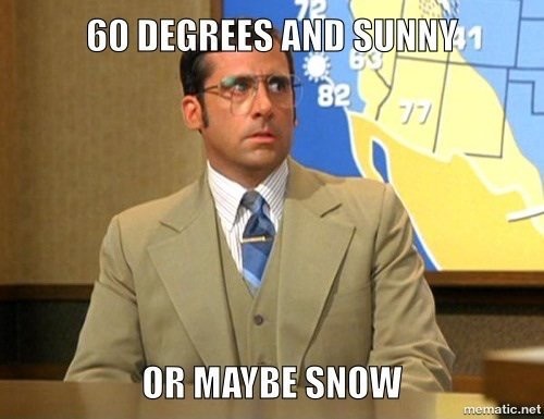
GFS be like...
SoulSingMG- Senior Enthusiast
- Posts : 2853
Reputation : 74
Join date : 2013-12-11
Location : Long Island City, NY
Re: Long Range Thread 10.0
![]() by devsman Fri Feb 19, 2016 7:24 pm
by devsman Fri Feb 19, 2016 7:24 pm

devsman- Pro Enthusiast

- Posts : 424
Reputation : 4
Join date : 2014-01-01
Age : 48
Location : merrick, ny (south shore of Long Island)
Re: Long Range Thread 10.0
![]() by hyde345 Fri Feb 19, 2016 7:37 pm
by hyde345 Fri Feb 19, 2016 7:37 pm

hyde345- Pro Enthusiast
- Posts : 1082
Reputation : 48
Join date : 2013-01-08
Location : Hyde Park, NY
Re: Long Range Thread 10.0
![]() by skinsfan1177 Fri Feb 19, 2016 9:03 pm
by skinsfan1177 Fri Feb 19, 2016 9:03 pm

skinsfan1177- Senior Enthusiast
- Posts : 4485
Reputation : 35
Join date : 2013-01-07
Age : 46
Location : Point Pleasant Boro
Re: Long Range Thread 10.0
![]() by sroc4 Fri Feb 19, 2016 9:08 pm
by sroc4 Fri Feb 19, 2016 9:08 pm
_________________
"In weather and in life, there's no winning and losing; there's only winning and learning."
WINTER 2012/2013 TOTALS 43.65"WINTER 2017/2018 TOTALS 62.85" WINTER 2022/2023 TOTALS 4.9"
WINTER 2013/2014 TOTALS 64.85"WINTER 2018/2019 TOTALS 14.25" WINTER 2023/2024 TOTALS 13.1"
WINTER 2014/2015 TOTALS 71.20"WINTER 2019/2020 TOTALS 6.35"
WINTER 2015/2016 TOTALS 35.00"WINTER 2020/2021 TOTALS 37.75"
WINTER 2016/2017 TOTALS 42.25"WINTER 2021/2022 TOTALS 31.65"
sroc4- Admin
- Posts : 8331
Reputation : 301
Join date : 2013-01-07
Location : Wading River, LI
Re: Long Range Thread 10.0
![]() by Guest Fri Feb 19, 2016 9:52 pm
by Guest Fri Feb 19, 2016 9:52 pm
Guest- Guest
Re: Long Range Thread 10.0
![]() by Biggin23 Fri Feb 19, 2016 11:23 pm
by Biggin23 Fri Feb 19, 2016 11:23 pm
However, the model changes this winter seem to be massive. I have only been following the weather closely the last four years, but I don't think I have ever seen as many drastic changes and misses as this winter, so who know what can happen the rest of the way....
Biggin23- Posts : 259
Reputation : 0
Join date : 2015-02-11
Location : Jackson, NJ
Page 25 of 28 • 1 ... 14 ... 24, 25, 26, 27, 28 ![]()
|
|
|