
 Search
Tracking 01-30 Arctic Front
Page 5 of 9 •  1, 2, 3, 4, 5, 6, 7, 8, 9
 ![]()
Re: Tracking 01-30 Arctic Front
![]() by SENJsnowman Mon Jan 28, 2019 6:43 pm
by SENJsnowman Mon Jan 28, 2019 6:43 pm
SENJsnowman- Senior Enthusiast

- Posts : 1189
Join date : 2017-01-06
Re: Tracking 01-30 Arctic Front
![]() by heehaw453 Mon Jan 28, 2019 6:45 pm
by heehaw453 Mon Jan 28, 2019 6:45 pm
SENJsnowman wrote:Is that a more area wide squall threat, or also n/w only?
I think this is area wide threat.
heehaw453- Advanced Forecaster

- Posts : 3906
Join date : 2014-01-20
Re: Tracking 01-30 Arctic Front
![]() by amugs Mon Jan 28, 2019 7:18 pm
by amugs Mon Jan 28, 2019 7:18 pm
heehaw453 wrote:SENJsnowman wrote:Is that a more area wide squall threat, or also n/w only?
I think this is area wide threat.
Yes it is from SNJ up through Conn - where it hits and you are lucky to be in it for 30 minutes take video - will be the best storm of the winter!!
_________________
Mugs
AKA:King: Snow Weenie
Self Proclaimed
WINTER 2014-15 : 55.12" +.02 for 6 coatings (avg. 35")
WINTER 2015-16 Total - 29.8" (Avg 35")
WINTER 2016-17 : 39.5" so far

amugs- Advanced Forecaster - Mod

- Posts : 15095
Reputation : 213
Join date : 2013-01-07
Age : 54
Location : Hillsdale,NJ
Re: Tracking 01-30 Arctic Front
![]() by SENJsnowman Mon Jan 28, 2019 7:27 pm
by SENJsnowman Mon Jan 28, 2019 7:27 pm
SENJsnowman- Senior Enthusiast
- Posts : 1189
Reputation : 61
Join date : 2017-01-06
Age : 51
Location : Bayville, NJ
Re: Tracking 01-30 Arctic Front
![]() by Scullybutcher Mon Jan 28, 2019 7:57 pm
by Scullybutcher Mon Jan 28, 2019 7:57 pm
Last edited by Scullybutcher on Mon Jan 28, 2019 8:02 pm; edited 1 time in total

Scullybutcher- Pro Enthusiast

- Posts : 543
Reputation : 16
Join date : 2013-02-06
Location : North Smithtown, western Suffolk county, long island
Re: Tracking 01-30 Arctic Front
![]() by heehaw453 Mon Jan 28, 2019 7:57 pm
by heehaw453 Mon Jan 28, 2019 7:57 pm
heehaw453- Advanced Forecaster
- Posts : 3906
Reputation : 86
Join date : 2014-01-20
Location : Bedminster Township, PA Elevation 600' ASL
Re: Tracking 01-30 Arctic Front
![]() by amugs Mon Jan 28, 2019 9:22 pm
by amugs Mon Jan 28, 2019 9:22 pm
Could we get a positive bust this winter? GFS being the colder of the models is a red flag.
_________________
Mugs
AKA:King: Snow Weenie
Self Proclaimed
WINTER 2014-15 : 55.12" +.02 for 6 coatings (avg. 35")
WINTER 2015-16 Total - 29.8" (Avg 35")
WINTER 2016-17 : 39.5" so far
amugs- Advanced Forecaster - Mod
- Posts : 15095
Reputation : 213
Join date : 2013-01-07
Age : 54
Location : Hillsdale,NJ
Re: Tracking 01-30 Arctic Front
![]() by heehaw453 Mon Jan 28, 2019 9:48 pm
by heehaw453 Mon Jan 28, 2019 9:48 pm
amugs wrote:Maybe a surprise tomorrow for some if this cold is true. SE winds yes but if they are light it won't erode the cold air. It's all about the BL here.
Could we get a positive bust this winter? GFS being the colder of the models is a red flag.
NAM says my temperature should be 24 at 10 PM. I’m now at 18.
heehaw453- Advanced Forecaster
- Posts : 3906
Reputation : 86
Join date : 2014-01-20
Location : Bedminster Township, PA Elevation 600' ASL
Re: Tracking 01-30 Arctic Front
![]() by Grselig Mon Jan 28, 2019 9:56 pm
by Grselig Mon Jan 28, 2019 9:56 pm
heehaw453 wrote:amugs wrote:Maybe a surprise tomorrow for some if this cold is true. SE winds yes but if they are light it won't erode the cold air. It's all about the BL here.
Could we get a positive bust this winter? GFS being the colder of the models is a red flag.
NAM says my temperature should be 24 at 10 PM. I’m now at 18.
I’m 19. Forecast low of 21 already beaten

Grselig- Senior Enthusiast
- Posts : 1408
Reputation : 140
Join date : 2013-03-04
Age : 54
Location : Wayne NJ
Re: Tracking 01-30 Arctic Front
![]() by CPcantmeasuresnow Mon Jan 28, 2019 10:04 pm
by CPcantmeasuresnow Mon Jan 28, 2019 10:04 pm
Scullybutcher wrote:Any chance we wake up to Boxing Day 2010? I know completely different but one can hope.
0.1% chance of that and I'm being optimistic. But I'm sure you weren't being serious so........

CPcantmeasuresnow- Wx Statistician Guru

- Posts : 7274
Reputation : 230
Join date : 2013-01-07
Age : 103
Location : Eastern Orange County, NY
Re: Tracking 01-30 Arctic Front
![]() by CPcantmeasuresnow Mon Jan 28, 2019 10:06 pm
by CPcantmeasuresnow Mon Jan 28, 2019 10:06 pm
I'm sure it will go up some tonight once the clouds roll in but I don't see how we get any mix up here tomorrow, BL seems fine and I doubt we crack 30°. The weather channel app is on crack, high of 36°, not happening.
CPcantmeasuresnow- Wx Statistician Guru
- Posts : 7274
Reputation : 230
Join date : 2013-01-07
Age : 103
Location : Eastern Orange County, NY
Re: Tracking 01-30 Arctic Front
![]() by amugs Mon Jan 28, 2019 10:29 pm
by amugs Mon Jan 28, 2019 10:29 pm
That on crackdown sure.CPcantmeasuresnow wrote:14.2° right now.
I'm sure it will go up some tonight once the clouds roll in but I don't see how we get any mix up here tomorrow, BL seems fine and I doubt we crack 30°. The weather channel app is on crack, high of 36°, not happening.
Delayed precip.moving in is a good sign so cold air will be in better place later as the front moves in IMO. Saying it darts in the afternoon and tapers off in the early wed morning hours. Winds gustingbton30 mph. Gonna be fun over night manana.
Squall line looking serious for Wednesday aftwrnoon., LI maybe some enuance mentioned by this as dies Conn

_________________
Mugs
AKA:King: Snow Weenie
Self Proclaimed
WINTER 2014-15 : 55.12" +.02 for 6 coatings (avg. 35")
WINTER 2015-16 Total - 29.8" (Avg 35")
WINTER 2016-17 : 39.5" so far
amugs- Advanced Forecaster - Mod
- Posts : 15095
Reputation : 213
Join date : 2013-01-07
Age : 54
Location : Hillsdale,NJ
heehaw453- Advanced Forecaster
- Posts : 3906
Reputation : 86
Join date : 2014-01-20
Location : Bedminster Township, PA Elevation 600' ASL
Re: Tracking 01-30 Arctic Front
![]() by jmanley32 Tue Jan 29, 2019 8:21 am
by jmanley32 Tue Jan 29, 2019 8:21 am

jmanley32- Senior Enthusiast
- Posts : 20535
Reputation : 108
Join date : 2013-12-12
Age : 43
Location : Yonkers, NY
Re: Tracking 01-30 Arctic Front
![]() by docstox12 Tue Jan 29, 2019 8:40 am
by docstox12 Tue Jan 29, 2019 8:40 am
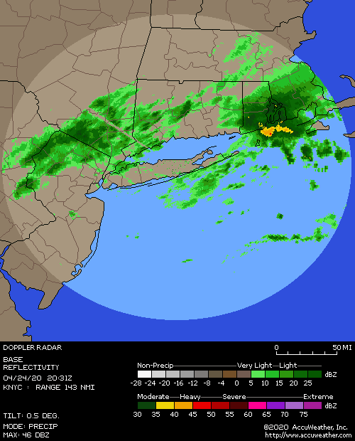
jmanley32 wrote:Radar looks like a few banks of weak snow showers why are there wsw up for north areas no ones get more than a dusting from those.
Agree, if it doesn't explode and fill in, looks like a bust right now.Could change fast though.Looks like it's going to start very soon up here.

docstox12- Wx Statistician Guru
- Posts : 8530
Reputation : 222
Join date : 2013-01-07
Age : 73
Location : Monroe NY
Re: Tracking 01-30 Arctic Front
![]() by 1190ftalt Tue Jan 29, 2019 8:50 am
by 1190ftalt Tue Jan 29, 2019 8:50 am

1190ftalt- Pro Enthusiast
- Posts : 401
Reputation : 10
Join date : 2013-12-13
Location : Stillwater, NJ
Re: Tracking 01-30 Arctic Front
![]() by CPcantmeasuresnow Tue Jan 29, 2019 9:06 am
by CPcantmeasuresnow Tue Jan 29, 2019 9:06 am
docstox12 wrote:jmanley32 wrote:Radar looks like a few banks of weak snow showers why are there wsw up for north areas no ones get more than a dusting from those.
Agree, if it doesn't explode and fill in, looks like a bust right now.Could change fast though.Looks like it's going to start very soon up here.
DOn't expect anything from this crap moving in now. The short range models have it snowing of varying intensities from about 5 PM to 11 PM today. If we're going to get 4 or 5 inches today it will all have to fall then.
23.0° and flurries
CPcantmeasuresnow- Wx Statistician Guru
- Posts : 7274
Reputation : 230
Join date : 2013-01-07
Age : 103
Location : Eastern Orange County, NY
Re: Tracking 01-30 Arctic Front
![]() by sabamfa Tue Jan 29, 2019 9:11 am
by sabamfa Tue Jan 29, 2019 9:11 am
sabamfa- Pro Enthusiast
- Posts : 246
Reputation : 2
Join date : 2013-11-05
Age : 38
Location : Wayne, NJ
Dtone- Wx Statistician Guru
- Posts : 1738
Reputation : 9
Join date : 2013-08-26
Location : Bronx, NY
Re: Tracking 01-30 Arctic Front
![]() by heehaw453 Tue Jan 29, 2019 9:23 am
by heehaw453 Tue Jan 29, 2019 9:23 am
heehaw453- Advanced Forecaster
- Posts : 3906
Reputation : 86
Join date : 2014-01-20
Location : Bedminster Township, PA Elevation 600' ASL
Re: Tracking 01-30 Arctic Front
![]() by amugs Tue Jan 29, 2019 9:24 am
by amugs Tue Jan 29, 2019 9:24 am
Snow squalls tomorrow are gonna be fun!!
_________________
Mugs
AKA:King: Snow Weenie
Self Proclaimed
WINTER 2014-15 : 55.12" +.02 for 6 coatings (avg. 35")
WINTER 2015-16 Total - 29.8" (Avg 35")
WINTER 2016-17 : 39.5" so far
amugs- Advanced Forecaster - Mod
- Posts : 15095
Reputation : 213
Join date : 2013-01-07
Age : 54
Location : Hillsdale,NJ
Re: Tracking 01-30 Arctic Front
![]() by amugs Tue Jan 29, 2019 9:39 am
by amugs Tue Jan 29, 2019 9:39 am
_________________
Mugs
AKA:King: Snow Weenie
Self Proclaimed
WINTER 2014-15 : 55.12" +.02 for 6 coatings (avg. 35")
WINTER 2015-16 Total - 29.8" (Avg 35")
WINTER 2016-17 : 39.5" so far
amugs- Advanced Forecaster - Mod
- Posts : 15095
Reputation : 213
Join date : 2013-01-07
Age : 54
Location : Hillsdale,NJ
Re: Tracking 01-30 Arctic Front
![]() by brownie Tue Jan 29, 2019 9:49 am
by brownie Tue Jan 29, 2019 9:49 am
brownie- Posts : 393
Reputation : 17
Join date : 2013-11-10
Location : Parsippany, NJ
Re: Tracking 01-30 Arctic Front
![]() by docstox12 Tue Jan 29, 2019 10:08 am
by docstox12 Tue Jan 29, 2019 10:08 am
docstox12- Wx Statistician Guru
- Posts : 8530
Reputation : 222
Join date : 2013-01-07
Age : 73
Location : Monroe NY
Re: Tracking 01-30 Arctic Front
![]() by hyde345 Tue Jan 29, 2019 10:38 am
by hyde345 Tue Jan 29, 2019 10:38 am

hyde345- Pro Enthusiast
- Posts : 1082
Reputation : 48
Join date : 2013-01-08
Location : Hyde Park, NY
Re: Tracking 01-30 Arctic Front
![]() by amugs Tue Jan 29, 2019 10:44 am
by amugs Tue Jan 29, 2019 10:44 am
Nice band here now - ground moderate coating
_________________
Mugs
AKA:King: Snow Weenie
Self Proclaimed
WINTER 2014-15 : 55.12" +.02 for 6 coatings (avg. 35")
WINTER 2015-16 Total - 29.8" (Avg 35")
WINTER 2016-17 : 39.5" so far
amugs- Advanced Forecaster - Mod
- Posts : 15095
Reputation : 213
Join date : 2013-01-07
Age : 54
Location : Hillsdale,NJ
Re: Tracking 01-30 Arctic Front
![]() by docstox12 Tue Jan 29, 2019 10:46 am
by docstox12 Tue Jan 29, 2019 10:46 am
docstox12- Wx Statistician Guru
- Posts : 8530
Reputation : 222
Join date : 2013-01-07
Age : 73
Location : Monroe NY
Page 5 of 9 • 1, 2, 3, 4, 5, 6, 7, 8, 9 ![]()
|
|
|