
 Search
UPDATE #1: SUNDAY FEB 8TH-TUESDAY FEB 10TH STORM POTENTIAL
Page 3 of 10 •  1, 2, 3, 4, 5, 6, 7, 8, 9, 10
 ![]()
Re: UPDATE #1: SUNDAY FEB 8TH-TUESDAY FEB 10TH STORM POTENTIAL
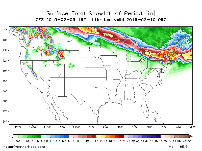
![]() by emokid51783 Thu Feb 05, 2015 3:05 pm
by emokid51783 Thu Feb 05, 2015 3:05 pm
emokid51783- Posts : 144
Join date : 2013-12-12
Re: UPDATE #1: SUNDAY FEB 8TH-TUESDAY FEB 10TH STORM POTENTIAL
![]() by Frank_Wx Thu Feb 05, 2015 3:15 pm
by Frank_Wx Thu Feb 05, 2015 3:15 pm
emokid51783 wrote:Let's take the nooses down so far people. It's a complicated set up, and when all the energy gets on shore it can actually get modeled properly. There's enough cold air in place that it can certainly make it down through NYC
Well, the cold is there to a certain extent. The problem we're seeing again is the surface low maturing to our south and west which raises heights along the EC. There's plenty of confluence to our north to prevent a cutter, but the initial rise in heights pushes the temp. gradient north too. We need the 1st wave on Saturday to track further south or for the HP to our north to press south.
Frank_Wx- Godzilla Seeker

- Posts : 21305
Join date : 2013-01-05 -

Re: UPDATE #1: SUNDAY FEB 8TH-TUESDAY FEB 10TH STORM POTENTIAL
![]() by jmanley32 Thu Feb 05, 2015 3:18 pm
by jmanley32 Thu Feb 05, 2015 3:18 pm

jmanley32- Senior Enthusiast

- Posts : 20513
Reputation : 108
Join date : 2013-12-12
Age : 42
Location : Yonkers, NY
Re: UPDATE #1: SUNDAY FEB 8TH-TUESDAY FEB 10TH STORM POTENTIAL
![]() by Frank_Wx Thu Feb 05, 2015 3:24 pm
by Frank_Wx Thu Feb 05, 2015 3:24 pm
jmanley32 wrote:FWIW, and not a lot since its based completely off the GFS as has been stated before but the local forecasts such as TWC, NWS and weatherunderground have 1 inch sunday, 3-5 sunday night, 3-5 Monday and 1-3 Monday night. That would be sweet but things do only look ok, and my bad Frank, usually when you remove something it means your no longer interested, it seemed kinda odd to me so I guess I should waited. FWIW the Euro ensembles are not terrible for NYC, but its long duration and not all that much even if it is a foot I would not classify 1-2 1/2 days to get that a Godzilla, or would you Frank? I know NWS mentioned that if it was over that long a period everyone would likely see WWA rather than WSW, unless the coastal hits hard which would warrant WSW, they said WSW has to be snowfall within a 24 hour period, I did not know that, WWA is over that or lower amounts I believe under 6.
The problem with long duration, light snowfall events is some of the snow starts to melt and you'll never get an accurate measurement of how much as fallen. It's very easy for cleaning crew's to keep up with it as long as it's light. That said, still too early in the game. While trends today have gone north, the last storm turned out colder than expected so models may not have a grasp of the low level cold until Friday at the latest. Also need to wait for better sampling. Potential is still there for significant, but I am betting against it for now.
_________________
_______________________________________________________________________________________________________
CLICK HERE to view NJ Strong Snowstorm Classifications

Frank_Wx- Godzilla Seeker
- Posts : 21305
Reputation : 328
Join date : 2013-01-05
Age : 31
Location : Jersey City, NJ -
Re: UPDATE #1: SUNDAY FEB 8TH-TUESDAY FEB 10TH STORM POTENTIAL
![]() by jmanley32 Thu Feb 05, 2015 3:49 pm
by jmanley32 Thu Feb 05, 2015 3:49 pm
jmanley32- Senior Enthusiast
- Posts : 20513
Reputation : 108
Join date : 2013-12-12
Age : 42
Location : Yonkers, NY
Re: UPDATE #1: SUNDAY FEB 8TH-TUESDAY FEB 10TH STORM POTENTIAL
![]() by SoulSingMG Thu Feb 05, 2015 4:23 pm
by SoulSingMG Thu Feb 05, 2015 4:23 pm

SoulSingMG- Senior Enthusiast
- Posts : 2853
Reputation : 74
Join date : 2013-12-11
Location : Long Island City, NY
Re: UPDATE #1: SUNDAY FEB 8TH-TUESDAY FEB 10TH STORM POTENTIAL
![]() by skinsfan1177 Thu Feb 05, 2015 4:26 pm
by skinsfan1177 Thu Feb 05, 2015 4:26 pm

skinsfan1177- Senior Enthusiast
- Posts : 4485
Reputation : 35
Join date : 2013-01-07
Age : 46
Location : Point Pleasant Boro
Re: UPDATE #1: SUNDAY FEB 8TH-TUESDAY FEB 10TH STORM POTENTIAL
![]() by skinsfan1177 Thu Feb 05, 2015 4:31 pm
by skinsfan1177 Thu Feb 05, 2015 4:31 pm
skinsfan1177- Senior Enthusiast
- Posts : 4485
Reputation : 35
Join date : 2013-01-07
Age : 46
Location : Point Pleasant Boro
Re: UPDATE #1: SUNDAY FEB 8TH-TUESDAY FEB 10TH STORM POTENTIAL
![]() by Frank_Wx Thu Feb 05, 2015 4:38 pm
by Frank_Wx Thu Feb 05, 2015 4:38 pm
skinsfan1177 wrote:Of course local Mets now back off bc it's not going their way.
It's straight up model hugging. They can only go by what the models tell them. I'm sure when the talk among themselves they're probably thinking "man, this should trend this way because the pattern looks like this" or "this event in the past looks like a pattern we're currently in"
They can't say that on TV
_________________
_______________________________________________________________________________________________________
CLICK HERE to view NJ Strong Snowstorm Classifications
Frank_Wx- Godzilla Seeker
- Posts : 21305
Reputation : 328
Join date : 2013-01-05
Age : 31
Location : Jersey City, NJ -
Re: UPDATE #1: SUNDAY FEB 8TH-TUESDAY FEB 10TH STORM POTENTIAL
![]() by Quietace Thu Feb 05, 2015 4:51 pm
by Quietace Thu Feb 05, 2015 4:51 pm
Most forecast off of the "Futurecast" (4 or 12km RPM from WSI) these days that lead to inaccuracies in short term forecasting for on air mets. They use it for snowfall, future radar, and temps to give the public the information in the most "simplistic" way possible to understand the data. Yet sometimes this way leads to misconceptions about forecasts and inaccuracies. I am sure on air mets hate using the RPM as its performance is mostly below average, yet find is necessary to keep the public modestly informed. Which goes along with what you are saying. They cant say what they want too, because A) the public will misinterpret it, or B) the public wont understand data or forecast. This goes along with the need to further inform the public about weather forecasting so we can be a safer and more responsive country to events.Frank_Wx wrote:skinsfan1177 wrote:Of course local Mets now back off bc it's not going their way.
It's straight up model hugging. They can only go by what the models tell them. I'm sure when the talk among themselves they're probably thinking "man, this should trend this way because the pattern looks like this" or "this event in the past looks like a pattern we're currently in"
They can't say that on TV
Last edited by Quietace on Thu Feb 05, 2015 4:53 pm; edited 1 time in total

Quietace- Meteorologist - Mod

- Posts : 3687
Reputation : 33
Join date : 2013-01-07
Age : 27
Location : Point Pleasant, NJ
Re: UPDATE #1: SUNDAY FEB 8TH-TUESDAY FEB 10TH STORM POTENTIAL
![]() by jimv45 Thu Feb 05, 2015 4:52 pm
by jimv45 Thu Feb 05, 2015 4:52 pm
jimv45- Senior Enthusiast
- Posts : 1168
Reputation : 36
Join date : 2013-09-20
Location : Hopewell jct.
Re: UPDATE #1: SUNDAY FEB 8TH-TUESDAY FEB 10TH STORM POTENTIAL
![]() by aiannone Thu Feb 05, 2015 5:11 pm
by aiannone Thu Feb 05, 2015 5:11 pm
_________________
-Alex Iannone-

aiannone- Senior Enthusiast - Mod

- Posts : 4813
Reputation : 92
Join date : 2013-01-07
Location : Saint James, LI (Northwest Suffolk Co.)
Re: UPDATE #1: SUNDAY FEB 8TH-TUESDAY FEB 10TH STORM POTENTIAL
![]() by Frank_Wx Thu Feb 05, 2015 5:51 pm
by Frank_Wx Thu Feb 05, 2015 5:51 pm
_________________
_______________________________________________________________________________________________________
CLICK HERE to view NJ Strong Snowstorm Classifications
Frank_Wx- Godzilla Seeker
- Posts : 21305
Reputation : 328
Join date : 2013-01-05
Age : 31
Location : Jersey City, NJ -
Re: UPDATE #1: SUNDAY FEB 8TH-TUESDAY FEB 10TH STORM POTENTIAL
![]() by Frank_Wx Thu Feb 05, 2015 5:52 pm
by Frank_Wx Thu Feb 05, 2015 5:52 pm
_________________
_______________________________________________________________________________________________________
CLICK HERE to view NJ Strong Snowstorm Classifications
Frank_Wx- Godzilla Seeker
- Posts : 21305
Reputation : 328
Join date : 2013-01-05
Age : 31
Location : Jersey City, NJ -
Re: UPDATE #1: SUNDAY FEB 8TH-TUESDAY FEB 10TH STORM POTENTIAL
![]() by RJB8525 Thu Feb 05, 2015 5:59 pm
by RJB8525 Thu Feb 05, 2015 5:59 pm
aiannone wrote:18z GFS went further north again. Please don't hate me. I know Frank is already jealous lol
Lee's going with the northern trend as well

RJB8525- Senior Enthusiast
- Posts : 1994
Reputation : 28
Join date : 2013-02-06
Age : 38
Location : Hackettstown, NJ
Re: UPDATE #1: SUNDAY FEB 8TH-TUESDAY FEB 10TH STORM POTENTIAL
![]() by CPcantmeasuresnow Thu Feb 05, 2015 6:54 pm
by CPcantmeasuresnow Thu Feb 05, 2015 6:54 pm
aiannone wrote:18z GFS went further north again. Please don't hate me. I know Frank is already jealous lol
I liked you a lot better when you lived in Long Island. Can you transfer to Stony Brook?

CPcantmeasuresnow- Wx Statistician Guru

- Posts : 7274
Reputation : 230
Join date : 2013-01-07
Age : 103
Location : Eastern Orange County, NY
Re: UPDATE #1: SUNDAY FEB 8TH-TUESDAY FEB 10TH STORM POTENTIAL
![]() by jimv45 Thu Feb 05, 2015 7:02 pm
by jimv45 Thu Feb 05, 2015 7:02 pm
jimv45- Senior Enthusiast
- Posts : 1168
Reputation : 36
Join date : 2013-09-20
Location : Hopewell jct.
Re: UPDATE #1: SUNDAY FEB 8TH-TUESDAY FEB 10TH STORM POTENTIAL
![]() by Guest Thu Feb 05, 2015 7:05 pm
by Guest Thu Feb 05, 2015 7:05 pm
INTO MONDAY NIGHT. AT THIS TIME IT APPEARS THAT THE LOWER HUDSON
VALLEY AND SOUTHERN CONNECTICUT WILL SEE PRIMARILY SNOW WITH THE
POTENTIAL FOR 8 OR MORE INCHES OF ACCUMULATION...WHILE NORTHEAST
NEW JERSEY...THE NEW YORK CITY METROPOLITAN AREA AND LONG ISLAND
MAY BE MORE LIKELY TO SEE SNOW CHANGING TO A WINTRY MIX.
screwed again. Moving to Boston!!
Just another example of being in the bullseye too early leading to too much hype.
Guest- Guest
Re: UPDATE #1: SUNDAY FEB 8TH-TUESDAY FEB 10TH STORM POTENTIAL
![]() by jimv45 Thu Feb 05, 2015 7:07 pm
by jimv45 Thu Feb 05, 2015 7:07 pm
jimv45- Senior Enthusiast
- Posts : 1168
Reputation : 36
Join date : 2013-09-20
Location : Hopewell jct.
Re: UPDATE #1: SUNDAY FEB 8TH-TUESDAY FEB 10TH STORM POTENTIAL
![]() by SoulSingMG Thu Feb 05, 2015 7:09 pm
by SoulSingMG Thu Feb 05, 2015 7:09 pm
SoulSingMG- Senior Enthusiast
- Posts : 2853
Reputation : 74
Join date : 2013-12-11
Location : Long Island City, NY
Re: UPDATE #1: SUNDAY FEB 8TH-TUESDAY FEB 10TH STORM POTENTIAL
![]() by SoulSingMG Thu Feb 05, 2015 7:20 pm
by SoulSingMG Thu Feb 05, 2015 7:20 pm
What do we think the chances are of this trending south now that better sampling will come in on the 00z's?
SoulSingMG- Senior Enthusiast
- Posts : 2853
Reputation : 74
Join date : 2013-12-11
Location : Long Island City, NY
Re: UPDATE #1: SUNDAY FEB 8TH-TUESDAY FEB 10TH STORM POTENTIAL
![]() by carvin1079 Thu Feb 05, 2015 7:25 pm
by carvin1079 Thu Feb 05, 2015 7:25 pm
carvin1079- Posts : 61
Reputation : 0
Join date : 2014-11-06
Re: UPDATE #1: SUNDAY FEB 8TH-TUESDAY FEB 10TH STORM POTENTIAL
![]() by jimv45 Thu Feb 05, 2015 7:26 pm
by jimv45 Thu Feb 05, 2015 7:26 pm
jimv45- Senior Enthusiast
- Posts : 1168
Reputation : 36
Join date : 2013-09-20
Location : Hopewell jct.
Re: UPDATE #1: SUNDAY FEB 8TH-TUESDAY FEB 10TH STORM POTENTIAL
![]() by devsman Thu Feb 05, 2015 7:36 pm
by devsman Thu Feb 05, 2015 7:36 pm

devsman- Pro Enthusiast

- Posts : 424
Reputation : 4
Join date : 2014-01-01
Age : 48
Location : merrick, ny (south shore of Long Island)
Re: UPDATE #1: SUNDAY FEB 8TH-TUESDAY FEB 10TH STORM POTENTIAL
![]() by CPcantmeasuresnow Thu Feb 05, 2015 8:00 pm
by CPcantmeasuresnow Thu Feb 05, 2015 8:00 pm
syosnow94 wrote:A LONG DURATION WINTER WEATHER EVENT IS LIKELY FROM SATURDAY NIGHT
INTO MONDAY NIGHT. AT THIS TIME IT APPEARS THAT THE LOWER HUDSON
VALLEY AND SOUTHERN CONNECTICUT WILL SEE PRIMARILY SNOW WITH THE
POTENTIAL FOR 8 OR MORE INCHES OF ACCUMULATION...WHILE NORTHEAST
NEW JERSEY...THE NEW YORK CITY METROPOLITAN AREA AND LONG ISLAND
MAY BE MORE LIKELY TO SEE SNOW CHANGING TO A WINTRY MIX.
screwed again. Moving to Boston!!
Just another example of being in the bullseye too early leading to too much hype.
Move to the HV, we average more snow per season than Boston, plus we don't have the annoying accents.
This year so far is their year, not always the case.
CPcantmeasuresnow- Wx Statistician Guru
- Posts : 7274
Reputation : 230
Join date : 2013-01-07
Age : 103
Location : Eastern Orange County, NY
Re: UPDATE #1: SUNDAY FEB 8TH-TUESDAY FEB 10TH STORM POTENTIAL
![]() by CPcantmeasuresnow Thu Feb 05, 2015 8:01 pm
by CPcantmeasuresnow Thu Feb 05, 2015 8:01 pm
jimv45 wrote:cp doc looks good for us have feeling this will move south a bit!!
I agree Jim, still 3 days away and most sampling isn't even on land yet. If it doesn't go our way it's Alex's fault.
CPcantmeasuresnow- Wx Statistician Guru
- Posts : 7274
Reputation : 230
Join date : 2013-01-07
Age : 103
Location : Eastern Orange County, NY
Re: UPDATE #1: SUNDAY FEB 8TH-TUESDAY FEB 10TH STORM POTENTIAL
![]() by aiannone Thu Feb 05, 2015 8:30 pm
by aiannone Thu Feb 05, 2015 8:30 pm
CPcantmeasuresnow wrote:jimv45 wrote:cp doc looks good for us have feeling this will move south a bit!!
I agree Jim, still 3 days away and most sampling isn't even on land yet. If it doesn't go our way it's Alex's fault.
I'll take the blame, which will feel pretty crappy, but then i'll get my 8-10" of snow and be happy again :p. And no, I would never transfer to Stony Brook lol. The program is too good here!
_________________
-Alex Iannone-
aiannone- Senior Enthusiast - Mod
- Posts : 4813
Reputation : 92
Join date : 2013-01-07
Location : Saint James, LI (Northwest Suffolk Co.)
Sponsored content
Page 3 of 10 • 1, 2, 3, 4, 5, 6, 7, 8, 9, 10 ![]()
|
|
|